

Mori Atlas logo
Protected landscapeWiśnicko-Lipnicki Park Krajobrazowy

Examining the sandstone mushroom rocks, diverse habitats, and historic cultural mosaic

Wiśnicko-Lipnicki Park Krajobrazowy: A Protected Landscape in the Polish Carpathian Foothills

Wiśnicko-Lipnicki Park Krajobrazowy serves as a vital protected area within the Lesser Poland Voivodeship, spanning 14,200 hectares of the Outer Carpathians. The terrain showcases an intricate flysch landscape featuring ridge-and-valley patterns, steep ravines, and characteristic sandstone rock outcrops shaped by differential erosion. Beyond these natural formations, the area integrates a rich cultural heritage of medieval towns, historic manor houses, and wooden churches, creating a distinctive blend of preserved nature and human history.

landscape parkPolish Carpathians foothillsflysch landscapesandstone rock outcropsmushroom rocksmixed forest
A digital illustration of a forest scene with large, moss-covered sandstone rock formations in the foreground, coniferous trees in the distance, and a small waterfall visible in the background.

Wiśnicko-Lipnicki Park Krajobrazowy

Protected landscape

Park overview

Structured park overview, official facts, and landscape profile for Wiśnicko-Lipnicki Park Krajobrazowy

Wiśnicko-Lipnicki Park Krajobrazowy park facts, protected area profile, and essential visitor context

Review the core facts for Wiśnicko-Lipnicki Park Krajobrazowy, including designation, size, terrain, visitor scale, habitats, and operating context in one park-focused overview.

About Wiśnicko-Lipnicki Park Krajobrazowy

Wiśnicko-Lipnicki Park Krajobrazowy lies in the heartland of the Polish Carpathian foothills, on the Pogórze Wiśnickie, where the flysch bedrock of alternating sandstone and shale layers has been eroded into a pattern of closely spaced ridges, valleys, and isolated hills. Despite its modest total extent of around 14,200 hectares, the park compresses a remarkable amount of physical variety into its boundaries. Visitors and researchers moving through the area encounter forested crests above 500 meters, gentler low and flat hills, deeply cut river valleys, narrow stream ravines, maintained agricultural patches, meadows, and peat bogs, all within the same landscape.

This physical diversity translates directly into ecological diversity. Carpathian beech forest, lowland acidophilous beech forest, oak-hornbeam forest, mixed coniferous forest, ash-alder floodplain forest, sub-mountain ash floodplain forest, Carpathian alder swamp, and fertile fir stands all occur here. Open habitats include sedge-foxtail and sedge-valerian młaki (spring mires), xerothermic grasslands, and peatland communities, giving the park a near-complete cross-section of the foothill habitat spectrum found in the Polish Carpathians.

The protected area is also notable for the strong presence of sandstone rock outcrops. The hardest sandstone layers of the flysch series have resisted erosion and now project above the forest canopy as isolated tors, frequently in the form of cap-and-stem shapes popularly described as 'mushroom rocks.' These formations define the visual identity of the park, particularly around Paprotna and on the summit areas of Kobyla Góra near Chronów, and have earned legal protection as inanimate natural monuments alongside the Kamień Grzyb reserve.

Beyond its natural assets, the park's defining feature is the way in which its natural landscape remains interwoven with a centuries-old cultural landscape. Long-established villages such as Nowy Wiśnicz, Lipnica Murowana, Rajbrot, Stary Wiśnicz, Chronów, and Królówka sit at the heart of the protected area, with preserved medieval town layouts, fortified town walls, Gothic wooden churches, classicist manor houses, and a network of World War I cemeteries. The establishment of the park in 1997 explicitly recognized this joint natural and cultural value, making it a useful example of integrated landscape protection in the Polish Carpathian foothills.

Quick facts and research context for Wiśnicko-Lipnicki Park Krajobrazowy

Wiśnicko-Lipnicki Park Krajobrazowy is a landscape park (park krajobrazowy) in south-central Poland, in the central part of the Małopolskie Voivodeship, lying entirely within the communes of Nowy Wiśnicz and Lipnica Murowana. The protected area sits on the Pogórze Wiśnickie, a region classified as part of the flysch-based Outer Carpathians.

The park was created in May 1997 by regulation of the Tarnów Voivode, with the dual purpose of protecting the natural landscape and the cultural landscape of the region. Its area is buffered by two protected landscape areas (obszary chronionego krajobrazu) covering the eastern and western edges of the same foothill belt. One strict nature reserve, Kamień-Grzyb, and a second forest reserve on Bukowiec hill fall within its boundaries, alongside a notable set of inanimate natural monuments including the Kamienie Brodzińskiego and Skałki Chronowskie sandstone formations.

Protection and recognition

Documented terrestrial protection scope and administrative recognition data

Wiśnicko-Lipnicki Park Krajobrazowy Protection Status and Recognition

Wiśnicko-Lipnicki Park Krajobrazowy maintains a documented terrestrial protection scope within its regional landscape boundary. Structured administrative records outline the active conservation framework and official designation history for this protected area.

Protection details

Protection scope
Terrestrial
Transboundary protection
No
Park context

Deeper park guide and search-rich context for Wiśnicko-Lipnicki Park Krajobrazowy

Wiśnicko-Lipnicki Park Krajobrazowy history, landscape, wildlife, and travel context

Explore Wiśnicko-Lipnicki Park Krajobrazowy through its history, landscape character, ecosystems, wildlife, conservation priorities, cultural context, and seasonal travel timing in a structured park guide built for atlas discovery and search intent.

Why Wiśnicko-Lipnicki Park Krajobrazowy stands out

Wiśnicko-Lipnicki Park Krajobrazowy is best known for the unusual density of mushroom-shaped sandstone rock outcrops rising above its forest ridges, a feature visible on landmarks such as Kamień Grzyb, Kamienie Brodzińskiego on Paprotna hill, and the Skałki Chronowskie above Kobyla Góra. The protected area combines this geological character with a classic Carpathian foothill mosaic: beech, fir, oak, and pine forests, peat bogs and moist sedge meadows in the valleys, and drier xerothermic grasslands on sun-exposed slopes. The park is equally known for the cultural landscape wrapped around these natural assets. Within and around its boundaries lie medieval towns with preserved historic layouts, Gothic wooden churches including the famous St. Leonard church in Lipnica Murowana, the Kmita castle at Stary Wiśnicz, and a network of well-preserved World War I military cemeteries. Together these make the park a compact example of the intertwined natural and human heritage of the Polish Carpathian foothills.
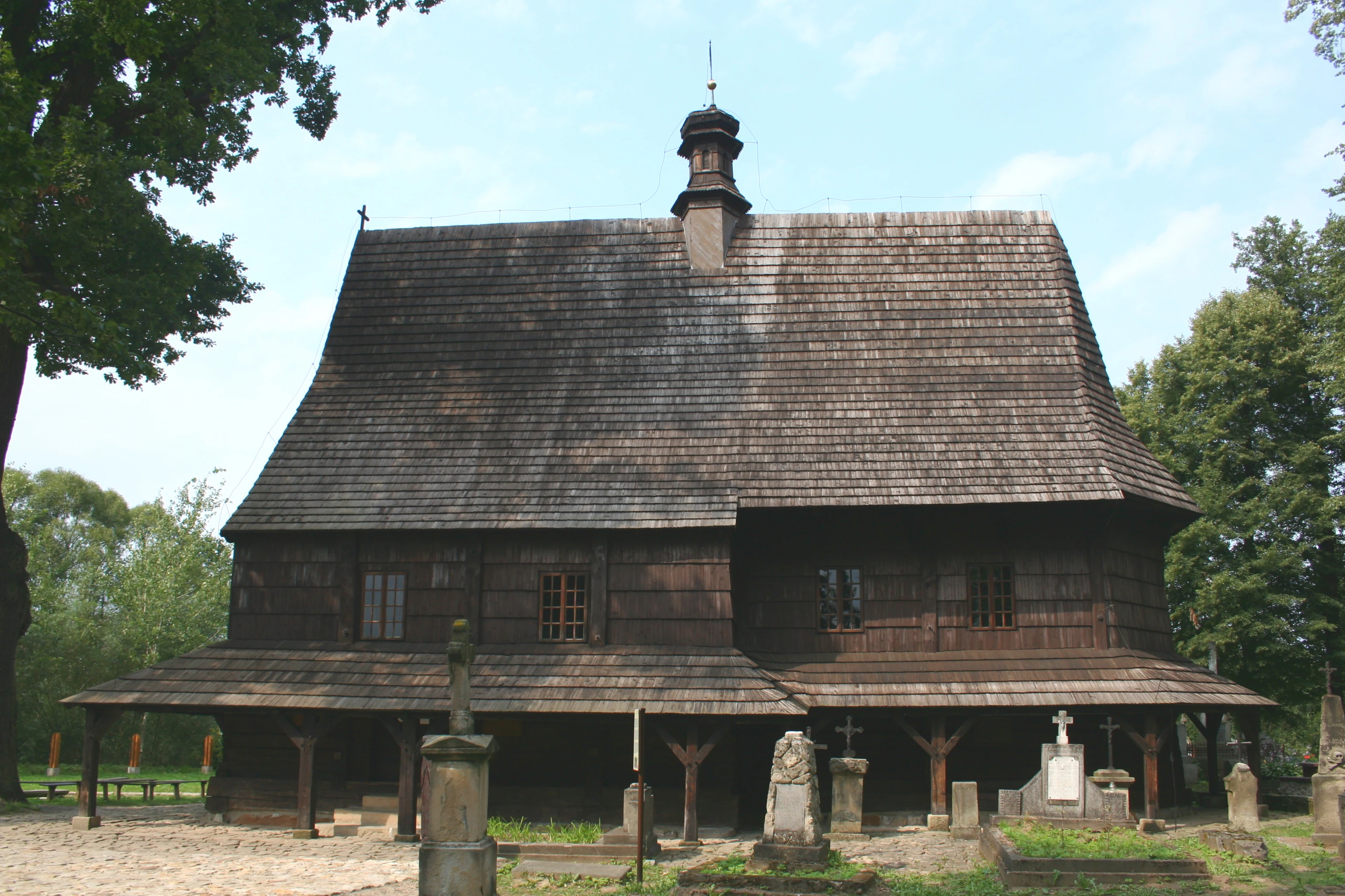
Front view of the historic wooden Saint Leonard Church in Lipnica Murowana, featuring a steep shingled roof, dark timber walls, and surrounding stone grave markers in the foreground.
Saint Leonard Church in Lipnica Murowana, a wooden historic landmark within the park boundaries.

Wiśnicko-Lipnicki Park Krajobrazowy history and protected-area timeline

Wiśnicko-Lipnicki Park Krajobrazowy was formally established in May 1997 through Regulation No. 27/97 of the Voivode of Tarnów, dated 12 May 1997. The regulation was issued at a moment when Polish landscape protection was expanding rapidly across the Carpathian foothills, and the park was one of a series of landscape parks created in the region during the late 1990s.

The rationale behind the park's creation was explicitly twofold. Its drafters recognized that the Pogórze Wiśnickie held both a distinctive natural landscape, shaped by flysch geology and the resulting mosaic of habitats, and an unusually well-preserved cultural landscape of small historic towns, wooden churches, castles, and older rural land use patterns. The park's purpose in formal terms was to safeguard these two layers together, with explicit reference to the value of both the natural and the cultural landscape.

Within the park itself, earlier protection actions were later reinforced and built upon. The Kamień-Grzyb reserve, established around the mushroom-shaped boulder near Połom Duży south of Nowy Wiśnicz, was already a recognized site of geological protection, and a second forest reserve on Bukowiec hill near Iwkowa was added to the park's network of strict reserves. Individual rock groups, including the Kamienie Brodzińskiego group on Paprotna and the Skałki Chronowskie on Kobyla Góra, were separately designated as inanimate natural monuments, giving the park a layered protection structure of landscape park, buffer zones, reserves, and monument-level designations.

In parallel, the surrounding hills have continued to recover from centuries of intensive agricultural use. The source descriptions note an ongoing renaturalization trend, with abandoned arable fields progressively reverting to forest, meadow, or rough pasture, a process that has strengthened rather than diminished the park's ecological value over the decades following its establishment.

Wiśnicko-Lipnicki Park Krajobrazowy landscape and geographic character

The landscape of Wiśnicko-Lipnicki Park Krajobrazowy is a textbook example of flysch foothill topography. The underlying rock consists of layered sandstone and shale deposits typical of the Outer Carpathians, and differential erosion of these layers has produced the alternating ridge-and-valley pattern that defines the Pogórze Wiśnickie. Within the park, ridges rising above 500 meters in elevation sit alongside much lower, more rounded hills, and the same compact area contains both broad valley floors and steep, narrow stream ravines.

Valleys cut by local streams are among the park's most distinctive landscape elements. The Piekarski Potok valley and similar stream corridors descend through steep-sided jary, with talus slopes and exposed bedrock along the ravine walls. On the higher and drier slopes, the same flysch layers have resisted erosion as sandstone outcrops, often standing isolated on hill summits and frequently undercut by softer shales below to produce characteristic cap-and-stem mushroom rocks. Kamień Grzyb itself reaches roughly 7 meters in height, while other groups such as the Kamienie Brodziński and the Skałki Chronowskie form extensive rocky ensembles along ridge crests.

The lower terrain adds further variety. Flat valley floors hold peat bogs and moist sedge meadows, while sun-exposed south-facing slopes support xerothermic grassland communities. Where agriculture has been abandoned, these grassland patches increasingly merge with regenerating woodland, giving the park a transitional landscape character between fully open cultural countryside and closed forest. From viewpoints such as Rajbrot, panoramic views toward the Pasmo Szpilówki ridge illustrate this layered combination of cultivated lowlands, forested ridges, isolated rock outcrops, and distant higher mountain silhouettes.
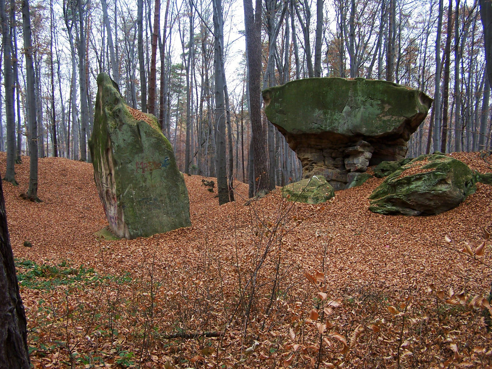
A large mushroom-shaped sandstone rock formation sits on a forest floor covered in fallen autumn leaves, with tall deciduous trees in the background.
Kamień Grzyb, a distinctive mushroom-shaped rock formation within the forest landscape of Wiśnicko-Lipnicki Park Krajobrazowy.

Wiśnicko-Lipnicki Park Krajobrazowy ecosystems, habitats, and plant life

Ecologically, the park represents an unusually complete foothill habitat mosaic. On forested slopes, the dominant communities include Carpathian beech forest, fertile fir stands, mixed oak-hornbeam forest, acidophilous lowland beech forest, mixed coniferous forest, and various ash- and alder-dominated floodplain forests along the stream corridors. Carpathian alder swamp communities occur in permanently wet pockets, supporting moisture-loving undergrowth and a distinctive bryophyte flora.

Open habitats are equally important. The park holds examples of spring mires (młaki), including both sedge-foxtail and sedge-valerian types, which depend on groundwater seepage from the flysch slopes and support a specialized flora of moisture-loving herbs. On warmer, drier slopes, xerothermic grasslands preserve open-country plant communities that have largely retreated elsewhere in the region, while peatland vegetation in the wetter basins includes bog-loving species such as Modrzewnica pospolita. The vascular flora of the park has been documented at around 671 species, with the bryophyte flora adding roughly 122 further species.

Protected species constitute a meaningful share of this flora. The park supports around 51 protected vascular plant species and 24 protected moss and liverwort species, ranging from woodland orchids such as Podkolan biały and the broad-leaved and spotted Kukułka species, through woodland edge species like Parzydło leśne and Lilium złotogłów, to classic European woodland indicators such as the ostrich fern, giant horsetail, and lily of the valley in shaded forest interiors. The combined forest, mire, grassland, rock, and peatland habitats provide refuges for both widely distributed foothill species and more localized specialists of the Outer Carpathians.
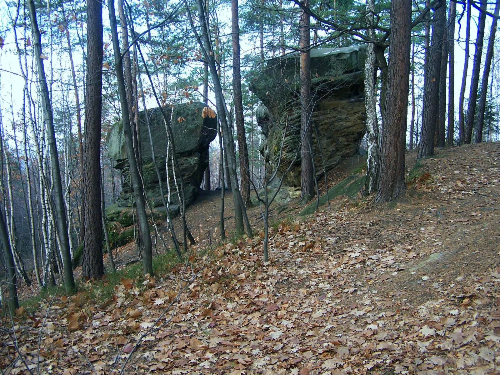
Two large, moss-covered sandstone rock formations stand among pine and birch trees in an autumn forest, with fallen leaves covering the ground.
The Brodzinski Rocks, prominent natural sandstone formations nestled within the forest of the Wiśnicko-Lipnicki Landscape Park.

Wiśnicko-Lipnicki Park Krajobrazowy wildlife and species highlights

Wiśnicko-Lipnicki Park Krajobrazowy supports a remarkably complete foothill fauna, with recorded occurrences of 119 protected animal species across major groups. The amphibian fauna alone includes 12 protected species, among them the common frog, the fire-bellied toad (kumak górski), the European tree frog (rzekotka drzewna), the common toad (ropucha szara), and the fire salamander (salamandra plamista), reflecting the park's network of clean streams, seepages, and small wetlands. Six protected reptile species are also present.

Fish communities in the park's streams are likewise characteristic of clean foothill waters. Species documented include the stream-dwelling strzebla potokowa, the brown trout (pstrąg potokowy), the common gudgeon (śliz pospolity), the European barbel (brzanka), and the piekielnica, all of which require oxygen-rich, relatively unpolluted water and indicate the park's favorable freshwater conditions.

The park holds a particularly rich mammal fauna of 39 recorded protected species. Larger ungulates include wild boar, European roe deer, and red deer, while smaller carnivores include the stoat and the least weasel. Semi-aquatic species such as the European otter and the Eurasian beaver are present along the larger watercourses. Shrew and hedgehog species documented include the orzesznica, the Eastern hedgehog, the Eurasian water shrew, the common shrew, the lesser shrew, the Mediterranean water shrew, the Etruscan shrew, and the lesser white-toothed shrew. The park is also a noted bat habitat, with recorded species including the brown long-eared bat, the western barbastelle, the common pipistrelle's relative (mroczek późny), and the lesser horseshoe bat.

Birdlife is correspondingly rich, with 101 protected bird species recorded. Characteristic species include the black stork, hawfinch, Eurasian treecreeper, marsh tit, and long-tailed tit, often associated with mature Carpathian foothill forest. Invertebrate diversity adds a further tier, including ground beetles such as the tęcznik liszkarz and the rare longhorn beetle kozioróg dębosz, together with notable butterflies such as the scarce swallowtail, the Old World swallowtail, and two Apatura species of the mieniak group, all indicators of well-structured woodland habitat mosaics.
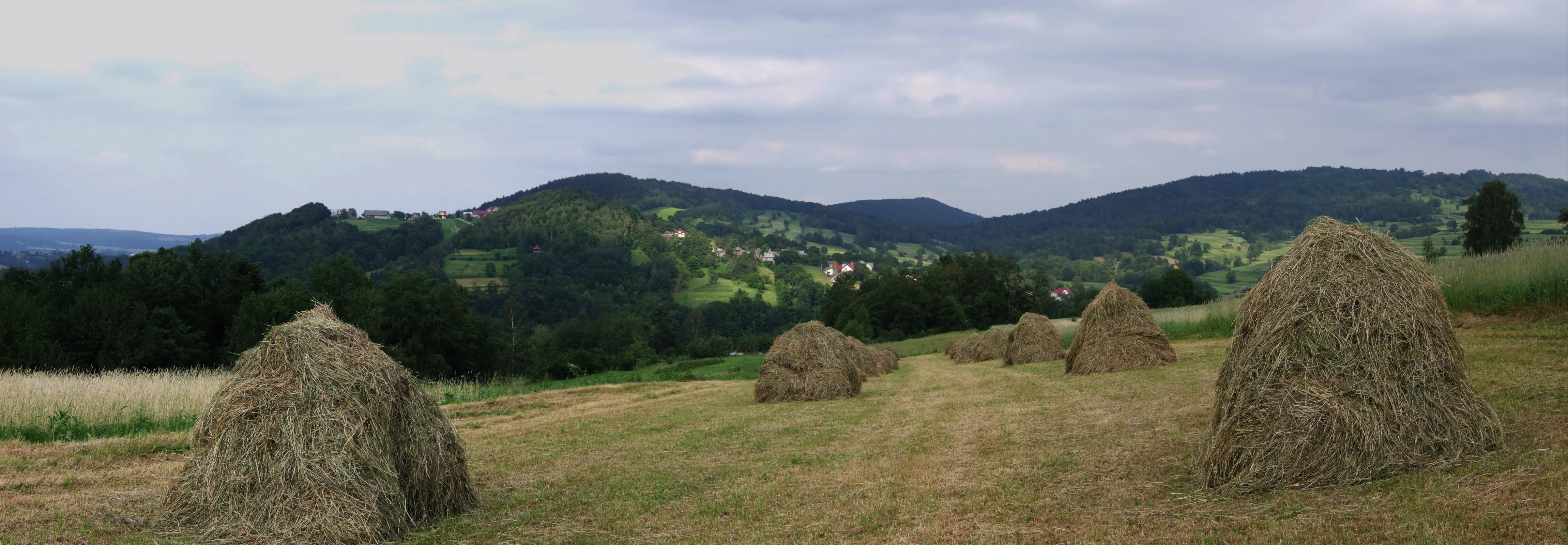
A wide view of a harvested field with several haystacks in the foreground and a rolling forested mountain range under a cloudy sky in the distance.
Haystacks in a field with the rolling hills of the Szpilówka range in the background.

Wiśnicko-Lipnicki Park Krajobrazowy conservation status and protection priorities

From a conservation perspective, the park's significance lies in the way it bundles multiple protection categories around a single coherent foothill system. At the landscape scale, the park itself is classified as a park krajobrazowy, a Polish category dedicated to protecting both natural and cultural landscape values. Around it, two adjacent protected landscape areas (obszary chronionego krajobrazu) form a buffer zone covering the eastern and western Pogórze Wiśnickie, while one strict nature reserve within the park and a second forest reserve on Bukowiec hill add more intensive protection over the most sensitive sites.

The park's ecological value rests on the unusual concentration of sandstone rock outcrops, peatlands, mires, and old-growth foothill forest types within a relatively compact area. Source descriptions emphasize that the area is only lightly affected by pollution, with no heavy industry and no large urban centers in the immediate vicinity, and with agriculture largely of a near-ecological character. This has allowed sensitive habitats, including peat bogs, xerothermic grasslands, and bat hibernacula, to persist in relatively undisturbed condition. The ongoing renaturalization of abandoned farmland into forest and rough grassland further increases the structural diversity of habitats.

Recognition of the park extends through individual protection orders as well. Apart from the Kamień-Grzyb strict reserve, individual rock formations such as the Kamienie Brodziński group on Paprotna hill and the Skałki Chronowskie on Kobyla Góra have been designated as inanimate natural monuments (pomniki przyrody nieożywionej), giving them long-term legal protection independent of the broader landscape designation. Together these layered designations reflect a conservation strategy aimed not only at preserving scenery but at safeguarding the geological substrate, habitat mosaic, and cultural heritage of the Pogórze Wiśnickie as a whole.

Wiśnicko-Lipnicki Park Krajobrazowy cultural meaning and human context

The cultural context of Wiśnicko-Lipnicki Park Krajobrazowy is unusually rich for a landscape park, because the park's drafters explicitly incorporated the cultural landscape into the rationale for its creation. Several long-established villages and small towns lie within or adjacent to the protected area, and their medieval and early-modern built heritage remains largely intact.

In Nowy Wiśnicz, the park's landscape meets the town's preserved fortifications and historic center, the town hall, and a 17th-century cloister complex that today serves as a penitentiary institution. Lipnica Murowana retains its medieval urban layout, a 14th-century parish church, a 19th-century manor house, arcaded houses around its market square, and the famous wooden church of St. Leonard. Rajbrot is known for its Gothic wooden church dedicated to the Nativity of the Blessed Virgin Mary, while Stary Wiśnicz holds a Gothic church dedicated to St. Adalbert and the 14th-century castle of the Kmita family, one of the most important medieval strongholds of the region. Smaller villages such as Chronów and Królówka complete this pattern with their own sacred architecture.

A second layer of cultural memory comes from World War I, during which the Pogórze Wiśnickie lay close to the front between the Austro-Hungarian and Russian armies. The park contains several well-preserved war cemeteries from this period, including cemeteries numbered 299, 300, 303, 308, 311, and 312 in the regional military cemetery system, located around Lipnica Murowana, Rajbrot, Królówka, Nowy Wiśnicz, and Stary Wiśnicz. Together with the medieval and wooden sacred architecture, they form an important part of the cultural landscape the park was created to safeguard.

A wide panoramic photograph showing a rural landscape with mown fields in the foreground, patches of forest, and a rolling, tree-covered hillside in the distance under a bright sky.
A panoramic view of the rolling landscape of Paprotna, featuring grassy fields and forested hills in the background.

Top sights and standout views in Wiśnicko-Lipnicki Park Krajobrazowy

Wiśnicko-Lipnicki Park Krajobrazowy's strongest identity comes from the combination of mushroom-shaped sandstone tors, a tightly compressed mosaic of foothill habitats, and an unusually dense cluster of historic Carpathian villages. The mushroom rock at the Kamień-Grzyb reserve near Połom Duży is the most famous single landmark, but the broader set of rock formations on Paprotna and at Kobyla Góra is just as characteristic.

The park also stands out for its breadth within a small area: beech, fir, oak, and pine forests, stream ravines, peat bogs, xerothermic grasslands, and spring mires all occur within its roughly 14,200 hectares, alongside 671 documented vascular plant species, 122 bryophyte species, and 119 protected animal species. Layered over this natural richness is a cultural layer of medieval town layouts, Gothic wooden churches, a 14th-century castle, and well-preserved World War I cemeteries, which together make the park a showcase of integrated landscape protection in the Polish Carpathian foothills.
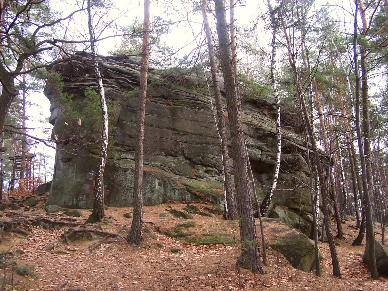
A large, monolithic sandstone rock formation surrounded by thin, tall pine and birch trees in a forest setting.
The Brodzinski Stones rock formation located within the Wiśnicko-Lipnicki Landscape Park.

Best time to visit Wiśnicko-Lipnicki Park Krajobrazowy

The park's character shifts meaningfully with the seasons, and any visit should reflect this. Late spring and early summer, roughly from May into June, are the most rewarding period for appreciating the botanical richness of the park: spring mires and moist meadows are at their peak, deciduous forest canopies close overhead, and woodland undergrowth including wild orchids is in flower. The full effect of the multiple habitat types, from bog to dry grassland, is most visible during these months.

Late summer and early autumn, from August into October, are favorable for landscape photography and hiking along the sandstone outcrops, when deciduous trees change color and the bare ridges around Kamień Grzyb, Paprotna, and the Skałki Chronowskie are more easily visible through thinner forest cover. Hikers using the marked trails that cross the park should keep in mind that the foothill terrain includes narrow stream ravines and steep sections that become slippery after heavy rain, so drier periods within these seasons tend to give the safest walking conditions. Winter visits are possible in snow but require awareness of shorter daylight hours and the more limited accessibility of some forest tracks.

Monthly climate preview

Long-term representative point measurements for temperature and precipitation patterns

Wiśnicko-Lipnicki Park Krajobrazowy Climate Normals and Annual Temperature Rhythm

Representative coordinates record measured monthly temperature ranges and precipitation rhythms spanning multi-year climatology periods for Wiśnicko-Lipnicki Park Krajobrazowy. Exploring the full twelve-month profile provides detailed meteorological data across the protected landscape.
Annual mean8 °C
-3 °C20 °C
Jan-3°
Feb-2°
Mar
Apr
May14°
Jun18°
Jul20°
Aug20°
Sep14°
Oct
Nov
Dec-2°
Warmest month
July

19.8 °C

Coolest month
January

-3.3 °C

Wettest month
July

3.4 mm/day

Driest month
December

1.3 mm/day

Park location guide

Geography guide, regional context, and park location map for Wiśnicko-Lipnicki Park Krajobrazowy

Wiśnicko-Lipnicki Park Krajobrazowy park geography, regions, and map view in Poland

Understand where Wiśnicko-Lipnicki Park Krajobrazowy sits in Poland through a broader geographic reading of the surrounding landscape, nearby location context, and its mapped position within the national park landscape.

How Wiśnicko-Lipnicki Park Krajobrazowy fits into Poland

Poland, officially the Republic of Poland, is a Central European country spanning from the Baltic Sea in the north to the Carpathian Mountains in the south. It borders Germany, Czech Republic, Slovakia, Ukraine, Belarus, Lithuania, and Kaliningrad Oblast. The country has a temperate climate, diverse landscapes, and is known for its rich history, cultural heritage, and strong economic position within the EU.

Wider geography shaping Wiśnicko-Lipnicki Park Krajobrazowy in Poland

Poland occupies 312,696 km2 in Central Europe, extending from the Baltic Sea coast in the north to the Sudetes and Carpathian Mountains in the south. It borders Germany to the west, Czech Republic and Slovakia to the south, Ukraine and Belarus to the east, and Lithuania and Kaliningrad Oblast to the northeast. The landscape includes lowland plains, uplands, and mountain ranges.

Map view of Wiśnicko-Lipnicki Park Krajobrazowy

Use this park location map to pinpoint Wiśnicko-Lipnicki Park Krajobrazowy in Poland, understand its exact geographic position, and read its mapped placement within the surrounding landscape more clearly.

Pigeon | © OpenStreetMap contributors

Location context for Wiśnicko-Lipnicki Park Krajobrazowy

Lesser Poland Voivodeship

Visual exploration of flysch ridges, sandstone mushroom formations, and Carpathian foothill habitats

Wiśnicko-Lipnicki Park Krajobrazowy Photos and Protected Landscape Scenery

Visual documentation reveals the distinctive flysch topography, rare sandstone rock formations, and dense forest mosaics defining Wiśnicko-Lipnicki Park Krajobrazowy. Photographic records provide clear insight into the protected terrain, stream ravines, and integrated cultural heritage characterizing the region.

Front view of the historic wooden Saint Leonard Church in Lipnica Murowana, featuring a steep shingled roof, dark timber walls, and surrounding stone grave markers in the foreground.

A historic castle with red tiled roofs, multiple towers, and cream colored stone walls, situated amidst a dense green forest canopy.

A large mushroom-shaped sandstone rock formation sits on a forest floor covered in fallen autumn leaves, with tall deciduous trees in the background.

Two large, moss-covered sandstone rock formations stand among pine and birch trees in an autumn forest, with fallen leaves covering the ground.

A wide view of a harvested field with several haystacks in the foreground and a rolling forested mountain range under a cloudy sky in the distance.

A large, weathered sandstone boulder with inscriptions, situated in a forest with fallen autumn leaves covering the ground.

A wide panoramic photograph showing a rural landscape with mown fields in the foreground, patches of forest, and a rolling, tree-covered hillside in the distance under a bright sky.

A large, monolithic sandstone rock formation surrounded by thin, tall pine and birch trees in a forest setting.

Park atlas

Compare adjacent Carpathian foothill reserves, sandstone outcrops, and regional nature parks

Parks Near Wiśnicko Lipnicki Park Krajobrazowy and Surrounding Protected Landscapes

Browsing other protected areas near Wiśnicko Lipnicki Park Krajobrazowy reveals the broader ecological patterns and flysch topography defining the Outer Carpathians. Extending regional exploration helps visitors compare adjacent forest reserves, river valleys, and protected landscapes across the surrounding Małopolskie region.
A horizontal watercolor illustration showing a peaceful forest scene with a fallen tree in the foreground and rolling hills in the background.
Nature reserveLesser Poland Voivodeship
About 14 km away#1 closest

North

Rezerwat przyrody Dębina: Protected Oak Woodland and Regional Geography in Lesser Poland

Strictly protected forest island within the Niepołomice area

Located at the southeastern fringe of the Niepołomice Forest, Rezerwat przyrody Dębina protects a high-quality fragment of historical oak woodland. The reserve serves as a critical ecological reference point, demonstrating the original character of lowland deciduous forests in southern Poland. Its distinct boundaries, defined by the Proszowski Potok stream, offer a unique perspective on the persistence of old-growth ecosystems within a heavily managed agricultural and infrastructural matrix.

Area
0.127 km²
Established
1957
Relief
Lowland
Climate
Temperate
Nature reserveLesser Poland Voivodeship
About 16 km away#2 closest

Northwest

Długosz Królewski Nature Reserve: A Geographical Overview of Protected Polish Fern Habitats

Botanical landscape conservation in the Lesser Poland Voivodeship region.

Długosz Królewski Nature Reserve serves as a vital protected area for the rare royal fern, Osmunda regalis, within the humid forest corridors of the Niepołomice Forest. Situated in the Podgórze Bocheńskie mesoregion, this reserve provides a stable micro-climate and moist substrate for diverse acidophilic plant communities. It functions as an integral piece of the Natura 2000 protected network, illustrating the geographic importance of localized forest conservation in the southern Polish landscape.

Area
0.242 km²
Established
1963
Relief
Lowland
Climate
Temperate
A soft watercolor illustration depicting a winding stream flowing through a green mountain valley with forested slopes in the background.
Protected areaLesser Poland Voivodeship
About 19 km away#3 closest

Southeast

Łososina Protected Area: Mapped Landscapes and Riparian Geography in Southern Poland

A concentrated Natura 2000 conservation site in the Pogórze Rożnowskie foothills

The Łososina protected area features a unique sequence of stream-side habitats including grey willow scrub and mature alder floodplain forests. Mapped across four distinct enclaves in the Lesser Poland Voivodeship, the terrain provides essential shelter for the Mediterranean barbel, reflecting a highly intact submontane ecosystem maintained by active mountain stream processes.

Area
3.454 km²
Relief
Upland
Water
Major water bodies
Protected areaLesser Poland Voivodeship
About 24 km away#4 closest

Southeast

Ostoje Nietoperzy okolic Bukowca: Geography and Protected Area Overview

A forest and cave sanctuary in the Lesser Poland Voivodeship.

This protected area represents an ecologically coherent network of forest habitats and hibernation sites across the Pogórze Rożnowskie. It preserves Carpathian woodland remnants and essential roosting environments, offering a detailed look at micro-scale landscape conservation and geological formations like Diabla Dziura in the Polish countryside.

Area
5.863 km²
Established
2008
Relief
Upland
Climate
Temperate
Nature reserveLesser Poland Voivodeship
About 25 km away#5 closest

Southwest

Uroczysko Łopień Nature Reserve: Geography and Protected Habitat Mapping

Beskid Wyspowy mountain landscape and karst cave systems

Uroczysko Łopień represents a concentrated protected landscape within the Beskid Wyspowy, defined by its complex geology, primeval beech forests, and essential bat hibernation caves. The reserve showcases a remarkable density of micro-habitats, including raised peat bogs and sandstone rock formations, providing an essential study in Carpathian mountain conservation geography.

Area
0.445 km²
Relief
Mountain
Climate
Temperate
Access
Highly restricted
Protected areaLesser Poland Voivodeship
About 26 km away#6 closest

South

Środkowy Dunajec z dopływami: Protected River Habitats and Carpathian Foothills Geography

Exploring the river corridor and riparian ecosystems of southern Poland

Spanning 755 hectares across four connected enclaves, Środkowy Dunajec z dopływami protects the vital riverine systems of the middle Dunajec and its tributaries. This site offers a unique look at the fluvial processes and biodiversity of Carpathian mountain streams, showcasing diverse habitat structures from pioneer gravel banks to mature riparian forests.

Area
7.56 km²
Relief
Upland
Scope
Terrestrial
Water
Major water bodies
A watercolor painting showing soft, green rolling mountains and hills with a central winding river, framed by delicate bare branches with red berries on the sides.
Nature reserveWojewództwo małopolskie
About 29 km away#7 closest

Southwest

Rezerwat przyrody Mogielica: Mapping Protected Forests and Summit Terrain in the Beskid Wyspowy

A vital Carpathian nature reserve and bird sanctuary

Located at the highest point of the Beskid Wyspowy, Rezerwat przyrody Mogielica is a significant protected area dedicated to forest conservation and the preservation of rare wildlife, including the capercaillie. This site showcases unique geological features around its rocky summit and preserves intact montane forest gradients that characterize the natural heritage of the Polish Carpathians.

Area
0.504 km²
Established
2011
Relief
Mountain
Climate
Temperate
Nature reserveLesser Poland Voivodeship
About 29 km away#8 closest

Southwest

Ostoja Gorczańska: Protected Area Mapping and Carpathian Mountain Geography in Lesser Poland

Ecological corridors across the Gorce and Beskid Wyspowy ranges

Covering nearly 18,000 hectares, Ostoja Gorczańska represents a significant biodiversity reservoir in the Polish Carpathians. The site integrates multiple protection frameworks, safeguarding varied habitats from subalpine grasslands to dense montane forests and peatland depressions. Use this resource to examine the structural connectivity of these mountain units and the expansive wilderness corridors found within the Lesser Poland Voivodeship.

Area
179.979 km²
Established
2008
Relief
Mountain
Climate
Temperate

Common questions about visiting, size, designation, and location context for Wiśnicko-Lipnicki Park Krajobrazowy

Wiśnicko-Lipnicki Park Krajobrazowy FAQs for park facts, access, geography, and protected area context

Find quick answers about Wiśnicko-Lipnicki Park Krajobrazowy, including protected-area facts, park geography, trail and visitor context, and how the park fits into its surrounding country and regional landscape.
MoriAtlas Explorer

Continue Your Protected Areas Search Across the Global Atlas

Deepen your exploration by continuing the structured search for national parks and protected areas worldwide. Utilize the comprehensive filtering capabilities to compare different conservation landscapes and refine your understanding of global park geography. Discover more about the distribution and characteristics of protected natural areas.

Global natural geography