
Mori Atlas logo
Nature reserveWurmtal

Mapping the meandering river dynamics, riparian forest corridors, and erosion landforms

Wurmtal Nature Reserve: A Detailed Geographic Atlas of This Protected German River Valley

(Naturschutzgebiet Wurmtal)

The Wurmtal Nature Reserve represents a critical protected landscape following the course of the Wurm River in North Rhine-Westphalia, Germany. This detailed map-based overview examines the geomorphology of the valley, ranging from steep erosion banks to expansive floodplain meadows. Users can analyze the ecological refuge created by this near-natural corridor and its integration within the surrounding industrial and agricultural terrain.

river valleynature reservemeandering riverfloodplain forestsilver willow galleryriparian habitat
A flat-style vector illustration of a waterfall flowing down between two high rocky cliffs into a calm lake, surrounded by pine trees under a light sky.

Wurmtal

Nature reserve

Park overview

Structured park overview, official facts, and landscape profile for Wurmtal Nature Reserve

Wurmtal Nature Reserve park facts, protected area profile, and essential visitor context

Review the core facts for Wurmtal Nature Reserve, including designation, size, terrain, visitor scale, habitats, and operating context in one park-focused overview.

About Wurmtal Nature Reserve

Wurmtal is a protected river valley in the far west of North Rhine-Westphalia, anchored on the Wurm, a roughly 57-kilometer tributary of the Rur. The reserve straddles the municipal areas of Würselen and Herzogenrath, immediately north of the city of Aachen, and is reached where the Wurm leaves the Aachen Basin and incises itself into the surrounding countryside as a narrow Kerbsohlental (a V-shaped valley with a flat river bed and steep flanks).

Despite being embedded in one of the most densely settled parts of Germany, with towns pressing directly up against the wooded valley flanks, the reserve retains a strongly structured and ecologically rich landscape. The southern subunit preserves wide, freely meandering sections of the Wurm through an open floodplain with considerable agricultural use, while the smaller northern subunit focuses on an almost undisturbed lowland flow with a silver willow floodplain forest. Together they form a continuous ribbon of river habitat that contrasts sharply with the open farmland and suburbs around it.

The protected area also carries a layer of industrial heritage. Inside or beside the reserve sit the Weiße Halde, a hill of chalky residues from a former soda industry, and the Schwarze Halde, a dark heap created by historic hard-coal mining, both now supporting unusual dry-flower vegetation. At Würselen-Morsbach, the drainage adit of the former Grube Gouley coal mine still discharges into the Wurm. These post-industrial features, combined with the dynamic river landscape, give Wurmtal a hybrid identity that is neither purely natural nor purely urban fringe.

Quick facts and research context for Wurmtal Nature Reserve

Wurmtal is a German Naturschutzgebiet (nature reserve) located along the Wurm river between Würselen and Herzogenrath in North Rhine-Westphalia. It was formally designated in 1989 and is also part of the European Union's Natura 2000 network as a Fauna-Flora-Habitat (FFH) site, reported to Brussels between 1998 and 2000.

The southern subunit of the reserve covers about 445 hectares of meandering river and floodplain, while the northern subunit spans roughly 19 hectares and focuses on a silver willow gallery forest corridor. The protected valley is flanked by the Aachener Wald to the south, forms part of the transition zone between the Rhineland Massif and the North German Plain, and today function as both a local recreation area and a regionally important bird habitat.

Protection and recognition

Documented terrestrial conservation framework established in 1989

Wurmtal Protection Status and Official Designation History

Wurmtal maintains a documented terrestrial protection status established in 1989 for its regional conservation landscape. Official records outline the baseline designation framework and administrative history without additional international recognition sources.

Protection details

Protection scope
Terrestrial
Designated year
1989
Transboundary protection
No
Park context

Deeper park guide and search-rich context for Wurmtal Nature Reserve

Wurmtal Nature Reserve history, landscape, wildlife, and travel context

Explore Wurmtal Nature Reserve through its history, landscape character, ecosystems, wildlife, conservation priorities, cultural context, and seasonal travel timing in a structured park guide built for atlas discovery and search intent.

Why Wurmtal Nature Reserve stands out

Wurmtal is best known for its freely meandering lowland course of the Wurm River, with steep erosion banks, gravel and sand deposits, and a softwood floodplain forest of silver willows. It stands out as a near-natural river corridor embedded in an otherwise heavily settled and farmed region, providing a striking ecological contrast to the surrounding Börde landscape. The reserve is also recognized for its importance to birds. Kingfishers breed in the erosion banks, and species associated with dynamic gravel-bed rivers such as common sandpipers, green sandpipers, snipe, and water pipits use the valley regularly. Its combination of meandering river, floodplain woodland, and industrial-heritage hills such as the Weiße Halde and Schwarze Halde gives Wurmtal a distinctive mix of natural and cultural-industrial character.
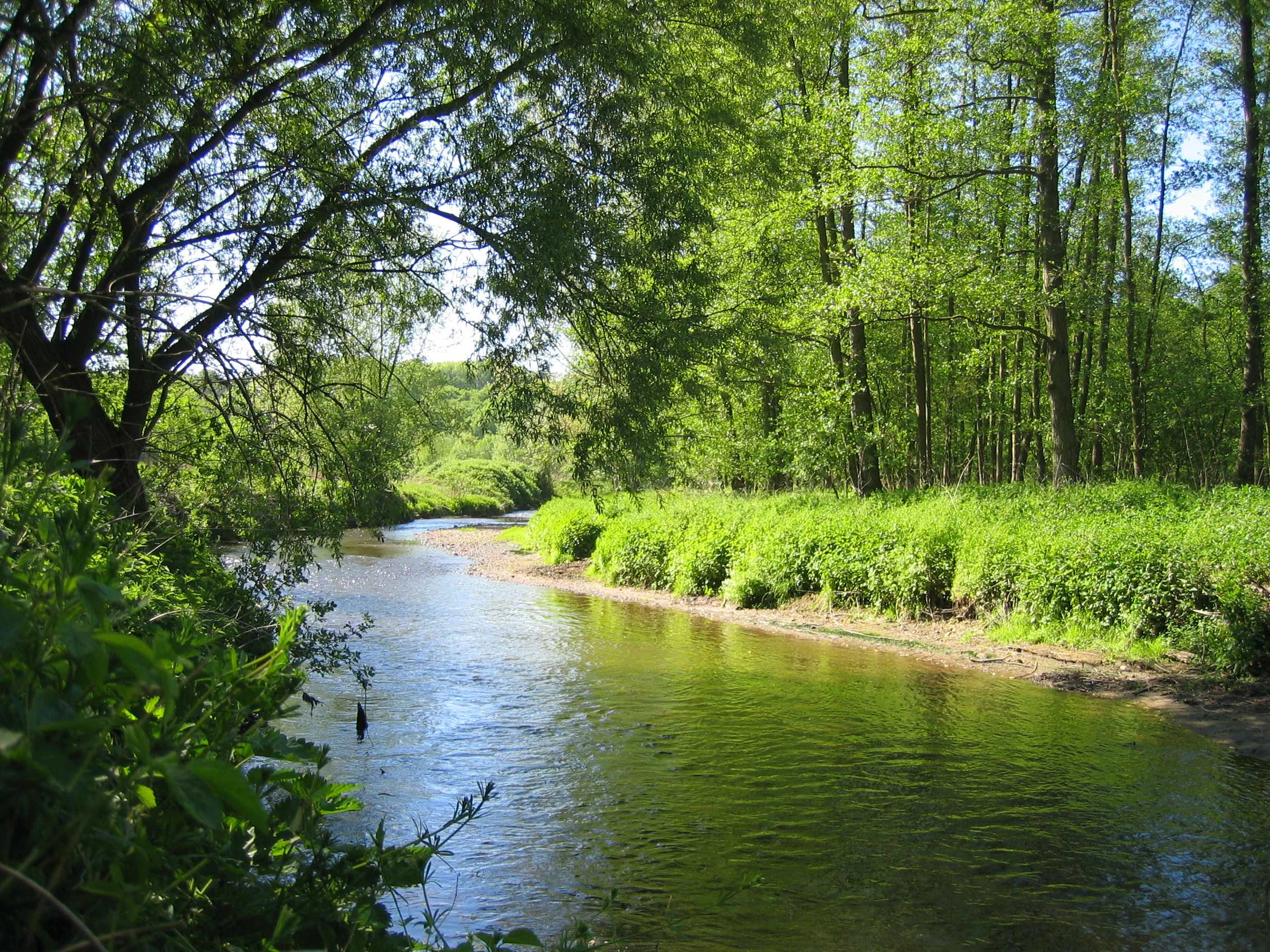
A peaceful river flows through a vibrant green deciduous forest, with overhanging tree branches along the banks.
The Wurm river flowing through the greenery of the Wurmtal nature reserve.

Wurmtal Nature Reserve history and protected-area timeline

The valley's modern protection history begins on 16 June 1989, when the southern part of Wurmtal south of Herzogenrath, including the Meisbach tributary, was officially designated as a Naturschutzgebiet. The smaller northern subunit, Wurmtal nördlich Herzogenrath, was reserved to protect an almost undisturbed lowland river reach held within its silver willow floodplain forest.

In June 1998 the North Rhine-Westphalian government reported the area upstream of Herzogenrath to the European Commission as a Fauna-Flora-Habitat (FFH) site under the EU Habitats Directive, followed by the downstream section in 2000, bringing Wurmtal into the Natura 2000 network. Between 2009 and 2010 substantial renaturation works were carried out where the Wurm leaves Aachen, freeing the riverbed from its canalized state.

Earlier in the 20th century, the Wurm had been straightened and reinforced between Herzogenrath and its confluence with the Rur to control flooding, which left long sections resembling a canal for decades. Since 2006 the river has been progressively remended between Übach-Palenberg and Geilenkirchen, and renaturation also took place near the Zweibrügger mill in 2013 and near Schloss Trips in 2017. Together these measures form the modern history of restoring, and then protecting, a river that had been heavily engineered for water-power, industry, and flood control.

Wurmtal Nature Reserve landscape and geographic character

The defining feature of Wurmtal is the Wurm itself, which flows in a tightly meandering pattern through a narrow valley with often wooded, sometimes very steep sides. In its upper section near Aachen, the valley is a classic Kerbsohlental, with vertical erosion banks and gravelly inside-bends producing a finely structured sequence of shallow water, sandy beaches, and undercut cliffs.

The floodplain contains mixed meadows, pasture, and relict alluvial woodland, with the strength of natural river dynamics clearly visible in fresh erosion scars and freshly deposited gravel bars. On the eastern edge near Würselen, two unusual landmarks rise above the green valley: the bright, chalk-like Weiße Halde, formed from soda-industry residues, and the Schwarze Halde, a dark spoil heap from the historic coal-mining industry. These provide dry, mineral-rich habitats that contrast with the wet valley floor.

North of Herzogenrath the topography opens out gradually: the flanks become lower, the relief differences to the surrounding plain shrink, and the river's character shifts from a steep meandering gorge to a softer, more open lowland valley before it eventually joins the Rur near Heinsberg-Kempen.
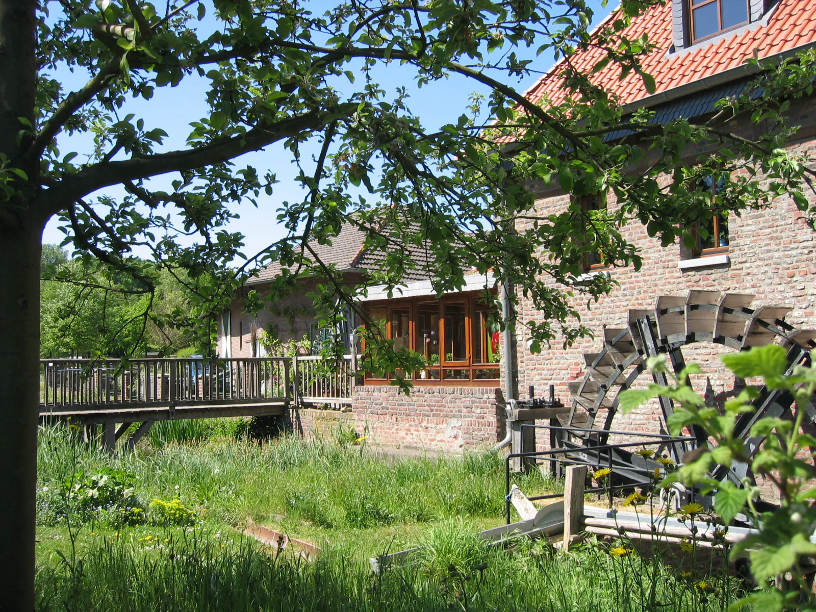
A historic brick building with a water wheel in the foreground, situated in a green, grassy valley area with a wooden bridge to the left.
A historic brick water mill building located in the Wurmtal valley landscape.

Wurmtal Nature Reserve ecosystems, habitats, and plant life

Wurmtal's ecological identity is shaped by the contrast between a near-natural river and its intensively used surroundings. The Wurm here is a classic dynamic lowland stream, with significant gravel and sand mobility, steep cut banks, and active lateral erosion. This physical dynamism, absent in most neighbouring waterways, drives a structurally rich mosaic of microhabitats along the river.

Vegetation along the valley floor includes herb-rich banks, softwood floodplain woodland dominated by silver willow (Salix alba), and small patches of hardwood alluvial forest. The northern subunit protects a particularly intact gallery of silver willow forest around an unconstrained section of the Wurm. On the industrial hills along the edge of the reserve, the dry, mineral-rich substrate of the Weiße Halde and Schwarze Halde supports specialised dry-flower communities of regional conservation interest.

The combination of aquatic, riparian, floodplain, and dry-grassland habitats within a narrow corridor makes Wurmtal ecologically disproportionate to its size, providing rare, high-value niches within a region dominated by agriculture and urban land.
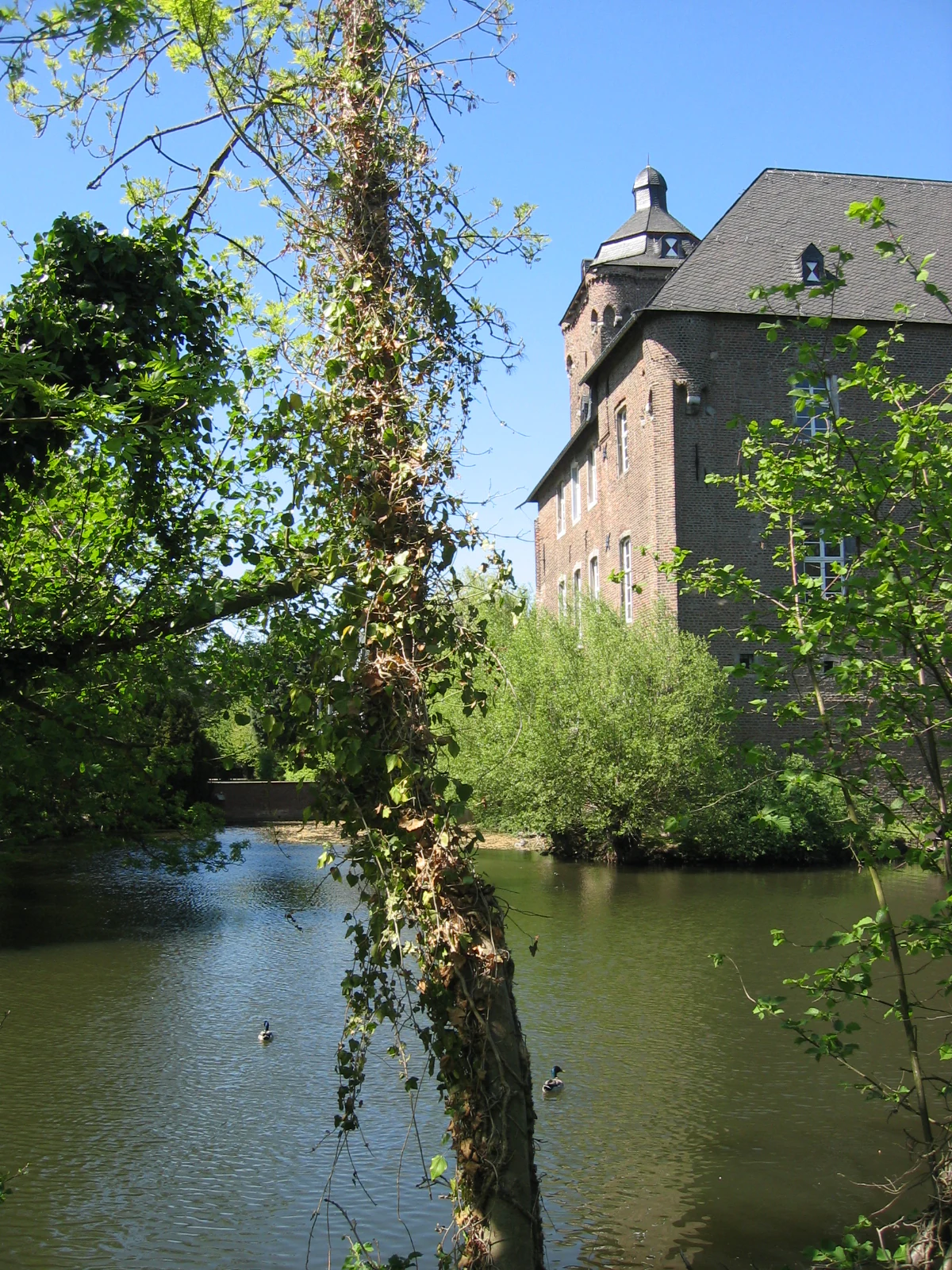
A historic brick castle with a tower sits beside a river, framed by trees and foliage on a sunny day.
Schloss Trips situated along the river in the Wurmtal valley.

Wurmtal Nature Reserve wildlife and species highlights

Wildlife is one of the main reasons for the reserve's regional importance. The dynamic gravel and sand banks attract riparian specialists that are now rare across much of North Rhine-Westphalia, including common sandpipers, green sandpipers, snipe, and water pipits, with the river's exposed sediments functioning as important foraging and resting habitat.

The vertical erosion banks are particularly important for breeding birds. Kingfishers, considered a rare breeding species in the region, dig nest burrows directly into the soft loamy cliff faces, with the population linked to both the Wurm and the adjacent Amstelbachtal. A marked nature trail through the northern subunit highlights the valley's birdlife and the associated natural landscape.

Beyond birds, the cleaned-up water quality has supported the return and persistence of typical lowland-stream fish such as pike, eel, chub, and perch in the Wurm itself, with occasional records of the non-native goldfish. The broader mosaic of habitats, from flowing water and gravel bars to meadows and floodplain woodland, also supports a wide community of invertebrates, amphibians, and small mammals, and the valley as a whole functions as a refuge and stepping stone within the heavily populated Aachen-Heinsberg corridor.
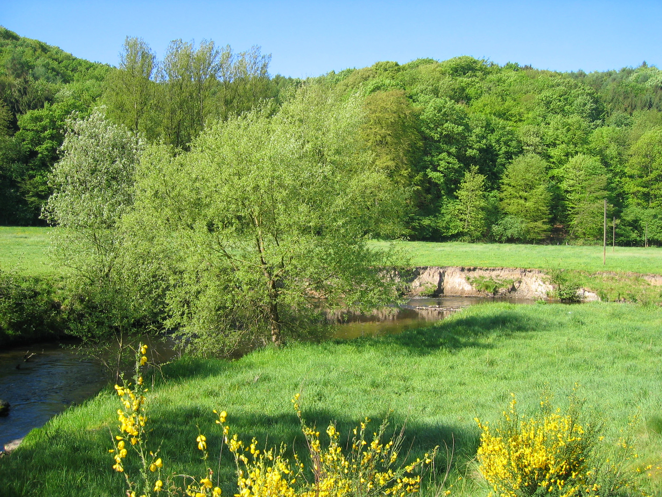
A peaceful winding river flows through a vibrant green meadow and forest in the Wurmtal valley with yellow flowers in the foreground.
The Wurm river flowing through the lush green valley of the Wurmtal nature reserve.

Wurmtal Nature Reserve conservation status and protection priorities

Wurmtal's primary conservation value is that it preserves a dynamic, near-natural stretch of a lowland river in a landscape that has otherwise been heavily straightened, industrialized, and settled. As a Naturschutzgebiet it enjoys strong legal protection, with management aimed at maintaining the river's natural meandering behaviour, its floodplain habitats, and the structural diversity of erosion banks and gravel deposits.

The area's role inside the European Natura 2000 network, as part of an FFH site reported to Brussels in 1998 and 2000, gives it additional supranational importance: the small-scale ecosystems along the Wurm are explicitly protected at the EU level, making Wurmtal a recognised component of Europe's ecological network.

The reserve also delivers conservation functions well beyond its boundaries. It acts as a refuge and a stepping-stone for migratory and wintering birds within the densely populated Börde region, and as a refuge for several rare and threatened species that have disappeared from most neighbouring waters. Restoration work since the 2000s, including remending of the river between Übach-Palenberg and Geilenkirchen and major projects near Schloss Trips in 2017, has been explicitly aimed at recovering the ecological lost attributes of the river.

Wurmtal Nature Reserve cultural meaning and human context

The Wurm has been a cultural and economic artery of the Aachen region for many centuries. Already in Celtic and then Roman times, the interplay between the river and the famous Aachen thermal springs supported early settlement, and the Romans channelled part of the cold Wurm water (the 'Kalte Bach') past the hot springs to supply fresh water to the city.

From the Middle Ages onwards, mills, hammerworks, tanneries, dye works, cloth manufacturers, and other water-using industries lined the river. Aachen's medieval cloth industry in particular depended on the soft, non-thermal water of the Wurm, and historical water-rights (Wassergerechtsame) carefully allocated access to it. The river also functioned as a political border: between the Middle Ages and the 19th century it separated numerous lordships, duchies, bishoprics, and finally, between Herzogenrath and Übach-Palenberg, the modern border between Germany and the Netherlands. Traces of the medieval Aachen Landgraben, 20th-century Westwall bunkers and dragon's teeth, and industrial mining heritage all sit within or close to the reserve.
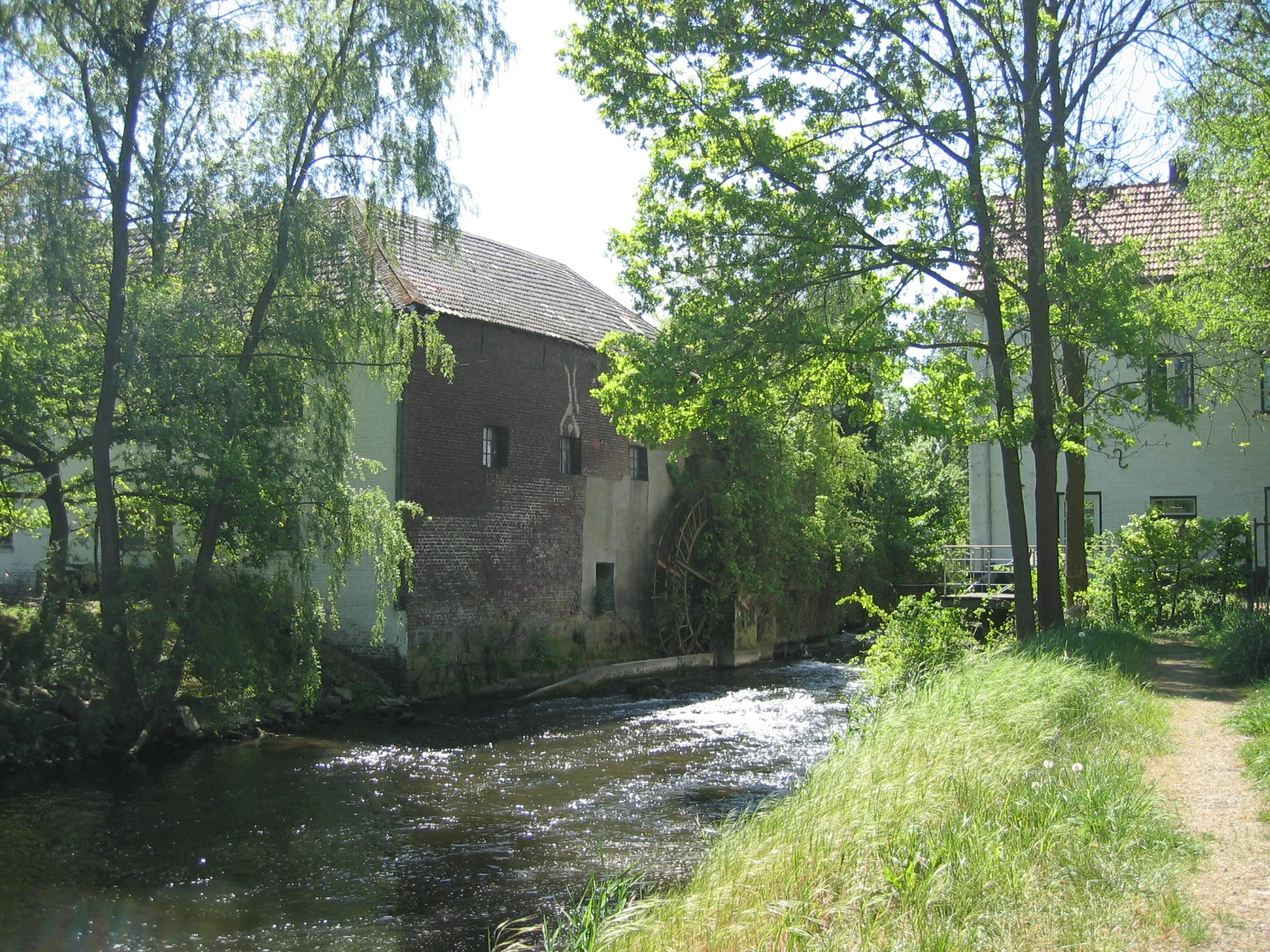
An old brick and stone mill with a water wheel located on the edge of a flowing river, surrounded by lush green trees and a dirt path.
A historic water mill situated along the banks of the Wurm river in the Wurmtal region.

Top sights and standout views in Wurmtal Nature Reserve

Among the reserve's standout features are the wide, freely meandering bends of the Wurm south of Herzogenrath, the steep erosion banks that are ideal nesting sites for kingfishers, and the bright Weiße Halde and dark Schwarze Halde spoil heaps, which together create a striking visual and ecological counterpoint inside the valley.

Equally distinctive are the unconstrained, silver-willow-flooded lowland reach north of Herzogenrath, the information-rich nature trail that explains the valley's natural history, and the valley's ambivalent identity as both an industrial heritage landscape and one of the most ecologically valuable Natura 2000 river sections in the western Rur basin.
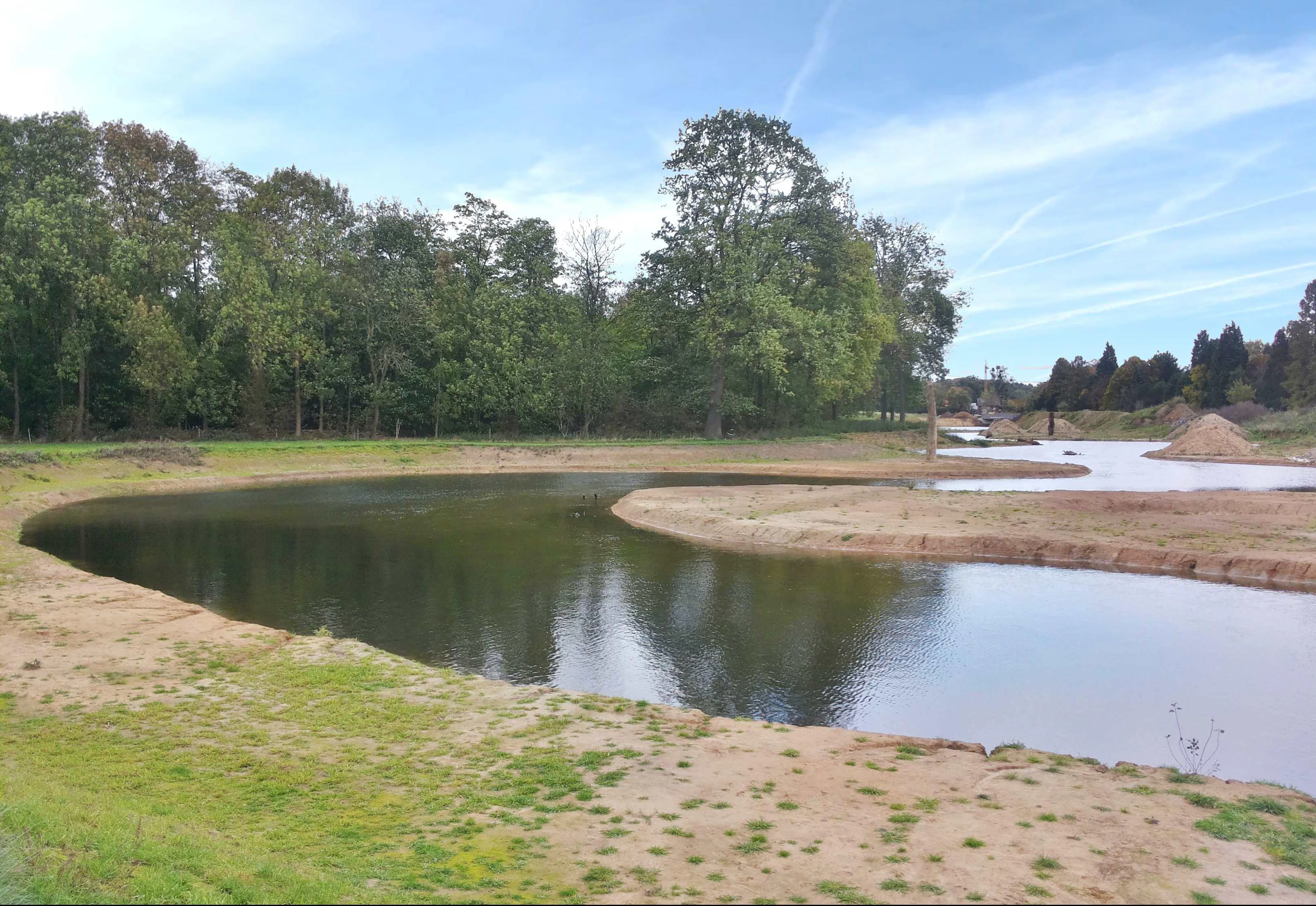
A newly realigned, winding river channel with exposed sandy banks, bordered by green trees and fields on a clear day.
A section of the Wurm river following a realignment and restoration project near Burg Trips.

Best time to visit Wurmtal Nature Reserve

Wurmtal can be visited all year, and the experience changes noticeably with the seasons. Spring and early summer are the most rewarding periods for birdwatching, when kingfishers are active around the erosion banks and migrant waders use the exposed gravel bars; late spring is also when the valley's meadows and woodland edges are at their most flower-rich.

Late summer and early autumn tend to offer the most pleasant walking conditions along the nature trails in the southern subunit, with low water levels exposing fresh gravel banks and meander scrolls, while winter brings a clearer view across the open floodplain of the southern section and the chance to see significant numbers of overwintering waterbirds. The reserve's climate is mild and Atlantic-influenced, as is typical of the Aachen region, but visitors should be aware that, like much of the Maas basin, the valley can experience heavy rainfall and even flooding at any time of year, especially during prolonged north-westerly weather.
Monthly climate preview

Long term representative point temperature and monthly precipitation records for Wurmtal

Wurmtal Climate Normals and Measured Annual Temperature Patterns

Representative coordinate sampling reveals the measured annual temperature range and steady monthly precipitation rhythm across Wurmtal. Examining the complete twelve month dataset provides deeper insight into long term climate averages and regional weather by month.
Annual mean8 °C
0 °C17 °C
Jan
Feb
Mar
Apr
May11°
Jun15°
Jul17°
Aug17°
Sep13°
Oct
Nov
Dec
Warmest month
July

17 °C

Coolest month
January

-0 °C

Wettest month
December

3.1 mm/day

Driest month
April

1.9 mm/day

Park location guide

Geography guide, regional context, and park location map for Wurmtal Nature Reserve

Wurmtal Nature Reserve park geography, regions, and map view in Germany

Understand where Wurmtal Nature Reserve sits in Germany through a broader geographic reading of the surrounding landscape, nearby location context, and its mapped position within the national park landscape.

How Wurmtal Nature Reserve fits into Germany

Germany is a federal republic in Western and Central Europe with a population of over 83 million across sixteen constituent states. It is Europe's largest economy by nominal GDP and a major global exporter and importer. The capital is Berlin, and the country borders Denmark, Poland, Czech Republic, Austria, Switzerland, France, Luxembourg, Belgium, and the Netherlands.

Wider geography shaping Wurmtal Nature Reserve in Germany

Germany is located in Western and Central Europe, spanning 357,022 km². It borders Denmark to the north, Poland and the Czech Republic to the east, Austria and Switzerland to the south, and France, Luxembourg, Belgium, and the Netherlands to the west. The country has coastlines on the Baltic Sea and North Sea to the north, with the Alps located in the southern region.

Map view of Wurmtal Nature Reserve

Use this park location map to pinpoint Wurmtal Nature Reserve in Germany, understand its exact geographic position, and read its mapped placement within the surrounding landscape more clearly.

Pigeon | © OpenStreetMap contributors

Visual reference of meandering river channels, steep erosion banks, and floodplain forest habitats

Wurmtal Landscape Photography and Protected River Valley Scenery

Visual documentation of Wurmtal reveals the intricate geomorphology of its meandering river valley and protected alluvial habitats. Examining these protected area views provides a clear understanding of the terrain, riparian vegetation, and striking industrial heritage contrasts.

A peaceful river flows through a vibrant green deciduous forest, with overhanging tree branches along the banks.

A view of the Wurm river flowing through a lush green landscape with grass banks, trees, and small white flowering shrubs.

A historic brick building with a water wheel in the foreground, situated in a green, grassy valley area with a wooden bridge to the left.

A historic brick castle with a tower sits beside a river, framed by trees and foliage on a sunny day.

A peaceful winding river flows through a vibrant green meadow and forest in the Wurmtal valley with yellow flowers in the foreground.

Children playing near the low stone walls of the reconstructed Roman bath ruins, set against a small pond and green forested hillside.

An old brick and stone mill with a water wheel located on the edge of a flowing river, surrounded by lush green trees and a dirt path.

A newly realigned, winding river channel with exposed sandy banks, bordered by green trees and fields on a clear day.

A narrow river flows through a green meadow with a deciduous tree in the foreground and a historic building visible in the distance.

A narrow river flows through a green landscape with trees lining both banks.

A close up view of a large rusted metal watermill wheel partially submerged in a flowing river next to a stone and brick building wall.

A calm, reflective river junction surrounded by lush green trees and grassy riverbanks on a sunny day.

A paved pedestrian path winds along the bank of a river with a wooden footbridge spanning the water, flanked by a bare willow tree.

A historic white building with a dark roof stands behind a line of trees in a grassy meadow with a small stream in the foreground.

A stylized map showing the rivers Wurm and Rur, with text labels in German indicating locations such as Heinsberg, Hückelhoven, Linnich, and river mouth points.

Park atlas

Compare adjacent river valleys and regional conservation areas across North Rhine Westphalia.

Explore Parks Near Wurmtal and Surrounding Protected Landscapes

Browsing other protected areas near Wurmtal reveals connected regional river corridors and contrasting valley habitats. Continuing into nearby protected landscapes provides broader geographic context for the surrounding western Rur basin.
A horizontal watercolor illustration depicting rolling, soft-toned hills and a line of stylized trees in greens and pinks against a white background.
Nature reserveNordrhein-Westfalen
About 6.9 km away#1 closest

Southeast

Naturschutzgebiet Schmithof: A Geological and Ecological Protected Area in Nordrhein-Westfalen

Mapped limestone quarries and traditional coppice forest landscapes

Located within the Städteregion Aachen, Naturschutzgebiet Schmithof protects a significant conjunction of geological and biological values. The site features an abandoned limestone quarry set against a backdrop of historic oak-hornbeam forest. This reserve provides a clear window into the local terrain, where calcareous grassland soils support rare flora and reflect ongoing habitat succession within a protected landscape context.

Area
0.048 km²
Established
1988
IUCN
IV
Relief
Lowland
A soft watercolor painting showing a meandering stream winding through green meadows and trees with distant purple hills.
Nature reserveNorth Rhine-Westphalia
About 8.2 km away#2 closest

Northeast

Münsterbusch zwischen Hamm und Haumühle Nature Reserve: Geography and Protected Landscapes

Ecological terrain and Inde valley floodplain mapping

Located in the Städteregion Aachen, Münsterbusch zwischen Hamm und Haumühle offers a compact yet diverse protected terrain. This nature reserve maps as a valuable corridor of oak-hornbeam forests, wet meadows, and specialized grasslands, showcasing the intersection of industrial history and botanical heritage within western Germany.

Established
2004
IUCN
IV
A soft watercolor illustration showing a winding river flowing through a forested valley with gentle rolling hills in the background.
Nature reserveGermany
About 9.1 km away#3 closest

Southeast

Naturschutzgebiet Oberlauf der Inde im Münsterwald: Germany Protected Nature Reserve Atlas

Headwater streams and rare wetland habitats in the Aachen region.

Situated in the Münsterwald near Aachen, this nature reserve protects the intact headwaters of the Inde and Fobisbach streams. The area is characterized by a complex, compact landscape of alder carr, spring-fed bogs, and Molinia grasslands, offering a rare window into the natural hydrology and wetland vegetation of the region.

Area
0.299 km²
Established
1988
Relief
Upland
Climate
Temperate
A wide panoramic watercolor painting showing a landscape with a winding light green river or meadow in the foreground, a band of green trees in the middle ground, and purple mountains in the background against a white sky.
Nature reserveNordrhein-Westfalen
About 9.5 km away#4 closest

East

Naturschutzgebiet Schomet: Mapping the Protected Limestone Ridge and Reclaimed Quarry Landscapes

Nature reserve geography in Stolberg, Nordrhein-Westfalen

Examine the distinct geomorphology of Naturschutzgebiet Schomet, where abandoned Carboniferous limestone quarries have evolved into sheltered refuges for hornbeam forest and spring flora. This protected area offers insight into the regional geology of the Eifel foothills, showcasing how human-modified landscapes serve as important ecological corridors for amphibians and rare butterfly species within the broader Stolberg municipal network.

Area
12.81 km²
Established
2005
IUCN
IV
A watercolor painting showing a soft green landscape with rolling hills, a small pond, and trees under a white background.
Nature reserveStädteregion Aachen
About 11 km away#5 closest

East

Naturschutzgebiet Schlangenberg: A Geographic Profile of Protected Mining Landscapes

Rare heavy metal habitats in the Städteregion Aachen

Naturschutzgebiet Schlangenberg serves as a protected ecological island featuring specialized Galmei flora that thrives on toxic zinc-rich soils. The reserve offers a clear look at how geological formation and historic mining practices created a unique steppe-like terrain, supporting diverse butterfly populations and rare botanical species within the North Rhine-Westphalia landscape.

Area
1.237 km²
Established
1975
IUCN
IV
Relief
Upland
A watercolor painting depicting rolling, soft-toned green hills and a foreground of trees and riparian vegetation.
Nature reserveNorth Rhine-Westphalia
About 14 km away#6 closest

Southeast

Laubwald am Hasselbachgraben Nature Reserve in North Rhine-Westphalia

Protected Eifel forest and riparian stream landscape

Located in the Städteregion Aachen, Laubwald am Hasselbachgraben preserves a distinct mix of European beech, oak, and spruce. The reserve is anchored by the Hasselbach stream valley and the landmark Kreitzberg Naturwaldzelle, providing a critical study of near-natural woodland structure within the northern Eifel region.

Area
2.88 km²
Established
1999
IUCN
IV
Relief
Upland
A watercolor painting showing a soft, pastel-colored landscape with a wetland in the foreground and gentle, rolling hills in the background.
Nature reserveNordrhein-Westfalen
About 16 km away#7 closest

Southeast

Hoscheider Venn mit Quellgebieten des Dreiläger- und Schleebaches Nature Reserve Atlas

Protected raised bog and glacial pingo terrain in North Rhine-Westphalia

Hoscheider Venn mit Quellgebieten des Dreiläger- und Schleebaches safeguards a representative upland moor environment on the western edge of the Eifel. The reserve includes diverse habitats ranging from nutrient poor bog pools to acidophilous forests, maintaining active restoration zones for regenerating wet heath and peatland ecosystems across its unique topographic mosaic.

Area
1.96 km²
Established
1982
IUCN
IV
Relief
Upland
Nature reserveGermany
About 16 km away#8 closest

Northeast

Korkus Nature Reserve: A Detailed Geographic Overview of Protected Woodland in Germany

Mapping the historic mining terrain and stream-valley ecology

Korkus Nature Reserve offers a focused view into the woodland mosaic of the Städteregion Aachen. This protected area preserves a unique synthesis of stream-bordered forest and remnants of ancient iron extraction, providing a distinct geographic footprint within the broader context of North Rhine-Westphalia.

Area
5.208 km²
Established
1990
IUCN
IV

Common questions about visiting, size, designation, and location context for Wurmtal Nature Reserve

Wurmtal Nature Reserve FAQs for park facts, access, geography, and protected area context

Find quick answers about Wurmtal Nature Reserve, including protected-area facts, park geography, trail and visitor context, and how the park fits into its surrounding country and regional landscape.
MoriAtlas Explorer

Continue Your Protected Areas Search Across the Global Atlas

Deepen your exploration by continuing the structured search for national parks and protected areas worldwide. Utilize the comprehensive filtering capabilities to compare different conservation landscapes and refine your understanding of global park geography. Discover more about the distribution and characteristics of protected natural areas.

Global natural geography