Mori Atlas logo
Protected landscapeZalew Wiślany i Mierzeja Wiślana

Coastal dune successions and brackish lagoon habitats along the Polish Baltic coast

Zalew Wiślany i Mierzeja Wiślana Protected Landscape Geography and Mapped Boundaries

Discover the complex ecological mosaic of Zalew Wiślany i Mierzeja Wiślana, where the expansive Vistula Lagoon meets the narrow, wind-swept Vistula Sandspit. This protected landscape preserves a rare transition of habitats, from embryonic white dunes and stabilized grey dune forests to inland bog woodlands and riverside meadows. The site serves as a vital coastal node in the Natura 2000 network, defining the environmental character of the northern Pomeranian region.

coastal lagoonsandspitBaltic coastNatura 2000Special Area of Conservationcoastal dunes

Zalew Wiślany i Mierzeja Wiślana

Protected landscape

Park overview

Structured park overview, official facts, and landscape profile for Zalew Wiślany i Mierzeja Wiślana

Zalew Wiślany i Mierzeja Wiślana park facts, protected area profile, and essential visitor context

Review the core facts for Zalew Wiślany i Mierzeja Wiślana, including designation, size, terrain, visitor scale, habitats, and operating context in one park-focused overview.

About Zalew Wiślany i Mierzeja Wiślana

Zalew Wiślany i Mierzeja Wiślana is a designated Special Area of Conservation (code PLH280007) within the European Natura 2000 network, located in Poland's Pomeranian Voivodeship along the northern coast. The site takes its name from the two geographic features it unifies: the Vistula Lagoon, a broad, shallow, brackish body of water separated from the open Baltic Sea by a sandy barrier, and the Vistula Sandspit itself, the long curving stretch of sand and dunes that encloses the lagoon on its seaward side.

The character of the protected area is strongly shaped by this lagoon-barrier relationship. The vast majority of the site, about three quarters of the roughly 40,862 hectare total, is open water, so the lagoon functions as the dominant physical and ecological element. Against this aquatic backdrop lie the narrow bands of shoreline, dune formations, coastal forests, and small inland habitat fragments that make the Mierzeja Wiślana such a distinctive landscape. The result is a protected site that is simultaneously a marine, littoral, and terrestrial conservation area, where water chemistry, sediment movement, and wind-driven dune dynamics all interact.

Ecologically, the area is designed to conserve a wide spectrum of natural habitat types that occur in close contact with one another. Coastal lagoons and estuarine habitats form the aquatic core, while the sandspit supports a full successional sequence of dune habitats, beginning with embryonic white dunes near the shoreline, moving through shifting white dunes of marram grass, and gradually transitioning into more stable grey dunes and dune forests. Inland pockets add bog woodlands, birch-pine swamp forests, riverside herb communities, and traditionally managed meadows, expanding the conservation value of the area far beyond the shoreline alone.

The site also holds significance at the network level. As a Special Area of Conservation under the EU Habitats Directive, Zalew Wiślany i Mierzeja Wiślana contributes to the broader coherence of the Natura 2000 network across the southern Baltic coast. Its designation reflects the recognition that lagoon-barrier systems are among the most ecologically valuable and vulnerable coastal formations in the region, both for their intrinsic biodiversity and for the role they play in protecting migratory and anadromous species. A formal protection plan adopted in 2022 reinforces this role by defining conservation targets, identifying internal and external threats, and aligning local spatial planning with the site's ecological needs.

Quick facts and research context for Zalew Wiślany i Mierzeja Wiślana

Zalew Wiślany i Mierzeja Wiślana is a Special Area of Conservation (PLH280007) within the Natura 2000 ecological network, situated entirely within Poland's Pomeranian Voivodeship. It covers a combined land and water area of roughly 40,862 hectares, of which approximately 74 percent is open water tied to the Vistula Lagoon.

The site protects a mosaic of marine and terrestrial habitat types, including coastal lagoons, estuaries, white and grey dunes, dune forests, bog woodlands, floodplain meadows, and natural eutrophic water bodies. It also shelters populations of rare and threatened species such as sabertooth pelagic fish, twaite shad, sea and river lampreys, Eurasian otter, and grey seal. A dedicated protection plan was established in 2022 to manage conservation actions, spatial planning requirements, and monitoring of the area's conservation status.

Protection and recognition

Documented protection scope and international recognition frameworks

Zalew Wiślany i Mierzeja Wiślana Protection Status and Recognition Data

Zalew Wiślany i Mierzeja Wiślana maintains a mixed protection scope within the regional conservation network. Structured facts outline the recorded designation history and management parameters.

Protection details

Protection scope
Mixed
Transboundary protection
No
Park context

Deeper park guide and search-rich context for Zalew Wiślany i Mierzeja Wiślana

Zalew Wiślany i Mierzeja Wiślana history, landscape, wildlife, and travel context

Explore Zalew Wiślany i Mierzeja Wiślana through its history, landscape character, ecosystems, wildlife, conservation priorities, cultural context, and seasonal travel timing in a structured park guide built for atlas discovery and search intent.

Why Zalew Wiślany i Mierzeja Wiślana stands out

Zalew Wiślany i Mierzeja Wiślana is best known for combining the brackish Vistula Lagoon with the long, narrow Vistula Sandspit, producing a transitional zone where Baltic marine influence meets sandy coastal landforms. The site is also notable for its diversity of protected habitat types within a single Natura 2000 boundary: from coastal lagoons and estuaries through successional white dunes to mature grey dune forests, bog woodlands, and riverside meadows. It is particularly recognized for hosting populations of threatened species that depend on this lagoon-shore interface, including migratory and anadromous fish, the Eurasian otter, and the grey seal.

Zalew Wiślany i Mierzeja Wiślana history and protected-area timeline

The Zalew Wiślany i Mierzeja Wiślana site was established as part of the Natura 2000 ecological network as a Special Area of Conservation, registered under the European site code PLH280007. Its creation responded to the need to protect the combined lagoon and sandbar ecosystem of the Vistula coastal region within Poland's Pomeranian Voivodeship, recognizing the ecological importance of both the brackish lagoon waters and the associated dune and forest habitats along the sandspit.

Until 2022 the area was administered primarily through standard Natura 2000 framework measures. In that year a comprehensive protection plan was developed for the site. This plan documented the area's boundaries, identified existing and potential threats to the natural habitats and species it protects, and laid out conditions necessary to maintain or restore their favorable conservation status. It also established procedures for monitoring conservation outcomes and linked the site's protection with municipal spatial planning instruments, requiring updates to local development studies and zoning plans to eliminate or reduce identified threats to the protected habitats and species.

Zalew Wiślany i Mierzeja Wiślana landscape and geographic character

The landscape of Zalew Wiślany i Mierzeja Wiślana is defined by the interplay between a large brackish lagoon and a slender marine sandspit. The Vistula Lagoon dominates the area, forming a shallow, low-energy body of tidal-influenced water where fine sediments settle along shifting shorelines. The water surface accounts for about three quarters of the protected site, shaping both its visual identity and its ecological dynamics.

Along the seaward edge, the Vistula Sandspit introduces a contrasting world of sand and wind. The terrain of the spit is shaped by a classic dune succession: embryonic dunes near the beach, active white dunes stabilized by marram grass, and older grey dunes inland. Between and behind these dune ridges lie patches of mixed forest and boreal-type pine-birch woodlands, along with wet depressions that support bog vegetation. Inland to the south, the landscape transitions gradually into meadows, riverside vegetation, and small natural water bodies, softening the boundary between the sandspit ecosystem and the broader coastal hinterland.

This combination of open water, dune ridges, coastal forest stands, and meadowland gives the site a strongly transitional quality. The terrain is generally low-lying and shaped largely by coastal processes; elevation changes are modest and the defining character comes from the lateral movement of water, sand, and vegetation rather than from vertical relief.

Zalew Wiślany i Mierzeja Wiślana ecosystems, habitats, and plant life

The natural character of Zalew Wiślany i Mierzeja Wiślana is organized around a chain of coastal and wetland habitat types that occur in close proximity. The aquatic side of the system is built on coastal lagoons and estuarine habitats, with associated natural eutrophic water bodies and oxbow-type features near the mainland shore. These water bodies support rich planktonic and fish-based food webs and provide essential conditions for migratory and anadromous species.

On land, the site captures the full natural sequence of sandspit habitats. Pioneer dune vegetation gives way to mature white dune communities dominated by marram grass, which over time stabilize into grey dune landscapes where soils begin to develop. Further inland, dune forests, pine forests on dunes, and boggy woodland communities take over, creating layered vegetation communities that range from open sandy ground to dense forest cover. Small wet depressions within the dune belt support bog woodland habitats typical of boreal conditions.

Additional inland habitat types add further ecological diversity. Floodplain and riverside herb communities thrive along the edges of fresh water inputs, while traditionally managed meadows provide open, species-rich grassland habitat. The juxtaposition of these habitat types within a single Natura 2000 boundary creates a richly structured mosaic in which aquatic, maritime, dune, forest, bog, and meadow ecosystems reinforce one another.

Zalew Wiślany i Mierzeja Wiślana wildlife and species highlights

Wildlife in Zalew Wiślany i Mierzeja Wiślana is closely tied to the dual identity of the site as both a lagoon and a sandspit environment. The brackish waters of the Vistula Lagoon are an important habitat for migratory and anadromous fish that travel between the Baltic Sea and inland waters. Species of conservation concern recorded for the site include the sabertooth pelagic fish and the twaite shad, alongside the sea lamprey and the river lamprey, both of which depend on the lagoon as a transition zone between marine and freshwater environments.

The mammal fauna adds a terrestrial-marine dimension to the protected area. The Eurasian otter is among the mammals of conservation interest protected here, reflecting the value of clean coastal and fresh water habitats. The grey seal, a marine mammal associated with the Baltic Sea coast, is also recorded among the species targeted by the site's protection, highlighting the importance of the lagoon's interface with the open sea.

In terrestrial habitats, the dune and forest mosaic supports the typical range of coastal wildlife: birds associated with dune landscapes, reedbeds, and open water, together with mammals and invertebrates of sandy and woodland environments. The variety of habitat types within the site, from open lagoon water to dune ridges and boggy woodland, supports a correspondingly diverse animal community whose presence reinforces the ecological significance of the protected area.

Zalew Wiślany i Mierzeja Wiślana conservation status and protection priorities

Zalew Wiślany i Mierzeja Wiślana holds substantial conservation value as a Natura 2000 Special Area of Conservation covering both marine and terrestrial ecosystems that are considered vulnerable across the Baltic region. Its designation reflects the recognition that lagoon-barrier systems are among the most ecologically important and fragile coastal formations, and that their long-term protection requires coordinated management at the landscape scale.

At the core of its conservation significance is the protection of natural habitat types that are rare or threatened at the European level, including coastal lagoons, estuarine habitats, the full sequence of Baltic dune habitats, dune forests, bog woodlands, floodplain meadows, and natural eutrophic water bodies. These habitat types are mirrored by the protection of species of conservation concern, among them anadromous and brackish-water fish, the Eurasian otter, and the grey seal, whose survival depends on the integrity of lagoon and shoreline environments. Together, the protected habitats and species form a coherent conservation unit spanning marine, littoral, dune, forest, and meadow systems.

A formal protection plan for the site was developed in 2022, addressing both internal and external threats to the area's conservation status. The plan identifies actions needed to maintain or restore the favorable conservation status of the protected habitats and species, sets monitoring methods for tracking outcomes, and links conservation objectives to local land-use planning by requiring updates to municipal spatial development plans. Through these mechanisms, the site contributes not only to habitat protection in its own right but also to the broader coherence of the Natura 2000 network along Poland's Baltic coast.

Top sights and standout views in Zalew Wiślany i Mierzeja Wiślana

Zalew Wiślany i Mierzeja Wiślana unites two iconic Baltic landforms within a single protected boundary: the brackish Vistula Lagoon and the long sandy Vistula Sandspit. The result is a site where roughly three quarters of the area is open water, while the rest carries a layered sequence of dunes, dune forests, bog woodlands, and meadows.

The area stands out for the breadth of habitat types it conserves within a single Natura 2000 boundary, from coastal lagoons and estuaries through white and grey dunes to boreal-type bog forests and riverside meadows. It is also notable for the rare and threatened species that depend on this lagoon-shore interface, including twaite shad, sea and river lampreys, the Eurasian otter, and the grey seal, making the site an important node in the regional conservation network along Poland's northern coast.
Monthly climate preview

Long-term temperature ranges and monthly precipitation data recorded at a representative coordinate

Zalew Wiślany i Mierzeja Wiślana Climate Normals and Annual Weather Patterns

Representative coordinate measurements reveal how monthly temperatures transition across the year alongside stable daily precipitation averages. Examining the complete twelve-month record provides deeper insight into long-term climate normals for Zalew Wiślany i Mierzeja Wiślana.
Annual mean9 °C
0 °C19 °C
Jan
Feb
Mar
Apr
May11°
Jun15°
Jul18°
Aug19°
Sep15°
Oct10°
Nov
Dec
Warmest month
August

18.8 °C

Coolest month
January

0.4 °C

Wettest month
November

2.4 mm/day

Driest month
April

1.3 mm/day

Park location guide

Geography guide, regional context, and park location map for Zalew Wiślany i Mierzeja Wiślana

Zalew Wiślany i Mierzeja Wiślana park geography, regions, and map view in Poland

Understand where Zalew Wiślany i Mierzeja Wiślana sits in Poland through a broader geographic reading of the surrounding landscape, nearby location context, and its mapped position within the national park landscape.

How Zalew Wiślany i Mierzeja Wiślana fits into Poland

Poland, officially the Republic of Poland, is a Central European country spanning from the Baltic Sea in the north to the Carpathian Mountains in the south. It borders Germany, Czech Republic, Slovakia, Ukraine, Belarus, Lithuania, and Kaliningrad Oblast. The country has a temperate climate, diverse landscapes, and is known for its rich history, cultural heritage, and strong economic position within the EU.

Wider geography shaping Zalew Wiślany i Mierzeja Wiślana in Poland

Poland occupies 312,696 km2 in Central Europe, extending from the Baltic Sea coast in the north to the Sudetes and Carpathian Mountains in the south. It borders Germany to the west, Czech Republic and Slovakia to the south, Ukraine and Belarus to the east, and Lithuania and Kaliningrad Oblast to the northeast. The landscape includes lowland plains, uplands, and mountain ranges.

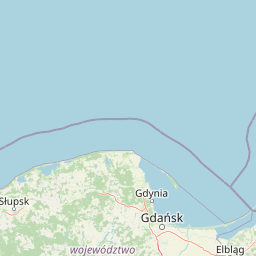
Map view of Zalew Wiślany i Mierzeja Wiślana

Use this park location map to pinpoint Zalew Wiślany i Mierzeja Wiślana in Poland, understand its exact geographic position, and read its mapped placement within the surrounding landscape more clearly.

Pigeon | © OpenStreetMap contributors
Park atlas

Compare surrounding coastal geography, brackish lagoons, and Baltic nature reserves

Parks Near Zalew Wiślany i Mierzeja Wiślana and Related Protected Landscapes

Browsing parks near Zalew Wiślany i Mierzeja Wiślana reveals interconnected coastal habitats across the Pomeranian region. Comparing adjacent protected landscapes clarifies regional ecological patterns along the southern Baltic shoreline.
Protected landscapeWarmian-Masurian Voivodeship
About 7.2 km away#1 closest

Southeast

Park Krajobrazowy Wysoczyzny Elbląskiej: Mapping Upland Terrain and Protected Forest Zones

Geography of a distinctive morainic plateau in northern Poland

Investigate the natural landscape of Park Krajobrazowy Wysoczyzny Elbląskiej, a protected area in the Warmian-Masurian Voivodeship. Focus on the interplay between stream valleys, morainic ridges, and rare plant communities. This mapping resource details the ecological significance of the upland terrain and its transition toward coastal lowland borders.

Area
137.32 km²
Established
1985
Relief
Upland
Climate
Temperate
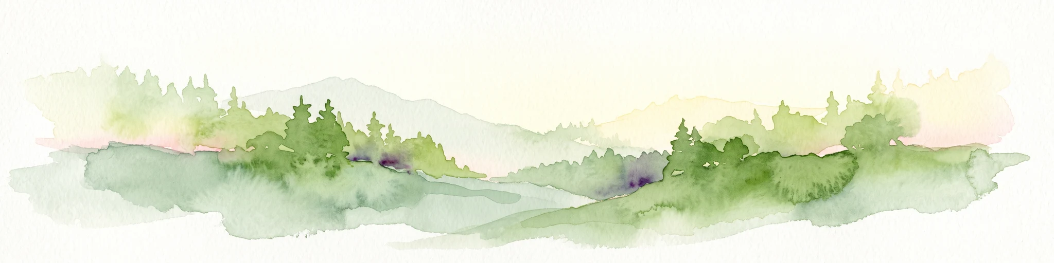
A soft watercolor illustration depicting a river valley with green vegetation, rolling hills, and marshy banks, rendered in light washes.
Nature reserveWarmian-Masurian Voivodeship
About 14 km away#2 closest

East

Rezerwat przyrody Dolina Stradanki: Protected Forest and River Valley Geography

Nature reserve within the Warmian-Masurian Voivodeship

Rezerwat przyrody Dolina Stradanki is a critical protected area in northern Poland, known for its intricate system of side valleys and mature beech forest. This reserve integrates hydrological and biological values, functioning as a key ecological unit within the Elbląg Upland Landscape Park. Explore the map of this glacial valley, which provides a high-quality habitat for diverse avifauna and protected flora.

Area
1.211 km²
Established
2006
Relief
Upland
Scope
Terrestrial
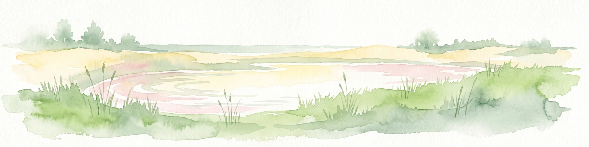
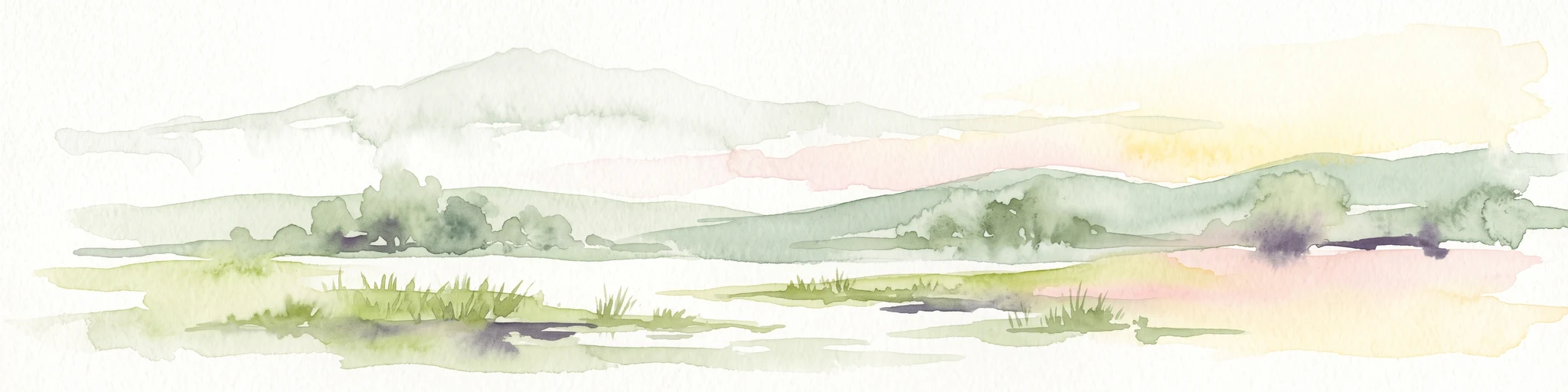
A soft watercolor painting of a marshy coastal landscape with tall grasses, calm water, and distant dunes under a bright, clear sky.
Nature reservePomeranian Voivodeship
About 27 km away#3 closest

West

Rezerwat przyrody Mewia Łacha: Protected Coastal Geography and Vistula Estuary Map

Dynamic Baltic sandbars and migratory bird habitat in Pomerania

Rezerwat przyrody Mewia Łacha occupies a vital coastal strip where river discharge meets the Gulf of Gdańsk. This nature reserve serves as an essential site for migratory waterfowl and nesting terns, defined by its shifting sandbars, dune slacks, and brackish pools. It stands as a key example of the varied estuarine geography found within the Pomeranian Voivodeship.

Area
1.505 km²
Established
1991
Relief
Lowland
Climate
Temperate
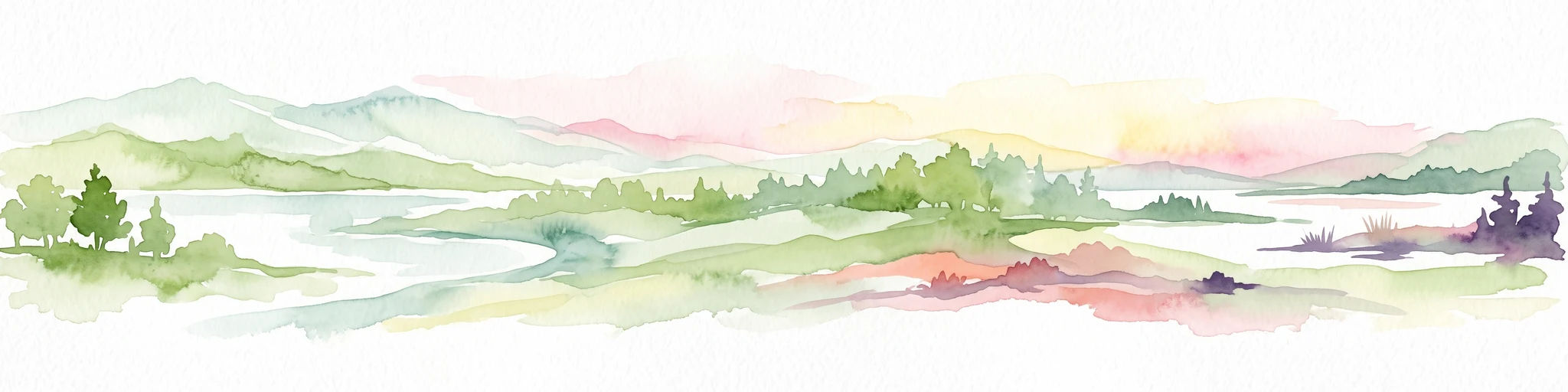
A wide panoramic watercolor illustration showing a pastoral landscape with green rolling hills, a winding river, scattered trees, and a soft sky with pink and yellow hues.
Protected areaPomeranian Voivodeship
About 45 km away#4 closest

West

Twierdza Wisłoujście Protected Area: Coastal Geography and Historical Mapping in Gdańsk

A historic Baltic fortification and vital ecological site in Pomeranian Voivodeship.

Explore the layered masonry and water-influenced landscape of Twierdza Wisłoujście, a coastal fortress established on the delta of the Vistula River. This site bridges the history of maritime defense and modern ecological conservation as a designated Natura 2000 area. Examine how shifting river channels and centuries of construction define the current defensive perimeters and moated surroundings within the Pomeranian Voivodeship.

Established
1482
Relief
Lowland
Climate
Temperate
Access
Easy access
Nature reserveGdańsk
About 49 km away#5 closest

West

Zbiornik Wody Stara Orunia: A Protected Industrial Heritage Site and Nature Reserve in Gdańsk

Historic brick architecture meeting urban bat conservation zones

Built in 1869, this historic underground reservoir in the Orunia district of Gdańsk combines rare Prussian engineering with a vital role as a Natura 2000 protected habitat. The site serves as a key component of the regional water trail, offering a look into the complex relationship between industrial infrastructure, urban landscape development, and the protection of essential wildlife hibernation cycles.

Area
0.001 km²
Established
1869
Relief
Upland
Climate
Temperate
Nature reservePomeranian Voivodeship
About 54 km away#6 closest

West

Dolina Strzyży Nature Reserve Protected Forest and Stream Valley Geography

Natural riparian forest in Pomeranian Voivodeship

Explore the geographic profile of Dolina Strzyży Nature Reserve, a protected valley woodland in the Pomeranian Voivodeship of Poland. This reserve maintains dense oak-hornbeam habitats and stream-side ecosystems, functioning as a vital green connection between urban Gdańsk and the expansive Trójmiejski Park Krajobrazowy, preserving historic forest remnants.

Area
0.385 km²
Established
2007
Relief
Upland
Climate
Temperate
Protected landscapePomeranian Voivodeship
About 57 km away#7 closest

West

Trójmiejski Park Krajobrazowy: Protected Landscape and Glacial Geography in Pomerania

Exploring the forested moraine upland near the Baltic coast

Covering nearly 20,000 hectares, Trójmiejski Park Krajobrazowy forms an essential green belt along the Kashubian moraine. Its terrain is defined by dramatic erosion, including 80-meter deep ravines and extensive pine-beech forests that host rare relic plant species and protected peatland habitats.

Area
199.3 km²
Established
1979
Relief
Upland
Climate
Temperate
Nature reservePomeranian Voivodeship
About 57 km away#8 closest

West

Dolina Kłodawy Nature Reserve: Geography and Botanical Protected Areas in Pomeranian Voivodeship

Glacial river gorge landscapes in Northern Poland

This protected area centers on a 1.6 kilometer section of the Kłodawa stream, showcasing complex forest ecosystems including ash-alder woodlands and oak-hornbeam slopes. The site remains a vital reference for regional botanical geography, highlighting how glacial moraine hills create unique habitats for rare plants within the Pomeranian Voivodeship landscape.

Area
0.104 km²
Established
1999
Relief
Lowland
Climate
Temperate

Common questions about visiting, size, designation, and location context for Zalew Wiślany i Mierzeja Wiślana

Zalew Wiślany i Mierzeja Wiślana FAQs for park facts, access, geography, and protected area context

Find quick answers about Zalew Wiślany i Mierzeja Wiślana, including protected-area facts, park geography, trail and visitor context, and how the park fits into its surrounding country and regional landscape.
MoriAtlas Explorer

Continue Your Protected Areas Search Across the Global Atlas

Deepen your exploration by continuing the structured search for national parks and protected areas worldwide. Utilize the comprehensive filtering capabilities to compare different conservation landscapes and refine your understanding of global park geography. Discover more about the distribution and characteristics of protected natural areas.

Global natural geography