
Mori Atlas logo
Protected landscapeTrójmiejski Park Krajobrazowy

Tracing glacial valleys, dense forest mosaics, and the Kashubian moraine upland geography

Trójmiejski Park Krajobrazowy: A Mapped Protected Landscape in the Pomeranian Voivodeship

Trójmiejski Park Krajobrazowy represents a significant protected landscape on the northeastern edge of the Kashubian Lake District, shaped by the retreat of the Scandinavian ice sheet. This forested expanse encompasses deeply incised valleys, kettle bogs, and erratic boulders that reveal a complex post-glacial history. Spanning diverse municipalities near the Tri-City metropolis, the region offers a distinct look at lowland ecology through its network of strict nature reserves and ancient woodland.

landscape parkPomeraniaKashubian Lake Districtmoraine uplandglacial valleysScots pine forest
A flat-style digital illustration of a valley landscape featuring coniferous trees, rugged cliff faces, two tiers of waterfalls, and a winding river.

Trójmiejski Park Krajobrazowy

Protected landscape

Park overview

Structured park overview, official facts, and landscape profile for Trójmiejski Park Krajobrazowy

Trójmiejski Park Krajobrazowy park facts, protected area profile, and essential visitor context

Review the core facts for Trójmiejski Park Krajobrazowy, including designation, size, terrain, visitor scale, habitats, and operating context in one park-focused overview.

About Trójmiejski Park Krajobrazowy

Trójmiejski Park Krajobrazowy is a major Polish landscape park that wraps around the inland side of the Tri-City conurbation along the Baltic coast. Its nearly 20,000 hectares form a green wedge of morainic upland, pine and beech forest, glacial lakes, and river valleys, separating the dense urban fabric of Gdańsk, Gdynia, and Sopot from the broader hinterland of the Kashubian Lake District.

The protected area was created in 1979 as one of the early regional landscape parks of post-war Poland and has evolved into an essential ecological and recreational corridor for the Pomeranian region. Withabout 90 percent forest cover, it functions both as a working woodland managed by the Gdańsk Forest District and as a strictly protected reserve system that guards the area's most sensitive natural features. Ten nature reserves, scattered across the park, protect old-growth forests, spring mires, beech and yew stands, and deeply carved valleys that illustrate the regional geological history.

Ecologically, the park is significant for its mix of habitats. Coniferous forest on acidic glacial outwash gives way to mixed deciduous forest on richer moraine soils, while the valley bottoms preserve alder swamps, peat bogs, and spring-fed streams. The flora includes more than 850 vascular plant species, of which a substantial portion is protected under Polish law, alongside bryophytes, lichens, and roughly 200 species of macrofungi. The wildlife profile is characteristic of the Polish lowlands, with healthy populations of red deer, roe deer, wild boar, and occasional moose, while the birdlife includes white-tailed eagles, goshawks, buzzards, several owl species, and black as well as green woodpeckers.

Culturally, the park also carries strong regional identity. It contains the historic Calvary of Wejherowo, one of the oldest Passion sanctuaries in Poland. Seven long-distance hiking trails, eight cycling routes, and nature-education paths link the Tri-City stations of Sopot, Gdańsk, and Gdynia with towns and villages deeper in the Kashubian region, making the park a practical everyday landscape for urban residents as much as a destination for visitors exploring northern Poland.

Quick facts and research context for Trójmiejski Park Krajobrazowy

Trójmiejski Park Krajobrazowy lies in the Pomeranian Voivodeship of northern Poland, straddling the northeastern margin of the Kashubian Lake District mesoregion. It was established on 3 May 1979 by resolution of the Provincial National Council in Gdańsk, and currently covers 19,930 hectares with a surrounding buffer zone of 16,542 hectares.

The park spans seven municipalities, including urban territory within Gdańsk, Gdynia, Sopot, Rumia, Reda, and Wejherowo as well as parts of the rural gminas of Wejherowo and Szemud. It contains ten strict nature reserves, approximately 170 natural monuments, 20 ecological use areas, three Natura 2000 sites, and a protected landscape complex along the Strzyża and Jasień streams. About 90 percent of the park is forested, with the remainder occupied by lakes, peat bogs, valleys, and small agricultural villages.

Protection and recognition

Explore documented terrestrial protection parameters and conservation governance details

Trójmiejski Park Krajobrazowy Protection Status and Designated Frameworks

Trójmiejski Park Krajobrazowy maintains a recorded terrestrial protection scope within its regional landscape boundary. Documented protection status details provide clear insight into the official conservation framework governing this protected area.

Protection details

Protection scope
Terrestrial
Transboundary protection
No
Buffer area
165.42 km²
Park context

Deeper park guide and search-rich context for Trójmiejski Park Krajobrazowy

Trójmiejski Park Krajobrazowy history, landscape, wildlife, and travel context

Explore Trójmiejski Park Krajobrazowy through its history, landscape character, ecosystems, wildlife, conservation priorities, cultural context, and seasonal travel timing in a structured park guide built for atlas discovery and search intent.

Why Trójmiejski Park Krajobrazowy stands out

Trójmiejski Park Krajobrazowy is known for its exceptional combination of glacial geomorphology and intact lowland forest, set directly behind the Tri-City metropolis. The park's terrain was shaped by the Scandinavian ice sheet between roughly 13,000 and 15,000 years ago, leaving behind deeply incised valleys, large erratic boulders, kettle lakes, peat bogs, and the steep edge of the Kashubian moraine upland that drops dramatically toward the coast. The forested plateau, dominated by Scots pine, beech, and oak, harbors more than 850 vascular plant species, including rare relic and mountain taxa such as spiny quillwort, wood sweet-grass, ribbed spleenwort, and mountain speedwell. Ten strict nature reserves protect particularly sensitive fragments such as the spring-fed valley of stream Ewa, the old-growth yew grove at Cisowa, and the deeply eroded Samborowo and Strzyża valleys. The park is also famous for the Gruby Dąb, a more than 350-year-old pedunculate oak considered the oldest tree in the area.
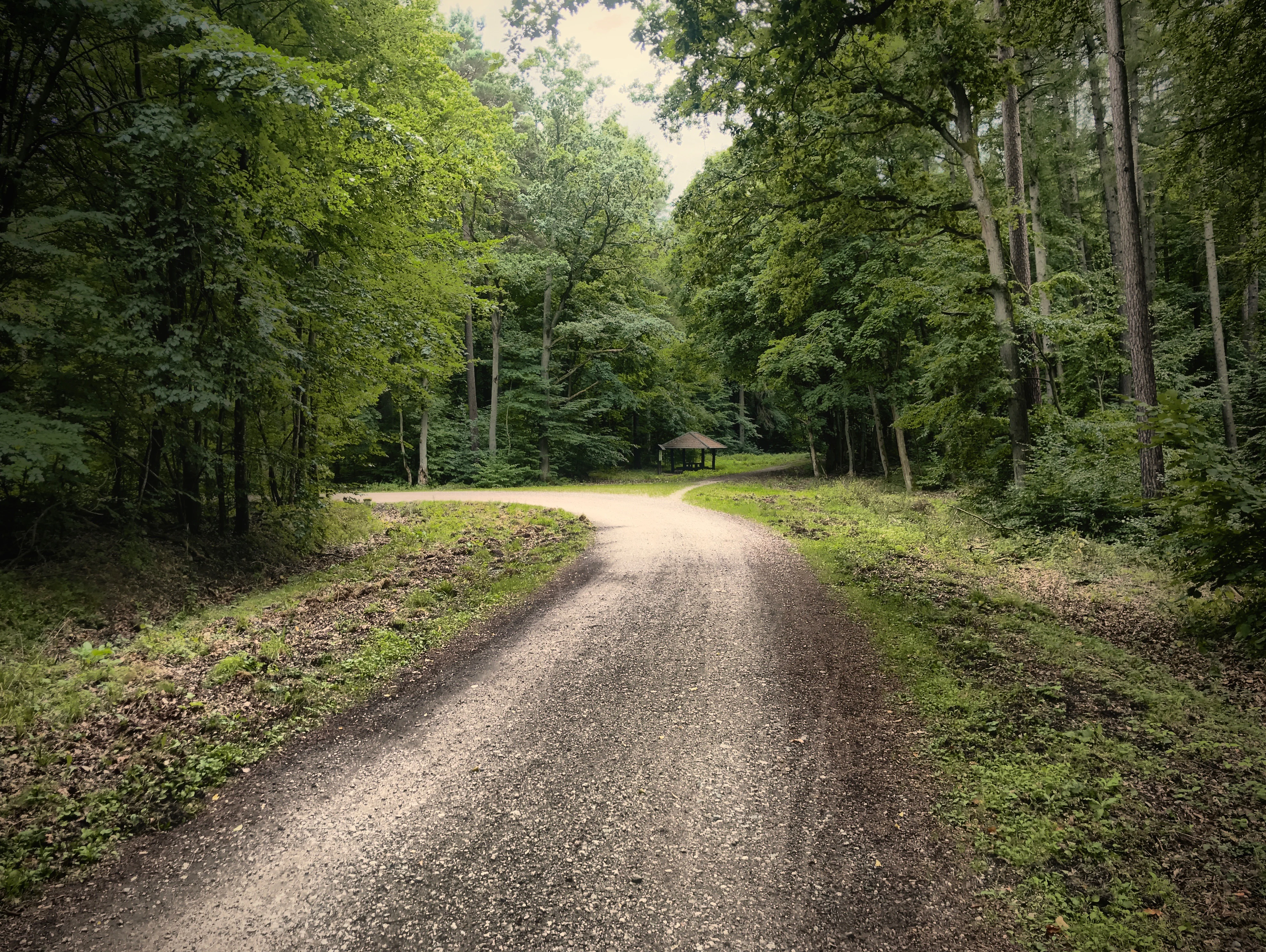
A gravel forest path curves into a dense green woodland, leading to a small wooden gazebo in the distance.
A forest trail leading toward a small wooden gazebo in the Owczarnia region of Trójmiejski Park Krajobrazowy.

Trójmiejski Park Krajobrazowy history and protected-area timeline

Trójmiejski Park Krajobrazowy was established on 3 May 1979 by resolution of the Provincial National Council in Gdańsk, with an initial area of 20,104 hectares. The decision was part of the late-1970s expansion of Poland's regional landscape park network and created a protected buffer for the rapidly growing Tri-City conurbation.

The park's boundaries and status were revised twice in the years that followed. In 1994 (effective from 1995) the park's area was increased to 20,312 hectares through the addition of forests south of Słowackiego Street in Gdańsk and the inclusion of communal woodlands, and a protective buffer zone was formally designated to mark fifteen years of operation. Then in 1998 the rural enclave of the village of Łężyce was excised from the park, reducing its core area to the current 19,930 hectares.

Over the decades, the park's internal protection system has grown significantly. The first four nature reserves were established in 1983, followed by additional reserves in 1988, 1990, 1999, 2005, and 2007, bringing the total to ten. The park also accumulated roughly 170 natural monuments, twenty ecological use areas, three Natura 2000 sites, and a protected landscape complex along the Strzyża and Jasień streams, reflecting a gradual intensification of habitat-focused conservation within the broader landscape-protection framework.

Trójmiejski Park Krajobrazowy landscape and geographic character

The terrain of Trójmiejski Park Krajobrazowy is the product of a single decisive event in its geological history: the advance and retreat of the Scandinavian ice sheet between roughly 13,000 and 15,000 years ago. Glacial scouring and deposition sculpted the park into two clearly distinct landscape zones.

The western portion of the park is dominated by gently undulating ground moraine, locally broken by small ridges of terminal moraine. Within this mosaic one finds sandur plains, meltwater channels filled with lake water, and small kettle hollows, often hosting peat bogs and small lakes. This landscape is typical of the broader Kashubian Lake District and gives the park much of its characteristic open-forest character.

The eastern zone, by contrast, includes the steep edge of the Kashubian upland, where erosional landforms become pronounced. Deeply incised valleys cut by post-glacial streams expose slopes with denivelations of up to 80 meters and inclinations of as much as 40 percent, with the Lasy Oliwskie north of Gdańsk representing the most dramatic example. Throughout the park, scattered erratic boulders, glacial lakes, peatlands, and small streams reveal the underlying pattern of glacial and post-glacial processes that continue to define the visual and ecological character of the protected area. Notable elevations include Cieniawa, Głowica, Góra Dantyszka, Ślimak, Wiecha, and Wzgórze Pachołek, which offer viewpoints over the forested upland and, from the eastern edge, glimpses toward the Bay of Gdańsk.

A wide panoramic photograph showing a lush, green deciduous and coniferous forest with gentle slopes and dappled light, captured during the daytime.
A panoramic view of the forested landscape within Trójmiejski Park Krajobrazowy.

Trójmiejski Park Krajobrazowy ecosystems, habitats, and plant life

The ecological identity of Trójmiejski Park Krajobrazowy is rooted in the close interplay between glacial soils, varied moisture regimes, and the long continuity of forest cover across most of its surface. The dominant habitat is a mosaic of dry coniferous forest on sandy outwash and moraine ridges, mixed deciduous forest on richer brown soils, and humid valley forests along streams and around lakes. Scots pine forms the prevailing canopy, accompanied by common beech, sessile and pedunculate oak, silver and downy birch, black alder, aspen, and goat willow.

The park's flora is unusually rich for a lowland protected area, with roughly 850 vascular plant species currently recorded. Among these, 49 species are under strict protection and 17 are under partial protection, while a significant share consists of rare, relict, or upland taxa that are normally found much farther south or in montane environments. Notable examples include spiny quillwort, wood sweet-grass, ribbed spleenwort, and mountain speedwell, along with bryophyte and lichen communities that contribute to the biological interest of old-growth forest patches and rock outcrops.

Alongside its vascular flora, the park harbors significant populations of mosses, roughly 200 species of macrofungi, and about 50 species of saxicolous lichens. The combination of acidic pine forest, base-rich beech and oak stands, spring mires, and peatlands means that markedly different plant communities are able to coexist within a relatively compact geographic frame, supporting both specialist woodland species and the more generalist flora and fauna of the Polish lowlands.

Trójmiejski Park Krajobrazowy wildlife and species highlights

The wildlife of Trójmiejski Park Krajobrazowy reflects its position as a forested lowland refuge embedded in an urbanized coastal region. Among the larger mammals, the park holds stable populations of wild boar, roe deer, and red deer, while moose appear as occasional visitors and give the area a touch of northern wilderness character. Smaller mammals include European hare, European rabbit, red squirrel, red fox, and European badger, with bat species such as the common noctule and the greater mouse-eared bat recorded in older forest stands and built structures.

Birds of prey and other forest birds form one of the most distinctive elements of the park's fauna. White-tailed eagles soar over the lakes and forested valleys, accompanied by goshawks and common buzzards in the canopy, while three owl species, the boreal owl, long-eared owl, and tawny owl, occupy old forest patches. The deciduous and mixed woodlands additionally support both black and green woodpeckers, indicators of mature, structurally diverse forest. Surveys have also documented eight amphibian species and five reptile species, a sign of the habitat diversity provided by lakes, peatlands, streams, and sun-exposed slopes within the park.

The combination of strictly protected reserves, mature forest, and lake-edge habitats means that even though the park is surrounded by urban development, it retains a functioning lowland fauna that includes regionally important raptor species and forest-dependent mammals. The presence of Natura 2000 sites underscores the area's role in maintaining viable populations and migratory routes for several of these species.

Trójmiejski Park Krajobrazowy conservation status and protection priorities

Trójmiejski Park Krajobrazowy is a key conservation node for the Pomeranian region, bridging urbanized northern Poland and the more extensive protected landscapes of the Kashubian Lake District. Its landscape-park designation protects a broad mosaic of glacial landforms, forests, and wetlands from intensive development while still allowing traditional forest management under the Gdańsk Forest District across most of the wooded area.

The park's stricter conservation backbone is provided by ten nature reserves, ranging from the spring mires of the Ewa valley and the peat-rich Łęg nad Swelinią to old-growth beech- and yew-dominated forests at Cisowa and the steep, geomorphologically significant ravine of Wąwóz Huzarów. Additional protection is afforded by roughly 170 natural monuments, mainly ancient trees, tree groups, and erratics; twenty ecological-use areas; and three Natura 2000 sites that together ensure the long-term survival of specific habitats and species assemblages.

From a broader perspective, the park safeguards populations of regionally rare and relict plant species, provides a refuge for large forest mammals and raptor birds in an otherwise densely populated coastal region, and protects a connected chain of spring mires and stream valleys whose water quality and hydrology underpin the ecological character of the Tri-City area. Its conservation value lies as much in this connective function, linking coastal and inland habitats, as in the individual species or sites it shelters.

Trójmiejski Park Krajobrazowy cultural meaning and human context

Trójmiejski Park Krajobrazowy is closely intertwined with the cultural and historical identity of Pomerania. Beneath its forest canopy lies the historic Kalwaria Wejherowska, one of the oldest Passion of Christ sanctuaries in Poland and the second after Kalwaria Zebrzydowska. This religious landscape, with its chapels, paths, and devotional stations, links the natural environment with centuries of regional pilgrimage tradition.

Beyond the Calvary, the park overlays a mosaic of Kashubian villages such as Gniewowo, Zbychowo, Nowy Dwór Wejherowski, Reszki, and Bieszkowice. These agricultural enclaves preserve the rural, Kashubian-influenced character of the area, providing continuity between the forested landscape and the long-standing patterns of small-scale farming and settlement in the hinterland of Gdańsk and Gdynia. The mix of woodland, fields, historic religious sites, and traditional villages gives the park a distinctly regional cultural fabric.

Top sights and standout views in Trójmiejski Park Krajobrazowy

Standing out within Trójmiejski Park Krajobrazowy are its deeply incised glacial valleys, especially the steep, forested ravines of Lasy Oliwskie, which combine dramatic relief with old-growth beech and oak. The Gruby Dąb, a more than 350-year-old pedunculate oak in the Samborowo valley protected as a natural monument, anchors the park's sense of deep natural history.

Equally notable are the ten nature reserves, from the spring mires of Źródliska w Dolinie Ewy and the yew-rich forests of Cisowa to the erosional landscape of Wąwóz Huzarów and the peatland of Łęg nad Swelinią. Together with the historic Kalwaria Wejherowska, the network of long-distance hiking and cycling trails, and rare relic plant species, these features make the park a compact but richly layered destination for landscape, ecology, and regional heritage.

Best time to visit Trójmiejski Park Krajobrazowy

Trójmiejski Park Krajobrazowy is accessible as an outdoor destination throughout much of the year, but spring and early autumn tend to offer the most rewarding conditions for landscape and nature visitors. In spring, the deciduous forests of Lasy Oliwskie and the lower valleys come alive with fresh green beech and oak foliage, wildflowers, and active birdlife, while the lakes and mires around the western lakes begin to thaw.

Early autumn brings a different character: changing leaf colors across the mixed forests, cooler temperatures suitable for longer hikes on routes such as the Trójmiejski or Kartuski trails, and seasonal visibility of mushrooms in the coniferous stands, of interest to those exploring roughly 200 recorded species of macrofungi. Winter brings snow cover that highlights the relief of the morainic upland and the steep eastern edge of the park, while summer remains the most popular period for casual hikers and cyclists, though busier on the well-known routes close to the Tri-City urban core.
Monthly climate preview

Long-term representative monthly temperature and precipitation data patterns

Trójmiejski Park Krajobrazowy Climate Normals and Annual Temperature Rhythm

Representative coordinate sampling records the annual temperature progression alongside long-term daily precipitation measurements for Trójmiejski Park Krajobrazowy. Detailed monthly climate normals expand on this baseline data to clarify twelve-month meteorological patterns across the protected landscape.
Annual mean8 °C
0 °C18 °C
Jan
Feb
Mar
Apr
May11°
Jun15°
Jul18°
Aug18°
Sep14°
Oct
Nov
Dec
Warmest month
August

18.3 °C

Coolest month
January

-0.5 °C

Wettest month
July

2.5 mm/day

Driest month
April

1.3 mm/day

Park location guide

Geography guide, regional context, and park location map for Trójmiejski Park Krajobrazowy

Trójmiejski Park Krajobrazowy park geography, regions, and map view in Poland

Understand where Trójmiejski Park Krajobrazowy sits in Poland through a broader geographic reading of the surrounding landscape, nearby location context, and its mapped position within the national park landscape.

How Trójmiejski Park Krajobrazowy fits into Poland

Poland, officially the Republic of Poland, is a Central European country spanning from the Baltic Sea in the north to the Carpathian Mountains in the south. It borders Germany, Czech Republic, Slovakia, Ukraine, Belarus, Lithuania, and Kaliningrad Oblast. The country has a temperate climate, diverse landscapes, and is known for its rich history, cultural heritage, and strong economic position within the EU.

Wider geography shaping Trójmiejski Park Krajobrazowy in Poland

Poland occupies 312,696 km2 in Central Europe, extending from the Baltic Sea coast in the north to the Sudetes and Carpathian Mountains in the south. It borders Germany to the west, Czech Republic and Slovakia to the south, Ukraine and Belarus to the east, and Lithuania and Kaliningrad Oblast to the northeast. The landscape includes lowland plains, uplands, and mountain ranges.

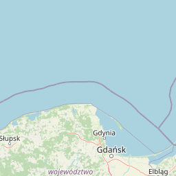
Map view of Trójmiejski Park Krajobrazowy

Use this park location map to pinpoint Trójmiejski Park Krajobrazowy in Poland, understand its exact geographic position, and read its mapped placement within the surrounding landscape more clearly.

Pigeon | © OpenStreetMap contributors

Location context for Trójmiejski Park Krajobrazowy

Pomeranian Voivodeship

Examine glacial valleys, dense pine forests, and protected terrain across northern Poland.

Trójmiejski Park Krajobrazowy Photos and Landscapes Visual Explorer

Visual documentation captures the complex terrain, old growth forests, and glacial landforms defining Trójmiejski Park Krajobrazowy. Photographic records provide clear insight into the protected habitats and varied topography spanning the Pomeranian moraine upland.

A gravel forest path curves into a dense green woodland, leading to a small wooden gazebo in the distance.

A wide, panoramic shot of a mature deciduous forest in autumn or early spring, with bare trees, leaf litter on the forest floor, and soft shadows cast on the ground.

A wide panoramic photograph showing a lush, green deciduous and coniferous forest with gentle slopes and dappled light, captured during the daytime.

Park atlas

Compare nearby regional geography, glacial moraines, and connected forest reserves

Other Parks Near Trójmiejski Park Krajobrazowy and Surrounding Protected Landscapes

Browsing other parks near Trójmiejski Park Krajobrazowy reveals the broader ecological continuity of northern Poland and the Kashubian moraine upland. Examining adjacent protected areas allows researchers and travelers to compare similar glacial valley formations and forest reserves across the region.
A horizontal watercolor illustration showing a gentle river landscape with soft green meadows, trees, and rolling hills in the background.
Nature reservePomeranian Voivodeship
About 6.3 km away#1 closest

North

Kacze Łęgi Nature Reserve: Mapped Protected Woodland and River Valley Geography

Riparian floodplain forest in the Pomeranian Voivodeship of Poland

Kacze Łęgi functions as a crucial nature reserve that maintains an unusually well-preserved fragment of elm and alder floodplain forest. Nestled along the Kacza River valley in Gdynia, this site offers a concentrated look at the original vegetation of Baltic river valleys. It remains a key component of the regional protected landscape, providing a deep study of moisture-loving woodland within the larger context of the Pomeranian coastal lowlands.

Area
0.09 km²
Established
1983
Relief
Lowland
Scope
Terrestrial
Nature reservePomeranian Voivodeship
About 7.9 km away#2 closest

South

Dolina Strzyży Nature Reserve Protected Forest and Stream Valley Geography

Natural riparian forest in Pomeranian Voivodeship

Explore the geographic profile of Dolina Strzyży Nature Reserve, a protected valley woodland in the Pomeranian Voivodeship of Poland. This reserve maintains dense oak-hornbeam habitats and stream-side ecosystems, functioning as a vital green connection between urban Gdańsk and the expansive Trójmiejski Park Krajobrazowy, preserving historic forest remnants.

Area
0.385 km²
Established
2007
Relief
Upland
Climate
Temperate
A wide panoramic watercolor illustration showing a pastoral landscape with green rolling hills, a winding river, scattered trees, and a soft sky with pink and yellow hues.
Protected areaPomeranian Voivodeship
About 11 km away#3 closest

East

Twierdza Wisłoujście Protected Area: Coastal Geography and Historical Mapping in Gdańsk

A historic Baltic fortification and vital ecological site in Pomeranian Voivodeship.

Explore the layered masonry and water-influenced landscape of Twierdza Wisłoujście, a coastal fortress established on the delta of the Vistula River. This site bridges the history of maritime defense and modern ecological conservation as a designated Natura 2000 area. Examine how shifting river channels and centuries of construction define the current defensive perimeters and moated surroundings within the Pomeranian Voivodeship.

Established
1482
Relief
Lowland
Climate
Temperate
Access
Easy access
Nature reserveGdańsk
About 15 km away#4 closest

Southeast

Zbiornik Wody Stara Orunia: A Protected Industrial Heritage Site and Nature Reserve in Gdańsk

Historic brick architecture meeting urban bat conservation zones

Built in 1869, this historic underground reservoir in the Orunia district of Gdańsk combines rare Prussian engineering with a vital role as a Natura 2000 protected habitat. The site serves as a key component of the regional water trail, offering a look into the complex relationship between industrial infrastructure, urban landscape development, and the protection of essential wildlife hibernation cycles.

Area
0.001 km²
Established
1869
Relief
Upland
Climate
Temperate
Nature reservePomeranian Voivodeship
About 21 km away#5 closest

North

Mechelińskie Łąki Nature Reserve: Coastal Geography and Protected Baltic Wetland Atlas

Pomeranian Voivodeship coastal dune and marsh landscape exploration

Investigate the protected topography of Mechelińskie Łąki Nature Reserve, where saline meadows meet the Baltic shoreline of Puck Bay. This faunistic reserve preserves an essential mosaic of dunes, marshes, and reedbeds in northern Poland, serving as a significant habitat for nesting shorebirds and rare amphibian species within the Pomeranian Voivodeship.

Area
1.135 km²
Established
2000
Relief
Lowland
Climate
Temperate
Nature reservePomeranian Voivodeship
About 27 km away#6 closest

South

Dolina Kłodawy Nature Reserve: Geography and Botanical Protected Areas in Pomeranian Voivodeship

Glacial river gorge landscapes in Northern Poland

This protected area centers on a 1.6 kilometer section of the Kłodawa stream, showcasing complex forest ecosystems including ash-alder woodlands and oak-hornbeam slopes. The site remains a vital reference for regional botanical geography, highlighting how glacial moraine hills create unique habitats for rare plants within the Pomeranian Voivodeship landscape.

Area
0.104 km²
Established
1999
Relief
Lowland
Climate
Temperate
A soft watercolor painting of a marshy coastal landscape with tall grasses, calm water, and distant dunes under a bright, clear sky.
Nature reservePomeranian Voivodeship
About 30 km away#7 closest

East

Rezerwat przyrody Mewia Łacha: Protected Coastal Geography and Vistula Estuary Map

Dynamic Baltic sandbars and migratory bird habitat in Pomerania

Rezerwat przyrody Mewia Łacha occupies a vital coastal strip where river discharge meets the Gulf of Gdańsk. This nature reserve serves as an essential site for migratory waterfowl and nesting terns, defined by its shifting sandbars, dune slacks, and brackish pools. It stands as a key example of the varied estuarine geography found within the Pomeranian Voivodeship.

Area
1.505 km²
Established
1991
Relief
Lowland
Climate
Temperate
Nature reservePomeranian Voivodeship
About 37 km away#8 closest

West

Rezerwat przyrody Jezioro Turzycowe: Wetland Protected Area in Pomeranian Voivodeship

Kashubian Lake District bog forest and dystrophic lake atlas

Rezerwat przyrody Jezioro Turzycowe protects a concentrated mosaic of post-glacial wetland environments, including a dystrophic lake and raised bog habitats. This nature reserve offers deep insight into the specific hydrological and botanical conditions defining northern Polish wilderness corridors.

Area
0.114 km²
Established
1959
Relief
Upland
Climate
Temperate

Common questions about visiting, size, designation, and location context for Trójmiejski Park Krajobrazowy

Trójmiejski Park Krajobrazowy FAQs for park facts, access, geography, and protected area context

Find quick answers about Trójmiejski Park Krajobrazowy, including protected-area facts, park geography, trail and visitor context, and how the park fits into its surrounding country and regional landscape.
MoriAtlas Explorer

Continue Your Protected Areas Search Across the Global Atlas

Deepen your exploration by continuing the structured search for national parks and protected areas worldwide. Utilize the comprehensive filtering capabilities to compare different conservation landscapes and refine your understanding of global park geography. Discover more about the distribution and characteristics of protected natural areas.

Global natural geography