
Mori Atlas logo
Protected areaAlbtrauf Donzdorf-Heubach

Examining the geological terrain and protected habitats of this Jura escarpment segment

Albtrauf Donzdorf-Heubach: A Protected Karst Landscape along the Swabian Alb Escarpment

(FFH-Gebiet Albtrauf Donzdorf-Heubach)

Albtrauf Donzdorf-Heubach represents a significant protected area within the Swabian Alb of Baden-Württemberg, defined by its steep northern escarpment and diverse limestone geology. This atlas entry provides insight into the mosaic of juniper heaths, near-natural beech forests, and over eighty documented karst caves that characterize the terrain. Through its scattered sub-areas, the region serves as a vital corridor for rare habitats along the upper Jurassic ridge.

Swabian AlbAlbtrauf escarpmentlimestone karstbeech forestsjuniper heathcalcareous grasslands
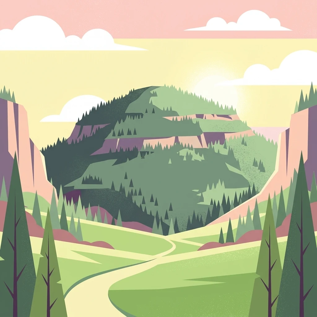
A flat vector illustration of a green mountain valley with a winding path, pine trees in the foreground, and pink cliffs on the sides under a pastel sky.

Albtrauf Donzdorf-Heubach

Protected area

Park overview

Structured park overview, official facts, and landscape profile for Albtrauf Donzdorf-Heubach

Albtrauf Donzdorf-Heubach park facts, protected area profile, and essential visitor context

Review the core facts for Albtrauf Donzdorf-Heubach, including designation, size, terrain, visitor scale, habitats, and operating context in one park-focused overview.

About Albtrauf Donzdorf-Heubach

Albtrauf Donzdorf-Heubach occupies a strategic position along the northern edge of the Swabian Alb, where the flat Alb plateau breaks dramatically downward into the foothills of the Albvorland. The protected area captures this transition in eight non-contiguous parcels that together total approximately 2,530 hectares. Two-thirds of the site lies within the Ostalbkreis and one-third within the district of Göppingen, with the largest single contributions coming from the municipalities of Heubach, Schwäbisch Gmünd, and Waldstetten.

The site's defining character comes from its geology and topography. Built from Upper Jurassic limestone, the escarpment rises to an average elevation near 567 meters above sea level and is deeply incised by erosion on its rear side, creating a strongly dissected landscape of ridges, sinkholes, and sheltered valleys. The karstic nature of the limestone is reflected in the presence of more than 80 caves within the site, while surface exposures produce limestone cliffs and pioneer vegetation that anchors the dry grassland habitat types.

Ecologically, the area is remarkable for the contrast it draws between forested and open landscapes across very short distances. Beech-dominated woodland, including orchid-rich stands, covers more than half of the site, while mixed forests, juniper heaths, dry limestone grasslands, and species-rich meadows occupy much of the remaining area. Habitats such as calcareous rocky swards with orchids, Nardus-rich boron grasslands, ravine forests, and karst cave systems highlight the conservation value that led to the site's inclusion in the European Natura 2000 network.

Administration of the site rests with the Stuttgart Regional Council, which proposed the area in 2005 and secured its formal designation by regulation on 30 October 2018, with the rules entering into force on 11 January 2019. This legal framework ties the area to the broader conservation objectives of the European Habitats Directive and aligns it with neighboring FFH sites that protect other sections of the Swabian Alb and its escarpment.

Quick facts and research context for Albtrauf Donzdorf-Heubach

Albtrauf Donzdorf-Heubach is a designated Fauna-Flora-Habitat (FFH) site in Baden-Württemberg, Germany, classified under the European Habitats Directive (92/43/EEC) with site code DE-7224-342. It covers roughly 2,530 hectares fragmented across eight sub-areas in the districts of Göppingen and the Ostalbkreis, spanning municipalities such as Donzdorf, Lauterstein, Heubach, Schwäbisch Gmünd, and Waldstetten.

The terrain lies on the Upper Jurassic limestone of the Swabian Alb, centered on the steep Albtrauf escarpment at an average elevation of around 567 meters above sea level. The site was proposed by the Stuttgart Regional Council in 2005 and formally designated by regulation on 30 October 2018, taking legal effect on 11 January 2019. It protects habitat types including beech forests, juniper heaths, limestone dry grasslands, karst caves, and orchid-rich woodlands, and is significant for bat species such as the Greater Mouse-eared Bat and Bechstein's Bat.

Protection and recognition

Documented terrestrial protection history, designation records, and Natura 2000 sources

Albtrauf Donzdorf-Heubach Protection Status and International Recognition Data

Albtrauf Donzdorf-Heubach maintains a recorded terrestrial protection status established in 2018 alongside official Natura 2000 designation sources. Official records outline the formal conservation framework, historical designation milestones, and international recognition data for this protected area.

International recognition

Protection details

Protection scope
Terrestrial
Designated year
2018
Transboundary protection
No
WDPA ID
555521850
Park context

Deeper park guide and search-rich context for Albtrauf Donzdorf-Heubach

Albtrauf Donzdorf-Heubach history, landscape, wildlife, and travel context

Explore Albtrauf Donzdorf-Heubach through its history, landscape character, ecosystems, wildlife, conservation priorities, cultural context, and seasonal travel timing in a structured park guide built for atlas discovery and search intent.

Why Albtrauf Donzdorf-Heubach stands out

Albtrauf Donzdorf-Heubach is best known for its unusually well-preserved fragments of the Albtrauf, the steep north-facing escarpment of the Swabian Alb, where limestone cliffs, near-natural beech forests, juniper heath pastures, and karst caves coexist within a single Natura 2000 framework. More than 80 documented caves give the area a distinctive karst character uncommon elsewhere in the region. The site is also recognized for its rare and habitat-rich mosaic of calcareous grasslands, orchid beechwoods, ravine and slope mixed forests, and species-rich Nardus grasslands that develop on the thin, dry soils of the escarpment and its eroded rear slopes. This combination of geological drama, habitat diversity, and species rarity defines the site's conservation identity.
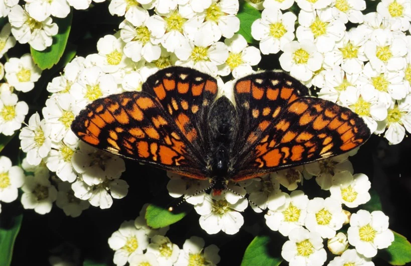
A close-up view of an orange and black patterned butterfly resting on a bed of small white flowers with yellow centers.
A Scarce fritillary butterfly resting on a cluster of small white flowers.

Albtrauf Donzdorf-Heubach history and protected-area timeline

The origins of the protected area lie in the European Union's Habitats Directive (92/43/EEC), which obliges member states to identify and designate special areas of conservation for threatened habitats and species. The Stuttgart Regional Council submitted the Albtrauf Donzdorf-Heubach site as a candidate Fauna-Flora-Habitat area in 2005, with the technical identifier DE-7224-342.

After years of assessment, the Regional Council issued a formal regulation on 30 October 2018 establishing the area as a Site of Community Importance, and the protections came into legal force on 11 January 2019. The designation formalized long-standing regional recognition of the escarpment's ecological value and embedded the site within Baden-Württemberg's larger network of protected escarpment and Alb habitats.

Although the Natura 2000 designation is recent, traditional land uses such as grazing on juniper-rich heath pastures and small-scale forestry have shaped the open and semi-open character of the area over many generations. These cultural practices remain relevant to maintaining the dry grassland and heath habitats that were a central justification for the site's selection.

Albtrauf Donzdorf-Heubach landscape and geographic character

The landscape of Albtrauf Donzdorf-Heubach is dominated by the Albtrauf, the bold northern escarpment of the Swabian Alb, where a high plateau falls steeply toward the lowlands of the Albvorland. Upper Jurassic limestone forms the geological backbone of this terrain, producing karstic features such as sinkholes, exposed rock faces, and more than 80 known caves scattered across the protected sub-areas.

At an average elevation of about 567 meters above sea level, the topography is far from uniform. The escarpment's fronts are interrupted by deeply cut valleys and dissected slopes, while the rear side of the ridge shows pronounced signs of erosion. This relief creates a fast-changing mosaic of sunny south-facing rock ledges, shaded ravines, and small sheltered plateaus, all within short horizontal distances.

The scenery is shaped as much by vegetation as by geology. Open, dry slopes of juniper heath and limestone grassland cling to the warmer aspects, while the cooler, sheltered slopes and valleys carry beech forest, mixed forest, and small clearings of hay meadow. The result is a visually dramatic, edge-of-the-plateau landscape that reads clearly from both the foothills below and the plateau above.

Albtrauf Donzdorf-Heubach ecosystems, habitats, and plant life

The protected area's ecological identity rests on a strong contrast between dry calcareous habitats on the sunny escarpment faces and more humid forest communities in the valleys and shaded slopes. Roughly 54 percent of the site is classified as broadleaf forest, dominated by beech, with an additional 14 percent classified as mixed forest and 4 percent as coniferous forest. These woodlands include orchid-rich beech stands and ravine and slope mixed forests that depend on the site's particular soil and moisture conditions.

Open habitats are also ecologically central despite occupying a smaller share of the surface. Dry and semi-dry grasslands on calcareous soils, juniper heaths, species-rich Nardus grasslands, and patches of traditionally managed hay meadow together account for roughly a quarter of the area, while small streams with aquatic vegetation add a freshwater dimension to the habitat mosaic. Limestone cliffs and pioneer grasslands on exposed rock complete the range of habitat types recognized under the Habitats Directive.

Cave systems form a special ecological compartment within the area. The more than 80 documented caves provide hibernation and roosting conditions for cave-dependent bat species, while also supporting specialized invertebrates and microbial communities. The combination of surface conditions and karstic underground habitat is a defining feature of the site's biodiversity profile.

Albtrauf Donzdorf-Heubach wildlife and species highlights

Albtrauf Donzdorf-Heubach is significant for both its cave-dwelling bats and its rare butterfly fauna. Two bat species named in the designation documents, the Greater Mouse-eared Bat (Myotis myotis) and Bechstein's Bat (Myotis bechsteinii), depend on the extensive cave systems and on the structurally rich, insect-rich forests that cover much of the escarpment.

Among the invertebrates, the Scarce Fritillary, also known in German as the Maivogel or Eschen-Scheckenfalter (Euphydryas maturna), is one of the most notable species recorded in the area. This butterfly is associated with old, open deciduous forests that contain ash trees, a habitat pattern that fits the mixed forest and beech woodland mosaic along the Albtrauf.

The structure of the landscape supports a broader community of woodland birds, insects, and small mammals typical of southern German escarpment habitats, with the alternation of closed forest, open heath, and warm rock slopes creating feeding and breeding conditions for many species. The inclusion of multiple Annex II habitat types and the presence of two bat species mentioned in the directive's Annex II helped justify the site's selection at the European level.

Albtrauf Donzdorf-Heubach conservation status and protection priorities

The site's conservation importance is rooted in the European Natura 2000 framework. Designated as a Site of Community Importance under the Habitats Directive, it contributes to a coordinated network of protected areas across the European Union aimed at maintaining threatened habitat types and species populations in favorable condition. The site is administered by the Stuttgart Regional Council and identified under the code DE-7224-342.

A key objective at the site is the maintenance of large, near-natural beech forests, including orchid beechwoods and ravine forests, on the Alb escarpment. Equally important is the preservation of its dry calcareous grasslands, juniper heaths, and species-rich Nardus grasslands, which depend on continued traditional land management such as grazing and mowing to prevent succession into closed forest.

The cave systems, with more than 80 documented sites, are recognized as critical for the protection of bat populations. The site's combination of habitat diversity, karstic geology, and ecological connectivity with neighboring protected areas along the Swabian Alb gives Albtrauf Donzdorf-Heubach a meaningful role in regional conservation planning for the Schwäbische Alb.

Albtrauf Donzdorf-Heubach cultural meaning and human context

The Albtrauf has long been shaped by a mixture of forest use and pastoral agriculture. Juniper heaths and dry limestone grasslands are semi-cultural landscapes that have developed and persisted through centuries of grazing, haymaking, and woodland management on the escarpment's thin soils. Many of the open habitats currently protected were maintained by these traditional practices rather than by wilderness.

Local towns such as Heubach, Schwäbisch Gmünd, Donzdorf, Lauterstein, and Waldstetten have cultural ties to the escarpment landscape, which historically provided timber, grazing land, and a distinct local identity rooted in the contrast between the high Alb plateau and the lower Fils and Leintal valleys. The Schwäbische Alb region itself carries a strong regional cultural profile in Baden-Württemberg, and the Albtrauf forms one of its most recognizable geographic features.

The caves of the Swabian Alb more broadly hold significant prehistoric and cultural associations, and while the caves within this site are primarily valued for their biodiversity, they sit within a landscape that has long attracted human attention for both practical and cultural reasons.

Top sights and standout views in Albtrauf Donzdorf-Heubach

The protected area's most striking highlights include its eight sub-areas strung along the dramatic Albtrauf escarpment and the more than 80 caves that the site contains, a feature that immediately sets it apart from many other Swabian Alb reserves. These karstic systems provide roosting habitat for bat species such as the Greater Mouse-eared Bat and Bechstein's Bat, and they anchor the area's conservation significance for cave-dependent fauna.

Above ground, the highlights include extensive near-natural beech forests, including orchid-rich stands with recorded populations of Cypripedium calceolus, and well-developed calcareous dry grasslands with juniper heaths that reflect long-standing cultural land use. The presence of the Scarce Fritillary butterfly reinforces the area's value as a habitat for rare forest-dwelling invertebrates.

Finally, the location between the districts of Göppingen and the Ostalbkreis, with its largest parcels around Heubach, Schwäbisch Gmünd, and Waldstetten, gives the site a strong connective role within the broader Natura 2000 network along the Swabian Alb, linking smaller protected escarpment fragments into a more coherent ecological corridor.

Best time to visit Albtrauf Donzdorf-Heubach

Spring and early summer are the most rewarding periods to experience the Albtrauf between Donzdorf and Heubach. As the weather warms, the orchid-rich beech woodlands come into bloom, including the Yellow Lady's Slipper orchid, and the dry limestone grasslands on the warmer slopes take on their richest display of wildflowers. The same season is favorable for bat emergence around the many caves, while woodland bird and butterfly activity rises across the mosaic of forest and open ground.

Late summer and early autumn bring a different character, with the juniper heaths and dry meadows holding color into the warm months and the deciduous woodlands shifting toward their autumnal tones. The cooler half of the year emphasizes the geological drama of the escarpment, when bare rock, fallen leaves, and clearer views along the Albtrauf edges make the landscape's structure especially visible.

Across the year, the temperate climate of the eastern Swabian Alb generally supports outdoor exploration in any season, though path conditions on the steep escarpment slopes can become slippery after rain or frozen in winter. Detailed access and route planning should rely on current local information.

Monthly climate preview

Long-term representative temperature and precipitation patterns across the year

Albtrauf Donzdorf-Heubach Climate Normals and Monthly Weather Records

Representative point measurements track recorded monthly temperature variations and precipitation rates for Albtrauf Donzdorf-Heubach from 1991 to 2020. Examining the complete twelve-month climatology profile provides deeper insight into annual weather distributions and long-term averages.
Annual mean8 °C
-1 °C18 °C
Jan-1°
Feb-1°
Mar
Apr
May12°
Jun16°
Jul18°
Aug18°
Sep13°
Oct
Nov
Dec-1°
Warmest month
July

17.8 °C

Coolest month
January

-1.5 °C

Wettest month
July

3.4 mm/day

Driest month
February

1.7 mm/day

Park location guide

Geography guide, regional context, and park location map for Albtrauf Donzdorf-Heubach

Albtrauf Donzdorf-Heubach park geography, regions, and map view in Germany

Understand where Albtrauf Donzdorf-Heubach sits in Germany through a broader geographic reading of the surrounding landscape, nearby location context, and its mapped position within the national park landscape.

How Albtrauf Donzdorf-Heubach fits into Germany

Germany is a federal republic in Western and Central Europe with a population of over 83 million across sixteen constituent states. It is Europe's largest economy by nominal GDP and a major global exporter and importer. The capital is Berlin, and the country borders Denmark, Poland, Czech Republic, Austria, Switzerland, France, Luxembourg, Belgium, and the Netherlands.

Wider geography shaping Albtrauf Donzdorf-Heubach in Germany

Germany is located in Western and Central Europe, spanning 357,022 km². It borders Denmark to the north, Poland and the Czech Republic to the east, Austria and Switzerland to the south, and France, Luxembourg, Belgium, and the Netherlands to the west. The country has coastlines on the Baltic Sea and North Sea to the north, with the Alps located in the southern region.

Map view of Albtrauf Donzdorf-Heubach

Use this park location map to pinpoint Albtrauf Donzdorf-Heubach in Germany, understand its exact geographic position, and read its mapped placement within the surrounding landscape more clearly.

Pigeon | © OpenStreetMap contributors

Location context for Albtrauf Donzdorf-Heubach

Baden-Württemberg
Recorded earthquake history

Review the Recorded Earthquake History of Albtrauf Donzdorf-Heubach

Examine the historical catalogue of seismic events linked to the Albtrauf Donzdorf-Heubach region. This MoriAtlas collection maps recorded earthquake occurrences against the protected boundaries of the escarpment to provide transparent access to regional seismic data.

Albtrauf Donzdorf-Heubach Earthquake History

Catalogued events

8 events

Strongest magnitude

Magnitude 4.3

Most recent event

Aug 1, 1999

This history includes earthquakes recorded inside the park or within 50 km of its borders

Visual reference guide to escarpment terrain, beech forests, and limestone habitats

Albtrauf Donzdorf-Heubach Photos and Landscape Scenery

Visual records capture the steep limestone escarpment, deciduous woodlands, and juniper heath pastures defining the protected terrain of Albtrauf Donzdorf-Heubach. Photographic documentation reveals the geological structure and diverse habitat mosaic across the eight designated sub-areas.

A close-up view of an orange and black patterned butterfly resting on a bed of small white flowers with yellow centers.

Wide panoramic landscape showing a paved road leading through green meadows toward forested rolling hills under a blue sky with scattered white clouds

Park atlas

Compare adjacent limestone escarpments and regional protected landscapes across the Swabian Alb.

Other Parks and Protected Areas Near Albtrauf Donzdorf-Heubach

Browse nearby protected areas and connected escarpment reserves that share the distinctive geological terrain of Albtrauf Donzdorf-Heubach. Extending the geographic review allows visitors to trace wider regional conservation corridors and compare neighboring limestone habitats.
A horizontal watercolor painting showing rolling green meadows with small clusters of trees and soft hills in the background on a white background.
Protected areaBaden-Württemberg
3 km away#1 closest

East

Albuchwiesen: A Protected Landscape of Wetlands and Historical Grasslands on the Swabian Alb

Geographic atlas of the smallest Habitats Directive site in Baden-Württemberg

Albuchwiesen represents a critical refuge for wetland biodiversity outside the Brenz valley, characterized by its scattered parcels of calcareous dry grasslands and wet meadow systems. The area preserves essential remnants of historical land use on the Ostalb, including distinct clay-lined ponds and transitional mires that define this localized plateau terrain.

Area
51.1 km²
Established
2019
Protected landscapeBaden-Württemberg
About 5.7 km away#2 closest

Southwest

Weigoldsberg Protected Landscape: Mapped Terrain in the Swabian Alb of Baden-Württemberg

A contiguous hill-landscape with integrated Natura 2000 ecological zones

Weigoldsberg functions as a coherent protected landscape unit within the Mittlere Kuppenalb, spanning the transition between upland terrain and the Fils valley. This area integrates near-natural forest, traditional meadow mosaics, and high-value ecological zones such as the Filsalb FFH and Mittlere Schwäbische Alb bird protection area. Gain insights into its relief, land use patterns, and conservation designation.

Area
2.16 km²
Established
1975
IUCN
V
Relief
Mountain
A pale, horizontal watercolor illustration depicting rolling green hills, scattered trees, and a forested horizon line on a white background.
Protected areaBaden-Württemberg
7.3 km away#3 closest

Southeast

Hungerbrunnen-, Sacken- und Lonetal Protected Area: Geography and Landscape Atlas

Karst limestone valleys and juniper heath corridors

This protected area showcases the unique hydrology and geology of the eastern Swabian Alb. The landscape is defined by its dramatic transition from plateau to valley floor, featuring intermittent stream beds, limestone rocky outcrops, and high-value beech forest ecosystems that form a vital part of the local Natura 2000 network.

Area
9.179 km²
Established
2005
Relief
Upland
Climate
Temperate
Protected landscapeBaden-Württemberg
About 11 km away#4 closest

East

Ur-Brenztal Protected Landscape: Geography and River Valley Mapping in Baden-Württemberg

Wetland meadow corridors and ancestral drainage relics

Ur-Brenztal stands as a vital protected landscape in the Landkreis Heidenheim, serving as a rare open grassland passage. The area preserves flat valley floors and low-energy stream channels that provide essential stepping stone habitats for migratory birds and meadow-nesting populations between regional high plateaus.

Area
0.69 km²
Established
2003
IUCN
V
Relief
Lowland
A horizontal watercolor painting depicting a soft-focus landscape with green fields, patches of trees, and rolling hills in the background under a pale sky.
Protected landscapeBaden-Wuerttemberg
About 12 km away#5 closest

Southwest

Nellingen Protected Landscape: Mapping the Cultural and Karstic Terrain of Central Swabia

Protected landscape geography and regional land use

Nellingen Protected Landscape encompasses over 1,500 hectares of the Swabian Alb, forming an essential link in the regional conservation network. This site provides insight into the karstic landforms of the Kuppenalb, including sinkholes and dry valleys, while preserving a living history of agricultural practices such as orchard management and sheep grazing. This analysis provides a structured overview of the area topography and its significance in the regional landscape context.

Area
15.212 km²
Established
1999
IUCN
V
Relief
Upland
Protected landscapeBaden-Württemberg
About 14 km away#6 closest

Southwest

Wolfschlugen Protected Landscape: Geography and Atlas of the Filder Plateau

Mapped protected lands in Baden-Württemberg Germany

Wolfschlugen stands as a significant protected area in the Esslingen district, preserving traditional orchard meadows and open agricultural plains. The area offers a detailed study of regional land use, featuring a mosaic of meadow habitats and stream-side wetlands essential to the Filder plateau landscape character.

Area
0.51 km²
Established
1985
IUCN
V
Protected landscapeBaden-Württemberg
About 15 km away#7 closest

East

Weidmichele, Eichelesäcker und anschließender Talgrund Protected Landscape Atlas

Geographic analysis of Swabian Alb dry valley terrain

Examine the topographical profile of Weidmichele, Eichelesäcker und anschließender Talgrund. This landscape protection area showcases the classic karst dry valley form found in Baden-Württemberg, providing a vital, narrow grassland corridor between upland plateaus and the lower Brenz valley ecosystem.

Area
0.153 km²
Established
1978
IUCN
V
Protected landscapeBaden-Württemberg
About 15 km away#8 closest

Southwest

Oberes Filstal-Gemeinde Mühlhausen im Täle: Protected Landscape Geography and Map Data

Swabian Alb regional landscape and habitat mosaic

Analyze the protected landscape of Oberes Filstal-Gemeinde Mühlhausen im Täle through its unique physical terrain and ecological structure. This area in the Göppingen district features a complex interplay of river valleys and plateau uplands, creating a habitat corridor that links the Fils valley with the wider Swabian Alb, supporting diverse flora and traditional land-use patterns.

Area
5.13 km²
Established
1983
IUCN
V

Common questions about visiting, size, designation, and location context for Albtrauf Donzdorf-Heubach

Albtrauf Donzdorf-Heubach FAQs for park facts, access, geography, and protected area context

Find quick answers about Albtrauf Donzdorf-Heubach, including protected-area facts, park geography, trail and visitor context, and how the park fits into its surrounding country and regional landscape.
MoriAtlas Explorer

Continue Your Protected Areas Search Across the Global Atlas

Deepen your exploration by continuing the structured search for national parks and protected areas worldwide. Utilize the comprehensive filtering capabilities to compare different conservation landscapes and refine your understanding of global park geography. Discover more about the distribution and characteristics of protected natural areas.

Global natural geography