
Mori Atlas logo
Nature reserveAltdorfer Wald

A concentrated network of mires, calcareous springs, and diverse forest ecosystems within Upper Swabia.

Altdorfer Wald Nature Reserve: Mapped Protected Landscapes and Regional Terrain in Baden-Württemberg

(FFH-Gebiet Altdorfer Wald)

Altdorfer Wald spans an extensive area in the Landkreis Ravensburg, where it serves as a critical protected landscape for Pre-Alpine habitat types. Through the integration of multiple former reserves, the site preserves a complex geographic mosaic of active raised bogs, transition mires, calcareous spring fens, and varied woodland communities ranging from beech-dominated slopes to alder-rich floodplains.

FFH-GebietNatura 2000Pre-AlpineUpper SwabiaLandkreis Ravensburgraised bog
A flat-style vector illustration of a forest scene looking toward a river and mountains with a waterfall in the distance.

Altdorfer Wald

Nature reserve

Park overview

Structured park overview, official facts, and landscape profile for Altdorfer Wald

Altdorfer Wald park facts, protected area profile, and essential visitor context

Review the core facts for Altdorfer Wald, including designation, size, terrain, visitor scale, habitats, and operating context in one park-focused overview.

About Altdorfer Wald

Altdorfer Wald represents one of the more ecologically complex FFH sites in Upper Swabia, combining Pre-Alpine hill country with extensive peatland, spring, and forest systems. Its ten sub-areas span the municipalities of Bad Waldsee, Baienfurt, Baindt, Bergatreute, Kißlegg, Ravensburg, Schlier, Vogt, Weingarten, Wolfegg, and Wolpertswende, all within the Landkreis Ravensburg. The protected area sits at elevations of 500 to 700 metres above sea level, where the glacial and post-glacial topography of southern Germany has shaped a landscape of low hills, kettle wetlands, and forested valleys.

The site's ecological identity is defined by the convergence of distinct habitat families in close proximity. Mires dominate the wetland story: the FFH area includes active raised bogs, transition mires and quaking mires, Rhynchosporion hollows within peat bogs, base-rich fens, calcareous fens with Cladium and species of the Caricion davallianae, and calcareous tufa springs. Water bodies include oligotrophic to mesotrophic standing waters with Littorelletea or Isoëto-Nanojuncetea vegetation, calcareous nutrient-poor standing waters with charophyte algae, natural eutrophic lakes, and streams with floating Ranunculion or Callitricho-Batrachion vegetation. Dry environments are not absent: the area also hosts orchid-rich calcareous grasslands in their natural state and on scrub-invaded stages, as well as calcareous rock habitat with fissure vegetation.

Forest covers a large portion of the area and contributes strongly to its character. Woodruff beech (Asperulo-Fagetum) forest forms the bedrock of the woodland communities, supplemented by Tilio-Acerion ravine and slope forests, bog woodlands in mire settings, Alno-Padion floodplain forests of alder, ash, and willow, and montane to alpine acidophilous spruce forests of the Vaccinio-Piceetea class. Together, these forest types frame the open mires and create the buffer zones that sustain the hydrology of the peatland systems.

By tying together the nature reserves Füremoos, Tuffsteinbruch Weissenbronnen, Wolfegger Ach, Girasmoos, Saßweiher, and Lochmoos, Altdorfer Wald is effectively a landscape-scale conservation project. Its management plan, commissioned by the Regierungspräsidium Tübingen, coordinates habitat preservation, species protection, and forestry practice across the constituent reserves, reflecting a recognition that the site's value lies in the interplay between its individual protected patches.

Quick facts and research context for Altdorfer Wald

Altdorfer Wald is a Natura 2000 / FFH area in Baden-Württemberg, Germany, with the site code DE-8124-341 (Natura-2000 ID DE8124341, WDPA-ID 555522128). The protected area comprises about 1,371 hectares across ten sub-areas in the Landkreis Ravensburg and is administered by the Regierungspräsidium Tübingen.

The site covers a Pre-Alpine landscape of hills and mires between 500 and 700 metres above sea level, overlapping both the Bodenseebecken basin and the Upper Swabian and West Allgäu hill country. It was proposed in 2005 and formally designated by regulation of the Regierungspräsidium Tübingen dated 5 November 2018, taking effect on 11 January 2019.

Protection and recognition

Documented terrestrial designation history and Natura 2000 recognition sources

Altdorfer Wald Protection Status and Official International Recognition Facts

Altdorfer Wald holds a documented terrestrial protection status established in 2019 alongside verified Natura 2000 recognition sources. Official designation records outline the management scope and international framework details for this protected area landscape.

International recognition

Protection details

Protection scope
Terrestrial
Designated year
2019
Transboundary protection
No
WDPA ID
555522128
Park context

Deeper park guide and search-rich context for Altdorfer Wald

Altdorfer Wald history, landscape, wildlife, and travel context

Explore Altdorfer Wald through its history, landscape character, ecosystems, wildlife, conservation priorities, cultural context, and seasonal travel timing in a structured park guide built for atlas discovery and search intent.

Why Altdorfer Wald stands out

Altdorfer Wald is best known for its extraordinary diversity of wetland and mire habitats within a relatively compact Pre-Alpine setting. Living raised bogs, transition and quaking mires, calcareous fens, kettle holes, calcareous spring fens, and spring-fed mires are concentrated within the same area as calcareous dry grasslands and a wide spectrum of forest types. The site is also recognised for its varied woodland communities, ranging from woodruff beech forest to calcareous ravine and slope forests, mire forests, and alder-floodplain forests. This juxtaposition of nutrient-poor peatlands, calcareous flushes, and structurally diverse forest stands gives the area a concentrated ecological value that is unusual within Baden-Württemberg's Natura 2000 network.
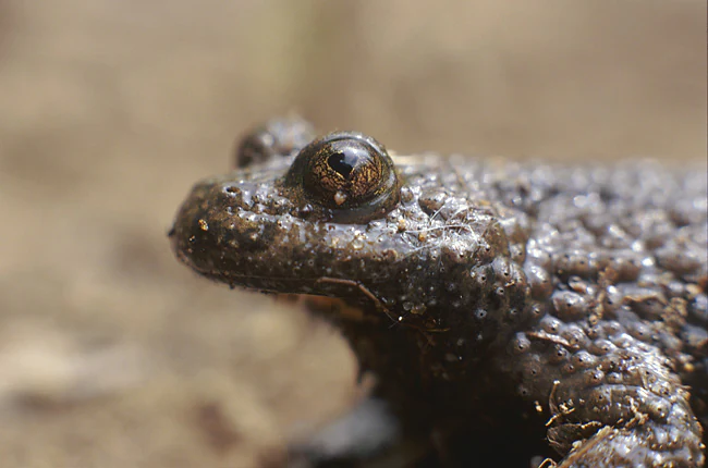
A close up side profile of a yellow-bellied toad showing its dark, warty, textured skin and prominent eyes.
A close up view of a yellow-bellied toad, a protected species found in the Altdorfer Wald region.

Altdorfer Wald history and protected-area timeline

The area was first proposed for inclusion in the European Union's Natura 2000 network by the Regierungspräsidium Tübingen in 2005, drawing on the long-standing conservation value of the constituent nature reserves. After more than a decade of preparatory and review work, the protected area was confirmed by regulation of the Regierungspräsidium Tübingen dated 5 November 2018, with the designation formally taking effect on 11 January 2019.

The site coordinates several pre-existing nature reserves, including Füremoos, the Tuffsteinbruch Weissenbronnen (White Springs Tuff Quarry), Wolfegger Ach, Girasmoos, Saßweiher, and Lochmoos. The integration of these individual reserves into a single FFH-Gebiet reflects a shift from isolated site protection toward a larger-scale, ecologically connected conservation framework that recognises the landscape-scale interactions between mires, watercourses, and surrounding forests.

Altdorfer Wald landscape and geographic character

Altdorfer Wald occupies a transitional belt of gently rolling Pre-Alpine hill country at the meeting point of the Bodenseebecken basin and the Oberschwäbisches Hügelland, extending into the Westallgäuer Hügelland. Elevation ranges from 500 to 700 metres, with a topography that combines low hills, kettle depressions, river-cut valleys, and spring-fed lowlands.

The hydrological setting is the most distinctive element of the physical landscape. Active raised bogs, transition mires, and quaking mires occupy the flatter or sunken portions of the terrain, fed by precipitation in the ombrotrophic bogs and by mineral-rich groundwater in the calcareous fens. Calcareous tufa and CRATONEURION spring habitats mark locations where groundwater emerges through calcareous glacial deposits, often precipitating the tuff deposits that give the Tuffsteinbruch Weissenbronnen reserve its name. Streams and small flowing waters with beds of Ranunculion or Callitricho-Batrachion vegetation weave through the forest compartments.

Dry landforms are also present: calcareous grasslands occur on sun-exposed slopes, sometimes grading into calcareous rock outcrops with fissure vegetation. On the more acidic substrates, bodensaure Fichtenwälder (acidophilous spruce forests) occupy the higher elevations. Forest types shift from montane spruce stands on acid soils through woodruff beech forest on richer, often calcareous substrates to Tilio-Acerion ravine and slope forests in steep, unstable terrain, and to fen and floodplain forests along the wetland edges.
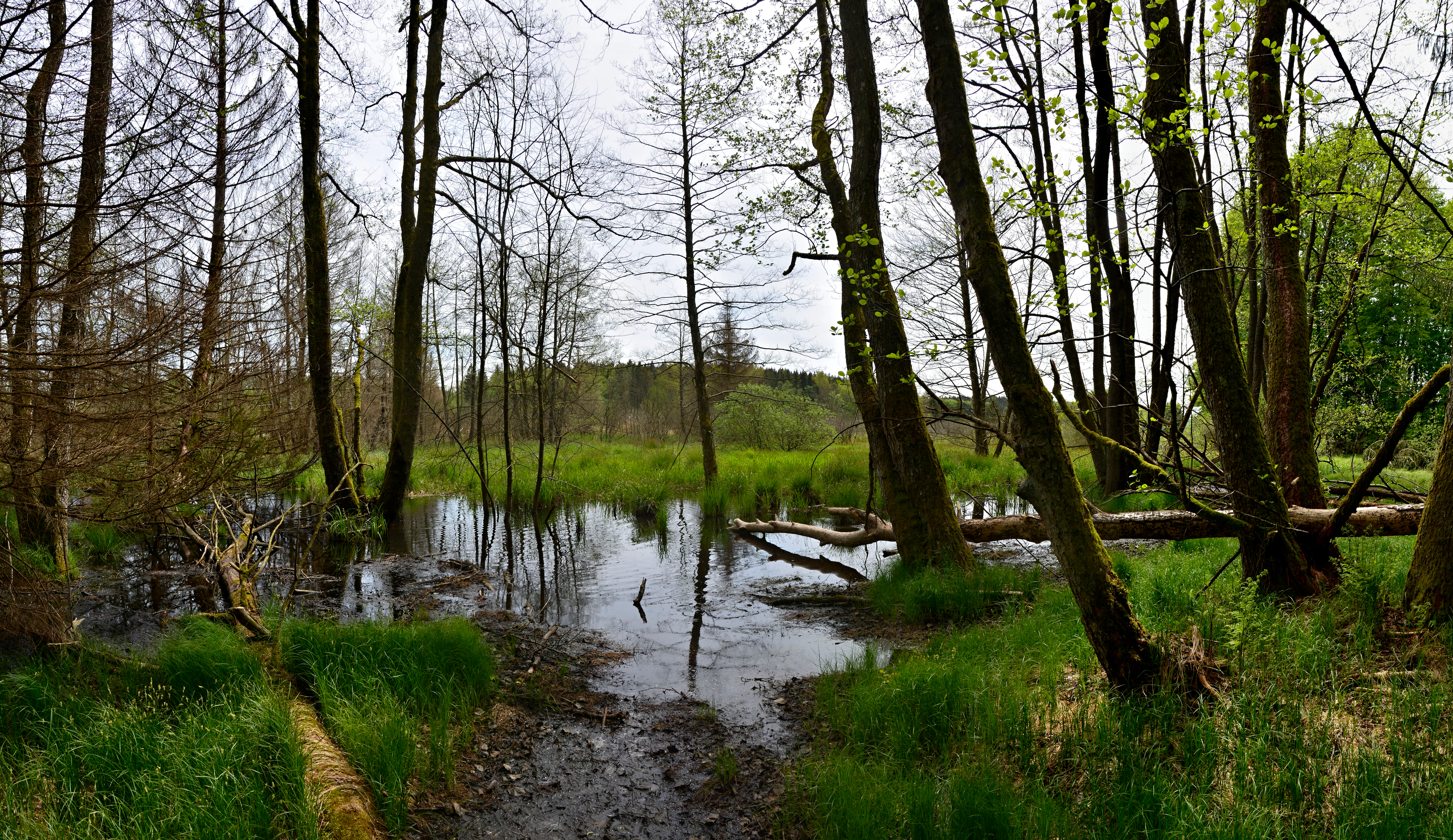
A wide angle view of a lush green wetland area in a forest with trees growing directly out of shallow water, reflecting the sky and surroundings.
The Lochmoos nature reserve within Altdorfer Wald, featuring a wetland environment with trees.

Altdorfer Wald ecosystems, habitats, and plant life

Ecologically, Altdorfer Wald sits at a remarkable intersection of mire, aquatic, grassland, and forest systems. The site includes habitat types from nineteen different categories listed under Annex I of the EU Habitats Directive, providing almost continuous ecological variation across the protection area. Wetland habitats dominate this mosaic: living raised bogs (7110), transition mires and quaking bogs (7140), Rhynchosporion hollows (7150), calcareous fens with Cladium (7210*), calcareous tufa springs (7220*), and base-rich fens (7230) collectively create a layered peatland complex supported by calcareous groundwater.

Aquatic habitats add to the diversity. Oligotrophic to mesotrophic standing waters of the Littorelletea and Isoëto-Nanojuncetea types (3130) and calcareous, nutrient-poor standing waters with Characeae (3140) reflect the area's varied water chemistry, while natural eutrophic lakes (3150) and streams with floating water vegetation (3260) extend the gradient from acidic to base-rich conditions.

Terrestrial habitats range from calcareous dry grasslands in orchid-rich states (6210*) and calcareous rock with fissure vegetation (8210) on drier ground to a wide forest mosaic on wetter and richer soils: Molinion caeruleae meadows (6410) and tall-herb communities (6430) on the wet-mesic boundary; Asperulo-Fagetum beech forest (9130) on mesic calcareous slopes; Tilio-Acerion ravine and slope forests (9180*) on steep ground; bog woodlands (91D0*) and Alno-Padion floodplain forests (91E0*) along spring and stream margins; and montane acidophilous spruce forest (9410) on poorer upland soils.

Altdorfer Wald wildlife and species highlights

The Annex II animal list for Altdorfer Wald spans a broad taxonomic range, reflecting the site's habitat complexity. Molluscs include the four-toothed whorl snail (Vertigo geyeri) and the narrow whorl snail (Vertigo angustior), small species strongly tied to calcareous wetland and spring habitats, and the thick-shelled river mussel (Unio crassus), a freshwater bivalve dependent on clean streams.

Two dragonfly and butterfly species of community interest occur: the mercury bluet (Coenagrion mercuriale), a damselfly of small calcareous streams, and the marsh fritillary (Euphydryas aurinia), a butterfly linked to damp meadows and tall-herb communities. Freshwater fauna is further represented by the stone crayfish (Austropotamobius torrentium), while amphibians include the great crested newt (Triturus cristatus) and the yellow-bellied toad (Bombina variegata), both tied to a network of small, often calcareous water bodies and spring habitats.

Mammals include the greater mouse-eared bat (Myotis myotis), a cave- and forest-roosting species that uses old-growth woodland and structured forest edges, and the Eurasian beaver (Castor fiber), whose presence reflects the integrity of the area's stream and pond systems. Bryophytes add to the assemblage with the green broom moss (Dicranum viride) and the green goblin moss (Buxbaumia viridis), both indicators of structurally rich, undisturbed forest landscapes. Two notable plant species are recorded: the lady's slipper orchid (Cypripedium calceolus), associated with calcareous woodlands and dry grassland edges, and the fen orchid (Liparis loeselii), a species of base-rich mires.

Altdorfer Wald conservation status and protection priorities

Altdorfer Wald carries significant weight within the Baden-Württemberg Natura 2000 network because it consolidates several habitats and species of community interest within a single Pre-Alpine area. The site protects numerous priority and non-priority habitat types of the Habitats Directive, including, among others, calcareous dry grasslands, calcareous fens with Cladium, calcareous tufa springs, Tilio-Acerion ravine forests, bog woodlands, Alno-Padion floodplain forests, and active raised bogs.

Its mosaic structure is itself a conservation asset: the close proximity of raised bogs, base-rich fens, calcareous springs, and acidophilous spruce forest creates a complex hydrological and ecological gradient that supports relict species of both nutrient-poor and nutrient-rich substrates. The site's role as a refuge for several Annex II species, including the lady's slipper orchid, the fen orchid, the Eurasian beaver, the stone crayfish, and several snail, moth, and bat species of conservation concern, underscores its importance for species-level protection alongside habitat management.

Management of the area is guided by a dedicated plan prepared for the Regierungspräsidium Tübingen by the Tier- und Landschaftsökologie (TLÖ) working group. It coordinates forestry, peatland hydrology, and species-specific measures across the constituent nature reserves, recognising that the long-term integrity of the mires depends on maintaining water tables and buffering the surrounding forest stands from damaging interventions.

Altdorfer Wald cultural meaning and human context

The constituent nature reserves of Altdorfer Wald carry long local histories tied to the modest scale of human use typical of southern Germany's rural Pre-Alpine hill country. Mires such as Füremoos, Girasmoos, Saßweiher, and Lochmoos are part of a regional tradition in which small peatlands and kettle lakes have been valued for haymaking, grazing, or simply as distinct wetland patches within the agricultural landscape; their formal protection reflects a shift from utilitarian conservation toward recognising their ecological function.

The Tuffsteinbruch Weissenbronnen reserve points to a quieter industrial heritage: calcareous tufa deposits, formed at natural springs, were at one point a small-scale resource, and the present-day reserve protects both the geological phenomenon and its associated spring and forest habitats. The surrounding municipalities, including Wolfegg, Kißlegg, and Bad Waldsee, frame the protected area within a typical Upper Swabian landscape of villages, farms, and long-established forestry traditions, although the cultural context is best understood as modest in scale rather than dominant.

Top sights and standout views in Altdorfer Wald

Within a relatively compact Pre-Alpine area, Altdorfer Wald gathers together an unusually comprehensive suite of mire, spring, forest, and dry-grassland habitats, including active raised bogs, transition mires, calcareous tufa springs, dry calcareous grasslands, and a forest mosaic from beechwoods to floodplain alder stands.

The site's species list reinforces this ecological profile: priority and non-priority Habitats Directive habitats are accompanied by a community-interest fauna that includes the four-toothed whorl snail, the narrow whorl snail, the thick-shelled river mussel, the stone crayfish, the great crested newt, the yellow-bellied toad, the greater mouse-eared bat, the Eurasian beaver, and a characteristic flora featuring the lady's slipper orchid and the fen orchid. The integration of six previously separate nature reserves into a single FFH area gives the site a landscape-scale coherence that few Natura 2000 sites in Upper Swabia can match.

Best time to visit Altdorfer Wald

As a protected landscape rather than a tourist site, Altdorfer Wald is best appreciated in seasons that reveal its ecological character. Late spring and early summer typically bring out the diversity of calcareous fens, tall-herb communities, and orchids such as the lady's slipper, while damper late-summer conditions favour observation of dragonflies and butterflies in the marsh fritillary's habitat.

Autumn and winter can be rewarding for visitors interested in mire hydrology and forest structure, when the absence of foliage makes the contour of raised bogs, kettle holes, and floodplain forests much easier to read. Wet weather and seasonal access restrictions should always be taken into account, as the conservation sensitivity of the constituent reserves means that visitors typically view the area from designated trails rather than entering core mire zones.

Monthly climate preview

Monthly temperature ranges and precipitation patterns recorded across representative coordinates

Altdorfer Wald Climate Normals, Long-Term Temperature and Precipitation Preview

Altdorfer Wald exhibits measurable long-term shifts in monthly temperature and precipitation from sub-zero winter minimums to warm summer peaks based on historical records. Examining the complete twelve-month profile provides granular meteorological context for researchers analyzing regional protected-area environments.
Annual mean8 °C
-1 °C18 °C
Jan-1°
Feb-1°
Mar
Apr
May13°
Jun16°
Jul18°
Aug18°
Sep13°
Oct
Nov
Dec-1°
Warmest month
July

17.8 °C

Coolest month
January

-1.4 °C

Wettest month
July

4.2 mm/day

Driest month
February

2.1 mm/day

Park location guide

Geography guide, regional context, and park location map for Altdorfer Wald

Altdorfer Wald park geography, regions, and map view in Germany

Understand where Altdorfer Wald sits in Germany through a broader geographic reading of the surrounding landscape, nearby location context, and its mapped position within the national park landscape.

How Altdorfer Wald fits into Germany

Germany is a federal republic in Western and Central Europe with a population of over 83 million across sixteen constituent states. It is Europe's largest economy by nominal GDP and a major global exporter and importer. The capital is Berlin, and the country borders Denmark, Poland, Czech Republic, Austria, Switzerland, France, Luxembourg, Belgium, and the Netherlands.

Wider geography shaping Altdorfer Wald in Germany

Germany is located in Western and Central Europe, spanning 357,022 km². It borders Denmark to the north, Poland and the Czech Republic to the east, Austria and Switzerland to the south, and France, Luxembourg, Belgium, and the Netherlands to the west. The country has coastlines on the Baltic Sea and North Sea to the north, with the Alps located in the southern region.

Map view of Altdorfer Wald

Use this park location map to pinpoint Altdorfer Wald in Germany, understand its exact geographic position, and read its mapped placement within the surrounding landscape more clearly.

Pigeon | © OpenStreetMap contributors

Location context for Altdorfer Wald

Baden-Württemberg
Recorded earthquake history

Examine the Recorded Earthquake History Associated with Altdorfer Wald

Navigate into the historical seismic record to review documented earthquake events, magnitudes, and epicentre locations near Altdorfer Wald. This archive offers a focused look at recorded data for this protected Baden-Württemberg landscape.

Altdorfer Wald Earthquake History

Catalogued events

21 events

Strongest magnitude

Magnitude 5.2

Most recent event

Jul 20, 2013

This history includes earthquakes recorded inside the park or within 50 km of its borders

Explore the terrain, raised bogs, and forest habitats of this Pre Alpine reserve through imagery

Altdorfer Wald Photos and Landscape Scenery: Visualizing the Protected Area

Photographic documentation reveals the complex terrain, active raised bogs, and diverse forest mosaics defining Altdorfer Wald. Visualizing these rare mire and spring habitats provides deeper insight into the protected ecosystems of Upper Swabia.

A close up side profile of a yellow-bellied toad showing its dark, warty, textured skin and prominent eyes.

Two yellow lady's slipper orchids with distinct dark maroon petals against a blurry green forest background.

A wide angle view of a lush green wetland area in a forest with trees growing directly out of shallow water, reflecting the sky and surroundings.

Park atlas

Compare regional park geography and adjacent wetland landscapes

Parks Near Altdorfer Wald and Surrounding Protected Areas

Browsing parks near Altdorfer Wald reveals connected protected landscapes across the Pre-Alpine hill country. Comparing adjacent reserves provides broader context for regional mire networks and woodland habitats.
Watercolor painting of a tranquil wetland landscape with pine trees, grassy shorelines, and distant rolling hills against a soft background.
Nature reserveBaden-Württemberg
4.8 km away#1 closest

North

Feuchtgebiete um Bad Schussenried: Protected Wetland Mosaic and Regional Geography

Nature reserve complex in the Upper Swabian hill country

Feuchtgebiete um Bad Schussenried is an essential European FFH site spanning seven protected sub-areas. The landscape encompasses a dense patchwork of lowland fens, alder forests, and kettle-hole lakes, representing the unique glacial terrain of Upper Swabia through its intricate peatland and spring mire systems.

Area
6.1 km²
Established
2019
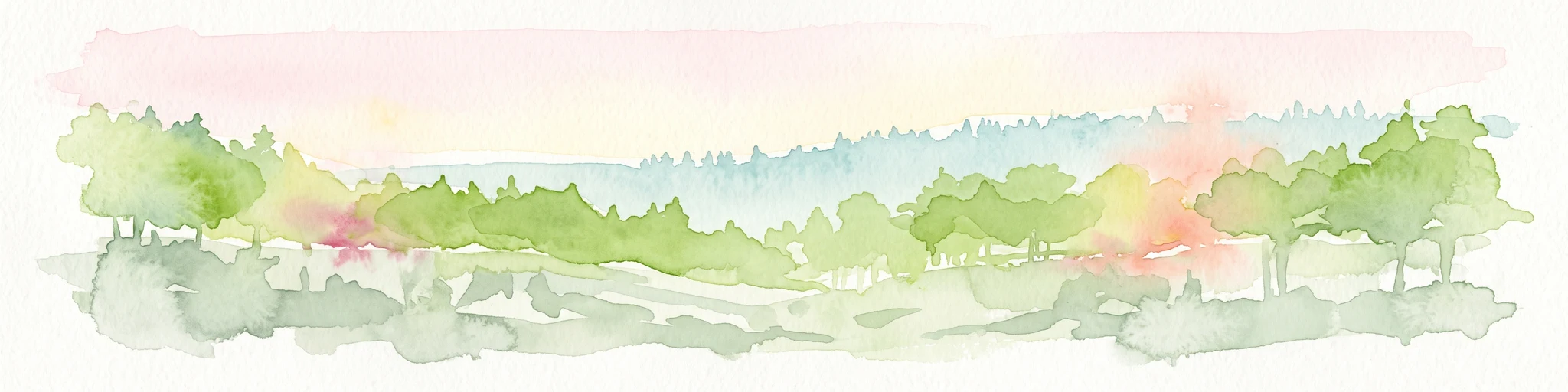
A soft watercolor painting of a rolling landscape featuring a winding river, grassy plains, and distant hills in muted green, pink, and yellow tones.
Protected landscapeBodenseekreis
About 11 km away#2 closest

South

Spätwürmeiszeitliche Terrassen zwischen Burnau, Prestenberg, Vorderreute, Buch und Krumbach Geography

A protected landscape site in the Bodenseekreis district

Spätwürmeiszeitliche Terrassen zwischen Burnau, Prestenberg, Vorderreute, Buch und Krumbach is defined by its series of level river terraces resulting from Würm ice age glacial retreat. Spanning roughly 22 hectares near the Schwarzach river, the site remains a vital example of fluvioglacial geomorphology and regional landscape preservation within the pre-Alpine foreland.

Area
0.22 km²
Established
1963
Relief
Upland
Climate
Temperate
Protected landscapeBaden-Württemberg
About 13 km away#3 closest

North

Oberes Rißtal Protected Landscape: Glacial Geography and Wetland Corridors in Baden-Württemberg

Mapping the upper Riß river valley and its complex fen ecosystems

Oberes Rißtal stands as a crucial protected landscape in Baden-Württemberg, distinguished by its winding river meanders and multi-layered glacial terrain. This area merges the Riß and Würm ice-age legacy with active riparian habitats, including extensive lowland fens, kettle depressions, and traditional meadows. Explore the mapped boundaries and geographic features that define this essential Upper Swabian corridor.

Area
41.638 km²
Established
1975
IUCN
V
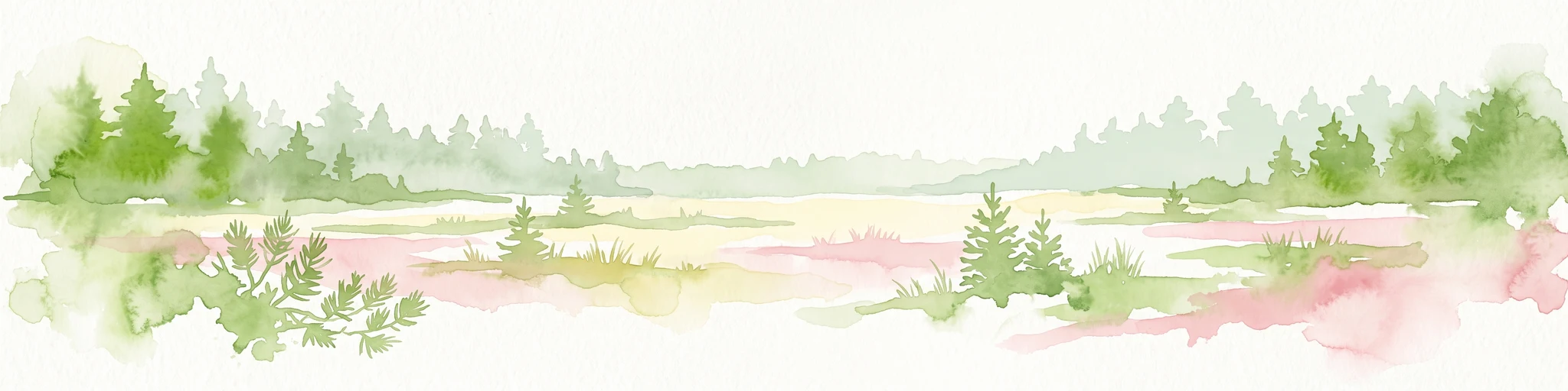
A watercolor painting showing a panoramic view of a wetland with coniferous trees, soft green forest lines, and reddish bog vegetation against a pale background.
Nature reserveBaden-Württemberg
15 km away#4 closest

Southeast

Bodenmöser und Hengelesweiher Nature Reserve: Mapped Geography and Protected Wetland Atlas

A diverse mosaic of peatlands and lakes in Westallgäu

Bodenmöser und Hengelesweiher represents a significant conservation network in southwestern Germany. This detailed view covers the distribution of calcareous fens, raised bogs, and dark-water pools that characterize the pre-Alpine hill landscape. Learn about the geographic configuration of this protected site as it bridges nutrient-poor lake ecosystems with surrounding alder woodlands and wet meadow corridors near Isny im Allgäu.

Area
7.59 km²
Established
2019
Protected landscapeBaden-Württemberg
About 15 km away#5 closest

East

Uferbewuchs der Eschach Protected Landscape and Riparian Corridor Map

Riparian conservation within the Riß-Aitrach-Platten of Baden-Württemberg

Tracing the protected linear riparian corridors of the Eschach stream, this area is a significant example of urban-edge conservation in Germany. It maintains continuous stream-bank vegetation through the Leutkirch municipal landscape, linking directly to broader floodplain habitats of the Aitrach river system through its glacial-plateau geographic setting.

Established
1953
IUCN
V
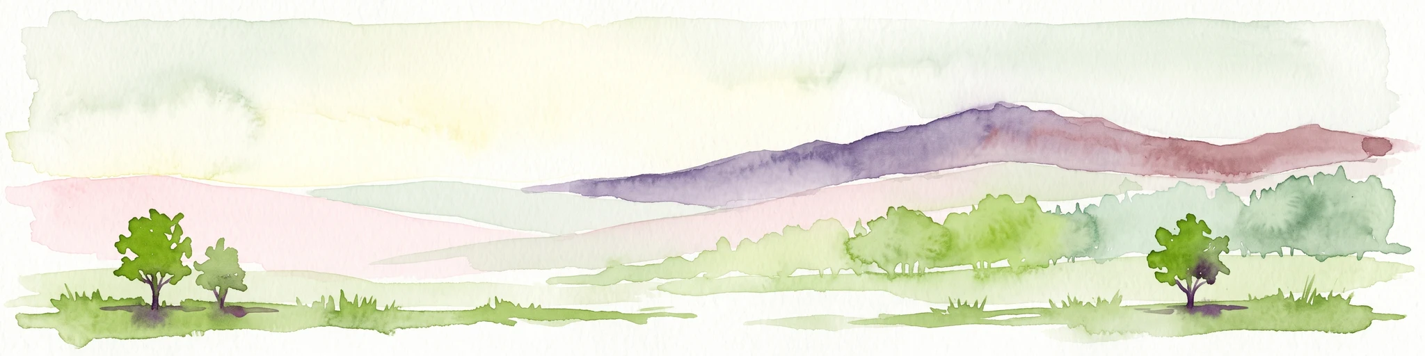
A horizontal watercolor painting depicting a soft-focus valley scene with rolling hills, scattered green trees, and a light sky.
Nature reserveBaden-Württemberg
16 km away#6 closest

West

Deggenhauser Tal Nature Reserve: Mapped Geography and Protected Valley Landscapes

Glacial terrain and watershed ridges in Baden-Württemberg

Investigate the protected geography of Deggenhauser Tal, an expansive nature reserve in the Oberschwäbisches Hügelland. This record maps the complex network of stream corridors, steep valley slopes, and ridge heights that define this Natura 2000 protected area. Gain insights into the glacial relief and varied land use patterns that characterize this essential southwestern German valley ecosystem.

Area
8.492 km²
Established
2019
Protected landscapeBaden-Württemberg
About 16 km away#7 closest

West

Pfrunger Ried, Rinkenburg Protected Landscape: Geographic and Terrain Analysis

Moorland and molasse hill system in Baden-Württemberg

Covering roughly 762 hectares in the Ravensburg district, Pfrunger Ried, Rinkenburg is a significant protected landscape known for its glacial tongue basin and peat-forming wetlands. This entry explores the interplay between the wetland systems and the prominent Tertiary molasse hill that define this distinct upper Swabian natural area.

Area
7.62 km²
Established
1967
Relief
Upland
Scope
Terrestrial
Protected landscapeBaden-Württemberg
About 16 km away#8 closest

Southwest

Tettnanger Wald mit Hochwacht, Krüntenbühl, Reichenbühl, Argenhardter Kopf, Schoos und Steilrand des Argentales an dem Schwandenbogen: Geography and Protected Boundaries

A Glacial Landscape Protection Area in the Lake Constance Basin

This protected landscape in Baden-Württemberg captures a classic moraine terrain shaped by glacial retreat. With its system of ridges, dead-ice hollows, and escarpments along the Argen valley, the area serves as a critical geological reference point. Explore the detailed topography and mapped boundaries of this forest landscape within the broader Bodenseebecken region.

Area
7.01 km²
Established
1954

Common questions about visiting, size, designation, and location context for Altdorfer Wald

Altdorfer Wald FAQs for park facts, access, geography, and protected area context

Find quick answers about Altdorfer Wald, including protected-area facts, park geography, trail and visitor context, and how the park fits into its surrounding country and regional landscape.
MoriAtlas Explorer

Continue Your Protected Areas Search Across the Global Atlas

Deepen your exploration by continuing the structured search for national parks and protected areas worldwide. Utilize the comprehensive filtering capabilities to compare different conservation landscapes and refine your understanding of global park geography. Discover more about the distribution and characteristics of protected natural areas.

Global natural geography