
Mori Atlas logo
Protected landscapeBienwald

Analyzing the alluvial sandy fans, ancient dune ridges, and seasonal woodland hydrologies

Bienwald Protected Landscape: A Deep Geographic Atlas of the Rhineland-Palatinate Lowland Forests

Bienwald represents a vital lowland forest complex within the southern Rhineland-Palatinate region of Germany. Spanning approximately 120 square kilometers, this protected landscape is defined by its origin as a series of alluvial fans deposited by streams emerging from the Palatinate Forest during the last ice age. The terrain features a complex mosaic of dry pine-oak woodland on stable dune ridges and wet alder carr forests along seasonal streams, creating a dense, biodiverse environment that serves as an essential habitat for numerous protected species.

lowland forestalluvial plainsandy soilsdune ridgespine woodlandoak forest
A graphic illustration depicting a serene landscape with a winding river in the foreground, surrounded by trees, with cliffs and a waterfall in the distance under a pale sky.

Bienwald

Protected landscape

Park overview

Structured park overview, official facts, and landscape profile for Bienwald

Bienwald park facts, protected area profile, and essential visitor context

Review the core facts for Bienwald, including designation, size, terrain, visitor scale, habitats, and operating context in one park-focused overview.

About Bienwald

Bienwald occupies the broad alluvial fan where the Lauter and neighboring streams emerge from the eastern edge of the Pfälzerwald and spread toward the Rhine. Because the loose sandy soils proved poorly suited to agriculture, the area became one of the few large stretches of the Upper Rhine plain to remain continuously forested from prehistoric times to the present. Today it forms a roughly triangular block stretching from the villages of Schweighofen and Rheinzabern in the northwest down to the French border in the southwest, with the high bank of the Rhine closing off its eastern edge.

What distinguishes Bienwald from more famous German forests is its subtle complexity rather than its relief. Streams, ditches and seasonal runoff channels weave through the sandy fan, alternating dry ridges of wind-deposited dunes with marshy lowlands that flood in winter and dry out in summer. This micro-topographic variety supports more than 300 mapped biotope types within a relatively small elevation span and creates an ecological richness that is uncommon for lowland terrain.

Most of the forest is state-owned and managed by the Forstamt Bienwald based in the nearby town of Kandel. A large federal conservation project launched in 2004 and concluded in 2022 has worked to preserve and reconnect key habitats across the forest, including abandoned farmland around Büchelberg converted into reed beds and meadows. The combination of long unbroken forest cover, intentional habitat restoration, and a network of more than 470 kilometers of forest roads makes Bienwald both a working woodland and a significant conservation landscape.

Beyond its ecological profile, Bienwald carries visible traces of centuries of human activity, from a Bronze Age burial field near the high bank of the Rhine to a Roman road and the medieval legend of Bishop Theodard, and from mass oak felling after the Thirty Years' War to grenade fragments still lodged in the trunks of trees from the Second World War. The result is a forest that is at once a quiet natural refuge and a deeply layered cultural landscape.

Quick facts and research context for Bienwald

Bienwald is a state-owned forest in the Südpfalz region of Rhineland-Palatinate, situated on the Niederterrasse (low terrace) of the Rhine and bordered to the southwest by France along the Lauter river. It has been designated as a landscape protection area since November 1987 and is part of the Natura 2000 network as the FFH area Bienwaldschwemmfächer. Today the state of Rhineland-Palatinate owns roughly 10,275 hectares of the forest, with additional municipal and private holdings bringing the total to about 12,000 hectares.

The terrain is remarkably flat, descending only gently from about 130 meters in the west to 105 meters in the northeast, with low dune-like ridges rising modestly above the plain. Roughly 56 percent of the woodland is coniferous (overwhelmingly pine, first planted in 1576) and 44 percent broadleaf, dominated by oak. A federal large-scale conservation project (Naturschutzgroßprojekt) approved in 2004 ran through 2022 to preserve and develop key habitats within this already ecologically valuable lowland forest.

Protection and recognition

Documented terrestrial protection records and designation timeline for Bienwald.

Bienwald Protection Status and Official Designation History

Bienwald maintains a documented terrestrial protection status established in 1987 under verified international databases. Official records outline the formal designation history and management scope associated with this protected area.

Protection details

Protection scope
Terrestrial
Designated year
1987
Transboundary protection
No
WDPA ID
319927
Park context

Deeper park guide and search-rich context for Bienwald

Bienwald history, landscape, wildlife, and travel context

Explore Bienwald through its history, landscape character, ecosystems, wildlife, conservation priorities, cultural context, and seasonal travel timing in a structured park guide built for atlas discovery and search intent.

Why Bienwald stands out

Bienwald is best known for being one of the largest contiguous lowland forests in western Germany, anchored on a system of alluvial sand fans built up by streams emerging from the Pfälzerwald at the end of the last ice age. Within that seemingly uniform sandy plain lies an unusually varied mosaic of dry pine-oak woodland on dune ridges, wet alder swamps along seasonal brooks, and old-growth patches with rare deadwood beetles. The forest is also recognized as the only known lowland occurrence of the European wildcat in Europe, with a resident population estimated at roughly 45 to 60 animals. Combined with its rich amphibian fauna (all 16 species native to Rhineland-Palatinate), more than 2,200 documented beetle species, and one of Europe's richest deadwood beetle communities, Bienwald has a conservation profile that disproportionately exceeds the modest elevation and reputation of a lowland forest.
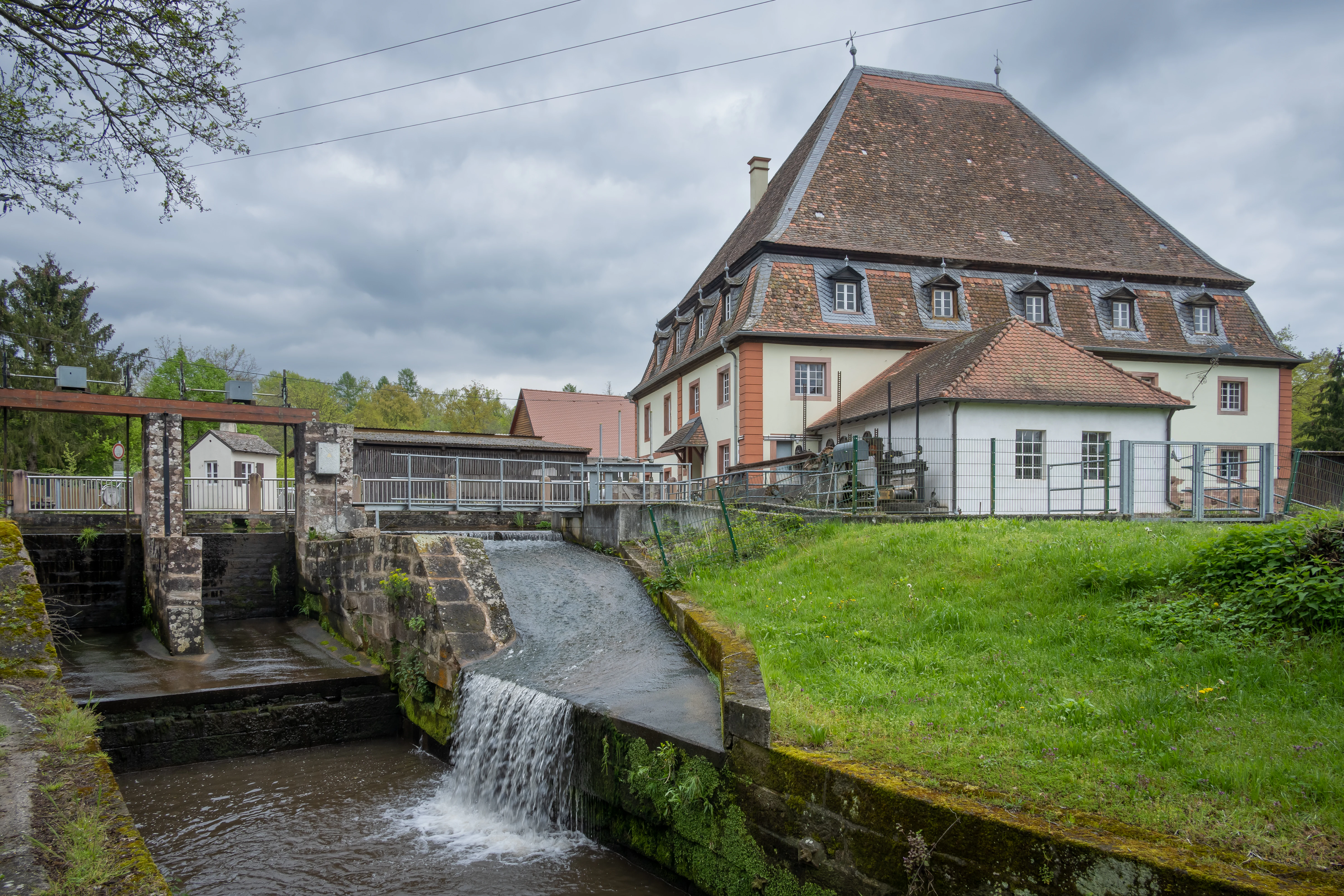
A multi-story historic mill building with a steep tile roof, featuring a small waterfall flowing into a stone-lined channel in the foreground.
The historic Bienwaldmühle mill, situated alongside a small water channel within the Bienwald forest area.

Bienwald history and protected-area timeline

The name Bienwald itself is old and uncertain in meaning: the area appears in records around 670 CE as Biwalt, later passing through forms such as Byewalt, Biewalt, Bewald, and Böhnwald before settling into the modern spelling in the early nineteenth century. One interpretation links the first syllable to an old Germanic or Celtic root for bee or woodland, suggesting the name may once have meant "forest of the bees."

Human use of the area reaches far back. A Bronze Age cemetery of burial mounds, dating to roughly 1500 to 1200 BCE, sits near the high bank of the Rhine at the present-day Wörth-Dorschberg, and an early medieval defensive mound called the Affelderle nearby may have been first built as a timber-and-earth fortification around the tenth century. The Romans extended an older trail along the high bank into a proper road, founding the important ceramic settlement of Rheinzabern (Tabernae) around 10 CE, and the forest itself formed a boundary between the tribal territories of the Triboci and the Nemetes.

Later centuries brought both legend and exploitation. Around 670 CE, the tradition holds that the Bishop Theodard of Maastricht was attacked and killed while traveling through the forest near Rülzheim, and his veneration gave rise to a chapel later replaced by the modern Dieterskirchel. From the eighth century onward the woodland was managed for timber, with oaks especially favored. The Thirty Years' War led to such heavy felling of oaks for shipbuilding and construction that in 1718 a local ordinance forbade cutting more than a single oak at any one site.

The forest's position along the Franco-German border shaped its military history. In 1793, several engagements of the First Coalition War were fought here between Austrian and French forces. Two centuries later, the Siegfried Line, known in Germany as the Westwall, cut through the forest, and the trenches and grenade fragments that remain today are recalled on a memorial hiking trail near Schaidt.

Modern protection came in stages. A landscape protection area was designated on 27 November 1987, followed in 1998 by recognition as an FFH (Flora Fauna Habitat) site under the name Bienwaldschwemmfächer. In 2004 the federal government approved a large-scale conservation project, the Naturschutzgroßprojekt Bienwald, whose planning continued through 2007 and whose measures were largely implemented by 2022. Today roughly 10,275 hectares are state forest, with smaller municipal and private holdings completing the protected landscape.

Bienwald landscape and geographic character

Bienwald sits on the Niederterrasse, the lower of the two alluvial terraces that step down from the Palatinate Forest toward the Rhine. The terrain looks deceptively flat: across roughly 20 kilometers from west to east the land drops only about 25 meters, falling from around 130 meters near the French border to about 105 meters in the northeast, a gradient of just over 1.25 meters per kilometer. The visual relief comes instead from low dunes, the so-called Dünenbuckel, with modest summits reaching 141 meters in the Unterer Mundatwald, 135 meters along the northern edge, and 152 meters east of the center of the forest.

These dunes were heaped up by wind across the sandy outwash plain at the close of the last ice age. They are now vegetated and stable, but they shape which parts of the forest are dry and which are damp. The Lauter, which in its upper course is called the Wieslauter, traces the entire southwestern edge of the forest as the international boundary with France, looping broadly through its own floodplain in a near-natural state. Inside the forest, a dense network of rills, streams, and drainage ditches, including the Heßbach, Heilbach, Wiebelsbach, and Schmerbach, runs broadly west to east, falling dry in summer and swelling into widespread surface flooding in wetter seasons.

Beneath the surface, impermeable clay and marl layers force groundwater to move in stacked aquifers from the Palatinate Forest toward the Rhine. In the western part of Bienwald these layers lie near the surface, producing the wet "nasser Bienwald" with strong seasonal alternation between saturation and dryness. In the eastern part, the ground drops abruptly by about 10 meters at the high bank of the Rhine, lowering the water table and leaving the soils notably dry. The result is a quiet, mostly level forest whose visual interest comes from shifting textures of pine, oak, dune, brook, and open meadow rather than from dramatic topography.
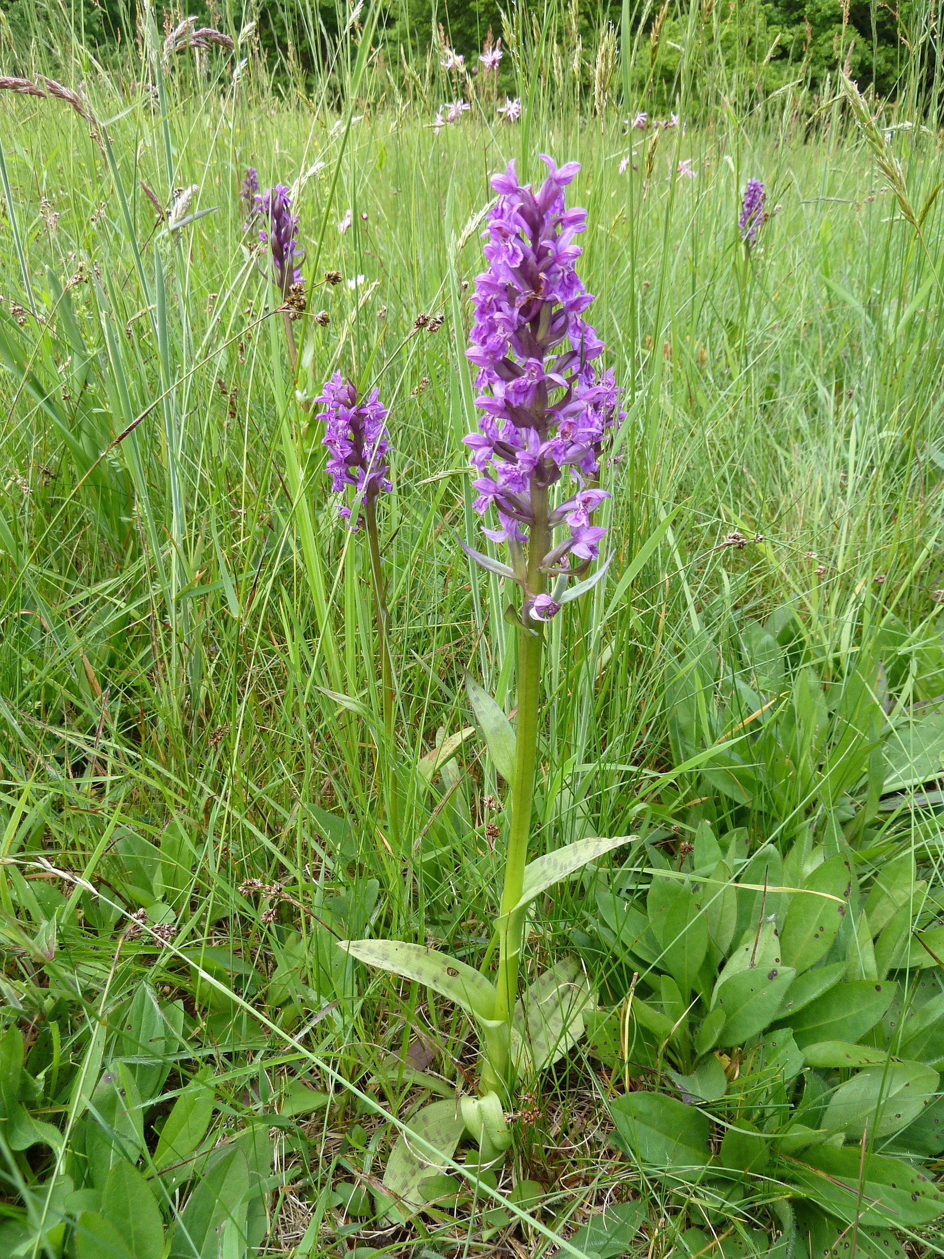
A group of vibrant purple Broad-leaved marsh orchid flowers growing in a lush green meadow.
Broad-leaved marsh orchids blooming in a meadow within the Bienwald region.

Bienwald ecosystems, habitats, and plant life

The ecological character of Bienwald is built on its alluvial sands and the contrast between dry and wet soils. On the higher, drier sites, light stands of Scots pine, originally planted from 1576 onward, mix with oaks, beeches, and hornbeams, while the lowest, wettest zones support relict alder carr forests that hold water for much of the year. Between these extremes lies an unusually fine-grained mosaic of more than 300 mapped biotope types and vegetation units.

Vegetation reflects the underlying poverty of the sandy soils. Conifers now make up about 56 percent of the forest, with pine the dominant species; broadleaves, especially oak, account for about 44 percent. Surveys have documented 151 rare or threatened plant species within the forest, including a number of orchid species, 86 of them considered endangered in Rhineland-Palatinate and 72 endangered at the federal level. Pine favors the drier soils, oak and other broadleaves the wetter ones, and the two formations interweave across the dunes and stream corridors.

The streams and ditches that cross the forest are biologically rich in their own right. The macrozoobenthic fauna of the water system includes 254 species or species groups, among them substantial populations of the freshwater pearl mussel in the Bruchbach-Otterbach lowland. A small crustacean, the spring fairy shrimp, reaches the southern edge of its European range here, and 46 dragonfly species have been recorded. The combination of old trees, abundant deadwood, undisturbed ground, and continuously wet and dry microhabitats gives Bienwald a lowland biodiversity profile that is exceptional for such a modest elevation range.
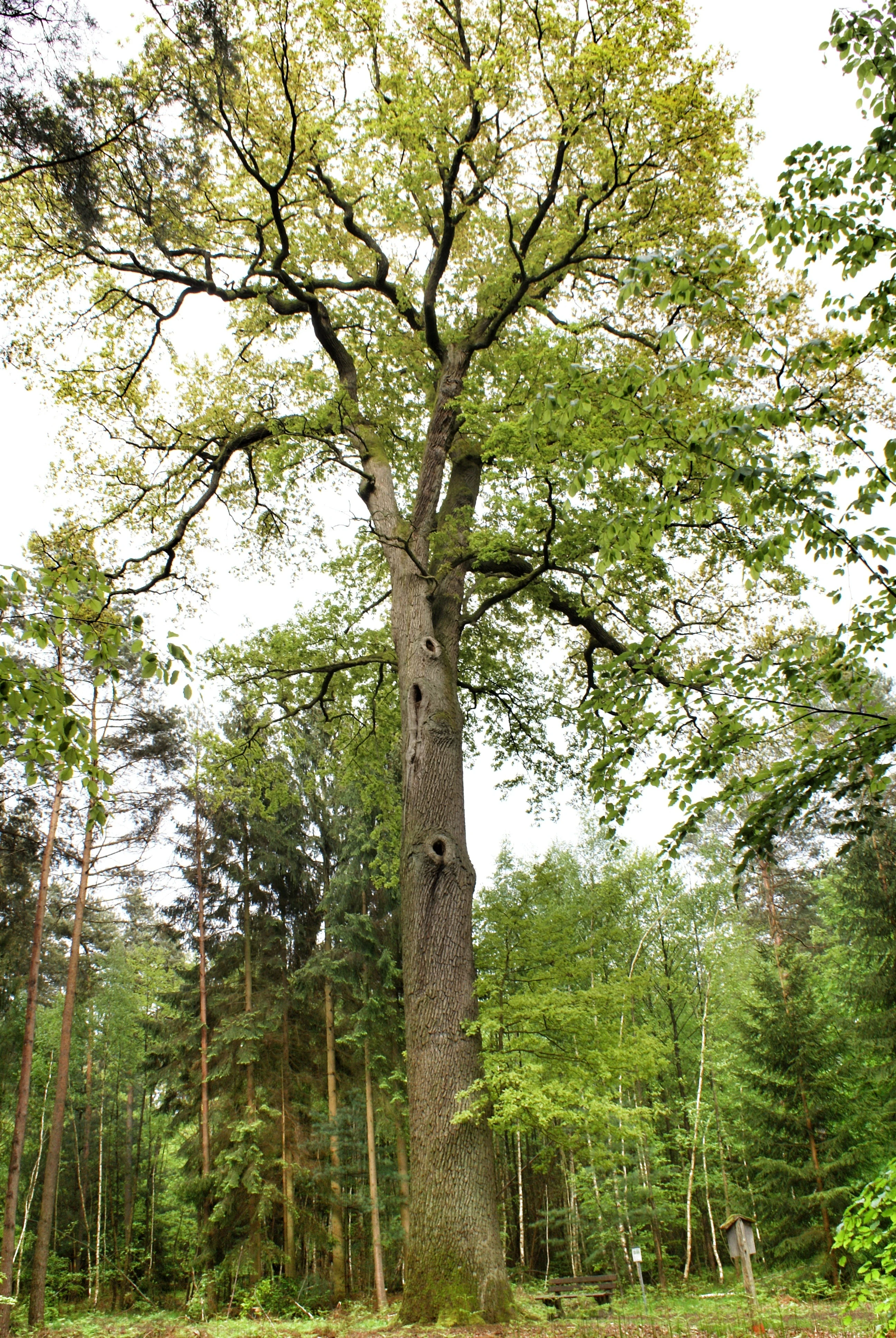
A large, mature oak tree with a tall, thick trunk and spreading branches stands prominently in the middle of a deciduous and coniferous forest.
The Bismarck Oak, a notable tree situated in the Bienwald forest near Schaidt.

Bienwald wildlife and species highlights

Bienwald's wildlife is shaped by the same alternation of dry pine woodland, open dune clearings, wet alder forest, and abandoned farmland that defines its plant life. The largest mammals present are wild boar and roe deer; red deer, once part of the fauna, no longer occur here. Among the predators, red foxes remain common, pine martens are scarcer, and the European wildcat has returned in recent decades. Its population, estimated at 45 to 60 animals, is the only known lowland wildcat population in Europe and gives the forest an outsized importance for the conservation of the species.

The forest is also significant for birds. Around 120 species breed within Bienwald and a total of 143 species have been observed, including a reconstituted white stork population whose recovery along the grassland of the Viehstrich at the northwestern edge has been supported by the Aktion Pfalzstorch and now forms a strong regional presence.

Amphibians are unusually diverse for a lowland forest. All 16 amphibian species native to Rhineland-Palatinate occur here, three-quarters of the German total. The spring frog is considered the characteristic species of Bienwald, and its presence reflects the network of wet ditches and seasonal pools across the alluvial fan.

Invertebrate diversity is exceptional. Roughly 2,200 beetle species have been documented, including 190 ground beetle species, around one-third of those found in Germany. The number of deadwood-dependent beetle species, about 670, is higher than in any other forest known in Europe and is one of the principal reasons Bienwald is treated as a conservation priority beyond the simple measure of its size.
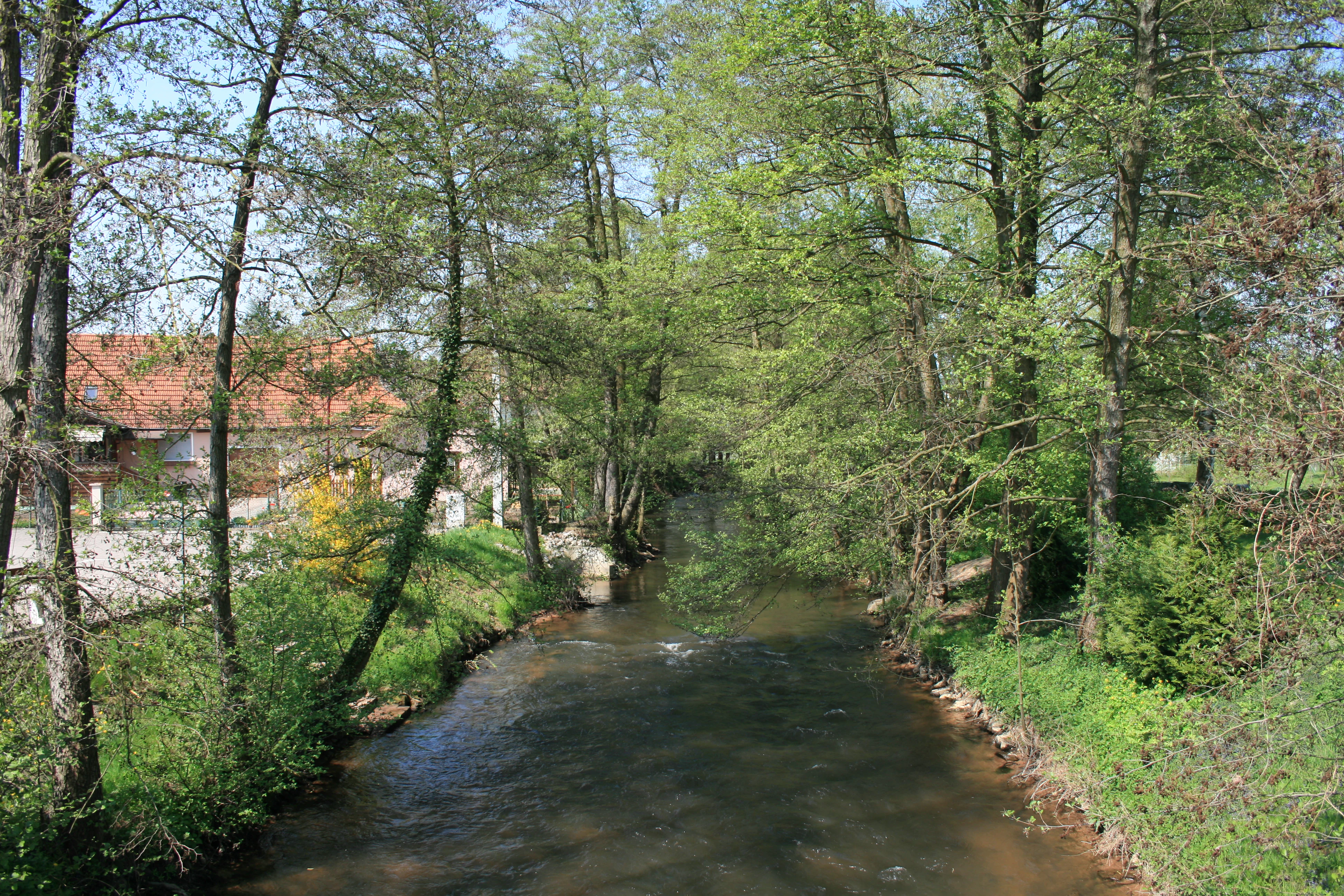
A small river flows through a dense forest with trees lining the banks and a building visible in the background.
The Lauter river flowing through the forested landscape of the Bienwald region near Scheibenhard.

Bienwald conservation status and protection priorities

Bienwald's conservation value arises from the combination of large size, ecological continuity, habitat variety, and the survival of very old, undisturbed patches. The forest was first formally protected on 27 November 1987 through designation as a landscape protection area (Landschaftsschutzgebiet), and in 1998 a large part of it was recognized under the European Union Habitats Directive as the FFH site Bienwaldschwemmfächer. Together with the adjacent bird protection area Bienwald und Viehstrichwiesen, it forms a central node in the regional Natura 2000 network.

In 2004 the federal government approved a major funding program, the Naturschutzgroßprojekt Bienwald, whose planning phase ran through 2007 and whose measures were largely implemented by 2022. The project focused on establishing and safeguarding parts of the forest and its surrounding landscape that are of nationally representative conservation significance. Around the village of Büchelberg, former farmland has been converted into reed beds and managed meadows, with caretakers maintaining habitats for rare plants and animals, and an orchard of historical apple varieties has been planted.

The combination of state ownership, long continuity of forest cover, formal protection designations, and a sustained federal investment in habitat management gives Bienwald a stronger conservation foundation than its modest elevation and understated scenery might suggest.

Bienwald cultural meaning and human context

Bienwald lies along one of the older cultural frontiers of western Europe, and its forest carries a long memory of that position. Bronze Age burial mounds near the high bank of the Rhine predate any written history of the woodland, and the area later sat between the Roman territories of the Triboci and the Nemetes, with Rheinzabern nearby becoming one of the empire's most important pottery centers north of the Alps.

Medieval legend and early Christian veneration are also part of the forest's identity. The tradition surrounding Bishop Theodard of Maastricht, said to have been killed while traveling through the Biwalt near Rülzheim around 670 CE, gave rise to a chapel at his grave, later replaced by the Dieterskirchel, which still stands along the road between Rülzheim and Rheinzabern.

In more recent centuries, the forest has been repeatedly shaped by the Franco-German border that runs through it. Eighteenth-century hunting and timber roads still cross the woodland, the straight lines laid out for forest management are part of the present-day path network, and traces of the Siegfried Line from the Second World War, including grenade fragments still lodged in tree trunks, are the subject of a memorial hiking trail near Schaidt. The annual Bienwald-Marathon, run through the northern part of the forest since 1976, is one small expression of how the woodland remains a living part of regional identity.
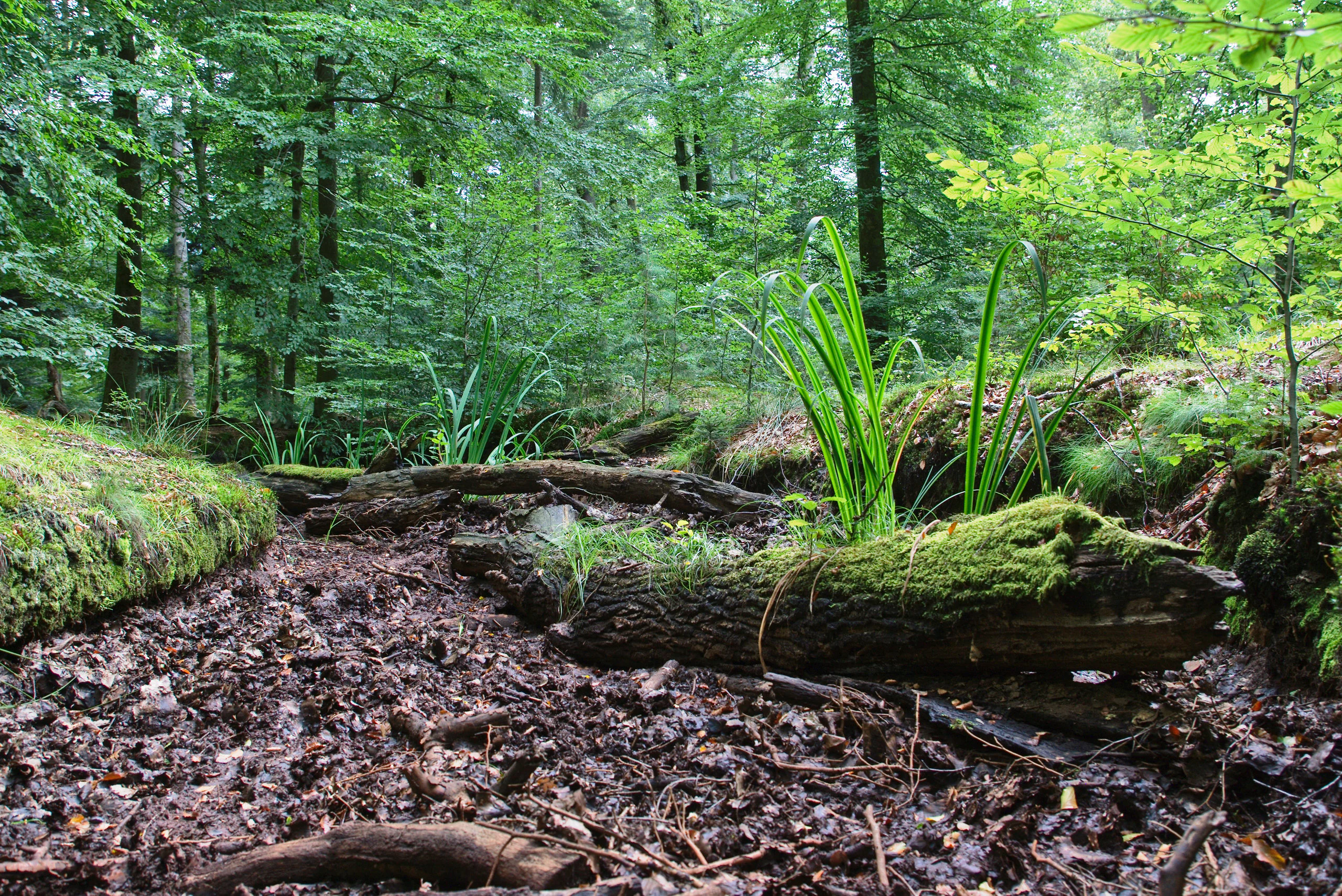
A dried out creek bed covered with dead leaves and fallen logs, surrounded by a lush green forest with mossy vegetation and tall grass growing within the stream channel.
A dry section of the Heilbach stream bed within the Bienwald forest.

Top sights and standout views in Bienwald

Bienwald's strongest quality is the contrast between ordinary appearance and extraordinary ecological density. A flat, sandy, almost monotonous lowland forest turns out, on close inspection, to contain more than 300 mapped biotope types, all 16 amphibian species of Rhineland-Palatinate, about 2,200 beetle species, and Europe's only known lowland population of the European wildcat.

The forest's physical origin gives it a particularly clean identity, sitting as it does on the alluvial fans built by streams emerging from the Pfälzerwald at the end of the last ice age. Today these Schwemmfächer anchor a protected landscape that has been formally protected since 1987, that hosts a large Natura 2000 site, and that has been the focus of a sustained federal conservation project. Few larger lowland forests in Germany combine this level of habitat variety, continuity, and ecological study.
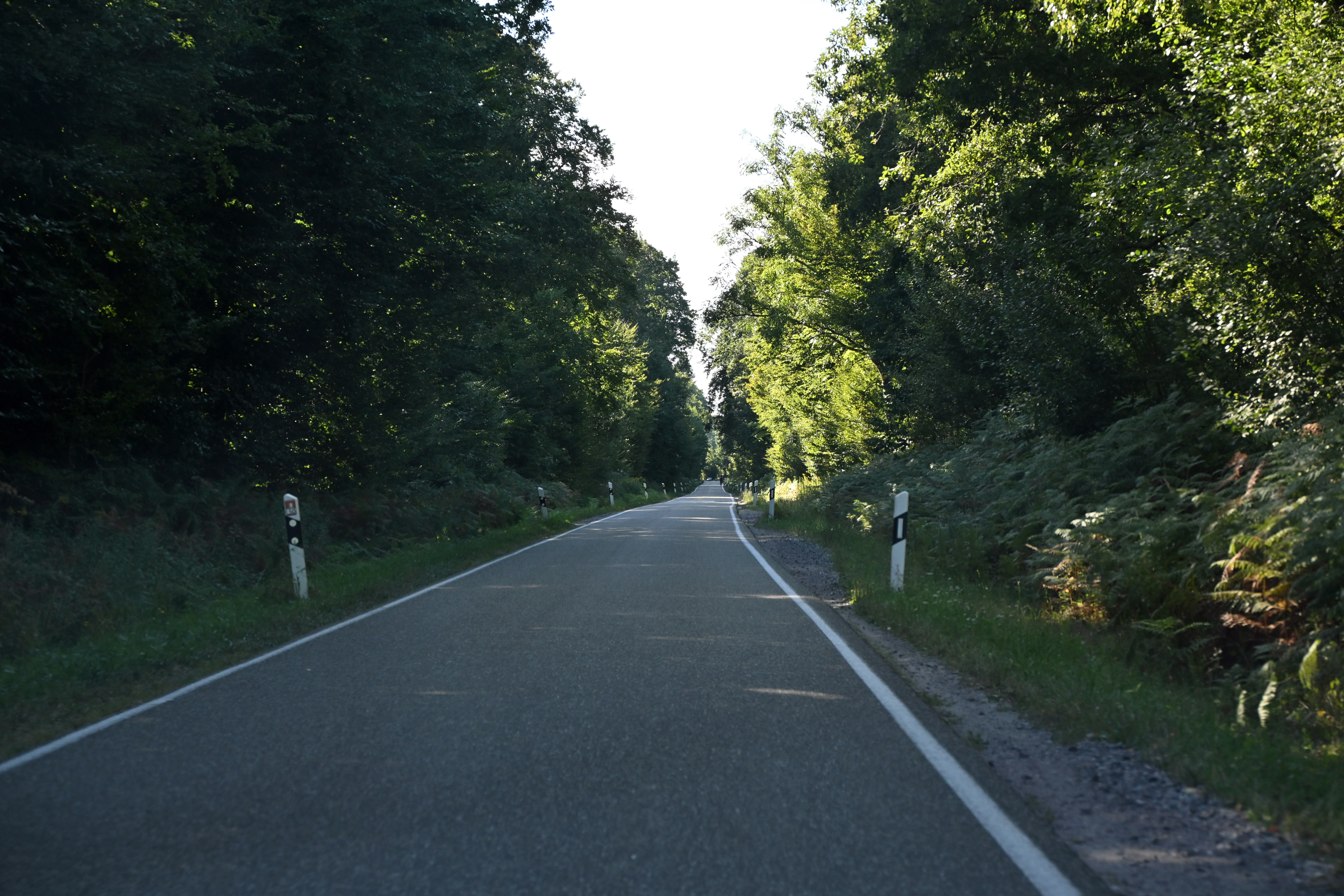
A paved road stretches into the distance, lined on both sides by dense green forest foliage.
The L545 road winding through the dense Bienwald forest near Scheibenhardt.

Best time to visit Bienwald

Bienwald has a strongly seasonal character that is worth taking into account when planning a visit. Late spring and early summer, roughly from May into June, are typically the most rewarding periods for orchids, amphibian activity along the wet ditches, and the richest expression of green vegetation across the dunes and stream corridors. These are also the months when the wet western sections of the forest are most accessible on foot before the smaller brooks dry out.

In high summer, many of the smaller streams and ditches within the forest fall dry, and the sandy soils of the eastern part of Bienwald can feel notably hot and dry under the pine canopy. Visits in this season are best concentrated on the cooler, wetter western sections and the meadows along the Viehstrich at the northwestern edge, where storks and other birds remain active. Autumn brings a quieter, more contemplative atmosphere, with the regular path structure of the forest more visible and wildlife observation generally easier. Winter can be atmospheric but wet, with large sections of the western forest, the "nasser Bienwald," regularly flooded by rising groundwater.

Monthly climate preview

Long-term representative measurements and weather by month for Bienwald

Bienwald Climate Normals: Annual Temperature and Precipitation Rhythm

Bienwald exhibits a measured annual temperature and precipitation rhythm across its representative coordinate from NASA Power climatology records. Reviewing the complete monthly climate profile provides deeper context on long-term temperature ranges and precipitation patterns.
Annual mean10 °C
1 °C21 °C
Jan
Feb
Mar
Apr10°
May15°
Jun19°
Jul21°
Aug20°
Sep16°
Oct10°
Nov
Dec
Warmest month
July

20.9 °C

Coolest month
January

0.6 °C

Wettest month
May

2.3 mm/day

Driest month
April

1.5 mm/day

Park location guide

Geography guide, regional context, and park location map for Bienwald

Bienwald park geography, regions, and map view in Germany

Understand where Bienwald sits in Germany through a broader geographic reading of the surrounding landscape, nearby location context, and its mapped position within the national park landscape.

How Bienwald fits into Germany

Germany is a federal republic in Western and Central Europe with a population of over 83 million across sixteen constituent states. It is Europe's largest economy by nominal GDP and a major global exporter and importer. The capital is Berlin, and the country borders Denmark, Poland, Czech Republic, Austria, Switzerland, France, Luxembourg, Belgium, and the Netherlands.

Wider geography shaping Bienwald in Germany

Germany is located in Western and Central Europe, spanning 357,022 km². It borders Denmark to the north, Poland and the Czech Republic to the east, Austria and Switzerland to the south, and France, Luxembourg, Belgium, and the Netherlands to the west. The country has coastlines on the Baltic Sea and North Sea to the north, with the Alps located in the southern region.

Map view of Bienwald

Use this park location map to pinpoint Bienwald in Germany, understand its exact geographic position, and read its mapped placement within the surrounding landscape more clearly.

Pigeon | © OpenStreetMap contributors

Location context for Bienwald

Rhineland-Palatinate

Explore visual records of sandy dune ridges, wet alder carr habitats, and alluvial terrain.

Bienwald Photos and Landscape Scenery: Visualizing the Protected Lowland Forest

Visual documentation captures the complex habitat mosaic and subtle dune topography defining the Bienwald lowland forest environment. Examining these field photographs reveals the intricate interplay between dry pine woodland and seasonal wetland corridors across the protected landscape.

A multi-story historic mill building with a steep tile roof, featuring a small waterfall flowing into a stone-lined channel in the foreground.

A weathered, moss-covered stone marker stands in a forest, featuring an engraved cross, the letters K and W, and additional faint carved symbols.

A group of vibrant purple Broad-leaved marsh orchid flowers growing in a lush green meadow.

A large, mature oak tree with a tall, thick trunk and spreading branches stands prominently in the middle of a deciduous and coniferous forest.

A small river flows through a dense forest with trees lining the banks and a building visible in the background.

A forest floor showing historical earthwork remnants including circular pits and depressions under tall trees.

A dried out creek bed covered with dead leaves and fallen logs, surrounded by a lush green forest with mossy vegetation and tall grass growing within the stream channel.

A paved road stretches into the distance, lined on both sides by dense green forest foliage.

Park atlas

Compare adjacent lowland forests, alluvial plains, and regional reserves

Explore Protected Areas and Parks Near Bienwald in the Upper Rhine Region

Browse nearby national parks and protected landscapes connected to the Upper Rhine plain. Compare adjacent forest reserves to understand the broader ecological network surrounding Bienwald.
Nature reserveRheinland-Pfalz
Mapped park locations coincide#1 closest

FFH-Gebiet Bienwaldschwemmfächer: Geography and Protected Area Overview in Rheinland-Pfalz

Inland dunes, wet forests, and alluvial sediment landscapes

FFH-Gebiet Bienwaldschwemmfächer is a vital nature reserve in southeastern Rhineland-Pfalz, Germany. Spanning a massive alluvial fan created by historical river deposits, the area offers a study in habitat extremes. Discover how its unique wind-reworked sand dunes contrast with the moist forest interiors of the nasser Bienwald, supported by limestone-influenced fens that define its regional ecological significance.

Area
135.53 km²
Established
1998
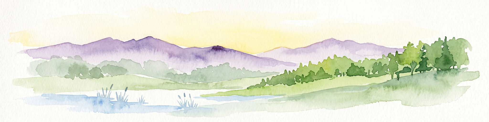
A soft, watercolor painting of a wide landscape with a calm water body in the foreground, rolling green hills in the midground, and purple-toned distant mountains under a pale sky.
Nature reserveRhineland-Palatinate
About 4.1 km away#2 closest

North

Bruchbach-Otterbachniederung Nature Reserve: Regional Floodplain and Wetland Geography

Mapping protected floodplain habitats along the Upper Rhine.

Bruchbach-Otterbachniederung is a landmark nature reserve in Rhineland-Palatinate, anchoring a continuous corridor of floodplain habitat from Rheinzabern to the French border. This protected area preserves a rare mosaic of reed beds, tall herb communities, and near-natural streams, providing essential sanctuary for regional flora and fauna within the southern Rhine lowlands.

Area
15.432 km²
Established
1988
IUCN
V
Relief
Lowland
Nature reserveRhineland-Palatinate
About 5.5 km away#3 closest

West

Lauterniederung Nature Reserve: Protected Floodplain Landscapes and Regional River Geography

A preserved riparian valley in Rhineland-Palatinate, Germany.

Lauterniederung provides a rare look at the original Auenlandschaft of the southern Palatinate. This nature reserve protects a meandering river channel and a diverse wetland mosaic of swamp forests and peat bogs, offering an essential geographic window into the natural history of the Upper Rhine Plain.

Area
2.07 km²
Established
1982
IUCN
IV
A watercolor painting showing a soft, atmospheric landscape with a foreground of water and green grasses, a midground of trees, and purple mountains in the background under a pale yellow sky.
Nature reserveRhineland-Palatinate
About 6.8 km away#4 closest

East

Rheinniederung Neuburg-Wörth: A Protected Floodplain Landscape in Rhineland-Palatinate

An analysis of river meanders, oxbows, and floodplain forest geography

This nature reserve encompasses a 14.5 square kilometer corridor of the Upper Rhine, featuring a distinct topography of hardwood forests, wet meadows, and aquatic habitats. The site remains a focal point for understanding Rhine river dynamics and the conservation of rare floodplain ecosystems like the Wörther Altrhein.

Area
14.48 km²
Established
2004
Relief
Lowland
Climate
Temperate
Watercolor painting showing layers of rolling green hills, dense tree lines, and distant purple mountain silhouettes under a soft sunset sky.
Nature reserveGermany
About 7.4 km away#5 closest

East

Riedried Nature Reserve: A Detailed Geographic Atlas of Bienwald Protected Wetlands

Wetland ecosystems and forest geography in Germany

Riedried is a specialized nature reserve in the Germersheim district of Germany, recognized for its black alder swamp forest and embedded lowland peat bog. This site serves as a crucial protected landscape within the Rhine plain, illustrating how small, managed wetlands function as a mosaic of rare habitat types in an otherwise drier forest region.

Area
0.25 km²
Established
1984
Relief
Lowland
Scope
Terrestrial
Nature reserveRheinland-Pfalz
About 14 km away#6 closest

Northeast

Wörther Altrhein Nature Reserve: Protected Wetland Atlas and Upper Rhine Landscape Context

Mapped conservation zones within the Rheinland-Pfalz floodplain

Investigate the protected landscape of Wörther Altrhein, an ecologically important former Rhine channel. This site offers a unique study in wetland geography, where controlled hydrology supports diverse reedbeds and alluvial forest habitats within the industrial backdrop of the southern Upper Rhine.

Area
2.4 km²
Established
2004
IUCN
IV
Relief
Lowland
Watercolor painting of a tranquil wetland landscape with soft green vegetation and a calm water body, reflecting the floodplain environment of the Rhine river.
Nature reserveLandkreis Germersheim
About 15 km away#7 closest

Northeast

Hördter Rheinaue Nature Reserve: Landscape and Geographic Context in Landkreis Germersheim

Examining the hydrology and floodplain forest of the German Rhine.

Hördter Rheinaue serves as a critical node in the Palatinate Rhine floodplains, preserving a vast mosaic of willow and poplar forests alongside stable hardwood stands. Analyze the mapped terrain shaped by centuries of river activity, including the meandering Michelsbach and associated oxbow systems that define this essential protected corridor in western Germany.

Area
8.18 km²
Established
1966
IUCN
IV
Relief
Lowland
A soft, light watercolor painting of a wetland scene with a winding river branch, reeds, and low-lying greenery under a hazy sky.
Nature reserveRheinland-Pfalz
About 16 km away#8 closest

Northeast

Neupotzer Altrhein Nature Reserve: A Detailed Map and Geographic Overview

Protected floodplain landscape in the Rheinland-Pfalz region.

The Neupotzer Altrhein reserve stands as a prominent example of Rhine floodplain recovery, featuring a diverse topography of slow-moving water channels, marshes, and softwood alluvial forests. Located in the Rheinland-Pfalz district of Germersheim, this protected area offers significant insight into the historical and natural shifts of the Rhine corridor, serving as a key refuge within the European Natura 2000 network.

Area
2.375 km²
Established
2000
IUCN
IV
Relief
Lowland

Common questions about visiting, size, designation, and location context for Bienwald

Bienwald FAQs for park facts, access, geography, and protected area context

Find quick answers about Bienwald, including protected-area facts, park geography, trail and visitor context, and how the park fits into its surrounding country and regional landscape.
MoriAtlas Explorer

Continue Your Protected Areas Search Across the Global Atlas

Deepen your exploration by continuing the structured search for national parks and protected areas worldwide. Utilize the comprehensive filtering capabilities to compare different conservation landscapes and refine your understanding of global park geography. Discover more about the distribution and characteristics of protected natural areas.

Global natural geography