
Mori Atlas logo
Nature reserveBirzberg, Honigsack/Kappelberghang bei Fechingen

Analyzing the protected slope woodlands and calcareous grassland habitats within the Saar valley corridor

Birzberg, Honigsack/Kappelberghang bei Fechingen: Protected Nature Reserve and Saarland Landscape

(Naturschutzgebiet Birzberg, Honigsack/Kappelberghang bei Fechingen)

Birzberg, Honigsack/Kappelberghang bei Fechingen is a designated nature reserve encompassing approximately 188 hectares of hillside woodlands and valley terrain southeast of Saarbrücken. The protected area serves as an essential ecological mosaic, preserving diverse flora along the limestone-influenced slopes and riparian corridors of the Saar valley. By maintaining habitat connectivity within the Saarland region, the site plays a vital role in regional conservation and the ongoing study of local protected landscapes.

nature reserveorchid floraslope woodlandcalcareous grasslandriparian habitatSaar valley
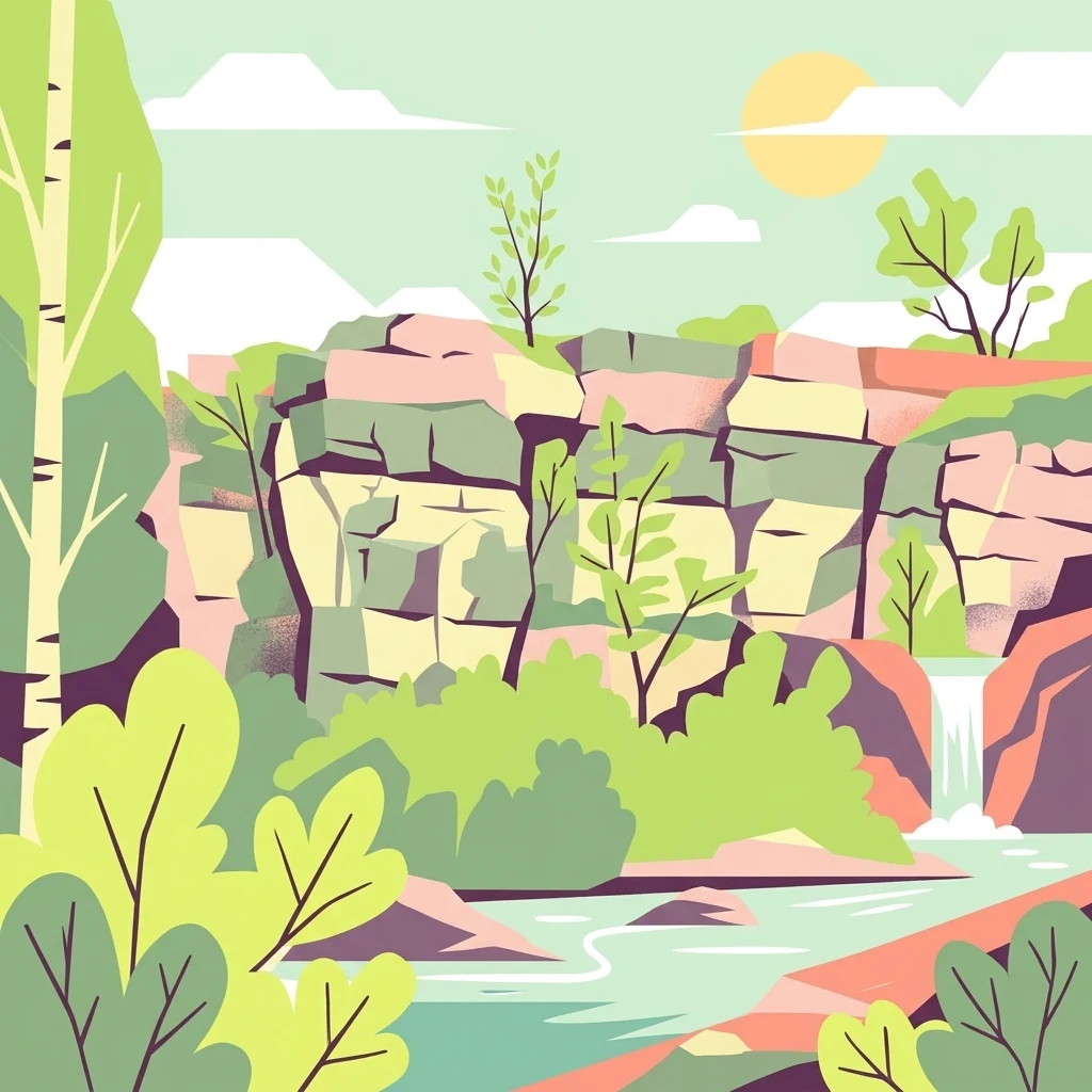
A flat vector illustration of a rocky cliff landscape with a small waterfall flowing into a stream, surrounded by lush green trees and foliage under a bright sun.

Birzberg, Honigsack/Kappelberghang bei Fechingen

Nature reserve

Park overview

Structured park overview, official facts, and landscape profile for Birzberg, Honigsack/Kappelberghang bei Fechingen

Birzberg, Honigsack/Kappelberghang bei Fechingen park facts, protected area profile, and essential visitor context

Review the core facts for Birzberg, Honigsack/Kappelberghang bei Fechingen, including designation, size, terrain, visitor scale, habitats, and operating context in one park-focused overview.

About Birzberg, Honigsack/Kappelberghang bei Fechingen

Birzberg, Honigsack/Kappelberghang bei Fechingen is a comparatively recent German nature reserve that has drawn regional attention primarily for its botanical richness, particularly its orchid populations. The protected area spans slopes and valley margins in the southern outskirts of Saarbrücken, in the Saarland state of Germany. Although it is modest in size when measured against larger German national parks, it plays an important role in maintaining habitat quality and species diversity within a heavily populated metropolitan and cross-border region, where natural corridors along the Saar valley are increasingly valued for their ecological function.

The site combines several ecological contexts in a relatively compact area. Sloping woodland, open calcareous-influenced grassland and scrub, and streamside habitat along tributaries of the Saar come together to create the varied microhabitats that orchids generally depend on. This habitat diversity helps explain both the orchid richness and the broader conservation importance of the protected area. By safeguarding these mosaics from further fragmentation, the reserve protects processes that sustain many plant and invertebrate species that would otherwise decline under intensifying land use.

As part of the network of nature reserves in the Regionalverband Saarbrücken, the area is connected in function, if not directly in space, with other protected sites in the region that maintain slope forests, valley woodlands, meadowlands, and old-growth cells across the Saarland. The reserve's official designation on 12 February 2016 formalized this protection and placed the area on the map of Germany's officially recognized nature reserves.

Quick facts and research context for Birzberg, Honigsack/Kappelberghang bei Fechingen

Birzberg, Honigsack/Kappelberghang bei Fechingen is a Naturschutzgebiet (nature reserve) on the municipal territory of Saarbrücken in the German state of Saarland. The reserve covers approximately 188 hectares and lies southeast of central Saarbrücken, south of Fechingen. Its official designation date is 12 February 2016, and it is catalogued under the identifier N-6808-301 in the regional nature reserve register. The site is also recorded in the World Database on Protected Areas under the WDPA ID 555579386. The locality position places it in the Saar valley corridor, near the Saarbach stream and close to the French border.

Protection and recognition

Documented conservation status, official boundaries, and international designation records

Birzberg, Honigsack/Kappelberghang bei Fechingen Protection Status and Natura 2000 Recognition

Birzberg, Honigsack/Kappelberghang bei Fechingen maintains verified protection status and recorded Natura 2000 framework assignments. Official database entries consolidate environmental designation records and international conservation metrics for protected area analysis.
Park context

Deeper park guide and search-rich context for Birzberg, Honigsack/Kappelberghang bei Fechingen

Birzberg, Honigsack/Kappelberghang bei Fechingen history, landscape, wildlife, and travel context

Explore Birzberg, Honigsack/Kappelberghang bei Fechingen through its history, landscape character, ecosystems, wildlife, conservation priorities, cultural context, and seasonal travel timing in a structured park guide built for atlas discovery and search intent.

Why Birzberg, Honigsack/Kappelberghang bei Fechingen stands out

The reserve is best known for its exceptional orchid flora. More than a dozen wild orchid species have been documented within the protected area, including the pyramidal orchid (Anacamptis pyramidalis), the white helleborine (Cephalanthera damasonium), dark red helleborine (Epipactis atrorubens), marsh helleborine (Epipactis palustris), lizard orchid (Himantoglossum hircinum), bird's-nest orchid (Neottia nidus-avis), common twayblade (Neottia ovata), bee orchid (Ophrys apifera), late spider orchid (Ophrys holoserica), man orchid (Orchis anthropophora), military orchid (Orchis militaris), and lesser butterfly orchid (Platanthera bifolia).
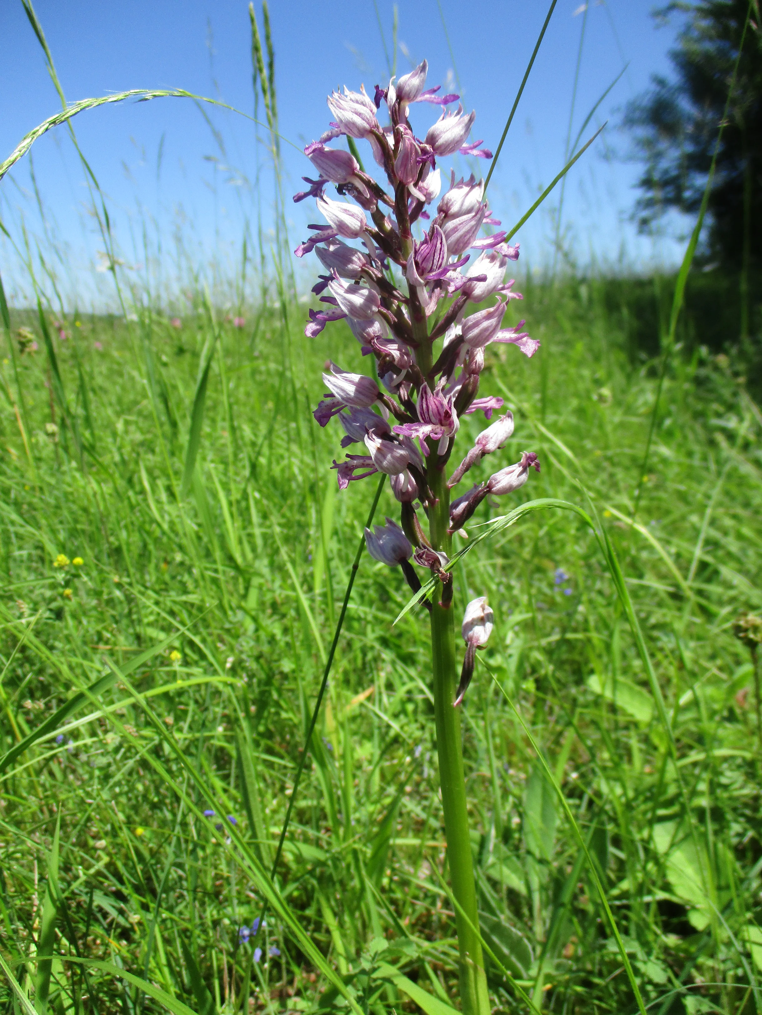
A close up view of a pale purple and white military orchid flower stem standing in a tall green meadow under a clear blue sky.
A military orchid, Orchis militaris, blooming in a meadow within the Birzberg, Honigsack/Kappelberghang nature reserve.

Birzberg, Honigsack/Kappelberghang bei Fechingen history and protected-area timeline

The area was officially designated as a Naturschutzgebiet on 12 February 2016 through an order issued in the Amtsblatt des Saarlandes (Official Gazette of Saarland). The designation corresponds to the registered identifier N-6808-301 and established the legal protection framework under which the reserve is managed. This relatively recent designation reflects a growing regional effort to formalize and strengthen protections for orchid-rich slope and woodland habitats in the Saarbrücken area. Beyond this formal establishment milestone, the source material does not provide a richer narrative history of land use, ownership changes, or earlier conservation attempts in the area, so a deeper historical narrative cannot be supported here.

Birzberg, Honigsack/Kappelberghang bei Fechingen landscape and geographic character

The protected landscape takes the form of a varied hillside-and-valley topography typical of the Saarland's mid-elevation terrain. Slopes form the dominant landform, including the namesake Birzberg, Honigsack, and Kappelberghang slopes that descend toward the Saar valley system southeast of Saarbrücken and south of Fechingen. The valley setting is shaped by the Saarbach, a right tributary of the Saar, which flows along the northern edge of the area, while the Saar river itself lies further to the west.

In terms of human context within the landscape, the western edge of the reserve is crossed by the regional road L 105, the L 107 runs along its northern margin near the Saarbach, and the federal highway B 51 runs on the western side along with the international border between Germany and France. These infrastructures subtly frame the reserve and confirm that the protected area is embedded within a culturally and geopolitically active landscape, very close to the Franco-German border corridor.
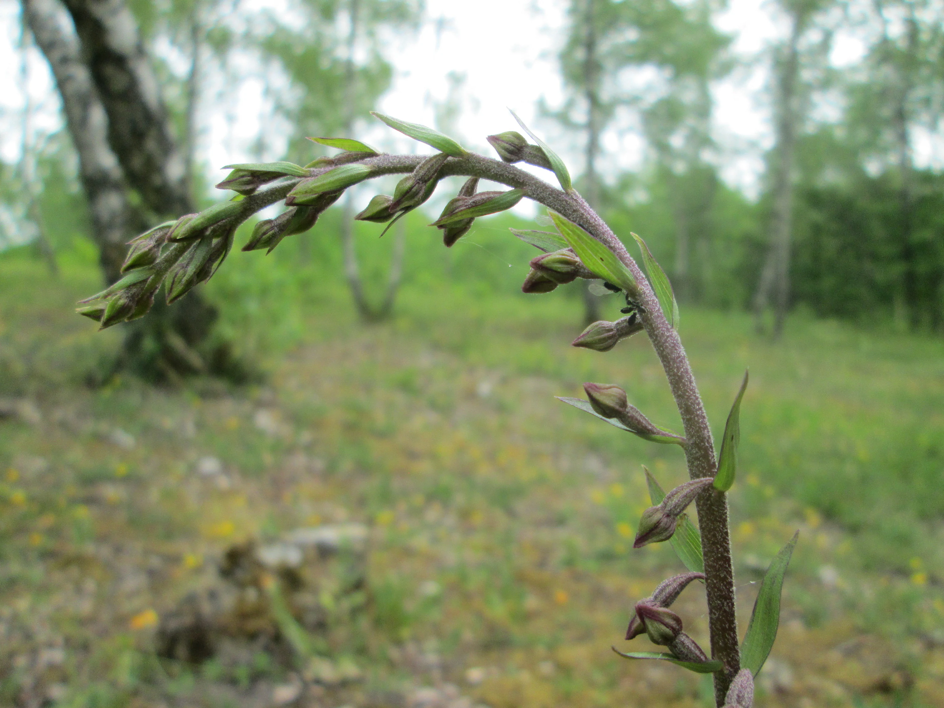
A close-up shot of a dark-red helleborine plant with a curved stem and budding flowers in a forest setting.
A dark-red helleborine (Epipactis atrorubens) in the Birzberg, Honigsack/Kappelberghang nature reserve.

Birzberg, Honigsack/Kappelberghang bei Fechingen ecosystems, habitats, and plant life

The nature reserve's ecological character is shaped by the transition between wooded hillsides and associated slope grasslands. Woodland habitats on the slope provide shaded and partially shaded niches, while the more open slope vegetation supports flowering plants adapted to higher light and often thinner, base-rich soils. The combination of sun-exposed slopes and sheltered woodland edge is precisely the mosaic pattern that supports many temperate orchid species, and the site is documented to host a diverse assemblage of wild orchids.

Streamside habitat along the Saarbach adds a riparian dimension to the reserve, contributing moisture gradients and edge habitats that complement the drier slope environments. Together, the slopes, woodland, and riparian fringe allow plant communities with differing moisture, light, and soil preferences to exist in close proximity. This ecological variability is what makes the area stand out within the broader Regionalverband Saarbrücken network of protected sites.
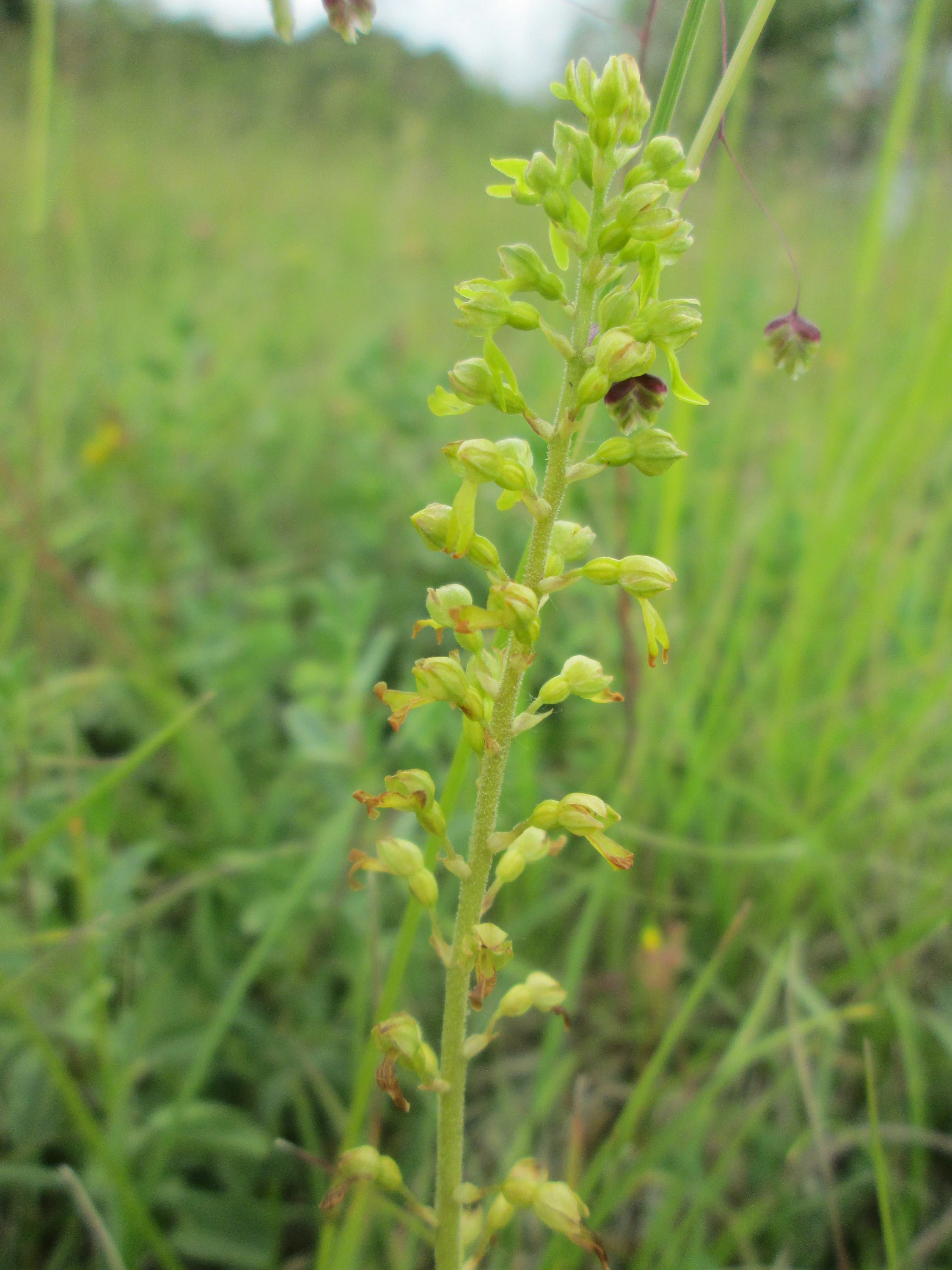
A close up view of a common twayblade orchid, Neottia ovata, showing its slender green stem and small greenish yellow flowers in a grassy meadow.
A common twayblade orchid in the Birzberg, Honigsack and Kappelberghang nature reserve.

Birzberg, Honigsack/Kappelberghang bei Fechingen wildlife and species highlights

Although the source material focuses primarily on the orchid flora of the reserve, the woodland, slope, and streamside mosaic that supports those orchids also provides habitat for a broad suite of invertebrates, including the pollinators, moths, butterflies, and other insects that depend on the floral resources of these slopes. Such sites commonly support small woodland mammals, breeding and migratory birds typical of mixed woodland and edge habitats in southwestern Germany, and herpetofauna associated with damp slope and streamside conditions along tributaries like the Saarbach. The wildlife section cannot be expanded into a definitive species inventory because the source material does not document specific fauna beyond the orchid conservation context.
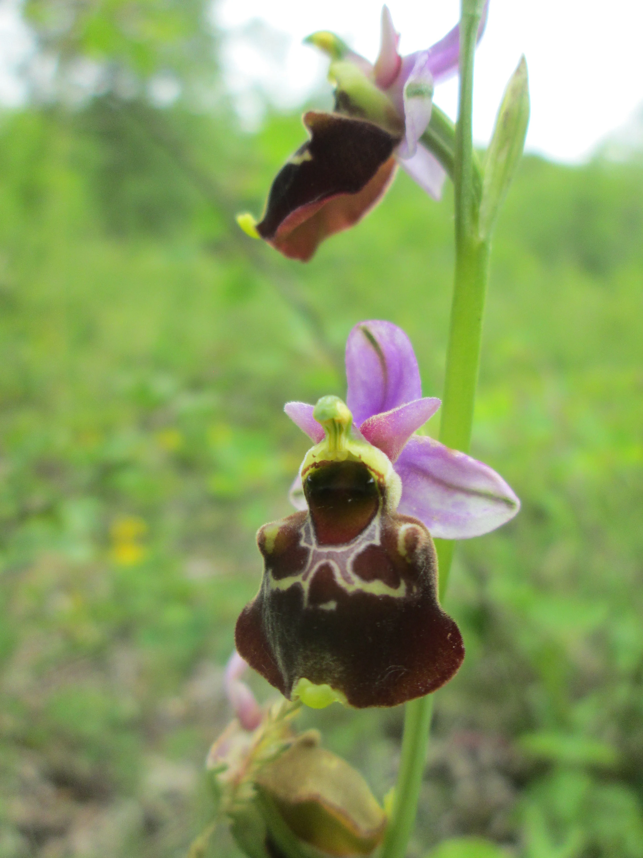
Close-up of a late spider orchid showing distinct brownish, velvety-textured labellum with light-colored markings and delicate pink sepals against a soft green background.
A close-up view of the late spider orchid (Ophrys holoserica) in the nature reserve.

Birzberg, Honigsack/Kappelberghang bei Fechingen conservation status and protection priorities

The reserve's conservation significance is anchored in its formal designation as a Naturschutzgebiet under Saarland law, registered as N-6808-301 and present in the World Database on Protected Areas under the WDPA ID 555579386. This formal protection gives the area standing as a legally safeguarded site whose habitats and species must be protected against degradation. The official conservation objective is supported by the park's role in preserving orchid-rich slope and woodland habitat within the Saar valley, an ecological resource that has become increasingly rare in central Europe under modern land use pressures.

Beyond the designation itself, the reserve contributes to broader regional conservation by acting as a refugium within the Saarbrücken urban and peri-urban landscape. By protecting slope woodlands, grasslands, and edges along tributaries of the Saar, the site helps maintain ecological connectivity in a landscape heavily shaped by infrastructure, settlement, and the international border with France. The reserve's inclusion in the landscape of protected sites surrounding Saarbrücken underscores its role in conserving the natural infrastructure of the Saar valley.

Birzberg, Honigsack/Kappelberghang bei Fechingen cultural meaning and human context

The reserve sits in the Saarland, a German state with a distinctive cultural history shaped by its position along the Saar river and its long border with France. The region's towns, including Saarbrücken, reflect this cross-border identity, and the protected area's location close to the French border, alongside the B 51 federal highway, places it firmly in this Franco-German contact zone. While the source material does not provide a detailed narrative of indigenous, traditional, or historical land use specific to this reserve, its setting makes it part of a broader regional identity where nature protection and cross-border cultural geography are intertwined.
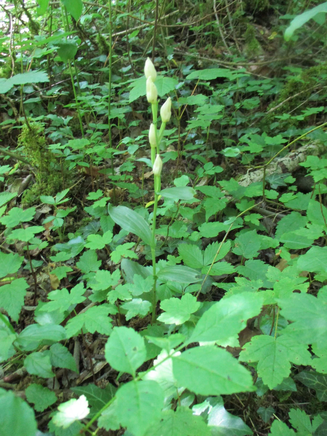
A close up view of a white helleborine orchid with several cream colored flower buds growing among lush green forest foliage and ground cover.
A white helleborine orchid, Cephalanthera damasonium, growing in the undergrowth of the Birzberg, Honigsack/Kappelberghang nature reserve.

Top sights and standout views in Birzberg, Honigsack/Kappelberghang bei Fechingen

The reserve's standout feature is its orchid flora, with more than twelve documented orchid species, including rare and conspicuous taxa such as the lizard orchid, man orchid, military orchid, late spider orchid, and bee orchid. Equally notable is its compact mosaic of woodland slopes, open grassy slope vegetation, and streamside habitat, all concentrated within a heavily populated metropolitan and cross-border setting.
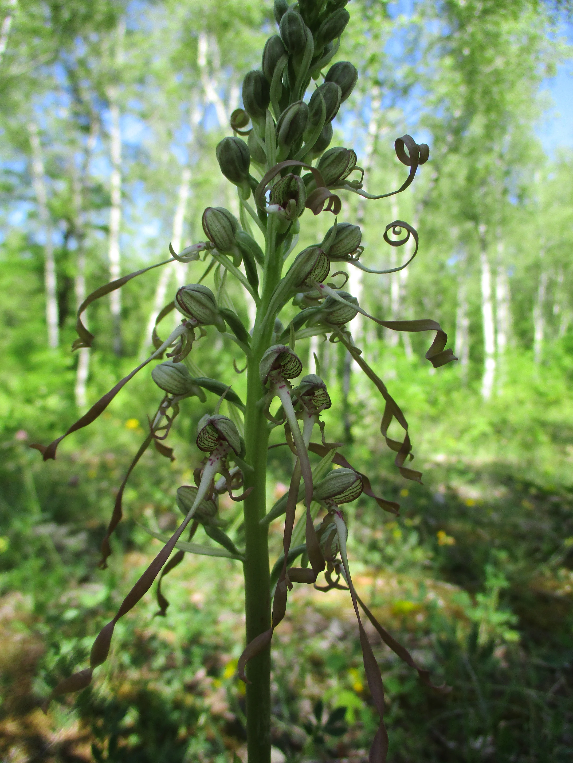
A close-up vertical shot of a tall, pale-green, and purple-tinged lizard orchid plant with spiraling, long-petaled flowers, set against a soft-focus background of trees.
A lizard orchid (Himantoglossum hircinum) blooming in the Birzberg, Honigsack/Kappelberghang nature reserve.

Best time to visit Birzberg, Honigsack/Kappelberghang bei Fechingen

The best time to experience the reserve's defining orchid flora is during the main European wild orchid flowering season, which generally spans late spring through mid-summer, when most of the documented species reach peak bloom. Cooler months offer a quieter experience focused on woodland and slope scenery rather than floral display. Beyond these broad seasonal patterns, the source material does not support more specific timing guidance, so detailed month-by-month or operational visit advice is not provided here.

Monthly climate preview

Long term temperature ranges and monthly precipitation patterns from representative coordinates

Annual Climate Normals and Temperature Rhythms for Birzberg, Honigsack/Kappelberghang bei Fechingen

Representative coordinate measurements reveal long term temperature variations alongside steady monthly precipitation levels across the terrain. Reviewing these multi year climate normals provides baseline environmental context for the protected landscape.
Annual mean10 °C
0 °C19 °C
Jan
Feb
Mar
Apr
May13°
Jun17°
Jul19°
Aug19°
Sep15°
Oct10°
Nov
Dec
Warmest month
July

19.5 °C

Coolest month
January

0.5 °C

Wettest month
December

2.6 mm/day

Driest month
April

1.6 mm/day

Park location guide

Geography guide, regional context, and park location map for Birzberg, Honigsack/Kappelberghang bei Fechingen

Birzberg, Honigsack/Kappelberghang bei Fechingen park geography, regions, and map view in Germany

Understand where Birzberg, Honigsack/Kappelberghang bei Fechingen sits in Germany through a broader geographic reading of the surrounding landscape, nearby location context, and its mapped position within the national park landscape.

How Birzberg, Honigsack/Kappelberghang bei Fechingen fits into Germany

Germany is a federal republic in Western and Central Europe with a population of over 83 million across sixteen constituent states. It is Europe's largest economy by nominal GDP and a major global exporter and importer. The capital is Berlin, and the country borders Denmark, Poland, Czech Republic, Austria, Switzerland, France, Luxembourg, Belgium, and the Netherlands.

Wider geography shaping Birzberg, Honigsack/Kappelberghang bei Fechingen in Germany

Germany is located in Western and Central Europe, spanning 357,022 km². It borders Denmark to the north, Poland and the Czech Republic to the east, Austria and Switzerland to the south, and France, Luxembourg, Belgium, and the Netherlands to the west. The country has coastlines on the Baltic Sea and North Sea to the north, with the Alps located in the southern region.

Map view of Birzberg, Honigsack/Kappelberghang bei Fechingen

Use this park location map to pinpoint Birzberg, Honigsack/Kappelberghang bei Fechingen in Germany, understand its exact geographic position, and read its mapped placement within the surrounding landscape more clearly.

Pigeon | © OpenStreetMap contributors

Location context for Birzberg, Honigsack/Kappelberghang bei Fechingen

Saarland
Recorded earthquake history

View Recorded Seismic Activity for Birzberg, Honigsack/Kappelberghang bei Fechingen

Open the historical earthquake catalogue to examine seismic events recorded in the vicinity of this nature reserve. The records detail regional activity within the Saarland landscape, supporting academic inquiry into local geographic history through documented event data.

Birzberg, Honigsack/Kappelberghang bei Fechingen Earthquake History

Catalogued events

227 events

Strongest magnitude

Magnitude 4.5

Most recent event

Sep 28, 2008

This history includes earthquakes recorded inside the park or within 50 km of its borders

Visual reference guide to hillside woodlands, calcareous slopes, and protected habitats

Birzberg, Honigsack/Kappelberghang bei Fechingen Photos and Landscape Scenery

Visual documentation of Birzberg, Honigsack/Kappelberghang bei Fechingen reveals the complex topography of woodland slopes and valley habitats across the Saarland region. Examining these protected landscapes provides clear insight into the rare orchid flora and terrain characteristics that define the reserve.

A close up view of a pale purple and white military orchid flower stem standing in a tall green meadow under a clear blue sky.

A close-up of a vibrant purple pyramidal orchid flower head in focus against a blurred background of green grass.

A close-up shot of a dark-red helleborine plant with a curved stem and budding flowers in a forest setting.

A close up view of a common twayblade orchid, Neottia ovata, showing its slender green stem and small greenish yellow flowers in a grassy meadow.

Close-up of a late spider orchid showing distinct brownish, velvety-textured labellum with light-colored markings and delicate pink sepals against a soft green background.

A close-up vertical shot of a white and pale green Lesser butterfly orchid flower stalk in a grassy field, with blurred green foliage in the background.

A close up view of a white helleborine orchid with several cream colored flower buds growing among lush green forest foliage and ground cover.

A close-up vertical shot of a tall, pale-green, and purple-tinged lizard orchid plant with spiraling, long-petaled flowers, set against a soft-focus background of trees.

A vertical shot of a man orchid plant centered in the foreground, with its tall spike of yellow and brown flowers. In the blurred background, there are green birch trees and a clear blue sky.

Two delicate Marsh Helleborine orchid flowers with white, ruffled labellum and greenish-purple petals, seen against a soft-focus green background.

A close up view of a bee orchid flower with its distinct patterned labellum resembling a bee, set against a soft, green, out-of-focus meadow background.

A pale, brownish-yellow bird's-nest orchid plant stands upright on the forest floor, set against a mossy tree trunk.

A low, weathered limestone cliff face partially covered by shrubs and small trees under an overcast sky.

Park atlas

Compare nearby protected landscapes and valley habitats across the surrounding regional terrain.

Parks Near Birzberg, Honigsack/Kappelberghang bei Fechingen: Protected Areas to Explore Next

Browse other protected areas and hillside reserves located near Birzberg, Honigsack/Kappelberghang bei Fechingen to examine broader ecological patterns in the Saar valley. Comparing adjacent natural habitats provides helpful context for understanding regional conservation networks and corridor connections.
Nature reserveSaarland
About 1.9 km away#1 closest

North

Wusterhang und Beierwies bei Fechingen: Protected Nature Reserve and Habitat Map

A study of calcareous beech forests and meadow geography in Saarland

Wusterhang und Beierwies bei Fechingen is a specialized nature reserve that captures the essential habitat diversity of the Saarland region. The area is defined by its small-scale mosaic of woodruff beech forest, orchid-rich calcareous slopes, and nutrient-poor grasslands. By examining this protected site, you can better understand the intersection of forest and meadow ecosystems that define this specific part of southwestern German geography.

Nature reserveSaarland
About 7 km away#2 closest

Southeast

Südlicher Bliesgau/Auf der Lohe: Mapped Protected Landscape in Saarland, Germany

Calcareous slopes and meadow habitat conservation areas

Located in the Saarpfalz-Kreis district, Südlicher Bliesgau/Auf der Lohe provides a focused conservation look at the slopes and ridges bordering the Blies river valley. The area showcases Muschelkalk geology and semi-open cultural landscapes, serving as a critical habitat for specialized plant communities within this unique German-French border geography.

Area
15.75 km²
Established
2004
IUCN
IV
A soft watercolor illustration depicting a river flowing through a lush green floodplain with trees, grasses, and a hazy background.
Nature reserveSaarland
11 km away#3 closest

East

Bliesaue zwischen Blieskastel und Bliesdalheim Nature Reserve and Regional Landscape Geography

Protected floodplain ecosystems in Saarland, Germany

The Bliesaue zwischen Blieskastel und Bliesdalheim protects a near-natural river course and its surrounding floodplain in the Saarland region. The reserve is characterized by complex soil conditions from Buntsandstein and Muschelkalk substrates, supporting a rich network of wetlands, marshes, and meadows that function as a cohesive ecological unit for migratory birds and protected species.

Area
1.981 km²
Established
2015
Relief
Lowland
Climate
Temperate
Nature reserveSaarland
15 km away#4 closest

East

Badstube Mimbach Nature Reserve: Protected Limestone Grasslands and Woodland in Saarland

A regional atlas exploration of Saarland biodiversity hotspots

Badstube Mimbach stands as a significant nature reserve located within the Bliesgau region of Saarland. This protected landscape is defined by its south-facing limestone slopes and terraced fields, providing essential habitat for rare flora and specialized fauna in a compact ten-hectare mosaic of open meadow and beech forest.

Area
0.095 km²
Established
2016
IUCN
IV
Nature reserveGermany
About 18 km away#5 closest

Northeast

Taubental Nature Reserve: Protected Landscape and Forest Geography in Germany

Core zone forest conservation in the Saarpfalz district.

Taubental Nature Reserve protects a continuous stretch of mixed broadleaf and coniferous forest situated on the Buntsandstone ridges of southwestern Germany. As a core zone within the Bliesgau Biosphere, it maintains essential habitat connectivity despite its proximity to major regional infrastructure, providing a unique case study in forest preservation within the Saarpfalz-Kreis landscape.

Area
4.26 km²
Established
2007
Nature reserveSaarland
About 20 km away#6 closest

Northwest

Breitborner Floß Nature Reserve: Mapping the Protected Landscape and Geography of Saarland

A vital habitat complex across the Saarlouis district

Breitborner Floß stands as a significant protected nature reserve in the Saarland state of Germany. Covering a mosaic of alluvial forests, silicate grasslands, and wet meadows, the site serves as a prime example of compact landscape conservation. Explore the mapped boundaries and natural terrain features that define this key component of the European Natura 2000 network.

Area
0.39 km²
Established
2015
IUCN
IV
Relief
Upland
A soft, artistic watercolor painting showing a wide, tranquil wetland scene with soft green and yellow hues, distant rolling hills, and patches of trees and vegetation in a floodplain environment.
Protected landscapeSaarland
About 21 km away#7 closest

Northeast

Beeder Bruch Protected Landscape: Blies River Floodplain and Wetland Geography in Saarland

A managed riverine sanctuary in the Bliesgau Biosphere Reserve

Beeder Bruch is a formally recognized protected landscape in Saarland, defined by the extensive floodplain of the Blies river. The site integrates wet meadows, riparian forests, and reedbeds, serving as a key European bird protection zone. Visitors can explore the mapped terrain, which utilizes conservation grazing to maintain essential wetland habitats and support local biodiversity within the Bliesgau region.

Area
127 km²
Established
2015
IUCN
V
Nature reserveRheinland-Pfalz
About 23 km away#8 closest

East

Monbijou Nature Reserve: Mapped Protected Landscapes in the Südwestpfalz District

Regional geography and conservation of dry grassland habitats

Monbijou stands as a significant twenty-six hectare nature reserve in Rheinland-Pfalz, defined by its mosaic of sun-exposed dry grasslands and forest-edge communities. This protected area plays a crucial role in maintaining rare plant species and uncommon animal habitats within the rolling terrain of the southwestern Palatinate, near the Hornbach stream and the local airfield.

Area
0.26 km²
Established
1978
Scope
Terrestrial
Water
Minor water

Common questions about visiting, size, designation, and location context for Birzberg, Honigsack/Kappelberghang bei Fechingen

Birzberg, Honigsack/Kappelberghang bei Fechingen FAQs for park facts, access, geography, and protected area context

Find quick answers about Birzberg, Honigsack/Kappelberghang bei Fechingen, including protected-area facts, park geography, trail and visitor context, and how the park fits into its surrounding country and regional landscape.
MoriAtlas Explorer

Continue Your Protected Areas Search Across the Global Atlas

Deepen your exploration by continuing the structured search for national parks and protected areas worldwide. Utilize the comprehensive filtering capabilities to compare different conservation landscapes and refine your understanding of global park geography. Discover more about the distribution and characteristics of protected natural areas.

Global natural geography