
Mori Atlas logo
Protected areaBleicheröder Berge

Examining the Muschelkalk topography and forested ridges of northern Thuringia, Germany.

Bleicheröder Berge: A Detailed Geographic Atlas of the Thuringian Protected Landscape

The Bleicheröder Berge constitute a significant protected landscape in northern Thuringia, defined by its distinct Zeugenberge topography and dense beech-dominated forests. This geographic profile details the range's Muschelkalk geological formations, including the fossil-rich Wellenkalk cliffs, alongside its diverse botanical presence and medieval site heritage. Explore the terrain characteristics of this mountain range situated near the Thuringian Basin.

MuschelkalkZeugenbergelow mountain rangebeech forestprotected landscapeLandschaftsschutzgebiet
A flat vector illustration of a valley between green hills, featuring a central waterfall, a small town with several buildings, and a rising sun in the background.

Bleicheröder Berge

Protected area

Park overview

Structured park overview, official facts, and landscape profile for Bleicheröder Berge

Bleicheröder Berge park facts, protected area profile, and essential visitor context

Review the core facts for Bleicheröder Berge, including designation, size, terrain, visitor scale, habitats, and operating context in one park-focused overview.

About Bleicheröder Berge

The Bleicheröder Berge occupy a distinctive position within the natural geography of northern Thuringia, forming a contiguous eastward extension of the Ohmgebirge and acting as a fragmented continuation of the northwest rim of the Thuringian Basin. Although modest in absolute height, with the Ziegenrück reaching 460.8 meters above sea level, the range stands out because of its dramatic Muschelkalk escarpments, dense forest cover, and isolation as a series of Zeugenberge, or outlier hills. Together with the adjacent Hasenburg, Harburg, and Hubenberg, the Bleicheröder Berge form a coherent landscape unit that has been recognized as a Landschaftsschutzgebiet.

The landscape is shaped by the alternating erosion of Muschelkalk strata, producing both flat upland surfaces and steep rocky cliffs. The Vogelberg cliff face, opposite the medieval Löwenburg castle, exposes the wavy-bedded Wellenkalk of the Lower Muschelkalk, displaying fossilized mussel shells and trace fossils of worm-like creatures from the ancient seabed. This combination of visually striking topography and scientifically interesting geology gives the range an importance well beyond its modest size.

Ecologically, the Bleicheröder Berge harbor one of the most diverse forest communities in the region. Beechnesses dominate the canopy, with pine on somewhat drier sites and notable stands of linden, wych elm, and European yew represented in the understory and intermediate layers. The limestone soils support a particularly rich ground flora, including fourteen native orchid species and the northernmost German population of the serviceberry. Wildlife includes red and roe deer, wild boar, fox, and hare, alongside woodpeckers and the rarer red kite in the canopy and airspace above the protected hills.

Culturally, the Bleicheröder Berge carry a strong medieval imprint. The Löwenburg, carved from Muschelkalk rock around 1279 for the von Bleicherode family, exemplifies the rock-castle tradition of the region, while the nearby Harburg hill once supported another medieval fortification. Together with a network of trails, including the August Petermann nature educational path, the range functions as a combined natural and historical landscape close to the town of Bleicherode.

Quick facts and research context for Bleicheröder Berge

The Bleicheröder Berge lie in the counties of Nordhausen and Eichsfeld in northern Thuringia, between the towns of Bleicherode, Buhla, Kraja, Sollstedt, Breitenworbis, and Haynrode. Geologically, the range is built primarily of Muschelkalk limestone and classified as Zeugenberge, isolated hill remnants formed by erosion.

The area is designated as a Landschaftsschutzgebiet and falls within the Weser-Leine-Bergland natural region. Together with the Ohmgebirge, the landscape covers roughly 76 square kilometers, with the Bleicheröder Berge specifically covering around 16 square kilometers. The Bode, Krajaer Bach, and Wipper rivers frame the range on its northern, southern, and eastern sides.

Protection and recognition

Documented terrestrial protection scope and official designation records

Bleicheröder Berge Protection Status and Natura 2000 Recognition

Bleicheröder Berge maintains a documented terrestrial protection scope backed by official Natura 2000 recognition records. Structured governance data highlights the conservation framework and formal designation parameters assigned to the protected landscape.
Park context

Deeper park guide and search-rich context for Bleicheröder Berge

Bleicheröder Berge history, landscape, wildlife, and travel context

Explore Bleicheröder Berge through its history, landscape character, ecosystems, wildlife, conservation priorities, cultural context, and seasonal travel timing in a structured park guide built for atlas discovery and search intent.

Why Bleicheröder Berge stands out

The Bleicheröder Berge are especially known for their Muschelkalk rock formations, which display characteristic Wellenkalk layers with shell fossils and ancient worm trail impressions. The protected hills are recognized as one of the richest botanical sites in northern Thuringia, with fourteen orchid species and rare mixed hardwood stands including linden, wych elm, and yew. The range is also known for its medieval heritage, particularly the Löwenburg, a small high-medieval lord's castle carved directly from the Muschelkalk rock around 1279. As a designated landscape protection area with a network of educational nature trails, it combines geological, ecological, and cultural significance in a compact Thuringian setting.
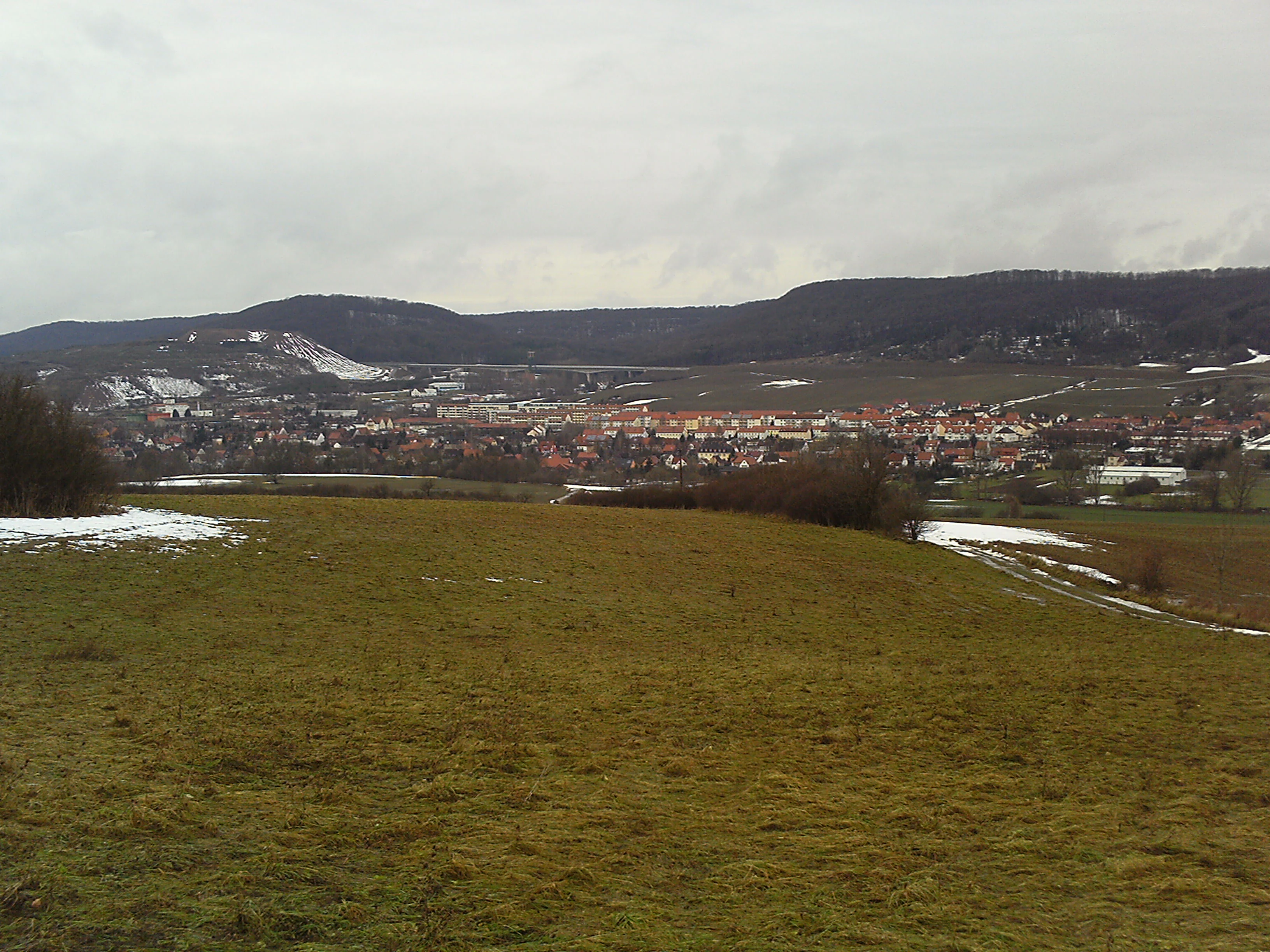
A wide landscape view of a green and partially snow-dusted meadow in the foreground leading to the town of Sollstedt and the Bleicheröder Berge ridgeline in the background under an overcast sky.
A view of the town of Sollstedt nestled at the base of the Bleicheröder Berge range.

Bleicheröder Berge history and protected-area timeline

The Bleicheröder Berge have a long history of settlement and local use, framed by the surrounding villages of Bleicherode, Buhla, Kraja, Sollstedt, and Haynrode. The clearest historical landmarks are the medieval castles that once stood on prominent hills of the range. The most remarkable is the Löwenburg, a small high-medieval lord's castle carved directly out of the Muschelkalk cliff near the town of Bleicherode. Built around 1279 for Johannes von Bleicherode, the castle represents the rock-hewn fortification tradition characteristic of the Muschelkalk regions of Thuringia.

The nearby Harburg hill, near Haynrode, once supported a now vanished castle, and the Hasenburg hill north of Buhla preserves the name of yet another fortification. These sites reflect the medieval strategic importance of the isolated Zeugenberge, which offered naturally defensible positions above the surrounding lowlands. Over the centuries, the forests of the Bleicheröder Berge became integrated into local land use, supporting timber, hunting, and traditional forest pasture.

In modern times, the range has taken on a conservation-focused identity. It was formally recognized as a Landschaftsschutzgebiet, and management plans were drawn up under the Natura 2000 framework, covering both an FFH habitat area and a European bird protection area. A 2009 preliminary forest treatment concept for the Bleicheröder Berge, prepared by the Thuringia State Institute for Forestry, Hunting, and Fisheries together with the Sondershausen forestry office Natura 2000 project group, marked an important milestone in integrating ecological, forestry, and protection goals. Educational infrastructure, including nature trails, was developed to support public engagement with the protected landscape.

Bleicheröder Berge landscape and geographic character

The Bleicheröder Berge are a classic example of Zeugenberge topography, a series of isolated hill remnants shaped by differential erosion of the underlying rock layers. The hills rise between the Krajaer Bach and the Bode to the north and the Wipper to the south, with the Bode flowing past the range to the northeast and the Wipper passing to the south. The highest point is the Ziegenrück, which reaches 460.8 meters above sea level and lies about one kilometer south-southeast of Buhla.

Physically, the range is built mainly of Muschelkalk, a limestone-rich sedimentary sequence that produces characteristic cuesta-like escarpments. The most visually striking exposures appear along the cliffs of the Vogelberg, on the valley side opposite the Löwenburg, where the wavy-bedded Wellenkalk of the Lower Muschelkalk is clearly visible. These layers contain fossilized mussel shells and trace fossils of worm-like creatures, recording the shallow marine conditions under which the original sediments were deposited.

Beyond the main ridge, several isolated Zeugenberge are counted as part of the broader Bleicheröder Berge landscape, including the Hasenburg north of Buhla, the Harburg southeast of Haynrode, and the Hubenberg southwest of Buhla. The valleys between these hills are drained by small streams such as the Bleibach near Bleicherode, the Friede near Sollstedt, and the Schmalenbach near Ascherode, all of which contribute to the varied relief and subtle mosaic of forest, meadow, and rocky outcrop that defines the area.

Bleicheröder Berge ecosystems, habitats, and plant life

Ecologically, the Bleicheröder Berge represent one of the more botanically diverse protected landscapes of northern Thuringia. The Muschelkalk substrate produces calcium-rich, well-drained soils that support a distinctive forest community dominated by beech, with pine on drier sites and a rich admixture of lime, wych elm, and European yew forming the older, structurally complex stands. These mixed hardwood components are unusually well represented here, contributing to a layered forest structure with high habitat value.

The ground flora is exceptionally varied, owing to the combination of calcareous soils, varied topography, and historical continuity of woodland cover. Fourteen native orchid species have been documented, alongside the rare and conspicuous serviceberry (Felsenbirne), whose population here marks the northernmost known occurrence of the species. Fungi include porcini, bay bolete, and May mushroom, all indicators of relatively undisturbed, mature forest conditions.

The woodland mosaic, interspersed with rocky outcrops, small valleys, and edge habitats, supports a wide range of invertebrates and vertebrates. Together, these features make the Bleicheröder Berge a compact but ecologically rich area where forest, rock, and meadow communities meet within a single protected landscape.

Bleicheröder Berge wildlife and species highlights

The forests of the Bleicheröder Berge host a typical mix of central German woodland fauna. Red deer and roe deer browse the understory and forest edges, while wild boar root through the leaf litter, particularly in the beech-dominated areas. Foxes are regular residents, and hares are common along the woodland margins and clearings. The varied structure of the older mixed stands provides shelter and breeding sites for these species throughout much of the year.

The birdlife of the range reflects its mix of mature deciduous and coniferous forest. Great spotted woodpeckers and green woodpeckers are characteristic residents, audible across the forested hills. The red kite, a less common and ecologically significant raptor, also occurs in the area, soaring above the ridges and forest edges in search of prey. These species indicate the presence of older trees with suitable nesting cavities as well as open foraging grounds near the woodland.

Smaller woodland fauna, including a wide range of insects and soil organisms associated with calcareous woodland, underpin the food web that supports the larger mammals and birds. Mushroom populations, including porcini, bay bolete, and May mushroom, further highlight the intact character of the forest and the rich below-ground biodiversity supported by the Muschelkalk soils.

Bleicheröder Berge conservation status and protection priorities

The Bleicheröder Berge hold formal protection as a Landschaftsschutzgebiet, recognizing their landscape, geological, and ecological value. Under European conservation frameworks, the area has also been designated both as an FFH habitat site and as a European bird protection area, integrating it into the broader Natura 2000 network. This dual designation reflects the area's importance for both habitat types and species groups, particularly woodland habitats and the bird species that depend on them.

The Muschelkalk geology is a central element of the area's conservation value. The Wellenkalk cliffs of the Vogelberg expose fossil-rich strata that are scientifically important, while the calcium-rich soils derived from the same rocks support a forest community and ground flora of notable diversity. The presence of fourteen orchid species and the northernmost German serviceberry stand gives the area a botanical significance that extends well beyond the local region.

Management of the area balances forestry, habitat protection, and public use. A 2009 preliminary forest treatment concept, prepared under the Natura 2000 framework, set out approaches for maintaining habitat quality while accommodating traditional forest uses. The presence of educational infrastructure, including nature trails, supports conservation awareness among local visitors and reinforces the protected status of the Bleicheröder Berge within the regional landscape network.

Bleicheröder Berge cultural meaning and human context

The Bleicheröder Berge carry a strong medieval cultural imprint shaped by the Muschelkalk landscape itself. The most distinctive cultural feature is the Löwenburg, a small high-medieval lord's castle carved directly from the Muschelkalk rock near Bleicherode around 1279 by Johannes von Bleicherode. The site illustrates the regional tradition of rock-cut castles that took advantage of the natural defensibility and workability of the limestone.

Other cultural traces are preserved mainly in ruins and place names. The Harburg hill near Haynrode once supported another medieval castle, and the Hasenburg north of Buhla preserves the legacy of a third fortification, although little structural evidence remains today. These castles marked the medieval control of the hills and their surroundings, integrating the landscape into the political and administrative structures of the Eichsfeld region.

Modern cultural engagement centers on local identity and nature education. The August Petermann nature trail runs through parts of the range, with stations that interpret the landscape, geology, and forest ecology for visitors. The trail connects the natural value of the area to the life and work of August Petermann, a notable figure associated with the region, and reflects the broader Thuringian tradition of linking local heritage with outdoor education.

Top sights and standout views in Bleicheröder Berge

The Bleicheröder Berge stand out for the combination of Muschelkalk geology, intact beech-dominated forest, and a remarkably rich ground flora that includes fourteen orchid species and the northernmost German serviceberry stand. The Vogelberg cliffs, with their exposed Wellenkalk and visible fossils, provide a striking geological highlight alongside the forested ridges.

Best time to visit Bleicheröder Berge

The Bleicheröder Berge are most rewarding to visit from late spring through early autumn, when the beech and mixed forests are in full leaf and the orchid-rich ground flora is most accessible along the nature trails. Summer offers the most lush forest atmosphere and the best conditions for walking the August Petermann educational trail and exploring the Muschelkalk cliffs of the Vogelberg. Spring brings fresh green foliage and active woodland birdlife, while early autumn features mushroom-rich forest floors and increasingly clear views from the higher ridges such as the Ziegenrück. In winter, the snow-covered Zeugenberge have a quiet, scenic character, though trail conditions and daylight hours are more limited.

Monthly climate preview

Long-term representative point measurements tracking monthly thermal and moisture rhythms

Bleicheröder Berge Climate Normals, Annual Temperature and Precipitation Profiles

Bleicheröder Berge records measured average temperatures and daily precipitation rates across twelve distinct baseline periods from NASA data. Examining the complete monthly climate normals reveals full variations in temperature extremes and precipitation distribution.
Annual mean8 °C
-1 °C18 °C
Jan-1°
Feb-1°
Mar
Apr
May12°
Jun15°
Jul18°
Aug18°
Sep13°
Oct
Nov
Dec
Warmest month
July

17.7 °C

Coolest month
January

-1.4 °C

Wettest month
July

2.8 mm/day

Driest month
April

1.5 mm/day

Park location guide

Geography guide, regional context, and park location map for Bleicheröder Berge

Bleicheröder Berge park geography, regions, and map view in Germany

Understand where Bleicheröder Berge sits in Germany through a broader geographic reading of the surrounding landscape, nearby location context, and its mapped position within the national park landscape.

How Bleicheröder Berge fits into Germany

Germany is a federal republic in Western and Central Europe with a population of over 83 million across sixteen constituent states. It is Europe's largest economy by nominal GDP and a major global exporter and importer. The capital is Berlin, and the country borders Denmark, Poland, Czech Republic, Austria, Switzerland, France, Luxembourg, Belgium, and the Netherlands.

Wider geography shaping Bleicheröder Berge in Germany

Germany is located in Western and Central Europe, spanning 357,022 km². It borders Denmark to the north, Poland and the Czech Republic to the east, Austria and Switzerland to the south, and France, Luxembourg, Belgium, and the Netherlands to the west. The country has coastlines on the Baltic Sea and North Sea to the north, with the Alps located in the southern region.

Map view of Bleicheröder Berge

Use this park location map to pinpoint Bleicheröder Berge in Germany, understand its exact geographic position, and read its mapped placement within the surrounding landscape more clearly.

Pigeon | © OpenStreetMap contributors

Location context for Bleicheröder Berge

Thuringia
Recorded earthquake history

View Recorded Earthquake History Near the Bleicheröder Berge

Examine the historical record of seismic events documented in the proximity of the Bleicheröder Berge. MoriAtlas provides a clear, data-driven catalogue of epicentres and associated magnitudes for this Thuringian protected landscape, supporting a deeper understanding of local geological history.

Bleicheröder Berge Earthquake History

Catalogued events

4 events

Strongest magnitude

Magnitude 3.6

Most recent event

Oct 25, 2006

This history includes earthquakes recorded inside the park or within 50 km of its borders

Visualizing the low mountain terrain, beech forests, and limestone rock formations

Bleicheröder Berge Photos and Protected Landscape Scenery

Visual documentation captures the dense beech forests and exposed Muschelkalk rock formations defining the Bleicheröder Berge. Examining these protected area landscapes reveals the distinct topography and habitat diversity shaping the regional reserve.

A wide landscape view of a green and partially snow-dusted meadow in the foreground leading to the town of Sollstedt and the Bleicheröder Berge ridgeline in the background under an overcast sky.

Park atlas

Compare regional low mountain ranges and protected natural areas across Thuringia

Parks Near Bleicheröder Berge And Surrounding Protected Landscape Exploration

Browse other protected areas and forested hill ranges situated near Bleicheröder Berge in northern Thuringia. Extending regional geography comparison helps connect individual mountain landscapes with broader conservation zones.
Nature reserveThuringia
About 7 km away#1 closest

East

Westliche Hainleite Nature Reserve: Mapping the Protected Ridgeline Landscapes of Northern Thuringia

A study of forest escarpments, erosional valleys, and Natura 2000 ecological connectivity

Westliche Hainleite is a protected nature reserve in Thuringia defined by its steep ridgeline escarpments and transitionary geography between the Hainleite range and the Dün hills. This area preserves a mosaic of woodland, cliff, and slope habitats, maintaining essential ecological continuity across the northern German hill country. Its topography is characterized by deep erosional gullies and named summits like Der Berg, which create a distinctive vertical profile within the regional landscape.

Area
9.459 km²
Established
2004
IUCN
IV
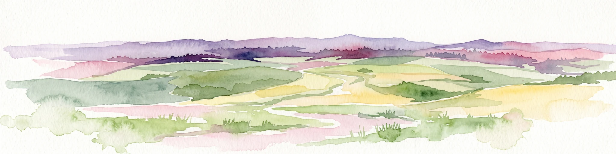
A horizontal watercolor painting showing rolling green and yellow hills with distant purple-toned forests against a white background.
Nature reserveThuringia
About 7.5 km away#2 closest

South

Keulaer Wald Nature Reserve: Geographic Overview of the Dün Plateau Forest in Thuringia

Mapped beech-dominated plenterwald and limestone escarpment terrain

Located in northern Thuringia, Keulaer Wald is a designated nature reserve characterized by its continuous beech canopy on shell limestone bedrock. This site serves as a vital protected area within the regional forest belt, offering high-elevation viewpoints over the surrounding Eichsfeld Basin and the distant Harz mountain range.

Area
2.97 km²
Established
1961
Relief
Mountain
Climate
Temperate
Nature reserveThuringia
About 9.4 km away#3 closest

East

Wöbelsburg Nature Reserve: Protected Plateau Landscapes and Geography in Thuringia, Germany

Mapped shell limestone escarpment and Iron Age hillfort site.

Wöbelsburg offers a focused look at the rugged Muschelkalk terrain characteristic of the northwestern Hainleite. As a protected nature reserve, the site features a prominent mountain spur that drops steeply toward the Wipper lowland, providing a clear example of geological undercutting and plateau formation in central Germany.

Area
0.659 km²
Established
1961
Relief
Upland
Water
Minor water
A minimalist watercolor painting showing layers of rolling hills in soft green, purple, and pale yellow tones against a white background.
Nature reserveThuringia
About 10 km away#4 closest

West

Bodenstein Nature Reserve: Geographic Atlas and Protected Area Context in Thuringia

Limestone escarpments and ravine landscapes of the Eichsfeld

Bodenstein is a protected nature reserve featuring a distinctive limestone escarpment along the Ohmgebirgsplateau. The terrain encompasses a series of hilltops and ravines shaped by geological shifts, serving as a key reference site for the forest ecosystems and spring-fed hydrological networks found across the Thuringia region.

Area
1.335 km²
Established
1961
IUCN
IV
Relief
Upland
Nature reserveThuringia
About 12 km away#5 closest

North

Sülzensee, Mackenröder Wald: A Detailed Look at Thuringia's Protected Nature Reserve

Exploring the beech forest landscapes and stream-carved terrain of northern Thuringia.

Sülzensee, Mackenröder Wald is a protected nature reserve in northern Thuringia known for its expansive beech forests and diverse geological foundation. Spanning over 280 hectares, the area features undulating ridges, deep-cut stream valleys, and a unique position atop the Elbe-Weser watershed. This geography-focused overview details the reserve's status as a corridor for wildlife and its significant role in regional habitat conservation.

Area
2.802 km²
Established
2000
IUCN
IV
A horizontal watercolor painting depicting a soft, rolling landscape with green meadows, patches of forest, and distant hills under a light sky.
Nature reserveLandkreis Eichsfeld
About 14 km away#6 closest

Northwest

Grenzstreifen zwischen Teistungen und Ecklingerode Protected Nature Reserve Mapping

Conservation corridor within the Landkreis Eichsfeld regional geography.

Located in the Eichsfeld district of Thuringia, the Grenzstreifen zwischen Teistungen und Ecklingerode nature reserve functions as a vital segment of the trans-European Green Belt. This protected area showcases an elongated, structural diversity of beech forest ecosystems and meadowlands shaped by natural succession. Review the mapped boundaries and topographical characteristics of this significant corridor that bridges modern forestry and historical conservation.

Area
1.477 km²
Established
2000
IUCN
IV
Relief
Upland
A soft watercolor painting of a meadow landscape, featuring a dirt path winding through wildflowers toward green trees with rolling hills in the background.
Nature reserveThuringia
About 18 km away#7 closest

Southwest

Kühmstedter Berg Nature Reserve: A Protected Landscape and Archaeological Site in Thuringia

Examining forest ecology and medieval earthworks on a central German ridge

Kühmstedter Berg stands as a protected nature reserve in Thuringia, characterized by its Muschelkalk geology and established beech-rich oak and hornbeam woodland. This site maps a critical intersection of natural forest habitat and historical land use, featuring visible remnants of a Bronze Age tumulus cemetery and the defensive lines of the medieval Mühlhäuser Landgraben.

Area
0.387 km²
Established
1961
Relief
Upland
Scope
Terrestrial
Watercolor painting of a green, rolling valley with muted pastel tones.
Nature reserveThuringia
About 19 km away#8 closest

South

Flachstal Nature Reserve: Geographic Profile and Protected Valley Landscapes in Thuringia

Ecologically rich calcareous dry valley and protected habitat mosaic

Flachstal represents a significant nature reserve within Thuringia, defined by its steep flanks of Muschelkalk limestone and centuries of traditional sheep grazing. This dry valley functions as both a hotspot for grassland species and a vital climate corridor for the surrounding plateau. The site offers an opportunity to study the intersection of geological history, fossil-rich streambeds, and modern conservation management within the Natura 2000 network.

Area
1.876 km²
Established
1999
IUCN
IV
Relief
Upland

Common questions about visiting, size, designation, and location context for Bleicheröder Berge

Bleicheröder Berge FAQs for park facts, access, geography, and protected area context

Find quick answers about Bleicheröder Berge, including protected-area facts, park geography, trail and visitor context, and how the park fits into its surrounding country and regional landscape.
MoriAtlas Explorer

Continue Your Protected Areas Search Across the Global Atlas

Deepen your exploration by continuing the structured search for national parks and protected areas worldwide. Utilize the comprehensive filtering capabilities to compare different conservation landscapes and refine your understanding of global park geography. Discover more about the distribution and characteristics of protected natural areas.

Global natural geography