
Why Bliesaue between Blieskastel and Bliesdalheim stands out
The reserve is best known for its extensive, naturally flooding floodplain along the Blies, set into a geological frame of Buntsandstein and Muschelkalk. It represents one of the most important connected riverine wetland complexes in this section of the Saarland. Its importance lies in the combination of habitat diversity and species richness: reed beds and tall sedge stands, wet and moist meadows, and floodplain forest create a mosaic that supports rare species such as Bechstein's bat, the Eurasian beaver, the great crested newt, the yellow-bellied toad, and several protected dragonflies and butterflies. The floodplain also serves as a key refuge for breeding, resting, and migratory birds including black and red kites, marsh harrier, kingfisher, grey-headed woodpecker, and red-backed shrike.
Bliesaue between Blieskastel and Bliesdalheim history and protected-area timeline
The Bliesaue between Blieskastel and Bliesdalheim has a history of protection stretching back to 1993, when a nature reserve covering the same stretch of the Blies valley was first established, then totaling around 213 hectares. That initial designation reflected recognition of the valley as a high-value floodplain ecosystem amid the broader agricultural and settlement landscape of the Saarland.
In the following two decades, management needs and legal frameworks evolved, prompting a reissue of protection. On 2 November 2015, the modern reserve was established under the ordinance identifier NSG-N-6709-302, covering approximately 198 hectares of the Blies floodplain between the town of Blieskastel and the village of Bliesdalheim in Gersheim. The 2015 designation updated the boundary and area of the original reserve and reaffirmed the ecological importance of the river corridor under current nature conservation law.
The reserve is part of a wider network of protected areas in the Saarpfalz district, and it sits within the Bliesgau region, an area recognized for its mosaic of traditional land use and remaining natural habitat. Its history illustrates a continuity of conservation intent for the Blies floodplain rather than a sudden new initiative.
Bliesaue between Blieskastel and Bliesdalheim landscape and geographic character
The landscape of the Bliesaue is defined by the broad valley of the Blies, which has carved its way into a substrate of Buntsandstein (Lower Triassic sandstone) and Muschelkalk (Middle Triassic limestone). This geological setting creates a valley floor with both soft sandstone sections and more resistant limestone influences, producing varied soil conditions along the river corridor.
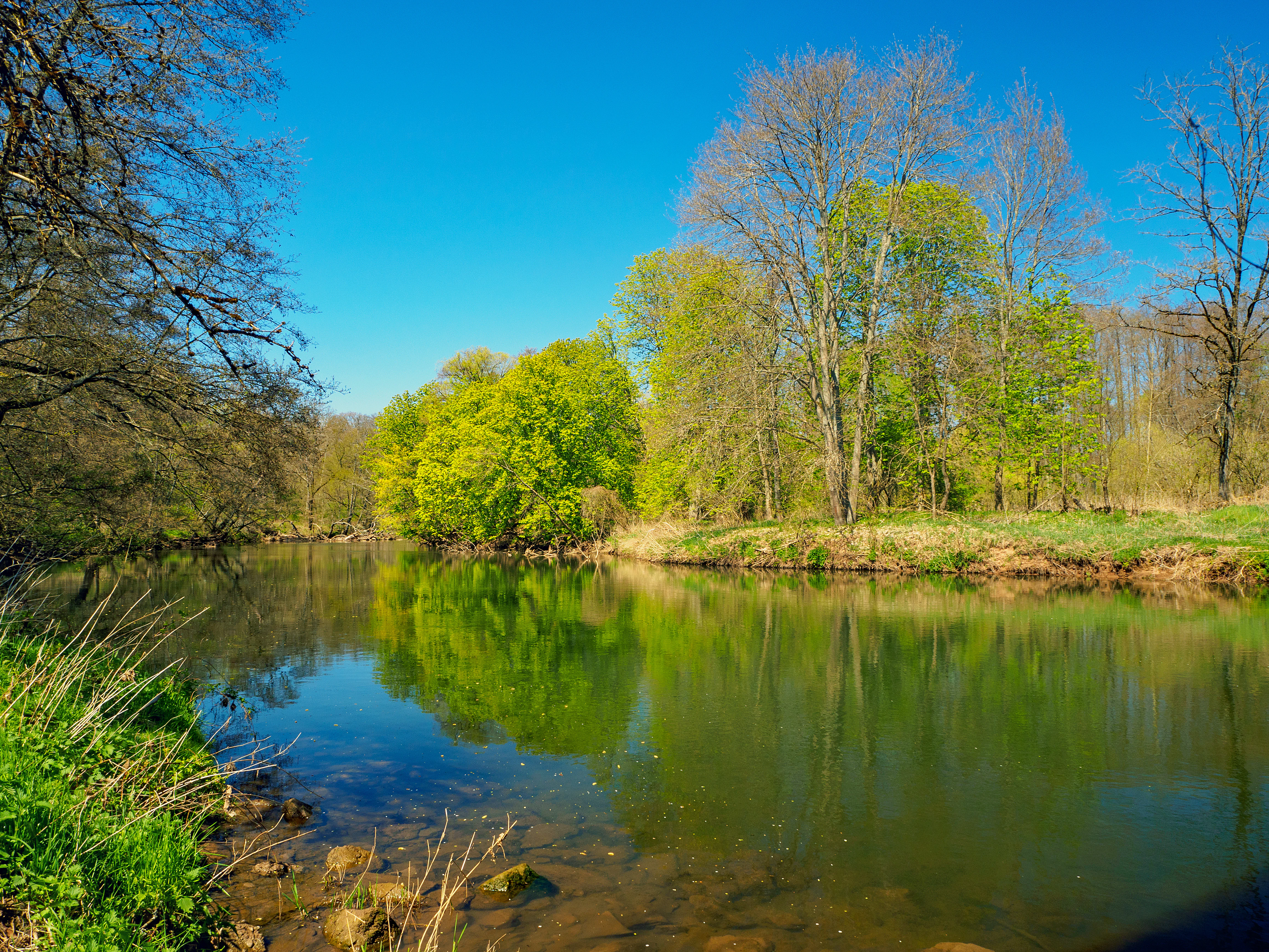
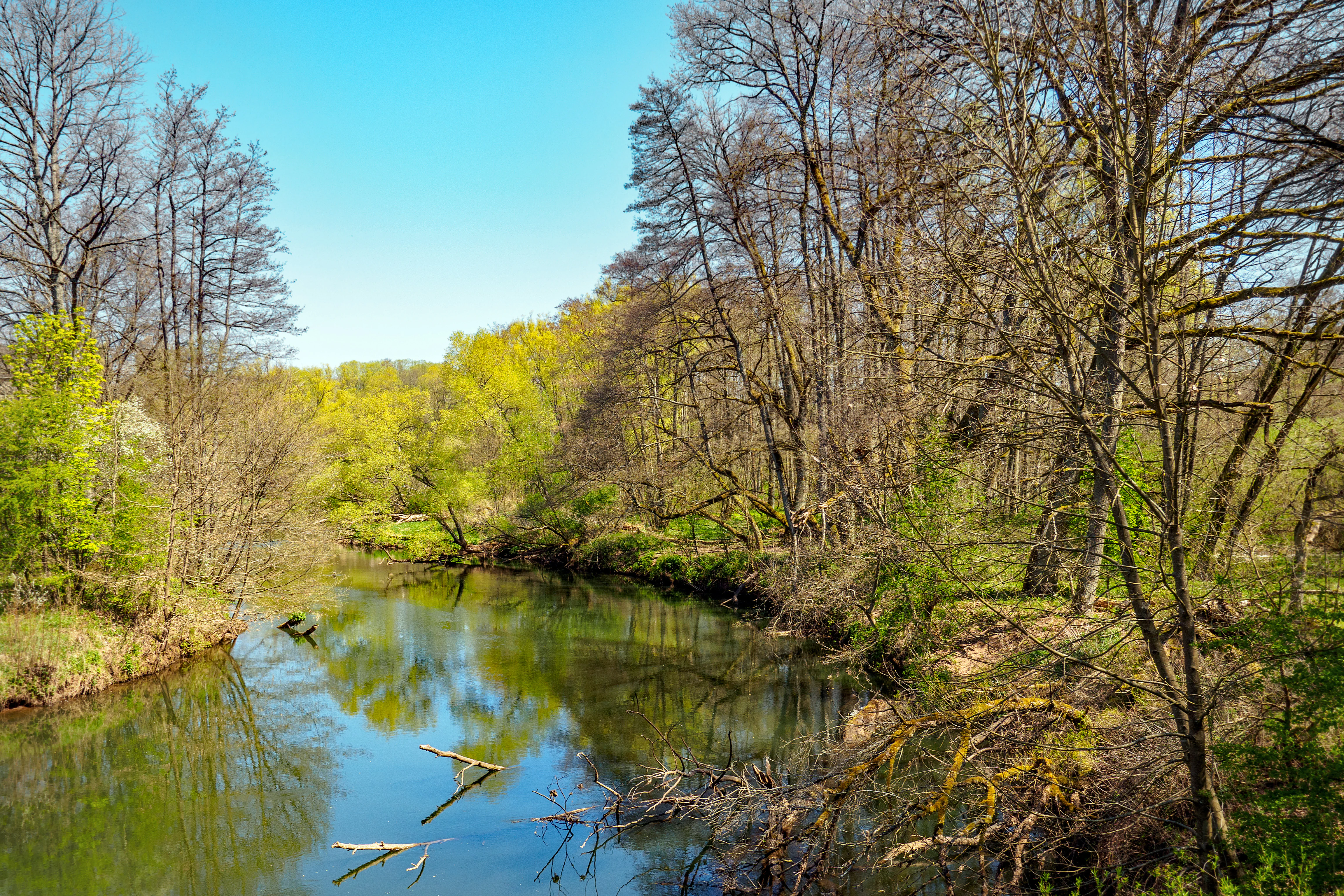
The dominant feature is the active floodplain itself. The Blies winds through the reserve, flanked by reed belts, tall sedge stands, and stretches of wet meadow that are regularly shaped by seasonal flooding. Between Blickweiler and Breitfurt, the river runs in a particularly natural-looking, meandering course, with the steep transition between the river and the surrounding land softened by successive vegetation zones.
Along the edges of the floodplain, the terrain rises gently into the surrounding Bliesgau landscape, a region marked by rolling terrain, agricultural fields, and scattered villages. The valley's overall topography is flat to gently undulating where the river actively shapes the land, with the contrast between valley floor and adjacent uplands giving the reserve a clearly defined ecological boundary.
Bliesaue between Blieskastel and Bliesdalheim ecosystems, habitats, and plant life
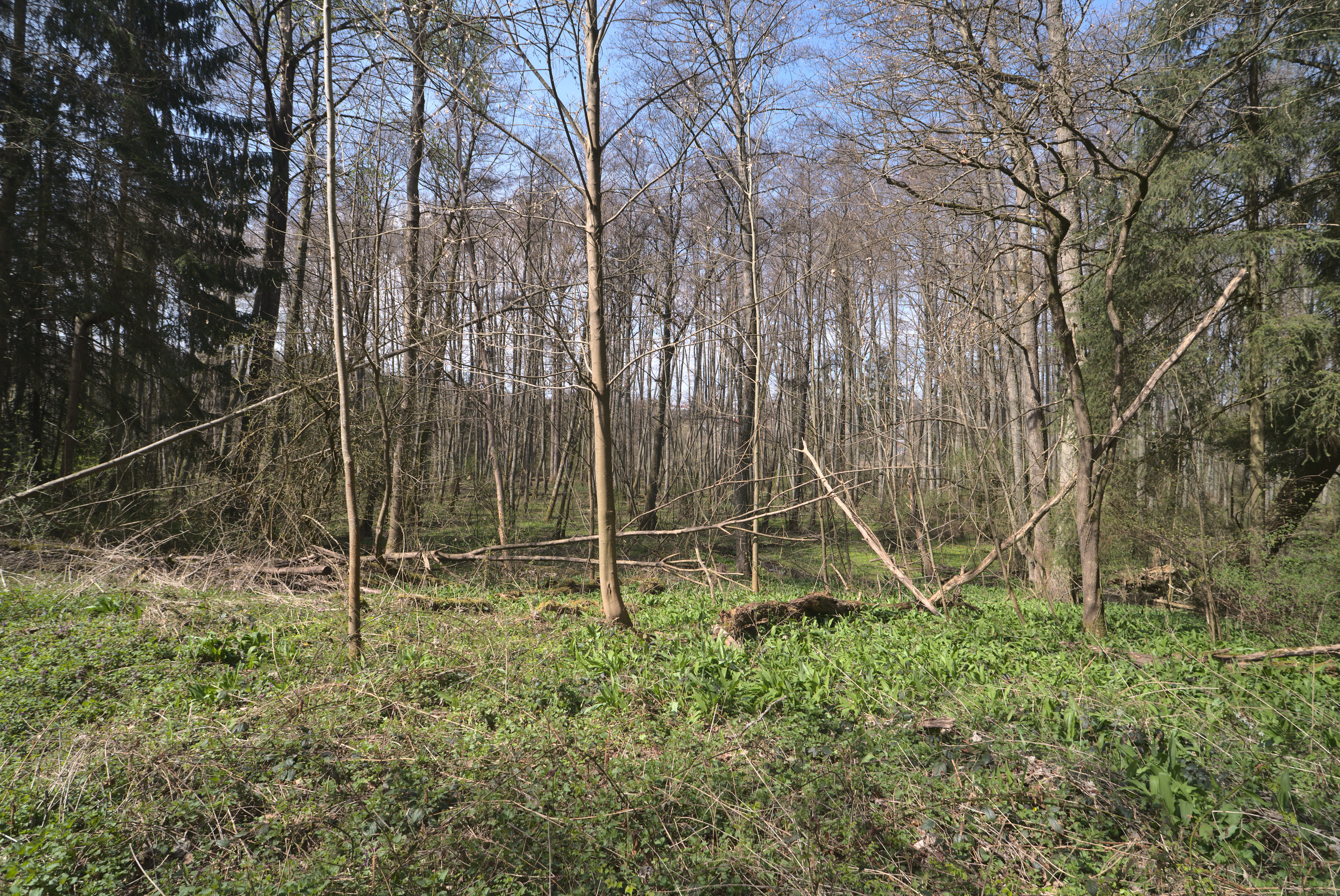
Ecologically, the reserve is a textbook example of a near-natural Central European floodplain. The recurring flood pulses of the Blies maintain a characteristic habitat mosaic: open water and fringing reed beds give way to tall sedge communities (Großseggenrieder), then to mesotrophic wet meadows, wet fallow land, and finally to softwood floodplain forest.
The combination of permanent and temporary standing water, slow-flowing sections, and emergent vegetation supports both aquatic and terrestrial ecological communities. Wet meadows and floodplain forest are particularly important for invertebrates, amphibians, and breeding birds, while the open reed and sedge areas provide shelter and foraging habitat for a wide range of wetland species.
The geological substrate adds further ecological nuance. Sandstone and limestone-derived soils influence local water chemistry, soil moisture, and plant communities along the valley. This subtle geological diversity, layered with the flooding dynamics, gives the reserve an unusually rich ecological structure for an area of its size.
Bliesaue between Blieskastel and Bliesdalheim wildlife and species highlights
The reserve's mosaic of habitats supports a notable community of protected and rare species. Among mammals, Bechstein's bat and the Eurasian beaver are among the most significant conservation targets, the beaver especially tied to the slow-flowing stretches of the Blies and its banks.
Amphibians are well represented, with the great crested newt and the yellow-bellied toad using the wet meadows, ponds, and flooded sections of the floodplain. The Groppe (a small bottom-dwelling freshwater fish) is recorded in the river itself, signaling good water quality and intact streambed structure.
Insect life is particularly diverse in the wet meadows and reed edges, where species such as the Large Copper butterfly (Großer Feuerfalter) and the Dark Meadow-Blue butterfly (Dunkler Wiesenknopf-Ameisenbläuling) are of conservation interest, along with the Green Hooktail dragonfly (Grüne Keiljungfer) along slow-moving water.
The floodplain is also a key site for birds. Breeding, resting, and migratory species documented as targets of protection include the black kite, red kite, marsh harrier, common kingfisher, grey-headed woodpecker, and red-backed shrike. The reed beds, wet meadows, and floodplain forest together provide nesting, feeding, and stopover habitat across the seasons.
Bliesaue between Blieskastel and Bliesdalheim conservation status and protection priorities
The reserve carries clear conservation significance as one of the most intact floodplain stretches of the Blies, a tributary of the Saar, in the Saarland. Its designation under the identifier NSG-N-6709-302 formalizes the protection of a habitat complex that has become increasingly rare in densely settled and agriculturally used regions of western Germany.
From a conservation standpoint, the reserve is valuable for several overlapping reasons. It safeguards a functioning riverine system still shaped by natural flooding, preserving the dynamic processes that maintain reed beds, sedge communities, and floodplain forest. It supports populations of protected species listed under European and German nature conservation frameworks, including bat, amphibian, fish, dragonfly, and butterfly species, as well as a suite of raptors and other birds. It also acts as a refuge and stepping stone within the wider Saar-Palatinate landscape, connecting to a broader network of protected areas in the Saarpfalz district.
The successor designation in 2015, replacing an earlier 1993 protection, underscores an ongoing commitment to maintaining the natural character of the Blies floodplain against the pressures of agricultural use, infrastructure development, and broader land-use change in southwestern Germany.
Bliesaue between Blieskastel and Bliesdalheim cultural meaning and human context
The reserve lies within the Bliesgau, a region of the Saarland distinguished by gently undulating terrain, a patchwork of fields, meadows, orchards, and traditional villages. This cultural landscape has long been shaped by small-scale farming and a relatively low-density settlement pattern, which has helped preserve substantial areas of semi-natural habitat around its river valleys.
Villages such as Blieskastel, Mimbach, Blickweiler, Breitfurt, and Bliesdalheim form the immediate human context of the reserve. Their long-standing relationship with the Blies, as a source of water, meadowland, and historically flood-prone agricultural ground, is part of the broader cultural identity of the Bliesgau. The reserve represents the remaining natural thread of a landscape that has otherwise been largely converted to human use.
Top sights and standout views in Bliesaue between Blieskastel and Bliesdalheim
The Bliesaue between Blieskastel and Bliesdalheim stands out for the combination of a near-natural river course with an exceptionally complete floodplain habitat mosaic in a relatively small area. Its reed beds, sedge marshes, wet meadows, and floodplain forest form a coherent ecological unit along about 198 hectares of the Blies valley.
Particularly distinctive is the species combination it supports in such close proximity: Bechstein's bat and beaver alongside amphibians such as the great crested newt and yellow-bellied toad; river-associated fish like the Groppe; rare butterflies and dragonflies; and breeding, resting, and migratory birds including black and red kites, marsh harrier, kingfisher, grey-headed woodpecker, and red-backed shrike. The underlying Buntsandstein and Muschelkalk geology adds further ecological character to the floodplain.
Best time to visit Bliesaue between Blieskastel and Bliesdalheim
The reserve is a nature protection area, not a tourism-focused park, and visitation is generally oriented around walking and quiet observation along the river. In ecological terms, the most dynamic period is spring and early summer, when water levels are typically higher, amphibian activity peaks, and breeding birds are most present in the reed beds, wet meadows, and floodplain forest.
Late spring through summer also tends to be the most rewarding time for observing butterflies and dragonflies along the wet meadows and water margins, while autumn brings quieter conditions, lower water levels, and the chance to see migratory bird species using the river corridor. Winter visits can offer a stark, open view of the meandering Blies and its floodplain structure, though conditions underfoot in wet areas can be challenging.