Mori Atlas logo
Nature reserveBosque Protector La Prosperina

Mapping the ecological boundaries and terrain of this significant equatorial forest reserve

Bosque Protector La Prosperina: A Protected Tropical Dry Forest Landscape in Guayas, Ecuador

Bosque Protector La Prosperina serves as a vital fragment of equatorial dry forest within the coastal lowlands of Guayas, Ecuador. This nature reserve, characterized by seasonal quebradas and drought-adapted flora like the ceibo, provides a crucial reference point for understanding the region's remaining biodiversity. The protected area functions as a living laboratory, showcasing complex interactions between urban-adjacent terrain and native tropical ecosystems.

tropical dry forestequatorial dry foresturban forest reserveprotected forestbirdwatchinguniversity reserve

Bosque Protector La Prosperina

Nature reserve

Park overview

Structured park overview, official facts, and landscape profile for Bosque Protector La Prosperina

Bosque Protector La Prosperina park facts, protected area profile, and essential visitor context

Review the core facts for Bosque Protector La Prosperina, including designation, size, terrain, visitor scale, habitats, and operating context in one park-focused overview.

About Bosque Protector La Prosperina

Bosque Protector La Prosperina is a protected tropical dry forest reserve within Ecuador's coastal lowlands, situated in the Guayas province near the western edge of Guayaquil. The reserve sits on the campus grounds of the Escuela Superior Politécnica del Litoral (ESPOL), one of Ecuador's leading technical universities, and operates simultaneously as a conservation area, a research station, and an environmental education space.

The reserve belongs to the equatorial dry forest ecosystem, a once-widespread biome that has been heavily reduced by agricultural expansion, urban growth, and recurrent fires. Although it occupies only a few hundred hectares, La Prosperina has become ecologically significant precisely because it preserves a remnant of that habitat within an otherwise urbanized and fragmented landscape. The forest is bordered by residential developments, quarries, and roads, giving it a strong role as an ecological island in the Guayaquil metropolitan area.

Climate at La Prosperina is bi-seasonal, shaped by a tropical savanna pattern influenced by the Chongón-Colonche mountain range. Roughly half the year experiences pronounced water deficit, a condition that has shaped the local vegetation toward drought-adapted dry-forest species. Despite the harsh hydrological cycle, the reserve supports a diverse flora and fauna, including large trees such as the ceibo (Ceiba trischistandra), seasonally flowering shrubs like Cochlospermum vitifolium, and a wide range of birds, mammals, reptiles, and insects.

The reserve is also notable for its institutional character. Since its creation in 1994, ESPOL has treated La Prosperina as a long-term teaching and research platform, embedding faculty projects, student-led monitoring programs, and community outreach into the management of the forest. This makes the site not only an ecological refuge but also a working example of how a university can integrate conservation responsibility into its broader academic mission.

Quick facts and research context for Bosque Protector La Prosperina

Bosque Protector La Prosperina is a tropical dry forest reserve situated in the Guayas province of Ecuador, near the western edge of Guayaquil, within the campus of the Escuela Superior Politécnica del Litoral (ESPOL). It belongs to Ecuador's national category of 'Bosque Protector' (Protective Forest) and sits within the equatorial dry forest biome, an ecosystem now reduced to scattered fragments across the coastal lowlands.

The reserve spans roughly 570 hectares and was formally established on 29 June 1994 under the Ecuadorian protected-area system. Its microclimate is influenced by the nearby Chongón-Colonche mountain range, and it is classified as Köppen 'Aw' (tropical savanna). The reserve borders five main quebradas draining northwards and supports populations of dry-forest flora and fauna typical of Ecuador's threatened coastal ecosystems.

Protection and recognition

Examine documented terrestrial protection scope and official designation records.

Bosque Protector La Prosperina Protection Status and Recognition Data

Bosque Protector La Prosperina holds a documented terrestrial protection status within official conservation datasets. Structured facts detail the registered management scope and international recognition records associated with the protected area.

Protection details

Protection scope
Terrestrial
Transboundary protection
No
Park context

Deeper park guide and search-rich context for Bosque Protector La Prosperina

Bosque Protector La Prosperina history, landscape, wildlife, and travel context

Explore Bosque Protector La Prosperina through its history, landscape character, ecosystems, wildlife, conservation priorities, cultural context, and seasonal travel timing in a structured park guide built for atlas discovery and search intent.

Why Bosque Protector La Prosperina stands out

La Prosperina is best known for being one of the most important surviving fragments of tropical dry forest within the urban periphery of Guayaquil, Ecuador's largest coastal city. Its identity is shaped by the resilient dry-forest vegetation adapted to a long annual dry season, particularly species such as the ceibo (Ceiba trischistandra) and Cochlospermum vitifolium. The reserve is also recognized for its unusually high biodiversity inventory within a small and heavily pressured landscape. Over the years, ESPOL researchers, students, and citizen-science contributors have documented hundreds of plant and animal species, making the site an important reference point for understanding what remains of Ecuador's equatorial dry forest.
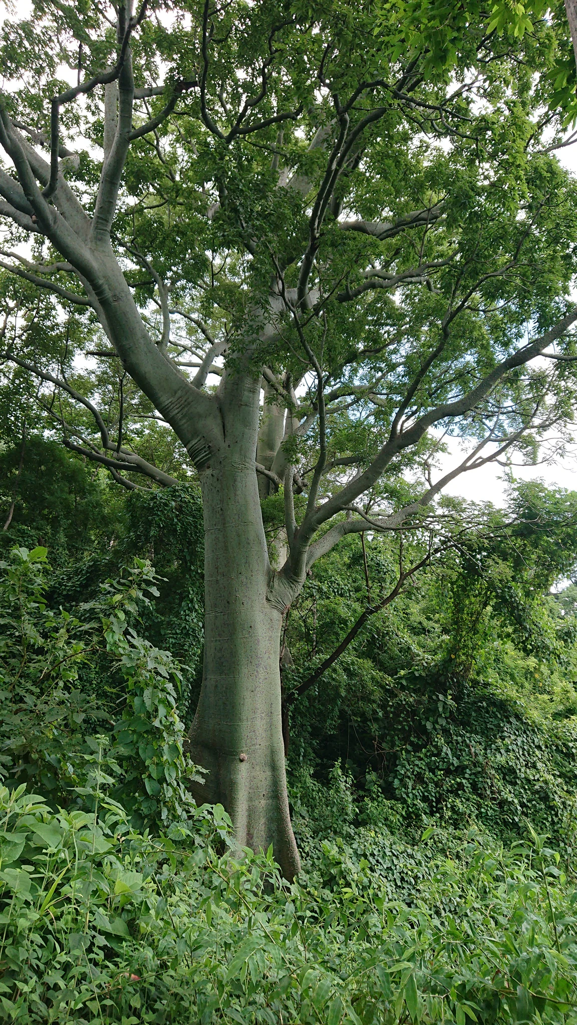
A large, mature Ceiba trischistandra tree with a thick, smooth, greenish-grey trunk rising above dense surrounding forest vegetation.
A Ceiba trischistandra tree in the tropical dry forest of Bosque Protector La Prosperina.

Bosque Protector La Prosperina history and protected-area timeline

La Prosperina was established on 29 June 1994 by ministerial agreement, published under official register number 472, as part of Ecuador's network of 'Bosque Protector' reserves. Its creation formalized the protection of a tropical dry forest fragment within the campus of ESPOL's Gustavo Galindo site, near Guayaquil in the Guayas province.

In 1998, a formal management plan was produced, and it provided the first systematic inventory of the forest's resources, documenting 165 species of flora. Subsequent updates have substantially expanded that figure, with more recent assessments reaching 272 documented plant species. The reserve has also been the focus of sustained ornithological monitoring since 2010, coordinated with ESPOL students, gradually building one of the most detailed bird inventories associated with an urban dry forest in Ecuador.

Since 2017, the institutional program 'Bosque Protector La Prosperina' (BPP) has consolidated the reserve's role as a teaching, research, and community engagement hub. Earlier, between 2013 and 2016, the Faculty of Communication (FADCOM) integrated circular economy concepts into its design courses, an initiative that helped reactivate the reserve's nurseries, compost areas, recycling spaces, interpretation center, and mirador trail with support from private sponsors. The reserve has gained recognition as an educational reference for dry forest conservation within the city's marginal urban context.

Bosque Protector La Prosperina landscape and geographic character

La Prosperina sits on the coastal lowlands of western Ecuador, just west of Guayaquil, in a fragmented landscape where remaining patches of native vegetation are surrounded by urban development, quarries, and road infrastructure. The terrain is gently undulating rather than mountainous, but the local microclimate is strongly influenced by the nearby Chongón-Colonche mountain range, which shapes rainfall and seasonal humidity patterns across the reserve.

Five principal quebradas (seasonal streams or ravines) cross the area, oriented roughly south to north and lying above the 100 meter elevation contour. These drainage lines define much of the reserve's topographic structure and shape how water moves through the landscape during the wet season, while drying out significantly during the long dry half of the year.

The soils are generally fine-textured, with low to moderate organic content and a degree of expansiveness linked to weathering of local minerals. Although the substrate is porous and permeable, its weathering profile leaves it susceptible to expansion processes. The combination of seasonal aridity, variable soils, and a dissected ravine network gives the forest a distinctive mosaic of microhabitats despite its relatively small footprint.

Bosque Protector La Prosperina ecosystems, habitats, and plant life

The defining ecological character of La Prosperina is its position within the equatorial dry forest biome, a globally threatened ecosystem that has been extensively reduced across Ecuador's coastal region. The vegetation is adapted to a strongly bi-seasonal climate in which around half the year is marked by water deficit, and plant communities reflect strategies for surviving prolonged drought.

Dominant and characteristic species of the reserve include the ceibo (Ceiba trischistandra), a large emergent tree of regional conservation importance, and Cochlospermum vitifolium, locally known as bototillo, a deciduous shrub that becomes conspicuous during the dry season. The plant community comprises a notable diversity for such a small area, with the 1998 management plan listing 165 species of flora and more recent assessments increasing that total to 272.

Because of its fragmented setting, surrounded by urbanization and infrastructure, the reserve's ecological value is amplified by what it retains rather than by its size. It functions as a refuge for native dry-forest flora and as a source area for fauna across the immediate urban matrix, including birds, mammals, reptiles, amphibians, and insects that depend on continuous native vegetation cover.

Bosque Protector La Prosperina wildlife and species highlights

Wildlife documentation at La Prosperina has been a long-running focus of ESPOL's research and teaching activities, particularly regarding birds. Since 2010, periodic ornithological monitoring along the reserve's trails has progressively built an extensive checklist. The first formal inventory recorded 54 bird species, while more recent monitoring combined with citizen-science platforms has documented approximately 230 bird species across 39 families, making the reserve an unusually rich urban bird site.

The reserve also supports mammals, reptiles, amphibians, and freshwater fauna. Recent inventories cite around 35 mammal species, 11 reptile species, 11 amphibian species, and 3 fish species, alongside invertebrate groups such as crustaceans, mollusks, and insects. Lepidoptera (butterflies and moths) have been especially well surveyed, with roughly 125 species recorded, and the Tabanidae family of flies is represented by around 10 documented species.

Several pressures shape wildlife dynamics within the reserve, including its proximity to roads, residential neighborhoods, and quarries, as well as the recurrent wildfires that affect the area during the dry season. These threats heighten the importance of the reserve as a refuge for species that otherwise face shrinking habitat in the surrounding dry-forest landscape.

Bosque Protector La Prosperina conservation status and protection priorities

La Prosperina is ecologically important primarily as one of the few surviving remnants of Ecuador's equatorial dry forest within the immediate influence zone of Guayaquil, Ecuador's largest coastal city. In a region where dry forest has been heavily converted to agriculture and urban land, the reserve preserves native vegetation, soil structure, and watershed function in drainage lines that feed into the broader lowland system.

The reserve faces ongoing pressures typical of dry forests embedded in urban peripheries. Recurrent wildfires, many of them anthropogenic, are a recurring threat during the dry season, while surrounding urbanizations, quarries, and roads increase ecological vulnerability and reduce habitat connectivity. These pressures give the protected area particular conservation significance, because it must perform refuge, buffer, and educational functions simultaneously.

Beyond its formal protected status as a Bosque Protector, La Prosperina benefits from an unusual conservation model in which the administering university, ESPOL, integrates biodiversity monitoring, habitat restoration, environmental education, and community engagement into reserve management. The reserve's institutional program, supported by student projects and partnerships with private sponsors, has strengthened nurseries, composting, recycling, and trail infrastructure, reinforcing its role as a model for dry forest conservation in marginal urban settings.

Bosque Protector La Prosperina cultural meaning and human context

Although the reserve itself is primarily an ecological and educational site, it carries meaningful cultural relevance as a recognized reference point for dry forest awareness within the Guayaquil region. Schools and communities in surrounding 'zonas' have engaged with the site through ESPOL's outreach programs, and the reserve is increasingly framed as a shared environmental heritage of the metropolitan coastal area.

The reserve also reflects a broader Ecuadorian cultural narrative that connects university life with environmental responsibility. Faculty and student projects at La Prosperina have linked disciplines such as design, communication, biology, and engineering to the practical care of a natural area, reinforcing an identity in which conservation is presented as part of civic and educational identity rather than as a separate technical exercise.

Top sights and standout views in Bosque Protector La Prosperina

One of the most distinctive features of La Prosperina is its unusual combination of high biodiversity documentation and small protected footprint, with hundreds of plant and bird species recorded within a few hundred hectares of urban-adjacent dry forest.

Another defining highlight is its identity as a university-administered reserve, where ESPOL integrates teaching, research, and community outreach into day-to-day conservation work. The presence of five main quebradas, the Chongón-Colonche-influenced microclimate, and the dominance of drought-adapted species such as the ceibo make the site a particularly illustrative example of Ecuador's threatened equatorial dry forest.

Best time to visit Bosque Protector La Prosperina

La Prosperina is shaped by a strongly bi-seasonal tropical climate, with a wet season and a dry season each lasting roughly six months. The dry season dominates much of the year and is the most sensitive period, as the forest is more exposed to wildfires, vegetation stress, and reduced visibility for wildlife observation, though deciduous species such as the ceibo and Cochlospermum vitifolium become especially conspicuous.

The wet season tends to bring greener vegetation, more active animal presence, and more favorable conditions for hiking and observing birds and insects under canopy cover. Visitors interested in birdwatching may find the wet period productive due to higher bird activity, while those interested in dry-forest landscapes and the characteristic phenology of deciduous species may prefer to experience the site under drier conditions. Given the reserve's location within an urban and ecologically pressured setting, planning visits to coincide with cooler parts of the day is generally advisable.

Monthly climate preview

Measured long-term temperature ranges and monthly precipitation data for Guayas

Bosque Protector La Prosperina Climate Normals and Annual Weather Patterns

Representative coordinate sampling reveals consistent monthly temperature averages alongside distinct precipitation shifts across the year at Bosque Protector La Prosperina. Reviewing the complete twelve-month climate profile provides deeper analytical context on long-term thermal and moisture conditions.
Annual mean27 °C
26 °C28 °C
Jan27°
Feb27°
Mar26°
Apr27°
May27°
Jun27°
Jul27°
Aug27°
Sep27°
Oct27°
Nov27°
Dec28°
Warmest month
December

27.6 °C

Coolest month
March

26.3 °C

Wettest month
February

8.4 mm/day

Driest month
August

0.1 mm/day

Park location guide

Geography guide, regional context, and park location map for Bosque Protector La Prosperina

Bosque Protector La Prosperina park geography, regions, and map view in Ecuador

Understand where Bosque Protector La Prosperina sits in Ecuador through a broader geographic reading of the surrounding landscape, nearby location context, and its mapped position within the national park landscape.

How Bosque Protector La Prosperina fits into Ecuador

Ecuador is a presidential republic located in northwestern South America, with Quito as its capital and Guayaquil as its largest city. The country spans 283,561 km² and encompasses the Galápagos Islands, a volcanic archipelago famous for unique wildlife that helped shape Darwin's theory of evolution. Ecuador is a plurinational state with Spanish as the official language, though Kichwa and Shuar are recognized for indigenous peoples.

Wider geography shaping Bosque Protector La Prosperina in Ecuador

Ecuador is located in northwestern South America along the Pacific coast. It shares borders with Colombia to the north and Peru to the east and south. The country includes the Galápagos Islands, a volcanic archipelago in the Pacific Ocean approximately 1,000 km west of the mainland. The territory encompasses diverse terrain including the Amazon rainforest in the east, the Andean highlands in the center, and coastal plains along the Pacific.

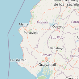
Map view of Bosque Protector La Prosperina

Use this park location map to pinpoint Bosque Protector La Prosperina in Ecuador, understand its exact geographic position, and read its mapped placement within the surrounding landscape more clearly.

Pigeon | © OpenStreetMap contributors

Location context for Bosque Protector La Prosperina

Guayas

Visual exploration of seasonal ravine terrain, native flora, and urban-adjacent protected habitats.

Bosque Protector La Prosperina Photos: Tropical Dry Forest Scenery and Landscape Views

Photographic records reveal the distinct character of surviving tropical dry forest vegetation across undulating coastal lowlands and seasonal ravines. Visual reference materials help observers interpret the ecological resilience of native canopy species and fragmented habitats.

A large, mature Ceiba trischistandra tree with a thick, smooth, greenish-grey trunk rising above dense surrounding forest vegetation.

A view overlooking a dry, sparsely vegetated valley from a hillside, framed by two large, leafless trees in the foreground.

Park atlas

Compare adjacent tropical dry forests and protected landscapes across western Ecuador

Explore Parks Near Bosque Protector La Prosperina and Regional Protected Areas

Continue browsing other parks and protected areas near Bosque Protector La Prosperina to examine related equatorial dry forest ecosystems. Evaluating these surrounding reserves provides a clearer picture of coastal lowland conservation and regional geography.
A horizontal watercolor painting showing a stylized forest landscape with soft pastel green, yellow, and pink hues representing trees and rolling hills.
Protected areaGuayas
About 6.4 km away#1 closest

Southwest

Bosque Protector Cerro Blanco: Protected Area and Tropical Dry Forest Geography in Guayas

Mapped terrain of the Chongon-Colonche mountain range

Bosque Protector Cerro Blanco functions as a major conservation site in coastal Ecuador, protecting rare Tumbesian forest ecosystems within the Guayas province. The reserve features diverse topography of ridges and valleys, serving as a critical buffer for regional endemic species and offering a unique look at seasonally dry forest landscapes near Guayaquil.

Area
60.78 km²
Established
1992
Visitors
12K annual
Relief
Upland
Wildlife reserveGuayas
About 12 km away#2 closest

South

Reserva de producción de fauna Manglares El Salado: Coastal Geography and Protected Lands

A mangrove-dominated wildlife reserve in Guayas, Ecuador.

Analyze the protected landscape of Reserva de producción de fauna Manglares El Salado, which spans extensive mangrove forests and estuarine waters within the Guayas province. This wildlife reserve showcases a unique transition between intertidal mangrove zones, salt flats, and remnants of tropical dry forest, providing essential habitat context for the Gulf of Guayaquil coastal region.

Area
53.09 km²
Established
2002
IUCN
VI
Relief
Lowland
A pale, soft watercolor painting showing a stylized, rolling landscape with light green, pink, and yellow hues representing hills and trees.
Nature reserveGuayas Province
About 27 km away#3 closest

Southeast

Reserva ecológica Manglares Churute: Mapping a Coastal Nature Reserve in Guayas Province

An ecological mosaic of mangrove forests, estuaries, and forested ridges.

Spanning from the inner Gulf of Guayaquil into the Churute hill range, Reserva ecológica Manglares Churute acts as an essential protected area within Ecuador. The region contains one of the country's most significant mangrove complexes, complemented by freshwater lagoons and unique fog-affected forest summits that support diverse wildlife populations and endemic vegetation.

Area
471.74 km²
Established
1979
IUCN
Ia
Relief
Mixed relief
Wildlife reserveGuayas
About 53 km away#4 closest

Southwest

Refugio de Vida Silvestre Manglares El Morro: Protected Coastal Landscape and Map

A strategic marine and mangrove ecosystem in the Guayas Province

The landscape of Refugio de Vida Silvestre Manglares El Morro consists of continuous mangrove forests and rocky farallones, linked by a complex network of tidal channels. This wildlife refuge serves as an essential marine habitat at the threshold of the Gulf of Guayaquil, showcasing the interplay between tidal aquatic systems and coastal vegetation across the southwestern Ecuadorian region.

Area
101.3 km²
Established
2007
IUCN
Ib
Visitors
23K annual
Wildlife reserveLos Rios
About 88 km away#5 closest

Northeast

Refugio de Vida Silvestre Samama Mumbes: Foothill Forest and Protected Area Map

Mapping the western Andean slopes and Chocó forest fragments

Refugio de Vida Silvestre Samama Mumbes protects one of the final remnants of the Chocó Ecuatorial forest in the Ecuadorian Andes. This reserve encompasses steep, dissected ridges and vital river catchments, supporting endemic orchids, birds, and amphibians within a highly modified regional landscape. Gain deeper insight into its forest boundaries and watershed contribution.

Area
21.456 km²
Established
2016
IUCN
IV
Relief
Mountain
National parkManabí Province
About 93 km away#6 closest

Northwest

Machalilla National Park: Protected Area and Geographic Context in Manabí Province

Explore mapped natural landscapes and regional geography.

Delve into Machalilla National Park, a protected national park situated in Ecuador's Manabí Province. This page provides a focused view on its protected landscape character, emphasizing its geographic setting and mapped natural terrain. Understand how Machalilla National Park fits into the regional geography, offering a distinct case study for protected-area discovery and landscape atlas exploration.

Area
750.59 km²
Established
1979
IUCN
II
A horizontal watercolor painting showing a pale green and soft pink landscape with rolling hills in the background, a flat expanse of light green vegetation in the midground, and a suggestion of water in the foreground.
Marine protected areaSanta Elena
About 95 km away#7 closest

West

Reserva Marina El Pelado: Coastal Marine Protected Area and Underwater Reef Geography

Oceanic convergence zone within the Santa Elena province

Reserva Marina El Pelado features a distinct maritime landscape defined by thirteen submarine shoals, octocoral forests, and coastal mangrove systems. Located within the Santa Elena province, this protected area serves as an essential biological laboratory where tropical and temperate current systems collide, shaping a complex mosaic of rocky reefs and diverse marine habitats.

Area
131.55 km²
Established
2012
IUCN
VI
Relief
Lowland
Watercolor painting of a mountain landscape with a lake, rolling hills, and coniferous trees in soft green and yellow tones.
National parkAzuay
About 101 km away#8 closest

Southeast

Parque nacional Cajas: Mapping the Glacial Lakes and Paramo of the Ecuadorian Andes

Geographic analysis of high-elevation protected lands

Parque nacional Cajas encompasses a rugged, glacial-sculpted plateau characterized by cushion vegetation, boggy wetlands, and frequent fog. This protected area offers deep insight into the highland Andean geography of Azuay, where water bodies and mountain ridges intersect to form an essential ecological and cultural corridor for the region.

Area
293.89 km²
Established
1977
IUCN
II
Visitors
53K annual

Common questions about visiting, size, designation, and location context for Bosque Protector La Prosperina

Bosque Protector La Prosperina FAQs for park facts, access, geography, and protected area context

Find quick answers about Bosque Protector La Prosperina, including protected-area facts, park geography, trail and visitor context, and how the park fits into its surrounding country and regional landscape.
MoriAtlas Explorer

Continue Your Protected Areas Search Across the Global Atlas

Deepen your exploration by continuing the structured search for national parks and protected areas worldwide. Utilize the comprehensive filtering capabilities to compare different conservation landscapes and refine your understanding of global park geography. Discover more about the distribution and characteristics of protected natural areas.

Global natural geography