
Mori Atlas logo
Nature reserveBraunsteich

Understanding the unique glacial terrain and protected moorland boundaries of this Lusatian site.

Braunsteich Nature Reserve: A Mapped Study of Wetland Landscapes and Saxon Geography

Braunsteich sits within the sandy outwash plains of the Muskau Faltenbogen in eastern Saxony, presenting a clear division between its open northern angling basin and the dense, reed-choked southern moorland. This nature reserve functions as a critical wetland habitat embedded in a wider landscape of pine forests and ancient glacial features. Visitors and researchers can trace the historic dam structures and mire vegetation that define this protected area's specific role within the Oberlausitz region.

lakepondmoorlandreed bedspine forestlowland landscape
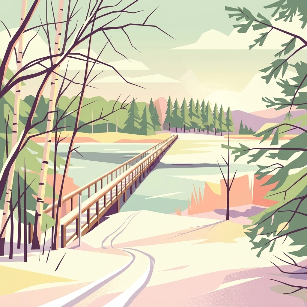
A stylized, colorful illustration of a long, narrow wooden footbridge crossing a tranquil body of water, flanked by birch trees and pine forests under a soft sky.

Braunsteich

Nature reserve

Park overview

Structured park overview, official facts, and landscape profile for Braunsteich

Braunsteich park facts, protected area profile, and essential visitor context

Review the core facts for Braunsteich, including designation, size, terrain, visitor scale, habitats, and operating context in one park-focused overview.

About Braunsteich

Braunsteich sits at the eastern edge of Weißwasser in the Oberlausitz, on the sandy outwash plain of the Muskau Faltenbogen. The lake is small in absolute terms but ecologically rich, because its two halves behave like two different water bodies. In the north, the basin is open, relatively clear, and used by anglers. In the south, the lake becomes a shallow, reed-choked expanse that grades directly into a large moorland area. This combination of open water, reed belt, and adjoining bog is the defining landscape signature of the site.

The lake was created in the 15th century by damming the small Rotwassergraben to supply process water for the Keulahütte ironworks at Krauschwitz. The dam that holds the water can still be walked along today. After the original feeder stream was cut off by lignite mining at the Nochten opencast mine, the lake is now fed with mine drainage water and drains eastward through the Braunsteichgraben into the Legnitzka and ultimately the Lausitzer Neiße.

For visitors, the lake reads as a peaceful local landscape: pine forests on sandy soils, a calm expanse of water crossed by a restored pedestrian bridge built in 1994, and a shoreline that swings from open bathing-and-fishing water to dense reedbeds and bog. The nearby Waldhaus, an excursion restaurant with a beer garden on the water, serves as a small gathering point. Beyond leisure, Braunsteich has value as a protected piece of the larger Oberlausitzer Heide- und Teichlandschaft, contributing wetland and open-water habitat to a regional mosaic of heath, forest, and pond ecosystems.

Quick facts and research context for Braunsteich

Braunsteich is a roughly 44 hectare lake in Landkreis Görlitz, Saxony, situated directly east of the town of Weißwasser in the Oberlausitz region. The lake lies within the outwash sand plain of the Muskau Faltenbogen and is surrounded by pine-dominated forest, including the regionally characteristic Lausitzer Tieflandsfichte. The southern part of the basin transitions into extensive moorland and is largely covered by reed, while the northern half is open water used for angling. A 124 hectare area covering the southern lake section and its inflow stream is protected as a nature reserve, and a 615 hectare surrounding landscape extends that protection as a landscape protection area.

Park context

Deeper park guide and search-rich context for Braunsteich

Braunsteich history, landscape, wildlife, and travel context

Explore Braunsteich through its history, landscape character, ecosystems, wildlife, conservation priorities, cultural context, and seasonal travel timing in a structured park guide built for atlas discovery and search intent.

Why Braunsteich stands out

Braunsteich is best known for the contrast between a clear, open angling pond in its northern half and a wild, reed-filled, boggy southern end that merges into moorland. It is also recognized as a protected wetland habitat embedded in the sandy, pine-forested terrain of the Muskau Faltenbogen, and as a local landmark tied to the centuries-old iron and water management history of the Oberlausitz. Mute swans are the most conspicuous wildlife feature, while the surrounding forest, with its Lowland spruce and typical moor birches, gives the place a distinctly Lusatian character.
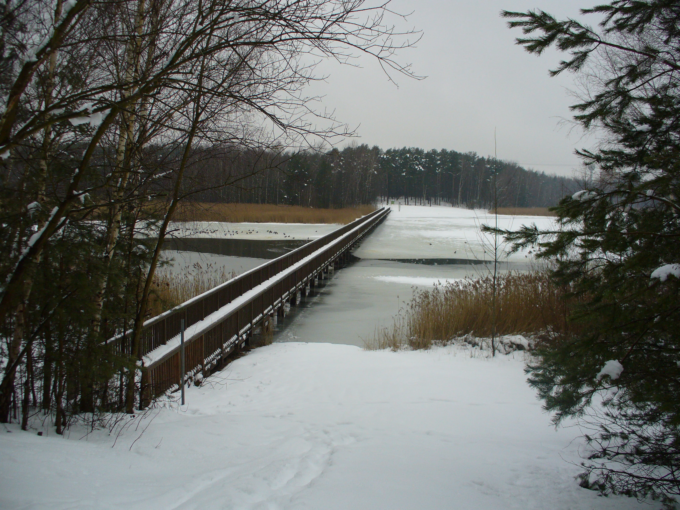
A long, narrow wooden bridge crosses a partially frozen body of water surrounded by snow-covered banks and pine forest under a grey sky.
A wooden footbridge spanning the frozen Braunsteich reservoir in winter.

Braunsteich history and protected-area timeline

Braunsteich was artificially created in the 15th century when the Rotwassergraben, which normally flowed northward, was dammed to provide water for the Keulahütte ironworks at nearby Krauschwitz. The dam itself survives as a walkable feature and remains the structural reason the lake exists.

In the early 20th century the Waldhaus, an excursion restaurant with a dance hall, was built on the northeastern shore and quickly became a local destination. It burned down in March 1936 but was rebuilt in 1938 and still operates today as a popular restaurant with a beer garden by the water, known for hosting events for up to around 120 guests as well as organized tour groups. In 1929 a Weißwasser ice hockey team played one of its first matches on the frozen surface of the lake, a small but telling episode in the pond's recreational history.

Later in the 20th century, the original Rotwassergraben inflow was severed by the expanding Nochten opencast lignite mine. To keep the lake from drying out, mine water from Nochten was redirected into Braunsteich, replacing the natural feed. The southern section of the lake and its inflow were then formally designated as a nature reserve, and a broader surrounding area as a landscape protection area, anchoring the site in the regional conservation network of Landkreis Görlitz.

Braunsteich landscape and geographic character

Braunsteich lies within a broad sandy outwash plain associated with the Muskauer Faltenbogen, a glacially shaped belt of push moraines, sandurs, and valleys reaching from Saxony into Brandenburg and Poland. The terrain around the lake is therefore flat to gently rolling and dominated by sandy soils that support pine forest rather than richer deciduous woodland. The lake itself, about one kilometer long and covering roughly 44 hectares, sits plum against the eastern edge of Weißwasser, separated from the town only by a disused railway line.

The shoreline is sharply divided into two landscape zones. The northern half is an open, reed-free basin where anglers use the water and where views reach across to the forested banks. The southern half narrows and thickens with reed until the open water disappears entirely into an extensive moorland landscape. South of that transitional belt the wet ground becomes a mosaic of marsh plants and white birch growing in boggy substrate, a typical mire vegetation of the Lusatian lowlands.

A pedestrian bridge rebuilt in 1994 crosses the lake east to west, reinforcing the linear, elongated shape of the basin. The dam on the northern side, originally built to drive the 15th century ironworks, still traces a clear ridge across the landscape and can be walked as a path. Together the dam, the bridge, the wooded margins, and the mire south of the lake give the site a strongly defined, almost architectural shape within the otherwise soft sandy forest around it.

Braunsteich ecosystems, habitats, and plant life

The vegetation around Braunsteich is shaped by the sandy substrate of a glacial outwash plain, the Sander of the Muskauer Faltenbogen. Pine is the dominant tree across the wider surroundings, while closer to the water the forest shifts in character: the Lausitzer Tieflandsfichte, a regional lowland form of Norway spruce, is the most characteristic conifer in the immediate vicinity of the lake. Along the wetter margins and especially in the moorland belt to the south, white birch becomes common alongside typical bog plants. A continuous fringe of reed lines the shore, particularly in the southern basin, marking the transition from open water to mire.

This combination of dry sandy pine forest, boggy birch-moorland, and reed-fringed open water forms a compact but varied ecological mosaic. The water body itself is relatively nutrient-rich, which supports abundant fish stocks and partly explains its long use as an angling lake, while the surrounding sandy soils keep the upland vegetation open and dry. The southern moorland section provides a very different setting: wet, slow-draining, and dominated by peat-forming plants rather than forest.

Braunsteich is therefore a textbook example of how the Muskau Faltenbogen produces small but ecologically diverse wetland pockets within a much larger pine-forested sand plain. The lake and its moor act as a local concentration of moisture, plant diversity, and animal habitat inside an otherwise dry regional forest landscape.

Braunsteich wildlife and species highlights

The most conspicuous animal at Braunsteich is the mute swan, which is the signature species of the lake and the one most likely to be noticed by visitors. The reed beds around the southern basin and along the shore host a variety of ducks that use the cover for nesting and feeding, while the open northern water attracts waterfowl in general and supports fish populations large enough to make the lake a working angling water.

Because the lake sits at the meeting point between open water, dense reed, and adjoining birch moorland, it provides a small but unusually varied set of habitats for a regional bird community. The surrounding pine forest adds another layer, supporting typical Lusatian lowland woodland species. The combination of fishing pressure, waterfowl presence, and a protected status means the lake is both a working recreational site and a refuge for local wetland fauna, particularly in its southern, less disturbed sections.

Braunsteich conservation status and protection priorities

Braunsteich is protected on two overlapping levels. The southern part of the lake together with its inflow stream, covering 124 hectares, is designated as a Naturschutzgebiet, Germany's stricter nature reserve category, which focuses on habitat and species conservation. A larger surrounding area of 615 hectares, including the lake itself with its shoreline zone and a north-easterly section of the adjacent Muskauer Faltenbogen, is designated as a Landschaftsschutzgebiet, the landscape protection category, which safeguards the broader scenic and ecological character of the area.

Together these designations recognize two conservation values at once. The southern wetland is protected as a specific habitat complex of open water, reed, and moor, valuable for mire plants, waterfowl, and the mute swans that typify the site. The wider landscape protection preserves the relationship between the lake and its sandy, pine-forested setting within the Muskau Faltenbogen, an important regional geomorphological feature. Braunsteich also forms one of several protected pieces inside the larger Oberlausitzer Heide- und Teichlandschaft, contributing wetland and open-water habitat to a regional conservation mosaic.

Braunsteich cultural meaning and human context

The lake is closely tied to the industrial history of the Upper Lusatia region. It was created in the 15th century to supply water for the Keulahütte ironworks at Krauschwitz, and the surviving dam that holds the water is a direct inheritance from that period. The Sorbian language name Brusnik preserves the area's long-standing Sorbian cultural identity, which remains part of regional heritage in the Oberlausitz around Weißwasser.

In the 20th century the Waldhaus, an excursion restaurant with a beer garden on the lake shore, became a gathering place for day-trippers and tour groups, and is still used for celebrations and group dining. In 1929, a Weißwasser ice hockey team played an early match on the frozen lake, linking the pond to the town's broader sporting culture. The pedestrian bridge rebuilt in 1994 across the basin and the walkable old dam path also reflect the lake's continuing role as a local recreational landscape.

Top sights and standout views in Braunsteich

Braunsteich's standout features are the strong visual contrast between its open northern basin and its reed-and-moor southern end, the survivor 15th century dam that still holds the lake, and the mute swans that define the site's wildlife image. A 1994 pedestrian bridge crosses the water and connects both halves of the basin, while the surrounding pine forest and the Lausitzer Tieflandsfichte give the place a recognizable Lusatian lowland character. The lake's dual protection as both a nature reserve and a landscape protection area anchors it within the wider Oberlausitzer Heide- und Teichlandschaft conservation network.

Best time to visit Braunsteich

Braunsteich reads differently depending on the season. Spring and early summer bring the most active birdlife, with swans, ducks, and other waterfowl using the reed-fringed southern basin and the open northern water, while the surrounding pine forest and white birch in the adjoining moorland are at their freshest. Summer is the most comfortable time for walking the dam and the restored east-west bridge, with the Waldhaus beer garden operating by the water. In winter the frozen surface becomes a quiet, open landscape and historically has supported ice sports, though visitors should expect cold, often grey conditions typical of the upper Lusatian lowlands.


Monthly climate preview

Review measured monthly averages and representative coordinates for Braunsteich in Saxony

Braunsteich Climate and Weather by Month: Long-Term Temperature and Precipitation Normals

Braunsteich exhibits a recorded annual temperature range from sub-zero winter minimums to warm summer maximums alongside measured monthly precipitation levels. Accessing the complete monthly climate dataset provides detailed long-term averages for thorough geographic comparison.
Annual mean9 °C
-1 °C20 °C
Jan-1°
Feb
Mar
Apr
May14°
Jun18°
Jul20°
Aug20°
Sep15°
Oct
Nov
Dec
Warmest month
July

20.4 °C

Coolest month
January

-1.1 °C

Wettest month
July

2.7 mm/day

Driest month
April

1.2 mm/day

Park location guide

Geography guide, regional context, and park location map for Braunsteich

Braunsteich park geography, regions, and map view in Germany

Understand where Braunsteich sits in Germany through a broader geographic reading of the surrounding landscape, nearby location context, and its mapped position within the national park landscape.

How Braunsteich fits into Germany

Germany is a federal republic in Western and Central Europe with a population of over 83 million across sixteen constituent states. It is Europe's largest economy by nominal GDP and a major global exporter and importer. The capital is Berlin, and the country borders Denmark, Poland, Czech Republic, Austria, Switzerland, France, Luxembourg, Belgium, and the Netherlands.

Wider geography shaping Braunsteich in Germany

Germany is located in Western and Central Europe, spanning 357,022 km². It borders Denmark to the north, Poland and the Czech Republic to the east, Austria and Switzerland to the south, and France, Luxembourg, Belgium, and the Netherlands to the west. The country has coastlines on the Baltic Sea and North Sea to the north, with the Alps located in the southern region.

Map view of Braunsteich

Use this park location map to pinpoint Braunsteich in Germany, understand its exact geographic position, and read its mapped placement within the surrounding landscape more clearly.

Pigeon | © OpenStreetMap contributors

Location context for Braunsteich

Saxony

Explore visual records of open water basins, pine forests, and moorland terrain.

Braunsteich Photos and Landscape Scenery: Visualizing Protected Wetland Habitats

Visual documentation reveals the distinctive geography of Braunsteich, contrasting open angling basins against dense reed-fringed moorlands. Photographic archives offer clear insight into the protected wetland environment and sandy terrain of the surrounding Lusatian lowlands.

A long, narrow wooden bridge crosses a partially frozen body of water surrounded by snow-covered banks and pine forest under a grey sky.

Park atlas

Discover related natural reserves and regional park geography across the Lusatian landscape.

Explore Protected Areas and Parks Near Braunsteich in the Oberlausitz Region

Browse other protected areas and wetland habitats situated within the sandy pine forests surrounding Braunsteich. Comparing adjacent regional nature reserves provides a broader perspective on the glacial terrain and lowland conservation networks of Saxony.
Nature reserveSaxony
About 3.7 km away#1 closest

East

Hammerlugk Nature Reserve: Mapped Protected Wetlands and Mosaic Landscapes in Saxony

A rare surviving remnant of the historic Upper Lusatian moorland ecosystem.

Spanning 74 hectares, Hammerlugk stands as a crucial nature reserve in Saxony, characterized by its swampy woodland and wet meadow mosaic. This protected area serves as an important ecological anchor within the Muskauer Heide, preserving wetland habitats that have largely vanished elsewhere due to lignite mining and regional drainage. The reserve provides a quiet, low-lying sanctuary that remains vital for understanding the original natural terrain of the Upper Lusatian heath country.

Area
0.74 km²
Established
1996
Relief
Lowland
Climate
Temperate
Protected areaSaxony
About 4.6 km away#2 closest

West

Trebendorfer Tiergarten: Protected Woodland and Natura 2000 Habitat in Saxony

Mapped forest terrain in the Landkreis Görlitz

Trebendorfer Tiergarten encompasses approximately 201 hectares of inland forest, reflecting the habitat conservation priorities of the European Union. Located in eastern Saxony, the reserve features clearly defined boundaries shaped by historic infrastructure and forestry, offering a precise case study of protected land within the wider Lusatian heath and pond landscape.

Area
2.01 km²
Established
1961
Relief
Lowland
Climate
Temperate
Nature reserveSachsen
About 7.6 km away#3 closest

Northwest

Altes Schleifer Teichgelände: Geographic Context of the Sachsen Nature Reserve

Wetland habitats and protected heathland in Upper Lusatia

Altes Schleifer Teichgelände represents a key protected area where the Struga stream feeds a network of historic ponds and damp meadows. Situated at the edge of the Trebendorf plateau, this nature reserve offers a study in landscape restoration, balancing diverse birch mire forests with orchid-rich grasslands in the heart of the Muskauer Heide.

Area
0.676 km²
Established
1981
IUCN
IV
Relief
Lowland
Nature reserveBrandenburg
About 9.7 km away#4 closest

North

Zschornoer Wald Nature Reserve: Regional Geography and Protected Landscape Analysis

A Lusatian forest protected area within the Spree-Neisse district.

Zschornoer Wald represents a notable example of post-Cold War land reclamation in Brandenburg, Germany. This 628 hectare nature reserve serves as an ecological anchor near the Lausitzer Neisse river, providing vital forest habitat management. By mapping its unique origins as a former bombing range alongside its current conservation role, this atlas entry provides a comprehensive look at the reserve's physical geography, human-altered terrain, and its position within the broader Spree-Neisse landscape.

Area
6.28 km²
Established
2002
IUCN
IV
Relief
Lowland
Nature reserveBautzen
About 29 km away#5 closest

South

Spreeniederung Malschwitz Nature Reserve and Riverine Floodplain Geography

Protected riparian landscapes in the Bautzen district

Spreeniederung Malschwitz represents a significant protected floodplain along the Spree river. This nature reserve provides crucial habitats through its complex network of traditional fishponds, oxbow lakes, and old-growth forests, serving as a key staging site for migratory waterfowl within the Upper Lusatian landscape.

Area
18.57 km²
Established
2002
A pale, soft watercolor painting of a serene moorland landscape with rolling green hills and a light, misty background.
Nature reserveSaxony
About 32 km away#6 closest

West

Dubringer Moor Nature Reserve: Geographic Atlas and Protected Landscape Mapping

Extensive mire and wetland complex in the Saxony region

Spanning over 1,700 hectares, Dubringer Moor serves as a prime example of a through-flow moor system with deep peat deposits. The reserve features a unique integration of old fish-pond culture, open heath-mire, and coniferous forest, all situated within a glacial landscape that anchors the wetland ecology of northern Saxony. Examine the boundaries and environmental context of this significant habitat.

Area
17.11 km²
Established
1995
IUCN
IV
Relief
Lowland
Watercolor illustration depicting a path through a green forest, with a pale meadow in the background.
Nature reserveSachsen
About 33 km away#7 closest

South

Gröditzer Skala Nature Reserve: Geography and Protected Landscapes of the Upper Lusatian Region

A dense greywacke valley corridor in eastern Saxony

Centred on a narrow, rock-cut valley, Gröditzer Skala provides a dramatic display of geological features and botanical richness within the Landkreis Bautzen. This protected area, known for its steep slopes and diverse deciduous forest communities, offers a compact but highly varied terrain that remains a cornerstone of the regional natural heritage.

Area
0.39 km²
Established
1961
IUCN
IV
Relief
Upland
Nature reserveBrandenburg
About 38 km away#8 closest

Northwest

Koselmühlenfließ Nature Reserve: A Protected Stream Valley in the Brandenburg Region

Geographic overview of the Lusatian land ridge brook habitat

Koselmühlenfließ protects a largely natural lowland stream and its floodplain corridor set amidst the undulating landscapes of the Lusatian land ridge. This nature reserve in the Spree-Neisse district represents a focused contribution to the Brandenburg conservation network, highlighting the value of small-scale brook environments in northeast Germany.

Area
1.12 km²
Established
2006
IUCN
IV
Relief
Lowland

Common questions about visiting, size, designation, and location context for Braunsteich

Braunsteich FAQs for park facts, access, geography, and protected area context

Find quick answers about Braunsteich, including protected-area facts, park geography, trail and visitor context, and how the park fits into its surrounding country and regional landscape.
MoriAtlas Explorer

Continue Your Protected Areas Search Across the Global Atlas

Deepen your exploration by continuing the structured search for national parks and protected areas worldwide. Utilize the comprehensive filtering capabilities to compare different conservation landscapes and refine your understanding of global park geography. Discover more about the distribution and characteristics of protected natural areas.

Global natural geography