
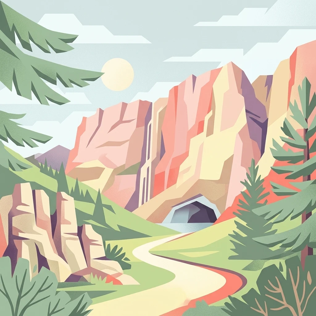

Why Chelmos-Vouraikos UNESCO Global Geopark stands out
Chelmos-Vouraikos is especially known for its exceptional geological heritage, particularly its deeply karstified limestone terrain that has produced some of the most striking karst features in Greece. The Cave of the Lakes with its thirteen underground lakes, the 47-meter-deep Ladon's eye sinkhole, the glacial alpine lake Mavrolimni, and the dramatic Water of Styx in a steep gorge all function as signature geological landmarks. These features sit within a landscape where the Chelmos massif rises to remarkable altitudes and where the Vouraikos Gorge cuts through layers of limestone, flysch, radiolarite, and volcanic rock. Beyond geology, the geopark is widely recognized for its biodiversity anchored in geodiversity: over 1,100 plant species, including more than thirty endemics of the Peloponnese and local Chelmos endemics such as Globularia stygia (a priority species under the European Habitats Directive), thrive across varied microhabitats. The territory also shelters 149 bird species, nine endemic reptile species, and a winter bat colony of around 18,000 individuals in the Cave of the Lakes, one of the largest in Europe, all of which reinforce the park's profile as a layered natural and scientific landmark.
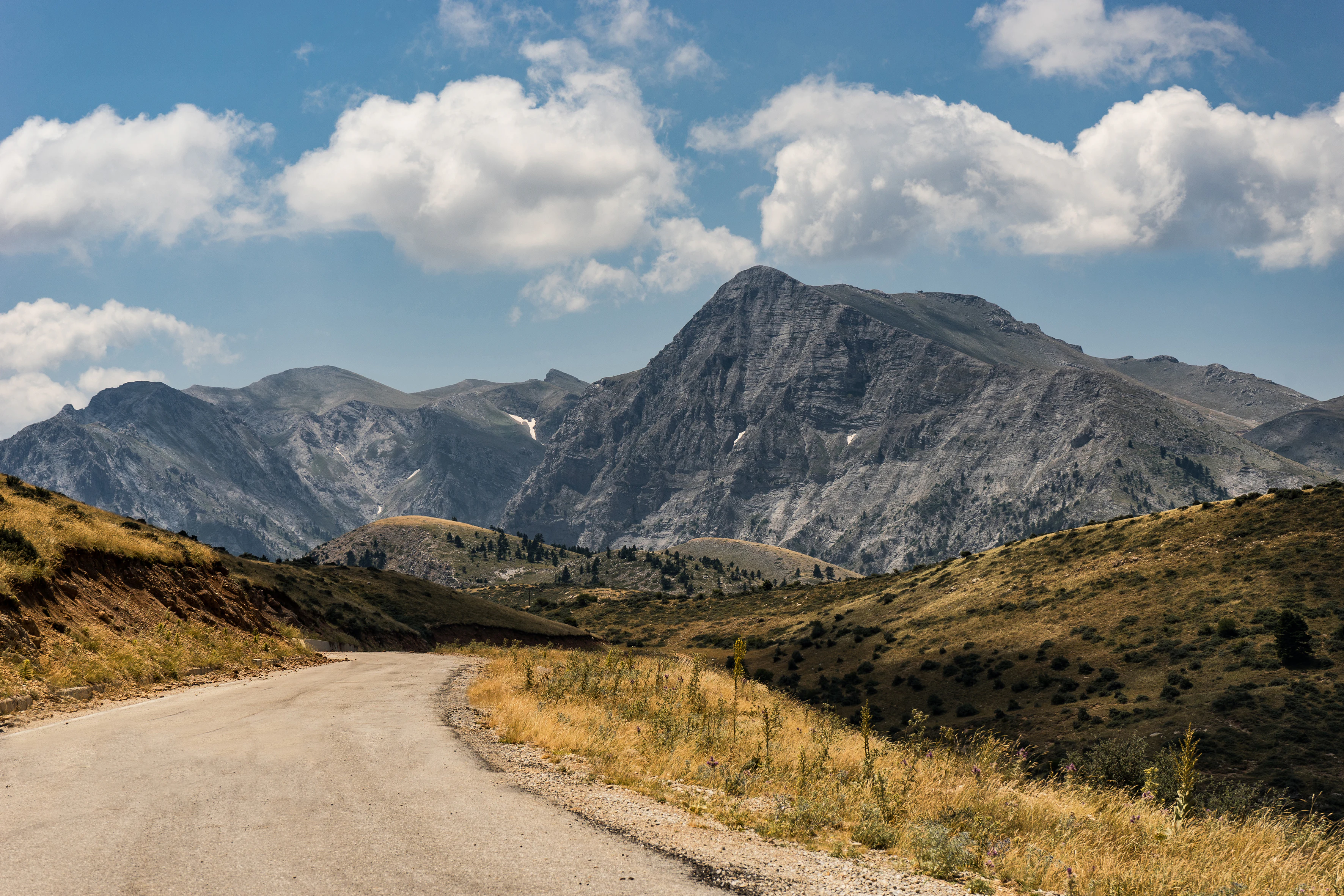
Chelmos-Vouraikos UNESCO Global Geopark history and protected-area timeline
The Chelmos-Vouraikos Geopark took institutional shape in 2002, when the Chelmos-Vouraikos Management Body was established to oversee the conservation, protection, and overall management of the protected area. Although the body became legally active in 2002, it was not staffed and operational until 2007. By October 2009, the territory had formally joined the European Geoparks Network, the Global Geoparks Network, and the Hellenic Geopark Forum, integrating its management with international geopark practice.
Following positive evaluations in 2013, 2015, and 2019, the geopark was admitted as a UNESCO Global Geopark in 2015, becoming one of the recognized geoparks on UNESCO's worldwide list. In 2016, it received the European Charter for Sustainable Tourism certification from EUROPARC Federation, signaling alignment with broader European sustainable tourism standards for protected areas. Over time, the Management Body has also coordinated environmental education, guided tours, stakeholder partnerships, and the integration of five Natura 2000 sites within the broader geopark framework.
The park's historical weight, however, reaches far beyond administrative milestones. The territory contains monasteries that were central to modern Greek identity (notably Agia Lavra, traditionally associated with the Greek War of Independence, and Mega Spilaio), ancient settlements such as Loussoi, Kleitoria, and Feneos, and the late nineteenth-century Rack Railway between Diakofto and Kalavryta. The town of Kalavryta is also a place of modern historical memory, both because of its World War II Holocaust Museum and because of the surrounding landscapes that have long supported mountain communities and Mediterranean lifestyles.
Chelmos-Vouraikos UNESCO Global Geopark landscape and geographic character
The landscape of Chelmos-Vouraikos is shaped by the Chelmos (Aroania) massif, a rugged limestone-dominated range that defines the northern Peloponnese and rises to alpine elevations, including the geological high point known as Psili Korfi. The bedrock is overwhelmingly limestone, frequently karstified, but also incorporates flysch, radiolarite, marl, sandstone, conglomerate, schist, phyllite, quartzite, dolomite, and limited volcanic rocks from the Tripoli zone. Across roughly 654 square kilometers, the terrain transitions from karst plateaus and glacial alpine lakes to steep gorges and deeply dissected river valleys.
Karst processes are the dominant sculptors of the surface. Sinkholes, dolines, poljes (notably around Lousoi and Feneos), caves, springs, and underground drainage systems are widespread. The most celebrated karst features include the Cave of the Lakes on Mount Amolinitsa, where thirteen underground lakes occupy successive levels of the cave system, the Ladon's eye sinkhole with its 47-meter-deep karst lake, and the Water of Styx, a flow that collects in a steep, narrow limestone gorge. Mavrolimni, a glacial alpine lake on Mount Chelmos, and the Spanolakkos glacial deposits point to a Pleistocene past of frost-shattered rock and ice-driven landscape formation.
River and gorge scenery further amplifies the territory's visual identity. The Vouraikos Gorge, with thin-platty limestones and dramatic cliffs, hosts the historic rack railway between Diakofto and Kalavryta. The Aroanios Springs at Planitero and the Analipsi gorge add concentrated zones of high moisture and erosion, while tectonic features, such as the tectonic window at Niamata-Vouraikos, the tectonic graben beneath Kalavryta, thrust faults, folds, and mylonites, reveal the deep structural architecture on which the surface scenery rests. Together, mountain mass, karst, rivers, glacial traces, and active tectonic structures produce a varied and dramatic Peloponnesian landscape.
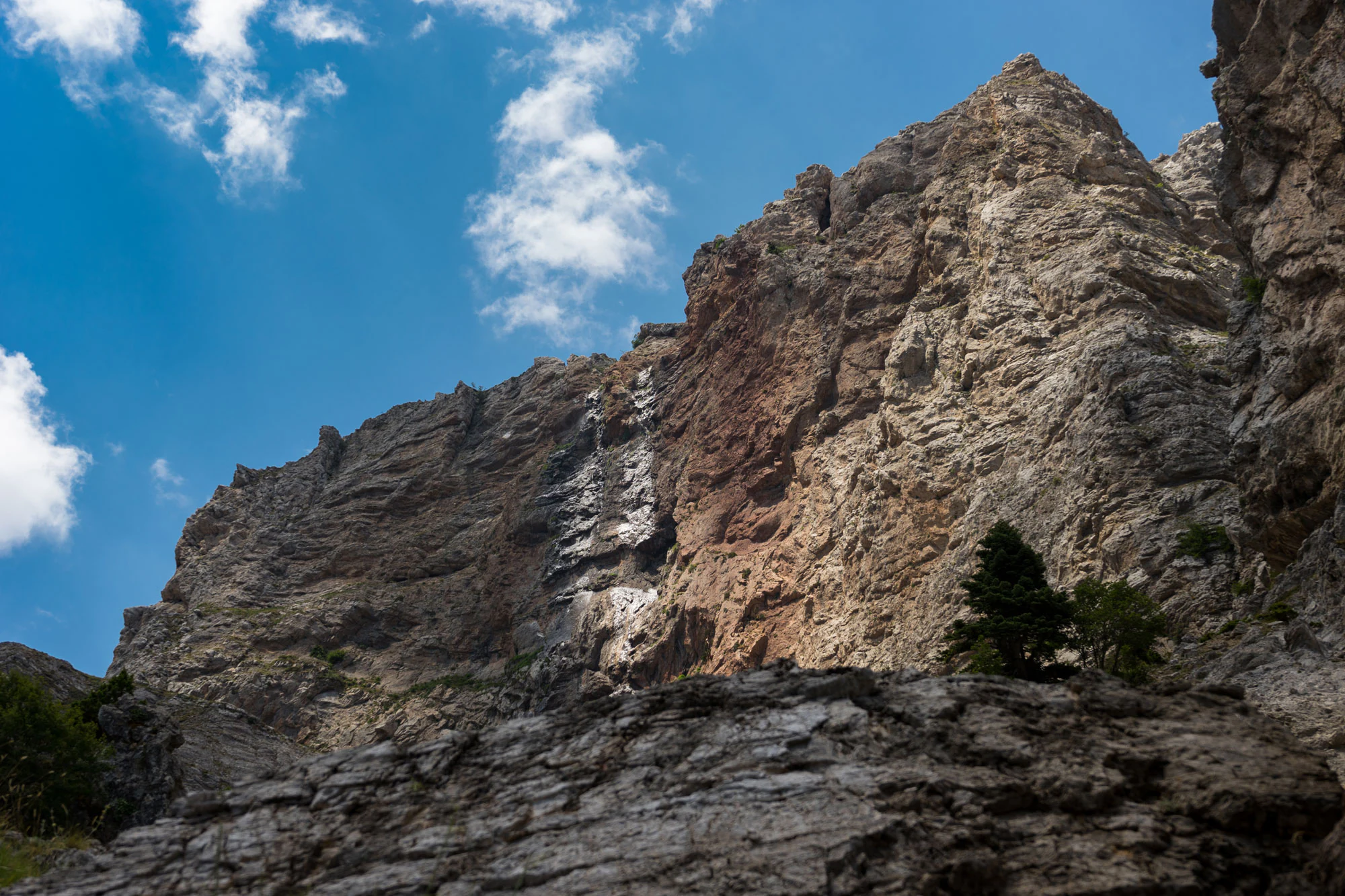
Chelmos-Vouraikos UNESCO Global Geopark ecosystems, habitats, and plant life
The Chelmos-Vouraikos UNESCO Global Geopark derives its ecological character from an unusually close relationship between geology and biology: the geodiversity of the area, through soils, moisture regimes, microclimates, and exposure patterns, creates a wide range of habitats for specialist and endemic species. Limestone dominates much of the Chelmos massif and provides the porous, mineral-rich substrate on which many endemics depend. Concurrently, gorges, springs, alpine meadows, and forest patches layer additional habitat types into a compact territory.
The flora reflects this mosaic. The geopark hosts more than 1,100 plant species, including roughly thirty endemics of the Peloponnese, more than one hundred Greek endemics, and five local endemics restricted to Chelmos itself. Species composition is strongly tied to soil and rock type, with limestone specialists prominent on Chelmos; pharmaceutical and aromatic plants are also widespread across the territory. Beyond the showpiece Globularia stygia, the flora includes several species that are listed in the IUCN Red Data Book or otherwise protected under international regimes.
Vegetation transitions across altitude, from Mediterranean agricultural and forest belts in the lower areas, through beech and mixed mountain forests, to alpine and sub-alpine zones above, where scree slopes, rock ledges, and exposed cliffs host hardier, often endemic plants. Caves and shaded gorges provide refuges for moisture-loving species and for cave-adapted invertebrates. The Kalavryta Aesthetic Forest and the forests of Perithori and Zarouchla contribute larger wooded habitats, particularly important for birds, mammals, and a range of forest-floor invertebrates, while the combination of cliffs and forest patches creates the heterogeneous habitat structure that supports the area's unusually rich biodiversity.
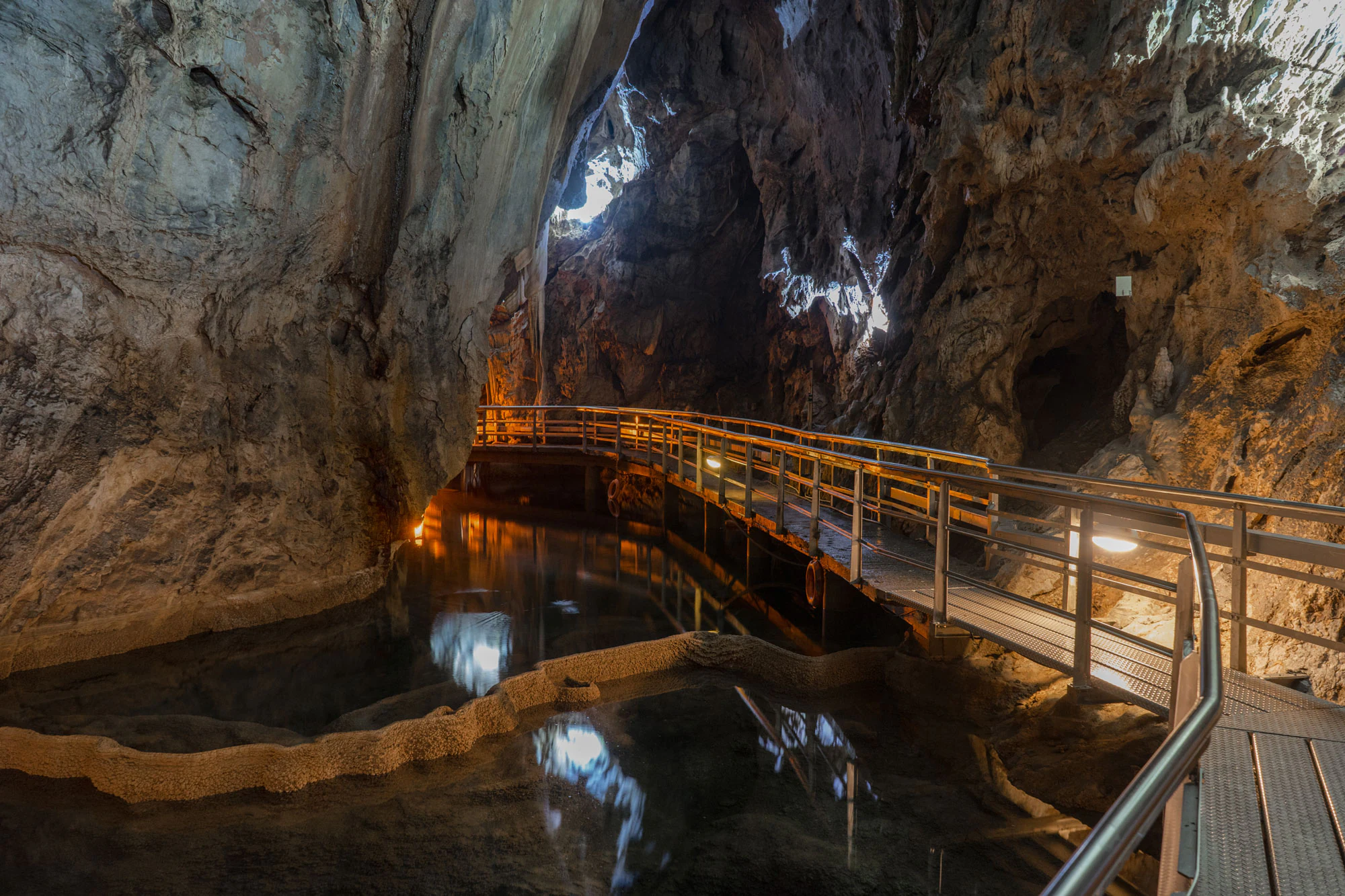
Chelmos-Vouraikos UNESCO Global Geopark wildlife and species highlights
The geopark's wildlife profile is built on its mosaic of habitats, where mountains, gorges, alpine meadows, springs, and deep caves all interact. Fauna include 76 recorded invertebrate species, with a notable presence of endemic and rare butterflies in the alpine grasslands and mountain plains. The reptiles are particularly important to the territory's identity: of 23 recorded species, nine are endemic, a level of endemism that reflects both the geological isolation of Peloponnesian massifs and the diversity of microhabitats within them.
Amphibians are documented across nine species, benefiting from the abundant springs, wet meadows, and aquatic corridors formed by the Aroanios, Vouraikos, and Ladonas river systems, while four fish species, including two endemics, occupy the area's inland waters; some of these waters are supplemented by trout and salmon aquaculture in the area. Mammal diversity is concentrated in the forested and mountainous zones and accounts for 18 species across the geopark.
Birds form the most visible element of the area's fauna: 149 species either reside in or pass through the Chelmos-Vouraikos territory, using the altitudinal gradient, the cliffs and gorges, and the mosaic of forest fragments. Raptors are typical of the mountainous terrain, while forest birds and water-associated species find habitat in the wooded valleys and around the lakes. The Cave of the Lakes stands out for its resident winter bat colony, estimated at around 18,000 individuals, one of the most important hibernation sites for bats in Europe and a strong empirical statement of the geopark's relevance to European fauna conservation.
Chelmos-Vouraikos UNESCO Global Geopark conservation status and protection priorities
The conservation value of the Chelmos-Vouraikos UNESCO Global Geopark sits on a layered system of recognition. As a national park, it benefits from formal Greek protection and is supervised through the Ministry of the Environment and Energy; as a UNESCO Global Geopark, since 2015, it has met internationally evaluated criteria for the protection and presentation of geological heritage; and as a holder of five Natura 2000 sites, it must also meet the European Union's standards for habitats and species protection under the Birds and Habitats Directives. These overlapping frameworks together amplify the practical protection of the territory.
Beyond formal status, the geopark's value is grounded in the link between geodiversity and biodiversity. The karst and tectonic complexity has produced rare endemic plants (such as the directive-protected Globularia stygia), endemic reptiles, and unique cave fauna, including the large winter bat colony. Protection of these species is therefore inseparable from protection of the karst systems themselves, which is why the management body explicitly treats geo- and biodiversity as a single conservation program. Sustainable tourism certification, recognition through international geopark networks (European Geoparks Network, Global Geoparks Network, Hellenic Geopark Forum), and the EUROPARC Sustainable Tourism Charter (2016) reflect a deliberate effort to make conservation compatible with regional development.
Pressures nevertheless remain. The geopark faces documented environmental challenges including pollution and solid waste management, habitat deterioration, illegal logging, forest fires, inappropriate forest management, agricultural intensification (irrigation works, fertilizers, overgrazing), and infrastructure construction. The management body addresses these through ranger patrols, environmental education programs, partnerships with research institutions, and cooperation with regional stakeholders, framing the geopark both as a working model of integrated conservation and as a territory that must continually adapt to human pressures in and around its borders.
Chelmos-Vouraikos UNESCO Global Geopark cultural meaning and human context
Chelmos-Vouraikos is anchored in a deep cultural landscape, where Orthodox Christian monasticism, ancient Greek settlement, and modern Greek history all leave a visible imprint. The monasteries of Agia Lavra and Mega Spilaio are not only religious centers but also national symbols, with Agia Lavra long associated with the raising of the Greek flag during the 1821 War of Independence and Mega Spilaio perched dramatically against the cliffs in a setting that fuses faith, geology, and architecture. The Cave of the Lakes itself lies near the Kastria area, where monastic and rural culture remain part of daily life.
Further cultural layers come from antiquity: the ancient city of Feneos, the archaeological site of Loussoi, ancient Kleitoria, and the legendary Pausanias Vine connect the territory to classical Greek geography and travel writing, sustaining its identity as a place where myth and history meet landscape. Working cultural assets also include the Aesthetic Forest of Kalavryta, the traditional Petmesa family building, the Ladonas River valley, and the forested villages of Perithori and Zarouchla, all of which preserve vernacular architecture and rural traditions.
Twentieth-century history adds a sobering layer. The town of Kalavryta hosts the Holocaust Museum, which commemorates a defining wartime tragedy for modern Greece, and the Rack Railway between Diakofto and Kalavryta, an engineering landmark more than a century old, threads through the Vouraikos Gorge and links the coast to the mountain interior. Together, these monasteries, ancient sites, and modern memorials situate the geopark in an unusually layered cultural context, where local identity, ecological awareness, and national memory routinely intersect.
Top sights and standout views in Chelmos-Vouraikos UNESCO Global Geopark
Among the most distinctive elements of the Chelmos-Vouraikos UNESCO Global Geopark are the Cave of the Lakes with its thirteen underground lakes and a winter bat colony of around 18,000 individuals; the dramatic Water of Styx flowing through a narrow limestone gorge; the 47-meter-deep Ladon's eye karst sinkhole; the alpine glacial lake Mavrolimni on Mount Chelmos; the Vouraikos Gorge with its historic rack railway; the karst poljes of Lousoi and Feneos; and the tectonic features that make the area an outdoor classroom for European geology. Equally notable are the endemic Psili Korfi peak on Chelmos, the cave-rich Amolinitsa area, and globally rare plant species such as Globularia stygia, a priority species under the European Habitats Directive.
Best time to visit Chelmos-Vouraikos UNESCO Global Geopark
Seasonality follows the dual topography of Chelmos-Vouraikos: the low valleys and the high peaks behave differently through the year. Spring is generally rich in moisture and wildflower display across the lower slopes and meadows, with snowmelt driving active flow at springs, cascades, and rivers such as the Aroanios and Vouraikos. Summer opens up alpine grassland and the wider network of geosites, including caves, sinkholes, karst plateaus, and monastery visits, under warmer Mediterranean conditions, though the higher elevations remain significantly cooler than the coast.
Autumn brings cooler temperatures, stable weather, and clear views across the Chelmos massif, with forests turning color and lower tourist numbers, making it a balanced period for mixed hiking, geological exploration, and cultural visits. Winter concentrates activity around the Kalavryta Ski Center on the northern slopes of Chelmos, where snowfall transforms the high massif into a winter sports setting; lower areas remain comparatively mild, and the Cave of the Lakes houses its internationally significant bat hibernation colony, of interest to specialist visitors year-round.