
Mori Atlas logo
Protected landscapeChurn Creek Protected Area

Discover the complex dryland topography and river-carved benchlands of this British Columbia protected landscape

Churn Creek Protected Area: Mapping the Grasslands and Canyons of the Chilcotin Plateau

Churn Creek Protected Area represents a significant expanse of dryland steppe and canyon terrain in south-central British Columbia. Located along the southern edge of the Chilcotin Plateau, the protected area features deeply incised river drainages and extensive grasslands. Users can examine the interplay between the arid benchlands and the steep elevations of the Camelsfoot Range, gaining insight into the geological and ecological forces that define this rugged Canadian landscape.

grasslandsdryland steppecanyon countrybighorn sheepprotected grasslandChilcotin Plateau
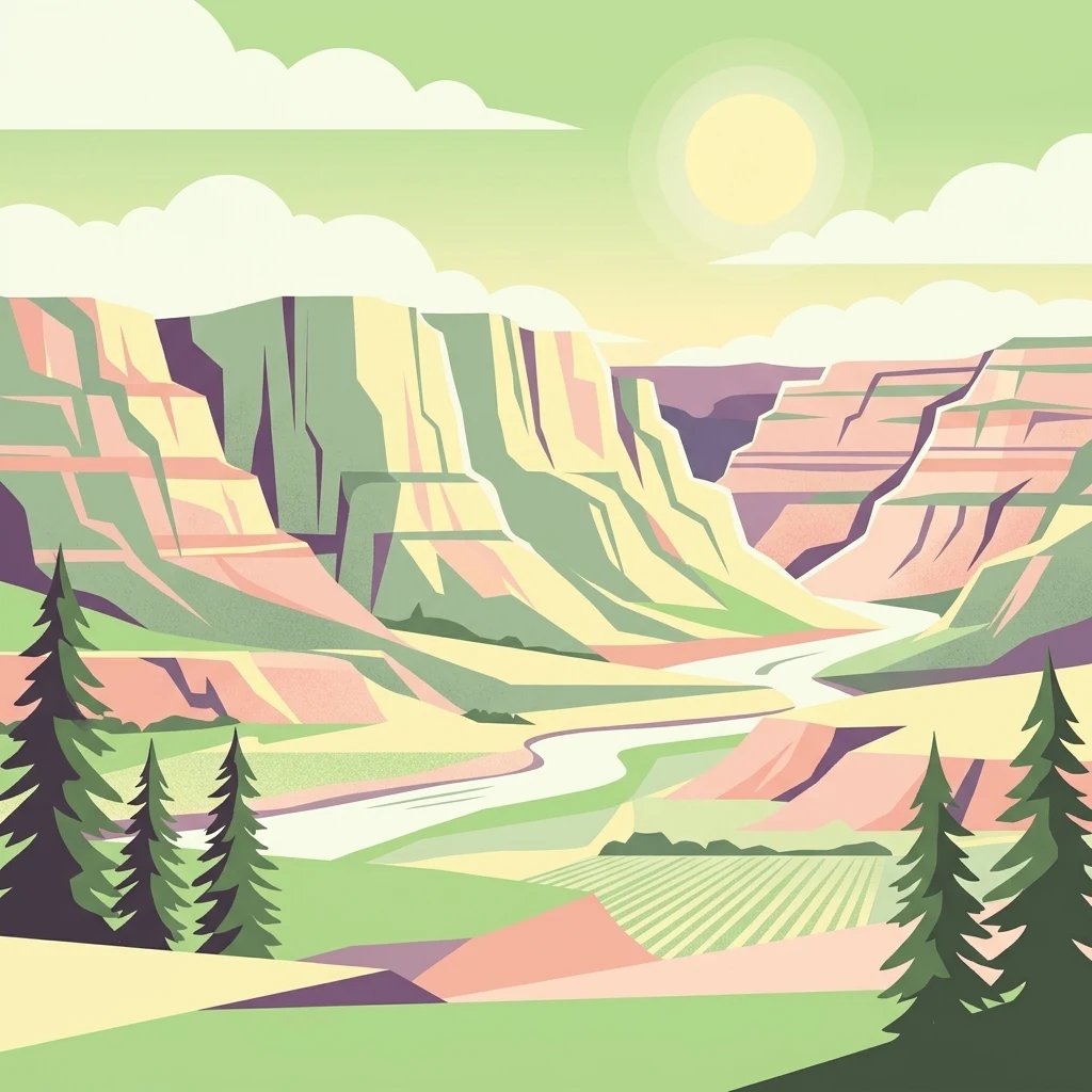
A flat vector illustration of a canyon with pink and green layered rock walls, a winding river, green fields, and pine trees in the foreground under a sunny sky.

Churn Creek Protected Area

Protected landscape

Park overview

Structured park overview, official facts, and landscape profile for Churn Creek Protected Area

Churn Creek Protected Area park facts, protected area profile, and essential visitor context

Review the core facts for Churn Creek Protected Area, including designation, size, terrain, visitor scale, habitats, and operating context in one park-focused overview.

About Churn Creek Protected Area

Churn Creek Protected Area is an expansive piece of relatively undisturbed interior grassland and canyon country, sitting where the southern Chilcotin Plateau drops down toward the Fraser River. Although its name implies just a single watercourse, the protected area encompasses most of the Churn Creek watershed, important segments of the Fraser River shoreline, and the lower drainages of creeks such as Grinder and Lone Cabin.

The reserve's defining quality is contrast: hot, dry bunchgrass benches lie immediately adjacent to cool moister forests, deep gorges, and high rocky ridges. The Camelsfoot Range, which forms the park's western boundary, climbs above 1,500 meters and creates an abrupt transition from open steppe to subalpine terrain. Along the creeks and rivers, groves of aspen and poplar, together with stands of Interior Douglas fir at higher elevations, produce a mosaic of habitats unusual for this part of British Columbia, where coniferous forest is the more typical cover.

Churn Creek is also notable as one of five provincial protected areas in British Columbia specifically dedicated to grassland conservation. Its management under an IUCN Category VI designation reflects an unusual balance: the area is protected for its ecological values yet retains designated grazing allotments, a compromise with the local ranching community that dates back to the park's earliest planning.

Quick facts and research context for Churn Creek Protected Area

Churn Creek Protected Area was established in 1995 and expanded in 1997 with the addition of the Empire Valley ranch lands. It is managed by BC Parks under an IUCN Category VI designation, recognizing sustainable use of natural resources, including cattle grazing.

Geographically, it sits in the Cariboo region of British Columbia, occupying most of the Churn Creek drainage and bordered on the east by the Fraser River. Its terrain rises into the Camelsfoot Range at more than 1,500 meters.

Protection and recognition

Documented terrestrial protection scope, management records, and formal status details

Churn Creek Protected Area Protection Status and International Recognition

Reviews the documented terrestrial protection status and management scope recorded for Churn Creek Protected Area within the global database. Aggregates official designation facts and international recognition records to provide transparent conservation context.

Protection details

Protection scope
Terrestrial
Transboundary protection
No
WDPA ID
9621811
Park context

Deeper park guide and search-rich context for Churn Creek Protected Area

Churn Creek Protected Area history, landscape, wildlife, and travel context

Explore Churn Creek Protected Area through its history, landscape character, ecosystems, wildlife, conservation priorities, cultural context, and seasonal travel timing in a structured park guide built for atlas discovery and search intent.

Why Churn Creek Protected Area stands out

Churn Creek is best known for protecting one of British Columbia's rarest landscape types: an interior dryland grassland ecosystem stitched between deep river canyons and forested high country. The protected area preserves extensive bluebunch wheatgrass steppe, big sagebrush communities, and unusual erosional features such as hoodoos and pillars in the Churn Creek canyon itself. The reserve is also widely recognized as a stronghold for California bighorn sheep in British Columbia, with resident herds that have shaped the area's conservation story from the earliest park planning attempts onward.
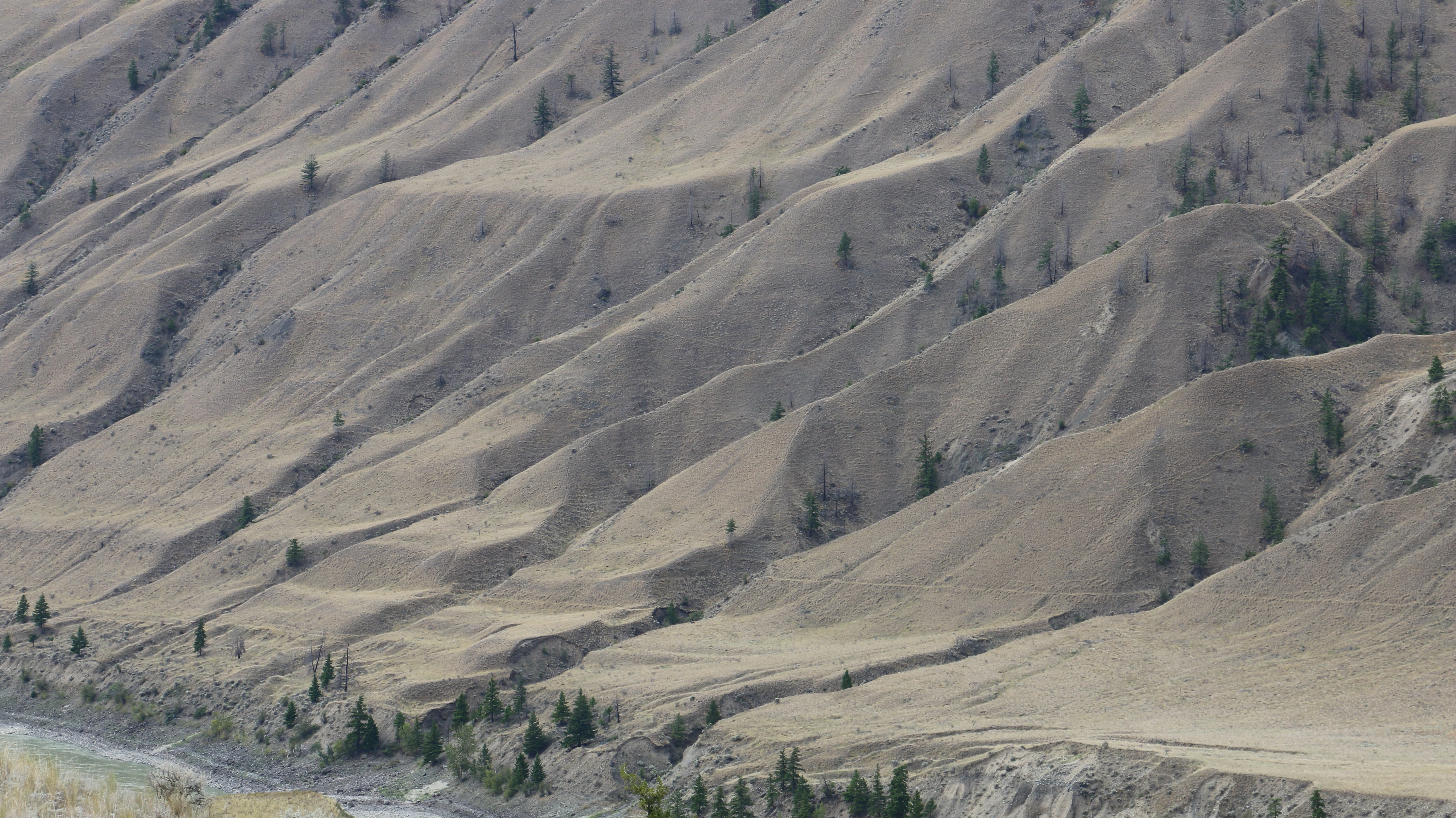
Wide view of dry, rolling hills with eroded slopes and scattered evergreen trees, with a river visible at the bottom left.
Bunchgrass and scattered conifers on eroded benchlands above the Fraser River.

Churn Creek Protected Area history and protected-area timeline

Long before it was a protected area, the Churn Creek landscape was shaped by thousands of years of human presence. Tsilhqot'in and Secwepemc First Nations people inhabited the area for at least 7,000 years, with communities such as the Tcexwe'ptem band using the Empire Valley. The arrival of Europeans in the wake of the mid-1800s Cariboo gold rush disrupted this Indigenous landscape profoundly. Smallpox, previously unknown to local peoples, devastated the Tcexwe'ptem in the 1860s, and survivors joined the Canoe and Dog Creek bands to the east.

In the late nineteenth century, ranching emerged as the dominant European land use in the region. Two large operations, the Empire Valley Ranch and the historic Gang Ranch, were established around Churn Creek and defined the working landscape well into the twentieth century.

The movement to protect Churn Creek began with national-level interest. Parks Canada identified the area as a potential national park because of its bighorn sheep populations and other wildlife values, but local ranching opposition halted that effort. After the Province of British Columbia completed a regional environmental assessment of the Cariboo in the 1990s, attention returned to Churn Creek. Rather than removing grazing from the landscape, the province negotiated a compromise that allowed cattle to continue on designated areas within the park. Churn Creek Protected Area was officially designated in 1995, and in 1997 the former Empire Valley ranch lands were added, expanding its footprint and consolidating grassland protection in the region.

Churn Creek Protected Area landscape and geographic character

The Churn Creek landscape is defined by the interplay between arid plateau country and deep river-carved canyons. The protected area occupies the southern margin of the Chilcotin Plateau, where rivers and creeks have incised the surface into a complex of benches, gullies, and steep-walled drainages. Churn Creek's own canyon is one of the most visually striking features, eroded into pillars and hoodoos that stand out against the otherwise open terrain.

Along the eastern edge, the Fraser River forms a long boundary, and the southern portion of the protected area follows the river's western bank into the lower Grinder and Lone Cabin Creek drainages. Several small lakes dot the otherwise dry landscape. To the west, the land rises sharply into the Camelsfoot Range, with elevations above 1,500 meters forming a dramatic backdrop and creating a clear altitudinal transition from steppe to forested ridge and alpine habitat.

The resulting scenery is open and expansive, with grasslands giving way to forested draws, rimrock, and canyon headwalls within short distances. This juxtaposition of dryland and canyon topography is one of the defining visual characteristics of Churn Creek.

Churn Creek Protected Area ecosystems, habitats, and plant life

Churn Creek Protected Area protects one of the most ecologically distinctive settings in British Columbia: an interior dryland steppe that sits beside, and depends on, surrounding forest, canyon, and riparian habitats. At lower elevations, the grasslands are dominated by bluebunch wheatgrass, with big sagebrush forming characteristic clumps across the benchlands. A particularly notable feature of these grasslands is the dense ground cover of lichens and mosses, which can blanket up to eighty percent of the surface beneath and between the vascular plants.

Where elevation increases, the open steppe shifts into Interior Douglas fir forest, while along rivers, creeks, and small lakes, deciduous trees such as aspen and poplar form copses and gallery stands. Together these vegetation layers create a grassland-forest mosaic that supports a wide range of wildlife and that is increasingly rare in a province where fire suppression and land use have reduced natural grassland extent.

The park's ecological significance is amplified by its protected status: Churn Creek is one of only five provincial parks in British Columbia dedicated specifically to grassland conservation, making it a critical refuge for arid-land habitats at this latitude.

Churn Creek Protected Area wildlife and species highlights

Wildlife is central to Churn Creek's identity and was the original reason Parks Canada evaluated the area for protection. California bighorn sheep are the area's most conspicuous residents. Several herds live within the protected area, some remaining year-round on the benchlands and others moving seasonally into nearby alpine country during the summer.

Mule deer are also well established in the park, sharing the open terrain with the bighorn. The grassland environment supports a rich community of smaller fauna, including bats, small rodents, and reptiles. Birdlife is particularly diverse. Grassland specialists such as Brewer's sparrow, long-billed curlew, and prairie falcon are joined by species such as Lewis's woodpecker, gyrfalcon, and short-eared owl. Recorded bats include the Western small-footed myotis, while reptiles include the rubber boa and gopher snake.

In the forested portions of the reserve, the fauna shifts accordingly. Forest-dependent species such as flammulated owl, Townsend's big-eared bat, and sharp-tailed grouse occupy the woodland habitat, rounding out a wildlife community that spans the gradient between dry steppe and forested uplands.

Churn Creek Protected Area conservation status and protection priorities

Churn Creek Protected Area exists primarily to safeguard one of British Columbia's rarest ecosystems: interior dryland grassland. Although the broader province is dominated by coniferous forest, the arid steppe country at Churn Creek represents a vanishingly small share of the total landscape. The reserve protects the watershed of Churn Creek, substantial frontage on the Fraser River, and important Canadian bighorn sheep habitat under a single designation.

Its IUCN Category VI status, which permits sustainable use of natural resources, reflects a deliberate compromise between ecological protection and the area's long ranching history. Designated grazing zones allow cattle to remain on the landscape while still maintaining the grassland communities that prompted protection in the first place. This arrangement is part of why the area transitioned from a proposed national park into a provincially managed protected area.

Churn Creek's conservation importance is also recognized through its inclusion among only five provincial parks in British Columbia specifically dedicated to preserving grassland ecosystems. The 1997 expansion to include the former Empire Valley Ranch lands further strengthened that role by bringing additional contiguous steppe and canyon habitat under protection.

Churn Creek Protected Area cultural meaning and human context

Churn Creek carries a layered human history that stretches back thousands of years. Tsilhqot'in and Secwepemc First Nations peoples used and inhabited the area for at least seven millennia, with groups such as the Tcexwe'ptem occupying the Empire Valley. The second half of the nineteenth century brought profound disruption through the Cariboo gold rush and the introduction of smallpox, which decimated Indigenous communities and reshaped regional demographics.

European settlement introduced a new land use based on large-scale cattle ranching. Operations such as the Gang Ranch and Empire Valley Ranch defined the post-1860s cultural landscape around Churn Creek, and elements of that ranching heritage remain visible today. The historic Gang Ranch lies just north of the protected area, and the Empire Valley Ranch lands were absorbed into the park during its 1997 expansion.

The continuing presence of cattle within designated grazing zones means Churn Creek is still a working landscape as well as a protected one, a feature that is now part of the area's identity rather than an obstacle to its conservation mandate.

Top sights and standout views in Churn Creek Protected Area

Churn Creek Protected Area is the place to encounter one of British Columbia's rarest ecological settings: a large, intact dryland steppe and canyon system sitting above the Fraser River. The combination of bluebunch wheatgrass grasslands, sagebrush stands, lichen-covered ground, and deeply eroded canyon features such as hoodoos gives the area a character found almost nowhere else in the province.

Its wildlife profile is equally distinctive, with resident California bighorn sheep herds, mule deer on the open benches, and a rich grassland bird community that includes long-billed curlew, Brewer's sparrow, and Lewis's woodpecker. Together with the surrounding Camelsfoot Range and the long sweep of the Fraser River shoreline, Churn Creek offers an unusually complete picture of south-central British Columbia's natural and human past.

Best time to visit Churn Creek Protected Area

Spring and early summer are generally the most rewarding seasons at Churn Creek, when the grasslands are green, wildflowers and sagebrush are actively growing, and grassland birds are most active. Cooler temperatures also make longer exploration of the open benchlands more comfortable.

Late summer and early autumn bring dry, warm conditions and a more golden character to the steppe, while also offering the best chances to observe bighorn sheep concentrated near water. Winters can be cold and snowy at higher elevations in the Camelsfoot Range, and access to canyon and rangeland areas typically becomes more limited under snow.
Monthly climate preview

Long-term temperature ranges and monthly precipitation averages across the protected terrain

Churn Creek Protected Area Climate Normals and Annual Weather Patterns

Historical coordinate data records measured monthly temperature variations and precipitation totals spanning twelve distinct intervals at Churn Creek Protected Area. Examining the full climate profile reveals detailed twelve-month meteorological statistics for deeper regional evaluation.
Annual mean3 °C
-8 °C15 °C
Jan-8°
Feb-6°
Mar-3°
Apr
May
Jun11°
Jul15°
Aug14°
Sep
Oct
Nov-4°
Dec-8°
Warmest month
July

14.6 °C

Coolest month
December

-7.9 °C

Wettest month
June

2.2 mm/day

Driest month
February

1.2 mm/day

Park location guide

Geography guide, regional context, and park location map for Churn Creek Protected Area

Churn Creek Protected Area park geography, regions, and map view in Canada

Understand where Churn Creek Protected Area sits in Canada through a broader geographic reading of the surrounding landscape, nearby location context, and its mapped position within the national park landscape.

How Churn Creek Protected Area fits into Canada

Canada is a federal parliamentary constitutional monarchy spanning North America from the Atlantic to the Pacific and Arctic Oceans. With a population of over 41 million, it is officially bilingual in English and French at the federal level. The country gained independence from the United Kingdom through a gradual process culminating in 1982.

Wider geography shaping Churn Creek Protected Area in Canada

Canada occupies the northern portion of North America, sharing its longest international border with the United States. The country extends from the Atlantic Ocean to the Pacific Ocean and northward into the Arctic Ocean, giving it the longest coastline of any nation.

Map view of Churn Creek Protected Area

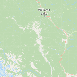
Use this park location map to pinpoint Churn Creek Protected Area in Canada, understand its exact geographic position, and read its mapped placement within the surrounding landscape more clearly.

Pigeon | © OpenStreetMap contributors

Location context for Churn Creek Protected Area

British Columbia

Explore photographic records of arid grasslands, deep canyons, and rare interior steppe environments.

Visualizing Churn Creek Protected Area Photos, Scenery, and Dryland Landscape Character

Photographs capture the expansive dryland terrain, sagebrush benchlands, and eroded hoodoo formations defining Churn Creek Protected Area. Visual documentation provides essential context for understanding the rugged canyon topography and rare grassland ecosystems preserved within the Chilcotin Plateau.

Wide view of dry, rolling hills with eroded slopes and scattered evergreen trees, with a river visible at the bottom left.

Wide landscape view of dry rolling hills and canyon terrain with sparse vegetation, rocky outcrops, and a partly cloudy sky.

Park atlas

Compare adjacent canyon reserves, dryland steppe, and regional protected terrain.

Explore Other Parks Near Churn Creek Protected Area and Surrounding Protected Landscapes

Browse nearby national parks and protected areas to compare regional geography beyond Churn Creek Protected Area. Analyzing adjacent dryland steppe and canyon reserves reveals broader ecological patterns across south-central British Columbia.
State or regional parkBritish Columbia
About 59 km away#1 closest

Southeast

Edge Hills Provincial Park: Mapping the Fraser Canyon and Interior British Columbia Geography

A remote protected fore-range between canyon and mountain

Edge Hills Provincial Park offers a study in interior British Columbia topography, where dramatic vertical relief from the Fraser River canyon meets high-elevation rolling hills. This undeveloped preserve highlights the transition between coniferous forests and dry grasslands, providing a distinct geographic perspective for those interested in Canadian protected landscapes and rugged mountain terrain.

Area
118.82 km²
Established
1995
IUCN
II
Relief
Mountain
State or regional parkBritish Columbia
About 85 km away#2 closest

Southeast

Marble Canyon Provincial Park: A Geological Exploration of British Columbia's Limestone Terrain

Mapping the canyons, mountain lakes, and microbialite ecosystems of the Marble Range.

Marble Canyon Provincial Park provides a dense concentration of natural features in British Columbia. The area protects a deep, river-carved limestone gorge, surrounding mountain slopes, and the distinct carbonate structures of Pavilion Lake. This site serves as a vital natural laboratory for geological and scientific research while offering an accessible landscape of cliffs and clear interior waters.

Area
25.44 km²
Established
1956
IUCN
II
Relief
Mountain
A watercolor illustration showing a river winding through a valley with soft colored hills, a sandy bank in the foreground, and sparse trees along the shore.
State or regional parkBritish Columbia
About 125 km away#3 closest

Southeast

Juniper Beach Provincial Park: Geography and Protected Landscapes in British Columbia

Arid sagebrush steppe along the Thompson River corridor

Juniper Beach Provincial Park preserves a specialized pocket of desert ecology within British Columbia. Spanning 260 hectares, the area features a flat riverfront beach, steep bluffs, and open sagebrush slopes. This protected landscape offers a study in interior plateau geography, bridging the gap between riparian river systems and the dry, sun-exposed terrain of the Thompson Country.

Area
2.6 km²
Established
1989
IUCN
II
Relief
Lowland
A watercolor illustration of a mountain range behind a calm lake with evergreen trees and grassy banks.
State or regional parkBritish Columbia
About 128 km away#4 closest

South

Joffre Lakes Provincial Park: Geographic Atlas of Southwestern British Columbia Mountains

Glacial valleys and alpine wilderness protected areas

Joffre Lakes Provincial Park serves as a benchmark for alpine geography in British Columbia, showcasing a compact amphitheater of polished bedrock, moraines, and intense turquoise lakes. This protected area offers a focused look at the intersection of glacial hydrography and high-mountain terrain within the Coast Mountains, illustrating how meltwater and high-altitude peaks define this regional ecosystem.

Area
14.87 km²
Established
1996
Relief
Mountain
Climate
Alpine
A horizontal watercolor painting depicting a light, airy landscape with distant snow-capped mountains, rolling green hills, and coniferous forest edges.
State or regional parkBritish Columbia
About 141 km away#5 closest

South

Garibaldi Provincial Park: An Atlas of Volcanic and Glacial Terrain in British Columbia

Protected wilderness in the Garibaldi Volcanic Belt

Garibaldi Provincial Park preserves a massive expanse of mountainous wilderness, defined by iconic landmarks such as The Black Tusk and Garibaldi Lake. The park represents a crucial study in vertical zonation, transitioning from temperate coastal forests to vast alpine meadows, glaciers, and jagged volcanic summits. Analyze the geological history and mapped protected boundaries that shape this significant British Columbia conservation area.

Area
1,950 km²
Established
1920
IUCN
II
Visitors
136K annual
State or regional parkBritish Columbia
About 149 km away#6 closest

East

Porcupine Meadows Provincial Park: Protected Interior Landscapes and Plateau Geography

High-elevation sub-alpine meadows on the Bonaparte Plateau

Porcupine Meadows Provincial Park serves as a critical protected area within the interior of British Columbia. The terrain is characterized by expansive sub-alpine meadows, boggy wetland complexes, and mature old growth forest stands. This remote high-elevation environment offers a unique look at the plateau geography situated west of the North Thompson River, highlighting the transition between alpine habitats and forest interior.

Area
27.04 km²
Established
1996
IUCN
II
Relief
Upland
A horizontal watercolor illustration depicting gentle green hills, a small grove of trees, and a pale ground plane against a white background.
Protected areaBritish Columbia
About 164 km away#7 closest

Southeast

Lac du Bois Grasslands Protected Area: Mapped Geography and Interior Plateau Landscapes

Exploring dryland ecosystems and native prairies in British Columbia.

Located in the Thompson-Nicola Regional District, this protected area spans over fifteen thousand hectares of rolling hills and elevated rocky benches. It remains a flagship example of interior plateau conservation, preserving a unique ecological gradient that stretches from arid sagebrush-covered terrain up into denser montane coniferous forest communities.

Area
157.12 km²
Established
1996
IUCN
II
Relief
Upland
A watercolor painting showing a soft-focus landscape with rolling green hills, distant mountains, and a central river or water feature.
State or regional parkBritish Columbia
About 196 km away#8 closest

South

Golden Ears Provincial Park: Geographic Atlas and Protected Landscape Overview

Coast Mountains terrain and protected wilderness boundaries

Golden Ears Provincial Park is a major protected wilderness in British Columbia, defined by the twin peaks of the Golden Ears massif and vast glacial lake systems like Alouette and Pitt. This site serves as a vital ecological corridor where lowland forests meet high subalpine ridges. Explore the park through its mapped boundaries and diverse ecological zones within the Pacific Northwest mountain landscape.

Area
609 km²
Established
1967
IUCN
II
Visitors
956.5K annual

Common questions about visiting, size, designation, and location context for Churn Creek Protected Area

Churn Creek Protected Area FAQs for park facts, access, geography, and protected area context

Find quick answers about Churn Creek Protected Area, including protected-area facts, park geography, trail and visitor context, and how the park fits into its surrounding country and regional landscape.
MoriAtlas Explorer

Continue Your Protected Areas Search Across the Global Atlas

Deepen your exploration by continuing the structured search for national parks and protected areas worldwide. Utilize the comprehensive filtering capabilities to compare different conservation landscapes and refine your understanding of global park geography. Discover more about the distribution and characteristics of protected natural areas.

Global natural geography