Why Conguillío National Park stands out
Conguillío National Park is best known for its striking volcanic landscapes where islands of lush forest stand in vivid contrast to vast expanses of lava flows. The park harbors some of the finest remaining araucaria forests in the world, a species that predates the dinosaurs and is sacred to the indigenous Mapuche people. The symmetrical cone of Llaima volcano and the panoramic views from Sierra Nevada's five lookout points are among the park's most recognizable features. The park is also famous for its distinctive "Los Paraguas" (The Umbrellas) landscape, named for the umbrella-like canopy shape of mature monkey puzzle trees.
Conguillío National Park history and protected-area timeline
Conguillío National Park was established in 1950, formalizing protection for this ecologically and geologically significant area of the Chilean Andes. In 1983, the park received international recognition when it was designated, together with the Alto Bío Bío National Reserve, as part of the Araucarias Biosphere Reserve by UNESCO. This designation acknowledged the park's importance in conserving the world's last remaining araucaria forests and the unique biodiversity they support. The park's significance continued to grow when it became part of the Kütralkura Geopark, which was officially recognized as a member of UNESCO's Global Geoparks Network on April 17, 2019. This geopark status highlights the exceptional geological heritage of the region, including its volcanic formations, lava flows, and the active volcanic systems that have shaped the landscape over millions of years. The park has also gained cultural prominence as a filming location for the BBC television series "Walking with Dinosaurs," which showcased its dramatic volcanic scenery.
Conguillío National Park landscape and geographic character
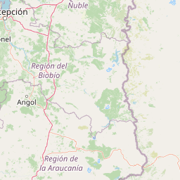
The landscape of Conguillío National Park is defined by its volcanic origin and the resulting contrast between stark lava fields and verdant forest islands. The park's terrain rises from the shores of Conguillío Lake at approximately 1,000 meters elevation to the peaks of its two major volcanoes. Llaima volcano reaches 3,125 meters and presents a classic stratovolcano profile, while Sierra Nevada, though slightly lower, offers extensive panoramic views from its five designated lookout points. The park's most distinctive visual feature is the pattern of vegetation islands that emerge from extensive lava flow areas, creating a archipelago-like pattern across the volcanic terrain. These lava flows, some dating back thousands of years, create a stark backdrop of black volcanic rock against the green of the araucaria and Nothofagus forests. The park contains several significant water bodies beyond Conguillío Lake, including Laguna Captrén and the Truful-Truful river system with its notable waterfalls. The rivers Lonquimay and Biobío originate in or flow through the park region, adding to the aquatic diversity of the landscape.
Conguillío National Park ecosystems, habitats, and plant life
The ecological character of Conguillío National Park is defined by its montane forests dominated by the ancient araucaria (Araucaria araucana), a species that represents one of the oldest living conifers on Earth. These monkey puzzle trees can live for over a thousand years and form the backbone of the park's forest ecosystem. The araucaria forests are interspersed with various Nothofagus species, creating a mosaic of forest types that varies with elevation and microclimate. At lower elevations, coigüe and roble dominate, while higher elevations feature lenga and the hardy ñirre that can survive in harsher conditions. The understory contains a rich variety of shrubs, ferns, and herbaceous plants adapted to the cool, humid conditions of the Chilean Andes. The park's position within the Araucarias Biosphere Reserve reflects its global importance for conserving this ancient forest type, which has been significantly reduced across its historical range by logging and land conversion. The volcanic soils and varied topography create numerous microhabitats, supporting the park's notable biodiversity.
Conguillío National Park wildlife and species highlights
Conguillío National Park supports a diverse mammal fauna that includes several species of conservation significance. The park provides habitat for the pudú, one of the world's smallest deer species, as well as the elusive kodkod cat, one of the rarest felines in the Americas. Puma, the largest predator in the region, roams the park's forests and volcanic terrain, while both culpeo and chilla foxes are relatively common. The monito-del-monte, a small marsupial unique to southern South America, inhabits the forest understory. The park is equally notable for its birdlife, with over thirty bird species documented within its boundaries. Waterfowl and wading birds are abundant around the lakes and wetlands, including the Andean duck, ashy-headed goose, black-faced ibis, and various grebes and coots. Raptors soar above the volcanic peaks, with the Andean condor being the most iconic, while crested caracaras, variable hawks, and Chilean hawks hunt across the meadows and forests. The forest interior supports woodpeckers including the Magellanic woodpecker, as well as numerous passerines such as the Austral blackbird, Chilean mockingbird, and various finches and sparrows.
Conguillío National Park conservation status and protection priorities
Conguillío National Park plays a crucial role in conserving some of the last remaining old-growth araucaria forests in the world. The park's designation as part of the UNESCO Araucarias Biosphere Reserve in 1983 recognized its global significance for biodiversity conservation, specifically for protecting the araucaria species that once dominated vast areas of southern South America. The park's inclusion in the Kütralkura Geopark since 2019 adds geological conservation to its mandate, protecting the volcanic landscapes and active geological processes that shape the ecosystem. The protection of habitat for endangered species like the kodkod and pudú further underscores the park's conservation importance. The management by CONAF includes monitoring volcanic activity, maintaining trails, and managing visitor impacts to ensure the long-term health of the park's ecosystems. The park's dual designation as both a national park and biosphere reserve provides layered protection that addresses both ecosystem conservation and sustainable use of natural resources.
Conguillío National Park cultural meaning and human context
The cultural significance of Conguillío National Park is deeply intertwined with the indigenous Mapuche people, whose ancestral lands encompass much of the Araucanía Region. The park's name itself derives from the Mapudungun language, the tongue of the Mapuche, meaning "water with araucaria seeds" – a direct reference to the relationship between the landscape and its iconic tree. The araucaria holds particular cultural importance for the Mapuche, who have traditionally harvested its seeds as a food source and consider the tree sacred. This cultural connection adds depth to the park's ecological significance, linking contemporary conservation efforts to centuries of indigenous stewardship. The Mapuche have inhabited this volcanic landscape for millennia, developing cultural practices and knowledge systems that are intimately connected to the rhythms of the forest and the mountain.
Top sights and standout views in Conguillío National Park
The most compelling highlights of Conguillío National Park include the dramatic volcanic scenery centered on the active Llaima volcano, whose frequent eruptions have shaped much of the park's landscape. The ancient araucaria forests, some containing trees over a thousand years old, represent living relics of prehistoric ecosystems and provide unparalleled opportunities to experience one of Earth's oldest tree species. The panoramic views from Sierra Nevada volcano's five lookout points offer sweeping vistas across the park's volcanic terrain and forest archipelago. Conguillío Lake itself is a striking natural feature, its waters reflecting the volcanic peaks and providing a focal point for the park experience. The network of hiking trails, including the path around Laguna Captrén and the route through the ancient araucaria forests to the "Araucaria Mother" tree, provides access to the park's most scenic locations.
Best time to visit Conguillío National Park
The optimal time to visit Conguillío National Park is during the Southern Hemisphere spring and summer months from November to March, when weather conditions are most favorable and the park's roads are in excellent condition. During this period, temperatures are mild, vegetation is lush, and visitors can fully access the trail network across the park. The summer months offer the longest days and most reliable access to high-elevation areas including the Sierra Nevada viewpoints. For those interested in skiing, the winter months (June to September) provide access to the Araucarias ski center located on the western slopes of Llaima volcano. The ski facility offers basic amenities including cable tows, equipment rental, and mountain refuge lodging, though visitors should be prepared for winter mountain conditions and potential road closures due to snow.