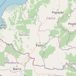
Why Cueva de los Guácharos National Natural Park stands out
Cueva de los Guácharos is most renowned for being Colombia's first national park, established in 1960 and setting the precedent for the country's modern protected area network. The park protects one of the last intact oak forests in Colombia, featuring both Quercus humboldtii and the rare Trigonobalanus excelsa, a relict species of global botanical significance. The oilbird colonies that inhabit the park's caves provide one of the most accessible opportunities to observe this unique bird species in its natural roosting habitat. The transition between cloud forest and páramo ecosystems within a single protected area makes this site particularly valuable for understanding tropical mountain ecology and climate change impacts on Andean biodiversity.
Cueva de los Guácharos National Natural Park history and protected-area timeline
Cueva de los Guácharos was established on November 9, 1960, making it the oldest national park in Colombia and one of the earliest protected areas in South America. The park's creation represented a pioneering effort by the Colombian government to preserve its natural heritage at a time when conservation awareness was still emerging in the region. The selection of this particular area for protection was driven by the unique cave systems inhabited by oilbirds and the exceptional biological richness of the Andean cloud forest. Following its establishment, the park became a founding element of what would later develop into Colombia's National Natural Parks System (Sistema de Parques Nacionales Naturales), which now encompasses more than 60 protected areas across the country. The park has maintained its protection status continuously since 1960, surviving periods of political instability and economic pressure that have threatened other protected areas in Latin America.
Cueva de los Guácharos National Natural Park landscape and geographic character
The physical landscape of Cueva de los Guácharos is defined by the steep eastern face of the Colombian Andes, where elevation changes occur dramatically over short distances. The terrain consists of parallel mountain ridges separated by deep river valleys that carry water from the high páramo down to the Amazon basin. The underlying geology is dominated by limestone formations that have been dissolving over geological time to create the cave systems that characterize the park. These karstic zones feature sinkholes, underground rivers, and natural tunnels that add to the dramatic topography. The cloud forest zone features slopes often exceeding 45 degrees, with vegetation clinging to the terrain in ways that create a visually striking landscape where the canopy appears to flow like a green river down the mountain valleys. Above the tree line, the páramo presents a different visual character, with rolling grasslands punctuated by rock outcrops and scattered shrub vegetation that survives in this harsh environment.
Cueva de los Guácharos National Natural Park ecosystems, habitats, and plant life
The ecological significance of Cueva de los Guácharos stems from its role as a transitional zone between two of the most biodiverse ecosystems on Earth: the tropical Andes and the Amazon rainforest. The cloud forest that dominates the lower elevations receives persistent mist and fog throughout the year, creating conditions that support extraordinary biodiversity including numerous endemic plant and animal species. The park contains one of the last remaining intact oak forests in Colombia, featuring the native Andean oak Quercus humboldtii alongside Trigonobalanus excelsa, a relict species whose closest relatives are found in Southeast Asia, suggesting ancient dispersal patterns across the tropics. The páramo ecosystem above the cloud forest represents a unique adaptation to tropical high-altitude conditions, with specialized plant species that have evolved to survive frosty nights and intense solar radiation during the same day. These ecosystems together create a vertical gradient of biodiversity that makes the park a living laboratory for understanding tropical mountain ecology.
Cueva de los Guácharos National Natural Park wildlife and species highlights
The wildlife of Cueva de los Guácharos reflects the park's position at the intersection of Andean and Amazonian faunal communities. Bird surveys have recorded 296 species within the park, making it an important area for avian conservation in Colombia. The park's namesake species, the oilbird, roosts in colonies within the dark caves, feeding on fruit in the surrounding forest at night and using echolocation to navigate in the darkness. Among the park's mammal species, the woolly monkey (Lagothrix lagotricha) represents a vulnerable species that depends on the cloud forest for habitat. The spider monkey (Ateles paniscus) and capuchin monkey (Cebus apella) also occur in the forest canopy. The park provides habitat for several species of deer including the páramo deer (Mazama americana and Mazama rufina) and the tiny pudu (Pudu mephistophiles), one of the world's smallest deer species. Perhaps most notably, the park shelters the mountain tapir (Tapirus pinchaque), a threatened species that inhabits the páramo zone and represents an evolutionary lineage that survived the Pleistocene extinction that eliminated most other large mammals in the Americas.
Cueva de los Guácharos National Natural Park conservation status and protection priorities
Cueva de los Guácharos represents one of the most important conservation priorities in Colombia due to its role as a protected area that has maintained ecological integrity for more than six decades. The park protects critical habitat for species that are threatened across their ranges, including the mountain tapir, woolly monkey, and spider monkey, all of which face pressure from habitat loss and hunting outside protected boundaries. The intact oak forest within the park is of particular conservation value because oak forests throughout Colombia have been extensively cleared for agriculture and cattle ranching, making the old-growth stands in Cueva de los Guácharos increasingly rare. The páramo ecosystem, which stores large amounts of carbon in its soils and regulates water flow to lower elevations, faces mounting pressure from climate change and land conversion. As one of the oldest continuously protected areas in Colombia, the park provides a reference point for understanding how Andean ecosystems function in the absence of significant human disturbance.
Cueva de los Guácharos National Natural Park cultural meaning and human context
The name Guácharo derives from the indigenous Spanish term for the oilbird, a species that holds cultural significance in the region due to its distinctive appearance and unusual nocturnal behavior. The cave systems that give the park its name have been known to local communities for generations, and the oilbird colonies represent a natural phenomenon that has attracted visitors and researchers alike since the colonial era. The park lies within territory that has been traditionally inhabited by indigenous peoples, though the specific cultural history of human interaction with this landscape is not extensively documented in available sources. The establishment of the park in 1960 represented a turning point in how the Colombian state related to its natural landscapes, moving from exploitation to preservation of areas considered to hold outstanding universal value.
Top sights and standout views in Cueva de los Guácharos National Natural Park
The combination of ecological diversity, historical significance, and accessibility makes Cueva de los Guácharos a distinctive protected area in the Colombian park system. As the nation's oldest national park, it carries special significance in Colombian conservation history and serves as a symbol of the country's commitment to protecting its natural heritage. The opportunity to observe oilbirds in their natural cave habitat, combined with the dramatic mountain scenery and the chance to walk through both cloud forest and páramo within the same visit, creates a rich experience for visitors. The presence of old-growth oak forests and the endangered mountain tapir adds scientific value to the park's attractions, making it relevant for both conservation research and environmental education.
Best time to visit Cueva de los Guácharos National Natural Park
The park can be visited year-round due to its location in the tropical Andes, though visitors should expect cloudy and misty conditions throughout the year in the cloud forest zone. The driest period typically occurs from December through February, when precipitation is somewhat reduced and visibility may improve for viewing landscapes and wildlife. The wetter months from April through June and again from September through November bring more frequent rainfall and fog, which while sometimes challenging for hiking, create the atmospheric conditions that sustain the cloud forest ecosystem. Temperature decreases with elevation, and visitors exploring the páramo zone should be prepared for cold, windy conditions regardless of the season. The park's higher elevations may experience frost at night even during the dry season.