
Why Dillinger See stands out
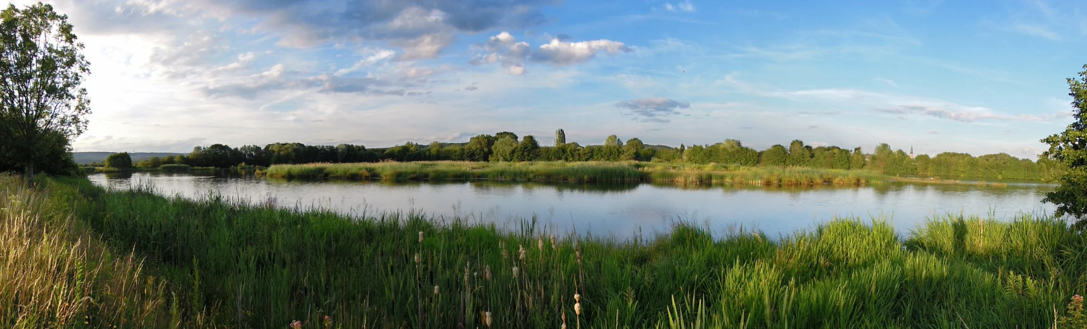
The Dillinger See is primarily known as a birdwatching destination within a designated EU bird protection area. Its combination of reed zones, shallow water areas, and a partly submerged artificial island creates habitat for swans, ducks, geese, cormorants, herons, storks, rails, grebes, gulls, and many songbirds. More than 130 bird species have been recorded from the shore, the lake's island, and dedicated observation points built along the trail. Equally distinctive is the lake's origin as a former Saar oxbow that was reactivated as part of Saar River expansion work in the 1980s. Originally created as a compensatory measure for lost floodplain land and to help regulate the Saar during high water events, the lake has been actively redesigned by conservation groups over more than a decade to improve its value for waterbirds and aquatic wildlife.
Dillinger See history and protected-area timeline
The Dillinger See as it exists today is a product of the large-scale modernization of the Saar River that took place in the 1980s. During those works, a former Saar oxbow on the western edge of Dillingen/Saar was reactivated as a compensating measure for floodplain areas lost to the river expansion, giving the area a new permanent body of water. From the outset, the lake was designed to support flood regulation for the Saar, holding and slowly releasing excess water during high-water periods.
During the construction of the lake, a shipwreck from the eighteenth century was discovered in the northern part of the water body. The find was documented by the regional monument conservator Alfons Kolling, and after scientific evaluation the wreck was left in place, reflooded, and marked on the nearby bank with an information panel. Nearby, a memorial in the form of an anchor recalls the historical 'Pähter Bock' transfer point on the riverbank, which once served the nearby Dillinger Hütte ironworks as a loading place.
The modern ecological profile of the lake developed in stages beginning in the early 2000s. In 2004 the area was formally designated as an EU bird protection area under the Habitats Directive. Between 2006 and 2014 the NABU Saarlouis/Dillingen chapter, together with the Saarland Ministry for the Environment and the State Office for the Environment and Occupational Safety, carried out an extensive redesign of the shoreline and the lake's island, leveling previously steep banks and reshaping the island to create new shallow-water zones and deeper water pockets. An observation hill on the eastern shore was created during this period, and in 2014 a four-meter observation tower was built on the western shore in cooperation with the city of Dillingen, formalizing the lake's role as a structured birdwatching and nature observation site.
Dillinger See landscape and geographic character
The Dillinger See lies in a former floodplain, or Auenlandschaft, of the Saar River. The lake itself runs from south to north along the river, with the Saar itself lying just to the east. To the south the lake is bordered by the L355 road, and to the north it connects to a roughly 3.6 kilometer circular walking trail that traces much of the elevated edge of the floodplain.
Dillinger See ecosystems, habitats, and plant life
The lake's vegetation pattern is shaped strongly by its floodplain setting. The shoreline is densely covered with trees and shrubs, and pronounced reed belts, or Schilfzonen, line large portions of the water's edge. The artificial island in the northern part of the lake was originally created as a bird breeding site and, after the NABU redesign work, now includes deliberately lower sections and varied depths to support different habitat conditions.
Among the plant species of note are the rare Rion's water buttercup (Rions Wasserhahnenfuß) and the fragile stonewort (Zerbrechliche Armleuchteralge), both of which are uncommon elements of the local flora. The interplay of reed zones, shallow water pockets, deeper pools, and vegetated banks makes the lake a compact but ecologically layered wetland environment within what is otherwise a heavily settled and industrially shaped part of the Saar valley.
Dillinger See wildlife and species highlights
The Dillinger See is, above all, a bird site. Mute swans, ducks, and geese are regular presences, alongside cormorants, herons, storks, birds of prey, grebes, rails, gulls, and many songbird species. More than 130 species have been recorded overall, and the redesign of the island and shoreline has been explicitly aimed at supporting breeding and feeding conditions for these birds.
Dillinger See conservation status and protection priorities
Conservation is the central reason the Dillinger See is significant today. Since 2004 the surrounding area, totaling about 80 hectares, has been recognized as an EU bird protection area under the Habitats Directive, giving the lake a binding protected status beyond its role as a local recreation site.
The NABU Saarlouis/Dillingen chapter has been the principal driver of the lake's ecological development. Between 2006 and 2014 the group reshaped several hundred meters of previously steep shore, remodeled the island to create new shallow water and deeper zones, and built observation infrastructure on the eastern and western banks. The state Ministry for the Environment and the State Office for the Environment and Occupational Safety supported the project, and the city of Dillingen partnered in the construction of the western observation tower in 2014.
Dillinger See cultural meaning and human context
The lake's setting carries visible traces of the region's industrial and transport history. The eighteenth-century shipwreck found during construction, and the anchor memorial on the northern trail recalling the 'Pähter Bock' loading point of the Dillinger Hütte ironworks, link the wetland landscape to the Saar valley's long-standing role as a corridor for river commerce and heavy industry.
A separate layer of local memory comes from the Second World War. On 20 November 1944, a US P-47 Thunderbolt was shot down over Pachten and came down in the area of what is now the Dillinger See. Sondage and recovery efforts by American, German, and local historical groups between 2000 and 2014 recovered only small fragments of the aircraft and unspent phosphorus bombs; the fate of pilot James G. Newman remains unresolved, and the site has become a quiet, ongoing element of the local wartime memory.
Top sights and standout views in Dillinger See
The Dillinger See packs several strong identity markers into a small area: a protected EU bird sanctuary of roughly 80 hectares, a lake originating from an old Saar oxbow, and a long-running NABU-led redesign that has reshaped shoreline and island habitats. Record-keeping from its observation hills and tower has produced a bird list of more than 130 species, and the circular trail around the lake makes it straightforward to combine a short walk with birdwatching.
Equally distinctive is the layered historical record at the site: an eighteenth-century river wreck preserved in situ, an industrial-era anchor memorial tied to the Dillinger Hütte, and an unresolved Second World War story connected to a downed P-47 Thunderbolt. Together these features give the lake a character that goes well beyond its modest size.
Best time to visit Dillinger See
As an ecological lake and bird sanctuary rather than a developed tourism destination, the Dillinger See is broadly usable year-round for walks and birdwatching. Spring and early summer tend to coincide with the most active breeding and singing bird season, when wetland species are most visible around the reed zones and the island. Autumn brings migration and seasonal gathering of waterfowl, while winter can offer calmer observation conditions and clearer sightlines, depending on ice.
For casual visitors from the surrounding region, mild weather in the warmer half of the year is generally the most pleasant window for walking the 3.6 kilometer loop, while dedicated birdwatchers may time visits to dawn or dusk in any season to make the most of the lake's quiet character. Because direct access to the water is restricted, the experience is shaped by the observation points and the circular trail rather than by seasonal facilities.