
Why Eagle Cap Wilderness stands out
Eagle Cap Wilderness is best known for its high alpine terrain in the Wallowa Mountains, particularly its bare granite peaks, U shaped glacial valleys, and more than 60 named alpine lakes, including Legore Lake, one of Oregon's highest lakes. Sacajawea Peak and around thirty summits rising above 8,000 feet give the wilderness a distinctly high elevation character. The wilderness is also recognized as the headwaters landscape for four Wild and Scenic Rivers (the Lostine, Eagle Creek, Minam, and Imnaha), tying its identity to both mountain scenery and nationally designated waterways. Beyond landscape, Eagle Cap is known for its restored wildlife presence, including bighorn sheep, elk, mountain goats, and recolonizing wolf packs such as the Minam Pack, which makes it an important reference area for large carnivore recovery in Oregon.
Eagle Cap Wilderness history and protected-area timeline
The lands now protected as Eagle Cap Wilderness have a deep human history long predating formal wilderness designation. Archaeological context suggests that ancestors of the Nez Perce Indian tribe occupied the Wallowa Mountains roughly from around 1400 AD, later joined or followed by the Cayuse, Shoshone, and Bannock peoples, who used the high country for hunting bighorn sheep and deer and for gathering huckleberries. The area served as a summer homeland for the Joseph Band of the Nez Perce people, tying the Wallowa landscape closely to Indigenous identity and seasonal land use.
Euro American settlement of the Wallowa Valley began in 1860, gradually introducing new pressures on the landscape. By the early twentieth century, domestic sheep grazing had reached levels that exceeded the carrying capacity of the wilderness, and shortly after World War II, the decline of the wool industry led to a dramatic drop in sheep numbers across the area. In 1930, the Eagle Cap region was formally established as a primitive area, marking the first step toward federal protection.
In 1940, the primitive area was redesignated as a wilderness area, giving Eagle Cap one of the earliest formal wilderness recognitions in the western United States. The passage of the Wilderness Act of 1964 expanded the federal wilderness system nationwide, and Eagle Cap was included in the new National Wilderness Preservation System that same year. A 1972 boundary revision added approximately 73,000 acres to the wilderness, while the Wilderness Act itself contributed around 66,100 additional acres, producing roughly the present day extent of the protected area.
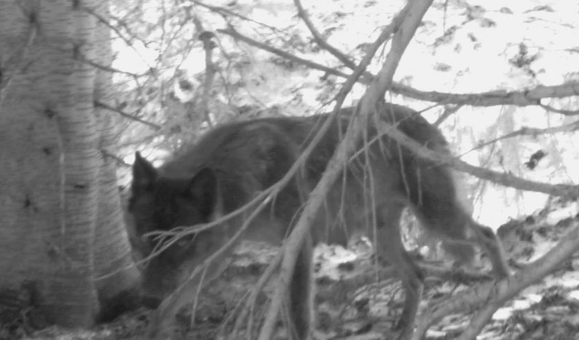
More recent history has been shaped by ecological recovery, including the recolonization of gray wolves. Wolves returned to Eagle Cap in the early 2010s, with the Minam Pack establishing a presence along the Upper Minam River and the Catherine Pack later forming in the wilderness from a pair bond between a Minam Pack female and a Snake River Pack male. These developments have added a new chapter to the wilderness's wildlife history and given it significance for large carnivore recovery in Oregon.
Eagle Cap Wilderness landscape and geographic character
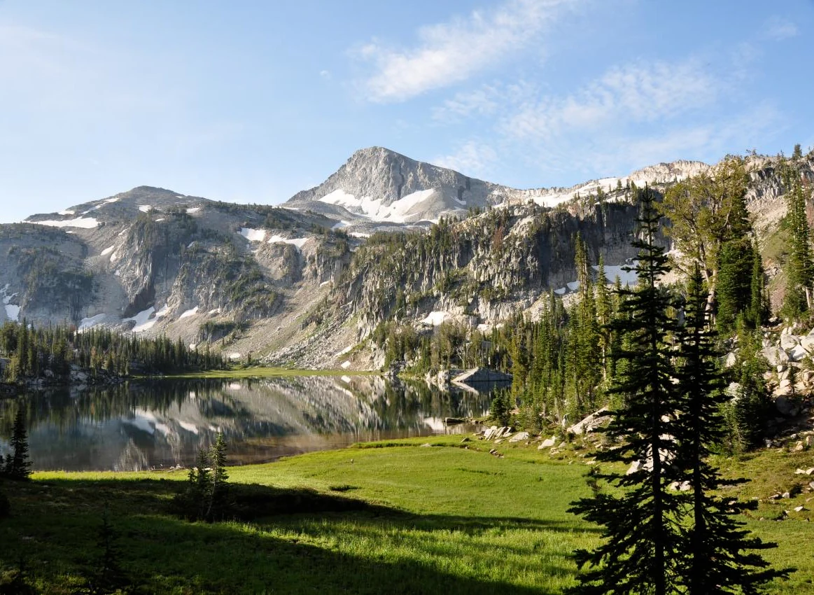
Eagle Cap Wilderness is a high mountain landscape defined by glacial sculpting. The terrain features U shaped valleys carved by past glaciation, separated by sharp ridges of bare granite and broad alpine plateaus dotted with lakes and meadows. Elevations climb rapidly from around 3,000 feet in the lower valleys to 9,838 feet at the summit of Sacajawea Peak, with roughly thirty additional summits exceeding 8,000 feet across the range.
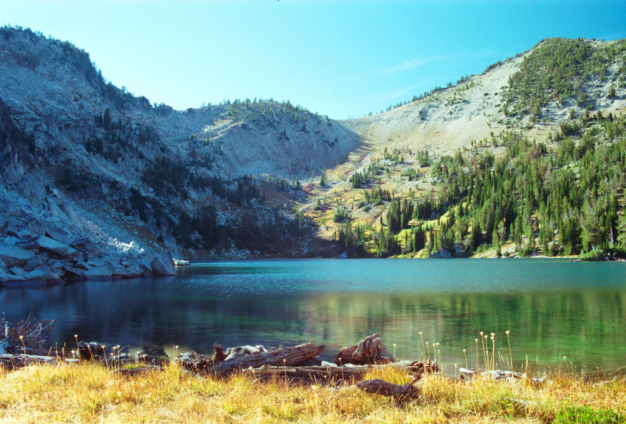
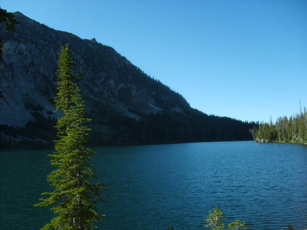
The wilderness includes more than 60 named alpine lakes and tarns, twelve of which sit above 8,000 feet. Legore Lake, at 8,950 feet, is among the highest true lakes in Oregon. Together with over 37 miles of streams, these water features give many basins a layered, reflective quality and produce the headwaters for several major river drainages. Thick coniferous forest covers the lower valleys, while scattered alpine timber and krummholz appear higher up, transitioning into open rock and meadow near the summits.
Four Wild and Scenic Rivers originate within the wilderness, including the Lostine River, Eagle Creek, the Minam River, and the Imnaha River, each descending from the high country in deeply cut valleys that define the edges of Eagle Cap. Viewpoints such as the Hurricane Creek Trail and locations around Mirror Lake and Aneroid Lake show the variety of the landscape, from forested approaches to expansive cirques and lake filled basins.
Eagle Cap Wilderness ecosystems, habitats, and plant life
Eagle Cap Wilderness spans an unusually broad ecological gradient, which is the foundation of its biological richness. Low elevation grasslands and ponderosa pine forests anchor the warmer, drier foothills, while dense mixed conifer stands cover middle elevation slopes. Higher up, forests transition to cold adapted species, including Engelmann spruce, subalpine fir, mountain hemlock, larch, and whitebark pine, with occasional small groves of old growth forest sheltered in less fire exposed pockets.
Above treeline, the wilderness opens into alpine meadows and rocky slopes supporting a rich community of wildflowers, including Indian paintbrush, sego lilies, elephanthead, larkspur, shooting stars, and bluebells. These meadows form a colorful but fragile layer of vegetation in the high basins, often ringing the alpine lakes. The combination of wet meadows, talus, exposed ridge, and forested valley creates a mosaic of habitat types that supports a wide variety of species.
Aquatic habitats are also ecologically important. The numerous alpine lakes and more than 37 miles of streams provide habitat for trout and serve as nesting and feeding areas for a range of bird species. The watershed origins of four Wild and Scenic Rivers link the wilderness to downstream aquatic systems in the Wallowa Mountains and beyond.
Eagle Cap Wilderness wildlife and species highlights
Eagle Cap Wilderness supports a notably diverse wildlife community for a single protected area. Large mammals characteristic of the Wallowa Mountains are well represented, including black bears, cougars, Rocky Mountain bighorn sheep, and mountain goats. In summer, the meadows and slopes are inhabited by white tailed deer, mule deer, and Rocky Mountain elk, which use the wilderness as important seasonal range.
Smaller mammals are equally characteristic of the alpine and subalpine habitats. Pikas live among the talus slopes, while pine martens, wolverines, badgers, marmots, and various squirrels occupy different parts of the vertical landscape. Wolverines, in particular, are among the more elusive and ecologically sensitive species associated with this wilderness.
The birdlife includes several high profile raptors and mountain adapted songbirds. Peregrine falcons, bald eagles, golden eagles, and ferruginous hawks nest or hunt across the wilderness, while the gray crowned rosy finch is among the notable alpine songbirds. Many lakes and streams hold trout populations, with the area known for trophy sized fish.
Wolves have returned to Eagle Cap in recent years. The Minam Pack, first confirmed in the early 2010s east of the Minam River, became a focal point for wolf monitoring in Oregon, with multiple packs documented in the broader area. The Catherine Pack later formed within the wilderness from a pair bond between wolves of the Minam and Snake River packs. While no human encounters have been reported, occasional livestock losses have been attributed to wolves in areas adjacent to grazing lands.
Eagle Cap Wilderness conservation status and protection priorities
Eagle Cap Wilderness is significant from a conservation standpoint because of its size, vertical range, and ecological completeness. As Oregon's largest wilderness area, it preserves a continuous block of high mountain habitat large enough to support population level ecological processes for wide ranging species such as elk, mountain goats, bighorn sheep, wolverines, and wolves. Its protected status under the National Wilderness Preservation System adds an additional layer of regulatory protection that limits road building, motorized access, and development.
The wilderness is also important for watershed conservation. The headwaters of the Lostine, Eagle Creek, Minam, and Imnaha Rivers all originate within Eagle Cap, and four distinct Wild and Scenic River designations reflect the recognized ecological and scenic value of these waters. Protecting these high elevation watersheds helps maintain downstream water quality, native trout populations, and aquatic habitat connectivity across a large portion of northeastern Oregon.
Restoration of large carnivores, particularly gray wolves, has given Eagle Cap a particular significance in regional biodiversity recovery. The establishment of the Minam Pack and the subsequent Catherine Pack within the wilderness illustrates how large, intact wildlands can support recolonization by wide ranging predators that were once extirpated from the region, and it positions Eagle Cap as a key site for monitoring carnivore recolonization in Oregon.
Eagle Cap Wilderness cultural meaning and human context
Eagle Cap Wilderness and the surrounding Wallowa Mountains hold deep significance for Indigenous peoples. Ancestors of the Nez Perce tribe occupied the region from around 1400 AD, and the wilderness country served as important summer territory for the Joseph Band of the Nez Perce. The Cayuse, Shoshone, and Bannock peoples also used the area historically for hunting bighorn sheep and deer and for gathering huckleberries, making the high country a shared cultural landscape among multiple tribal traditions.
Euro American settlement of the Wallowa Valley beginning in 1860 introduced new land uses, eventually including extensive sheep grazing that, at its early twentieth century peak, exceeded the carrying capacity of the landscape. The decline of the wool industry after World War II brought those grazing numbers down sharply. The tribal and settler layers of land use together give the wilderness a layered cultural context that complements its natural history, though the wilderness designation itself is primarily framed around ecological and recreational values today.
Top sights and standout views in Eagle Cap Wilderness
Eagle Cap Wilderness combines scale, elevation, and ecological diversity in a way few other Oregon wildernesses can match. Its defining highlights include Sacajawea Peak, the highest point in the Wallowa Mountains, more than thirty summits above 8,000 feet, and more than 60 named alpine lakes, including Legore Lake at 8,950 feet.
The wilderness is also notable for its hydrological significance: the Lostine, Eagle Creek, Minam, and Imnaha Rivers all originate here, and each carries Wild and Scenic River designation. Wildlife highlights include bighorn sheep, mountain goats, elk, wolverines, and reintroduced wolf packs such as the Minam Pack, while 534 miles of trails and 47 trailheads make this vast landscape unusually accessible for a wilderness of its size.
Best time to visit Eagle Cap Wilderness
Summer and early autumn are the most reliable seasons for experiencing Eagle Cap Wilderness, when snow has melted from the high basins and alpine lakes, meadows are in bloom, and trailheads across all three counties are accessible. This window supports the full range of backcountry activities, including hiking, horseback riding, fishing, and wildlife viewing, and provides the best chance to observe animals such as elk and deer in open summer range.
Winter transforms the wilderness into a snow based backcountry environment, with opportunities for telemark skiing, snowshoeing, and hut based trips, particularly around the McCully Basin. Skiers typically target the colder months when alpine areas hold stable snow cover. Spring is generally the most difficult season for access because of snowmelt, high water, and unstable conditions on high trails, though lower elevation routes can be reached earlier than alpine destinations. Visitors generally plan around these seasonal patterns rather than expecting uniform access throughout the year.