Why Edge Hills Provincial Park stands out
Edge Hills Provincial Park is best known for the sweeping vistas it provides over the Fraser Canyon and for the unusual juxtaposition of river-canyon scenery, coniferous forest, and dry interior grasslands within a single protected area. The Cougar Point overlook at the top of the Edge Hills is often highlighted as a signature feature, offering views that capture the depth of the canyon and the layered topography of the surrounding ranges. The park is also recognized for the way its fore-range position, sandwiched between the Fraser River and the taller Marble Range, creates a transition zone of habitats. This transition, combined with the park's lack of development, gives it a reputation among those familiar with the BC Parks system as a quiet, scenic preserve emphasizing landscape diversity rather than built visitor infrastructure.
Edge Hills Provincial Park history and protected-area timeline
Edge Hills Provincial Park was formally established on July 13, 1995, as a Class A provincial park under the management of BC Parks. Its creation reflected an interest in protecting a representative example of the transitional landscape where the Fraser Canyon meets the interior plateau ranges of south-central British Columbia, rather than setting aside an area with a long prior history of resource extraction or settlement. The park's protected status coincided with a broader provincial effort to conserve representative landscapes and ecosystems across British Columbia.
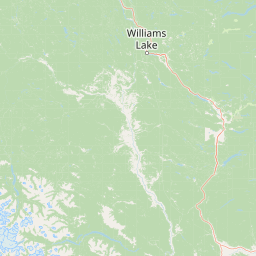
Because the area has remained undeveloped since its designation, there is little documented history of in-park infrastructure, settlement, or industrial activity. Access has historically been provided by the regional forest-road network, including Jesmond Road off the Pavilion Mountain Road near Kelly Lake and Downing Provincial Park. The Cougar Point spur road to the overlook atop the Edge Hills has become the de facto focal point for visitors, though it remains a rough, unmaintained route. The park's administrative identity continues to be defined by its 1995 establishment and its ongoing role as a lightly managed wilderness preserve within the BC Parks system.
Edge Hills Provincial Park landscape and geographic character
The defining landscape feature of Edge Hills Provincial Park is the Edge Hills themselves, a compact fore-range that rises between the Fraser River canyon and the higher Marble Range east of the river. From the ridge tops, the terrain drops steeply into the Fraser Canyon, producing some of the most dramatic vertical relief in the area and the views for which the park is best known. The Cougar Point overlook provides an elevated vantage over this canyon wall.
Across the hills, the topography shifts between rugged canyon-edge slopes, rolling forested ridges, and flatter grassy uplands. This transition from canyon to grassland to forest within a relatively small area gives the park a strong sense of visual contrast. The canyon itself, part of the broader Fraser Canyon system north of Moran Canyon, anchors the western edge of the park and shapes much of its hydrology and microclimate.
The Marble Range, lying just east of the Edge Hills, forms a taller backdrop and emphasizes the fore-range character of the park. Together, these landforms create a layered landscape in which the Edge Hills read as an intermediate step between the canyon's depths and the higher plateau ranges beyond.
Edge Hills Provincial Park ecosystems, habitats, and plant life
Edge Hills Provincial Park sits at an ecological crossroads in British Columbia's southern interior, where dry grassland, montane forest, and canyon-bottom riparian habitats meet within a single protected unit. The open grasslands on the upper slopes and ridges reflect the rain-shadow character of the region, with vegetation adapted to drier conditions and greater temperature extremes than the wetter coastal or sub-boreal zones to the north and west.
The forested zones, by contrast, support montane and sub-boreal coniferous communities typical of the interior plateaus, with tree cover stretching across the slopes and down toward the canyon's edge. In the canyon itself and along its margins, vegetation transitions again to include riparian and warm, dry microclimate species, adding further complexity to the habitat mosaic. The result is a relatively compact area where several distinct interior ecosystems are represented in close proximity.
This ecological compression, combining grassland, forest, and canyon habitats, is a defining element of the park's natural character and is the main reason the area was set aside for protection.
Edge Hills Provincial Park wildlife and species highlights
The wildlife profile of Edge Hills Provincial Park is closely tied to the diversity of habitats packed into its canyon, forest, and grassland terrain. The canyon's mix of rocky slopes, shrub cover, and riparian vegetation supports species adapted to both steep terrain and water-edge environments, while the open grasslands and meadows of the upper hills favor grazing and ground-dwelling species accustomed to drier interior conditions. The forested slopes in between provide cover and forage for species associated with montane and sub-boreal woodlands.
The park's undeveloped character contributes directly to its wildlife values: with no maintained roads, facilities, or significant human infrastructure inside its boundaries, animals are able to use habitats across the range without being concentrated around amenity areas. Large mammals, carnivores, ungulates, and a wide range of smaller species and birds are all part of this landscape, though visitors typically encounter wildlife in an unstructured, observational way rather than at specific viewing sites.
The combination of canyon-edge terrain and open vistas also makes the park a useful perch for viewing wildlife movements across the Fraser Canyon corridor, even where direct encounters are infrequent. This blend of habitat diversity and minimal disturbance is the core of the park's wildlife significance.
Edge Hills Provincial Park conservation status and protection priorities
Edge Hills Provincial Park was established to protect a representative example of the transitional landscape where the Fraser Canyon meets the interior plateau ranges, conserving canyon, forest, and grassland habitats in a single unit. The park IUCN category II designation places it among the province's higher-protection landscapes, emphasizing its ecological rather than primarily recreational role.
From a conservation perspective, the park's value lies as much in what is absent as in what is present. By remaining undeveloped, with no formal campgrounds, maintained trail network, or significant built infrastructure, the park avoids the kinds of habitat fragmentation and disturbance that often accompany more heavily visited protected areas. The Edge Hills fore-range is therefore preserved as a relatively continuous block of natural habitat, allowing ecosystems to function with limited human intervention.
The park also contributes to a broader conservation mosaic in the region, complementing neighboring protected areas such as Downing, Big Bar Lake, and Green Lake Provincial Parks. Together, these parks maintain connected habitat across the canyon, lake, and range landscapes of the south-central interior, reinforcing the ecological importance of Edge Hills within that larger network.
Edge Hills Provincial Park cultural meaning and human context
Edge Hills Provincial Park lies in the historical and cultural landscape of the southern interior of British Columbia, an area long associated with First Nations presence, the fur trade era, and later the road and rail corridors that linked the Fraser Canyon to the interior plateau. The canyon below the park has been a major travel and trade route through the region for generations, and the surrounding ranges, including the nearby Marble Range, carry the layered history of ranching, settlement, and resource use that shaped the Clinton area and the wider Cariboo.
The park itself contains little documented built heritage, reflecting its undeveloped status since 1995, but its access routes, including Jesmond Road and the Pavilion Mountain Road, trace through a landscape with deep human history. Visitor use today tends to be informal and self-directed, often by horseback or on foot along older trails, in keeping with the ranching and rural traditions of the surrounding region.
Top sights and standout views in Edge Hills Provincial Park
The standout feature of Edge Hills Provincial Park is the Cougar Point overlook, perched atop the Edge Hills where the fore-range drops steeply into the Fraser Canyon. From this vantage, visitors can read the layered geography of the area at a glance: the canyon's depth, the forested slopes, and the higher Marble Range beyond.
Equally important is the park's unusual concentration of contrasting landscapes, combining canyon terrain, coniferous forest, and dry interior grasslands within a single protected unit. This ecological compression, combined with the park's deliberate lack of development, makes Edge Hills Provincial Park a distinctive preserve within the BC Parks system, valued for solitude and scenery rather than amenities.
Best time to visit Edge Hills Provincial Park
Edge Hills Provincial Park is best experienced in the warmer months, when snow has receded from the hills and the access roads, including Jesmond Road and the spur to Cougar Point, are most reliably usable. Late spring through early fall typically offers the most rewarding hiking and horseback riding conditions, with cooler temperatures, longer days, and a chance to see both the green of the forested slopes and the golden tones of the upper grasslands.
For visitors interested in wildlife and active landscapes, summer and early autumn tend to bring the most visible animal activity across the canyon's edge and the open hills. Winter conditions can transform the park into a snow-covered, less accessible environment, and visitors should expect rougher road conditions and significantly more limited access if traveling outside the main dry season.