
Mori Atlas logo
Nature reserveErlache bei Bensheim

Examining the ecological corridors and former riverbed geography of this protected wetland site

Erlache bei Bensheim: A Protected Nature Reserve within the Hessen River Lowlands Landscape

(Naturschutzgebiet Erlache bei Bensheim)

Erlache bei Bensheim stands as a significant protected nature reserve located in the southern Hessian Ried of southwestern Germany. The area preserves a distinct mosaic of alder swamp woodland, expansive reedbeds, and open water habitats established within a curved former channel of the Altneckar. This ribbon-like landscape provides a vital sanctuary for wetland-dependent species and serves as a primary feature of the broader Hessische Altneckarschlingen regional site.

wetlandalder swamp forestformer river armreedbednature reservebirdwatching
Stylized digital illustration of a lake surrounded by rolling hills and dense foreground vegetation, with a distant tower on a hill under a pastel sky.

Erlache bei Bensheim

Nature reserve

Park overview

Structured park overview, official facts, and landscape profile for Erlache bei Bensheim

Erlache bei Bensheim park facts, protected area profile, and essential visitor context

Review the core facts for Erlache bei Bensheim, including designation, size, terrain, visitor scale, habitats, and operating context in one park-focused overview.

About Erlache bei Bensheim

Erlache bei Bensheim is one of the more quietly significant small nature reserves of southern Hessen, tucked into the southwestern outskirts of the town of Bensheim along the edge of the Hessische Ried. At roughly 48 hectares, it is not a large area, but its ecological density is high for its size, combining an old river bend, swamp forest, reedbeds, grassland, and open water in a single continuous corridor.

The site takes its name from the Erlache, a former arm of the Neckar. After the Ice Age, the Neckar meandered along the eastern side of the upper Rhine plain until it eventually turned northwest near Pfungstadt and emptied into the Rhine near Trebur. The traces it left behind, including the bogen-shaped course followed by today's reserve, became part of what is now known as the Hessische Altneckarschlingen. The combination of this ancient river valley with active conservation management has turned the Erlache into one of the foremost bird habitats in the Land.

The reserve is sandwiched between transport corridors and roads: the Kreisstraße K 31 to the north, the Bundesstraße 460 to the southwest, and the Bundesautobahn 5 to the east, with the Nibelungenbahn railway running along its northern edge. Despite this heavily bordered setting, the core of the Erlache has retained a strongly wetland character, and its enclosed mosaic of habitats has attracted some of the rarer bird and fish species of the region, as well as a new beaver colony.

Management of the reserve is shared between the Regierungspräsidium Darmstadt's legal framework and the practical conservation work coordinated through the nearby Naturschutzzentrum Bergstraße. Water buffalo grazing has been used since 2017 to maintain open habitats, while forestry activity ceased entirely in 2018, allowing the wet woodland to develop more naturally. The reserve's location within the Geo-Naturpark Bergstraße-Odenwald further ties it into a broader regional network of conservation and landscape interpretation.

Quick facts and research context for Erlache bei Bensheim

Erlache bei Bensheim is a designated nature reserve of roughly 48 hectares, established on 25 December 2000 by the Regierungspräsidium Darmstadt. It lies in the southwestern part of Bensheim in the Landkreis Bergstraße, Hessen, within the natural region of the Hessische Rheinebene, close to the border with the Lorsch municipal area.

The reserve occupies a former loop of the Altneckar, a prehistoric course of the River Neckar, and includes the western part of the Erlache lake, the Sallengraben stream corridor, and adjoining wet woodland, reedbeds, and grassland. It sits within the Geo-Naturpark Bergstraße-Odenwald and has been a component of the EU Birds Directive site Hessische Altneckarschlingen (site DE6217403) since 2007, holding WDPA-ID 318361.

Protection and recognition

Documented terrestrial protection history and conservation framework data

Erlache bei Bensheim Protection Status and Official Designated Area Records

Erlache bei Bensheim maintains a documented terrestrial protection status established in two thousand seven. Official records assemble designation timelines and management scope for environmental analysis.

Protection details

Protection scope
Terrestrial
Designated year
2007
Transboundary protection
No
WDPA ID
318361
Park context

Deeper park guide and search-rich context for Erlache bei Bensheim

Erlache bei Bensheim history, landscape, wildlife, and travel context

Explore Erlache bei Bensheim through its history, landscape character, ecosystems, wildlife, conservation priorities, cultural context, and seasonal travel timing in a structured park guide built for atlas discovery and search intent.

Why Erlache bei Bensheim stands out

Erlache bei Bensheim is best known as a top-tier wetland bird site in Hessen, particularly for breeding white storks and marsh warblers, and as a regionally important stopover area for waterbirds such as snipes, lapwings, and greenshanks. The reserve's mix of alder swamp woodland, reedbeds, open water, and species-rich grassland along the former Neckar bed gives it a diversity of wetland habitats that is rare in the surrounding agricultural plain.
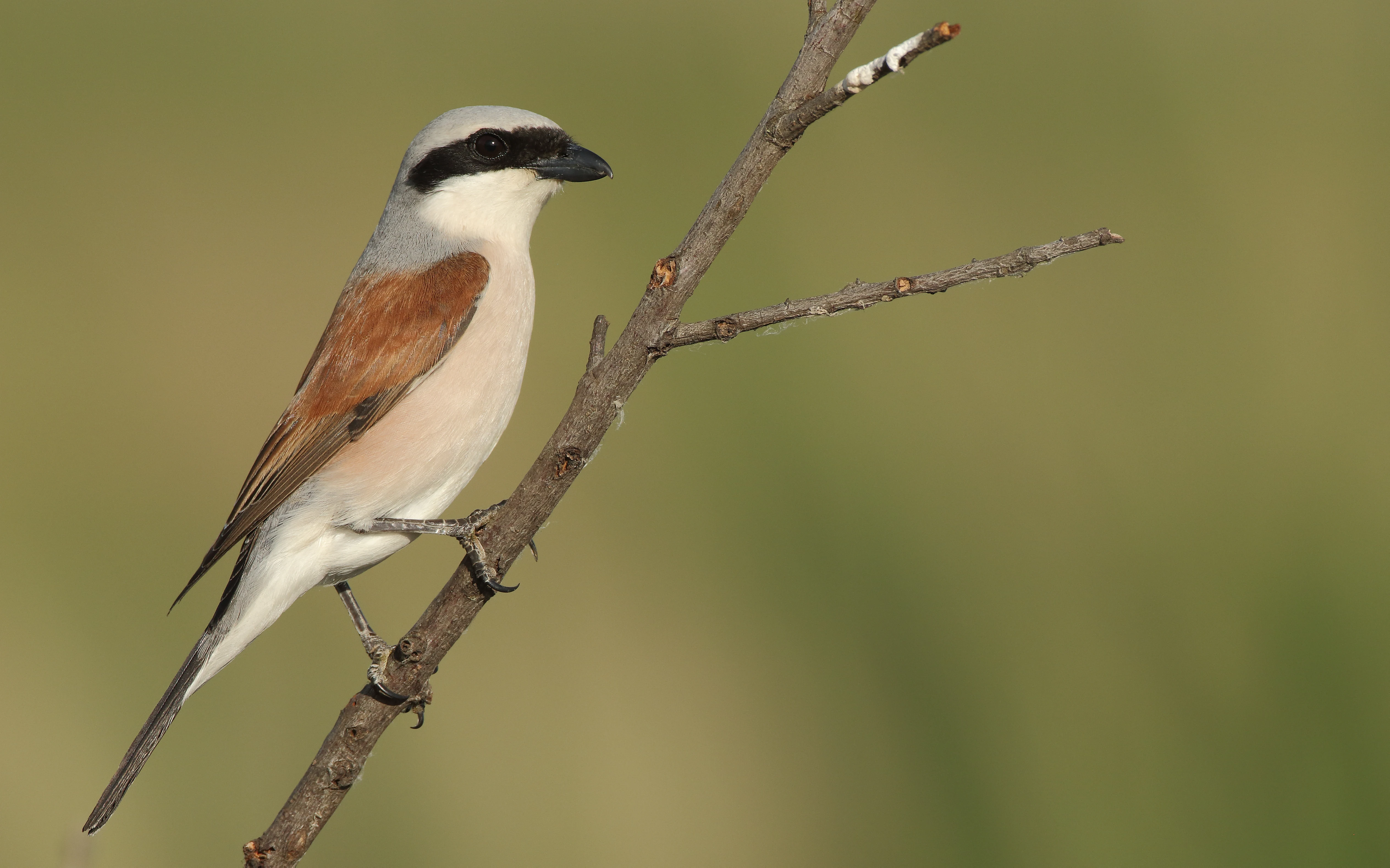
A male red-backed shrike with its characteristic black eye mask, grey head, and reddish-brown back, perched on a thin diagonal twig against a blurred green background.
A red-backed shrike perched on a branch within the Erlache bei Bensheim nature reserve.

Erlache bei Bensheim history and protected-area timeline

The protected area history of Erlache bei Bensheim begins not with the nature reserve itself, but with the deep geological history of the Rhine plain. After the last Ice Age, the River Neckar followed a more easterly course along what is now the Hessische Rheinebene before eventually shifting northwest and joining the Rhine near Trebur. The bend that gives the Erlache its shape is a relic of that prehistoric channel.

The modern nature reserve was established on 25 December 2000, when the Regierungspräsidium Darmstadt issued the protective ordinance for roughly 48 hectares, including alder swamp woodland, willow stands, grassland, reedbeds, and aquatic plant communities. The protection designation responded to the ecological importance of the remnants of the former Neckar arm and aimed to safeguard both the habitats and the animal and plant species they support.

A second major milestone came in 2007, when the Erlachbogen was formally designated as part of the European Birds Directive site Hessische Altneckarschlingen, under site code 6217403. Since then, the reserve has increasingly been shaped by active conservation. Water buffalo grazing began in autumn 2017 as a tool to maintain open areas, and forestry operations inside the small Erlachwäldchen were halted in 2018 to allow the wet woodland to develop with minimal human interference. The longstanding presence of the adjacent Naturschutzzentrum Bergstraße has also played a role in documenting rare species and coordinating habitat care.

Erlache bei Bensheim landscape and geographic character

The landscape of Erlache bei Bensheim is shaped by a single, bogen-shaped geological feature: a former loop of the Altneckar. From the western end of the Erlache lake, roughly eight hectares of open water, the reserve follows the curving former riverbed southeastward along the Sallengraben, a small stream that passes under the Nibelungenbahn railway embankment and ultimately drains into the Weschnitz to the northwest.

The width of the protected corridor averages about 300 metres, which gives the area its elongated, ribbon-like form. The terrain belongs to the flat Hessische Rheinebene, so dramatic relief is absent, but the visual variety comes instead from the sharp contrast between habitats. Wet alder woodland borders the open water, giving way to tall reedbeds where the water table remains high, and to patches of grassland and willow scrub on slightly drier ground.

Surrounding this corridor is a strongly humanised mosaic: the Kreisstraße K 31 runs along the northern boundary, the Bundesstraße 460 skirts the southwest, and the Bundesautobahn 5 cuts along the eastern edge, just beyond the neighbouring Tongrubengelände von Bensheim und Heppenheim. This combination of a continuous wetland strip with hard transport infrastructure on three sides is one of the most distinctive landscape features of the reserve.
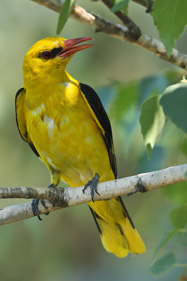
A bright yellow male Eurasian golden oriole with black wings and a reddish beak perched on a thin tree branch.
A male Eurasian golden oriole perched on a branch, representative of the bird species found in the Erlache area.

Erlache bei Bensheim ecosystems, habitats, and plant life

The ecological character of Erlache bei Bensheim is built around wet, lowland habitats typical of the upper Rhine plain. The Erlachwäldchen itself is a classic piece of feuchter Niederungswald, a lowland wet forest, dominated by alder and poplar with willow stands on the margins. Around this wet woodland lie reedbeds, water plant communities, and species-rich grassland, all interconnected through the open water of the Erlache lake and the slow-flowing Sallengraben.

Together, these habitats form a compact wetland mosaic that is unusual in such a heavily used agricultural landscape. Old river arms like the Erlache function as refuge habitats for species that depend on seasonal flooding, shallow open water, reed cover, and undisturbed wet soils, all features that have largely disappeared from the intensively drained and farmed Rhine lowlands. The mosaic also creates natural gradients between waterlogged and slightly drier ground, which supports a wider range of plant and animal communities than any single habitat type could provide on its own.

The presence of grazers is now part of the ecological equation. Water buffalo introduced in 2017 shape open areas through trampling and feeding, helping to prevent reedbeds and scrub from taking over the grassland. The combination of hydrogeological setting, intact micro-topography, and grazing-driven disturbance gives the reserve a distinctive, semi-open landscape that is rare along the edge of the Rhine plain.
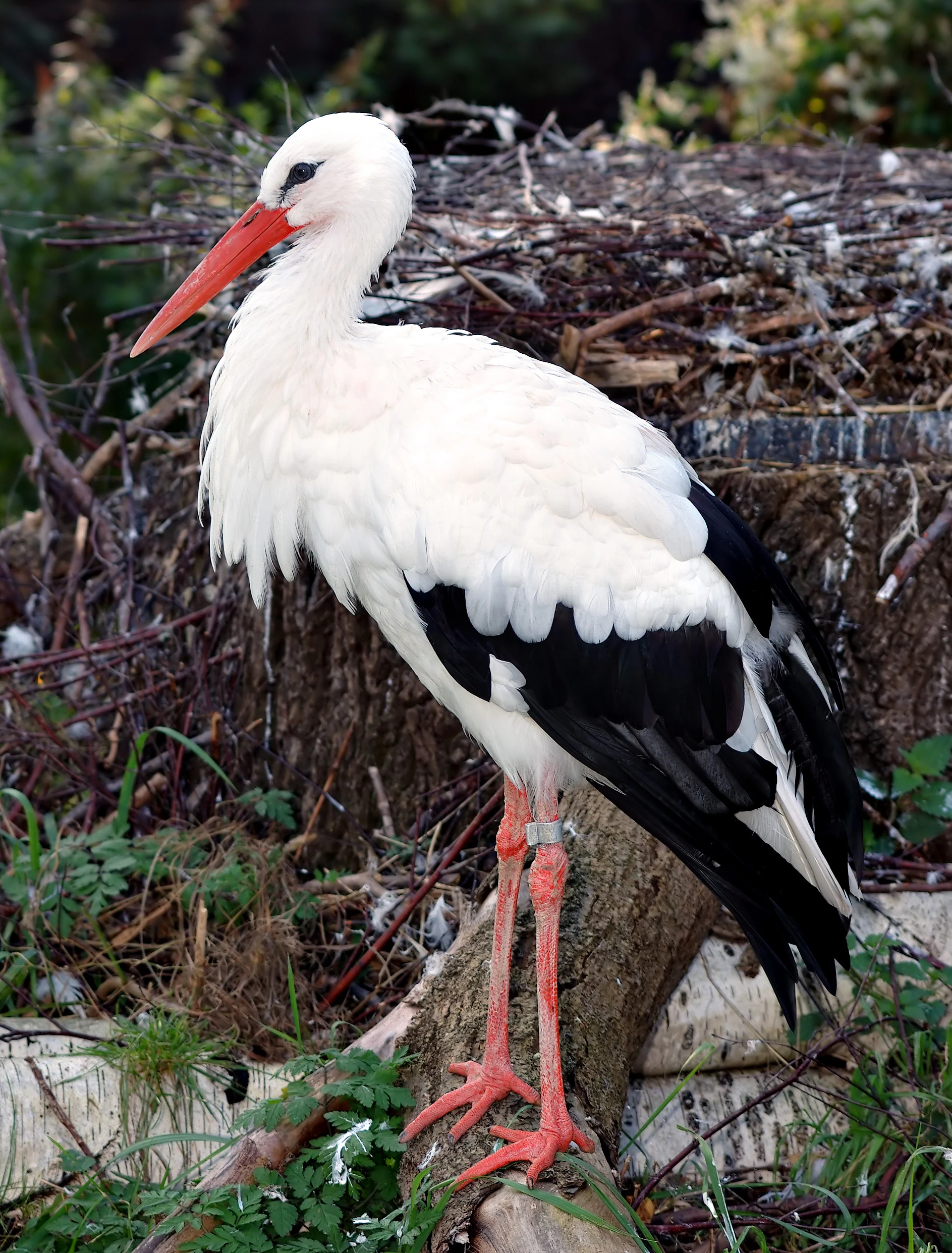
A white stork standing on a log in front of a nest, showing its white plumage, black wing feathers, and long red legs and bill.
A white stork standing in its habitat at the Erlache bei Bensheim nature reserve.

Erlache bei Bensheim wildlife and species highlights

Erlache bei Bensheim and its surroundings are considered the single best breeding area in Hessen for white stork and marsh warbler, and are among the top five breeding areas in the Land for bluethroat, marsh harrier, black kite, Eurasian curlew, golden oriole, reed bunting, and stonechat. The reserve is also one of the five most important resting areas in Hessen for waterbird species including snipe, little ringed plover, common sandpiper, greenshank, teal, redshank, curlew sandpiper, mallard, green sandpiper, and little grebe.

Around the immediate site, threatened species breed in the broader landscape, including red kite, hobby and peregrine falcon, red-backed shrike, kingfisher, great crested grebe, grey-headed and European green woodpeckers, grey heron, lesser spotted woodpecker, common cuckoo, and long-tailed tit, as recorded around 2018. Canada geese have been breeding here since 1986, with Egyptian geese also established, and occasional records of barnacle, black, swan, and ruddy shelducks as well as greylag and bar-headed geese.

The Erlache lake supports a rich fish community that includes eel, perch, common bream, pike, carp, roach, rudd, tench, bleak, and pikeperch. Since 2017, a beaver colony has been resident at the site, adding a further large-mammal presence to the wetland fauna. The combination of large breeding birds of conservation concern, waterbirds on migration, an established fish community, and recently returning beavers gives the reserve an unusually dynamic wildlife profile.
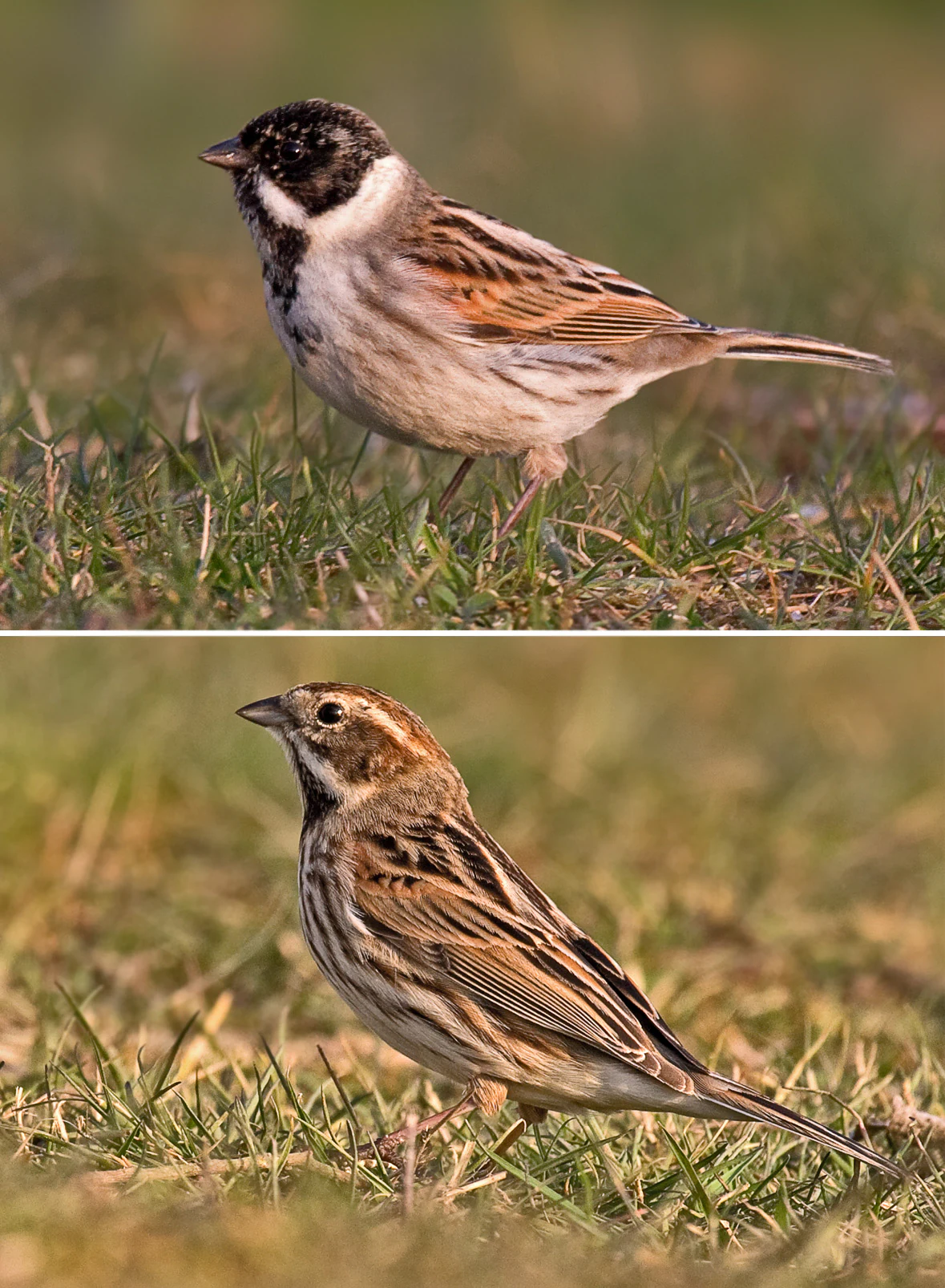
A split image showing a male reed bunting with a black head above, and a female reed bunting with a brown streaked head below, both standing in grass.
A male and female reed bunting, commonly found in wetland habitats.

Erlache bei Bensheim conservation status and protection priorities

Erlache bei Bensheim is formally protected as a German Naturschutzgebiet and classified as an IUCN Category IV Habitat/Species Management Area. The 2000 ordinance established protection for alder swamp forest, willow stands, species-rich grassland, reedbeds, and aquatic plant communities, together with the animal and plant species they support, providing a legal framework that has shaped subsequent conservation management.

Beyond national protection, the reserve has been a component of the EU Birds Directive site Hessische Altneckarschlingen since 2007, placing it within a transnational framework for the conservation of migratory and breeding wetland birds. As one of the top bird sites in Hessen, it contributes meaningfully to regional biodiversity targets for several threatened and declining species and acts as a stepping stone for waterbirds moving through the Rhine plain.

On-the-ground management has increasingly taken an active approach. Water buffalo grazing has been used since autumn 2017 to maintain open habitats in former reedbed and grassland areas, in a long-running beweidungsprojekt pattern. Forestry operations in the Erlachwäldchen ended in 2018, allowing wet woodland processes to develop more freely, while the nearby Naturschutzzentrum Bergstraße coordinates monitoring, rare species documentation, and habitat care. The arrival and establishment of beavers from 2017 onwards is itself a marker of improving hydrological conditions, though it also raises ongoing management questions about tree loss and bank stability.

Erlache bei Bensheim cultural meaning and human context

Culturally, the Erlache sits at the boundary between two long-established Hessian municipalities, Bensheim to the east and Lorsch to the north, whose Gemarkungen, or cadastral districts, meet across the reserve. The name itself, Erlache, reflects a landscape shaped by alder trees, Erlen in German, and the old phonetic form lache for a pond or small lake, tying the area's identity to its wet woodland and open water past.

The reserve lies within the Geo-Naturpark Bergstraße-Odenwald, which links it into a wider narrative about the cultural and natural landscape of the Bergstraße, a historic route between the Odenwald and the Rhine plain that has carried settlement, agriculture, and trade for centuries. The juxtaposition of an ancient river bend with motorway, federal road, and railway corridors reflects how the cultural layers of the Bergstraße, old transport routes and modern infrastructure, intersect with surviving fragments of wetland landscape.

There is no established traditional land use or indigenous narrative specific to the reserve itself, in the sense of pre-modern communities living on the site, but the area sits within a regionally significant cultural sphere dominated by Bensheim and the Lorsch Abbey legacy further north. As such, the reserve's cultural context is best understood as an ecological counterpoint to the long agricultural and settlement history of the southern Hessian Ried.
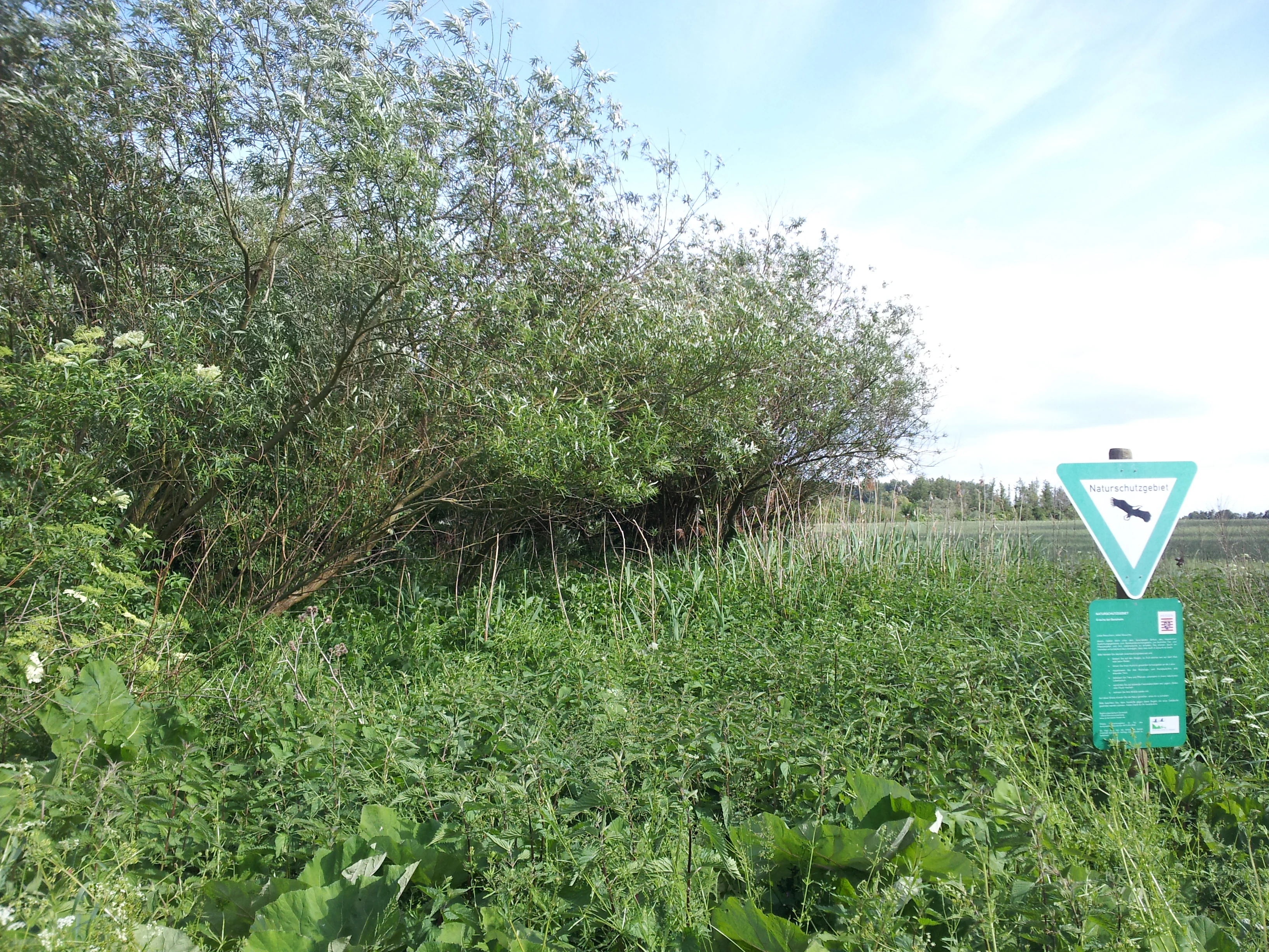
A green nature reserve warning sign with a white triangle and bird icon standing next to dense shrubs and tall grasses in a wetland environment.
A nature reserve sign at the edge of the Erlache bei Bensheim wetlands.

Top sights and standout views in Erlache bei Bensheim

The main highlights of Erlache bei Bensheim are its role as the leading white stork and marsh warbler breeding area in Hessen, its dense mosaic of alder swamp forest, reedbed, open water, and wet grassland along a former Neckar loop, and its integration into the EU Birds Directive site Hessische Altneckarschlingen. Active conservation measures such as water buffalo grazing and the recent cessation of forestry are reshaping the reserve toward a more natural wet woodland dynamic, while the return of beavers since 2017 adds a new dimension to the site's wildlife significance.

Best time to visit Erlache bei Bensheim

Erlache bei Bensheim is best appreciated in spring and early summer, when the breeding bird season brings white storks, marsh warriers, and bluethroats into the open reedbeds and alder woodland, and water levels around the Erlache lake and Sallengraben are typically at their most attractive. Late summer and early autumn draw migratory waterbirds through the area, particularly snipes, lapwings, and various sandpipers, which can use shallow margins of the lake and the slow-flowing stream.

Wetland habitats are most accessible visually when water levels are moderate, neither flooding farmland-adjacent paths nor drying out the reed margins. Visitors should expect a flat, lowland setting and a working agricultural and transport landscape around the reserve; the most rewarding experiences are usually quiet walks along the perimeter with binoculars, rather than any single panoramic viewpoint. Seasonal weather in the Rhine plain tends to be mild and wet, with conditions that generally favour wetland bird activity rather than alpine or coastal recreation.

Monthly climate preview

Track representative annual temperature swings and monthly precipitation patterns across the landscape

Erlache bei Bensheim Climate Normals and Long-Term Weather by Month

Long-term data records reveal measured monthly temperature averages alongside steady precipitation rates sampled from a representative point within Erlache bei Bensheim. Examining the full twelve-month climatology profile provides deeper insight into annual meteorological variation across the protected terrain.
Annual mean10 °C
0 °C20 °C
Jan
Feb
Mar
Apr
May14°
Jun18°
Jul20°
Aug20°
Sep15°
Oct10°
Nov
Dec
Warmest month
July

20.3 °C

Coolest month
January

0.1 °C

Wettest month
July

2.4 mm/day

Driest month
April

1.5 mm/day

Park location guide

Geography guide, regional context, and park location map for Erlache bei Bensheim

Erlache bei Bensheim park geography, regions, and map view in Germany

Understand where Erlache bei Bensheim sits in Germany through a broader geographic reading of the surrounding landscape, nearby location context, and its mapped position within the national park landscape.

How Erlache bei Bensheim fits into Germany

Germany is a federal republic in Western and Central Europe with a population of over 83 million across sixteen constituent states. It is Europe's largest economy by nominal GDP and a major global exporter and importer. The capital is Berlin, and the country borders Denmark, Poland, Czech Republic, Austria, Switzerland, France, Luxembourg, Belgium, and the Netherlands.

Wider geography shaping Erlache bei Bensheim in Germany

Germany is located in Western and Central Europe, spanning 357,022 km². It borders Denmark to the north, Poland and the Czech Republic to the east, Austria and Switzerland to the south, and France, Luxembourg, Belgium, and the Netherlands to the west. The country has coastlines on the Baltic Sea and North Sea to the north, with the Alps located in the southern region.

Map view of Erlache bei Bensheim

Use this park location map to pinpoint Erlache bei Bensheim in Germany, understand its exact geographic position, and read its mapped placement within the surrounding landscape more clearly.

Pigeon | © OpenStreetMap contributors

Location context for Erlache bei Bensheim

Hessen

Visual exploration of wetland habitats, old river loops, and alluvial terrain in southwestern Germany

Erlache bei Bensheim Photos and Protected Landscape Scenery

Visual documentation of Erlache bei Bensheim reveals a complex mosaic of wet alder woodland, reedbeds, and open water along an ancient Neckar river loop. Photographic records illustrate the distinct ecological character of this Hessian nature reserve amid surrounding agricultural plains.

A male red-backed shrike with its characteristic black eye mask, grey head, and reddish-brown back, perched on a thin diagonal twig against a blurred green background.

A peaceful lake view in the Erlache bei Bensheim nature reserve framed by dark tree silhouettes in the foreground, with rolling hills and white clouds in the background.

A bright yellow male Eurasian golden oriole with black wings and a reddish beak perched on a thin tree branch.

A white stork standing on a log in front of a nest, showing its white plumage, black wing feathers, and long red legs and bill.

A split image showing a male reed bunting with a black head above, and a female reed bunting with a brown streaked head below, both standing in grass.

A side profile of a Eurasian curlew bird standing in tall green grass and wildflowers.

A green nature reserve warning sign with a white triangle and bird icon standing next to dense shrubs and tall grasses in a wetland environment.

Park atlas

Compare adjacent wetland habitats and surrounding lowland reserves across the Hessian Ried.

Other Parks Near Erlache bei Bensheim and Regional Protected Areas

Continue exploring protected landscapes and wetland reserves located near Erlache bei Bensheim in the upper Rhine lowlands. Comparing adjacent natural areas reveals broader ecological patterns across the surrounding regional river plains.
A watercolor painting of a pastoral landscape with soft green meadows, scattered trees, and distant purplish hills under a white sky.
Nature reserveHessen
About 4.2 km away#1 closest

Northeast

Magerrasen von Gronau mit angrenzenden Flächen Protected Landscape and Regional Geography

A network of calcareous meadows in the Odenwald foothills

Located in the Bergstraße district of Hessen, this protected area spans three distinct sub-areas characterized by nutrient-poor calcareous soils. These warm, sun-exposed meadows serve as an essential refugium for orchid diversity and specialized butterfly populations, standing as a representative example of successfully managed dry grassland ecosystems within the broader Geo-Naturpark Bergstraße-Odenwald.

Area
1.6 km²
Established
2004
A soft watercolor painting of a rolling green hillside with trees, set against a pale, light-colored background.
Nature reserveHessen
About 7.8 km away#2 closest

North

Orbishöhe von Auerbach und Zwingenberg: Geography, Landscape, and Protected Area Mapping

An examination of Hessian quarry-based ecological conservation sites.

The Orbishöhe von Auerbach und Zwingenberg nature reserve serves as a prime example of localized conservation within the Odenwald hills. Its landscape is defined by former quarry faces and open slope terraces, which provide a critical habitat for rare and threatened plant species. This resource offers a clear look at the reserve's topography, physical boundaries, and its broader role within the Natura 2000 network of protected German lands.

Area
0.064 km²
Established
1988
Watercolor painting showing a stylized, panoramic landscape of rolling hills and forest, depicted in soft green and earth tones against a white background.
Nature reserveHessen
About 9.6 km away#3 closest

Northeast

Felsberg bei Reichenbach Nature Reserve: Geography and Granite Boulder Field Analysis

Protected forest and geological monument in the Odenwald range

Felsberg bei Reichenbach protects 168 hectares of Odenwald mountain slope in Southern Hessen. The site is centered on the Felsenmeer, a dramatic sea of granite boulders created by frost weathering, framed by mixed deciduous woodland. This area functions as an important Natura 2000 habitat, preserving both specialized rock ecosystems and montane forest, providing a clear geographic link between the Lautertal valley and the high slopes of the Felsberg summit.

Area
1.677 km²
Established
1972
IUCN
IV
Relief
Mountain
A watercolor painting showing a soft, stylized landscape of green meadows, sparse trees, and distant rolling hills against a white background.
Nature reserveHesse
About 9.6 km away#4 closest

North

Im Dulbaum bei Alsbach Nature Reserve: Mapped Inland Dunes and Grassland Geography

A vital protected sandy terrain in the Hessian Rhine Plain

Im Dulbaum bei Alsbach protects a remnant of the historic Rhine graben sand dune belt in southern Hesse. This nature reserve provides essential habitat connectivity for heat-loving species through its distinct calcareous sand grasslands and former quarry terrain, offering a look into the region's complex ecological history.

Area
0.092 km²
Established
1994
IUCN
IV
Relief
Lowland
A horizontal watercolor illustration of a soft green landscape with meadows, scattered trees, and distant rolling hills under a pale pink sky.
Nature reserveHessen
About 10 km away#5 closest

East

Schannenbacher Moor Nature Reserve: Geographic Overview and Protected Area Boundaries

Wetland and forest mosaic in the southern Hessian Odenwald

Schannenbacher Moor represents a significant protected area within Hessen, characterized by its combination of raised bog remnants, reedbeds, and near-natural floodplain woodlands. Framed by the Krehberg slopes and the Meerbach stream system, the reserve offers a rare example of low mountain bog ecology and biodiversity conservation. This mapped landscape provides essential data on the distribution of mire plant communities and bryophyte habitats in the region.

Area
0.162 km²
Established
1975
IUCN
IV
A soft, delicate watercolor painting depicting a meandering river flowing through a lush, grassy wetland landscape with rolling hills in the background.
Nature reserveHessen
About 11 km away#6 closest

North

Altneckarlachen von Alsbach, Hähnlein und Bickenbach: Protected Wetland and River Geography

A rare mosaic of prehistoric river loops in the Hessian Rhine plain

Altneckarlachen von Alsbach, Hähnlein und Bickenbach protects a unique sequence of prehistoric Neckar meanders featuring shallow water zones, reed belts, and black-alder swamp forest. This nature reserve in the Darmstadt-Dieburg district remains a critical wetland sanctuary, preserving a vital ecological cross-section of the ancient Rhine-Neckar landscape and its associated peatland soils.

Area
0.892 km²
Established
1990
IUCN
IV
Relief
Lowland
Watercolor painting of a green wetland landscape with a winding stream and distant hills in soft pastel colors.
Nature reserveHesse
About 12 km away#7 closest

East

Albersbacher Riedwiesen Nature Reserve: Mapped Geography and Protected Landscapes in Hesse

A detailed atlas view of the Albersbach stream valley conservation corridor.

Situated in the Weschnitz valley region of Hesse, the Albersbacher Riedwiesen nature reserve offers a concentrated look at traditional Odenwald landscapes. The area protects a unique combination of wet meadows, reedbeds, and dry grasslands that follow the natural meandering course of the Albersbach stream, providing a vital study in local geomorphology and conservation geography.

Area
0.124 km²
Established
1996
A horizontal watercolor painting showing a soft green landscape with meadows, low-lying trees, and distant hills under a light sky.
Nature reserveHesse
About 12 km away#8 closest

West

Lochwiesen von Biblis Nature Reserve: Geographic Overview and Protected Landscape Mapping

Rhine valley meadow conservation in the Hessisches Ried of southern Hesse.

Lochwiesen von Biblis serves as a protected sanctuary for riverine ecosystems in the Upper Rhine lowlands. This nature reserve provides essential habitat for lowland meadows and wet grassland species, offering a window into the natural floodplain dynamics that once defined the entire Hessian Rhine corridor. Explore the structural boundaries of this conservation area and its place in the larger regional landscape.

Area
0.511 km²
Established
1992
IUCN
IV

Common questions about visiting, size, designation, and location context for Erlache bei Bensheim

Erlache bei Bensheim FAQs for park facts, access, geography, and protected area context

Find quick answers about Erlache bei Bensheim, including protected-area facts, park geography, trail and visitor context, and how the park fits into its surrounding country and regional landscape.
MoriAtlas Explorer

Continue Your Protected Areas Search Across the Global Atlas

Deepen your exploration by continuing the structured search for national parks and protected areas worldwide. Utilize the comprehensive filtering capabilities to compare different conservation landscapes and refine your understanding of global park geography. Discover more about the distribution and characteristics of protected natural areas.

Global natural geography