

Mori Atlas logo
Nature reserveEttrick Conservation Park

Explore the ecological boundaries of a rare remnant of Murray-Darling Basin habitat.

Ettrick Conservation Park in South Australia: Mapping Protected Mallee Woodlands and Grasslands

Ettrick Conservation Park is a vital protected area in South Australia that serves as a refuge for hardy mallee eucalypt woodland and critically endangered tussock grassland. This compact reserve provides essential structural complexity for local bird populations in a landscape otherwise modified by extensive agricultural use. By preserving these rare vegetation communities, the park functions as a key geographical anchor for understanding the ecological remnants of the broader Murray-Darling Basin.

mallee woodlandtussock grasslandMurray-Darling Basinconservation parkSouth Australiabird sanctuary

Ettrick Conservation Park

Nature reserve

Park overview

Structured park overview, official facts, and landscape profile for Ettrick Conservation Park

Ettrick Conservation Park park facts, protected area profile, and essential visitor context

Review the core facts for Ettrick Conservation Park, including designation, size, terrain, visitor scale, habitats, and operating context in one park-focused overview.

About Ettrick Conservation Park

Ettrick Conservation Park sits quietly in the rural landscape east of Adelaide, in the part of South Australia that slopes gently toward the lower Murray River. Although it covers only a few square kilometres, the park represents a deliberate effort to set aside land that still carries some of the native vegetation character that once stretched across this part of the Murray-Darling Basin.

The park's defining feature is the contrast between its two main habitat types. Most of the area is open mallee, a low, multi-stemmed eucalypt woodland typical of dry inland Australia. Mallee vegetation has a distinctive structure, with several slender trunks rising from a single woody base beneath a sparse upper canopy and a diverse understorey of shrubs and grasses. This kind of woodland can look barren from a distance but is rich in microhabitats at ground level.

Within this mallee matrix, the park also contains a small but ecologically important stand of tussock grassland. Native tussock grasslands of this type have been extensively cleared across southern Australia for grazing and cropping, leaving only isolated remnants. The presence of such a remnant within a formally protected conservation park gives Ettrick a conservation value well beyond what its small size might suggest, and it is the reason the park has drawn attention from environmental managers and regional ecologists.

Quick facts and research context for Ettrick Conservation Park

Ettrick Conservation Park is a South Australian protected area covering approximately 4.79 square kilometres in the locality of Ettrick, between Adelaide and Murray Bridge. It was proclaimed on 31 October 2013 under the state's National Parks and Wildlife Act 1972 and is managed by the Department for Environment and Water. The park sits within a broader landscape shaped by the Murray-Darling Basin and protects a combination of open mallee eucalypt woodland and one of the few remaining patches of native tussock grassland in the region.

Protection and recognition

Examine the verified conservation scope and formal recognition metrics for this protected reserve.

Ettrick Conservation Park Protection Status and Mapped Terrestrial Designation

Ettrick Conservation Park maintains a documented terrestrial protection scope within the global conservation registry. Official records outline the baseline designation framework without relying on external international listings.

Protection details

Protection scope
Terrestrial
Transboundary protection
No
Park context

Deeper park guide and search-rich context for Ettrick Conservation Park

Ettrick Conservation Park history, landscape, wildlife, and travel context

Explore Ettrick Conservation Park through its history, landscape character, ecosystems, wildlife, conservation priorities, cultural context, and seasonal travel timing in a structured park guide built for atlas discovery and search intent.

Why Ettrick Conservation Park stands out

Ettrick Conservation Park is best known for protecting one of the last remaining patches of tussock grassland in its section of the Murray-Darling Basin, a vegetation community listed as critically endangered. It is also recognised for its open mallee eucalypt woodland, which supports species such as the malleefowl and the regent parrot in a landscape where such habitat has largely been cleared or fragmented.

Ettrick Conservation Park history and protected-area timeline

Ettrick Conservation Park was formally established on 31 October 2013 by proclamation under the South Australian National Parks and Wildlife Act 1972. The land it protects is crown land described as Allotment 99 in Deposited Plan 26809 within the cadastral unit known as the Hundred of Ettrick, and the park takes its name from that historical land division.

On the same date, a separate proclamation was issued to preserve existing rights of entry, prospecting, exploration, or mining under the state's Mining Act 1971 and Petroleum and Geothermal Energy Act 2000. The park's IUCN Category VI classification reflects this balance between conservation and the continued possibility of regulated resource activity.

The creation of the park was framed by then Minister for Sustainability, Environment and Conservation Ian Hunter as a step toward protecting rare local habitats, particularly the tussock grassland remnant, and securing refuge for threatened bird species such as the malleefowl.

Ettrick Conservation Park landscape and geographic character

The landscape of Ettrick Conservation Park is shaped by the dry, gently undulating country that characterises much of the Murray-Darling Basin's southern fringe. Soils in this part of South Australia are typically poor and shallow, conditions that favour the hardy vegetation the park protects rather than dense forest growth.

Open mallee dominates the visual impression of the area. The mallee trees are low and bushy, often with their trunks branching from a large underground lignotuber, which gives the woodland a layered, slightly scattered look. Beneath and between the eucalypts is a mix of shrubs and grasses, with patches of bare or sparsely covered ground typical of semi-arid Australian environments.

Where the mallee gives way to tussock grassland, the landscape shifts to something more open and grass-dominated. The native tussock grasses form a distinctive hummocky ground layer that has become increasingly rare in this region due to historical clearing for agriculture. The result is a small protected landscape in which woodland and grassland habitats sit side by side, creating an unusually varied ecological fabric for such a compact reserve.

Ettrick Conservation Park ecosystems, habitats, and plant life

Ecologically, Ettrick Conservation Park straddles two of southern Australia's most threatened native vegetation types: open mallee eucalypt woodland and temperate tussock grassland. While mallee remains relatively widespread across drier parts of the continent, the specific structure of the park's mallee, with its mix of eucalypt species and intact understorey, gives it additional value in a region heavily modified by land clearing.

The tussock grassland component is the most ecologically sensitive feature of the park. This vegetation community has been reduced to scattered remnants across southeastern Australia, with the local form found at Ettrick regarded as critically endangered. Preserving even a small fragment of this habitat within a formally protected reserve provides a living reference point for the species and processes that once characterised the broader landscape, and offers potential reference value for restoration work elsewhere.

The combination of woodland and open grassland also creates habitat edges and transitions that support a wider range of native species than either habitat type would on its own. Ground-layer complexity, fallen woody debris, patches of bare soil, and areas of regenerating growth all contribute to the ecological character of the park.

Ettrick Conservation Park wildlife and species highlights

Wildlife within Ettrick Conservation Park reflects the habitat preferences of the mallee and tussock grassland environments it protects. The park is particularly important for the malleefowl, a ground-dwelling mound-building bird that depends on intact leaf-litter and open understorey for feeding and breeding, and whose populations have declined sharply across southern Australia due to habitat loss and predation.

The regent parrot, a striking bird of the mallee belt, is also highlighted as a species the park supports. Smaller woodland birds are part of the park's birdlife as well, including the shy heathwren, hooded robin, jacky winter, restless flycatcher, white-winged chough, and painted buttonquail. Together these species indicate an understorey-rich environment with a healthy mix of ground-foraging and shrub-dwelling birds, which is a useful indicator of habitat condition.

While the park's wildlife profile in public documentation emphasises its birdlife, the combination of mallee litter, fallen timber, and tussock grass cover is also likely to support a range of reptiles, small mammals, and invertebrates typical of similar South Australian reserves.

Ettrick Conservation Park conservation status and protection priorities

Ettrick Conservation Park's conservation significance lies less in its size and more in what it still contains. The park was established specifically to protect remnants of vegetation that have been heavily reduced elsewhere in the region, most notably the tussock grassland listed as critically endangered in this part of the Murray-Darling Basin. By placing this habitat under formal protection, the park helps anchor a small but genuine foothold for that community in the regional landscape.

The park's designation as an IUCN Category VI protected area reflects its role as a refuge for biodiversity while still permitting certain forms of land use, including prospecting and exploration rights retained under earlier legislation. This acknowledges the broader South Australian approach in which conservation, resource management, and historical land use coexist within defined regulatory boundaries.

The presence of species such as the malleefowl and regent parrot adds further conservation weight, as both depend on the kind of habitat structure that the park's mallee woodland offers. Protecting these habitats helps maintain landscape connectivity for wildlife in a region dominated by agricultural land, where native vegetation has increasingly been reduced to scattered patches.

Top sights and standout views in Ettrick Conservation Park

Ettrick Conservation Park is a compact reserve that punches above its weight ecologically, protecting both open mallee eucalypt woodland and one of the last surviving tussock grassland remnants in its part of the Murray-Darling Basin. Its birdlife, including the malleefowl and regent parrot, reflects the value of intact understorey and ground cover in mallee habitats. The park also illustrates how small protected areas can play an important role in conserving critically endangered vegetation communities in working agricultural landscapes.

Best time to visit Ettrick Conservation Park

Because Ettrick Conservation Park protects semi-arid mallee and grassland habitat, cooler and milder months generally offer more comfortable conditions for field exploration. Spring can be a particularly rewarding time, when milder temperatures, active birdlife, and seasonal growth in the ground layer all enhance the experience of the park. Very hot summer conditions can make outdoor activity difficult in this kind of open landscape, while winter is typically quieter but cooler. As with any small South Australian conservation park, visitors should plan around current conditions and local signage rather than fixed seasonal schedules.

Monthly climate preview

Long-term monthly temperature averages and precipitation patterns for South Australia

Ettrick Conservation Park Climate Normals, Annual Temperature and Precipitation Rhythm

Representative coordinate measurements reveal measured annual temperature variations and monthly precipitation rhythms across Ettrick Conservation Park. Exploring the complete twelve-month climate profile provides detailed historical normals for deeper geographical comparison.
Annual mean16 °C
9 °C23 °C
Jan23°
Feb23°
Mar20°
Apr16°
May13°
Jun10°
Jul
Aug10°
Sep12°
Oct15°
Nov19°
Dec21°
Warmest month
January

22.9 °C

Coolest month
July

9.3 °C

Wettest month
June

1.6 mm/day

Driest month
January

0.6 mm/day

Park location guide

Geography guide, regional context, and park location map for Ettrick Conservation Park

Ettrick Conservation Park park geography, regions, and map view in Australia

Understand where Ettrick Conservation Park sits in Australia through a broader geographic reading of the surrounding landscape, nearby location context, and its mapped position within the national park landscape.

How Ettrick Conservation Park fits into Australia

Australia is a constitutional monarchy and federal parliamentary democracy comprising six states and ten territories. With a population of nearly 28 million, it is one of the world's most urbanised countries, with most people concentrated on the eastern seaboard. The country has a high Human Development Index and is known for its cultural diversity, ancient Aboriginal heritage, and unique wildlife.

Wider geography shaping Ettrick Conservation Park in Australia

Australia occupies the entire Australian continent, the island of Tasmania, and numerous smaller islands. It is the world's flattest and driest inhabited continent, featuring vast deserts in the interior (the Outback), tropical rainforests along the eastern coast, and a coastline bordering the Indian and Pacific Oceans.

Map view of Ettrick Conservation Park

Use this park location map to pinpoint Ettrick Conservation Park in Australia, understand its exact geographic position, and read its mapped placement within the surrounding landscape more clearly.

Pigeon | © OpenStreetMap contributors

Location context for Ettrick Conservation Park

South Australia
Park atlas

Compare regional habitats and nearby conservation reserves across the Murray-Darling Basin

Discover Parks Near Ettrick Conservation Park and Surrounding Protected Landscapes

Browse protected areas and semi-arid woodland habitats situated close to Ettrick Conservation Park. Comparing adjacent reserves reveals the broader ecological spread of mallee eucalypt ecosystems throughout the surrounding region.
Nature reserveSouth Australia
About 43 km away#1 closest

Southwest

Ferries McDonald Conservation Park: Protected Nature Reserve and Murray Plains Geography

Mallee bushland and endemic ecosystem remnants in South Australia

Ferries McDonald Conservation Park encompasses over 800 hectares of native shrubland and low woodland near Murray Bridge. This nature reserve provides a critical window into the original semi-arid geography of the region, offering a protected landscape where native species such as the Malleefowl and the endemic Resin Wattle find sanctuary amidst surrounding farmland.

Area
8.42 km²
Established
1938
IUCN
III
Relief
Lowland
Nature reserveSouth Australia
About 49 km away#2 closest

West

Charleston Conservation Park: Geography and Woodland Transitions in the Adelaide Hills

Explore protected terrain in South Australia

Charleston Conservation Park stands as an important ecological remnant in the Adelaide Hills. Its 54 hectares offer a concentrated look at woodland associations ranging from sheoak groves to blue gum forest and silver banksia stands. Use this atlas resource to understand the park's topography, its role in the Mount Lofty Ranges, and its contribution to regional conservation efforts.

Area
0.54 km²
Established
1976
IUCN
III
Relief
Upland
Nature reserveSouth Australia
About 51 km away#3 closest

Northwest

Cromer Conservation Park: Mapped Protected Landscapes of the South Australian Adelaide Hills

An undisturbed remnant of native eucalypt forest and rare shrub heath

Cromer Conservation Park functions as a significant ecological island in South Australia, preserving 44 hectares of natural vegetation largely untouched by historical land use. This reserve offers a focused look at the moist, undulating terrain of the Mount Lofty Ranges, providing essential habitat for rare species like the blue star sun-orchid and supporting a dense mosaic of native shrubs beneath an open forest canopy.

Area
0.44 km²
Established
1976
IUCN
III
Relief
Upland
Wildlife reserveSouth Australia
About 52 km away#4 closest

North

Yookamurra Sanctuary: A Wildlife Reserve within the Murraylands Geography of South Australia

Mapped protected landscape and arid-zone conservation terrain

Yookamurra Sanctuary acts as a protected island of native vegetation within the heavily modified agricultural landscape of South Australia. Defined by its gently undulating terrain and calcrete-influenced mallee woodlands, this reserve provides a essential habitat for arid-zone fauna. The sanctuary offers a focused look at how private conservation maintains biodiversity in the transitional zone between the Mount Lofty Ranges and the Murray River.

Area
50.55 km²
IUCN
IV
Relief
Lowland
Climate
Mediterranean
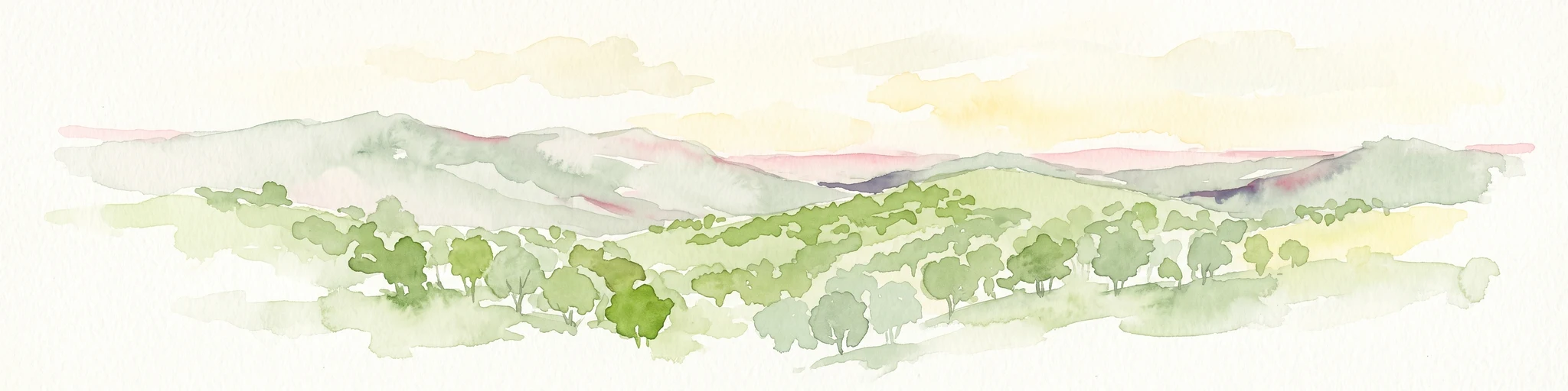
Watercolor painting of a rolling, hilly landscape with sparse trees against a pale, soft-toned sky.
Nature reserveSouth Australia
About 60 km away#5 closest

Northwest

Kaiserstuhl Conservation Park: Protected Nature Reserve in the Barossa Ranges

Mapping the forest ridges and hill country of South Australia

Kaiserstuhl Conservation Park preserves a distinctive segment of forested ridge and valley terrain within the Mount Crawford Forest. Situated near the Heysen Trail in South Australia, this nature reserve focuses on the protection of its 600-metre namesake peak, providing a clear geographic landmark within the eastern Barossa Ranges.

Area
4.35 km²
Established
1979
IUCN
III
Visitors
7.5K annual
Nature reserveSouth Australia
About 61 km away#6 closest

Northwest

Hale Conservation Park: Nature Reserve and Geological Landmark in South Australia

Protected forest landscapes in the Mount Lofty Ranges

Located near Williamstown, Hale Conservation Park preserves a rugged stretch of hilly terrain representative of the broader Mount Lofty Ranges. This nature reserve serves as a sanctuary for stringybark forest and provides scientists and map enthusiasts with clear evidence of a regional geological unconformity.

Area
1.89 km²
Established
1964
IUCN
III
Relief
Mountain
Nature reserveSouth Australia
About 61 km away#7 closest

West

Cudlee Creek Conservation Park: Geography, Protected Boundaries, and South Australian Terrain

Adelaide Hills nature reserve with riparian forest and eucalypt woodland habitat

Cudlee Creek Conservation Park provides a clear look at the Adelaide Hills landscape through its mix of steep stringybark forest and River Torrens riparian habitat. This small nature reserve serves as an important regional reference site for native plant communities and bird habitat within the context of a heavily altered agricultural landscape in South Australia.

Area
0.49 km²
Established
1971
IUCN
III
Relief
Upland
Protected landscapeSouth Australia
About 68 km away#8 closest

West

Black Hill Conservation Park: Mount Lofty Ranges Protected Area and Regional Geography

Bushland ridge lines and trail networks near Adelaide

Examine the geography of Black Hill Conservation Park, a significant protected landscape defined by its steep ridges and 467-metre summit. This area serves as a key bushland anchor in the Mount Lofty Ranges, featuring complex trail systems and specialized heathland habitats. Gain insights into the natural terrain, regional connectivity, and protected boundary characteristics of this essential conservation zone in South Australia.

Area
7.58 km²
Established
1972
IUCN
III
Relief
Mountain

Common questions about visiting, size, designation, and location context for Ettrick Conservation Park

Ettrick Conservation Park FAQs for park facts, access, geography, and protected area context

Find quick answers about Ettrick Conservation Park, including protected-area facts, park geography, trail and visitor context, and how the park fits into its surrounding country and regional landscape.
MoriAtlas Explorer

Continue Your Protected Areas Search Across the Global Atlas

Deepen your exploration by continuing the structured search for national parks and protected areas worldwide. Utilize the comprehensive filtering capabilities to compare different conservation landscapes and refine your understanding of global park geography. Discover more about the distribution and characteristics of protected natural areas.

Global natural geography