

Mori Atlas logo
Nature reserveFaros Kato Pafou

Mapping the Mediterranean bird habitats and coastal terrain of a vital Cypriot nature reserve

Faros Kato Pafou Nature Reserve: A Protected Coastal Landscape on the Cyprus Shoreline

Faros Kato Pafou is a concentrated coastal protected area situated along the Mediterranean shoreline near Paphos, Cyprus. This nature reserve serves as an ecological anchor, featuring a rare combination of embryonic dunes, sea-cliff vegetation, and Mediterranean woodland habitats like olive and carob. Recognized within the Natura 2000 network, the site remains a critical node for migratory bird flyways, preserving complex habitat mosaics within its compact geographic boundaries.

coastal protected areaMediterranean habitatsNatura 2000 sitebird protection areaseabirdsmigratory birds

Faros Kato Pafou

Nature reserve

Park overview

Structured park overview, official facts, and landscape profile for Faros Kato Pafou

Faros Kato Pafou park facts, protected area profile, and essential visitor context

Review the core facts for Faros Kato Pafou, including designation, size, terrain, visitor scale, habitats, and operating context in one park-focused overview.

About Faros Kato Pafou

Faros Kato Pafou is one of Cyprus's smaller but ecologically significant coastal protected areas, sitting on the southwestern edge of the island within the broader Paphos region. Its position along the Mediterranean coastline places it firmly within the Mediterranean ecoregion, a biogeographical setting that defines its vegetation, climate, and wildlife patterns. Despite its compact footprint, the site has been integrated into the European Natura 2000 network and holds three layered designations that cover both habitat conservation and bird protection.

The protected landscape is shaped by the meeting of land and sea. The salt-influenced fringe gives way to cliff vegetation, dune systems, and scrub formations, before opening into broader pockets of phrygana and mature Mediterranean woodland dominated by olive and carob. This compressed habitat mosaic, all within roughly eighty eight hectares, gives the site extraordinary ecological density and explains why a territory of this modest size can support such a long list of protected bird species.

Faros Kato Pafou is also notable as an example of how urban-adjacent coastlines can carry high conservation value. The site lies close to the developed surroundings of Kato Pafos, yet retains habitat types that are increasingly fragmented elsewhere along the Mediterranean littoral. Its protected status ensures that the mosaic of cliffs, dunes, scrub, and dry forest remains intact, providing refuge for both resident and migratory species that depend on intact coastal environments.

Quick facts and research context for Faros Kato Pafou

Faros Kato Pafou is a Natura 2000 protected area in Cyprus, located on the western Mediterranean coast near Paphos. The site covers approximately 87.7 hectares entirely on land, and sits within the Mediterranean ecoregion. It holds a triple Natura 2000 status: Site of Community Importance, Special Area of Conservation, and Special Protection Area for birds. The site was first designated as a bird protection area in December 2005, with later confirmations as a Site of Community Importance in March 2009 and as a Special Area of Conservation in September 2015.

Protection and recognition

Analysis of the 2005 establishment and administrative conservation framework

Faros Kato Pafou Protection Status and Designated Terrestrial Scope

Faros Kato Pafou maintains a documented terrestrial protection status established in the year 2005. Systematic records outline the designated management scope and official administrative history for this protected area.

Protection details

Protection scope
Terrestrial
Designated year
2005
Transboundary protection
No
Park context

Deeper park guide and search-rich context for Faros Kato Pafou

Faros Kato Pafou history, landscape, wildlife, and travel context

Explore Faros Kato Pafou through its history, landscape character, ecosystems, wildlife, conservation priorities, cultural context, and seasonal travel timing in a structured park guide built for atlas discovery and search intent.

Why Faros Kato Pafou stands out

Faros Kato Pafou is best known for its unusually high density of protected bird species relative to its small size, supporting forty seven bird species across a coastal Mediterranean landscape. It is also distinguished by the rare combination of overlapping Natura 2000 designations gathered into a single compact site. The site's profile is shaped by the variety of coastal habitats packed into its narrow footprint. Seabird populations, migratory songbirds, and birdlife tied to shoreline and scrub environments all converge here, giving the site an importance that exceeds its modest territorial extent.

An outdoor information sign displaying a map of the Faros Kato Pafou Natura 2000 protected area, including a legend and descriptive text in Greek and English.
Information sign displaying a map of the Faros Kato Pafou Natura 2000 site in Paphos, Cyprus.

Faros Kato Pafou history and protected-area timeline

The conservation history of Faros Kato Pafou reflects the gradual layering of European and Cypriot nature protection frameworks in the early twenty first century. The site was first formally recognized in December 2005, when it was designated as a Special Protection Area for birds under the Natura 2000 framework, with the initial declaration aimed at safeguarding forty seven animal species.

Following this first designation, the site received further recognition through additional Natura 2000 instruments. In March 2009, it was confirmed as a Site of Community Importance, reflecting the broader ecological value of its habitats. In September 2015, it was formally declared a Special Area of Conservation, consolidating its protected status across the network. The successive designations mark the evolution of the site from a bird-focused protection measure into a fully integrated habitat and species conservation area.

Faros Kato Pafou landscape and geographic character

The landscape of Faros Kato Pafou is shaped by its position directly on the Mediterranean coast near Paphos. The site occupies a stretch of shoreline where the sea meets a varied coastal hinterland, producing a compact mosaic of landforms. Cliffs and coastal platforms give way to dune formations still in early successional stages, while the inland edge rises gently toward areas of traditional Mediterranean woodland.

The vegetation follows the structure of a classic Mediterranean coastal landscape. Sea-cliffs host specialized endemic flora adapted to salt spray, dunes carry embryonic plant communities working to stabilize shifting sands, and the landward edge transitions into halonitrophilous scrub, arbutus and ziziphus formations, and mature stands of olive and carob. The result is a richly layered landscape where relatively high topographic and ecological diversity is compressed into a small geographic boundary.

Faros Kato Pafou ecosystems, habitats, and plant life

Ecologically, Faros Kato Pafou sits squarely within the Mediterranean ecoregion, and its protected status relies on the integrity of coastal habitat sequences that are increasingly rare in the region. The site hosts eight recognized natural habitats, covering the entire gradient from the tidal limit inland.

At the maritime fringe, annual vegetation at the tide line forms a thin but characteristic band of habitat. Slightly higher on the shore, sea cliffs carry their own distinctive plant communities, including endemic Limonium species found on Mediterranean coasts. Mediterranean salt-meadow pastures, halonitrophilous scrub, embryonic mobile dunes, and arbutus-rich matorral extend the habitat diversity further inland, before the landscape settles into phrygana and the dry olive and carob forests that characterize much of interior Cyprus near the coast. This compressed sequence gives the site a disproportionately rich ecological profile for its size.

Faros Kato Pafou wildlife and species highlights

Wildlife is the central focus of Faros Kato Pafou, and birdlife in particular drives the site's protected status. The site was designated primarily to protect forty seven bird species, ranging from strictly coastal species to migratory passerines that stop along the Mediterranean flyway. Resident and seasonal species share the same compact coastal environment, making the site important across multiple parts of the annual cycle.

The recorded bird assemblage includes species tied to wetland and shoreline habitats such as the little egret, black-winged stilt, and Kentish plover, as well as raptors like the marsh harrier and honey buzzard that hunt over the coastal scrub. Waders, warblers, wheatears, and shrikes contribute to the diversity of open and shrubby habitats, while cliff and scrub nesting species reflect the structural variety of the site. Although the primary focus of the designation is birdlife, the site also hosts recorded reptile species and a small number of plant records, broadening its conservation interest beyond ornithology alone.

Faros Kato Pafou conservation status and protection priorities

From a conservation perspective, Faros Kato Pafou illustrates the value of small coastal sites within broader European ecological networks. The site carries overlapping Natura 2000 designations, each addressing a different layer of conservation concern: habitat integrity, community-level ecological value, and bird protection. This triple designation gives the area one of the more robust protection frameworks available for a Mediterranean coastal site.

Conservation significance is amplified by the site's location near a developed urban quarter of Paphos. In landscapes where coastal habitats are frequently lost to tourism, infrastructure, and residential expansion, the protection of intact cliff, dune, scrub, and dry forest sequences becomes especially important. By safeguarding a coastal habitat mosaic that supports dozens of protected bird species, Faros Kato Pafou contributes to the long-term viability of migratory and resident populations whose ranges extend well beyond Cyprus.

Top sights and standout views in Faros Kato Pafou

Faros Kato Pafou stands out for the concentration of ecological value packed into a small coastal footprint. The site's strongest features include its triple Natura 2000 status, the unusually long list of protected bird species relative to its size, and the intact sequence of Mediterranean coastal habitats that connect sea cliffs, dunes, and inland dry forest.

Its other defining quality is the link between local geography and broader flyway conservation. The site's position on the southwestern Cypriot coast makes it a relevant node for migratory bird routes across the eastern Mediterranean, while its combination of bird-focused and habitat-focused designations ensures that both species and the environments they depend on are protected together.

Best time to visit Faros Kato Pafou

As a protected ecological site rather than a conventional visitor destination, Faros Kato Pafou is most relevant during periods when its birdlife is most active and its coastal habitats are at their most expressive. Spring and autumn stand out as particularly significant seasons because the site lies along a major Mediterranean migration corridor, when migratory species pass through in large numbers. Spring also brings breeding activity for several of the site's protected species, while the bright, salt-scented conditions of the Mediterranean coastal landscape make these seasons especially rewarding for understanding the site's ecological character.

Monthly climate preview

Track monthly temperature variations and precipitation averages across the protected terrain

Faros Kato Pafou Climate Normals, Long Term Temperature and Precipitation Patterns

Long term climate data for Faros Kato Pafou reveals steady monthly shifts in average temperature and precipitation, anchored by representative coordinate measurements from 1991 to 2020. Examining the complete twelve month profile provides detailed numerical context for comparing monthly weather patterns across the landscape.
Annual mean19 °C
11 °C27 °C
Jan11°
Feb11°
Mar13°
Apr16°
May20°
Jun24°
Jul27°
Aug27°
Sep25°
Oct21°
Nov17°
Dec13°
Warmest month
August

27.2 °C

Coolest month
January

11.1 °C

Wettest month
December

2.8 mm/day

Driest month
July

0.1 mm/day

Park location guide

Geography guide, regional context, and park location map for Faros Kato Pafou

Faros Kato Pafou park geography, regions, and map view in Cyprus

Understand where Faros Kato Pafou sits in Cyprus through a broader geographic reading of the surrounding landscape, nearby location context, and its mapped position within the national park landscape.

How Faros Kato Pafou fits into Cyprus

Cyprus is an island nation in the eastern Mediterranean Sea, positioned at the crossroads of Europe, Africa, and Asia. The Republic of Cyprus governs the southern portion of the island, with Nicosia as its capital and largest city. The island has a complex political situation due to the Turkish occupation in the north and contains British military bases in the south. Cyprus gained independence from Britain in 1960 and is a member of the European Union.

Wider geography shaping Faros Kato Pafou in Cyprus

Cyprus is an island located in the eastern Mediterranean Sea, off the coast of the Levant in West Asia. The island lies approximately 75 km south of Turkey, 105 km west of Syria, and 380 km north of Egypt. The terrain varies from mountainous regions in the north and interior to plains and coastal areas. The Troodos Mountains dominate the central and southwestern part of the island. The island has no land borders as it is entirely surrounded by sea.

Map view of Faros Kato Pafou

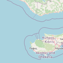
Use this park location map to pinpoint Faros Kato Pafou in Cyprus, understand its exact geographic position, and read its mapped placement within the surrounding landscape more clearly.

Pigeon | © OpenStreetMap contributors

Visual exploration of coastal habitats, cliffs, and protected terrain

Faros Kato Pafou Landscape and Scenery Photography

Visual documentation of Faros Kato Pafou reveals the intricate topography of sea cliffs, embryonic dunes, and coastal scrub along the Mediterranean shore. Examining these protected habitats provides direct insight into the ecological character of the Cypriot coastline.

An outdoor information sign displaying a map of the Faros Kato Pafou Natura 2000 protected area, including a legend and descriptive text in Greek and English.

Park atlas

Compare regional coastal habitats and Mediterranean protected areas across Cyprus

Exploring Other Parks Near Faros Kato Pafou and Surrounding Protected Landscapes

Browsing nearby national parks and protected areas provides deeper context for the coastal habitats surrounding Faros Kato Pafou. Comparing adjacent regional landscapes reveals how local ecological networks connect across the wider Mediterranean coastline.
Nature reserveCyprus
About 6.5 km away#1 closest

Southeast

Ekboles Potamon Ezousas, Xerou, Kai Diarizou: Nature Reserve and Coastal Habitat

Natura 2000 protected landscape in southwestern Cyprus

Spanning over 800 hectares, Ekboles Potamon Ezousas, Xerou, Kai Diarizou protects the vital intersections of three river mouths with the Mediterranean Sea. This nature reserve sustains a dense network of avian habitats, ranging from coastal flats to river corridors, and represents a crucial migratory waypoint and breeding ground within the Cyprus landscape.

Area
8.271 km²
Established
2007
Climate
Mediterranean
Scope
Terrestrial
Nature reserveCyprus
About 8.8 km away#2 closest

East

Koilada Ezousas: Protected Inland Valley Landscapes and Map Geography in Western Cyprus

Natura 2000 designated nature reserve in the Paphos district

Koilada Ezousas represents a strategically mapped protected area in western Cyprus, characterized by its extensive inland valley terrain. The site acts as a critical refuge within the Mediterranean ecoregion, supporting a high concentration of raptors and endemic passerines. Understanding its geographic spread provides insight into the broader network of protected corridors across the island.

Area
56.27 km²
Established
2019
Climate
Mediterranean
Scope
Terrestrial
Nature reserveCyprus
About 9 km away#3 closest

North

Koili - Mavrokolympos Nature Reserve: Mapping the Protected Landscapes of Interior Cyprus

A vital Mediterranean sanctuary defined by diverse habitats and limestone terrain.

Koili - Mavrokolympos stands as an essential nature reserve in the Cypriot interior, encompassing a dense mosaic of cypress forests, Oriental plane woodlands, and sun-drenched phrygana. This protected area offers deep insight into Mediterranean biodiversity, highlighting the intersection of complex hydrology and rocky, undulating limestone topography within a compact, ecologically significant boundary.

Area
2.968 km²
Established
2002
Relief
Mixed relief
Climate
Mediterranean
A soft watercolor painting of a curved sandy beach meeting the ocean, with green coastal hills and shrubs in the foreground.
Nature reservePaphos District
About 12 km away#4 closest

North

Chersonisos Akama Nature Reserve: Geography and Protected Area Overview in Paphos District

Mapping Mediterranean forest, coastal, and marine ecosystems

Chersonisos Akama stands as an essential protected landscape in northwestern Cyprus. This atlas entry provides geographic insights into its varied terrain, ranging from juniper woodlands and endemic-rich grasslands to its significant offshore reefs and sea turtle nesting beaches. Understand the spatial distribution of this Natura 2000 site and its role in preserving eastern Mediterranean biodiversity.

Area
179.144 km²
Established
2009
Relief
Mixed relief
Climate
Mediterranean
Nature reserveCyprus
About 12 km away#5 closest

Northeast

Episkopi Morou Nerou: Mapping the Protected Nature Reserve Landscapes of Western Cyprus

A regional geography of river valleys, riparian galleries, and forest mosaics

Located in western Cyprus, Episkopi Morou Nerou is a notable nature reserve spanning river valleys and Mediterranean scrubland. This protected area supports an array of habitats, from oriental plane forests and poplar galleries to open phrygana and pseudo-steppe grasslands, serving as a critical sanctuary for diverse bird populations and native plant species.

Area
4.193 km²
Established
2002
Relief
Mixed relief
Climate
Mediterranean
Nature reserveCyprus
About 17 km away#6 closest

East

Koilada Diarizou Nature Reserve and Mediterranean River Valley Geography

Protected riparian landscapes in the Paphos district of Cyprus

Koilada Diarizou represents a prime example of a Mediterranean river valley protected area in western Cyprus. This nature reserve sustains a mosaic of rocky limestone slopes, cypress woodlands, and seasonal riparian channels that serve as a critical reference point for understanding the island's unique ecological connectivity.

Area
13.58 km²
Established
2002
Relief
Mixed relief
Climate
Mediterranean
Nature reserveCyprus
About 18 km away#7 closest

Northeast

Kremmoi Ezousas Nature Reserve: Protected Inland Foothills and Bird Habitat in Cyprus

Mapped Mediterranean valley terrain and avian conservation zones

Situated in the inland valleys of western Cyprus, Kremmoi Ezousas functions as a key Special Protection Area within the Mediterranean ecoregion. The reserve supports a complex landscape of scrubland and seasonal watercourses that provide crucial breeding, wintering, and migratory refuge for dozens of bird species including raptors and passerines.

Area
15.7 km²
Established
2008
Climate
Mediterranean
Scope
Terrestrial
Nature reservePaphos District
About 20 km away#8 closest

East

Cha-Potami Nature Reserve: Protected Riverine Geography in Paphos District, Cyprus

River valley ecosystems and Mediterranean protected terrain

Cha-Potami spans a twelve-kilometer river stretch characterized by deep, narrow valleys and varied topography. This protected area offers a look into the rich ecological stratification of southwestern Cyprus, from dense riverside corridors and cypress-dotted slopes to rugged, raptor-nesting cliffside gorges that define the local landscape character.

Area
26.266 km²
Established
2000
Relief
Upland
Climate
Mediterranean

Common questions about visiting, size, designation, and location context for Faros Kato Pafou

Faros Kato Pafou FAQs for park facts, access, geography, and protected area context

Find quick answers about Faros Kato Pafou, including protected-area facts, park geography, trail and visitor context, and how the park fits into its surrounding country and regional landscape.
MoriAtlas Explorer

Continue Your Protected Areas Search Across the Global Atlas

Deepen your exploration by continuing the structured search for national parks and protected areas worldwide. Utilize the comprehensive filtering capabilities to compare different conservation landscapes and refine your understanding of global park geography. Discover more about the distribution and characteristics of protected natural areas.

Global natural geography