
Mori Atlas logo
Protected areaFFH-Gebiet Wälder der Hüttener Berge

A historic mosaic of Natura 2000 protected woodlands and complex glacial landscape terrain.

FFH-Gebiet Wälder der Hüttener Berge: Mapping the Glacial Moraine Forests of Northern Germany

FFH-Gebiet Wälder der Hüttener Berge represents a unique collection of eleven woodland parcels spanning the Rendsburg-Eckernförde district of Schleswig-Holstein. This protected area preserves a diverse mosaic of woodruff and woodrush beech forests, Atlantic beech stands, and wet floodplain habitats shaped by the terminal moraines of the last glacial period. By tracing forest continuity back to 1805, the landscape serves as a critical node in the regional biotope network and the broader Naturpark Hüttener Berge.

Natura 2000FFH areabeech forestwoodruff beechwoodwoodrush beechwoodAtlantic beech forest
A flat vector-style illustration of a scenic mountain landscape featuring a tall waterfall cascading between cliffs, a meadow with a wooden fence in the foreground, and pine trees surrounding the base.

FFH-Gebiet Wälder der Hüttener Berge

Protected area

Park overview

Structured park overview, official facts, and landscape profile for FFH-Gebiet Wälder der Hüttener Berge

FFH-Gebiet Wälder der Hüttener Berge park facts, protected area profile, and essential visitor context

Review the core facts for FFH-Gebiet Wälder der Hüttener Berge, including designation, size, terrain, visitor scale, habitats, and operating context in one park-focused overview.

About FFH-Gebiet Wälder der Hüttener Berge

The FFH-Gebiet Wälder der Hüttener Berge represents one of the most characteristic woodland Natura 2000 designations in northern Germany's Hügelland. Set on the southern slope of a Weichselian terminal moraine in the Rendsburg-Eckernförde district, the protected area captures a historically rooted beech-dominated forest landscape composed of eleven distinct, state-owned forest parcels. Together they form a coherent ecological unit within the wider Hüttener Berge landscape, contributing to a continuous forest belt that has been mapped since the early nineteenth century.

The site's defining character lies in the dominance of two beech forest habitat types: the widespread woodruff beech forest (Waldmeister-Buchenwald, habitat type 9130) and the more acidic lowland beech forest with woodrush (Hainsimsen-Buchenwald, habitat type 9110). Complementing these are smaller, ecologically significant patches of Atlantic beech forest with holly and yew (habitat type 9120, a priority habitat), as well as damp depressions harboring alder-ash floodplain forest (habitat type 91E0, also a priority habitat), dystrophic standing waters (type 3160) such as the Rammsee, and transition mires (type 7140). Almost half of the area has no specific habitat type designation but still contributes to the ecological mosaic.

From a landscape planning perspective, the protected area is integrated into multiple layers of conservation: the Natura 2000 designation, the landscape protection area of Wittensee, Hüttener and Duvenstedter Berge, the Naturpark Hüttener Berge, and the regional biotope network with priority areas and connecting axes linking core woodland habitat. Management aims focus on encouraging the conversion of conifer stands toward native broadleaf forest, restoring favorable water regimes in wet forest depressions, and supporting the development of additional natural forest reserves within the state forest. The Hüttener Berge site exemplifies how Natura 2000 protection in Schleswig-Holstein operates in the context of active, multifunctional state forestry rather than strict nature reserve exclusion.

Quick facts and research context for FFH-Gebiet Wälder der Hüttener Berge

The FFH-Gebiet Wälder der Hüttener Berge is a Natura 2000 site (code DE-1624-391) in the Rendsburg-Eckernförde district of Schleswig-Holstein, protected under Section 32 of the German Federal Nature Conservation Act in conjunction with Section 23 of the Schleswig-Holstein State Nature Conservation Act. The landscape is classified as the natural region 70103 Hüttener Berge, part of the major natural region Schleswig-Holsteinisches Hügelland. The protected area spans about 416 hectares across eleven separate forest sub-areas, with state-owned Schleswig-Holsteinische Landesforsten being the dominant landowner.

The site sits on the southern slope of a Weichselian terminal moraine with glacial boulder clay and marl soils. Elevation across the area ranges from roughly seven meters at the lowest northern edge near Krummland to about ninety-eight meters at the Heidberg hill in the Forst Brekendorf. Roughly forty percent of the area carries an FFH habitat type designation, with woodland beech habitats (9130 Waldmeister-Buchenwald and 9110 Hainsimsen-Buchenwald) dominating. The Natura 2000 standard data form was produced in May 2004, the site was confirmed as a Site of Community Importance by the EU in October 2007, and national confirmation as a Special Area of Conservation followed in January 2010, with a management plan published in December 2013.

Protection and recognition

Documented terrestrial protection scope, designation year, and official records

FFH-Gebiet Wälder der Hüttener Berge Protection Status and Designation Data

Terrestrial protection status records for FFH-Gebiet Wälder der Hüttener Berge outline formal designation history established in 2010. Documented facts include baseline management scope and international database identifiers without assigned external recognition programs.

Protection details

Protection scope
Terrestrial
Designated year
2010
Transboundary protection
No
WDPA ID
555517856
Park context

Deeper park guide and search-rich context for FFH-Gebiet Wälder der Hüttener Berge

FFH-Gebiet Wälder der Hüttener Berge history, landscape, wildlife, and travel context

Explore FFH-Gebiet Wälder der Hüttener Berge through its history, landscape character, ecosystems, wildlife, conservation priorities, cultural context, and seasonal travel timing in a structured park guide built for atlas discovery and search intent.

Why FFH-Gebiet Wälder der Hüttener Berge stands out

The site is especially known for its extensive historical beech forests on a glacial moraine ridge in the Hüttener Berge, including extensive stands of woodruff and woodrush beech woodland, small patches of rare Atlantic beech forest with holly and yew, and alder-ash softwood floodplain communities. Several of the forest parcels have been mapped as woodland continuously since at least 1805, making it one of the more continuity-rich woodland habitats in Schleswig-Holstein's Natura 2000 network. The area is also notable for its unusual landscape structure within a Natura 2000 site: eleven separate forest sub-areas, many of them quite small, scattered across several municipalities and integrated into a larger state forest and the Naturpark Hüttener Berge. This mosaic-like configuration reflects how the site combines practical forestry, landscape-scale habitat protection, and ecological connectivity through the regional biotope network.

A wide panoramic view of a lush deciduous forest in summer with a small, algae-covered pond nestled among the trees.
The Schierenskroog section of the Wälder der Hüttener Berge protected area, featuring mature deciduous forest bordering a pond.

FFH-Gebiet Wälder der Hüttener Berge history and protected-area timeline

The forests of the Hüttener Berge have long functioned as a continuous woodland complex within the Schleswig-Holstein Hügelland, with the earliest cartographic evidence appearing in the 1805 map of the Duchy of Schleswig produced by the Danish cartographer Johann Heinrich Christian du Plat, where most of the current sub-areas were already recorded as woodland. The du Plat map became a useful baseline for later assessments of forest continuity, and comparisons with the 1893 map of the German Empire show that the woodland configuration had changed relatively little by that time. Only the Forst Brekendorf stands out as a genuinely newer addition, having been afforested during the Prussian era around 1905 on ground that was still unwooded in 1893.

Formal Natura 2000 protection began with the preparation of the standard data form by the Landesamt für Landwirtschaft, Umwelt und ländliche Räume (LLUR) of Schleswig-Holstein in May 2004. The area was submitted as a candidate Site of Community Importance in September 2004, formally confirmed by the European Union in October 2007, and subsequently established nationally in January 2010 under Section 32 of the German Federal Nature Conservation Act combined with Section 23 of the Schleswig-Holstein State Nature Conservation Act. The standard data form was most recently updated in May 2017 (May 2019 for habitat mapping).

The management plan published on 10 December 2013 set out the conservation framework for the site, and the area has been periodically monitored under the state's six-year FFH monitoring cycle, with the latest published results dating to December 2012 (as of the article's 2022 state). The surrounding landscape protection area of Wittensee, Hüttener and Duvenstedter Berge was designated on 9 March 2001, providing a broader protective context for the woodland site within the Hüttener Berge region. Land ownership has remained concentrated with the Schleswig-Holsteinische Landesforsten, which has shaped the practical approach to conservation through integration with active state forestry rather than through excluding management.

FFH-Gebiet Wälder der Hüttener Berge landscape and geographic character

The protected area occupies the southern slope of a Weichsel-glacial terminal moraine, underlain by boulder clay (Geschiebelehm) and boulder marl (Geschiebemergel) that shape the soils and hydrology of the forests. Elevation across the eleven forest parcels ranges from about seven meters above sea level at the eastern edge of the Krummland enclosure near the Schlei lowlands to roughly ninety-eight meters at the Heidberg hill on the eastern fringe of the Forst Brekendorf, the highest point in the entire protected area. The Forst Brekendorf itself contains multiple summits above seventy meters and the rounded, hummocky terrain for which the Hüttener Berge are named.

From north to south, the protected area stretches about eight point two kilometers, beginning at the northern edge of the Ascheffel municipality south of the Bundesstraße 76, running through the ridge forests of the Hüttener Berge, and ending near the southern shore of the Bistensee at the Schierenskroog enclosure in the north of Holzbunge, just north of the Bundesstraße 205. The northern sub-areas (such as Krummland) drop gently eastward into the Schlei watershed via the Große Hüttener Au, while the western Forst Brekendorf drains westward via the Brekendorfer Au, Mühlenau, Sorge, and Eider into the North Sea.

The forest parcels themselves vary widely in character. The northern Krummland falls from thirty-six meters in the west to seven meters in the east, including wet depressions, source springs, and a low moor landscape. Gehege Brammerberg, Wellbörn, and Holzkoppel in the central part of the site form smaller woodland islands set against agricultural land, with slopes descending toward the Rohau and the Schlei. Toward the south, around the Bistensee, the sub-areas of Ahlefeld, Schierenskroog, Vosskuhlenmaas, and Bockholt are low-lying, gently sloping forests between roughly thirteen and twenty-nine meters, shaped by their proximity to the lake and a network of small drainage ditches. The Heidberg in the Forst Brekendorf and the nearby Scheelsberg at roughly one hundred six meters frame the highest landscape within and adjacent to the protected area.
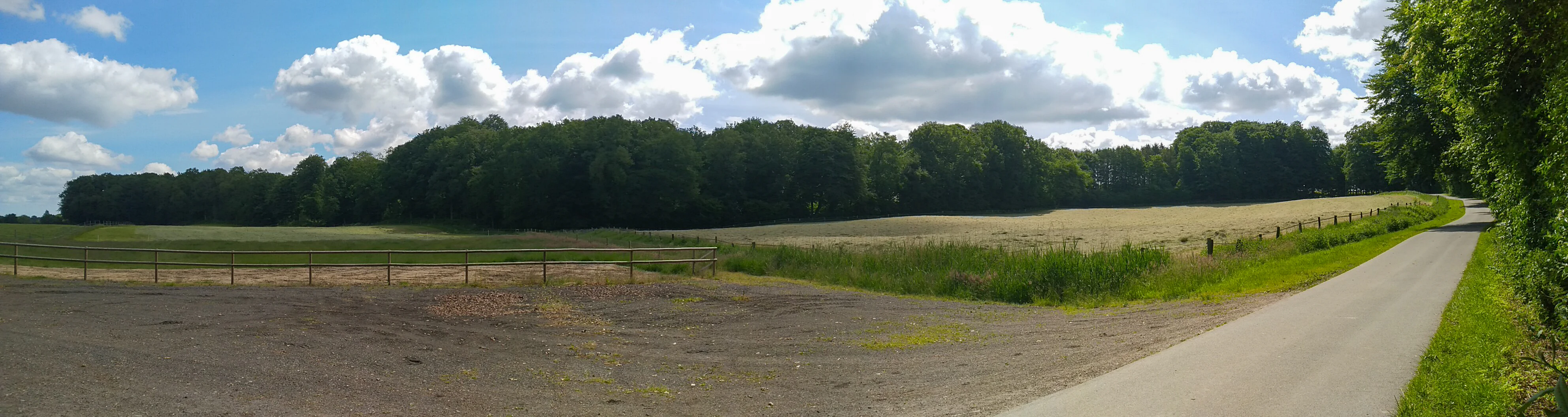
A wide panoramic view of a rural landscape in Germany, featuring a paved road leading toward a dense green forest, with a fenced field in the foreground.
A view of the Schierenskroog forest area within the Hüttener Berge landscape.

FFH-Gebiet Wälder der Hüttener Berge ecosystems, habitats, and plant life

Ecologically, the FFH-Gebiet Wälder der Hüttener Berge is dominated by broadleaf forest, with around forty percent of the area formally classified as an FFH habitat type and the remainder still functioning as ecologically connected woodland and transition zones. The most extensive habitat is the woodruff beech forest (Waldmeister-Buchenwald, habitat type 9130), which is widespread across nearly all of the smaller sub-areas and typically carries a moderate to favorable overall conservation assessment. The second key habitat is the lowland beech forest with woodrush (Hainsimsen-Buchenwald, habitat type 9110), particularly characteristic of the Forst Brekendorf, Gehege Fresenboje, and Gehege Bockholt, often in an unfavorable conservation state.

A particularly valuable ecological component is the presence of Atlantic beech forest with holly and yew (habitat type 9120), a priority habitat at the EU level. Occurring notably in the Gehege Silberbergen, this habitat type features understorey communities of holly (Ilex) and occasional yew (Taxus) and is restricted in distribution across Germany, lending the Hüttener Berge site some regional significance for this habitat.

Wet forest habitats also play an important role. Alder-ash and softwood floodplain forests (habitat type 91E0, also a priority habitat) line the small streams and seepage zones of the Rohau and other drainage features, appearing in the Krummland, Wellbörn, Holzkoppel, and Silberbergen sub-areas. In the Forst Brekendorf, the small Rammsee represents a dystrophic standing water (habitat type 3160), while transition and quaking bog communities (habitat type 7140) appear in scattered wet depressions, particularly around the Krummland enclosure. Together these elements create a habitat mosaic that combines dry ridge beechwoods, source-rich slope seepage forests, and mire-like wet depressions, sustained by the glacial clay-rich soils and gentle topography of the moraine.
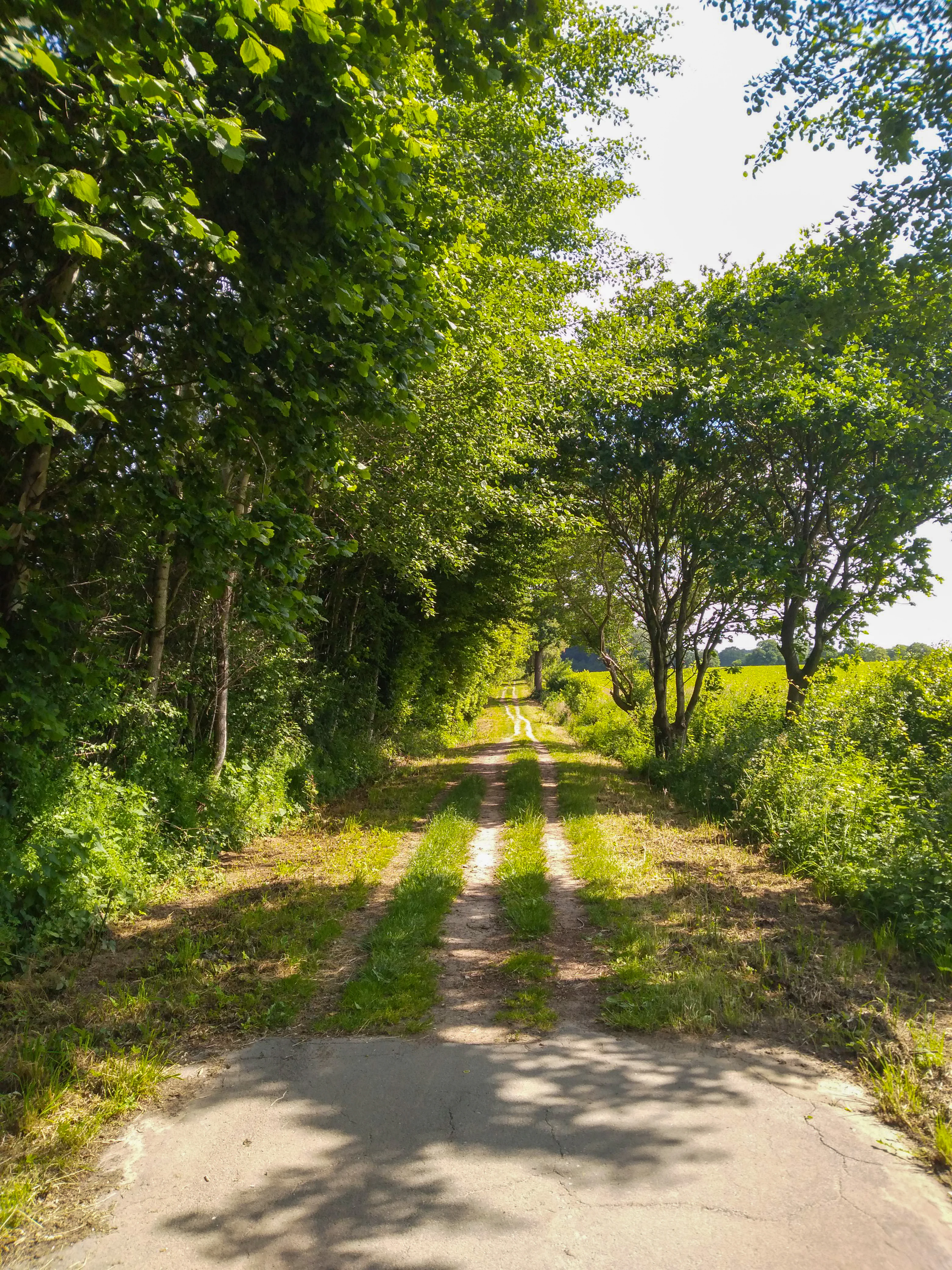
A narrow, unpaved rural path lined with dense green trees on one side and an open field on the other, receding into the distance under bright sunlight.
A dirt path flanked by deciduous trees and green fields in the Gehege Bockholt area.

FFH-Gebiet Wälder der Hüttener Berge wildlife and species highlights

The woodlands of the Hüttener Berge provide habitat for forest wildlife typical of the Schleswig-Holstein Hügelland, with the mosaic of broadleaf forests, seepage zones, small streams, and dystrophic lakes supporting a range of forest-dwelling fauna. The mix of older beech stands, natural forest reserves in Krummland, regenerating younger plantations, and surrounding agricultural land creates conditions for both woodland specialists and edge-of-habitat species. Although the source documentation focuses primarily on habitats and forest structure rather than detailed inventories, specific wildlife observations recorded include the sighting of a pair of common cranes (Kranichpaar) at the southern edge of the Gehege Ahlefeld, indicating that the site is used by large, wet-habitat-loving bird species in the lake-and-forest transition zone near the Bistensee.

The wetland and dystrophic water components of the site, particularly around the Rammsee, the Fresensee fringes, and the source-fed depressions in Krummland, support amphibian and invertebrate communities associated with nutrient-poor, humic waters. The alder-ash floodplain strips and broken-canopy seepage forests add structural diversity that benefits forest insects and associated birdlife. Where older beech stands with standing and fallen deadwood are retained, as in the nature forest areas of Krummland, Silbersberbergen, and the southern part of Vosskuhlenmaas, the site also provides important microhabitat conditions for saproxylic species and cavity-dependent fauna typical of long-established broadleaf forest.
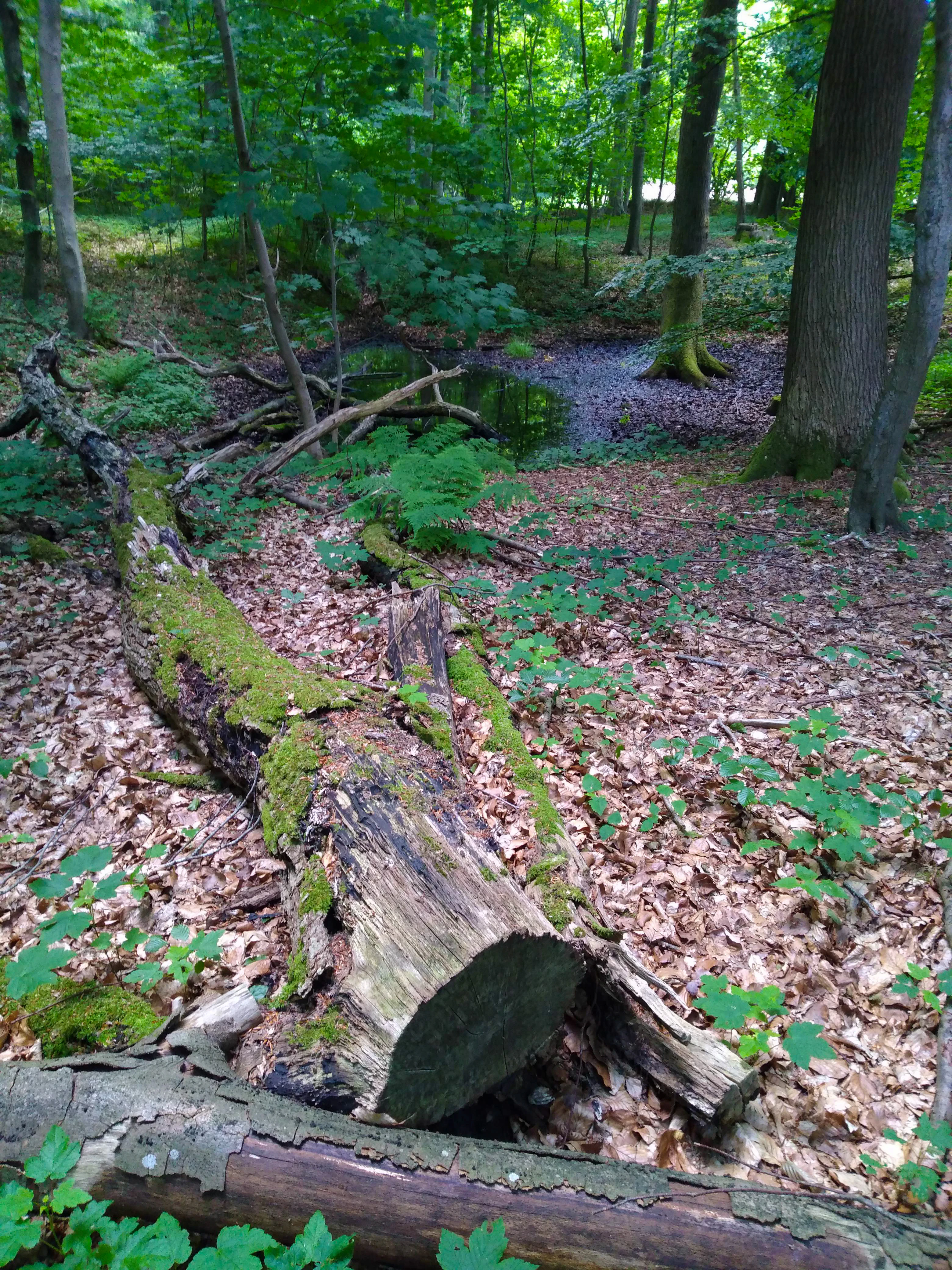
A large, moss-covered fallen log lies on a forest floor covered in dead leaves, with a small, dark pond visible in the background among deciduous trees.
A mossy fallen log within the forest of the FFH-Gebiet Wälder der Hüttener Berge.

FFH-Gebiet Wälder der Hüttener Berge conservation status and protection priorities

From a conservation perspective, the FFH-Gebiet Wälder der Hüttener Berge is significant primarily for the protection and long-term maintenance of historical beech forest habitats on glacial soils within the Natura 2000 network. The site combines large areas of two widespread beech habitat types with smaller, regionally important occurrences of priority habitats, specifically Atlantic beech forest with holly and yew and alder-ash floodplain forest, giving it value out of proportion to its modest area within Schleswig-Holstein's Natura 2000 portfolio.

The conservation framework layers multiple designations: a Natura 2000 FFH site (DE-1624-391), a Special Area of Conservation under sections of the federal and state nature conservation acts, inclusion in the landscape protection area of Wittensee, Hüttener and Duvenstedter Berge, and integration with the Naturpark Hüttener Berge and the regional biotope network. Most parcels lie within priority areas of the biotope network, while the woodlands around the Bistensee function as connecting axes.

Active management, guided by the December 2013 management plan and aligned with the principles for Natura 2000 in the Schleswig-Holsteinische Landesforsten, focuses on conversion of conifer stands to native broadleaf forest, expansion of natural forest reserves toward the five-percent state forest target, and improvement of the water balance in wet forest depressions through the installation of small dams in drainage ditches. Periodic six-year FFH monitoring evaluates implementation, and the 2020 landscape framework plan indicated that no further statutory protection designations were planned at that point, suggesting reliance on the existing layered protection regime.

FFH-Gebiet Wälder der Hüttener Berge cultural meaning and human context

The Hüttener Berge landscapes have long been part of the traditional settlement and forest-use history of the Duchy, and later the Prussian province, of Schleswig-Holstein. Many of today's protected woodlands were already functioning as mapped forest stands in 1805 under Danish administration, and by 1893 the configuration closely resembled the current one. The region's forest culture blends practical, state-managed forestry with traditional woodland recreation, including horse-riding trails, forest educational paths (such as the Waldlehrpfad at Silberbergen), and a network of hiking and cycling routes that connect the forests to surrounding villages and the Bistensee.

Agricultural land still surrounds many of the smaller forest parcels, and the woodland edges are commonly defined by traditional Schleswig-Holstein Knick hedgerows, reinforcing the cultural-historical character of the landscape. The Bistensee lakeside, the Heidberg hill, and the recreational forests of the Forst Brekendorf are integrated into the broader Naturpark Hüttener Berge, supporting outdoor recreation that connects ecological protection with regional cultural landscape identity.
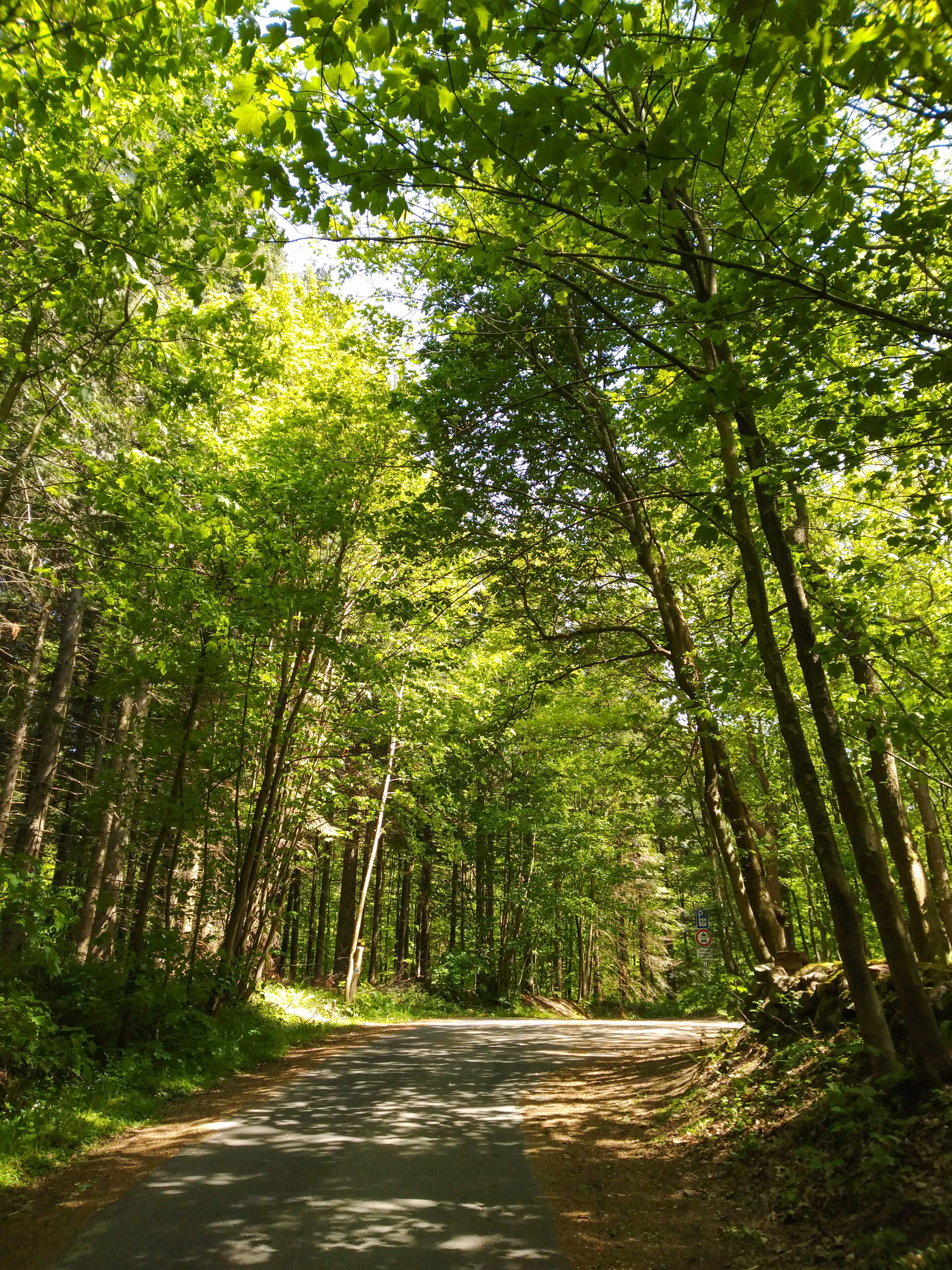
A paved forest path winding through a dense green canopy of deciduous trees with dappled sunlight on the ground.
A shaded forest road leading through the deciduous woodlands of the Hüttener Berge area.

Top sights and standout views in FFH-Gebiet Wälder der Hüttener Berge

Among the strongest distinguishing features is the long continuity of woodland cover, with most sub-areas already mapped as forest on the 1805 du Plat map. The mosaic structure of eleven state forest parcels, integrated into the Naturpark Hüttener Berge and the landscape protection area of Wittensee, Hüttener and Duvenstedter Berge, also sets this site apart within the regional Natura 2000 network. Ecologically, the co-occurrence of two widespread beech habitats with the rarer Atlantic beech forest with holly and yew, alder-ash floodplain forest, dystrophic waters, and transition mires gives the site a notably rich habitat composition for its size.
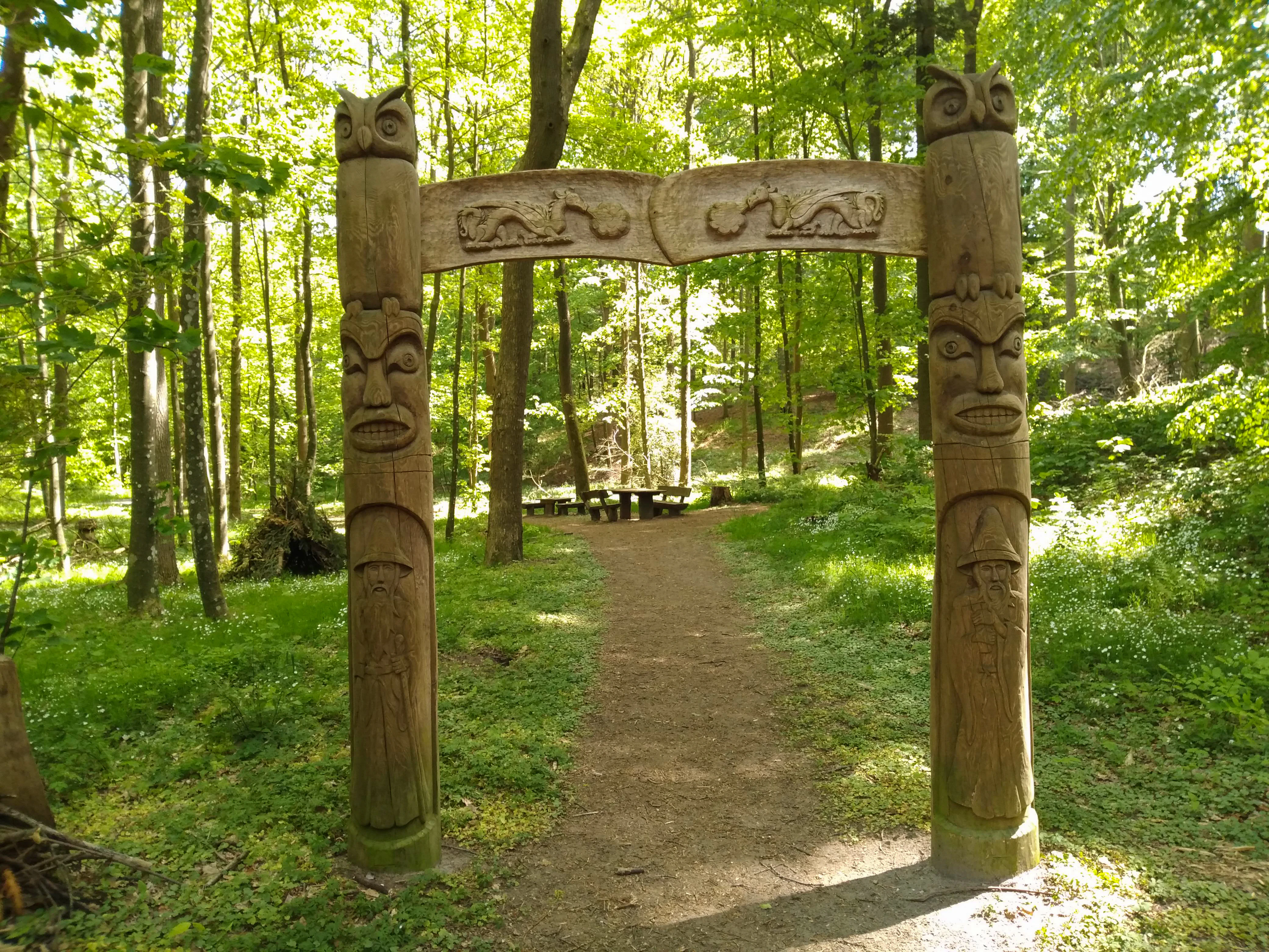
A decorative wooden archway featuring carved faces and animal figures marks the entrance to a forest trail, with a picnic table visible in the distance.
Wooden carved gateway leading to a resting area in the Brekendorf forest section.

Best time to visit FFH-Gebiet Wälder der Hüttener Berge

The forests of the Hüttener Berge are accessible year-round, but they show their most distinctive character in late spring and early summer, when the herb layer of the woodruff and woodrush beech forests blooms and the seepage zones in Krummland and the Bistensee sub-areas are most biologically active. Autumn brings rich coloration to the broadleaf canopy and offers good conditions for walking the forest educational paths at Silberbergen and around the Bistensee. Winter visits highlight the structural contrast between the historical beech stands, the nature forest reserves in Krummland with their standing and fallen deadwood, and the ridgeline terrain around the Heidberg. Wet depressions and small dystrophic lakes are most easily appreciated during drier periods, when forest paths are generally more accessible.

Monthly climate preview

Long-term representative point measurements tracking monthly temperature and precipitation rhythm

FFH-Gebiet Wälder der Hüttener Berge Climate Normals and Annual Weather Patterns

Representative coordinates record measured multi-year temperature ranges and precipitation rates across the landscape, establishing a clear baseline for the terrain. Reviewing the complete twelve-month record provides deeper insight into long-term meteorological trends and monthly variations.
Annual mean9 °C
1 °C17 °C
Jan
Feb
Mar
Apr
May12°
Jun15°
Jul17°
Aug17°
Sep14°
Oct10°
Nov
Dec
Warmest month
August

17.4 °C

Coolest month
January

1.3 °C

Wettest month
August

2.7 mm/day

Driest month
April

1.4 mm/day

Park location guide

Geography guide, regional context, and park location map for FFH-Gebiet Wälder der Hüttener Berge

FFH-Gebiet Wälder der Hüttener Berge park geography, regions, and map view in Germany

Understand where FFH-Gebiet Wälder der Hüttener Berge sits in Germany through a broader geographic reading of the surrounding landscape, nearby location context, and its mapped position within the national park landscape.

How FFH-Gebiet Wälder der Hüttener Berge fits into Germany

Germany is a federal republic in Western and Central Europe with a population of over 83 million across sixteen constituent states. It is Europe's largest economy by nominal GDP and a major global exporter and importer. The capital is Berlin, and the country borders Denmark, Poland, Czech Republic, Austria, Switzerland, France, Luxembourg, Belgium, and the Netherlands.

Wider geography shaping FFH-Gebiet Wälder der Hüttener Berge in Germany

Germany is located in Western and Central Europe, spanning 357,022 km². It borders Denmark to the north, Poland and the Czech Republic to the east, Austria and Switzerland to the south, and France, Luxembourg, Belgium, and the Netherlands to the west. The country has coastlines on the Baltic Sea and North Sea to the north, with the Alps located in the southern region.

Map view of FFH-Gebiet Wälder der Hüttener Berge

Use this park location map to pinpoint FFH-Gebiet Wälder der Hüttener Berge in Germany, understand its exact geographic position, and read its mapped placement within the surrounding landscape more clearly.

Pigeon | © OpenStreetMap contributors

Location context for FFH-Gebiet Wälder der Hüttener Berge

Schleswig-Holstein

Visual reference of woodland parcels, terminal moraine terrain, and beech habitats

FFH-Gebiet Wälder der Hüttener Berge Photos and Glacial Forest Landscapes

Visual records capture the fragmented forest mosaic, beech woodland canopies, and glacial terrain characteristic of FFH-Gebiet Wälder der Hüttener Berge. Photographic documentation allows visitors to examine habitat diversity, topography, and protected conservation environments across the region.

A wide panoramic view of a lush deciduous forest in summer with a small, algae-covered pond nestled among the trees.

Panoramic landscape of a green grassy field under a bright sky with fluffy white clouds, surrounded by dense green deciduous forest.

A wide panoramic view of a rural landscape in Germany, featuring a paved road leading toward a dense green forest, with a fenced field in the foreground.

A narrow, unpaved rural path lined with dense green trees on one side and an open field on the other, receding into the distance under bright sunlight.

A large, moss-covered fallen log lies on a forest floor covered in dead leaves, with a small, dark pond visible in the background among deciduous trees.

A dirt path leading into a dense green forest, with a wooden information signpost located on the right side of the trail.

A paved forest path winding through a dense green canopy of deciduous trees with dappled sunlight on the ground.

A decorative wooden archway featuring carved faces and animal figures marks the entrance to a forest trail, with a picnic table visible in the distance.

A dirt hiking trail leads into a dense green deciduous forest with a small wooden trail marker post on the right side.

A dirt path flanked by large beech trees enters a lush green forest; a wooden signpost with small circular symbols stands on the right side of the trail.

Two black and white Holstein cows standing in a bright green pasture surrounded by deciduous trees under a clear blue sky.

A narrow dirt path framed by dense green forest trees, with a wooden trail marker post featuring colored symbols on the right side.

A gravel trail entrance flanked by several wooden information signs and forest trees.

A dirt trail winds out of a leafy forest into an open field with a building visible in the distance.

A narrow dirt hiking path winding through a lush green forest, with a prominent weathered stone marker standing on the right side of the trail.

A wide view of a bright green meadow bounded by a line of mature trees under a blue sky with thin wispy clouds.

Park atlas

Compare regional forest reserves, glacial moraine terrain, and connected habitats

Other Parks Near FFH-Gebiet Wälder der Hüttener Berge And Surrounding Protected Landscapes

Browse protected areas surrounding FFH-Gebiet Wälder der Hüttener Berge to examine similar glacial moraine forests and regional biotope networks. Expanding the geographic scope helps place historical beech woodlands into a broader conservation context across northern Germany.
A watercolor painting showing a flat, marshy shoreline leading to a calm lake, with rolling hills in the background and soft, muted tones of green and yellow.
Protected areaSchleswig-Holstein
About 8 km away#1 closest

Southeast

FFH-Gebiet Wittensee und Flächen angrenzender Niederungen Protected Area Geography

Glacial lake and lowland landscape context in Schleswig-Holstein.

Explore the physical geography of the FFH-Gebiet Wittensee und Flächen angrenzender Niederungen, encompassing the Wittensee glacial basin and its neighboring wetland corridors. This record provides a detailed look at the site's habitat mosaic, including calcareous fens and riparian woodlands situated along the Habyer Au and Schirnauer Au streams.

Area
12.2 km²
Established
2004
Relief
Lowland
Climate
Temperate
Nature reserveSchleswig-Holstein
About 10 km away#2 closest

West

FFH-Gebiet Übergangsmoor im Kropper Forst: Protected Landscape and Mire Geography

A study of transitional mire habitats in Schleswig-Holstein.

This protected area centers on a treeless mire depression embedded within the coniferous Gehege Kropp forest. Covering 18 hectares of glacial terrain, the site illustrates the delicate balance of mire hydrology and the long-term ecological impact of regional landscape management in northern Germany.

Area
0.18 km²
Established
2004
Relief
Lowland
Climate
Temperate
Nature reserveBrandenburg
About 13 km away#3 closest

Southeast

Tiergarten Nature Reserve: Geography and Protected Habitat Mapping in Brandenburg, Germany

Ancient oak woodland, riparian wetlands, and historic forest trails.

Spanning 158 hectares, the Tiergarten nature reserve serves as an ecologically rich sanctuary of oak-hornbeam forests and wet meadows. This area, formerly a royal hunting ground, offers a dense mosaic of riparian zones along the Staabe river, protecting essential habitats within the broader Brandenburg landscape.

Area
1.58 km²
Established
1995
IUCN
IV
Nature reserveSchleswig-Holstein
About 16 km away#4 closest

Southwest

Wald östlich Hohn Nature Reserve: Ancient Broadleaf Forest Geography and Mapped Boundaries

Protected glacial moraine woodland in Schleswig-Holstein

Spanning roughly twelve hectares near Hohn, this nature reserve safeguards centuries-old broadleaf forest communities including beech and oak-hornbeam stands. The site is a significant protected area within the Schleswig-Holstein Geest, illustrating how ancient wooded islands persist amid intensive modern agricultural landscapes through formal Natura 2000 conservation status.

Area
0.118 km²
Established
2004
Relief
Lowland
Climate
Temperate
Nature reserveSchleswig-Holstein
About 18 km away#5 closest

Northwest

FFH-Gebiet Wellspanger-Loiter-Oxbek-System und angrenzende Wälder Protected Landscapes

Schleswig-Holstein nature reserve map and geography

This protected area bundles a wide range of priority habitat types, including calcareous springs, inland dunes, and old-growth beech forests. Spanning the Angeln peninsula, the site protects a hydrological backbone of stream systems and rare wet meadows that remain critical for regional biodiversity in Northern Germany.

Area
14.34 km²
Established
2004
Relief
Upland
Climate
Temperate
A watercolor painting showing a soft panoramic view of green hills and a winding stream, with distant pale mountains in the background.
Nature reserveSchleswig-Holstein
About 19 km away#6 closest

South

FFH-Gebiet Wehrau und Mühlenau Nature Reserve and River Corridor Geography

Protected riparian habitat in Schleswig-Holstein

Spanning over 246 hectares, this nature reserve protects a vital sequence of lowland streams, including the Mühlenau and Wehrau rivers. The area serves as an important refuge for rare mollusk species and aquatic wildlife, while preserving the integrity of a glacial tunnel valley geotope. This structured map view highlights the connectivity of wetlands, forests, and stream habitats that define the local landscape.

Area
2.46 km²
Established
2004
Relief
Lowland
Climate
Temperate
Protected areaSchleswig-Holstein
About 23 km away#7 closest

West

Wälder der Ostenfelder Geest: Geographic Mapping of Protected Forests in Northern Germany

A twelve-parcel woodland mosaic in the Schleswig-Holstein Geest.

Wälder der Ostenfelder Geest serves as a prime example of lowland conservation. This protected area connects diverse forest types across a glacial landscape, providing a stable habitat for beech and oak woodland communities while preserving the historic character of the Bredstedt-Husumer terrain.

Area
7.33 km²
Established
2004
Relief
Lowland
Climate
Temperate
Nature reserveSchleswig-Holstein
About 23 km away#8 closest

West

FFH-Gebiet Wälder bei Bergenhusen: Geographic Profile of Northern German Protected Woodlands

Protected forest habitat and historical geest landscapes in Schleswig-Holstein

Covering roughly 145 hectares within the Eider-Treene-Sorge lowland, this nature reserve protects a rare sequence of deciduous forest types and nutrient-rich aquatic habitats. The site is characterized by its distinct northern and southern parcels, which reveal the interplay between post-glacial geomorphology and long-standing human land use patterns preserved through centuries of forestry.

Area
1.45 km²
Established
1999
Relief
Lowland
Climate
Temperate

Common questions about visiting, size, designation, and location context for FFH-Gebiet Wälder der Hüttener Berge

FFH-Gebiet Wälder der Hüttener Berge FAQs for park facts, access, geography, and protected area context

Find quick answers about FFH-Gebiet Wälder der Hüttener Berge, including protected-area facts, park geography, trail and visitor context, and how the park fits into its surrounding country and regional landscape.
MoriAtlas Explorer

Continue Your Protected Areas Search Across the Global Atlas

Deepen your exploration by continuing the structured search for national parks and protected areas worldwide. Utilize the comprehensive filtering capabilities to compare different conservation landscapes and refine your understanding of global park geography. Discover more about the distribution and characteristics of protected natural areas.

Global natural geography