
Why FFH-Gebiet Wehrau und Mühlenau stands out
The site is most notable for protecting a continuous, near-natural lowland river corridor through an otherwise intensively farmed agricultural landscape. Its conservation value lies less in any single dramatic feature and more in the chain of small but characteristic habitat fragments strung along the Wehrau, Mühlenau, and Reidsbek: pondweed-rich standing waters, slow-flowing streams with submerged aquatic vegetation, small mires, wet tall herb fringes, species-rich mat-grass grassland, and scattered patches of alder-ash floodplain forest and old oak woodland. Equally characteristic is its role as a refuge for protected animal species that depend on small lowland rivers, including the spined loach (Steinbeisser), the European brook lamprey (Bachneunauge), and the Eurasian otter, together with the rare mollusk Vertigo moulinsiana. The site is also recognized for the glacial tunnel valley geotope at the head of the Mühlenau (the Westensee - Borgdorfer See tunnel valley system), linking its ecological value to a distinctive Quaternary geological feature.
FFH-Gebiet Wehrau und Mühlenau history and protected-area timeline
Protection planning for the site began in the early 2000s as part of the implementation of the European Union's Habitats Directive in Schleswig-Holstein. The state's environmental agency, the Landesamt für Landwirtschaft, Umwelt und ländliche Räume (LLUR), compiled the standard Natura 2000 data form for the area in June 2004. The site was proposed as a Site of Community Importance (Gebiet von gemeinschaftlicher Bedeutung, GGB) in September 2004, confirmed by the European Union in November 2007, and formally designated as a special area of conservation (besonderes Erhaltungsgebiet) under national law in January 2010. A management plan was published on 20 December 2017, and the standard data form was last updated in May 2019.
The protected river corridor crosses older conservation designations that predate the Natura 2000 listing. The Naturschutzgebiet Bokelholmer Fischteiche along the upper Reidsbek was established on 22 September 1952, more than fifty years earlier, and remains a separately managed refuge for wetland habitats and fish. The lower Linnebek, the Mühlenau, and part of the Reidsbek lie within the Naturpark Westensee, which provides a broader landscape framework for the site.
Human use of this landscape is visible in several surviving historical features. The protected watermill at Altmühlendorf still operates for hydropower generation and lies directly on the protected stretch of the Mühlenau. The lower Wehrau was once free-meandering through the lowlands; in the late nineteenth century it was channelized into windings, and the Linnebek was relocated northward as part of construction works for the Rendsburger Hochbrücke across the Kiel Canal. Near the Stampfmühle in Osterrönfeld, the remains of a medieval motte-and-bailey castle (Turmhügelburg) survive as an archaeological monument on the right bank. Nineteenth-century maps of the area, such as the historical map of the Reich from 1893, show how much the river course has since been altered by straightening, damming, and infrastructure works.
FFH-Gebiet Wehrau und Mühlenau landscape and geographic character
The site lies in a low-relief Weichselian end moraine landscape, with small lowmoor mires overlying sandy glacial deposits. Within the protected area, elevation varies only between about 1 and 24 meters above sea level (NHN), from the lowest point at the Wehrau's mouth into the Kiel Canal near Osterrönfeld to the highest point near the outflow of the Wardersee at Seehof. The terrain is shaped by glacial processes rather than dramatic relief: ridges of end moraine, small hollows filled with mires, and shallow stream valleys.
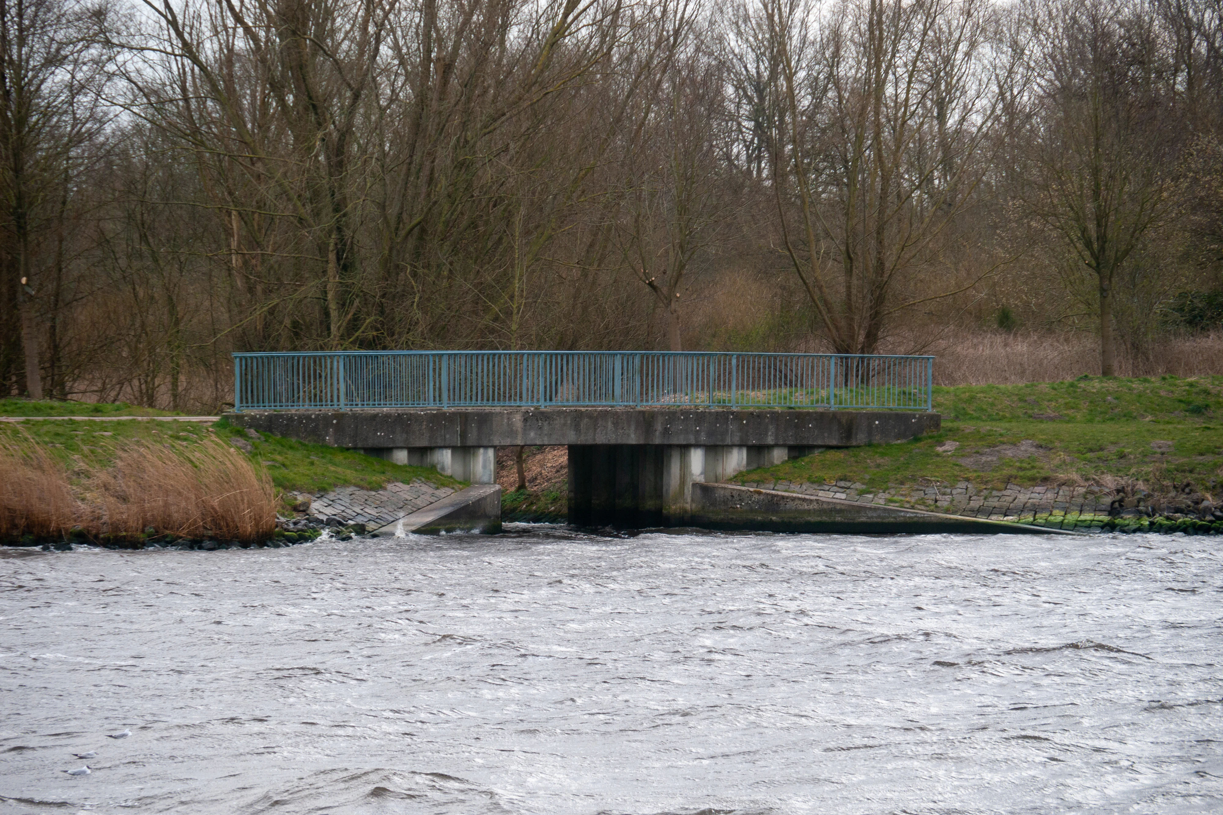
The central landscape feature is a chain of slow-moving lowland streams. The Mühlenau begins as the outflow of the Wardersee, runs northwestward past Altmühlendorf and Katenstedt, and receives a regulated tributary, the Reidsbek, near Neumühlen. North of that junction, the river takes the name Wehrau, which then flows, partly meandering and partly channelized, past Heidkrug, Linntal, and the Stampfmühle before joining the Kiel Canal. Along the way, a short side-arm of the Linnebek is also part of the protected corridor. A small eutrophic lake near the Wehrau's mouth widens the corridor to its maximum breadth of around 460 meters.
The vegetated landscape is strongly shaped by water. Sedge and reed fringes line the banks; wet meadows extend along much of the corridor; and small fragments of more structured vegetation survive where the rivers pass through wooded sections, such as the state forest stretches near Katenstedt and the broadleaf patches near Bokelholm. The head of the Mühlenau is also marked geologically as part of a glacial tunnel valley system, the Westensee - Borgdorfer See tunnel valley with its side valleys, which has been recognized as a protected geotope.
FFH-Gebiet Wehrau und Mühlenau ecosystems, habitats, and plant life
Ecologically, the protected area is best understood as a chain of small wetland and forest fragments strung along a lowland river, in a setting that has otherwise become dominated by intensive farming. About three quarters of the protected area is classified as moist or mesophilic grassland, with inland standing and flowing waters making up around eight percent and the remainder consisting of mire, swamp, and floodplain habitats.
The seven FFH habitat types formally mapped within the site reflect this character. Slow-flowing watercourses with submerged aquatic vegetation (habitat type 3260) form the spine of the network and account for the majority of the habitat-type area, with much smaller contributions from nutrient-rich standing waters with pondweed or frogbit communities (3150), species-rich mat-grass grassland (6230), wet tall herb fringes (6430), transition mires with quaking mats (7140), beech forests of the Luzulo-Fagetum type (9110), and old acidophilous oak forests with pedunculate oak on sand (9190). Alder-ash and softwood floodplain forests (91E0) are the most ecologically distinctive forest type, occurring along narrow strips of the Mühlenau, Wehrau, and Reidsbek.
Outside the formally classified habitat types, the site also includes reed beds along the Wardersee outflow, riparian alder and ash woodland, wet meadows in agricultural use, small ponds, and a mosaic of intensively used grasslands within the broader river corridor. All mapped FFH habitat types are currently assessed as being in an unfavorable-bad (category C) overall conservation status, underlining the fact that this is a heavily human-influenced landscape in which ecological quality has to be actively maintained.
FFH-Gebiet Wehrau und Mühlenau wildlife and species highlights
Wildlife is closely tied to the river corridor. The site supports a small but meaningful set of protected aquatic and semi-aquatic species, listed under the EU Habitats Directive as Annex II features for the area. These include the spined loach (Cobitis taenia, locally Steinbeisser), a small bottom-dwelling fish of slow-flowing lowland streams; the European brook lamprey (Lampetra planeri, Bachneunauge), which depends on clean gravel beds for spawning; the Eurasian otter (Lutra lutra, Fischotter), which uses the river corridors and associated ponds as movement and feeding habitat; and Vertigo moulinsiana (Bauchige Windelschnecke), a rare wetland mollusk associated with calcareous mires and tall herb vegetation.
These species signals that the river system still provides enough natural structure to support sensitive freshwater fauna, even though official assessments of conservation status are only moderate. The fish in particular depend on maintaining fish passage along the entire length of the corridor; obstacles such as the hydropower installation at Altmühlendorf, the Fuhlenau pumping station, and the weir controlling flow into the Reidsbek are highlighted as key challenges.
The otter population in Schleswig-Holstein has been recovering and is now present across most of the state, with traffic accidents on roads and poorly designed river underpasses identified as the greatest ongoing threat. Improving the otter passability of all stream crossings within the protected area is part of the site's conservation strategy. Fish, amphibians, and invertebrates typical of small lowland rivers and their associated wet meadows, mires, and pond margins would be the most characteristic elements of the broader, non-protected fauna.
FFH-Gebiet Wehrau und Mühlenau conservation status and protection priorities
From a conservation perspective, the site's primary value is that it secures a continuous freshwater corridor through an otherwise intensely cultivated region. By protecting both the waters themselves and the adjacent wet meadows, mires, and floodplain fragments, it provides a refuge for characteristic lowland stream species and helps maintain hydrological and ecological connectivity between the Wardersee, the surrounding mires (notably the Bokelholmer Fischteiche and Wildes Moor), and the Kiel Canal.
The site is part of both the European Natura 2000 network and the state's biotope connectivity system. It falls almost entirely within a priority area of the Schleswig-Holstein biotope network and is part of regional priority areas 358, 362, and 363, with the Wehrau mouth at Osterrönfeld marked as a main connectivity axis. The Mühlenau, Wehrau, and Reidsbek also have formal Water Framework Directive status, with current water body assessments noting an unsatisfactory ecological state and a chemical state that fails to meet the good status target until beyond 2045.
The main conservation challenges are the typical pressures of an agricultural lowland landscape: nutrient and sediment inputs from surrounding farmland, disruption of the natural flow regime by hydropower and pumping installations and weirs, habitat fragmentation by roads and the railway between Neumünster and Rendsburg, and past channelization of the Wehrau. Management measures focus on improving fish passage, restoring floodplain woodland and natural meandering, creating riparian buffer strips, extensifying grassland use, and retro-fitting river underpasses with wildlife crossings to benefit otters.
FFH-Gebiet Wehrau und Mühlenau cultural meaning and human context
Although the reserve is defined primarily by ecological criteria, the surrounding landscape carries strong traces of long-term human use. The historic watermill at Altmühlendorf, which today still generates electricity from water power, lies within the protected stretch of the Mühlenau and serves as both a working industrial monument and a local landmark.
The river corridor has also been a strategic crossing point for centuries. Archaeological remains of a medieval Turmhügelburg, a motte-and-bailey castle, have been documented on the right bank of the lower Wehrau opposite the Stampfmühle in Osterrönfeld, marking the site as part of the medieval defensive landscape of the region. The channelization of the Wehrau in the late nineteenth century and the relocation of the Linnebek during construction of the Rendsburger Hochbrücke further illustrate the long interaction between water engineering, infrastructure, and settlement along these streams.
The surrounding region is shaped by traditional Schleswig-Holstein rural land use, with field-hedged pastures (Knicks and Wallhecken), scattered small villages such as Seehof, Altmühlendorf, Katenstedt, Neumühlen, Bokelholm, Heidkrug, Linntal, and Osterrönfeld, and a working agricultural economy in which modern protected-area management must operate.
Top sights and standout views in FFH-Gebiet Wehrau und Mühlenau
• A continuous, near-natural river corridor through an intensively farmed region, anchored on the Mühlenau and Wehrau between the Wardersee and the Kiel Canal.
• A compact but representative set of seven FFH habitat types, including slow-flowing streams with submerged aquatic vegetation, transition mires, species-rich mat-grass grassland, wet tall herb fringes, and fragments of alder-ash floodplain beech and old oak woodland.
• A documented refuge for protected aquatic species such as the spined loach, the European brook lamprey, and the Eurasian otter, as well as the rare mollusk Vertigo moulinsiana.
• Integration with older conservation areas and regional planning, including the Naturpark Westensee and the Naturschutzgebiet Bokelholmer Fischteiche.
• A glacial tunnel valley geotope at the head of the Mühlenau, linking the ecological value of the area to a notable Quaternary geological feature.
• A clear example of conservation planning that combines EU Habitats Directive protections with Water Framework Directive water-body management across multiple private and public landowners.
Best time to visit FFH-Gebiet Wehrau und Mühlenau
As a protected aquatic and meadow landscape, the area changes character mainly through the seasons typical of northern German lowlands. Spring and early summer bring the most expressive wetland vegetation, with flowering wet meadows along the Mühlenau and tall herb fringes along the Wehrau, and are also likely the most rewarding period for observing freshwater habitats and breeding birds and amphibians. Summer displays the full reed and grassland vegetation along the corridor. Autumn and winter reduce plant visibility but can offer quieter conditions and clearer views of the river structure, historic mills, and surrounding villages such as Altmühlendorf, Katenstedt, and Osterrönfeld. Because the site is largely a working agricultural landscape crossed by public roads, accessibility depends on local conditions rather than on the reserve's own opening times.