
Mori Atlas logo
Protected areaFFH-Gebiet Wittensee und Flächen angrenzender Niederungen

Understanding the glacial lake geography, riparian woodland corridors, and wetland mosaic of this northern German habitat.

FFH-Gebiet Wittensee und Flächen angrenzender Niederungen: A Protected Landscape in Schleswig-Holstein

FFH-Gebiet Wittensee und Flächen angrenzender Niederungen represents a significant Natura 2000 protected area located within the Schleswig-Holstein region. The site preserves a complex glacial lake system, featuring the prominent Wittensee along with surrounding fen meadows, stream corridors, and riparian woodland environments. By examining the mapped boundaries and terrain of this region, you can gain insight into the conservation of northern German lowland landscapes, including the distinctive calcareous tufa springs and the interconnected Schirnauer Au water system.

Natura 2000FFH arealake landscapeglacial lakewetlandfen
A flat-style digital illustration showing a valley with large cliffs, a central waterfall flowing into a river, surrounded by trees and vegetation under a cloudy sky.

FFH-Gebiet Wittensee und Flächen angrenzender Niederungen

Protected area

Park overview

Structured park overview, official facts, and landscape profile for FFH-Gebiet Wittensee und Flächen angrenzender Niederungen

FFH-Gebiet Wittensee und Flächen angrenzender Niederungen park facts, protected area profile, and essential visitor context

Review the core facts for FFH-Gebiet Wittensee und Flächen angrenzender Niederungen, including designation, size, terrain, visitor scale, habitats, and operating context in one park-focused overview.

About FFH-Gebiet Wittensee und Flächen angrenzender Niederungen

The FFH-Gebiet Wittensee und Flächen angrenzender Niederungen is a compact Natura 2000 site that brings together glacial standing water, lowland streams, fens, and riparian woodland into a single protected landscape. Although modest in size, it captures several habitat types that are characteristic of the Schleswig-Holstein Hügelland and the Dänischer Wohld, a landscape otherwise rated as having only limited national conservation significance.

The defining element is the Wittensee itself. Originating as a glacial scour basin, today classified as the geotope 'Zu 008 Gletscherschürfbecken Wittensee', the lake is fed by ten small tributaries, the most important being the Habyer Au, the Brobach, the Meynbek, and the Mühlenbek. Its waters then leave through the Schirnauer Au, which flows on to the Nord-Ostsee-Kanal. Surrounding the lake and the Schirnauer Au are strips of priority alder-ash and softwood floodplain woodland (habitat type 91E0*), patches of Waldmeister beech forest (9130), and, in the lower Schirnau valley, sections of stream with floating water vegetation (3260). About one-sixth of the area, mostly dry or wet grassland, is not assigned to any FFH habitat type, but still contributes to the site's rural mosaic.

The second, separately mapped sub-area along the Habyer Au is comparatively small but ecologically disproportionate. It hosts calcareous fens (7230), transition and floating bog communities (7140), and a recently mapped patch of Molinia meadows (6410). A small calcareous tufa spring (7220*) near the Habyer Straße in Groß Wittensee adds an unusual and highly local feature to the site's range of protected habitat types.

Administratively the area is overseen by the Ministerium für Energiewende, Landwirtschaft, Umwelt und ländliche Räume des Landes Schleswig-Holstein, with site management delegated to a local environmental association. Its current management plan was published on 5 October 2015 and the underlying Natura 2000 standard data form was last updated in July 2020.

Quick facts and research context for FFH-Gebiet Wittensee und Flächen angrenzender Niederungen

Located in Schleswig-Holstein, northern Germany, in the Kreis Rendsburg-Eckernförde, the FFH-Gebiet Wittensee und Flächen angrenzender Niederungen covers roughly 1,220 hectares across five small communities on the western edge of the Dänischer Wohld. About eight-tenths of the site is open water, dominated by the glacial Lake Wittensee. Smaller but ecologically essential portions include the Schirnauer Au stream corridor, the Schirnau valley, and a separate fen-meadow complex along the Habyer Au. The site carries the Natura 2000 identifier DE1624392 and the national FFH code 1624-392, and it sits within both the Landschaftsschutzgebiet Wittensee, Hüttener und Duvenstedter Berge and the Naturpark Hüttener Berge.

Protection and recognition

Documented terrestrial protection metrics and official conservation status records

FFH-Gebiet Wittensee und Flächen angrenzender Niederungen Protection Status

Territorial protection status records for FFH-Gebiet Wittensee und Flächen angrenzender Niederungen outline official designation frameworks and administrative boundaries. Structured management data provides verified conservation context without implying specific ecological outcomes or international recognition.

Protection details

Protection scope
Terrestrial
Transboundary protection
No
WDPA ID
555517857
Park context

Deeper park guide and search-rich context for FFH-Gebiet Wittensee und Flächen angrenzender Niederungen

FFH-Gebiet Wittensee und Flächen angrenzender Niederungen history, landscape, wildlife, and travel context

Explore FFH-Gebiet Wittensee und Flächen angrenzender Niederungen through its history, landscape character, ecosystems, wildlife, conservation priorities, cultural context, and seasonal travel timing in a structured park guide built for atlas discovery and search intent.

Why FFH-Gebiet Wittensee und Flächen angrenzender Niederungen stands out

The site is best known for the glacial Wittensee, a kettle lake classified as the FFH habitat type 3140 (nutrient-poor to moderately nutrient-rich calcareous standing waters with charophyte algae). It is also recognized for the narrow Schirnauer Au stream corridor with rich riparian woodland, the small calcareous tufa spring in Groß Wittensee, and the calcareous fen meadow complex along the Habyer Au. Together these features form a representative lake-and-lowland Natura 2000 complex on the western Dänischer Wohld.
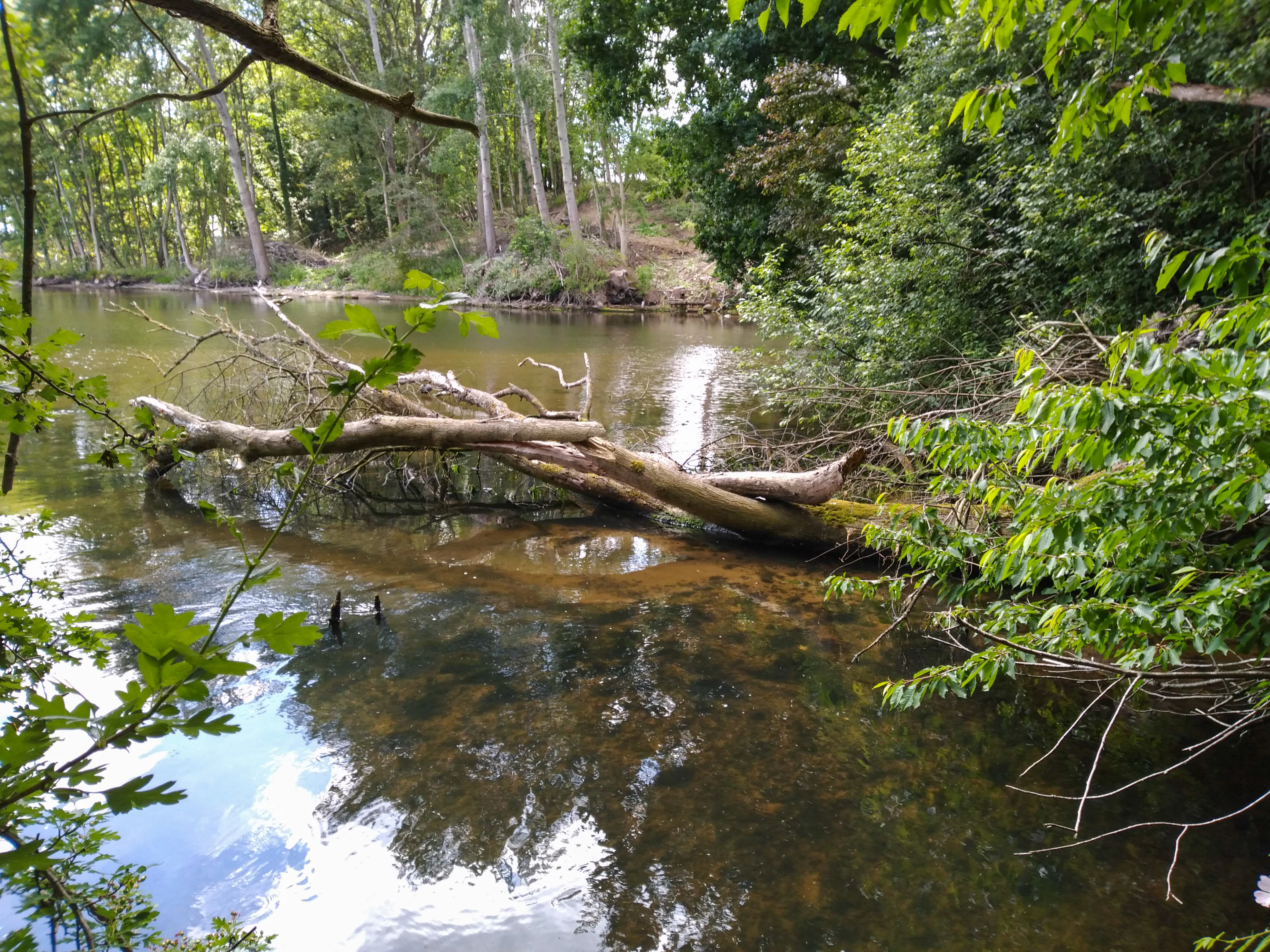
A large fallen tree trunk partially submerged in the calm, murky water of a stream, surrounded by lush green foliage and forest.
A fallen tree resting in the Schirnauer Au, part of the Wittensee protected area.

FFH-Gebiet Wittensee und Flächen angrenzender Niederungen history and protected-area timeline

The conservation history of the area follows the EU Natura 2000 process almost step for step. The standard data form for the FFH-Gebiet was drawn up in June 2004 by the Landesamt für Landwirtschaft, Umwelt und ländliche Räume (LLUR) of Schleswig-Holstein. In September 2004 the site was proposed as a Site of Community Importance (Gebiet von gemeinsinschaftlicher Bedeutung), in November 2007 the European Union confirmed this status, and in January 2010 the area was nationally designated under sections 32 (2-4) of the Federal Nature Conservation Act in conjunction with section 23 of the Schleswig-Holstein State Nature Conservation Act as a Besonderes Erhaltungsgebiet (special area of conservation).

The protection it now enjoys sits within a longer-standing framework of regional landscape conservation. The area is part of the Landschaftsschutzgebiet Wittensee, Hüttener und Duvenstedter Berge, established on 9 March 2001, and lies inside the Naturpark Hüttener Berge, where a dedicated association, the Verein zur Förderung des Umweltschutzes und der Landschaftspflege im Raume des Naturparks Hüttener Berge (VFUL), acts as site manager on behalf of the state. The Wittensee had already been recognised as a glacially formed geotope before Natura 2000 designation. A detailed site management plan was completed in October 2015, and the latest data form revision was released in July 2020. Schleswig-Holstein carries out a six-yearly monitoring of the site's conservation success, with the most recent results not yet published as of mid-2022.

FFH-Gebiet Wittensee und Flächen angrenzender Niederungen landscape and geographic character

The protected area sits in gently undulating countryside shaped by the Weichselian glaciation, with ground and terminal moraines of the Weichsel complex overlain by glacial sands. Elevations are modest: the highest point reaches about 16 m above sea level (NHN) at the edge of Klein Wittensee, while the lake surface of the Wittensee lies at roughly 3.8 m above NHN, giving the entire site a subtle relief.

The Wittensee is a classic glacial scour basin, a broadly rounded lake with relatively shallow margins, fed by ten small streams and drained to the south by the Schirnauer Au toward the Nord-Ostsee-Kanal. Around its shoreline narrow belts of alder-ash and softwood floodplain woodland soften the transition from water to land, while along the Schirnauer Au an almost continuous corridor of floodplain woodland runs down to the canal. The separate fen-meadow sub-area along the Habyer Au, set slightly higher and a kilometre to the west of the main unit, has a different feel: a flattened, marshy depression enclosed by wet grassland.

To the south, the landscape opens out along the southernmost extension of the site near the Schirnau district of Bünsdorf, where the Schirnauer Au crosses an historic arched weir close to where it discharges into the Nord-Ostsee-Kanal, near the magnetic test facility of the Deutsche Marine at the Borgstedter See. On the northern edge, the terrain near the 'Schanze' point in Groß Wittensee marks the northernmost reach of the protected area.
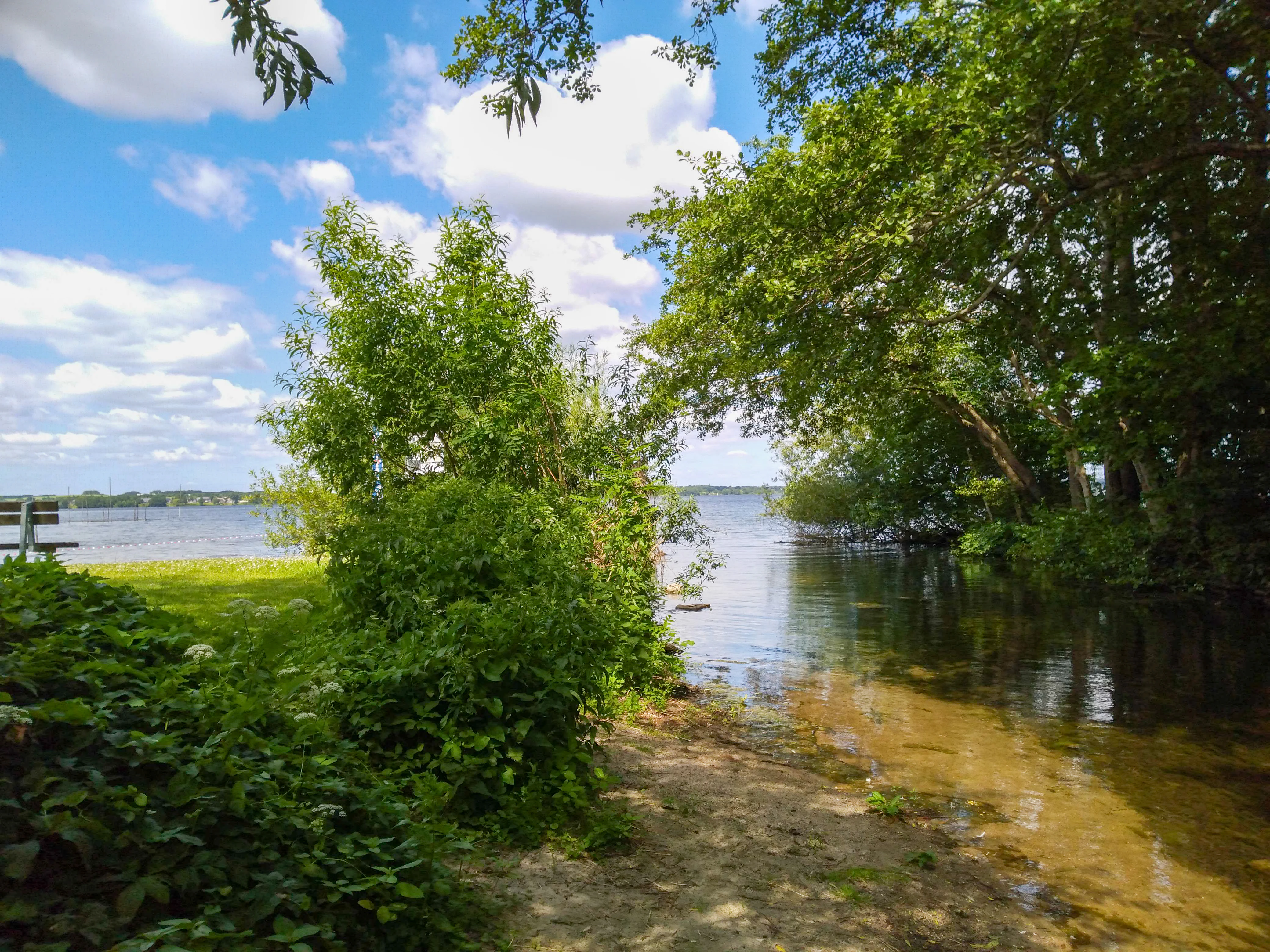
A view of a lake shore with a small sandy inlet in the foreground, surrounded by lush green trees and bushes, under a blue sky with white clouds.
A scenic view of the shoreline and calm waters of Wittensee in Northern Germany.

FFH-Gebiet Wittensee und Flächen angrenzender Niederungen ecosystems, habitats, and plant life

Ecologically, the site is dominated by the standing-water ecosystem of the Wittensee. The lake is officially assigned to the FFH habitat type 3140, nutrient-poor to moderately nutrient-rich calcareous standing waters with charophyte algae, although long-term agricultural nutrient inputs have shifted it from an originally oligotrophic character to a mesotrophic state by around 2010. Long-term pH measurements at a central monitoring station have remained in the alkaline range since 1991. Under the EU Water Framework Directive the Wittensee currently shows only a moderate ecological status, with targets for good ecological status extended to 2039.

Surrounding the lake and the Schirnauer Au, riparian vegetation completes the moisture gradient. Priority alder-ash and softwood floodplain woodland (91E0*) lines the lake margins and the lower Schirnauer Au, dependent in part on the water backed up behind an historic weir. On slightly elevated ground above this corridor, small fragments of Waldmeister beech forest (9130) survive as woodland patches. Open water along the Schirnauer Au is enriched by streams with floating water vegetation (habitat type 3260) downstream of the Bünsdorf sewage works.

The detached Habyer Au sub-area brings a different ecological register. Calcareous fens (7230) and transition or floating bog communities (7140) create a delicate moisture-controlled mosaic, complemented by a recently mapped Molinia meadow (6410) and a very small calcareous tufa spring (7220*) near Groß Wittensee. A small proportion of the land area is classified as legal biotope in addition to its FFH status, while a substantial share of dry, productive grassland lies outside any FFH habitat attribution.
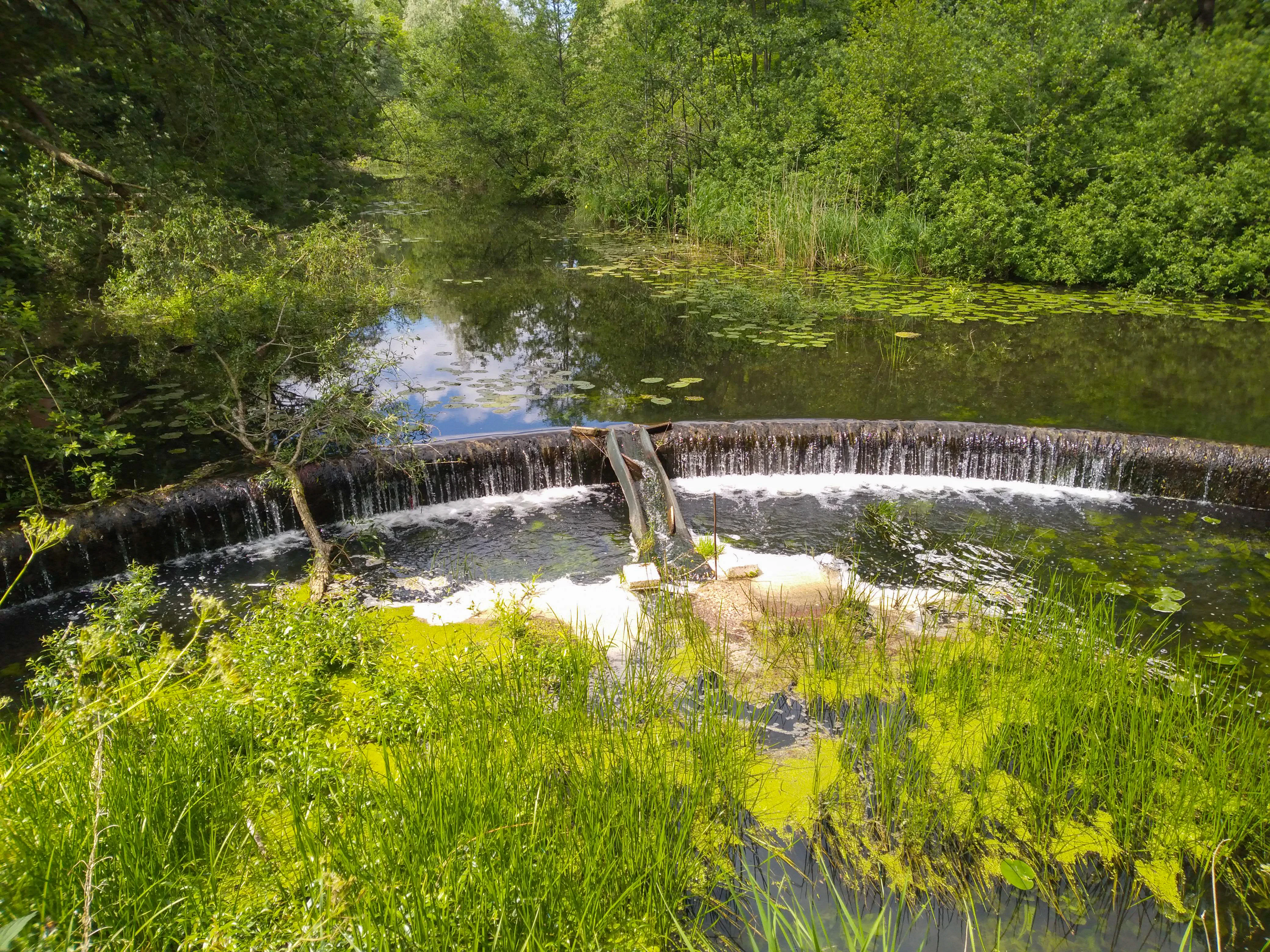
A small arched weir creating a waterfall on the Schirnauer Au, surrounded by lush green foliage and forest.
The Schirnauer Au river where it flows over a weir in the Wittensee protected area.

FFH-Gebiet Wittensee und Flächen angrenzender Niederungen wildlife and species highlights

Wildlife data for the site itself are limited, and no reliable population figures are available for any of the species listed in the Natura 2000 standard data form, all of which carry a 'data deficient' rating. The site nevertheless supports a meaningful set of species typical of the Schleswig-Holstein lake-and-wetland environment.

In the water bodies, two fish species of conservation interest are recorded: the spined loach (Steinbeißer, Cobitis taenia, species 1149) and the European brook lamprey (Bachneunauge, Lampetra planeri, species 1096). The otter (Fischotter, Lutra lutra, species 1355) is also listed for the area, reflecting the wetland-rich character of the catchment. Along the lake margins, shrubby and field-edge habitats host the red-backed shrike (Neuntöter, Lanius collurio, species A338).

The lake itself is regularly sampled at a deep-water monitoring station in operation since 1991, providing one of the longer hydrochemical time series for a lake of this type in the region. The combination of fish, otter, and breeding bird features, even with data-deficient ratings, is consistent with the site's broader role as a refuge within an otherwise heavily agricultural landscape.
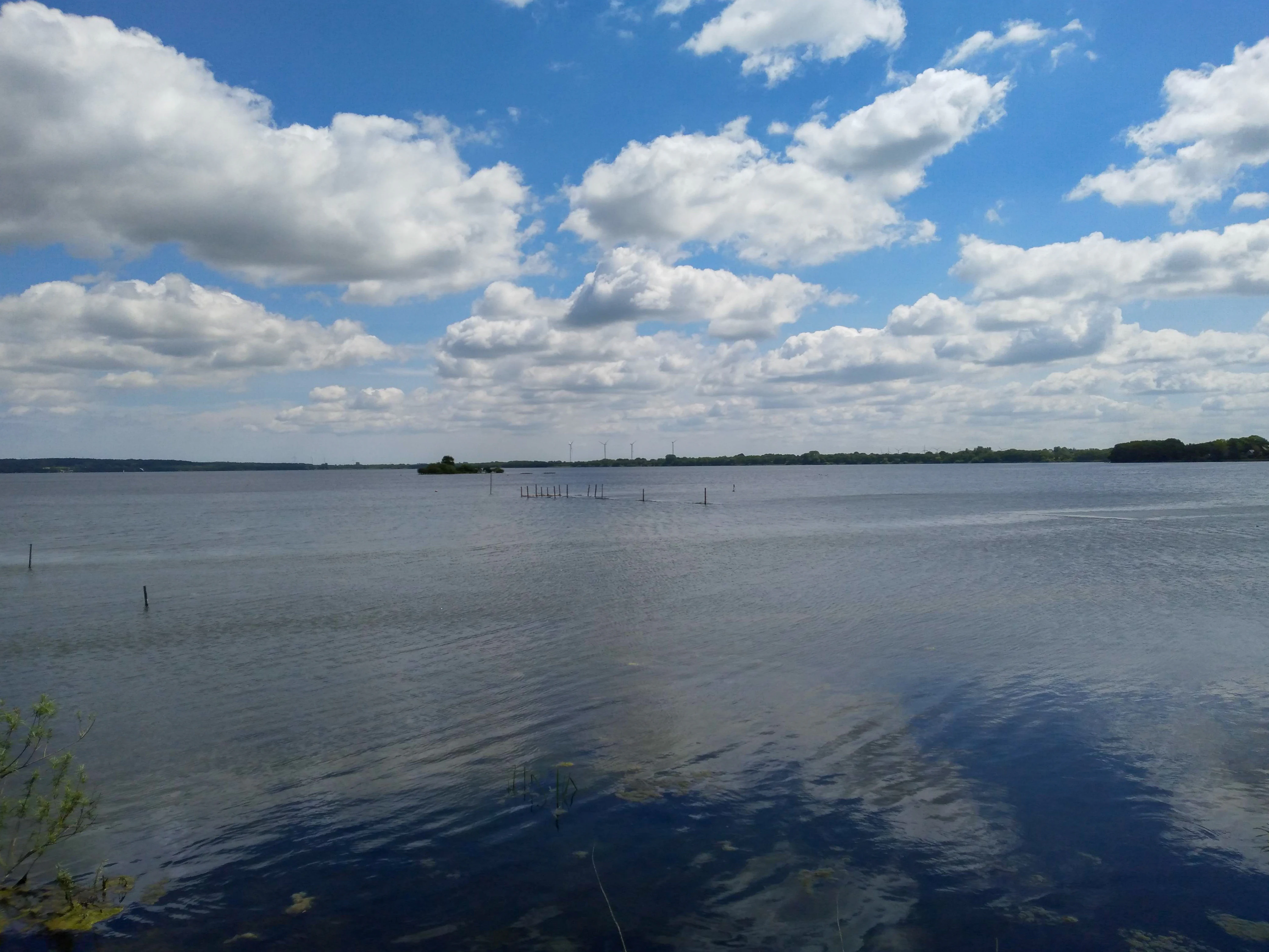
A wide, eye-level shot of a large, calm lake under a bright blue sky filled with white clouds. A small, low-lying island is visible in the middle of the lake, with some small vertical poles protruding from the water.
A view across the calm waters of Wittensee in Schleswig-Holstein, Germany.

FFH-Gebiet Wittensee und Flächen angrenzender Niederungen conservation status and protection priorities

The site's conservation significance lies in its concentration of several Annex I habitat types and Annex II species within a small, low-lying farming landscape. Standing-water, stream, fen, bog, spring, beech forest, and riparian woodland all converge here, making the protected area disproportionately valuable for habitat connectivity in the western Dänischer Wohld. The lake's western shoreline, the Schirnau valley, and the Habyer Au fen area form a key component of the state's biotope network, supplemented by secondary corridors along the northern and southern ends of the lake.

Habitat condition assessments are mixed. While most habitat types are rated in an overall 'good' state, several, including the priority alder-ash floodplain woodland and the lake itself, are rated 'unfavourable' in detailed condition. The lake's gradual nutrient enrichment over recent decades is the principal pressure, made worse by additional runoff from expanding residential developments around the shoreline. Conservation measures accordingly focus on extensive grazing, retention of natural shoreline zones, conversion of intensive grassland to extensive use near streams, and the creation of buffer strips along the Habyer Au, Brobach, Meynbek, Mühlenbek, and the middle reaches of the Schirnauer Au.

A particular management tension exists at the Schirnauer Au: the arched weir currently maintains water levels that support the priority floodplain woodland downstream, while the EU Water Framework Directive calls for free fish passage to the Nord-Ostsee-Kanal. A fish bypass has been constructed, but its effectiveness is questioned, illustrating the broader challenge of reconciling habitat and water-quality objectives within a single Natura 2000 site.

FFH-Gebiet Wittensee und Flächen angrenzender Niederungen cultural meaning and human context

The protected areas sit within a deeply rural cultural landscape in eastern Schleswig-Holstein, where small communities such as Groß Wittensee, Klein Wittensee, Haby, Sehestedt and Bünsdorf have shaped the shoreline and the stream valleys for centuries. The former water mill at Schirnau is the most visible cultural feature within the site, marked today by an arched weir (Bogenwehr) that controls the Schirnauer Au just upstream of its confluence with the Nord-Ostsee-Kanal.

Today the lake is ringed by both long-standing farms and a significant number of holiday properties along the shore, contributing to land-use pressure that the management plan now addresses through voluntary low-intensity care agreements. The site's broader setting within the Naturpark Hüttener Berge and the surrounding Landschaftsschutzgebiet reinforces a long regional tradition of combining productive land use with landscape and nature conservation.
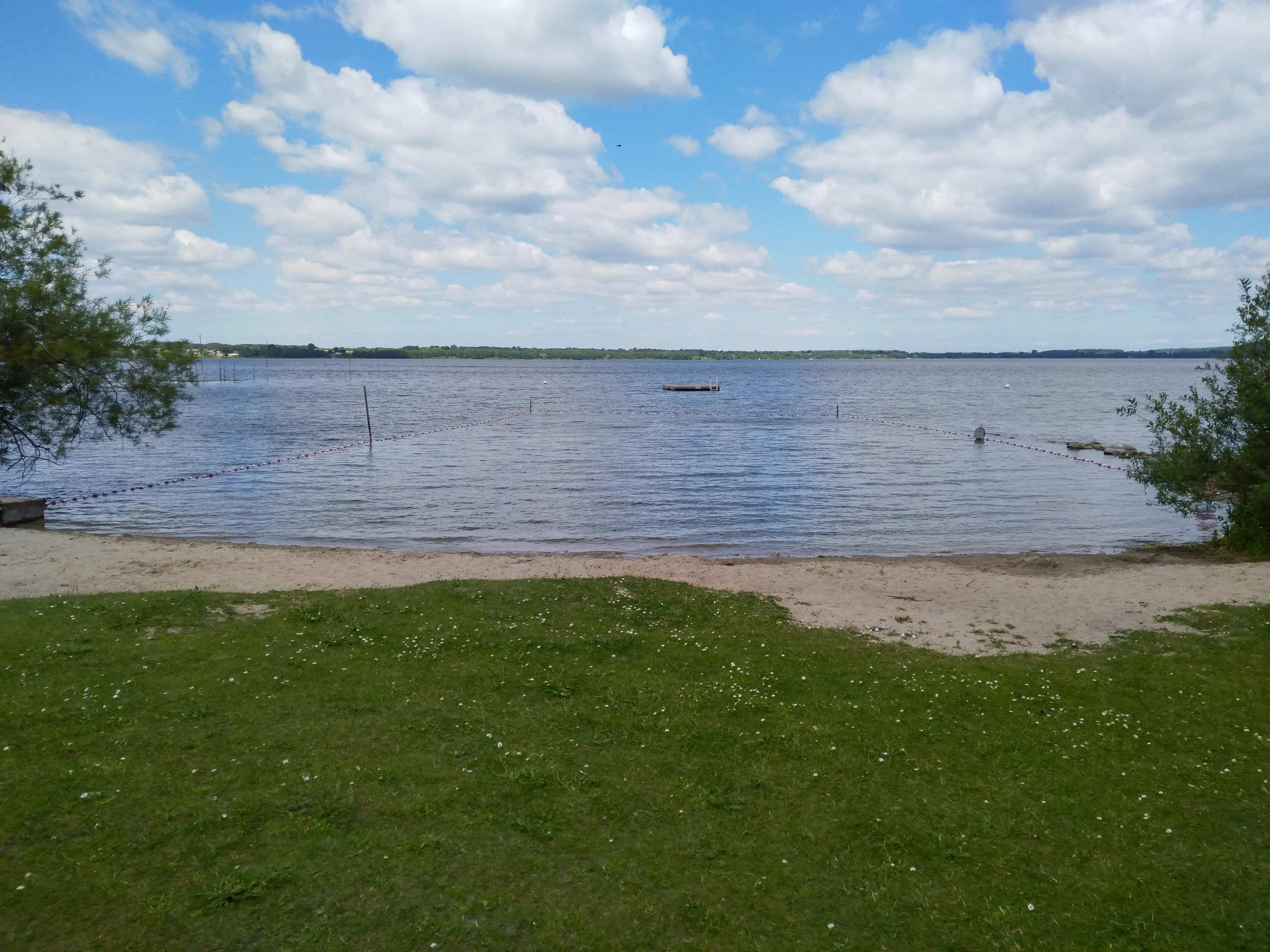
A sunny view across Wittensee lake with a green grassy foreground, a sandy shore, and calm water under a blue sky with scattered clouds.
A scenic view of the shoreline and open water at Wittensee.

Top sights and standout views in FFH-Gebiet Wittensee und Flächen angrenzender Niederungen

The site's standout features are the glacial Wittensee, an Annex I standing-water habitat with a long-term monitoring series; the rare calcareous tufa spring near Groß Wittensee; the Schirnau valley, where the Schirnauer Au links the lake to the Nord-Ostsee-Kanal through an arched weir and an historic mill site; and the modest but ecologically distinct fen-and-bog complex along the Habyer Au. Together these provide a compact but unusually varied example of northern German lake-and-lowland conservation.
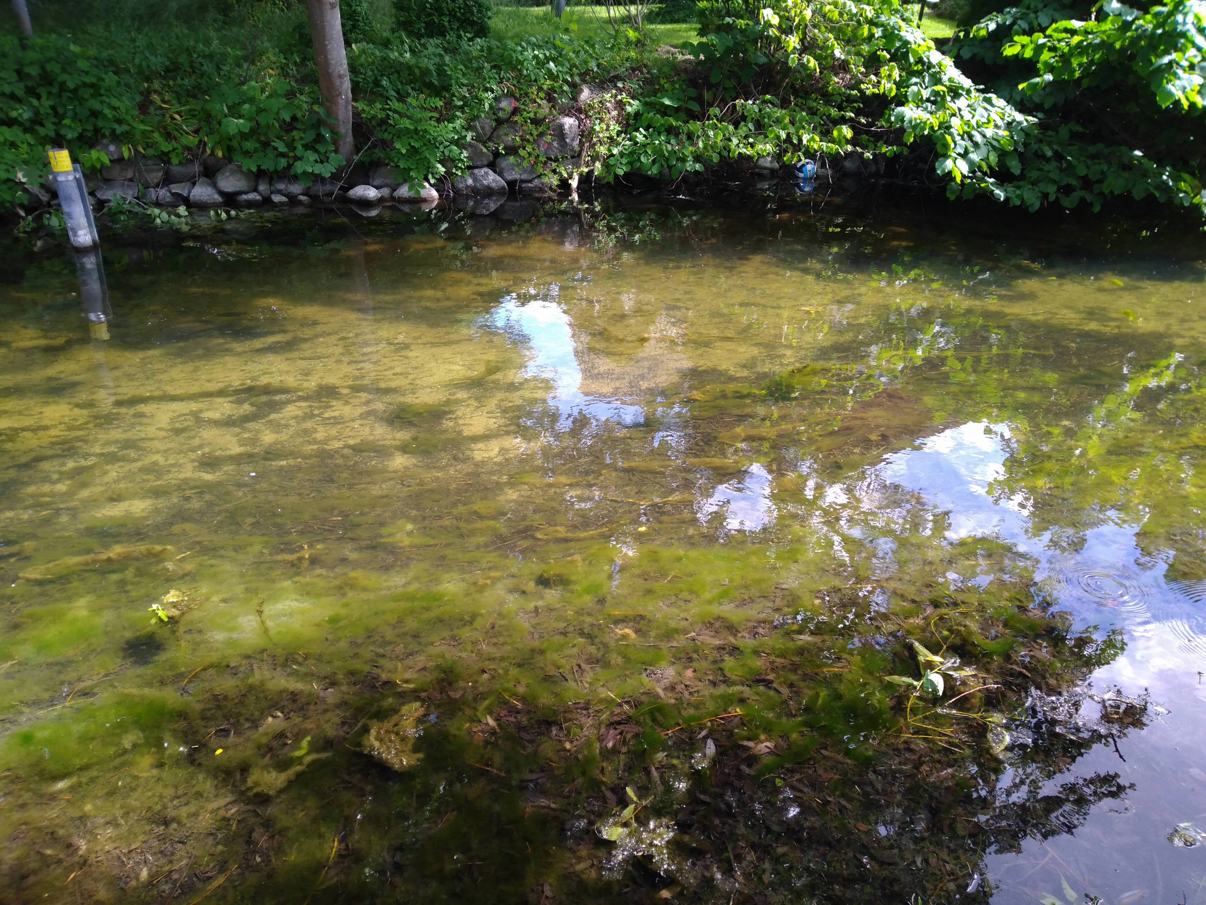
A close-up view of clear, shallow lake water with visible aquatic plants and algae, with a stone-lined bank and greenery in the background.
Shallow, clear waters and aquatic vegetation along the shoreline of the Wittensee.

Best time to visit FFH-Gebiet Wittensee und Flächen angrenzender Niederungen

The site is largely a working agricultural and residential landscape rather than a formal visitor destination, and seasonality is best considered in ecological rather than travel terms. Spring and early summer are the most productive periods for observing wetland vegetation around the Wittensee and along the Schirnauer Au, when floating water plants are actively growing and the floodplain woodlands are in full leaf. Autumn tends to highlight shoreline vegetation patterns and riparian colour along the lake and stream corridors, while winter reveals the openness of the lake and the broader Dänischer Wohld skyline.

Monthly climate preview

Long-term monthly temperature and precipitation rhythm for protected terrain

FFH-Gebiet Wittensee und Flächen angrenzender Niederungen Climate Normals

Representative coordinates record measured multi-year temperature variations and monthly precipitation trends across seasonal cycles. Opening the complete twelve-month record reveals detailed climate normals and temperature ranges for this protected location.
Annual mean9 °C
1 °C18 °C
Jan
Feb
Mar
Apr
May12°
Jun15°
Jul18°
Aug18°
Sep14°
Oct10°
Nov
Dec
Warmest month
August

17.6 °C

Coolest month
January

1.1 °C

Wettest month
August

2.5 mm/day

Driest month
April

1.3 mm/day

Park location guide

Geography guide, regional context, and park location map for FFH-Gebiet Wittensee und Flächen angrenzender Niederungen

FFH-Gebiet Wittensee und Flächen angrenzender Niederungen park geography, regions, and map view in Germany

Understand where FFH-Gebiet Wittensee und Flächen angrenzender Niederungen sits in Germany through a broader geographic reading of the surrounding landscape, nearby location context, and its mapped position within the national park landscape.

How FFH-Gebiet Wittensee und Flächen angrenzender Niederungen fits into Germany

Germany is a federal republic in Western and Central Europe with a population of over 83 million across sixteen constituent states. It is Europe's largest economy by nominal GDP and a major global exporter and importer. The capital is Berlin, and the country borders Denmark, Poland, Czech Republic, Austria, Switzerland, France, Luxembourg, Belgium, and the Netherlands.

Wider geography shaping FFH-Gebiet Wittensee und Flächen angrenzender Niederungen in Germany

Germany is located in Western and Central Europe, spanning 357,022 km². It borders Denmark to the north, Poland and the Czech Republic to the east, Austria and Switzerland to the south, and France, Luxembourg, Belgium, and the Netherlands to the west. The country has coastlines on the Baltic Sea and North Sea to the north, with the Alps located in the southern region.

Map view of FFH-Gebiet Wittensee und Flächen angrenzender Niederungen

Use this park location map to pinpoint FFH-Gebiet Wittensee und Flächen angrenzender Niederungen in Germany, understand its exact geographic position, and read its mapped placement within the surrounding landscape more clearly.

Pigeon | © OpenStreetMap contributors

Location context for FFH-Gebiet Wittensee und Flächen angrenzender Niederungen

Schleswig-Holstein

Visual exploration of glacial lake waters, riparian woodlands, and lowland wetland habitats

FFH-Gebiet Wittensee und Flächen angrenzender Niederungen Photos and Landscape Scenery

Photographic records reveal the subtle terrain, glacial basin waters, and fringing shoreline vegetation of FFH-Gebiet Wittensee und Flächen angrenzender Niederungen. Visual documentation captures the distinct character of the protected wetlands, stream corridors, and surrounding conservation landscapes.

A large fallen tree trunk partially submerged in the calm, murky water of a stream, surrounded by lush green foliage and forest.

A wide, panoramic view of a grassy meadow and field in the foreground, with a paved road curving along the right side and mature trees in the background under a blue sky with white clouds.

A view of a lake shore with a small sandy inlet in the foreground, surrounded by lush green trees and bushes, under a blue sky with white clouds.

A small arched weir creating a waterfall on the Schirnauer Au, surrounded by lush green foliage and forest.

A wide, eye-level shot of a large, calm lake under a bright blue sky filled with white clouds. A small, low-lying island is visible in the middle of the lake, with some small vertical poles protruding from the water.

An aerial view showing a large dark blue lake bordered by a small village, green fields, and rural roads.

A sunny view across Wittensee lake with a green grassy foreground, a sandy shore, and calm water under a blue sky with scattered clouds.

A close-up view of clear, shallow lake water with visible aquatic plants and algae, with a stone-lined bank and greenery in the background.

Park atlas

Compare surrounding regional landscapes and adjacent conservation zones

Explore Protected Areas Near FFH-Gebiet Wittensee und Flächen angrenzender Niederungen

Discover other protected areas near FFH-Gebiet Wittensee und Flächen angrenzender Niederungen to examine regional park geography and adjacent wetland habitats. Browsing related conservation landscapes provides broader context for northern German glacial lake ecosystems.
A horizontal watercolor painting depicting a soft, rolling landscape with green trees in the foreground, a light-colored meadow or field in the midground, and distant muted hills in the background.
Protected areaSchleswig-Holstein
About 8 km away#1 closest

Northwest

FFH-Gebiet Wälder der Hüttener Berge: Protected Area and Glacial Moraine Atlas

Ancient beech woodland mosaics in Schleswig-Holstein.

FFH-Gebiet Wälder der Hüttener Berge comprises eleven distinct state forest parcels stretching across northern Germany. This atlas entry details the site's rich habitat structure, including rare Atlantic beech forests, transition mires, and glacial soils, providing essential geographic context for this vital Natura 2000 protected territory.

Area
4.16 km²
Established
2004
Relief
Upland
Climate
Temperate
A watercolor painting showing a soft panoramic view of green hills and a winding stream, with distant pale mountains in the background.
Nature reserveSchleswig-Holstein
About 14 km away#2 closest

South

FFH-Gebiet Wehrau und Mühlenau Nature Reserve and River Corridor Geography

Protected riparian habitat in Schleswig-Holstein

Spanning over 246 hectares, this nature reserve protects a vital sequence of lowland streams, including the Mühlenau and Wehrau rivers. The area serves as an important refuge for rare mollusk species and aquatic wildlife, while preserving the integrity of a glacial tunnel valley geotope. This structured map view highlights the connectivity of wetlands, forests, and stream habitats that define the local landscape.

Area
2.46 km²
Established
2004
Relief
Lowland
Climate
Temperate
Nature reserveSchleswig-Holstein
About 16 km away#3 closest

West

FFH-Gebiet Übergangsmoor im Kropper Forst: Protected Landscape and Mire Geography

A study of transitional mire habitats in Schleswig-Holstein.

This protected area centers on a treeless mire depression embedded within the coniferous Gehege Kropp forest. Covering 18 hectares of glacial terrain, the site illustrates the delicate balance of mire hydrology and the long-term ecological impact of regional landscape management in northern Germany.

Area
0.18 km²
Established
2004
Relief
Lowland
Climate
Temperate
Nature reserveSchleswig-Holstein
About 17 km away#4 closest

Southwest

Wald östlich Hohn Nature Reserve: Ancient Broadleaf Forest Geography and Mapped Boundaries

Protected glacial moraine woodland in Schleswig-Holstein

Spanning roughly twelve hectares near Hohn, this nature reserve safeguards centuries-old broadleaf forest communities including beech and oak-hornbeam stands. The site is a significant protected area within the Schleswig-Holstein Geest, illustrating how ancient wooded islands persist amid intensive modern agricultural landscapes through formal Natura 2000 conservation status.

Area
0.118 km²
Established
2004
Relief
Lowland
Climate
Temperate
Nature reserveBrandenburg
About 21 km away#5 closest

Southeast

Tiergarten Nature Reserve: Geography and Protected Habitat Mapping in Brandenburg, Germany

Ancient oak woodland, riparian wetlands, and historic forest trails.

Spanning 158 hectares, the Tiergarten nature reserve serves as an ecologically rich sanctuary of oak-hornbeam forests and wet meadows. This area, formerly a royal hunting ground, offers a dense mosaic of riparian zones along the Staabe river, protecting essential habitats within the broader Brandenburg landscape.

Area
1.58 km²
Established
1995
IUCN
IV
A horizontal watercolor painting depicting a soft, ethereal landscape with green trees on the left and right, a winding stream in the center, and pale rolling hills in the background against a light, misty sky.
Nature reserveSchleswig-Holstein
About 24 km away#6 closest

Southeast

FFH-Gebiet Wennebeker Moor und Langwedel Nature Reserve: Geographic and Landscape Atlas

Protected mire and heathland complex in Schleswig-Holstein

The FFH-Gebiet Wennebeker Moor und Langwedel nature reserve encompasses a complex mosaic of wet and dry heath, quaking bogs, and Nardus grasslands. This site is distinguished by its unique integration of conservation obligations with active military land use, creating a rare habitat environment within a gently rolling morainal landscape.

Area
2.3 km²
Established
2004
Relief
Lowland
Climate
Temperate
Nature reserveSchleswig-Holstein
About 25 km away#7 closest

Northwest

FFH-Gebiet Wellspanger-Loiter-Oxbek-System und angrenzende Wälder Protected Landscapes

Schleswig-Holstein nature reserve map and geography

This protected area bundles a wide range of priority habitat types, including calcareous springs, inland dunes, and old-growth beech forests. Spanning the Angeln peninsula, the site protects a hydrological backbone of stream systems and rare wet meadows that remain critical for regional biodiversity in Northern Germany.

Area
14.34 km²
Established
2004
Relief
Upland
Climate
Temperate
Nature reserveSchleswig-Holstein
About 26 km away#8 closest

South

Wälder der nördlichen Itzehoer Geest: Protected Area and Forest Landscape Atlas

Natura 2000 ancient woodland in Schleswig-Holstein

Explore the geography of Wälder der nördlichen Itzehoer Geest, featuring four historical forest tracts across glacial moraines. This protected area highlights Atlantic acid beech forests and floodplain habitats, preserving centuries-old woodland continuity within the broader Schleswig-Holstein landscape.

Area
7.11 km²
Established
2004
Relief
Upland
Climate
Temperate

Common questions about visiting, size, designation, and location context for FFH-Gebiet Wittensee und Flächen angrenzender Niederungen

FFH-Gebiet Wittensee und Flächen angrenzender Niederungen FAQs for park facts, access, geography, and protected area context

Find quick answers about FFH-Gebiet Wittensee und Flächen angrenzender Niederungen, including protected-area facts, park geography, trail and visitor context, and how the park fits into its surrounding country and regional landscape.
MoriAtlas Explorer

Continue Your Protected Areas Search Across the Global Atlas

Deepen your exploration by continuing the structured search for national parks and protected areas worldwide. Utilize the comprehensive filtering capabilities to compare different conservation landscapes and refine your understanding of global park geography. Discover more about the distribution and characteristics of protected natural areas.

Global natural geography