

Mori Atlas logo
Nature reserveFountoukodasi Pitsilias

A diverse protected landscape spanning traditional mountain orchards and riparian forest valleys

Fountoukodasi Pitsilias Nature Reserve in the Nicosia District of Central Cyprus Mountains

Fountoukodasi Pitsilias represents a highly concentrated mosaic of Mediterranean habitats within the Troodos mountain range of the Nicosia District. This protected nature reserve integrates long-standing hazelnut orchards with native pine woodlands and riparian corridors, forming a complex ecological node in the central Cyprus interior. Mapped boundaries showcase a varied terrain of rolling valley floors and slopes that sustain a remarkably dense array of endemic plant species and threatened island fauna.

Natura 2000Troodos MountainsCyprusMediterranean cultural landscapeHazelnut orchardsPine forest

Fountoukodasi Pitsilias

Nature reserve

Park overview

Structured park overview, official facts, and landscape profile for Fountoukodasi Pitsilias

Fountoukodasi Pitsilias park facts, protected area profile, and essential visitor context

Review the core facts for Fountoukodasi Pitsilias, including designation, size, terrain, visitor scale, habitats, and operating context in one park-focused overview.

About Fountoukodasi Pitsilias

Fountoukodasi Pitsilias is a compact Natura 2000 protected site situated in the heart of the Troodos mountain range on the island of Cyprus. Designated in October 2006 under site code CY2000009, the area brings together natural, semi-natural, and traditional agricultural landscapes within a network of stream valleys that drain the central highlands. With an extent of roughly 127 hectares, the area is small in absolute terms, but its biological richness gives it considerable ecological significance within the broader context of Cypriot and Mediterranean nature conservation.

The protection area belongs to the Pitsilia region, a traditional rural landscape of the Troodos interior known for its terraced orchards, stone-built villages, and centuries-old agricultural practices. Within Fountoukodasi Pitsilias, this cultural imprint is expressed most clearly through the dominance of hazelnut trees and other fruit-bearing species, which form a continuous orchard cover. Intermingled with these cultivated elements are numerous pockets of more natural vegetation, creating a fine-grained mosaic of habitats across the slopes and along the watercourses.

Ecologically, the site captures several of the characteristic vegetation types of the Troodos range. Small stands of golden oak (Quercus alnifolia) and Quercus infectoria punctuate the upper slopes, while forests of Calabrian pine (Pinus brutia) occupy drier exposures. Along the rivulets, oriental plane (Platanus orientalis) and associated riparian species form distinctive gallery habitats. Open phrygana dominated by thorny cushion plants such as Sarcopoterium spinosum, as well as relict cypress woodland, contribute additional structural variety.

What makes Fountoukodasi Pitsilias particularly noteworthy is its concentration of endemic species. The site's official habitat register documents 19 endemic plant species, alongside endemic reptiles, insects, and breeding birds. These include species that are rare or threatened across Cyprus as a whole, making the area an important reservoir for the island's biological heritage. The diversity of habitats within such a small footprint makes the site valuable not only for conservation but also for studying how traditional human land use and natural processes interact in Mediterranean mountain environments.

Quick facts and research context for Fountoukodasi Pitsilias

Fountoukodasi Pitsilias is a Natura 2000 Fauna-Flora-Habitat site located in the Troodos mountains of central Cyprus, in the Nicosia district. The protected area covers approximately 127 hectares and encompasses several stream courses winding through the Pitsilia region. It was officially designated as a protected site in October 2006, joining the European network of nature conservation areas under site code CY2000009. The area combines traditional agricultural landscape elements, such as hazelnut and other fruit orchards, with semi-natural vegetation including pine forests, oak stands, riparian vegetation, and phrygana, making it a representative example of the Mediterranean cultural landscape mosaic of the Troodos interior.

Protection and recognition

Documented terrestrial protection scope and Natura 2000 recognition records

Fountoukodasi Pitsilias Protection Status and International Recognition

Fountoukodasi Pitsilias maintains documented terrestrial protection status supported by official Natura 2000 recognition sources. Terrestrial management parameters and administrative designations provide essential context for conservation geography.

International recognition

Protection details

Protection scope
Terrestrial
Transboundary protection
No
Park context

Deeper park guide and search-rich context for Fountoukodasi Pitsilias

Fountoukodasi Pitsilias history, landscape, wildlife, and travel context

Explore Fountoukodasi Pitsilias through its history, landscape character, ecosystems, wildlife, conservation priorities, cultural context, and seasonal travel timing in a structured park guide built for atlas discovery and search intent.

Why Fountoukodasi Pitsilias stands out

Fountoukodasi Pitsilias is best known for its exceptionally high concentration of endemic species within a very small area. The site combines traditional Mediterranean cultural landscape features, including old hazelnut orchards, with diverse natural vegetation types such as golden oak woodland, Calabrian pine forest, oriental plane riparian strips, and phrygana scrub. It is also recognized as an important refuge for Cyprus-endemic birds, including the Cyprus wheatear, Cyprus warbler, and the Masked shrike, as well as for populations of endemic reptiles and invertebrates. Its combination of a long-standing human-shaped landscape and high biodiversity makes the area a key reference site for understanding Mediterranean cultural-natural mosaics in the Troodos range.
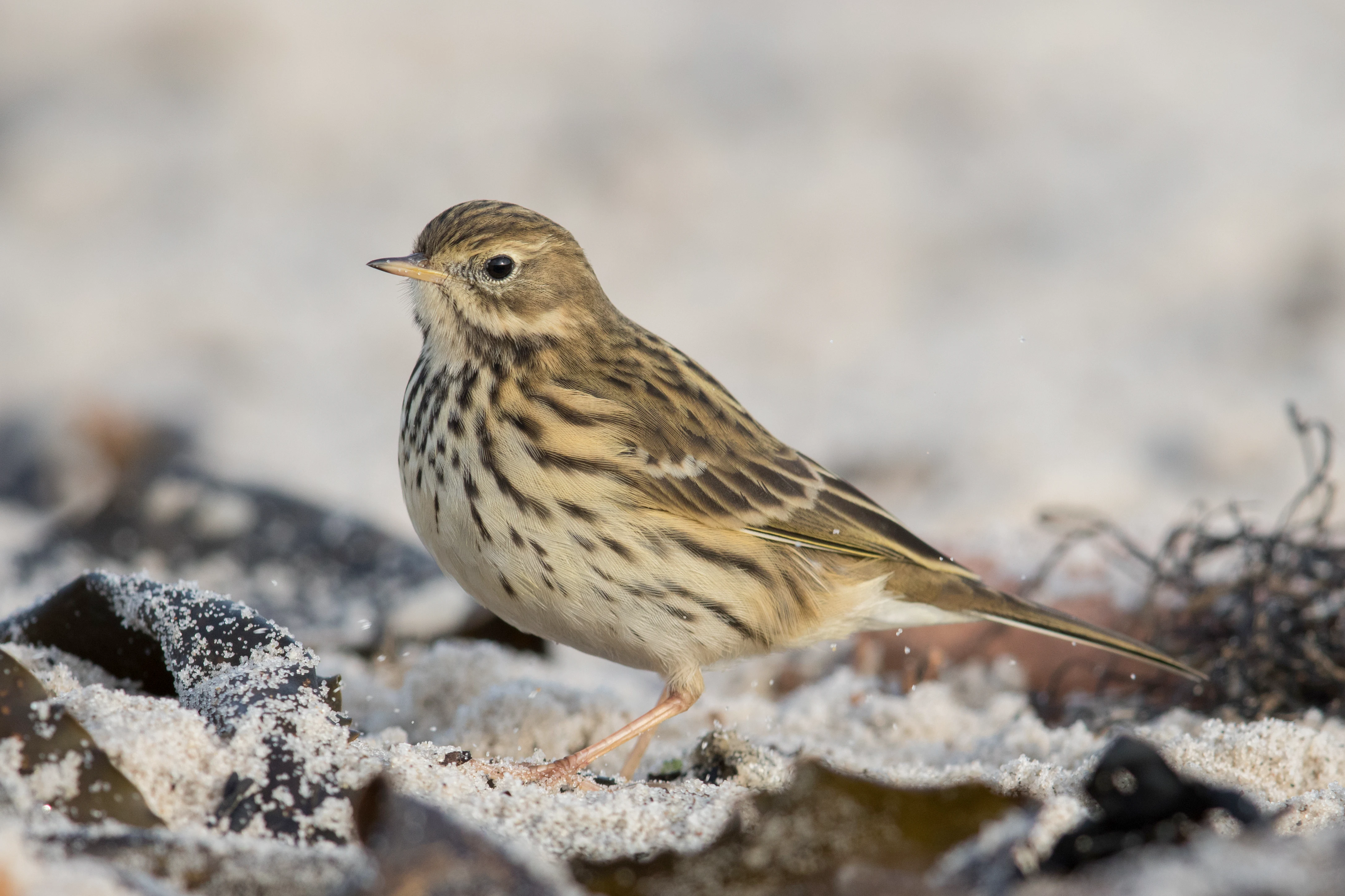
A small brown bird with streaked feathers, identified as a meadow pipit, standing on sandy ground with dark organic debris.
A meadow pipit (Anthus pratensis) resting in a natural meadow habitat.

Fountoukodasi Pitsilias history and protected-area timeline

The protection status of Fountoukodasi Pitsilias was formally established in October 2006. The site was designated as part of the European Natura 2000 network, recognizing its importance as a habitat for species of community interest and as a representative example of Mediterranean cultural and natural landscape in the Troodos mountains.

Beyond its formal designation, the landscape itself reflects a much longer history of human presence and land use. The Pitsilia region has been inhabited and cultivated for centuries, with terraced orchards of hazelnut and other fruit trees being a defining element of local agriculture. These long-established land uses have shaped the vegetation mosaic that the protection area now seeks to conserve. The relatively recent formal protection status thus overlays a much older cultural landscape, integrating rather than replacing the traditional agricultural matrix of the area.

Fountoukodasi Pitsilias landscape and geographic character

Fountoukodasi Pitsilias occupies a series of stream valleys in the central Troodos range, with terrain shaped by mountain runoff flowing through the Pitsilia foothills. The topography is characterized by rolling valley floors flanked by gentle slopes and ridges, cut by small perennial and seasonal watercourses that define much of the habitat structure.

Cultivated terraces and traditional orchards of hazelnut and other fruit trees dominate significant portions of the visible landscape, blending directly into surrounding natural vegetation. On the slopes, the terrain supports a patchwork of Mediterranean woodland and shrub formations: closed-canopy Calabrian pine forests on drier aspects, smaller groves of golden oak and Quercus infectoria, and open phrygana scrub on the most exposed sites.

Along the stream corridors, the landscape becomes distinctly more humid and structurally richer. Oriental plane trees and associated riparian vegetation form continuous gallery strips, while small fragments of relict cypress woodland survive on rocky outcrops. The result is a layered mountain landscape where natural woodland, agricultural terraces, and linear riparian habitats create an unusually diverse visual and ecological environment for such a compact area.

Fountoukodasi Pitsilias ecosystems, habitats, and plant life

The ecological character of Fountoukodasi Pitsilias is defined by the close interweaving of cultivated land and natural vegetation. The most extensive habitat is the traditional orchard landscape dominated by hazelnut trees, supplemented by other fruit-bearing species. These orchards are not monocultures in the modern sense; they retain an understory of native plants, creating structurally complex habitats that support far more species than simplified agricultural land.

Natural and semi-natural habitats cover smaller areas but contribute disproportionately to the site's biodiversity. Mediterranean pine forests of Pinus brutia occupy dry slopes, while golden oak and Quercus infectoria stands form broadleaf elements. Riparian vegetation with oriental plane along the streams provides moisture-rich habitat uncommon in this part of the Mediterranean. Distinct vegetation types such as Sarcopoterium spinosum phrygana and relict cypress forest are also present, each contributing different structural and floristic qualities.

Several habitat types recorded in the site's official register are of particular conservation interest at the European level, including the priority habitat of shrub and low woodland formations with Quercus alnifolia. Collectively, the variety of habitats within a small footprint gives Fountoukodasi Pitsilias its ecological signficance.

Fountoukodasi Pitsilias wildlife and species highlights

Fountoukodasi Pitsilias hosts a remarkably diverse fauna for its size, reflecting the structural variety of its habitats. The area is particularly important for birds, with official records listing more than 60 bird species protected under the EU Birds Directive, including several listed in Annex I.

Among the most notable bird species are the Cyprus wheatear and the Cyprus warbler, both island endemics that are a defining presence in the Troodos region. The site also supports populations of the Masked shrike, the Grauortolan bunting, and Rüppell's warbler, along with specialist raptors such as Bonelli's eagle, the long-legged buzzard, the peregrine falcon, and Eleonora's falcon. Common woodland and orchard species, from wrynecks and turtle doves to Eurasian jays and short-toed treecreepers, are also well represented.

Beyond birds, the area harbors important reptile populations, including the Levantine viper, the Montpellier snake, the coin snake, and the Cyprian subspecies of the Kotschy's gecko. Endemic invertebrates such as the butterfly Pontia chloridice further contribute to the site's zoological significance, while the Egyptian fruit bat and Savi's pipistrelle represent the mammal fauna. The interaction of woodland, orchard, riparian, and scrub habitats creates niche diversity that supports this wide range of animal life.

Fountoukodasi Pitsilias conservation status and protection priorities

Fountoukodasi Pitsilias is integrated into the European Natura 2000 network and is therefore managed within the broader framework of EU nature conservation policy. Its designation in 2006 was based on the presence of multiple habitat types listed under the EU Habitats Directive, including the priority habitat type of shrub and low woodland formations with Quercus alnifolia.

From a conservation perspective, the site's principal value lies in the combination of traditional Mediterranean cultural landscape with high concentrations of endemic species. The persistence of traditional hazelnut orchards has created and maintained habitat heterogeneity that supports rare plants, reptiles, and birds. Several species documented in the area, including endemic plants and reptiles as well as Annex I bird species, are considered rare or threatened at the national level, giving the site a real role in their long-term survival.

The protection framework aims to maintain this mosaic of habitats rather than excluding human land use entirely. In practice, this means conserving both the natural woodland and riparian elements and the traditional cultural landscape elements that underpin the site's biodiversity.

Fountoukodasi Pitsilias cultural meaning and human context

Fountoukodasi Pitsilias lies within the Pitsilia region, a traditionally rural part of the Troodos mountains known for its terraced agriculture, stone-built villages, and long-standing cultivation of hazelnuts, walnuts, and other fruit trees. The cultural landscape of this region has been shaped over generations by small-scale farming and orchard management, and the hazelnut-dominated vegetation of the protection area reflects this continuing human imprint.

The site is best understood not as untouched wilderness but as a working cultural-natural landscape, where orchards, woodlands, and stream valleys coexist. This context is central to the identity of the area and to the way its biodiversity has developed over time.

Top sights and standout views in Fountoukodasi Pitsilias

Fountoukodasi Pitsilias stands out as a small but ecologically dense Natura 2000 site in the central Troodos mountains. Its combination of traditional hazelnut orchards, Calabrian pine woodland, golden oak stands, oriental plane riparian strips, and phrygana scrub is unusually varied for its size.

Key highlights include 19 documented endemic plant species, multiple endemic reptiles and invertebrates, and a bird community of more than 60 protected species, many of them endemic to Cyprus or listed in Annex I of the EU Birds Directive. The site also carries the priority habitat type of Quercus alnifolia shrub and low woodland, underscoring its conservation relevance within the EU network. Together, these qualities make the area a representative showcase of Mediterranean cultural-natural mosaic conservation in the Troodos interior.

Best time to visit Fountoukodasi Pitsilias

The most rewarding periods to experience Fountoukodasi Pitsilias are spring and early autumn. In spring, the orchards and surrounding habitats come alive with flowering plants and peak bird activity, including breeding Cyprus wheatears, Cyprus warblers, and other Palearctic migrants that pass through or settle temporarily in the area. Cooler temperatures and lush vegetation also make the stream valleys and woodland most pleasant to explore.

Early autumn brings a return of migrants and offers milder conditions before the cooler winter period, when some species movements continue but access to higher ground can become less comfortable. Summer in the Troodos interior tends to be hot and dry, with reduced bird activity and a more parched landscape. Winter remains relatively mild but is the least distinctive season for biodiversity observation in this kind of mountain habitat.
Monthly climate preview

Long-term representative coordinate measurements for annual precipitation and temperature patterns

Fountoukodasi Pitsilias Climate Normals and Annual Temperature Rhythm

Fountoukodasi Pitsilias records distinct long-term shifts in average monthly temperature and precipitation based on NASA POWER climatology data from 1991 to 2020. Examining the complete monthly climate normals helps trace temperature ranges and precipitation totals across the entire annual cycle.
Annual mean20 °C
10 °C30 °C
Jan10°
Feb11°
Mar13°
Apr17°
May22°
Jun27°
Jul30°
Aug30°
Sep27°
Oct22°
Nov17°
Dec12°
Warmest month
July

29.8 °C

Coolest month
January

10.5 °C

Wettest month
December

2.7 mm/day

Driest month
July

0 mm/day

Park location guide

Geography guide, regional context, and park location map for Fountoukodasi Pitsilias

Fountoukodasi Pitsilias park geography, regions, and map view in Cyprus

Understand where Fountoukodasi Pitsilias sits in Cyprus through a broader geographic reading of the surrounding landscape, nearby location context, and its mapped position within the national park landscape.

How Fountoukodasi Pitsilias fits into Cyprus

Cyprus is an island nation in the eastern Mediterranean Sea, positioned at the crossroads of Europe, Africa, and Asia. The Republic of Cyprus governs the southern portion of the island, with Nicosia as its capital and largest city. The island has a complex political situation due to the Turkish occupation in the north and contains British military bases in the south. Cyprus gained independence from Britain in 1960 and is a member of the European Union.

Wider geography shaping Fountoukodasi Pitsilias in Cyprus

Cyprus is an island located in the eastern Mediterranean Sea, off the coast of the Levant in West Asia. The island lies approximately 75 km south of Turkey, 105 km west of Syria, and 380 km north of Egypt. The terrain varies from mountainous regions in the north and interior to plains and coastal areas. The Troodos Mountains dominate the central and southwestern part of the island. The island has no land borders as it is entirely surrounded by sea.

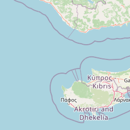
Map view of Fountoukodasi Pitsilias

Use this park location map to pinpoint Fountoukodasi Pitsilias in Cyprus, understand its exact geographic position, and read its mapped placement within the surrounding landscape more clearly.

Pigeon | © OpenStreetMap contributors

Location context for Fountoukodasi Pitsilias

Nicosia District
Recorded earthquake history

View the Recorded Earthquake History for Fountoukodasi Pitsilias

Consult the historical seismic catalogue for Fountoukodasi Pitsilias to review recorded earthquakes mapped near the reserve. MoriAtlas provides this structured overview of regional activity to support geographic exploration of the Troodos mountain landscape through available historical datasets.

Fountoukodasi Pitsilias Earthquake History

Catalogued events

231 events

Strongest magnitude

Magnitude 5.6

Most recent event

Nov 13, 2025

This history includes earthquakes recorded inside the park or within 50 km of its borders

Visualizing the mountain valleys, traditional orchards, and diverse habitats of Cyprus

Fountoukodasi Pitsilias Photos and Protected Area Landscape Scenery

Photographs capture the complex terrain, stream valleys, and mixed vegetation defining Fountoukodasi Pitsilias within the Troodos mountains. Visual documentation reveals the mosaic of pine woodland, agricultural terraces, and riparian habitats supporting rare endemic species.

A small brown bird with streaked feathers, identified as a meadow pipit, standing on sandy ground with dark organic debris.

Park atlas

Compare nearby mountain reserves, regional valleys, and connected conservation terrain

Explore Other Parks Near Fountoukodasi Pitsilias and Surrounding Protected Landscapes

Browsing other protected areas near Fountoukodasi Pitsilias reveals broader ecological patterns across the central mountain range. Comparing adjacent terrain helps trace regional biodiversity networks and connected Mediterranean habitats.
Nature reserveCyprus
Park boundaries overlap#1 closest

West

Madari - Papoutsa Nature Reserve: Protected Highland Landscapes and Geography of Central Cyprus

An ecological cornerstone of the Cyprus mountain backbone.

Madari - Papoutsa represents a significant protected territory within the Cyprus highlands, characterized by a complex mosaic of Mediterranean pine forests, juniper woodlands, and rocky scree slopes. Recognized for its role in biodiversity conservation, the area preserves endemic plant species and varied bird populations within its expansive mountain terrain. This site acts as a major ecological node, illustrating the structural diversity and natural heritage of the eastern Mediterranean environment.

Area
45.782 km²
Established
2004
Relief
Mountain
Climate
Mediterranean
Nature reserveCyprus
5.5 km away#2 closest

East

Periochi Tzionia: Protected Landscape Mapping and Geographic Context in Cyprus

A Natura 2000 designated nature reserve in the Cyprus interior.

Periochi Tzionia serves as a significant terrestrial protected area, defined by its function within the Mediterranean ecoregion. This nature reserve provides essential structural support for diverse bird communities, serving as a pillar of regional conservation efforts in Cyprus through its role in the EU Birds Directive framework.

Area
68.428 km²
Established
2008
Climate
Mediterranean
Scope
Terrestrial
Nature reserveCyprus
6.1 km away#3 closest

Northwest

Periochi Atsa - Agios Theodoros Nature Reserve: Inland Cyprus Protected Area and Mapping

Essential Mediterranean habitat for breeding and migratory birds

Located in the heart of Cyprus, this nature reserve protects nearly 3,000 hectares of Mediterranean terrain. Its primary function is maintaining ecological stability for 45 species of birds, including raptors and Mediterranean specialists. This site represents a key component of the inland protected area network, essential for understanding the environmental geography of the eastern Mediterranean basin.

Area
29.242 km²
Established
2008
Climate
Mediterranean
Scope
Terrestrial
Nature reserveCyprus
About 7.3 km away#4 closest

Southwest

Periochi Koiladas Xylourikou: Inland Valley Protected Area and Bird Conservation Site

Mapped Mediterranean landscape in central Cyprus

Periochi Koiladas Xylourikou represents a significant protected nature reserve situated in the central valley landscapes of Cyprus. This site provides an essential habitat for a wide array of raptors and migratory songbirds, serving as a key component of the regional Natura 2000 network that links Mediterranean ecological corridors across the island interior.

Area
32.031 km²
Established
2007
Climate
Mediterranean
Access
Access unknown
Nature reserveCyprus
8.1 km away#5 closest

East

Dasos Machaira Nature Reserve: Geographic Overview and Protected Landscape Mapping

A diverse Natura 2000 protected area in central Cyprus

Spanning an inland expanse in central Cyprus, Dasos Machaira serves as a prime example of Mediterranean ecological diversity. The nature reserve encompasses a varied terrain of river valleys, golden oak woodland, and steep rocky slopes, documented through its status as both a Site of Community Importance and a Special Protection Area. The site remains a critical hub for endemic plant life and migratory bird populations, showcasing a dense convergence of distinct habitat types.

Area
44.28 km²
Established
2002
Relief
Upland
Climate
Mediterranean
Protected areaCyprus
9.6 km away#6 closest

Northeast

Koilada Potamou Maroullenas Protected Area: Geography and Landscape of a Mediterranean Valley

Exploring natural terrain and riverine habitats in Cyprus

Koilada Potamou Maroullenas is a protected area in Cyprus characterized by its Mediterranean river valley, intermittent watercourses, and rich mosaic of vegetation. The landscape spans from riparian galleries to phrygana and pine forests, making it a vital unit for regional biodiversity and habitat preservation within the island nation.

Area
0.722 km²
Established
2002
Relief
Mixed relief
Climate
Mediterranean
Nature reserveCyprus
10 km away#7 closest

South

Dasos Lemesou Nature Reserve: Protected Mediterranean Landscapes and Geography in Cyprus

Analyzing habitat diversity across the southern Cypriot interior.

Dasos Lemesou is a vital nature reserve and Natura 2000 site in southern Cyprus, defined by rocky ridges, seasonal watercourses, and twelve distinct habitat types. This area offers an in-depth view of Mediterranean forest character, including rare serpentine grasslands and pine woodland ecosystems. Explore its geographic distribution and protected boundaries to understand its role in regional biodiversity conservation.

Area
48.32 km²
Established
2002
Relief
Mixed relief
Climate
Mediterranean
Protected areaCyprus
About 12 km away#8 closest

West

Ethniko Dasiko Parko Troodous: A Protected Mediterranean Mountain Forest in Central Cyprus

Mapped ecosystems and geographic terrain of the Troodos massif

Ethniko Dasiko Parko Troodous anchors conservation efforts across the central mountains of Cyprus. The park contains a diverse array of protected landscapes, including endemic pine forests, juniper woodlands, and rare serpentine grasslands that sustain a wide range of flora and fauna. By integrating mountainous topography with riparian galleries, the area forms a core component of the regional Natura 2000 network, serving as a primary site for understanding Mediterranean montane biodiversity and forest resilience.

Area
90.088 km²
Established
2005
Relief
Mountain
Scope
Terrestrial

Common questions about visiting, size, designation, and location context for Fountoukodasi Pitsilias

Fountoukodasi Pitsilias FAQs for park facts, access, geography, and protected area context

Find quick answers about Fountoukodasi Pitsilias, including protected-area facts, park geography, trail and visitor context, and how the park fits into its surrounding country and regional landscape.
MoriAtlas Explorer

Continue Your Protected Areas Search Across the Global Atlas

Deepen your exploration by continuing the structured search for national parks and protected areas worldwide. Utilize the comprehensive filtering capabilities to compare different conservation landscapes and refine your understanding of global park geography. Discover more about the distribution and characteristics of protected natural areas.

Global natural geography