
Mori Atlas logo
Wildlife reserveFrank Church—River of No Return Wilderness

Explore the geographic boundaries, river canyons, and intact alpine terrain of a premier wilderness reserve.

Frank Church—River of No Return Wilderness: Mapping Idaho's Vast Protected Mountain Landscapes

(Frank Church-River of No Return Wilderness)

The Frank Church—River of No Return Wilderness stands as the largest contiguous wilderness area in the contiguous United States. Spanning millions of acres of central Idaho, this massive protected region encompasses the rugged Salmon River Mountains, the Bighorn Crags, and the deep, dissected canyons of the Salmon River. Visitors can examine the complex mountain geography, forest-covered uplands, and the striking contrast between high-elevation ridges and arid, low-lying river corridors.

wilderness areamountain landscaperiver canyonsSalmon Riverwhitewater raftingconiferous forest
An artistic digital illustration of a deep river valley featuring steep rocky mountains, a river flowing through the center, a small waterfall, and evergreen forests.

Frank Church—River of No Return Wilderness

Wildlife reserve

Park overview

Structured park overview, official facts, and landscape profile for Frank Church-River of No Return Wilderness

Frank Church-River of No Return Wilderness park facts, protected area profile, and essential visitor context

Review the core facts for Frank Church-River of No Return Wilderness, including designation, size, terrain, visitor scale, habitats, and operating context in one park-focused overview.

About Frank Church-River of No Return Wilderness

The Frank Church-River of No Return Wilderness is a federally designated wilderness area in central Idaho, managed by the U.S. Forest Service. At more than 2.3 million acres, it is the largest contiguous wilderness area in the contiguous United States and one of the most expansive protected natural landscapes in North America outside of Alaska. Its territory is divided across six different national forests and a very small portion of Bureau of Land Management land, more components than any other wilderness in the National Wilderness Preservation System.

The heart of the wilderness is the rugged, deeply dissected terrain of central Idaho. The Salmon River Mountains, the Clearwater Mountains, and the dramatic Bighorn Crags each occupy large portions of the area, separated by the steep canyons of the Middle and Main forks of the Salmon River. These river corridors cut deeply into the landscape, producing a terrain that is extraordinarily remote, with limited road access and extensive unroaded terrain. Together with the neighboring Gospel Hump Wilderness and adjacent roadless Forest Service lands, the area forms the core of a roughly 3.3 million acre block of essentially unfragmented mountain country in the heart of Idaho, separated from the Selway-Bitterroot Wilderness to the north only by the narrow Magruder Corridor dirt road.

Ecologically, the wilderness preserves a sweeping vertical gradient of habitats. Coniferous forests dominated by species typical of the northern Rockies cover most of the uplands, while lower elevations along the river corridors support drier, more open vegetation. The sheer size and remoteness of the area make it one of the most important strongholds for large mammals in the contiguous United States. It supports populations of cougars, black bears, wolves, elk, mule deer, bighorn sheep, mountain goats, and wolverines, and historically has been identified as one of the few remaining areas in the lower 48 states with potential grizzly bear habitat.

Human presence in the wilderness is shaped by its history as a designated primitive area and by the legend of the Salmon River. Although the use of motorized equipment is generally prohibited in U.S. wilderness areas, jetboats on the Main Fork of the Salmon River and a number of remote airstrips remain permitted as grandfathered uses predating the wilderness designation. These exceptions support both traditional river access and a long-established backcountry flying tradition, making the wilderness an unusual blend of strict federal protection and continuity with the area's earlier modes of travel and recreation.

Quick facts and research context for Frank Church-River of No Return Wilderness

The Frank Church-River of No Return Wilderness was established in 1980 through the Central Idaho Wilderness Act and renamed in 1984 in honor of U.S. Senator Frank Church. It spans roughly 2.3 million acres across Idaho, Valley, Lemhi, and Custer counties in central Idaho and is administered by the U.S. Forest Service under an IUCN Category Ib designation.

It is the largest contiguous wilderness in the contiguous United States, and together with the adjacent Gospel Hump Wilderness and surrounding roadless Forest Service land it anchors a roughly 3.3 million acre roadless area. The wilderness crosses more separate national forests than any other wilderness in the country, with the Payette, Challis, Salmon, Boise, Bitterroot, and Nez Perce national forests all contributing portions of its territory.

Protection and recognition

Documented terrestrial protection scope, designation year, and management framework

Frank Church—River of No Return Wilderness Protection Status and Designation History

Frank Church—River of No Return Wilderness maintains a documented terrestrial protection scope established in 1984. Recorded management details and designation history frame the administrative framework supporting this protected area.

Protection details

Protection scope
Terrestrial
Designated year
1984
Transboundary protection
No
Park context

Deeper park guide and search-rich context for Frank Church-River of No Return Wilderness

Frank Church-River of No Return Wilderness history, landscape, wildlife, and travel context

Explore Frank Church-River of No Return Wilderness through its history, landscape character, ecosystems, wildlife, conservation priorities, cultural context, and seasonal travel timing in a structured park guide built for atlas discovery and search intent.

Why Frank Church-River of No Return Wilderness stands out

The wilderness is best known for its enormous, unbroken scale of roadless mountain country and for being home to the Salmon River, the "River of No Return," one of the most celebrated whitewater rivers in North America. The Middle Fork of the Salmon in particular is widely recognized as a premier multi-day rafting experience, drawing boaters from across the United States and abroad. Equally defining is the wilderness's ecological character: vast tracts of coniferous forest, deeply cut river canyons, and an unusually high concentration of large and wide-ranging mammals, including cougars, wolves, elk, bighorn sheep, mountain goats, and wolverines. The presence of reintroduced gray wolves and some of the most important wolverine habitat in the lower 48 states reinforces the area's reputation as one of the most significant intact wildlife strongholds in the contiguous United States.
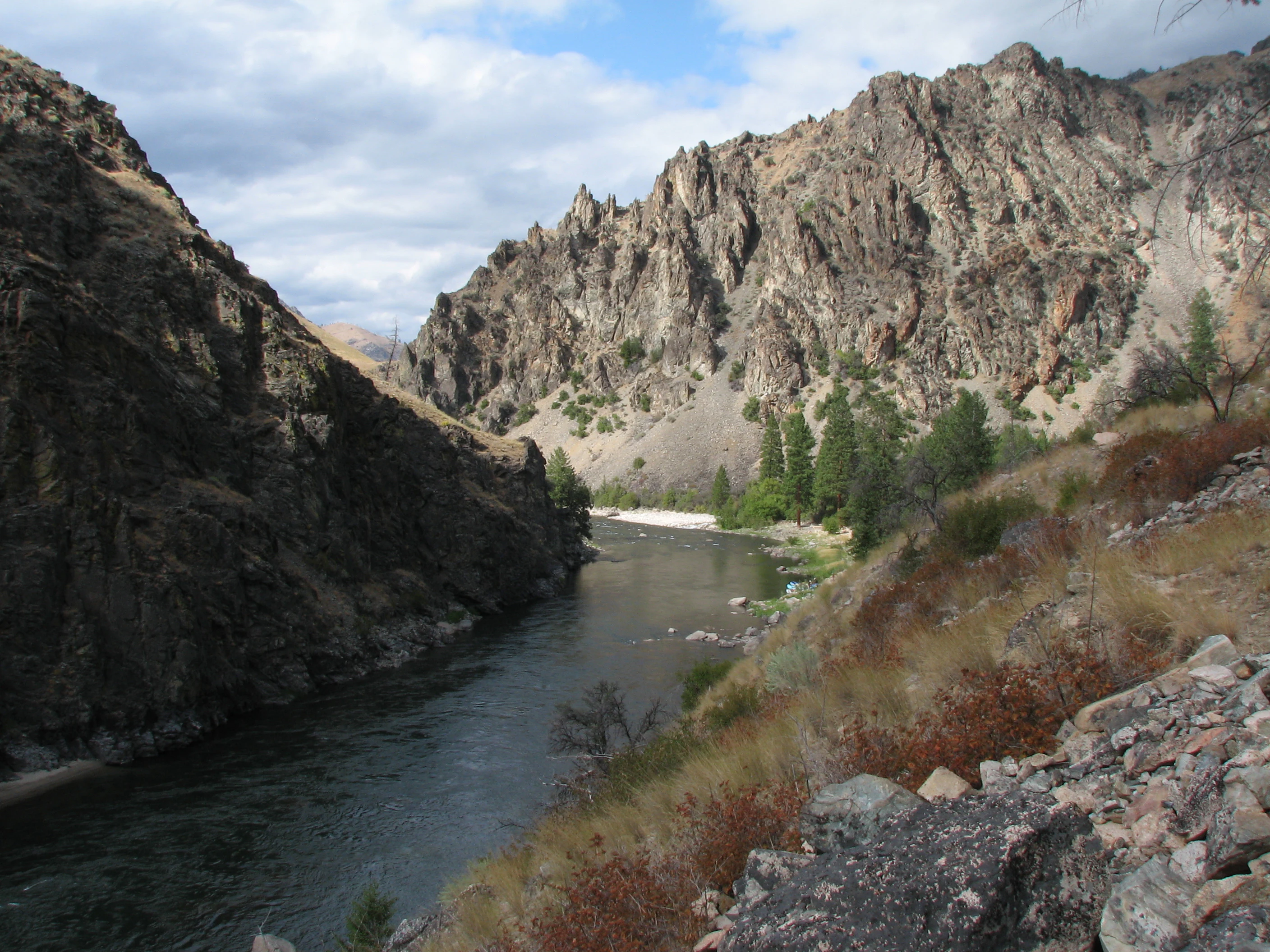
A wide shot looking down a river canyon with steep, rocky cliffs on both sides and a flowing river in the center.
The Middle Fork of the Salmon River flowing through the steep canyons of the Frank Church River of No Return Wilderness.

Frank Church-River of No Return Wilderness history and protected-area timeline

The history of the Frank Church-River of No Return Wilderness begins with the broader movement to protect intact landscapes in the American West. In 1931, the U.S. Forest Service designated approximately 1.09 million acres of central Idaho as the Idaho Primitive Area, an early administrative protection that laid the groundwork for later wilderness status. In 1963, this territory and surrounding lands were reorganized as part of the Selway-Bitterroot complex, with the Salmon River Breaks Primitive Area and the narrow Magruder Corridor recognized as distinct units between the two larger blocks.

U.S. Senator Frank Church of Idaho became a central figure in the modern American wilderness movement. He served as the Senate floor sponsor for the Wilderness Act of 1964, which established the National Wilderness Preservation System and protected roughly 9 million acres of federal land. In 1968, Church introduced the Wild and Scenic Rivers Act, a measure that included the Middle Fork of the Salmon River to ensure that the river and its immediate environment would be preserved in a free-flowing condition for future generations.

Church's environmental work for central Idaho culminated in 1980 with the passage of the Central Idaho Wilderness Act. The act combined the Idaho Primitive Area, the Salmon River Breaks Primitive Area, and a portion of the Magruder Corridor into a single large wilderness, the River of No Return Wilderness, and added 125 miles of the Salmon River to the Wild and Scenic Rivers System. President Jimmy Carter, who had floated the Middle Fork with his family and Interior Secretary Cecil Andrus in August 1978, signed the act into law on July 23, 1980.

In 1984, Congress undertook a further renaming of the area. After Senator Church was diagnosed with pancreatic cancer, Senator Jim McClure of Idaho introduced a measure in the Senate to honor him by renaming the wilderness the Frank Church-River of No Return Wilderness. President Ronald Reagan signed the bill on March 14, 1984, less than four weeks before Church's death on April 7, 1984, at the age of 59. The renamed wilderness continues to reflect Church's lasting influence on American wilderness and river conservation policy.

The area's wildlife story also plays an important role in its history. Beavers famously parachuted into the wilderness as part of Idaho's mid-twentieth-century beaver reintroduction effort established a lasting colony there. After gray wolves had been eliminated from most of Idaho by the early twentieth century, the remote, federally administered character of the wilderness made it a key site for wolf restoration: Canadian wolves were reintroduced in 1995, and subsequent years saw packs establish and reproduce, with the population in Idaho later delisted from endangered species status in 2011.

Frank Church-River of No Return Wilderness landscape and geographic character

The wilderness occupies a vast, deeply dissected section of central Idaho's Northern Rocky Mountain terrain. Several distinct mountain ranges extend across its boundaries, most prominently the Salmon River Mountains, the Clearwater Mountains, and the Bighorn Crags, a smaller but visually dramatic subrange known for its jagged granite spires. These ranges are separated by the steep canyons of the Middle Fork and Main Fork of the Salmon River, whose walls dissect the uplands into a complex pattern of ridges, basins, and side drainages.

Elevation changes are pronounced and abrupt. Rivers drop through narrow gorges cut into ancient rock, while forested summits, alpine ridges, and exposed rocky crags rise on either side. The Bighorn Crags in particular are notable for the contrast between their high, rugged alpine character and the broad forested valleys and river canyons that surround them. Although elevations are not extreme by some mountain standards, the combination of dense forest cover, steep terrain, and limited road access gives the landscape a strong sense of remoteness.

Vegetation patterns track elevation and exposure. Coniferous forests of species typical of the northern Rockies dominate the middle and upper elevations, while the river corridors and lower slopes support drier, more open plant communities. Along the Middle Fork and Main Fork of the Salmon River, sunny gravel bars, grassy benches, and semi-arid benchlands create a striking contrast with the deep, shaded forest of the uplands above. This variation in aspect and elevation produces a landscape that ranges from cool, dense evergreen forest to hot, dry river-bottom country within relatively short distances.

Frank Church-River of No Return Wilderness ecosystems, habitats, and plant life

Ecologically, the wilderness preserves one of the largest continuous blocks of northern Rocky Mountain habitat in the contiguous United States. The dominant vegetation is coniferous forest, with extensive stands of fir, pine, and related species typical of the region covering most of the middle and upper elevations. Above the forested zone, subalpine and alpine communities occupy the highest ridges and crags, including the rocky terrain of the Bighorn Crags.

Along the Salmon River and its larger tributaries, lower elevations support a markedly different ecological character. These areas are drier and more open, with grassland benches, shrublands, and mixed conifer stands forming a transition between the dense forest of the uplands and the arid country to the south and west. The juxtaposition of moist montane forest with dry, sunny river-bottom vegetation creates unusually high habitat diversity within the wilderness.

Aquatic ecosystems are equally significant. The Middle Fork and Main Fork of the Salmon River are renowned for their clarity, their cold water, and their free-flowing character. The Middle Fork's designation under the Wild and Scenic Rivers Act highlights both its ecological value and its exceptional water quality. A network of tributary streams drains the surrounding mountains, supporting native fishes and providing the hydrological foundation for the wilderness's riparian plant communities.

Frank Church-River of No Return Wilderness wildlife and species highlights

The Frank Church-River of No Return Wilderness supports one of the most diverse and ecologically intact assemblages of large mammals in the contiguous United States. Its sheer size and lack of roads provide a level of solitude that has allowed many wide-ranging and sensitive species to persist here long after they were eliminated from less protected landscapes.

Among large predators, the wilderness is inhabited by a substantial population of cougars and a well-established population of northwestern wolves. Wolves, once locally extinct in Idaho, were reintroduced to the area in 1995 from Canadian source populations; subsequent monitoring documented breeding pairs and growing packs through the late 1990s and into the following decade. Black bears are scattered throughout the area, and although grizzly bears have been identified as potentially suited to the habitat, no established population is currently known to occur.

Other notable mammals include bighorn sheep and mountain goats in the higher rocky country, and healthy herds of elk, moose, mule deer, and white-tailed deer throughout the forests and valleys. Lynx, coyotes, and red foxes are also present. The wilderness is recognized as one of the most important strongholds for wolverines in the lower 48 states, a species that requires exceptionally large, remote, and undisturbed landscapes like this one. Beavers, descended from animals famously parachuted into Idaho's wilderness as part of a mid-twentieth-century reintroduction effort, have established a thriving colony here, continuing a quietly remarkable chapter in the area's ecological history.

Frank Church-River of No Return Wilderness conservation status and protection priorities

From a conservation standpoint, the Frank Church-River of No Return Wilderness is one of the most significant protected natural areas in the contiguous United States. Its vast, unroaded terrain protects a large block of northern Rocky Mountain habitat from the fragmentation that has affected much of the surrounding region. Together with the adjacent Gospel Hump Wilderness and surrounding roadless Forest Service lands, it forms the core of a roughly 3.3 million acre intact landscape, an unusually large contiguous area where ecological processes can continue with minimal direct human interference.

Wilderness status under the U.S. Wilderness Act provides a high level of legal protection, restricting most forms of development and motorized use. Even so, the area reflects the careful compromises that shaped U.S. wilderness policy: jetboat use on the Main Fork of the Salmon River and a network of remote airstrips are retained as grandfathered uses from before the wilderness designation, preserving traditional river access and backcountry aviation while maintaining the wilderness's overall protected character.

The wilderness is also central to river conservation in Idaho. The Middle Fork of the Salmon River was included in the Wild and Scenic Rivers System at the same time the wilderness was created, and roughly 125 miles of the Salmon River are protected under that designation. The combination of federal wilderness protection and Wild and Scenic River designation makes the area a key reference point for landscape-scale conservation in the American West, and its role in the recovery of gray wolves in the northern Rockies further underscores its importance to regional wildlife conservation.

Frank Church-River of No Return Wilderness cultural meaning and human context

Although the wilderness is fundamentally defined by its natural character, it carries a strong cultural and political legacy tied to the American conservation movement and to Idaho's identity. Senator Frank Church, for whom the area was renamed, was one of the principal architects of modern U.S. wilderness and river policy, and the wilderness itself represents the culmination of decades of effort to protect central Idaho's primitive landscapes.

The Salmon River and its famous "River of No Return" nickname are deeply embedded in regional folklore, reflecting the era when the river's powerful current made upstream travel impractical and shaped the lives of miners, homesteaders, outfitters, and river runners. The continued presence of jetboats and remote airstrips within an otherwise strict wilderness reflects this layered human history, preserving links to a traditional way of moving through the backcountry even as the area's ecological protections have grown.

Top sights and standout views in Frank Church-River of No Return Wilderness

The wilderness's most striking qualities are its sheer size and its unbroken continuity. As the largest contiguous wilderness in the contiguous United States, it offers a scale of intact mountain landscape that is increasingly rare in the lower 48 states. Its deep canyons, forested ridges, and craggy subranges create a varied terrain that is at once remote and ecologically rich.

Equally notable are the Middle Fork and Main Fork of the Salmon River, which have made the area famous among rafters and river conservationists alike. The presence of large predators, healthy herds of elk and deer, bighorn sheep, mountain goats, and one of the lower 48's most important wolverine populations gives the wilderness a wildlife profile that rivals almost any other protected area in the continental United States.

Best time to visit Frank Church-River of No Return Wilderness

Summer is the dominant season for most visitors to the Frank Church-River of No Return Wilderness, when snow has melted from the higher elevations, rivers run at levels suitable for floating, and forest roads and airstrips are generally accessible. Rafting trips on the Middle Fork of the Salmon River typically take place in summer, when river conditions, weather, and access align for multi-day floats through the canyons.

Late spring and early fall can also offer attractive conditions for different pursuits. Spring brings high water and stirring scenery in the canyons, while early autumn tends to cool temperatures, thin crowds, and shifting light across the forested ridges, all of which can enhance hiking, wildlife watching, and photography. Winter brings deep snow to most of the wilderness, dramatically limiting access but transforming the landscape into a quiet, deeply snow-covered terrain that contrasts sharply with the busy summer season.

Monthly climate preview

Trace long-term average temperatures and precipitation rhythms across twelve recorded months.

Frank Church—River of No Return Wilderness Climate Normals and Monthly Weather Patterns

Representative coordinate data reveals measured temperature variations alongside consistent monthly precipitation values for Frank Church—River of No Return Wilderness. Examining the full twelve-month profile provides detailed meteorological context for studying long-term climate normals.
Annual mean2 °C
-9 °C16 °C
Jan-9°
Feb-8°
Mar-5°
Apr
May
Jun10°
Jul16°
Aug16°
Sep11°
Oct
Nov-4°
Dec-9°
Warmest month
July

16.1 °C

Coolest month
January

-9.3 °C

Wettest month
December

2.7 mm/day

Driest month
August

0.6 mm/day

Park location guide

Geography guide, regional context, and park location map for Frank Church-River of No Return Wilderness

Frank Church-River of No Return Wilderness park geography, regions, and map view in United States of America

Understand where Frank Church-River of No Return Wilderness sits in United States of America through a broader geographic reading of the surrounding landscape, nearby location context, and its mapped position within the national park landscape.

How Frank Church-River of No Return Wilderness fits into United States of America

The United States of America is a federal presidential republic and one of the world's largest countries by area and population. It consists of 50 states across a vast territory spanning multiple time zones, with its capital in Washington, D.C. and largest city in New York City. The nation has a diverse economy, influential political system, and significant cultural and military presence globally.

Wider geography shaping Frank Church-River of No Return Wilderness in United States of America

The United States occupies a vast territory in North America, bordered by Canada to the north and Mexico to the south. The 48 contiguous states stretch from the Atlantic to the Pacific Ocean, while Alaska occupies the northwestern region and Hawaii is an archipelago in the Pacific. The country encompasses diverse terrain including the Rocky Mountains, Appalachian Mountains, Great Plains, and extensive river systems.

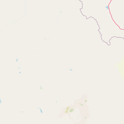
Map view of Frank Church-River of No Return Wilderness

Use this park location map to pinpoint Frank Church-River of No Return Wilderness in United States of America, understand its exact geographic position, and read its mapped placement within the surrounding landscape more clearly.

Pigeon | © OpenStreetMap contributors

Location context for Frank Church-River of No Return Wilderness

Idaho
Natural feature types

View the Named Natural Features of the Frank Church—River of No Return Wilderness

Navigate the geographic details of the Frank Church—River of No Return Wilderness through a curated set of natural features. MoriAtlas helps you trace the rugged topography, from deep river gorges to alpine summits, providing a clearer picture of this expansive wilderness landscape.
Recorded earthquake history

Review Recorded Seismic Events Near Frank Church—River of No Return Wilderness

Examine the historical record of seismic activity associated with the complex terrain of the Frank Church—River of No Return Wilderness. This catalogue allows for the exploration of documented earthquake events by location, magnitude, and date, offering a factual perspective on the recorded seismic history of this rugged central Idaho landscape.

Frank Church Wilderness Earthquakes

Catalogued events

1,043 events

Strongest magnitude

Magnitude 6.5

Most recent event

Sep 12, 2026

This history includes earthquakes recorded inside the park or within 50 km of its borders

Visual reference collection highlighting mountain terrain, river canyons, and protected habitats

Frank Church—River of No Return Wilderness Photos and Landscape Scenery

Examine high-resolution imagery showcasing the rugged mountain ranges, deep river canyons, and dense coniferous forests defining Frank Church—River of No Return Wilderness. Visual research provides critical context for understanding the expansive roadless terrain, protected wildlife habitats, and remote geography of central Idaho.

A wide shot looking down a river canyon with steep, rocky cliffs on both sides and a flowing river in the center.

Park atlas

Compare surrounding mountain landscapes, river canyons, and connected northern Rockies terrain

Parks Near Frank Church—River of No Return Wilderness and Regional Protected Areas

Browsing other protected areas near Frank Church—River of No Return Wilderness reveals broader patterns in rugged mountain terrain and remote wildlife habitats. Comparing these connected regional landscapes provides essential context for understanding high-elevation ecosystems across central Idaho.
Protected landscapeIdaho
Park boundaries overlap#1 closest

West

Payette National Forest: Geographic Overview of Idaho's Rugged Mountain Wilderness

Protected granite landscapes and glacial basin geography

Encompassing a vast portion of central Idaho, Payette National Forest represents a significant protected wilderness corridor. The forest geography transitions from granite-based alpine peaks and deep river gorges to dense coniferous slopes, providing essential habitat and extensive trail connectivity throughout the Northern Rockies.

Area
9,419.55 km²
Established
1944
Relief
Mountain
Access
Access unknown
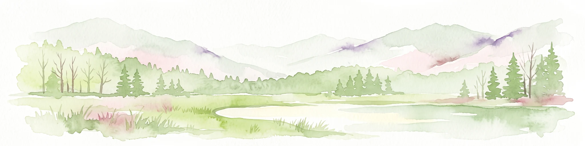
Soft watercolor illustration of a rolling mountain landscape with a forested foreground and faded, distant peaks.
Protected landscapeIdaho
Park boundaries overlap#2 closest

East

Salmon, Challis National Forest: Geography and Protected Land Map in Central Idaho

Extensive alpine ridges and wild river corridors

Spanning over 4.2 million acres, Salmon, Challis National Forest is a foundational protected landscape in Idaho. This area includes the highest peaks in the state, such as Borah Peak, and holds the majority of the Frank Church, River of No Return Wilderness. Utilize this atlas resource to examine the intricate mountain topography, expansive river systems, and the contiguous wild corridors that define this significant portion of the northern Rockies.

Area
17,142.2 km²
Established
1908
Relief
Mountain
Climate
Temperate
Watercolor painting of a calm lake surrounded by forested shores and distant mountains, depicted in soft pastel tones.
Protected landscapeIdaho
9.2 km away#3 closest

South

Sawtooth National Forest: Geographic Overview and Protected Mountain Boundaries

Central Idaho mountain systems and wilderness corridors

Spanning over two million acres, Sawtooth National Forest defines the heart of the Rocky Mountains in Idaho. This protected landscape contains a complex network of glacial basins, alpine lakes, and varied ecosystems ranging from arid sagebrush foothills to high-altitude peaks. Explore the internal boundaries, drainage systems, and structural geography of this significant wilderness area.

Area
8,540.52 km²
Established
1905
Visitors
1.2M annual
Relief
Mountain
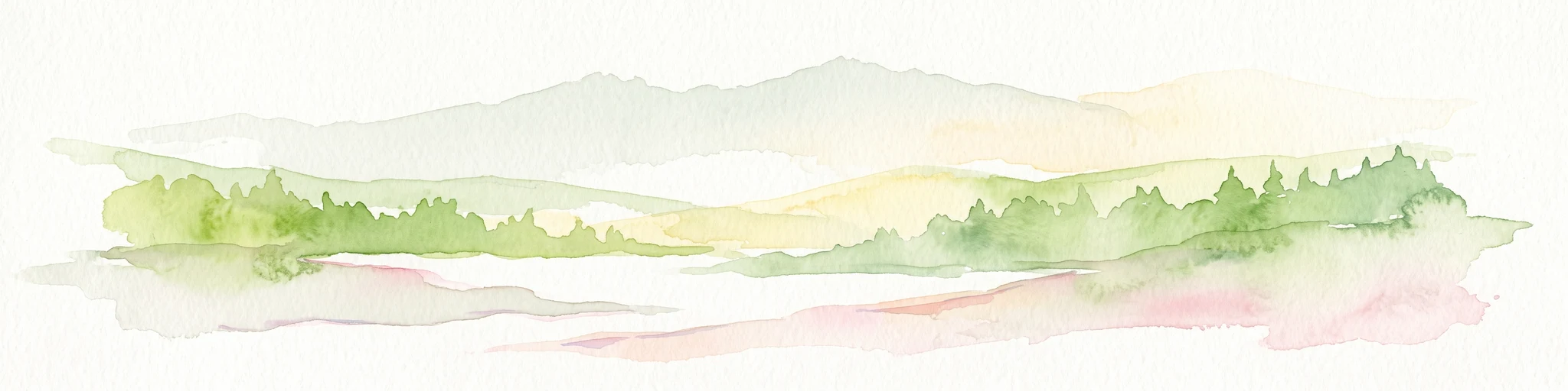
Watercolor painting of a tranquil lake surrounded by green forests and soft mountain ridgelines against a white background.
Protected landscapeIdaho
9.2 km away#4 closest

South

Sawtooth National Recreation Area: Mapping the Protected Landscape of Central Idaho

A vast mountain wilderness of granite peaks and glacier-carved lakes.

The Sawtooth National Recreation Area encompasses a quintessential northern Rocky Mountain terrain defined by the dramatic Sawtooth, White Cloud, and Boulder ranges. This protected landscape preserves over 700,000 acres of high-elevation wilderness, ranging from jagged granite arêtes to the broad, U-shaped Sawtooth Valley, serving as a critical hydrologic anchor for the rivers of the American West.

Area
2,957.7 km²
Established
1972
Relief
Mountain
Climate
Alpine
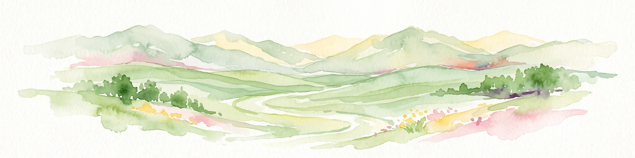
A watercolor painting of a wide, rolling landscape with green hills, a winding path or river, and soft mountains in the background against a white background.
Protected landscapeUnited States of America
37 km away#5 closest

Northwest

Hells Canyon National Recreation Area: Geologic Boundaries and Snake River Corridor Atlas

Deep canyon terrain and archaeological heritage in the American Northwest

This protected landscape encompasses the profound depth of the Snake River gorge, featuring rugged basalt cliffs and diverse forested uplands. The area serves as a significant intersection of natural history and ancient cultural presence, providing a detailed look at the topographic complexity defining the Oregon and Idaho boundary region.

Area
2,641 km²
Established
1975
Relief
Mountain
Climate
Temperate
Protected landscapeOregon
37 km away#6 closest

West

Wallowa-Whitman National Forest: A Geographic Overview of Northeastern Oregon Landscapes

Alpine wilderness, mountain ranges, and deep river gorges.

Wallowa-Whitman National Forest protects a vast, varied landscape of granite peaks, alpine meadows, and forested river canyons. This detailed overview covers the geographic significance of the Wallowa and Elkhorn mountains, the Hells Canyon corridor, and the surrounding wilderness regions within Oregon.

Area
9,682 km²
Established
1905
Visitors
505K annual
Relief
Mountain
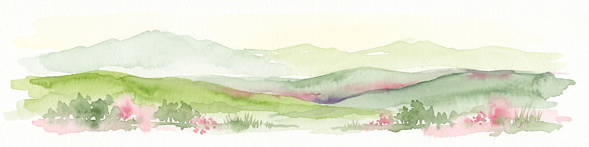
A soft watercolor painting of a mountain landscape with gentle green rolling hills, light green distant peaks, and scattered pink floral accents in the foreground against a white background.
Wildlife reserveIdaho
46 km away#7 closest

Southeast

Jim McClure, Jerry Peak Wilderness: Geography and Protected Landscape Map in Idaho

Mapping central Idaho's remote mountain backcountry

Investigate the high-elevation wilderness geography of Jim McClure, Jerry Peak. This protected area in Custer County sits within the Salmon-Challis landscape, featuring a rugged mix of mountain peaks, dense coniferous forests, and remote drainages that define the character of the American West.

Area
473.07 km²
Established
2015
IUCN
Ib
Relief
Mountain
Protected areaMontana
86 km away#8 closest

North

Lolo National Forest: An Atlas of Protected Lands and Mountainous Terrain in Montana

Ecological transition zone of the northern Rocky Mountains

This protected area covers two million acres of diverse northern Rocky Mountain geography. Known for its massive western red cedars and transitional ecology, the forest features a complex network of ridgelines, glacial lake basins, and river corridors that serve as vital habitat across the Montana landscape.

Area
8,894.85 km²
Established
1906
Relief
Mountain
Climate
Temperate

Common questions about visiting, size, designation, and location context for Frank Church-River of No Return Wilderness

Frank Church-River of No Return Wilderness FAQs for park facts, access, geography, and protected area context

Find quick answers about Frank Church-River of No Return Wilderness, including protected-area facts, park geography, trail and visitor context, and how the park fits into its surrounding country and regional landscape.
MoriAtlas Explorer

Continue Your Protected Areas Search Across the Global Atlas

Deepen your exploration by continuing the structured search for national parks and protected areas worldwide. Utilize the comprehensive filtering capabilities to compare different conservation landscapes and refine your understanding of global park geography. Discover more about the distribution and characteristics of protected natural areas.

Global natural geography