


Why Grünes Band Deutschland stands out
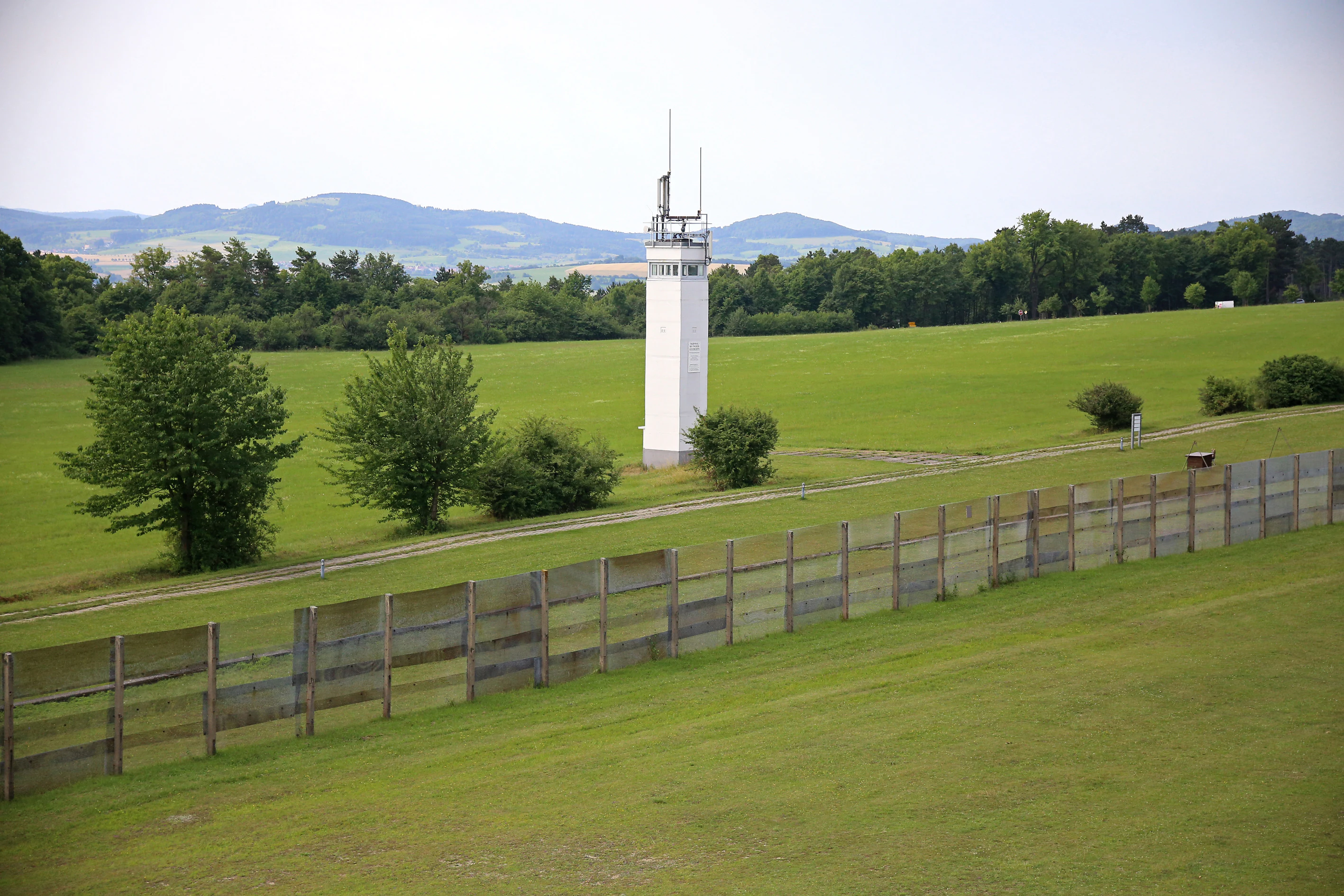
The Green Belt is best known as a continuous chain of rare habitats that developed in the no-man's land of the former inner-German border. Because the death strip and the surrounding controlled zone were kept free of intensive agriculture, roads, and settlement for almost forty years, the corridor retained dry grasslands, fallow land, scrub, pioneer woodland, and near-natural brooks that today harbour endangered species from wildcats and Eurasian otters to black storks and rare butterflies. The project is equally famous for its symbolic significance: it transformed a Cold War barrier into a shared, all-German conservation landscape linking federal states that were once separated by barbed wire and watchtowers. The Green Belt has also become a reference case for combining biodiversity protection with remembrance culture. Watchtowers, patrols roads, and abandoned border villages now stand alongside meadows, heaths, and orchids, and the project's supporters present the corridor as a model of how former conflict landscapes can be reinterpreted as living heritage.
Grünes Band Deutschland history and protected-area timeline
The idea of a green corridor along the inner-German border emerged from years of quiet observation during the Cold War. In the mid-1970s the schoolboy Kai Frobel, who later became the species protection officer of the Bund Naturschutz in Bayern, independently recorded rare birdlife along the Bavarian section of the border. The same association carried out early systematic bird surveys in 1979 and 1980, and in the 1980s East German officials of the Ministry for State Security allowed supervised youths to map species in the border zone eastwards.
The decisive moment came after the fall of the Berlin Wall. On 9 December 1989, roughly 400 nature and environmental protectionists met in Hof, and Kai Frobel proposed the name Grünes Band for the 'ecological backbone of Central Europe' that the former frontier could become. The meeting adopted a founding resolution and is regarded as the 'birth hour' of the Green Belt. Even before formal German reunification, the filmmaker Heinz Sielmann publicly advocated a national park stretching from the Baltic Sea to the Bavarian Forest, an idea that has never been fully realised but shaped the long-term ambition of the project.
The trademark names Grünes Band and Das Grünes Band have been registered by BUND since 2001. In June 2002 the idea of extending the concept eastward was publicly launched as the European Green Belt, with Mikhail Gorbachev accepting its patronage. Throughout the 2000s and 2010s individual Länder moved to formal protection: Thuringia designated its 763 kilometer section as a National Natural Monument in December 2018, Saxony-Anhalt followed in November 2019, Brandenburg in June 2022, and Hesse in February 2023. In 2024 the entire Green Belt was placed on Germany's tentative UNESCO list, seeking recognition as both natural and cultural heritage.
Grünes Band Deutschland landscape and geographic character
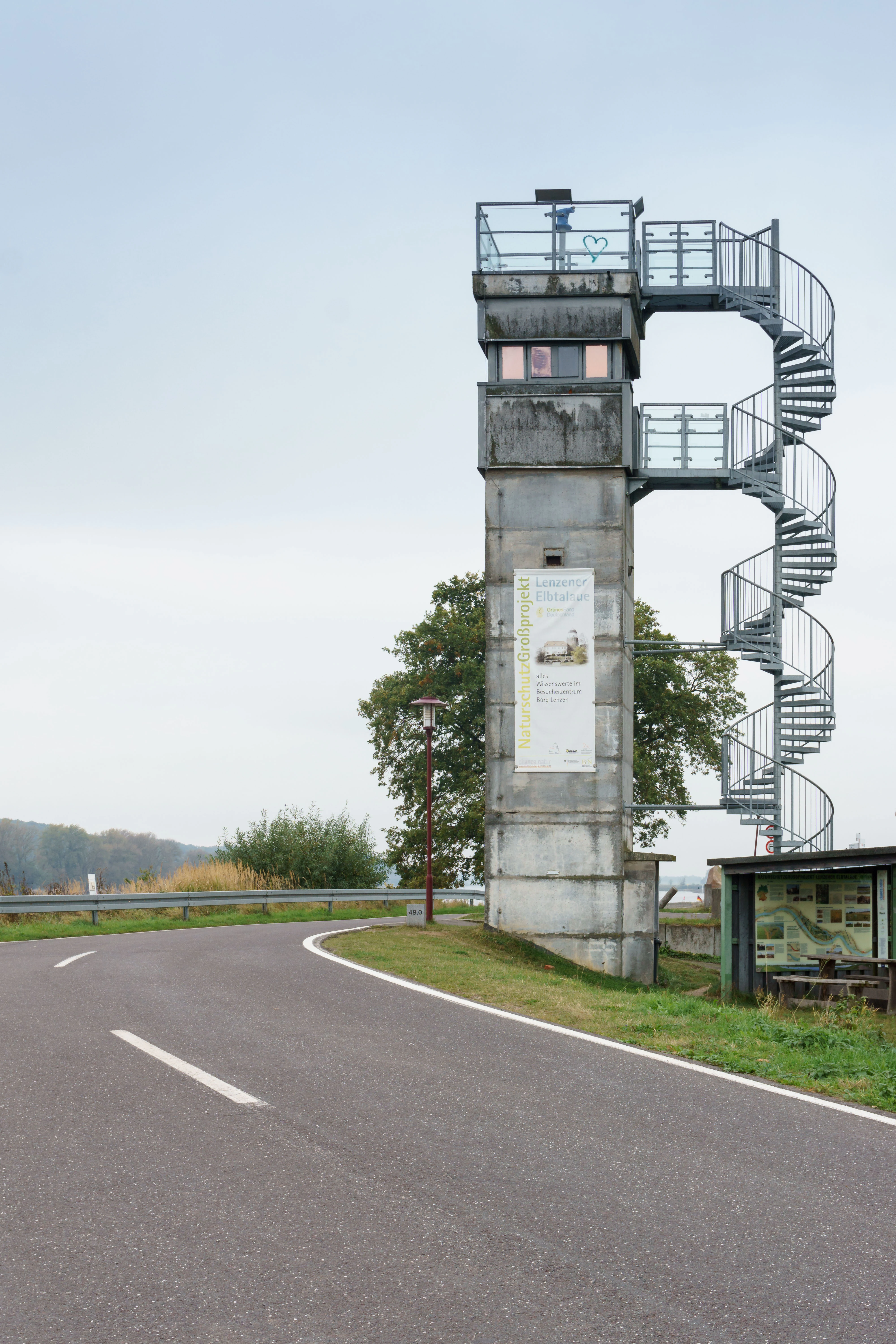
The Green Belt runs across almost every major natural landscape of Germany outside the high Alps, from the North German Plain to the central uplands. Its northern sections around Lübeck and the Schaalsee area consist of gently undulating countryside, lakes, and river floodplains, while the middle stretches near Lenzen on the Elbe, the Altmark, and the Colbitz-Letzlinger Heide pass through broad lowland ridges, heaths, and wetland mosaics.
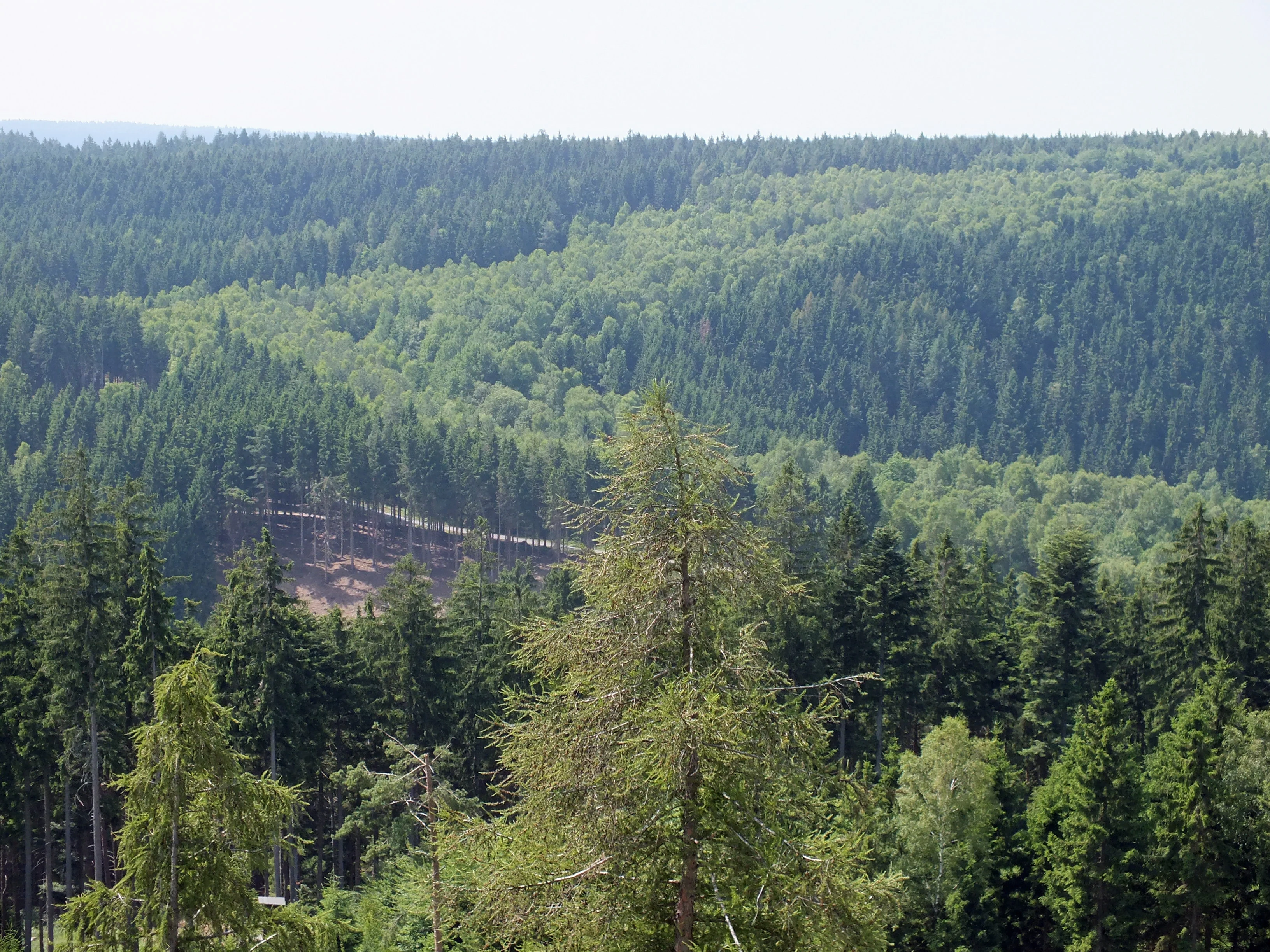
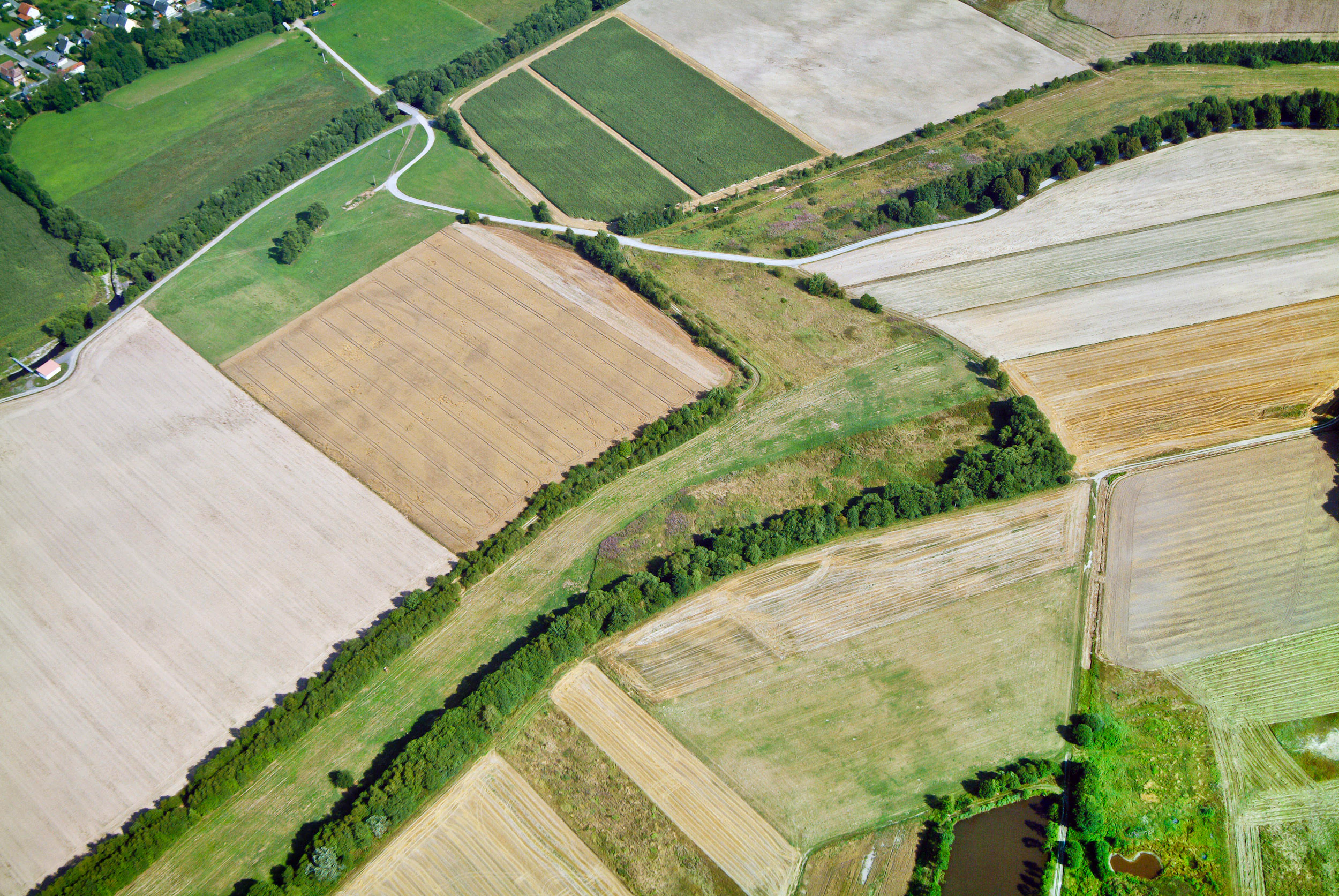
Further south the corridor crosses the wooded hills of the Harz, the open ridges and meadows of the Eichsfeld, the Thuringian Forest with its slate mountains and forested valleys, and the rolling country of the Franconian and Vogtland borderlands. Although the strip itself is only 50 to 200 meters wide, the closed character of the Cold War landscape left a clear visual signature: many sections still show a distinct ribbon of scrub, dry grassland, or pioneer woodland cutting through otherwise intensively used farmland.
Streams, springs, and brooks are central to the Green Belt's landscape character. Watercourses such as the Wakenitz near Lübeck, the Lüdersdorfer Bach, and numerous small tributaries of the Werra, Elbe, and Saale run along or across the corridor, producing a chain of floodplain, marsh, and wet-meadow habitats that complement the dry grasslands on the slopes above them.
Grünes Band Deutschland ecosystems, habitats, and plant life
Ecologically, the Green Belt is a linear refuge that emerged from the enforced absence of intensive land use. The long period of restricted access allowed habitats that have all but disappeared from the surrounding agricultural matrix to survive here: dry and nutrient-poor grasslands, heaths, scrub, pioneer woodland on former clearance strips, near-natural brooks, fens, bogs, and spring-fed mires. Many of these habitats are now classified as endangered on the German Red List, which gives the corridor an outsized role for national biodiversity.
Because the corridor stretches from the Baltic to the Bavarian Forest, it links very different ecological regions into a single biotope network. In the north it connects lake and river landscapes such as the Schaalsee biosphere reserve and the Elbe floodplains, in the central uplands it threads through mixed beech forests, montane meadows, and orchid-rich slopes, and in the south it reaches the montane spruce forests of the Bavarian Forest. The habitat surveys of 2001/2002 and 2012 documented around 109 and later 146 different biotope types respectively along its length.
The corridor's ecological value is maintained by active management. Heath areas are kept open by grazing with sheep and goats, meadows are mowed, and overgrown stretches are cleared to prevent succession into closed forest. The overall aim is to keep the corridor functional for species movement while preserving the open habitats in which many of the rarest species depend.
Grünes Band Deutschland wildlife and species highlights
More than 1,200 rare and threatened species of animals, plants, and fungi are recorded along the Green Belt, and the species composition reflects the wide habitat variety of the corridor. Large mammals include the endangered European wildcat, the Eurasian lynx, and the Eurasian otter, while bats are represented by numerous species that use the corridors, cellars, and old buildings of the border strip as refuges.
Birdlife is one of the most distinctive features of the Green Belt. Ground-nesting species of open habitats are particularly well represented, including the grasshopper warbler, whinchat, bluethroat, and European stonechat, together with higher-profile species such as the black stork, common kingfisher, red-backed shrike, European nightjar, and great grey shrike. Raptors of prey hunt along the open corridor and make use of the intact habitat mosaic.
Invertebrate diversity is similarly rich. Among the 40 dragonfly species recorded are the rare yellow-gold ringed dragonfly, and butterflies include the scarce fritillary (Abbiss-Scheckenfalter) and the violet copper, which had already been considered extinct in the Bavarian Forest before being rediscovered along the Green Belt. Grasshoppers such as the blue-winged grasshopper (Wanstschrecke) and many beetles, amphibian species including the palmate newt, and a wide array of fungi help make the corridor one of the country's most important reservoirs of low-intensity habitat specialists.
Grünes Band Deutschland conservation status and protection priorities
The Green Belt is a flagship project of German conservation because it demonstrates how a continuous ecological corridor can be maintained across federal states, property regimes, and administrative boundaries. About 85 percent of its area and roughly 80 percent of its length remain near-natural, and the corridor incorporates large designated sites including two national parks, three biosphere reserves, and around 150 nature reserves, much of the area also classed as European Natura 2000 sites such as Habitats Directive and Birds Directive areas.
The corridor's conservation value rests on its function as a refuge and a stepping-stone. The closure of the former border zone produced open habitats that are now rare in the surrounding farmland, and their linkage along the corridor allows species to move, recolonise, and maintain viable populations across a wide geographic range. Because the corridor is linear and follows an existing landscape feature, it is also unusually effective at connecting otherwise isolated protected areas into a single functional network.
Conservation challenges remain substantial. Around 450 roads cross the Green Belt, including several motorways, and these fragment the corridor into sections; crossings often act as barriers for terrestrial species. Successional change, especially the gradual conversion of open grassland into closed scrub and forest, threatens the open-land species that depend on periodic grazing and mowing. A long-running BUND-led project, Lückenschluss Grünes Band, has been working since 2012 to close gaps in the corridor and to reconnect fragmented sections, while conservation organisations continue to acquire land along the strip to secure its long-term management.
Grünes Band Deutschland cultural meaning and human context
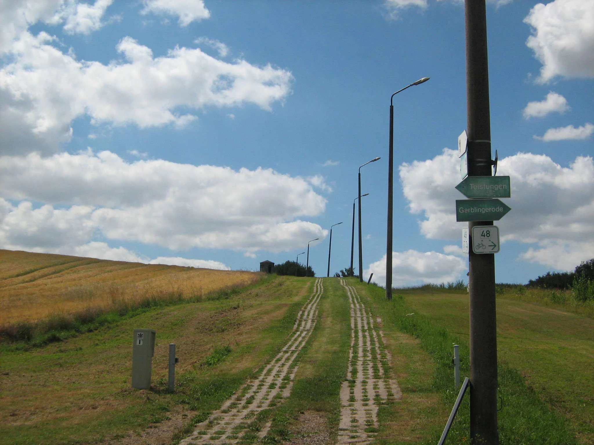
Alongside its ecological role, the Green Belt is one of Germany's most important memorial landscapes. The frontier between the Federal Republic and the German Democratic Republic, sealed and fortified from 1952, left behind watchtowers, patrol strips, fence lines, and the remains of villages whose inhabitants were forcibly resettled. Across the route visitors encounter border museums at Mödlareuth, Bad Sachsa, Schifflersgrund, Sorge, and the Eichsfeld, together with memorial sites such as the Point Alpha memorial and the former border crossing at Marienborn, which together document life along the frontier and the personal costs of the division.
The cultural significance of the Green Belt is increasingly recognised in formal protection. The status of National Natural Monument in Thuringia and Saxony-Anhalt stresses the equal importance of nature conservation and remembrance culture, and the 2024 nomination for UNESCO World Heritage seeks recognition both for the natural values of the corridor and for its role as a landscape of twentieth-century German history. Local cultural projects, art installations, and long-distance trails along the former patrol road reinforce this dual identity, turning what once was a controlled military zone into a shared space of memory and ecological recovery.
Top sights and standout views in Grünes Band Deutschland
The Green Belt's most distinctive contribution is that it transforms a Cold War barrier into a continuous habitat corridor of national importance, linking two national parks and three biosphere reserves into a single linear biotope network. It shelters more than 1,200 rare species in habitats that survived because the frontier was closed to intensive agriculture, and it functions simultaneously as a memorial landscape, an international cycling route along the Iron Curtain Trail, and a candidate UNESCO site.
For visitors, the corridor offers a uniquely compact experience of Germany's natural and recent history. Within a single multi-day walk or ride, the landscape shifts from Baltic lake districts to floodplains of the Elbe, from upland grasslands and orchids around the Harz and Eichsfeld to the montane forests of the Bavarian borderlands, while museums, watchtowers, and former patrol roads mark the human story of the border itself.
Best time to visit Grünes Band Deutschland
Spring and early summer are particularly rewarding along the Green Belt, when dry grasslands come into flower and orchids such as the lady's slipper are in bloom on the warmer slopes. This is also the most active period for ground-nesting birds and many butterfly species, which favour the mix of open grassland and scrub that the corridor maintains. Late summer and early autumn offer good conditions for hikes and long-distance cycle rides along the former patrol road, when meadows are at their richest and visibility across open sections is best.
Winter brings its own qualities. The deciduous scrub and pioneer woodland that characterise large sections of the corridor are easier to appreciate without foliage, and the contrast between the Green Belt and the surrounding intensively used fields is often at its sharpest. Because the corridor crosses several climate zones from north to south, peak conditions vary along its length; visitors planning to explore several regions are best served by timing individual sections to their local phenology rather than the calendar of the project as a whole.