Why Gunung Merapi National Park stands out
Gunung Merapi is best known as Indonesia's most active volcano, with a documented eruption history spanning over 450 years and a pattern of minor eruptions every two to three years with larger events every 10-15 years. The 2010 eruptions were the most destructive since 1872, killing 353 people and displacing 350,000. The volcano produces distinctive pyroclastic flows known locally as wedhus gembel (shaggy goat) and has been the subject of continuous scientific monitoring since 1924. The park also preserves endemic Javanese alpine vegetation and serves as the source of three major river systems: Solo, Opak, and Progo.
Gunung Merapi National Park history and protected-area timeline
The volcanic history of Merapi spans approximately 400,000 years, with the current cone representing the youngest phase of volcanic activity in a chain of volcanoes in southern Java. Stratigraphic analysis reveals that early eruptions were typically effusive, producing basaltic lava flows, while more recent activity has become increasingly explosive with viscous andesitic lavas generating lava domes. The name Merapi derives from Sanskrit meru (mountain) combined with Javanese api (fire), translating to Mountain of Fire. Major historical eruptions include the presumed 1006 event that allegedly covered central Java in ash and may have contributed to the collapse of the Hindu Kingdom of Mataram, and subsequent destructive eruptions in 1786, 1822, 1872, and 1930, the last destroying 13 villages and killing 1,400 people. The 2010 eruptions proved the most devastating in modern history, with 353 fatalities and 350,000 displaced, requiring months of continuous monitoring and exclusion zones. The national park designation in 2004 has faced legal challenges from environmental groups concerning consultation with local residents, particularly during the 2006 eruption when some residents expressed reluctance to evacuate for fear their land would be absorbed into the park.
Gunung Merapi National Park landscape and geographic character
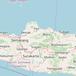
The landscape of Gunung Merapi is dominated by the steep symmetrical cone of the stratovolcano rising from the Java highlands, with the active summit crater continuously emitting smoke and periodic eruptions. The volcano sits at a critical geological boundary where the Indo-Australian plate subducts beneath the Sunda plate, creating the volcanic arc that runs through Java. The terrain below the summit is characterized by radial drainage patterns flowing outward through deep valleys carved into the volcanic flanks, with major river systems including Kali Gendol, Kali Boyong, Kali Krasak, and Kali Putih. The summit region remains devoid of vegetation due to continuous volcanic activity, while lower slopes feature a progression from alpine zones through bamboo forest to tropical montane rainforest. The western and southern slopes contain volcanic deposits from the 2010 eruption, with a prohibited sterile zone established in nine villages where no permanent habitation is permitted. The mountain forms a visual backdrop to the historic Prambanan temple complex and Yogyakarta city, with the peak often visible from the ancient royal capital.
Gunung Merapi National Park ecosystems, habitats, and plant life
The ecological character of Gunung Merapi National Park reflects the harsh conditions created by ongoing volcanic activity combined with the more benign environments of the lower slopes. The summit region above approximately 2,500 meters supports alpine vegetation characteristic of Javanese highlands, including Rhododendron species and edelweis jawa (Anaphalis javanica). Below this zone, bamboo forest dominates before giving way to tropical montane rainforest on the wetter southern and western slopes. The park preserves habitat for several endemic orchid species, including the rare Vanda tricolor 'Merapi', found in the montane rainforests of the southern slopes. The volcanic soils and regular disturbance regimes create specialized pioneer plant communities that colonize fresh deposits, while the river systems originating from the mountain support aquatic ecosystems across the downstream valleys. Birdlife includes species adapted to montane forest and open volcanic landscapes, though comprehensive species documentation focuses on the more accessible forest zones rather than the active summit area.
Gunung Merapi National Park wildlife and species highlights
Wildlife in the park reflects the transitional ecology from volcanic summit through montane forest to agricultural landscapes on the lower slopes. The montane forests shelter various primate species and smaller mammals, while the river valleys provide habitat for avian species including kingfishers and waterfowl. The park's position on the island of Java places it within distributions of Southeast Asian tropical biodiversity, though the active volcanic environment limits some species distributions. The bamboo forests support specialized bird species, and the mosaic of forest patches with agricultural areas creates edge habitat favorable for certain mammal and bird groups. The extensive monitoring network and restricted access to active volcanic areas mean wildlife surveys have focused on the more stable forest zones rather than the dynamic summit region.
Gunung Merapi National Park conservation status and protection priorities
Gunung Merapi National Park serves conservation purposes by protecting the watershed functions of the volcanic slopes, preserving endemic biodiversity in the montane forests, and maintaining a buffer zone that limits development in high-hazard areas. The park designation creates institutional frameworks for managing the volcanic landscape while balancing ecological preservation with the needs of communities who have historically inhabited the slopes. The prohibited sterile zone established after the 2010 eruptions in nine villages represents a conservation measure that also serves hazard management by preventing permanent habitation in areas with extreme volcanic risk. The ongoing volcanic activity makes this a challenging conservation context, where natural processes rather than preservation of static conditions define the management approach. The park also preserves the cultural landscape where Javanese spiritual traditions intersect with the volcanic environment, including sacred sites and the traditional role of the juru kunci (gatekeeper) appointed by the Yogyakarta Sultan.
Gunung Merapi National Park cultural meaning and human context
Gunung Merapi holds profound cultural significance for the Javanese people, particularly those living around its crater and the Yogyakarta Sultanate. The mountain is woven into Javanese cosmology through myths of creation and ongoing spiritual presence, with two legendary armourers, Empu Rama and Empu Permadi, believed to dwell beneath the mountain and govern mystical beings. Local beliefs hold that a spiritual palace (kraton) exists inside Merapi, serving as a counterpart to the Yogyakarta Sultanate and populated by the spirits of righteous ancestors. The Yogyakarta Sultan maintains a traditional juru kunci (gatekeeper) who serves as the spiritual custodian of the mountain, with the current position held by Mas Bekel Anom Suraksosihono following the death of Mbah Maridjan in the 2010 eruption. Merapi forms part of a sacred north-south axis in Javanese cosmology connecting the mountain peak, the Yogyakarta palace complex, and the Southern Ocean (Indian Ocean), with the queen of the Southern Ocean, Nyi Roro Kidul, considered a mystical consort of Javanese kings. Regular offerings are made to appease the mountain spirits, particularly on the anniversary of the sultan's coronation.
Top sights and standout views in Gunung Merapi National Park
The national park offers access to one of the world's most active and closely studied volcanoes, with multiple monitoring stations providing real-time data on volcanic activity. The landscape ranges from bare volcanic summit through bamboo forest to tropical montane rainforest, supporting endemic species including the rare Vanda tricolor 'Merapi' orchid. The cultural experience includes visits to the Merapi Museum Center in Kaliurang, which features exhibits on volcanic science and the 2010 eruptions. The mountain provides popular climbing routes from Selo in the north and Kaliurang in the south, though access is regulated based on volcanic activity levels. The watershed systems originating from Merapi support agricultural communities across central Java, with the rivers flowing to both the north and south coasts of the island.
Best time to visit Gunung Merapi National Park
The best time to visit the park depends on current volcanic activity levels, which are monitored continuously by the Indonesian Volcanological Authority. When access is permitted, the dry season from April to October generally offers more stable conditions for climbing and exploration, though this coincides with higher temperatures in the lowlands. The monsoon season from November to March brings heavy rainfall that can trigger lahars (volcanic mudflows) on the slopes and may close access routes. Visitor access is frequently restricted based on alert levels, with exclusion zones extending up to 20 kilometers from the summit during periods of high activity. The park management adjusts access regulations in response to seismic monitoring data, so visitors should check current status before planning any approach to the mountain.