Why Gunung Merbabu National Park stands out
Gunung Merbabu National Park is best known for its dramatic volcanic landscape featuring twin summit peaks, extensive summit grasslands (sabana), and the dramatic visual contrast between the mountain's forested slopes and the cultivated agricultural zones in the surrounding lowlands. The park is recognized for its ecological gradient, protecting forest types ranging from dipterocarp lowland forest through montane zones to ericaceous cloud forest near the summit. The mountain is a popular trekking destination with five established climbing routes, offering access to panoramic views of Central Java's volcanic landscape, including the striking proximity of Mount Merapi to the southeast. The summit grasslands, particularly the savanna ecosystem at higher elevations, represent a distinctive landscape feature not commonly found on Java's other volcanic peaks.
Gunung Merbabu National Park history and protected-area timeline
Mount Merbabu has appeared in Javanese historical records under different names, including Gunung Damalung and Gunung Pam(a)rihan, reflecting its significance in pre-Islamic Javanese culture. The mountain's slopes reportedly contained famous meditation sites (pertapaan) that were visited by practitioners including Bujangga Manik in the 15th century. The name Merbabu, combining the Javanese words for mountain (meru) and ash (abu), appears in Dutch colonial-era records and gradually replaced the earlier designations. The mountain was classified as a dormant stratovolcano following documented eruptions in 1560 and 1797, the latter rated as a 2 on the Volcanic Explosivity Index. Geological research indicates that the most recent volcanic activity was fed by a north-northwest to south-southeast trending fissure system that cut across the summit, producing lava flows from Kopeng crater on the northern flank and Kajor crater on the southern flank. The national park designation was formalized in 2004, protecting an area of approximately 57 square kilometers around the mountain's upper slopes and summit regions.
Gunung Merbabu National Park landscape and geographic character
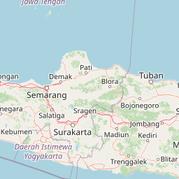
The landscape of Gunung Merbabu National Park is dominated by the mountain's dramatic volcanic topography, characterized by steep slopes rising to twin summit peaks. The Kenteng Songo peak reaches 3,145 meters while the Syarif peak stands at 3,119 meters, with a broad saddle at approximately 1,500 meters elevation separating them. The mountain's radial symmetry is marked by three U-shaped valleys extending from the Kenteng Songo summit in northwesterly, northeasterly, and southeasterly directions. The summit region features distinctive open grasslands (sabana) where the vegetation transitions from forest to more open terrain, creating a savanna-like landscape unusual among Java's peaks. The lower slopes are extensively cultivated with agricultural terraces and settlements, particularly on the northern and eastern flanks where towns such as Kopeng and Selo serve as common access points. The visual landscape includes sweeping vistas across the Central Java highlands, with the active volcano Mount Merapi visible in the proximity to the southeast, separated by a 1,500-meter-high broad saddle.
Gunung Merbabu National Park ecosystems, habitats, and plant life
The national park protects a vertical ecological gradient that includes multiple distinct forest types. The slopes support Tropical Dipterocarp Forest (Hutan Dipterokarp Bukit) in the lower elevations, transitioning to Upper Dipterocarp Forest, then Montane Forest (Hutan Montane), and finally Ericaceous Forest (Hutan Ericaceous atau Hutan Pegunungan) near the summit. This progression reflects decreasing temperature and increasing cloud immersion as elevation rises. The summit grasslands represent a particular ecological feature, maintained by a combination of climate conditions and periodic burning that prevents forest encroachment. The forest ecosystems provide critical watershed functions, capturing moisture from the prevailing winds and releasing it gradually to benefit downstream water users in the densely populated agricultural regions of Central Java. The park's position within the Sunda Arc region places it within a biodiversity hotspot, though the specific species composition reflects the mountain's elevation range and Java's level of ecological modification.
Gunung Merbabu National Park wildlife and species highlights
The forest ecosystems within Gunung Merbabu National Park support populations of native Javanese wildlife, though the park's proximity to human settlements and agricultural areas means that wildlife communities are influenced by surrounding land use. The montane and Ericaceous forests provide habitat for various bird species adapted to higher elevation environments, while the more accessible lower forest zones support populations of mammals including primates and other forest-dwelling species. The park's ecological gradient creates diverse habitat conditions that support different species assemblages across elevations, from lowland forest species in the protected valley bottoms to highland specialists adapted to cooler summit conditions. Specific species documentation for the park would require more detailed survey data than is available in the source material, but the forest habitats clearly provide ecological value for regional biodiversity conservation.
Gunung Merbabu National Park conservation status and protection priorities
Gunung Merbabu National Park was established to address conservation needs in a region where volcanic mountain ecosystems face multiple pressures from surrounding agricultural expansion, logging, and human settlement. The park protects critical watershed areas that provide hydrological services to downstream communities and agricultural lands in Central Java's productive farming regions. The forest cover maintained within the park boundaries serves important soil stabilization functions on the steep volcanic slopes, reducing erosion and landslide risks during the intense tropical rainfall seasons. The national park designation provides institutional protection for the mountain's natural values while allowing controlled access for sustainable recreational use through the established climbing routes. The park's conservation significance is enhanced by its role in protecting representative examples of Java's montane and summit grassland ecosystems, which have been heavily modified across the island.
Gunung Merbabu National Park cultural meaning and human context
Mount Merbabu holds meaningful place in Javanese cultural and spiritual traditions, appearing in historical manuscripts as a site of religious significance during the classical period of Javanese civilization. The mountain was known in pre-Islamic times as Gunung Damalung and was associated with meditation and spiritual practice, as evidenced by references to the famous hermitage sites on its slopes. The 15th-century Javanese text Bujangga Manik records visits to meditation sites in the Mount Merbabu area, demonstrating the mountain's historical religious importance. The landscape around the mountain continues to be shaped by traditional agricultural practices of Javanese rural communities, with terraced rice paddies and smallholder farms extending up the lower slopes in many areas. The mountain's prominent position in the Central Java landscape has also made it a subject of artistic representation, including historical watercolors depicting the volcano with surrounding towns and plantations.
Top sights and standout views in Gunung Merbabu National Park
The primary highlight of Gunung Merbabu National Park is the dramatic ascent to its twin summit peaks, offering trekkers the opportunity to reach 3,145 meters and experience panoramic views across Central Java's volcanic landscape. The summit grasslands (sabana) represent a distinctive landscape feature, providing photographic opportunities and a unique ecosystem within Java's volcanic mountain estate. The park's five established climbing routes from different villages offer varied experiences, from the popular Selo route favored by beginners to the more challenging Wekas approach favored by experienced climbers seeking faster summit access. The proximity to Mount Merapi, one of the world's most active volcanoes, creates a dramatic backdrop and offers interesting geological context for visitors understanding Java's volcanic systems. The ecological gradient from lowland forest to summit grassland provides visual and ecological variety within a single trek.
Best time to visit Gunung Merbabu National Park
The optimal period for visiting Gunung Merbabu National Park coincides with the dry season from approximately May through September, when conditions are most favorable for climbing and the risk of rainfall interfering with treks is reduced. The mountain can be climbed year-round, but the wet season from October through April brings higher precipitation, cloud immersion at higher elevations, and potentially more hazardous trail conditions. Early morning summits offer the best chance for clear views across the Central Java highlands before afternoon cloud formation typically obscures the landscape. The temperature at summit levels can be significantly cooler than the base, requiring appropriate clothing layers regardless of the season.