

Mori Atlas logo
Nature reserveHale Conservation Park

Examining the rugged hills, native eucalypt forest, and significant geological unconformity of this South Australia reserve.

Hale Conservation Park: A Protected Nature Reserve in the Mount Lofty Ranges Landscape

Hale Conservation Park sits within the north-central Mount Lofty Ranges of South Australia, encompassing a compact area of rugged, broken terrain. The landscape is defined by a rare low open forest of brown stringybark and pink gum, which provides critical habitat for native mammals and numerous bird species. Beyond its ecological forest value, this nature reserve is recognized for a distinct geological unconformity between ancient basement rocks and younger sedimentary sequences.

mount lofty rangesconservation parklow open foresteucalypt forestheath understoreyrugged hills

Hale Conservation Park

Nature reserve

Park overview

Structured park overview, official facts, and landscape profile for Hale Conservation Park

Hale Conservation Park park facts, protected area profile, and essential visitor context

Review the core facts for Hale Conservation Park, including designation, size, terrain, visitor scale, habitats, and operating context in one park-focused overview.

About Hale Conservation Park

Hale Conservation Park is one of the many small but ecologically and geologically interesting reserves scattered through the Mount Lofty Ranges of South Australia. Unlike the larger and more visited parks of the range, Hale is a compact reserve of just under two square kilometres, focused on a single rugged hillside of the Hundred of Barossa near Williamstown. Its size makes it modest on the map, but the combination of vegetation, fauna, and exposed rock preserved within its boundaries has given it an outsized scientific and conservation significance.

The park's ecological character is dominated by a low open eucalypt forest above a dense heath understorey, a vegetation pattern characteristic of the higher, poorer soils of the central ranges. Brown stringybark, long-leaved box, and pink gum form the canopy, while a mid-dense heath layer sits below. This forest-heath mosaic supports a community of western grey kangaroos, echidnas, and a rich bird assemblage of more than sixty recorded species, including the South Australian threatened scaly thrush, whose habitat requirements have made it a species of conservation concern as native vegetation in the ranges has been progressively cleared.

Beyond its ecological role, Hale Conservation Park is notable for its geology. The reserve shares with the neighbouring Warren Conservation Park a series of rock exposures showing a striking geological unconformity: a contact between the younger Adelaide Basin sedimentary sequence and an older, rejuvenated crystalline basement inlier. This boundary had been mapped and described as early as 1980 and gives the park an importance to geological research disproportionate to its small footprint.

Managed by the South Australian Department for Environment and Water, the park has been protected since 1964, first as a wildlife reserve, then as a national park, and since 1972 as a conservation park under South Australian legislation. It is listed under the former Register of the National Estate and is classified as an IUCN Category III protected area. A walking track traverses the length of the reserve, allowing visitors to experience both its forest and its geological heritage in a relatively short visit.

Quick facts and research context for Hale Conservation Park

Hale Conservation Park is located in the locality of Williamstown in South Australia, about 60 kilometres north-east of Adelaide and roughly 2 kilometres south-east of the Williamstown town centre. It sits within the cadastral unit of the Hundred of Barossa, in the rugged north-central part of the Mount Lofty Ranges. The park covers approximately 1.89 square kilometres and is classified as an IUCN Category III protected area, recognising its status as a natural monument or feature. It is managed by the South Australian Department for Environment and Water and was first given protected status as a wildlife reserve in 1964, becoming a conservation park in 1972.

Protection and recognition

Examine documented conservation boundaries and international recognition records.

Hale Conservation Park Protection Status and Designated Terrestrial Scope

Terrestrial protection status data for Hale Conservation Park outlines the documented conservation boundaries and management framework. International recognition sources remain unassigned within the current protected area records for this natural landscape.

Protection details

Protection scope
Terrestrial
Transboundary protection
No
Park context

Deeper park guide and search-rich context for Hale Conservation Park

Hale Conservation Park history, landscape, wildlife, and travel context

Explore Hale Conservation Park through its history, landscape character, ecosystems, wildlife, conservation priorities, cultural context, and seasonal travel timing in a structured park guide built for atlas discovery and search intent.

Why Hale Conservation Park stands out

Hale Conservation Park is best known for two very different things: its stringybark-eucalypt forest and heath vegetation, and its scientifically important geological unconformity. The park protects a low open forest of brown stringybark, long-leaved box, and pink gum above a mid-dense heath understorey, a community that is still well represented in the central Mount Lofty Ranges but increasingly rare under modern land use. The park is equally important to geology. Together with the adjacent Warren Conservation Park to the south, it contains unique exposures of an unconformity between the sedimentary Adelaide Basin sequence and a much older rejuvenated crystalline basement inlier. This feature, described in a 1980 heritage assessment still cited today, is the park's most distinctive contribution to scientific knowledge of the region.
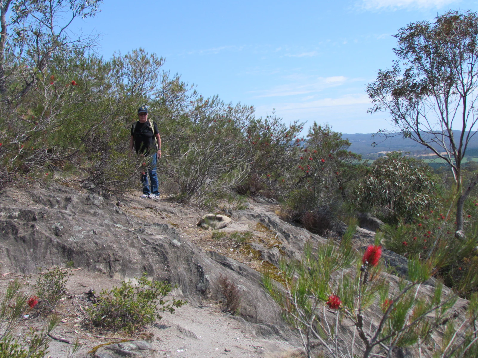
A hiker wearing a dark shirt and backpack walks along a rocky trail in a park with sparse trees, shrubs, and visible red flowers in the foreground.
A hiker traverses a rocky trail within Hale Conservation Park, surrounded by native eucalypt forest and wildflowers.

Hale Conservation Park history and protected-area timeline

The land that now forms Hale Conservation Park was first given formal protection on 9 January 1964, when several sections in the Hundred of Barossa were proclaimed as a wildlife reserve under the Crown Lands Act 1929. The following year, on 4 February 1965, additional land including section 315 was added and the entire area was proclaimed as the Hale Wild-Life Reserve under the same legislation.

In 1967, the reserve's status was elevated when it was proclaimed under the National Parks Act 1966 as Hale National Park. The legal and administrative framework changed again in 1972, when South Australia introduced the National Parks and Wildlife Act 1972. Under this act, the former Hale National Park was re-proclaimed as Hale Conservation Park on 27 April 1972, giving the reserve its present name and a continuing role in the state's conservation estate.

By 1980, the park was the subject of a formal heritage description that emphasised both its ecological and its geological significance, and it was at that time listed on the Register of the National Estate. The reserve has remained in continuous public ownership since and continues to be managed by what is now the Department for Environment and Water.

Hale Conservation Park landscape and geographic character

Hale Conservation Park occupies rugged hilly terrain in the north-central part of the Mount Lofty Ranges. The hills here are steep and broken, dissected by small gullies, and the vegetation pattern closely follows slope, soil depth, and exposure. The result is a landscape of rolling forested ridges and sheltered valleys rather than open plains or dramatic peaks, but with the dense, textured character typical of the higher Mount Lofty Ranges.

The underlying geology is a major part of what makes this landscape unusual. The park exposes a contact between the sedimentary Adelaide Basin sequence and an older crystalline basement inlier, a feature that is both visually striking in its own outcrops and scientifically significant. This geological context also influences the soils, which tend to be skeletal on the steeper slopes, helping to support the heathy vegetation that defines the park's appearance.

Hale Conservation Park ecosystems, habitats, and plant life

The natural environment of Hale Conservation Park is dominated by a low open eucalypt forest sitting above a mid-dense heath understorey, a vegetation pattern typical of the central Mount Lofty Ranges but increasingly uncommon in the modern landscape. The canopy species include brown stringybark, long-leaved box, and pink gum; below them, the heath layer fills the understorey and gives the forest floor its dense, shrubby character.

This vegetation mosaic supports a relatively rich native fauna for such a small reserve. The park's mammal community includes western grey kangaroos, which are common here, and echidnas. More than sixty bird species have been recorded in the reserve, reflecting the habitat diversity produced by the forest-heath mosaic and the rugged topography. The park's vegetation also provides important habitat for the scaly thrush, a species considered threatened in South Australia because clearance of native forest has reduced its available range.

Hale Conservation Park wildlife and species highlights

Despite its small area, Hale Conservation Park supports a recognisable and ecologically meaningful wildlife community. Western grey kangaroos are described as common in the reserve and are among its most visible native mammals, while echidnas add a distinctive element of the older, less disturbed Australian fauna.

The park is more notable for its birdlife. More than sixty species have been recorded within its boundaries, a diversity supported by the mix of eucalypt forest, heath understorey, and rugged topography. Of particular conservation interest is the scaly thrush, classified as threatened in South Australia due to ongoing destruction of its native habitat. Hale Conservation Park provides one of the refuge areas where this species can still be observed in the Mount Lofty Ranges, making the park disproportionately important for its role in protecting this single species.

Hale Conservation Park conservation status and protection priorities

Hale Conservation Park's conservation significance lies in the way it combines a relatively intact representation of central Mount Lofty Ranges forest-heath vegetation with habitat for threatened native fauna and unique geological exposures. The reserve protects brown stringybark, long-leaved box, and pink gum forest together with a mid-dense heath understorey, a vegetation type that has become increasingly fragmented across the ranges since European settlement.

The park also provides important refuge value for the scaly thrush, a species considered threatened in South Australia because of habitat loss. By holding a population of this species within protected forest habitat, Hale contributes meaningfully to its regional survival even though it is small in area. The reserve was recognised in this role in the 1980 heritage description of the park and was listed at that time on the Register of the National Estate.

From a geological perspective, the conservation significance of the reserve extends beyond living ecosystems. Together with Warren Conservation Park to the south, Hale preserves exposures of a recently discovered unconformity between the Adelaide Basin sedimentary sequence and a rejuvenated crystalline basement inlier. This feature gives the park a documented scientific value that complements its ecological role and places it among the more formally recognised small reserves of South Australia.

Top sights and standout views in Hale Conservation Park

Hale Conservation Park's strongest features are the unusual concentration of value within a very small footprint. The reserve contains a well-preserved low open eucalypt forest of brown stringybark, long-leaved box, and pink gum over a mid-dense heath understorey, a habitat type increasingly rare in the Mount Lofty Ranges. Within this forest, more than sixty bird species are recorded, including the threatened scaly thrush.

Equally distinctive is the park's geology, shared with neighbouring Warren Conservation Park. Hale contains exposed rock sections showing a striking unconformity between the Adelaide Basin sedimentary sequence and an older crystalline basement inlier, a feature of regional scientific importance well beyond what its modest size would suggest.

Best time to visit Hale Conservation Park

The park lies in a temperate part of South Australia, where summers are typically warm and dry and winters are mild and wetter. The cooler months from autumn through spring tend to be more comfortable for walking the park's rough, hilly tracks and are generally a productive time for observing native birds and mammals in active condition. Spring can be particularly rewarding for wildflower displays in the heath understorey, while the greenwinter period emphasises the lushness of the forest cover. Visitors should be prepared for uneven terrain and avoid conditions of high summer heat.

Monthly climate preview

Long term temperature and monthly precipitation patterns across representative coordinate samples

Hale Conservation Park Climate Normals and Weather by Month

Measured temperature records and monthly precipitation averages establish the long term climate rhythm at Hale Conservation Park. Examining the complete twelve month profile reveals detailed regional variations across the protected landscape.
Annual mean16 °C
9 °C24 °C
Jan24°
Feb24°
Mar20°
Apr17°
May13°
Jun10°
Jul
Aug10°
Sep12°
Oct16°
Nov19°
Dec22°
Warmest month
January

23.8 °C

Coolest month
July

9.5 °C

Wettest month
June

1.9 mm/day

Driest month
January

0.6 mm/day

Park location guide

Geography guide, regional context, and park location map for Hale Conservation Park

Hale Conservation Park park geography, regions, and map view in Australia

Understand where Hale Conservation Park sits in Australia through a broader geographic reading of the surrounding landscape, nearby location context, and its mapped position within the national park landscape.

How Hale Conservation Park fits into Australia

Australia is a constitutional monarchy and federal parliamentary democracy comprising six states and ten territories. With a population of nearly 28 million, it is one of the world's most urbanised countries, with most people concentrated on the eastern seaboard. The country has a high Human Development Index and is known for its cultural diversity, ancient Aboriginal heritage, and unique wildlife.

Wider geography shaping Hale Conservation Park in Australia

Australia occupies the entire Australian continent, the island of Tasmania, and numerous smaller islands. It is the world's flattest and driest inhabited continent, featuring vast deserts in the interior (the Outback), tropical rainforests along the eastern coast, and a coastline bordering the Indian and Pacific Oceans.

Map view of Hale Conservation Park

Use this park location map to pinpoint Hale Conservation Park in Australia, understand its exact geographic position, and read its mapped placement within the surrounding landscape more clearly.

Pigeon | © OpenStreetMap contributors

Location context for Hale Conservation Park

South Australia
Recorded earthquake history

Review the Historical Earthquake Catalogue for Hale Conservation Park

Consult the comprehensive record of documented seismic activity in the vicinity of Hale Conservation Park. MoriAtlas organizes these historical events by epicentre distance, providing a clear reference for understanding the seismic history of the Mount Lofty Ranges without suggesting future hazard or geological causation.

Hale Conservation Park Earthquake Records

Catalogued events

5 events

Strongest magnitude

Magnitude 4

Most recent event

Mar 5, 2022

This history includes earthquakes recorded inside the park or within 50 km of its borders

Visual reference guide for rugged hills, eucalypt forests, and geological exposures

Hale Conservation Park Photos and Protected Landscape Scenery

Visual records reveal the steep forested ridges, native heath understoreys, and exposed rock formations defining Hale Conservation Park. Studying these protected-area photographs helps observers understand the dense terrain and distinct ecological character of the Mount Lofty Ranges.

A hiker wearing a dark shirt and backpack walks along a rocky trail in a park with sparse trees, shrubs, and visible red flowers in the foreground.

Park atlas

Compare adjacent protected areas and surrounding Mount Lofty Ranges geography.

Exploring Parks Near Hale Conservation Park and Regional Protected Landscapes

Continue exploring regional protected areas by comparing Hale Conservation Park with neighbouring forest reserves and geological sites. Examining nearby natural habitats provides a broader understanding of the rugged terrain and native vegetation spread across the wider district.
Nature reserveSouth Australia
About 11 km away#1 closest

Southeast

Cromer Conservation Park: Mapped Protected Landscapes of the South Australian Adelaide Hills

An undisturbed remnant of native eucalypt forest and rare shrub heath

Cromer Conservation Park functions as a significant ecological island in South Australia, preserving 44 hectares of natural vegetation largely untouched by historical land use. This reserve offers a focused look at the moist, undulating terrain of the Mount Lofty Ranges, providing essential habitat for rare species like the blue star sun-orchid and supporting a dense mosaic of native shrubs beneath an open forest canopy.

Area
0.44 km²
Established
1976
IUCN
III
Relief
Upland
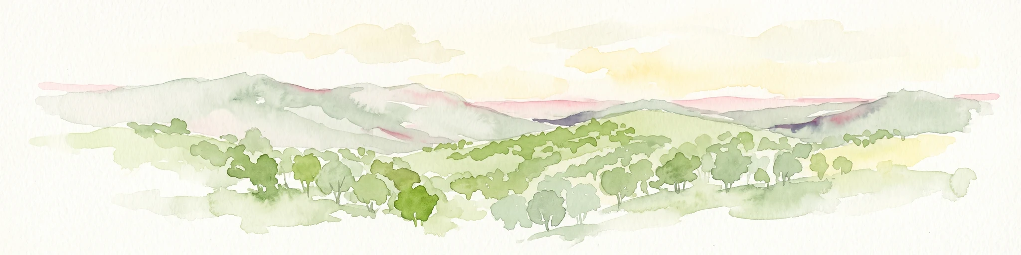
Watercolor painting of a rolling, hilly landscape with sparse trees against a pale, soft-toned sky.
Nature reserveSouth Australia
13 km away#2 closest

Northeast

Kaiserstuhl Conservation Park: Protected Nature Reserve in the Barossa Ranges

Mapping the forest ridges and hill country of South Australia

Kaiserstuhl Conservation Park preserves a distinctive segment of forested ridge and valley terrain within the Mount Crawford Forest. Situated near the Heysen Trail in South Australia, this nature reserve focuses on the protection of its 600-metre namesake peak, providing a clear geographic landmark within the eastern Barossa Ranges.

Area
4.35 km²
Established
1979
IUCN
III
Visitors
7.5K annual
Nature reserveSouth Australia
About 17 km away#3 closest

South

Cudlee Creek Conservation Park: Geography, Protected Boundaries, and South Australian Terrain

Adelaide Hills nature reserve with riparian forest and eucalypt woodland habitat

Cudlee Creek Conservation Park provides a clear look at the Adelaide Hills landscape through its mix of steep stringybark forest and River Torrens riparian habitat. This small nature reserve serves as an important regional reference site for native plant communities and bird habitat within the context of a heavily altered agricultural landscape in South Australia.

Area
0.49 km²
Established
1971
IUCN
III
Relief
Upland
Protected landscapeSouth Australia
23 km away#4 closest

Southwest

Black Hill Conservation Park: Mount Lofty Ranges Protected Area and Regional Geography

Bushland ridge lines and trail networks near Adelaide

Examine the geography of Black Hill Conservation Park, a significant protected landscape defined by its steep ridges and 467-metre summit. This area serves as a key bushland anchor in the Mount Lofty Ranges, featuring complex trail systems and specialized heathland habitats. Gain insights into the natural terrain, regional connectivity, and protected boundary characteristics of this essential conservation zone in South Australia.

Area
7.58 km²
Established
1972
IUCN
III
Relief
Mountain
Nature reserveSouth Australia
About 25 km away#5 closest

South

Charleston Conservation Park: Geography and Woodland Transitions in the Adelaide Hills

Explore protected terrain in South Australia

Charleston Conservation Park stands as an important ecological remnant in the Adelaide Hills. Its 54 hectares offer a concentrated look at woodland associations ranging from sheoak groves to blue gum forest and silver banksia stands. Use this atlas resource to understand the park's topography, its role in the Mount Lofty Ranges, and its contribution to regional conservation efforts.

Area
0.54 km²
Established
1976
IUCN
III
Relief
Upland
Nature reserveSouth Australia
30 km away#6 closest

Southwest

Giles Conservation Park: Protected Nature Reserve and Adelaide Hills Geography Map

Exploring native woodland terrain and regional trail corridors

Giles Conservation Park protects a significant pocket of remnant eucalypt woodland within the Adelaide Hills of South Australia. Located near Norton Summit, the reserve preserves native habitats that support western grey kangaroos and koalas while providing a key segment for the Heysen and Yurrebilla long distance walking trails. This landscape is a fundamental part of the foothills ecosystem and a notable feature in local topographic study.

Area
1.09 km²
Established
2007
IUCN
III
Water
Minor water
Nature reserveSouth Australia
About 32 km away#7 closest

Southwest

Horsnell Gully Conservation Park: Geographic Overview and Protected Landscape Mapping

Rugged gorges and native woodland in the Adelaide Hills

Horsnell Gully Conservation Park offers a dense concentration of natural features, including dramatic ridgelines and seasonal water flow, within the Mount Lofty Ranges. This protected area serves as a key segment of the Heysen Trail, highlighting its role in the regional geography of South Australia. Learn about the physical landforms and ecological character of this urban-adjacent nature reserve.

Area
1.37 km²
Established
1947
IUCN
III
Relief
Mountain
National parkAdelaide Hills
About 35 km away#8 closest

Southwest

Cleland National Park: Mapped Protected Landscape and Regional Geographic Context

Discover the natural terrain and park boundaries within Adelaide Hills.

Cleland National Park offers a critical lens into the protected landscapes of South Australia's Adelaide Hills. As a national park, its mapped boundaries and geographic position are key elements for understanding regional natural terrain. This resource facilitates atlas-style exploration of Cleland National Park, highlighting its importance within the conservation framework and providing a foundation for detailed geographic study.

Area
11.25 km²
Established
1945
IUCN
II
Visitors
100K annual

Common questions about visiting, size, designation, and location context for Hale Conservation Park

Hale Conservation Park FAQs for park facts, access, geography, and protected area context

Find quick answers about Hale Conservation Park, including protected-area facts, park geography, trail and visitor context, and how the park fits into its surrounding country and regional landscape.
MoriAtlas Explorer

Continue Your Protected Areas Search Across the Global Atlas

Deepen your exploration by continuing the structured search for national parks and protected areas worldwide. Utilize the comprehensive filtering capabilities to compare different conservation landscapes and refine your understanding of global park geography. Discover more about the distribution and characteristics of protected natural areas.

Global natural geography