
Mori Atlas logo
Nature reserveHasenwinkel bei Fretterode

Examining the geological profile and historic juniper heath habitats of this Thuringian nature reserve

Hasenwinkel bei Fretterode Nature Reserve: Mapped Protected Landscapes in Landkreis Eichsfeld

(Naturschutzgebiet Hasenwinkel bei Fretterode)

Hasenwinkel bei Fretterode represents a significant protected area within the Eichsfeld region of Thuringia, defined by its narrow three-kilometer Zechstein dolomite ridge. The landscape preserves distinct calcareous grassland and juniper heath ecosystems shaped by centuries of traditional grazing. This geographic record maps the reserve as part of the broader Natura 2000 framework, highlighting its rocky cliff-like outcrops and vital role in maintaining regional biodiversity corridors.

nature reservedolomite ridgejuniper heathcalcareous grasslanddry grasslandNatura 2000
A flat-style digital illustration showing a valley with jagged dolomite rock pillars, waterfalls flowing over cliffs, a winding river, and a foreground filled with yellow wildflowers.

Hasenwinkel bei Fretterode

Nature reserve

Park overview

Structured park overview, official facts, and landscape profile for Hasenwinkel bei Fretterode

Hasenwinkel bei Fretterode park facts, protected area profile, and essential visitor context

Review the core facts for Hasenwinkel bei Fretterode, including designation, size, terrain, visitor scale, habitats, and operating context in one park-focused overview.

About Hasenwinkel bei Fretterode

Hasenwinkel bei Fretterode is a compact but ecologically rich nature reserve in the Eichsfeld district of Thuringia, situated on a long, narrow ridge that runs northwest to southeast south of the villages of Gerbershausen and Fretterode. The roughly three-kilometer-long, 500-meter-wide ridge is framed by the Schierbach stream valley to the northeast and by the smaller Kringelbach valley to the south, which separates the Hasenwinkel from the neighboring Höheberg. Elevation across the protected area ranges from about 317 to 360 meters, with the highest western summit reaching around 380 meters just outside the reserve.

The site represents a piece of Zechstein geology that has been pushed upward through the Eichenberg-Gotha-Saalfeld fault zone, a structural graben that runs across the southwestern Eichsfeld. The exposed rock is Upper Zechstein dolomite and gypsum, forming layered gray, weathered boulders and knoll-like outcrops that crown the ridge. Soils derived from the dolomite are shallow, stony, loamy rendzinas that dry out easily in summer and erode readily, making the ridge unsuitable for cultivation but ideal, historically, for extensive grazing.

Culturally, the Hasenwinkel is an example of a juniper-heath landscape shaped by traditional land use. Because the dolomitic soils were too poor for crops, the open ridge was grazed by sheep and goats for centuries, which kept the woodland at bay and encouraged a rich community of dry-grassland plants and juniper. As early as the 1920s, the local conservation commissioner Franz Neureuter described the juniper stands as giving the landscape a character reminiscent of the North German heath, and he campaigned to have the area legally protected to prevent loss of its distinctive character.

Ecologically, the reserve includes exposed dolomite rocks with notable moss communities, open calcareous semi-dry grassland with some arable weed and weathering-grus vegetation fragments, juniper stands, and wooded sections. Surveys around 1993 documented around 230 fern and flowering plant species, 48 bird species including 33 breeding birds, and a rich Lepidoptera fauna of over 220 macro-moths and 19 micro-moths. The site is also relevant for bat conservation, particularly for species such as the lesser horseshoe bat and Bechstein's bat.

A roughly 2.3-kilometer circular trail runs through the reserve, with benches and interpretation panels describing habitat types, geology, flora, fauna, and the management regime. The central fenced area with the dolomite rocks can be entered through gates under the usual reserve rules, and the area is also crossed by the geological route of the Eichsfeld-Hainich-Werratal Nature Park.

Quick facts and research context for Hasenwinkel bei Fretterode

Hasenwinkel bei Fretterode is a 6.2-hectare nature reserve in the Eichsfeld district of northwestern Thuringia, located about 500 meters west of the village of Fretterode. It is categorized as an IUCN Category IV Habitat/Species Management Area and is listed under Thuringian nature reserve number 8 with WDPA code 163549.

The reserve protects a ridge of Upper Zechstein dolomite that has been pushed up through a graben structure, with elevations ranging from about 317 to 360 meters. The site lies within the Natura 2000 Röhrsberg – Hasenwinkel – Mühlberg Special Area of Conservation and the Werrabergland südwestlich Uder Special Protection Area, and it is also part of the Eichsfeld-Hainich-Werratal Nature Park.

Protection and recognition

Documented terrestrial protection scope, designation records, and administrative metadata

Hasenwinkel bei Fretterode Protection Status and Terrestrial Conservation Data

Hasenwinkel bei Fretterode maintains a recorded terrestrial protection status within official conservation databases. Documented administrative facts provide transparent insight into the established management framework and registered geographical designation.

Protection details

Protection scope
Terrestrial
Transboundary protection
No
WDPA ID
163549
Park context

Deeper park guide and search-rich context for Hasenwinkel bei Fretterode

Hasenwinkel bei Fretterode history, landscape, wildlife, and travel context

Explore Hasenwinkel bei Fretterode through its history, landscape character, ecosystems, wildlife, conservation priorities, cultural context, and seasonal travel timing in a structured park guide built for atlas discovery and search intent.

Why Hasenwinkel bei Fretterode stands out

The reserve is best known for its species-rich calcareous semi-dry grassland and juniper heath growing on a narrow dolomite ridge, a habitat combination shaped by centuries of sheep grazing on land that was never suitable for arable farming. The exposed dolomite rock formations, including the prominent points called the Spitze Steine and Breite Stein, are another defining feature and one of the reasons the area was protected so early.
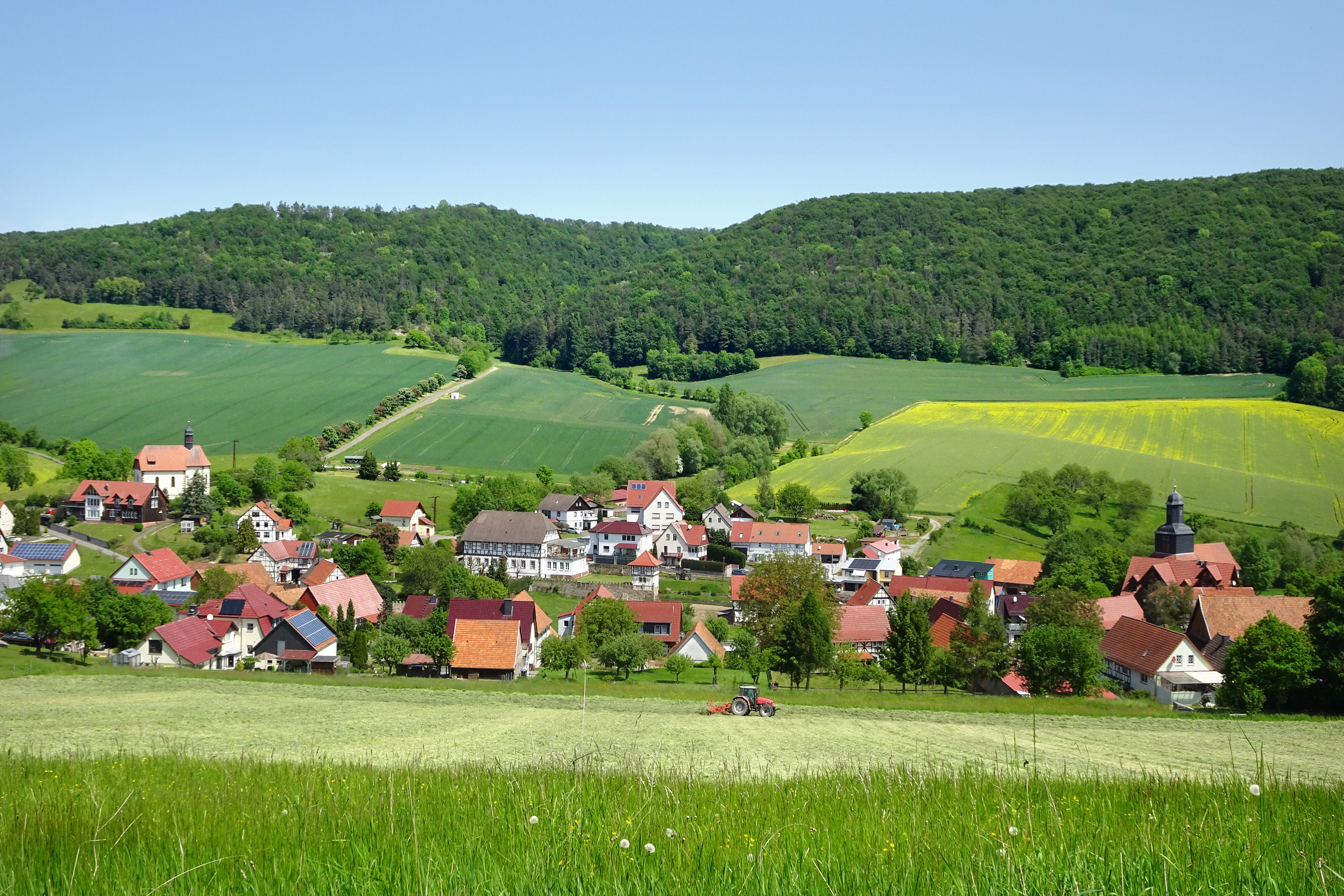
A wide, sunny landscape view of the village of Fretterode nestled in a green valley, with rolling hills and agricultural fields in the background.
View from the Hasenwinkel ridge overlooking the village of Fretterode and the surrounding hilly landscape.

Hasenwinkel bei Fretterode history and protected-area timeline

The Hasenwinkel is one of the very first protected areas in Thuringia and in the Eichsfeld region. Initial protection efforts began in the 1920s, when the regional conservation commissioner Franz Neureuter documented the unusual juniper stands and campaigned to place the area under formal nature protection to prevent the loss of its character.

The first legal protection is associated with the Prussian Field and Forest Police Law, which provided a framework to designate protected areas. On the basis of this legislation, the Hasenwinkel became the first area in the Eichsfeld to be placed under protection. The formal designation as a nature reserve followed on 15 July 1939 by order of the Prussian Regierungspräsident in Erfurt, and the area was entered into the Reich Nature Conservation Book under the 1935 Reich Nature Conservation Law. The original protection order forbade damaging, uprooting, or removing plants, and disturbing, capturing, or killing wild animals, while still allowing legal hunting.

During the post-war decades, traditional sheep grazing declined and parts of the open landscape were afforested with Scots pine, spruce, and beech, which by the late 1970s had so altered the area that the continuation of protection was even called into question. Intensive management work in the 1980s involved clearing selected areas and reintroducing grazing, which restored visible patches of juniper heath and re-exposed prominent features such as the Spitze Stein and the Breite Stein rock formations. Forest areas were removed from the forestry plan in 1988, ending timber use on those parts.

In December 1999, the Hasenwinkel was proposed as part of a larger Flora-Fauna-Habitat site by the Thuringian Environment Ministry and forwarded to the European Commission via the Federal Environment Ministry. After the site Röhrsberg – Hasenwinkel – Mühlberg was added to the EU list of Sites of Community Importance, protection objectives were formalized in the Thuringian Natura 2000 Conservation Objectives Ordinance of 29 May 2008. Today, ongoing management is coordinated by NABU Obereichsfeld together with the local nature conservation authority, the Natura 2000 station Unstrut-Hainich/Eichsfeld, and a local shepherding family, with the goal of keeping the historic grazing landscape intact.

Hasenwinkel bei Fretterode landscape and geographic character

The defining landscape feature of the Hasenwinkel is a narrow, northwest-to-southeast-trending dolomite ridge that rises about 60 to 80 meters above the surrounding lowlands and stretches roughly three kilometers in length. The ridge is framed by the Schierbach valley to the northeast, whose tributary Kringelbach separates the Hasenwinkel from the Höheberg to the south. The Schierbach feeds into the Walse, a right-bank tributary of the Werra.

Along the ridge, several rocky high points punctuate the skyline, including the Spitze Steine at about 360 meters within the protected area and the Breite Stein at about 330 meters toward the southeast. The western end of the ridge reaches roughly 380 meters at a point called the Spitzen Steine, while the neighboring Scharfshagen, separated from the ridge by the Gerbbach, rises to about 410 meters. The gentler lower slopes of the ridge are used for agriculture, while the rocky upper ridge carries the protected open habitats. A radio mast stands on the western part of the ridge crest outside the core reserve area.

Geologically, the ridge is an upthrust slab of Upper Zechstein dolomite and gypsum lying within the Eichenberg-Gotha-Saalfeld fault graben. The exposed rocks are gray, hole-weathered boulders and cliff-like outcrops that give the ridge a distinctive, almost heath-like profile against the surrounding cultivated countryside.
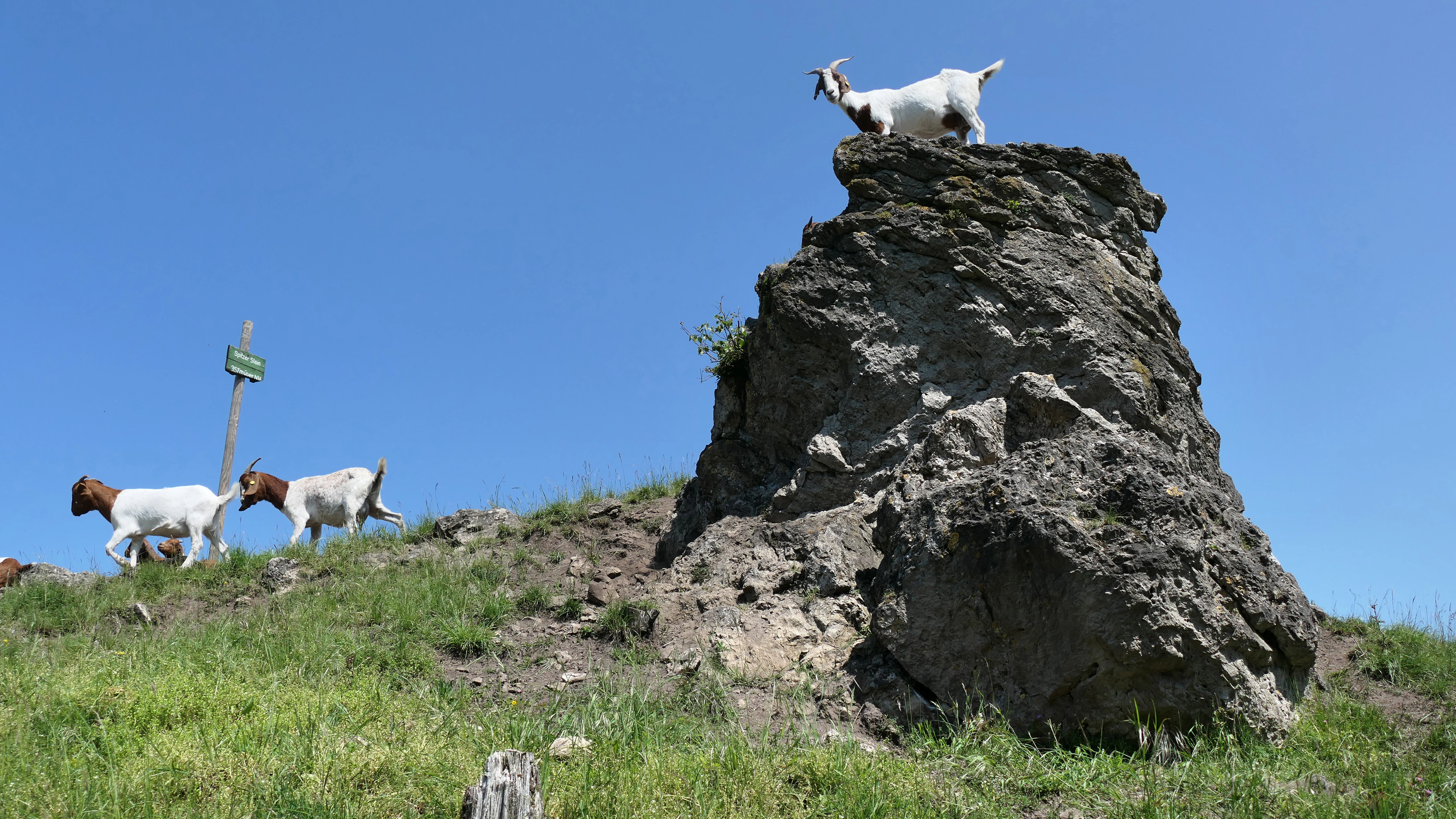
A white goat stands on top of a jagged dolomite rock, while two other goats graze on the grassy slope below, all under a clear blue sky.
Goats grazing near a dolomite rock formation in the Hasenwinkel nature reserve.

Hasenwinkel bei Fretterode ecosystems, habitats, and plant life

Ecologically, the Hasenwinkel is a small but unusually diverse mosaic of habitats centered on a dolomite ridge. Its open habitats are dominated by calcareous semi-dry grassland, with juniper heath as a defining feature, alongside patches of arable-weed vegetation, weathering-grus communities on the rocky outcrops, and a notable moss flora on the dolomite boulders. Shallow, stony rendzina soils over the dolomite dry out rapidly in summer and have very limited water retention, which limits tree growth and helps maintain the open character.

Around 1993, about 230 fern and flowering plant species were recorded in the reserve, a high figure for an area of just a few hectares. Wooded sections of the reserve have been left unmanaged since 1988, providing a contrast to the open, grazed habitats. The combination of open dry grassland, juniper, woodland, and exposed rock in such a compact area is what gives the site its particular ecological value.
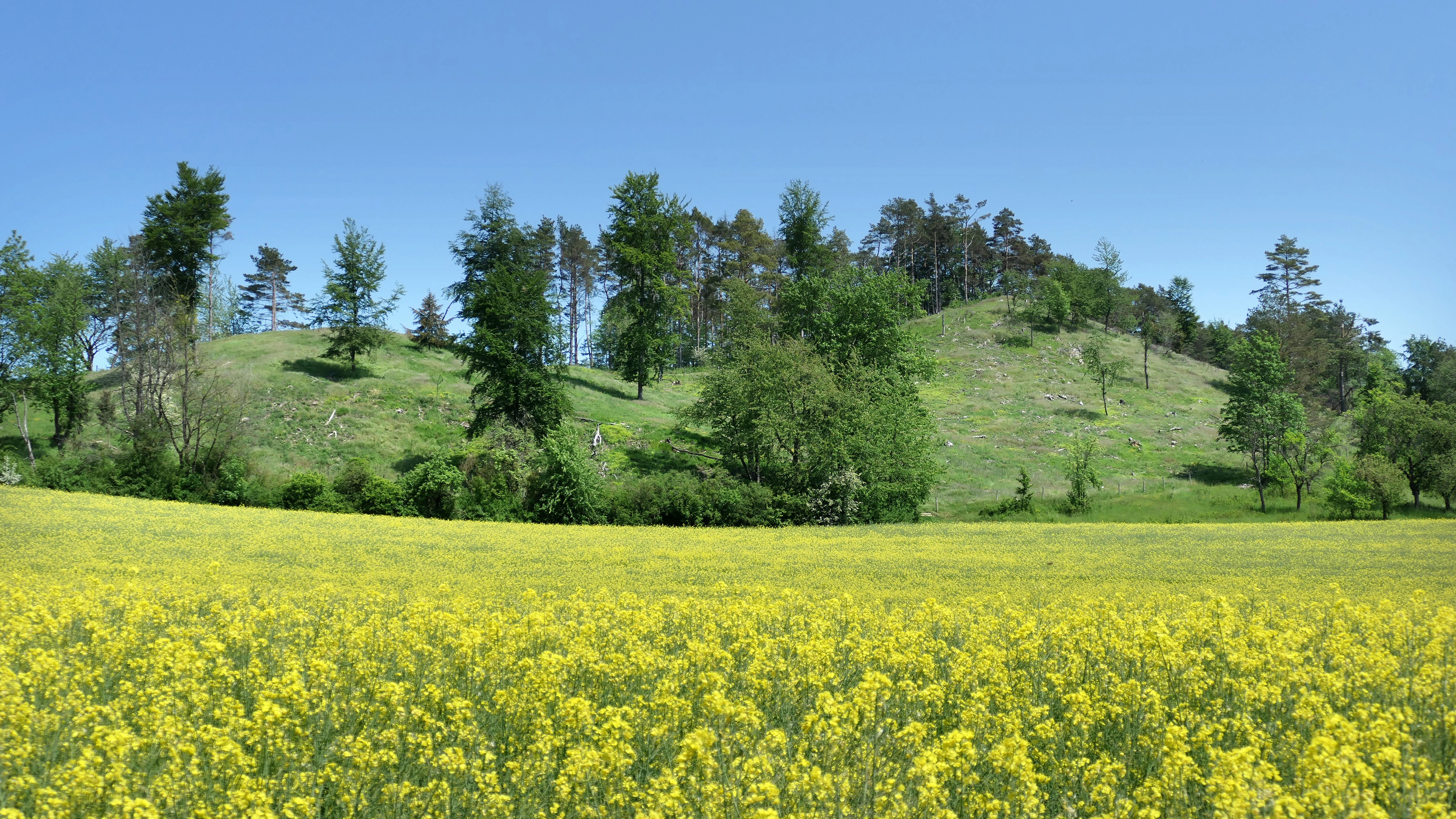
A wide, eye-level outdoor shot of a bright yellow field of wildflowers leading to a grassy, forested hill under a clear blue sky.
A scenic view of the Hasenwinkel nature reserve, featuring a vibrant yellow field in the foreground and a tree-covered dolomite ridge in the background.

Hasenwinkel bei Fretterode wildlife and species highlights

The Hasenwinkel supports a notable fauna across several groups. Surveys for a conservation assessment recorded 48 bird species, of which 33 are breeding birds. Notable feeding guests include red-backed shrike, red kite, and black woodpecker, species listed in Annex I of the EU Birds Directive for which special conservation measures are required. The site also lies within the larger Werrabergland südwestlich Uder Special Protection Area, which targets forest species such as honey buzzard, grey-headed, middle, and black woodpecker, open-country species such as red and black kite, turtle dove, red-backed shrike, great grey shrike, quail, and woodcock, and breeding sites of kingfisher and eagle owl.

The reserve is also regionally significant for bats, with the lesser horseshoe bat and Bechstein's bat recorded in the surrounding Flora-Fauna-Habitat site, both listed in Annex II of the EU Habitats Directive. The Lepidoptera fauna is rich for such a small site, with over 220 macro-moths and 19 micro-moths recorded, including species considered threatened in Thuringia such as the large fritillary, the great pearl fritillary, and the woodland fritillary. The traditional grazing management is critical to maintaining these open-ground moth and butterfly habitats.
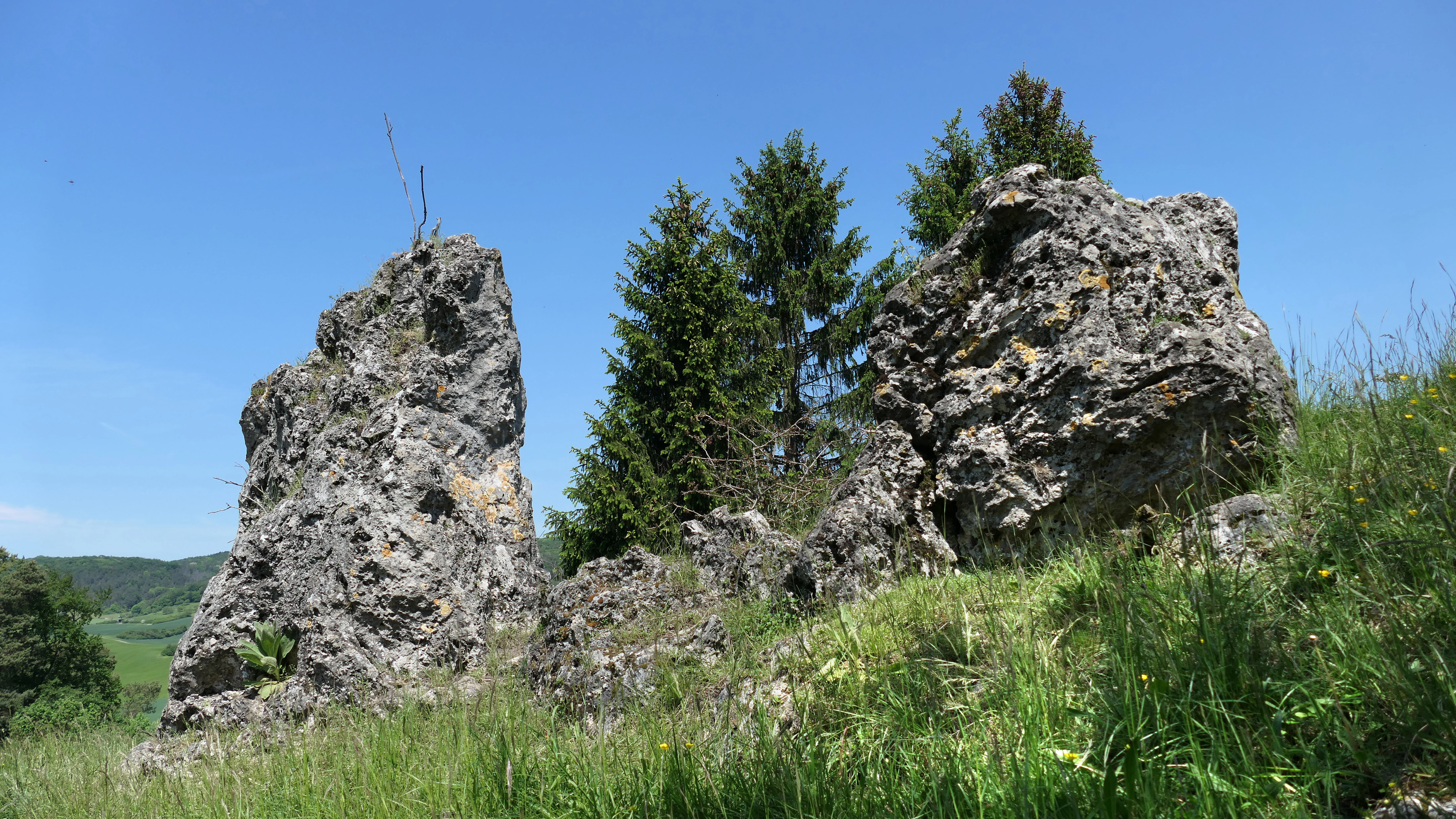
Two prominent, jagged dolomite rock outcrops rise from a grassy hillside under a clear blue sky, with spruce trees growing between them.
Dolomite rock formations along the Hasenwinkel ridge, a defining geological feature of the Hasenwinkel bei Fretterode nature reserve.

Hasenwinkel bei Fretterode conservation status and protection priorities

The Hasenwinkel matters from a conservation perspective because it preserves a small but intact example of a juniper-heath and dry-grassland landscape shaped by centuries of grazing, a habitat type that has become rare across central Germany. Its combination of Zechstein dolomite rock, species-rich semi-dry grassland, juniper stands, and adjacent woodland in just 6.2 hectares also makes it a useful reference site for limestone and dolomite grassland conservation.

Its protected status is multi-layered. As a Thuringian nature reserve it falls under IUCN Category IV Habitat/Species Management Area. As a component of the Röhrsberg – Hasenwinkel – Mühlberg Special Area of Conservation, it contributes to the EU Natura 2000 network with formal conservation objectives covering structured beech forest, fresh meadows, semi-dry grassland, juniper heath, and special habitats such as dolomite rocks and calcareous tufa springs. It also lies entirely within the larger Werrabergland südwestlich Uder Special Protection Area for birds, and within the Eichsfeld-Hainich-Werratal Nature Park and the Obereichsfeld Landscape Protection Area.

The reserve was part of a proposed Heinz Sielmann Stiftung conservation project along the former inner-German border, the Grünes Band Eichsfeld-Werratal, intended to connect woodland and open cultural landscape across Hesse and Thuringia. Today, ongoing maintenance to prevent scrub encroachment is carried out through a collaboration between NABU Obereichsfeld, the local nature conservation authority, the Natura 2000 station, and a local shepherding family working under the state's ENL program for nature and landscape development.

Hasenwinkel bei Fretterode cultural meaning and human context

The cultural identity of the Hasenwinkel is tied to the traditional grazing economy of the Eichsfeld. Because the dolomitic soils of the ridge were unsuitable for plowing, the open high ground was used for centuries as pasture for sheep and goats. This long history of grazing is what allowed juniper to dominate large parts of the ridge, since juniper is weakly competitive and is avoided by sheep even as young growth, so grazing both prevented woodland expansion and favored juniper survival.

The early 20th-century conservation movement in the Eichsfeld was central to the reserve's later formal protection. In the 1920s, Franz Neureuter, working as commissioner of the Eichsfeld landscape office for natural monument care, published an article describing the extraordinary beauty of the juniper stands and urged that the Hasenwinkel be placed under legal protection to preserve its character. He is widely regarded as the figure who initiated formal protection for the area, which became the first nature reserve in the Eichsfeld.
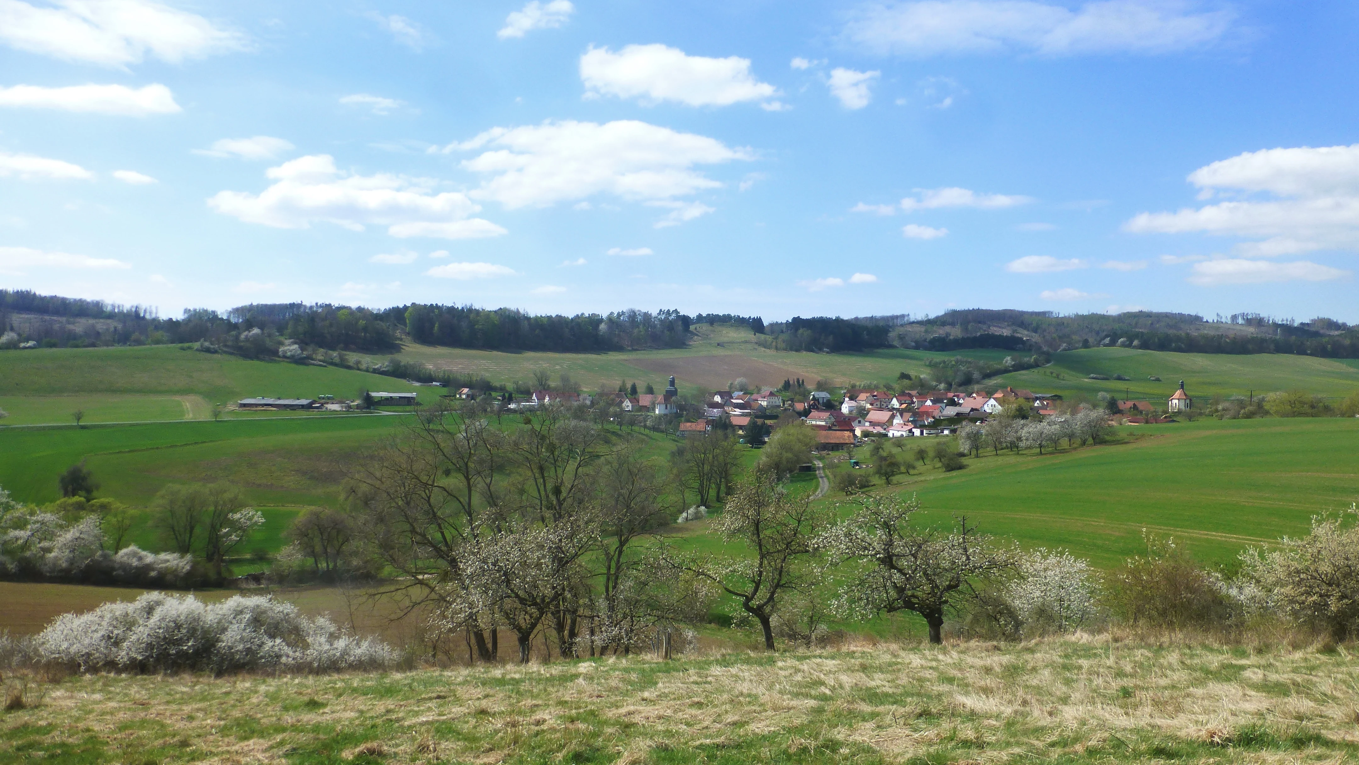
A wide, slightly elevated landscape view overlooking a small village nestled among rolling green fields, orchards, and forested hills under a blue sky with scattered clouds.
Panoramic view of Fretterode with the rolling fields and hills of the Hasenwinkel region in the distance.

Top sights and standout views in Hasenwinkel bei Fretterode

The Hasenwinkel stands out for combining, in just a few hectares, a Zechstein dolomite ridge, exposed rock formations, juniper heath, species-rich calcareous grassland, and wooded sections, all shaped by centuries of sheep and goat grazing. It is one of the earliest designated nature reserves in Thuringia and forms a core component of an EU Natura 2000 landscape that connects the Eichsfeld with the Werra valley across the Hessian border.
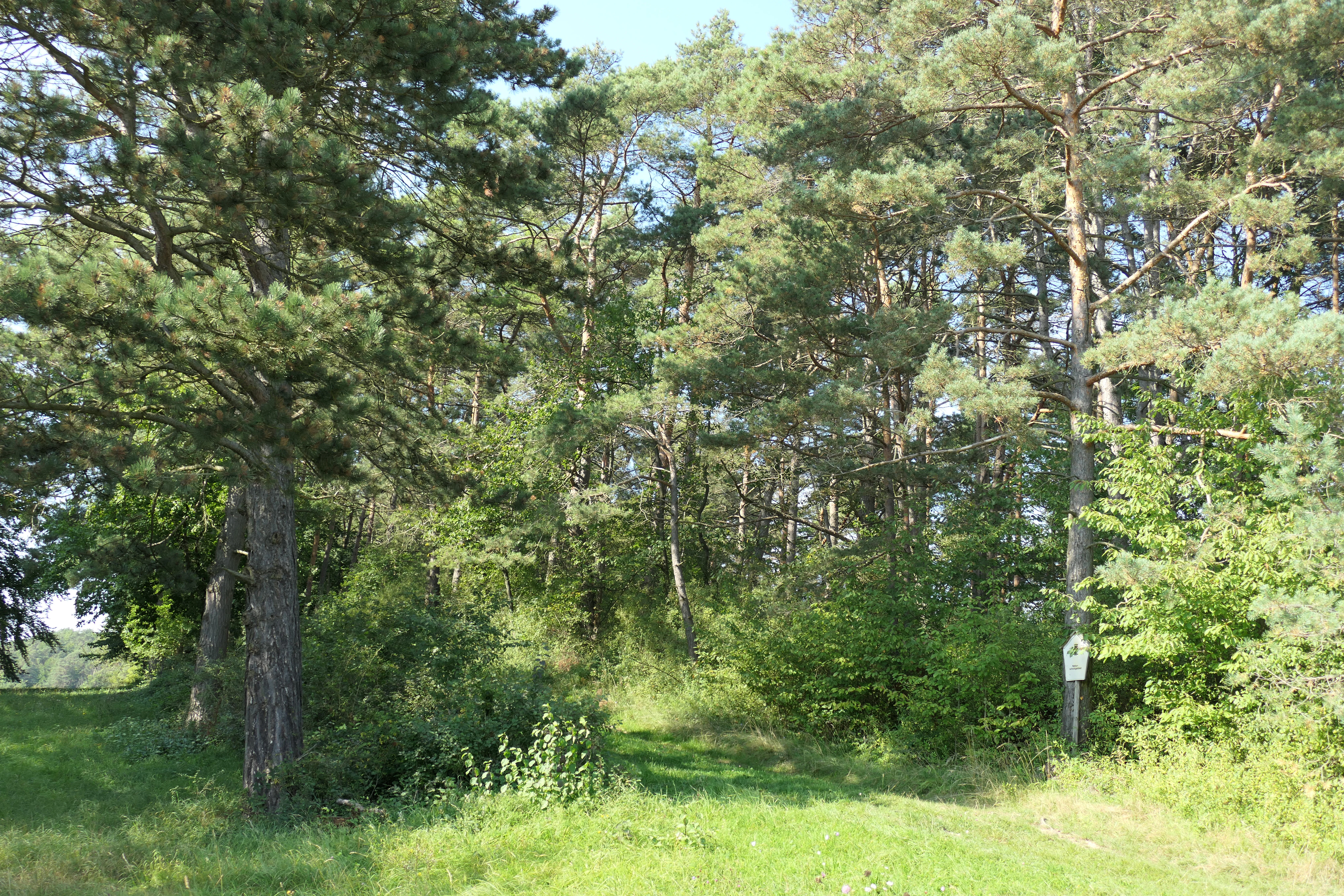
A grove of pine trees with grassy ground and a small nature reserve sign attached to a tree trunk.
Wooded area within the Hasenwinkel nature reserve.

Best time to visit Hasenwinkel bei Fretterode

The reserve lies in a low-mountain landscape of central Germany and can be visited in any season, but late spring and early summer are generally the best time to see the calcareous semi-dry grassland and juniper heath in full bloom, with many of the characteristic orchids, wildflowers, and butterflies active. Summer brings very warm, dry conditions on the shallow dolomite soils and exposes the rocky outcrops most clearly, while quieter autumn and winter visits offer better chances to observe woodland birds and the broader landscape character. Weather-appropriate clothing is useful, since the ridge is exposed and the paths pass close to fenced rocky areas.


Monthly climate preview

Long-term representative measurements outlining monthly climate patterns in Landkreis Eichsfeld

Hasenwinkel bei Fretterode Climate Normals: Annual Temperature and Precipitation Rhythm

Historical climate data for Hasenwinkel bei Fretterode records long-term monthly temperature swings alongside consistent precipitation rates from a representative coordinate. Reviewing the complete twelve-month profile provides deeper context for analyzing annual weather variations across the protected terrain.
Annual mean8 °C
-1 °C18 °C
Jan-1°
Feb
Mar
Apr
May12°
Jun16°
Jul18°
Aug18°
Sep14°
Oct
Nov
Dec
Warmest month
July

18.2 °C

Coolest month
January

-0.9 °C

Wettest month
July

2.6 mm/day

Driest month
April

1.5 mm/day

Park location guide

Geography guide, regional context, and park location map for Hasenwinkel bei Fretterode

Hasenwinkel bei Fretterode park geography, regions, and map view in Germany

Understand where Hasenwinkel bei Fretterode sits in Germany through a broader geographic reading of the surrounding landscape, nearby location context, and its mapped position within the national park landscape.

How Hasenwinkel bei Fretterode fits into Germany

Germany is a federal republic in Western and Central Europe with a population of over 83 million across sixteen constituent states. It is Europe's largest economy by nominal GDP and a major global exporter and importer. The capital is Berlin, and the country borders Denmark, Poland, Czech Republic, Austria, Switzerland, France, Luxembourg, Belgium, and the Netherlands.

Wider geography shaping Hasenwinkel bei Fretterode in Germany

Germany is located in Western and Central Europe, spanning 357,022 km². It borders Denmark to the north, Poland and the Czech Republic to the east, Austria and Switzerland to the south, and France, Luxembourg, Belgium, and the Netherlands to the west. The country has coastlines on the Baltic Sea and North Sea to the north, with the Alps located in the southern region.

Map view of Hasenwinkel bei Fretterode

Use this park location map to pinpoint Hasenwinkel bei Fretterode in Germany, understand its exact geographic position, and read its mapped placement within the surrounding landscape more clearly.

Pigeon | © OpenStreetMap contributors

Location context for Hasenwinkel bei Fretterode

Landkreis Eichsfeld

Visual exploration of Zechstein dolomite ridges, juniper heath, and calcareous grassland habitats

Hasenwinkel bei Fretterode Photos and Protected Landscape Scenery

Visual documentation of Hasenwinkel bei Fretterode reveals the rugged topography of its narrow dolomite ridge and exposed rock formations. Detailed photography provides clear insight into the protected juniper heath and calcareous grassland ecosystems shaped by historic grazing.

A wide, sunny landscape view of the village of Fretterode nestled in a green valley, with rolling hills and agricultural fields in the background.

A group of goats standing on and near prominent rocky outcrops in a grassy landscape under a clear blue sky.

A white goat stands on top of a jagged dolomite rock, while two other goats graze on the grassy slope below, all under a clear blue sky.

A wide, eye-level outdoor shot of a bright yellow field of wildflowers leading to a grassy, forested hill under a clear blue sky.

Two prominent, jagged dolomite rock outcrops rise from a grassy hillside under a clear blue sky, with spruce trees growing between them.

A path leads through a dense, green deciduous forest with a sloped, leaf-covered ground in the Hasenwinkel nature reserve.

A wide, slightly elevated landscape view overlooking a small village nestled among rolling green fields, orchards, and forested hills under a blue sky with scattered clouds.

A grove of pine trees with grassy ground and a small nature reserve sign attached to a tree trunk.

Park atlas

Compare surrounding regional geography and connected nature reserves

Other Protected Areas and Parks Near Hasenwinkel bei Fretterode

Explore nearby parks and protected areas sharing the distinctive limestone ridges and upland terrain of the surrounding region. Comparing adjacent natural reserves provides deeper context into the regional spread of protected habitats and local conservation landscapes.
A horizontal watercolor illustration depicting gentle rolling hills, grassy meadows, and distant mountain silhouettes in muted pastel tones.
Nature reserveThuringia
Mapped location lies within the park boundary#1 closest

Southeast

Röhrsberg - Hasenwinkel - Mühlberg: Mapping the Protected Landscapes of Thuringia

Geological ridge systems and native forest habitat networks.

The Röhrsberg - Hasenwinkel - Mühlberg nature reserve represents a significant protected area in Thuringia, characterized by the juxtaposition of Muschelkalk limestone hills and Zechstein dolomite ridges. This site offers a concentrated view of regional terrain, shifting from closed beech forests to open juniper heaths. It serves as an essential geographic reference for understanding the ecological mosaic of the lower Werra hill country.

Area
4.51 km²
Established
1999
IUCN
IV
Relief
Upland
Wide watercolor illustration of green trees and hills with purple mountains in the background under a pale sky.
Nature reserveThuringia
About 2.9 km away#2 closest

Southeast

Stein, Rachelsberg, Gobert: A Protected Limestone Landscape in Western Thuringia

Mapping a historic nature reserve and beech forest complex

Stein, Rachelsberg, Gobert stands as a key protected area within Thuringia. This nature reserve offers deep insights into limestone ridge geography, historic border woodland continuity, and diverse habitats ranging from dry grasslands to tufa springs and orchid-rich beech forests.

Area
7.16 km²
Established
1999
IUCN
IV
Relief
Mountain
A soft watercolor illustration depicting a winding river landscape with lush trees and rolling hills in the background.
Nature reserveLandkreis Eichsfeld
About 3.1 km away#3 closest

West

Kelle, Teufelskanzel Nature Reserve: Geographic Overview and Protected Area Atlas

Steep slopes and sandstone ridges in Landkreis Eichsfeld

Situated along the Höheberg ridge in Thuringia, Kelle, Teufelskanzel represents a vital 200 hectare nature reserve. Its geography is defined by deep V-shaped valleys, dramatic rock outcrops like the Teufelskanzel, and a dense mix of deciduous forests that form part of the historic Inner German Border conservation zone.

Area
2.002 km²
Established
1996
IUCN
IV
Relief
Mountain
Nature reserveThuringia
About 4.8 km away#4 closest

Southeast

Stein, Rachelsberg Nature Reserve: Mapped Muschelkalk Terrain in Thuringia

Protected low mountain hills and forested karst landscapes

The Stein, Rachelsberg nature reserve in Thuringia represents a protected mosaic of Muschelkalk ridges and Buntsandstein valleys. Its geography is defined by strongly broken relief, rocky outcrops, and a unique ring of forested summits including the Dieberg and Goburg, forming an essential link in regional conservation networks across the Thuringia and Hesse border.

Area
5.06 km²
Established
2023
Relief
Mountain
Climate
Temperate
Watercolor painting of a pastoral landscape with light green hills in the distance, a field with flowering pink trees, and a pale green meadow in the foreground.
Nature reserveWerra-Meißner-Kreis
About 5.9 km away#5 closest

West

Ebenhöhe-Liebenberg Nature Reserve: Geography and Protected Habitat Mapping

Protected calcareous forests and dry grassland mosaic

Explore the mapped boundaries and natural terrain of the Ebenhöhe-Liebenberg nature reserve. This site provides a critical habitat mosaic including orchid-rich beech woodlands, nutrient-poor grasslands, and sandstone outcrops that form a significant conservation area within the Hessian highlands.

Area
142.48 km²
Established
1995
IUCN
IV
Relief
Upland
Watercolor painting of a green landscape with rolling hills, a winding path or stream, and trees on both sides against a light background.
Nature reserveWerra-Meißner-Kreis
About 6.6 km away#6 closest

Southeast

Kalkklippen südlich des Iberges Nature Reserve and Muschelkalk Landscape Atlas

Protected beech forests and active landslide topography

This nature reserve in Werra-Meißner-Kreis reveals an active Muschelkalk ridge characterized by steep limestone cliffs and boulder-strewn talus slopes. Study the site's unique ecological composition, featuring noble hardwood-rich beech forests and native European yew populations that highlight the region's complex natural history and geological significance.

Area
0.473 km²
Established
1995
IUCN
IV
Watercolor painting of a rolling forested ridge under a pale sky.
Nature reserveThuringia
About 7 km away#7 closest

East

Lengenberg Nature Reserve: A Geographical Overview of the Eichsfeld Ridge

Protected beech and yew woodlands in Thuringia, Germany

The Lengenberg Nature Reserve forms a prominent, fully forested ridge within the Eichsfeld region of Thuringia. Renowned for hosting one of the most substantial yew populations in central Europe, the reserve showcases a geological transition between shell limestone and red sandstone. This mapping of the terrain provides insight into the ecological structure of the Eichsfeld-Hainich-Werratal area.

Area
0.26 km²
Established
1961
Relief
Mountain
Climate
Temperate
Watercolor painting of a mountain landscape with green slopes, coniferous forests, and rocky outcroppings under a soft, light-filled sky.
Nature reserveHesse
About 9.8 km away#8 closest

Southwest

Meißner Nature Reserve in Northern Hesse: Mapping the Hoher Meißner Basaltic Massif

A comprehensive look at forest wilderness, bogs, and volcanic geology

Covering roughly 930 hectares, the Meißner nature reserve in northern Hesse protects an ecologically distinct upland landscape. The area features a significant basalt plateau, ancient scree slopes, mountain meadows, and hanging spring bogs, offering a prime example of protected central German topography and forest wilderness.

Area
9.322 km²
Established
1989
IUCN
IV
Relief
Mountain

Common questions about visiting, size, designation, and location context for Hasenwinkel bei Fretterode

Hasenwinkel bei Fretterode FAQs for park facts, access, geography, and protected area context

Find quick answers about Hasenwinkel bei Fretterode, including protected-area facts, park geography, trail and visitor context, and how the park fits into its surrounding country and regional landscape.
MoriAtlas Explorer

Continue Your Protected Areas Search Across the Global Atlas

Deepen your exploration by continuing the structured search for national parks and protected areas worldwide. Utilize the comprehensive filtering capabilities to compare different conservation landscapes and refine your understanding of global park geography. Discover more about the distribution and characteristics of protected natural areas.

Global natural geography