
Mori Atlas logo
Protected landscapeHornopožárský les Nature Park

A Deep Forest Enclave and Protected Heritage Site in the Středočeský kraj Region

Hornopožárský les Nature Park: Mapping the Granite Landscapes of Central Bohemia

(Přírodní park Hornopožárský les)

Hornopožárský les Nature Park encompasses 25 square kilometers of undulating forested hills and granite-rich terrain within the Středočeský kraj region of the Czech Republic. This protected landscape is defined by its mix of broadleaved woodlands, historic stone quarrying sites, and the scenic valley of the Sázava River. Beyond its natural habitat, the area preserves a unique cultural legacy tied to the former estate of Archduke Franz Ferdinand d'Este.

forestgranite landscapenature parkcentral BohemiaPosázavíSázava valley
A flat-style digital illustration depicting a sunny forest scene with a winding river in the middle ground, framed by tall trees and granite cliffs in the background.

Hornopožárský les Nature Park

Protected landscape

Park overview

Structured park overview, official facts, and landscape profile for Hornopožárský les Nature Park

Hornopožárský les Nature Park park facts, protected area profile, and essential visitor context

Review the core facts for Hornopožárský les Nature Park, including designation, size, terrain, visitor scale, habitats, and operating context in one park-focused overview.

About Hornopožárský les Nature Park

Hornopožárský les Nature Park is one of the most easily accessible protected forest areas in central Bohemia, located in the lower reaches of the Posázaví region south of Prague. The park was established in 2002 to safeguard a substantial forested landscape that had long served as a recreational escape for residents of the capital. Despite its proximity to the densely populated Prague region, the park retains a quiet, heavily wooded character across its approximately 25 square kilometers.

The landscape is shaped by rolling hills of the Středočeská pahorkatina, with the highest point at Vlková at 521 meters. Granite geology defines much of the scenery, producing isolated boulders, rocky hillsides, and the specific conditions that support both the park's forest cover and its longstanding stone-quarrying tradition. The right bank of the Sázava River traces the eastern boundary, providing a scenic transition between the forested uplands and the broader river valley.

Ecologically, the park combines commercially managed coniferous stands with ecologically valuable remnants of original broadleaved forest. Small protected areas within the park, including the Grybla and Čížov nature reserves and the Vlčí rokle natural monument, safeguard some of the more sensitive habitats, including old-growth features, deciduous valleys, and rocky slopes. The Kamenický potok valley, with its group of protected spruces, illustrates the park's role in preserving characteristic local features.

Culturally, the park is anchored in 19th- and early-20th-century aristocratic history. Archduke Franz Ferdinand d'Este, the heir presumptive whose assassination in Sarajevo would trigger the First World War, had a hunting lodge with associated game-keeper's buildings built deep in these woods. The name 'Horní Požáry,' meaning the upper Požáry, derives from this estate and continues to define the park's identity. Today, the park is crisscrossed by trails used by hikers, mushroom pickers, cyclists, and casual visitors from Prague and the surrounding region.

Quick facts and research context for Hornopožárský les Nature Park

Protected as a přírodní park (nature park) on 2 April 2002, the area covers roughly 25 square kilometers and spans the districts of Praha-východ and Benešov in the Středočeský kraj. It sits on the right bank of the Sázava River, between settlements such as Kamenice, Krhanice, Jílové u Prahy, and Týnec nad Sázavou.

The park encompasses mixed forests, remnant broadleaved stands, granite rock formations, and quarries, and contains the nature reserves Grybla and Čížov, as well as the natural monument Vlčí rokle.

Protection and recognition

Documented terrestrial protection scope and administrative designation details

Hornopozarsky Les Nature Park Protection Status and Conservation Data

Hornopozarsky Les Nature Park maintains a documented terrestrial protection scope without supplementary international recognition sources. Administrative records outline the official protected area classification and management framework.

Protection details

Protection scope
Terrestrial
Transboundary protection
No
Park context

Deeper park guide and search-rich context for Hornopožárský les Nature Park

Hornopožárský les Nature Park history, landscape, wildlife, and travel context

Explore Hornopožárský les Nature Park through its history, landscape character, ecosystems, wildlife, conservation priorities, cultural context, and seasonal travel timing in a structured park guide built for atlas discovery and search intent.

Why Hornopožárský les Nature Park stands out

Hornopožárský les Nature Park is best known for its extensive, deeply wooded landscape forming a green enclave just south of Prague. The park's identity centers on its mix of commercial coniferous plantations, surviving broadleaved forest fragments, and characteristic granite outcrops. Granite is a defining theme: it appears both as natural boulder fields, rock formations, and cliff edges, and as an actively worked quarrying resource. This dual presence of natural and industrial granite shapes the visual and cultural identity of the area, alongside the placid Sázava valley that frames the eastern edge of the park.
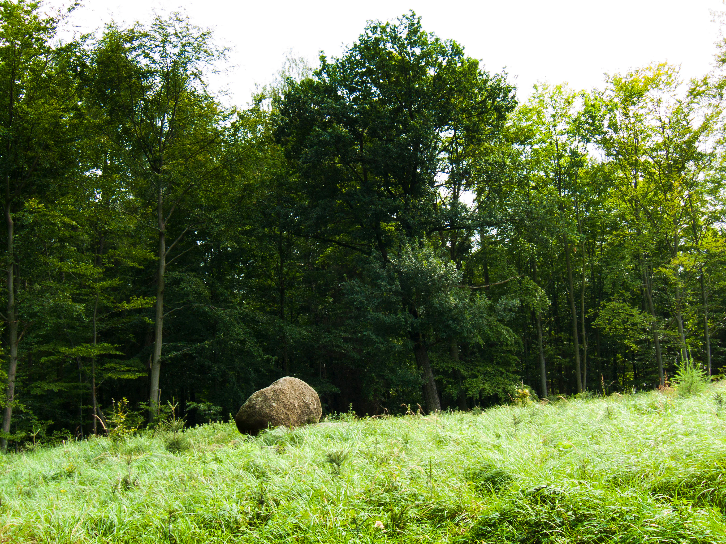
A large, rounded granite boulder sits in a grassy meadow at the edge of a lush, green deciduous forest.
A solitary boulder sits at the edge of a dense forest in Hornopožárský les Nature Park.

Hornopožárský les Nature Park history and protected-area timeline

The formal protection of Hornopožárský les as a přírodní park dates to 2 April 2002, when this forested landscape in the lower Posázaví was recognized for its natural, scenic, and recreational value. The designation reflected both the ecological significance of the area's woodlands and its long-standing role as a nearby escape from Prague.

Before its modern protection status, the area owed much of its character to the 19th-century aristocratic estate of Horní Požáry. The estate's hunting lodge, with its associated myslivna (game-keeper's building), was constructed in the middle of the forests on the initiative of Archduke Franz Ferdinand d'Este. This historical connection gives the park its name and ties its forested landscape to the broader Habsburg-era tradition of aristocratic hunting estates in Bohemia.

The surrounding villages and towns, including Kamenice, Krhanice, Týnec nad Sázavou, and Jílové u Prahy, developed alongside this forested setting over centuries, blending agriculture, forestry, quarrying, and later suburban recreational use. The establishment of the nature park in 2002 formalized the protection of these integrated land uses and natural systems, while allowing the area to continue functioning as an accessible recreational resource for the Prague metropolitan region.

Hornopožárský les Nature Park landscape and geographic character

The terrain of Hornopožárský les falls within the Středočeská pahorkatina, a system of rolling hills typical of central Bohemia. Elevations range across several hundred meters, with the highest summit, Vlková, reaching 521 meters. Other notable elevations include Grybla at 514 meters, Kněží hora at 488 meters, and Čížov at 433 meters. These forested ridges and gentle summits produce a continuous, undulating green horizon that defines the visual character of the park.

Granite bedrock defines much of the landscape. Visitors encounter scattered boulders, granite outcrops, and rock faces, particularly around historic and active quarry sites. The natural monument Vlčí rokle, for example, features a stone sea with the so-called Duchečkovo propadání, a notable collapsed rock feature. Smaller rocky elevations, including Váňův vrch, add further topographical variety to the forest.

The Sázava River runs along the park's eastern edge, while smaller streams such as the Kamenický potok carve narrow valleys through the woods. The Kamenický valley is notable for a group of memorial spruces growing along its course. Active and historic quarries, including those near Prosečnice, are a visible reminder of how the underlying geology has shaped both natural scenery and local industry.

Hornopožárský les Nature Park ecosystems, habitats, and plant life

Hornopožárský les is primarily a forested park, dominated by extensive woodlands that include both commercial coniferous plantations and ecologically valuable broadleaved fragments. The original deciduous forests survived only in small patches, but these remnants are ecologically significant for their composition and continuity with the area's broader habitat network.

The mosaic of habitats includes coniferous stands, broadleaved woodlands, stream valleys with characteristic riparian vegetation, granite rock communities, and boulder-field environments such as the Duchečkovo propadání within Vlčí rokle. The Kamenický potok valley provides a habitat for old-growth tree features, including a group of memorial spruces that mark out a distinctive segment of the park's hydrological and ecological corridor.

Within this broader matrix, several smaller protected zones carry more focused conservation significance. The Grybla and Čížov nature reserves, together with the Vlčí rokle natural monument, anchor the park's role in preserving sensitive habitats, rocky slopes, and small-scale forest communities that complement the larger forested landscape.

Hornopožárský les Nature Park wildlife and species highlights

The mix of coniferous plantations, broadleaved forest fragments, rocky slopes, and stream valleys supports a typical central Bohemian forest fauna. The extensive woodland cover provides habitat for common forest species, while the granite outcrops and boulder fields create microhabitats for rock-associated species such as reptiles and specialized invertebrates.

The numerous forest mushrooms, berries, and forest fruits for which the area is locally famous reflect a productive and biologically active understory. Stream valleys like the Kamenický potok contribute humid microclimates that sustain moisture-loving species, including amphibians adapted to small woodland watercourses.

Birdlife in the area follows the patterns typical of mixed central European forests, with common woodland and edge-of-forest species occupying the varied habitats. The combination of natural reserves and the broader forested matrix gives the park value for species that depend on quieter, less disturbed sections of woodland.

Hornopožárský les Nature Park conservation status and protection priorities

The 2002 designation as a přírodní park established a conservation framework for a landscape that includes both natural ecosystems and centuries of human use, particularly forestry and granite quarrying. The nature park status balances ecological protection with continued recreational use, recognizing the area's importance as a near-Prague natural refuge.

Smaller, more strictly protected reserves within the park concentrate conservation effort on the most ecologically valuable features. The Grybla and Čížov nature reserves and the Vlčí rokle natural monument safeguard forest fragments, rocky communities, and sensitive microhabitats that would otherwise be vulnerable within the larger managed forest matrix.

The park also conserves the broader landscape context for these reserves, maintaining ecological continuity across forests, stream valleys, and rocky outcrops, and preventing fragmentation that would arise from intensified suburban development south of Prague.

Hornopožárský les Nature Park cultural meaning and human context

The cultural identity of Hornopožárský les is closely tied to the aristocratic hunting tradition of the late Habsburg era. Archduke Franz Ferdinand d'Este, the Austro-Hungarian heir whose 1914 assassination at Sarajevo precipitated the First World War, commissioned the Horní Požáry hunting estate with its small chateau and game-keeper's lodge deep within these forests. The estate gave the entire landscape its present name.

The park's edge communities, including Kamenice, Krhanice, Prosečnice, Kamenný Přívoz, Týnec nad Sázavou, and Jílové u Prahy, preserve a layered rural and small-town heritage. Quarrying, forestry, agriculture, and riverside trade along the Sázava have all shaped local identity. The medieval ruin of Zbořený Kostelec adds a further historical dimension, marking older layers of human presence in the forested setting.

Today, the park functions as a cultural and recreational corridor for the Prague metropolitan area, sustaining traditions of mushroom gathering, hiking, cycling, and informal forest recreation that connect urban residents with a historic Bohemian woodland landscape.

Top sights and standout views in Hornopožárský les Nature Park

Hornopožárský les offers a compelling combination of extensive central Bohemian forest, granite geology, and historical estate heritage, all within easy reach of Prague. Its protected reserves at Grybla and Čížov and the Vlčí rokle natural monument anchor its ecological identity.

The park's granite character is unusually visible, expressed both through natural boulder fields and rock formations and through the active quarrying tradition associated with Prosečnice and neighboring villages. The legacy of Archduke Franz Ferdinand's Horní Požáry estate ties the landscape to wider European history, while the Sázava valley and the Kamenický potok valley offer scenic and ecological contrast with the forested uplands.

Best time to visit Hornopožárský les Nature Park

The forested landscape of Hornopožárský les Nature Park is most appealing in late spring and early autumn, when mild temperatures enhance walking and cycling through the woods. Autumn is especially notable for the park's traditional mushroom and berry-gathering, while spring offers fresh green foliage and active birdlife in the mixed forest stands.

In summer, the dense canopy provides shade and a cool atmosphere, making the park a popular escape from the heat of Prague. Winter brings quieter conditions under the deciduous and coniferous cover, with snow occasionally highlighting the undulating terrain and granite outcrops. The park's proximity to Prague means it is accessible year-round, though quieter weekdays reveal its more contemplative character.


Monthly climate preview

Long-term representative temperature and precipitation metrics across twelve months

Hornopožárský les Nature Park Climate Normals and Annual Weather Patterns

Representative point measurements for Hornopožárský les Nature Park outline a measured annual temperature rhythm spanning below-freezing winter means to warmer summer highs alongside steady daily precipitation. Examining the complete monthly climate dataset provides deeper comparative insight into long-term thermal and moisture trends.
Annual mean9 °C
-2 °C20 °C
Jan-2°
Feb-1°
Mar
Apr
May13°
Jun17°
Jul20°
Aug19°
Sep14°
Oct
Nov
Dec-1°
Warmest month
July

19.7 °C

Coolest month
January

-2.2 °C

Wettest month
June

2.6 mm/day

Driest month
February

1.1 mm/day

Park location guide

Geography guide, regional context, and park location map for Hornopožárský les Nature Park

Hornopožárský les Nature Park park geography, regions, and map view in Czechia

Understand where Hornopožárský les Nature Park sits in Czechia through a broader geographic reading of the surrounding landscape, nearby location context, and its mapped position within the national park landscape.

How Hornopožárský les Nature Park fits into Czechia

Czech Republic is a landlocked Central European country with a population of approximately 10.9 million people. The nation was established as an independent state on January 1, 1993, following the dissolution of Czechoslovakia. Its capital and largest city is Prague, with other major urban centers including Brno, Ostrava, Plzeň, and Liberec.

Wider geography shaping Hornopožárský les Nature Park in Czechia

The Czech Republic is a landlocked country in Central Europe. It is bordered by Germany to the west, Austria to the south, Poland to the northeast, and Slovakia to the southeast. The landscape is predominantly hilly, with the territory covering 78,871 square kilometers.

Map view of Hornopožárský les Nature Park

Use this park location map to pinpoint Hornopožárský les Nature Park in Czechia, understand its exact geographic position, and read its mapped placement within the surrounding landscape more clearly.

Pigeon | © OpenStreetMap contributors

Location context for Hornopožárský les Nature Park

Středočeský kraj

Visual exploration of granite outcrops, rolling forests, and protected habitats

Hornopožárský les Nature Park Photos and Landscape Scenery

Visual records capture the dense forest canopies, granite boulder fields, and rugged terrain that define Hornopožárský les Nature Park. Studying these protected landscapes reveals the underlying geology and woodland character of the central Bohemian region.

A large, rounded granite boulder sits in a grassy meadow at the edge of a lush, green deciduous forest.

Park atlas

Compare nearby regional landscapes, rolling hill forests, and adjacent protected natural habitats.

Exploring Other Parks Near Hornopožárský les Nature Park and Surrounding Protected Areas

Continue browsing parks near Hornopožárský les Nature Park to discover adjacent protected landscapes across the surrounding central Bohemian region. Comparing neighboring forested terrain and river valleys provides broader context for regional conservation geography.
Nature reserveStředočeský kraj
About 4.4 km away#1 closest

West

Vlčí rokle Nature Reserve: Geological Ravines and Ancient Beech Forests in Středočeský kraj

Mapping protected natural monument boundaries and ancient woodland remnants

Explore the geological and botanical features of Vlčí rokle, an exceptional nature reserve set within the Středočeský kraj. This protected area safeguards a fragment of ancient beech forest and a granite-boulder-strewn ravine, representing a classic example of central Bohemian geological and ecological heritage.

Area
0.085 km²
Established
1990
IUCN
III
Relief
Upland
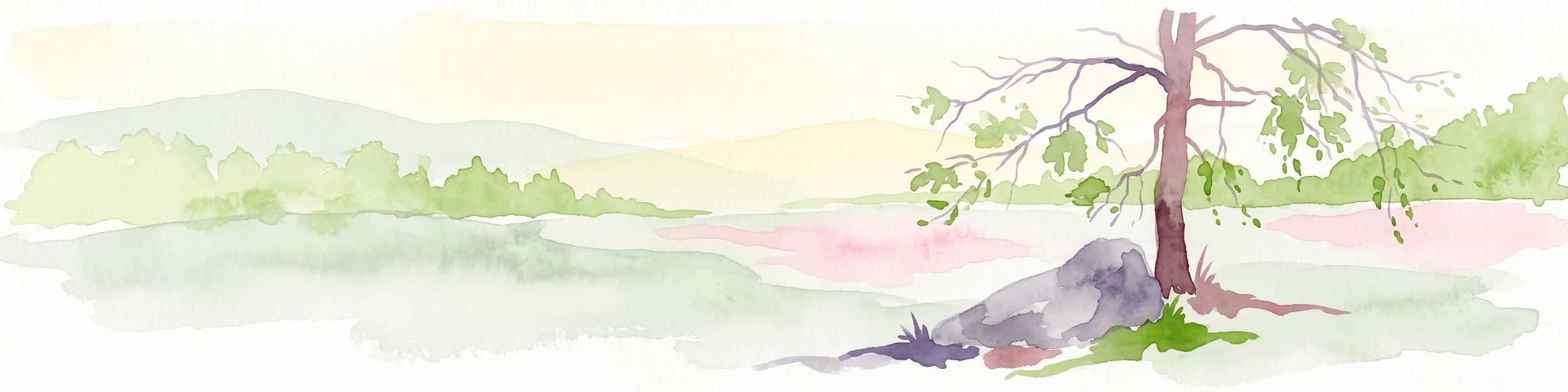
Watercolor painting of a pastoral landscape featuring a tree, a large rock, and soft hills in the background with a pale sky.
Natural monumentStředočeský kraj
About 4.4 km away#2 closest

Northwest

Skalsko Natural Monument: Mapped Wetland Landscapes and Protected Meadow Geography

A representative habitat in the Středočeský kraj uplands

Focusing on the conservation of sensitive wet meadow ecosystems, Skalsko serves as a key reference for the biodiversity of the Říčany Plateau. This site showcases a mosaic of flora, including rare orchids, set against the backdrop of the geologically distinct Central Bohemian uplands, providing a structured look at one of the region's most important protected natural monuments.

Area
0.036 km²
Established
2008
IUCN
IV
Relief
Upland
A soft, minimalist watercolor painting showing a green treeline against a pale pink and white background, suggestive of wetlands or ponds.
Natural monumentPrague
About 16 km away#3 closest

North

Milíčovský les a rybníky: Protected Landscape and Wetland Map in Prague, Czech Republic

Natural monument geography and forest-wetland habitat atlas

Milíčovský les a rybníky represents a core natural monument in southern Prague, featuring a mature deciduous forest integrated with a managed system of ponds. This protected area serves as a critical refuge for rare wetland and woodland species. Use the mapping tools to trace the terrain, from the dense oak-hornbeam canopy to the extensive reedbeds and aquatic environments that define this unique urban-edge landscape.

Area
1.047 km²
Established
1991
IUCN
III
Relief
Upland
A pale, soft-toned watercolor painting of a rolling landscape featuring a stream in the foreground, scattered trees in the midground, and faint mountains in the distant background.
Protected landscapePraha
About 16 km away#4 closest

North

Přírodní park Botič-Milíčov: Protected Landscape, River Valley, and Forest Map

A preserved green refuge featuring meandering streams and pond networks near Praha.

Přírodní park Botič-Milíčov stands as a significant protected landscape in Praha, defined by the seasonal flooding of the Botič and Pitkovický streams. The park hosts alluvial forests, a series of historic ponds, and archaeological traces of ancient mills. Through map-based exploration, identify the diverse terrain that includes rocky outcrops at Pitkovická stráň and extensive broadleaf woodlands on the edge of urban housing developments.

Area
8.24 km²
Established
1984
Relief
Lowland
Climate
Temperate
Nature reservePrague
About 18 km away#5 closest

Northwest

V hrobech Nature Reserve: A Protected Botanical Island within the Urban Landscape of Prague

Rare dry-grassland habitats in the Kamýk district

V hrobech is a designated nature reserve in Prague featuring 1.3 hectares of southeast-facing slopes and species-rich grassland. This site is home to rare thermophilic plants and represents an important example of intensive conservation management in an urban environment. Its protected boundaries connect with local forest fragments to maintain ecological value amidst the residential developments of Lhotka and Libuš.

Area
0.013 km²
Established
1988
IUCN
IV
Relief
Lowland
A soft watercolor painting of a rural landscape with light green meadows and clusters of trees under a pale, washed-out sky.
Protected landscapePrague
About 19 km away#6 closest

North

Přírodní park Říčanka: Protected Landscape and Geographic Map of Eastern Prague

An analysis of rural corridors, aquatic systems, and forest terrain.

Přírodní park Říčanka preserves an extensive rural ribbon of meadows, arable fields, and woodland patches on the eastern edge of Prague. This structured overview details the park's topography, its historic fishpond chain along the Říčanský potok, and the various natural monuments that characterize this protected Czech landscape.

Area
4 km²
Established
1984
Relief
Lowland
Climate
Temperate
A soft watercolor painting of a winding stream moving through green meadows with distant rolling hills and a light, misty atmosphere.
Natural monumentPrague
About 19 km away#7 closest

North

Meandry Botiče Natural Monument: Mapped Geography and Protected Stream Landscapes in Prague

Analyzing the ecological boundaries and riparian terrain of the Botič stream corridor

Meandry Botiče represents a significant natural monument in Prague, distinguished by its pronounced stream meanders and dense bankside vegetation. This site offers deep insights into urban conservation, documenting the delicate balance between native riparian flora and the pressures of encroaching residential districts within a managed protected environment.

Area
0.067 km²
Established
1968
IUCN
III
Relief
Lowland
A watercolor painting showing a panoramic landscape with a rocky quarry ledge in the foreground, green hills in the midground, and soft, pastel colored rolling hills in the background.
Natural monumentPrague
About 20 km away#8 closest

North

Rohožník, lom v Dubči: Geological Natural Monument and Protected Landscape in Prague

Analyzing the Ordovician quartzite and tectonic rock exposures of the Prague Plateau

Rohožník, lom v Dubči serves as a crucial natural monument in the Prague region, protecting abandoned quarries that showcase clear M-shaped tectonic folds and thick quartzite deposits. This site acts as a living laboratory for geological history, connecting archaeological finds with dry grassland communities in an otherwise suburban-agricultural landscape on the edge of the capital.

Area
0.034 km²
Established
1988
IUCN
III
Relief
Upland

Common questions about visiting, size, designation, and location context for Hornopožárský les Nature Park

Hornopožárský les Nature Park FAQs for park facts, access, geography, and protected area context

Find quick answers about Hornopožárský les Nature Park, including protected-area facts, park geography, trail and visitor context, and how the park fits into its surrounding country and regional landscape.
MoriAtlas Explorer

Continue Your Protected Areas Search Across the Global Atlas

Deepen your exploration by continuing the structured search for national parks and protected areas worldwide. Utilize the comprehensive filtering capabilities to compare different conservation landscapes and refine your understanding of global park geography. Discover more about the distribution and characteristics of protected natural areas.

Global natural geography