
Mori Atlas logo
Nature reserveHubbelrather Bachtal

A basin-shaped lowland habitat mosaic bridging the urban edge of the Bergisches Land

Hubbelrather Bachtal Nature Reserve: Mapped Protected Landscape and Regional Stream Valley Geography

(Naturschutzgebiet Hubbelrather Bachtal)

Hubbelrather Bachtal serves as a vital protected basin in Nordrhein-Westfalen, where the Hubbelrather Bach creates a persistent waterlogged valley floor. This nature reserve maps a distinctive landscape contrast between lush wet meadows, reedbeds, and elevated birch and beech woodland slopes. The presence of a former sand quarry further diversifies the terrain, offering a warm, dry refuge that functions as an ecological island within the surrounding densely settled environment.

stream valleywet meadowsreedbedsfloodplain habitatswet grasslandbirch and beech woodland
A flat-style digital illustration of a scenic valley featuring a waterfall, a winding stream, a large central tree, and surrounding forest, set against rocky cliffs under a soft sky.

Hubbelrather Bachtal

Nature reserve

Park overview

Structured park overview, official facts, and landscape profile for Hubbelrather Bachtal

Hubbelrather Bachtal park facts, protected area profile, and essential visitor context

Review the core facts for Hubbelrather Bachtal, including designation, size, terrain, visitor scale, habitats, and operating context in one park-focused overview.

About Hubbelrather Bachtal

Hubbelrather Bachtal is a compact lowland stream-valley nature reserve in the Bergisches Land foothills, on the edge of the city of Erkrath. It sits only a few kilometers south of central Düsseldorf, bordered by the A3 motorway and the Hubbelrath central landfill, yet it preserves a notably intact mosaic of wet and dry habitats that are increasingly rare in this densely settled part of North Rhine-Westphalia.

The defining feature of the reserve is the shallow, trough-like valley of the Hubbelrather Bach. The stream flows from Düsseldorf southward into Erkrath through a permanently waterlogged valley floor. Along the watercourse, reedbeds, rush- and sedge-rich wet grassland, and damp meadows form a continuous belt of characteristic stream-avenue habitat. Parts of this wet grassland are still managed extensively, supporting typical species of floodplain meadows, while other sections have been left to develop as fallow land, enriching the habitat structure for insects, amphibians, and breeding birds.

On the slopes above the valley, the character of the reserve changes. The Erkrath sides of the valley carry mixed deciduous woodland with birch and beech, interspersed with grassland and fallow areas. In the western part of the reserve, a structurally rich, near-natural forest occupies a ridge with deep incisions, providing mature and old-growth trees that are important for woodpeckers, other cavity-breeding birds, and hole-roosting bats. The included former sand quarry adds a contrasting warm, dry environment that supports heat-loving species and adds botanical interest to the reserve.

Because of this combination of valley wetlands, woodland hummocks, and dry warm sites, Hubbelrather Bachtal functions as a compact but ecologically significant refuge within an otherwise heavily used landscape. It links directly northward to the separately protected Düsseldorfer section of the same valley and forms a key piece of the broader network of small nature reserves across the Mettmann district.

Quick facts and research context for Hubbelrather Bachtal

Hubbelrather Bachtal is a small Naturschutzgebiet (nature reserve) in the Mettmann district of North Rhine-Westphalia, managed under the Kreis Mettmann landscape plan (2012) and administered by the lower landscape authority of the district. The site carries the official code ME-039 and is classified as an IUCN Category IV Habitat/Species Management Area.

The reserve lies on Erkrath municipal territory, north of the Erkrath town center, west of the A3 motorway, and south of the Hubbelrath central landfill. It represents the southern continuation of a larger, separately designated section of the same valley that lies within the city of Düsseldorf.

Although compact, the site combines a permanently damp valley floor with birch and beech woodland, and includes a former sand quarry that now serves as a sun-exposed dry habitat, giving the reserve a clear ecological contrast between wet valley features and warm dry slopes.

Protection and recognition

Examine documented conservation standing and administrative tracking records

Hubbelrather Bachtal Protection Status and International Recognition Data

Hubbelrather Bachtal holds structured conservation tracking records within global protected area databases. Official protection status parameters and international recognition metrics supply verified administrative details for comprehensive park analysis.

Protection details

WDPA ID
163807
Park context

Deeper park guide and search-rich context for Hubbelrather Bachtal

Hubbelrather Bachtal history, landscape, wildlife, and travel context

Explore Hubbelrather Bachtal through its history, landscape character, ecosystems, wildlife, conservation priorities, cultural context, and seasonal travel timing in a structured park guide built for atlas discovery and search intent.

Why Hubbelrather Bachtal stands out

Hubbelrather Bachtal is best known for its basin-shaped, waterlogged stream valley, where the Hubbelrather Bach runs through reedbeds, sedge- and rush-rich wet grassland, and damp meadows. This combination of permanently moist valley floor with adjacent birch and beech slopes creates an unusually rich habitat mosaic in a heavily urbanized region between Düsseldorf and the Bergisches Land. The reserve is also notable for the former sand quarry within the area. This site acts as a climate-favored warm island and a dry habitat that supports rare animal and plant species, providing a striking ecological counterpoint to the wet valley habitats only a short distance away. Together, these features make the small reserve a meaningful refuge for several Red List species in a densely populated setting.
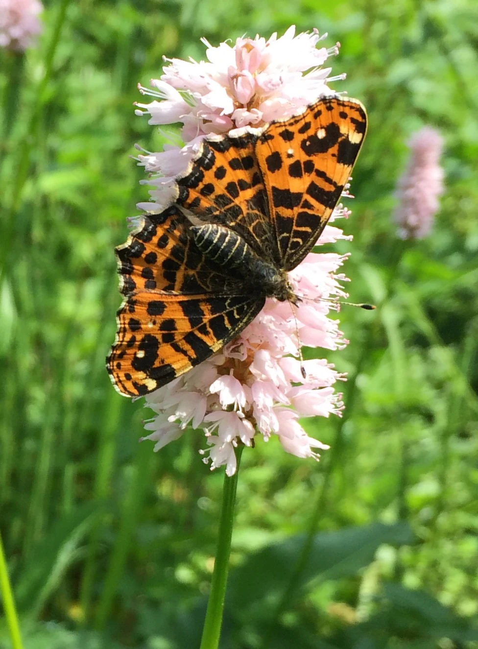
A Map butterfly, Araschnia levana, with orange and black patterned wings, rests on a cluster of small pink flowers.
A Map butterfly perched on a Common bistort flower, showcasing the biodiversity of Hubbelrather Bachtal.

Hubbelrather Bachtal history and protected-area timeline

Hubbelrather Bachtal was first placed under formal nature protection in 1997 and was subsequently integrated into the landscape plan of the Mettmann district, which was revised and adopted in 2012. The protections were put in place to secure a representative section of the Hubbelrather Bach valley at a time when surrounding land use was intensifying through motorway expansion, landfill operations, and urban growth around Erkrath and Düsseldorf.

The reserve corresponds to the southern continuation of the larger, separately designated Hubbelrather Bachtal area on Düsseldorfer municipal territory, which had already been recognized for its conservation value. By extending protection southward onto Erkrath land, authorities ensured that the valley's characteristic mix of wet meadows and woodland slopes would remain intact across administrative boundaries.

Today the reserve is administered by the lower landscape authority of the Mettmann district under the framework of the 2012 landscape plan. Within this framework, the protection objectives focus on preserving the natural stream course, the moist valley habitats, and the structural diversity of the adjacent woodlands, as well as safeguarding the former sand quarry as a dry, warm refugium for rare species.

Hubbelrather Bachtal landscape and geographic character

The landscape of Hubbelrather Bachtal is shaped by a shallow, basin-like valley cut into the gently undulating terrain of the northern Bergisches Land. The valley floor lies roughly between 59 and 108 meters above sea level, with an average elevation of around 83 meters, giving the reserve a clearly defined cross-section between moist low ground and drier slopes.

The central axis of the area is the Hubbelrather Bach, a small lowland stream that flows from Düsseldorf southward into Erkrath. Its valley floor is permanently waterlogged and is lined by reedbeds, damp meadows, and rush- and sedge-rich fallow grassland that produce a lush, green corridor through the otherwise built-up surroundings. Along the wet margins of the stream, typical floodplain and wetland vegetation patterns are clearly visible, with patches of tall herbs, pondweed-like stands, and wet meadow zones that change character with the seasons.

On the Erkrath side of the valley, the slopes rise into mixed woodland stands with birch and beech, alongside grassland and brachen (fallow areas) that add structural variety. In the western part of the reserve, a near-natural, structurally rich forest occupies a slight ridge with eroded incisions, where older trees and deadwood are particularly prominent. The inclusion of a former sand quarry introduces an additional landscape element: an open, sunny hollow with sandy substrate and warmer microclimate, which contrasts sharply with the shaded, moist valley just steps away.

Together these features produce a compact landscape mosaic, in which a damp, ecologically rich valley bottom sits in direct visual and ecological contrast with sunlit, dry slopes and a sheltered forest ridge. The combination is characteristic of many small stream valleys on the fringe of the Bergisches Land and constitutes the defining visual impression of the reserve.
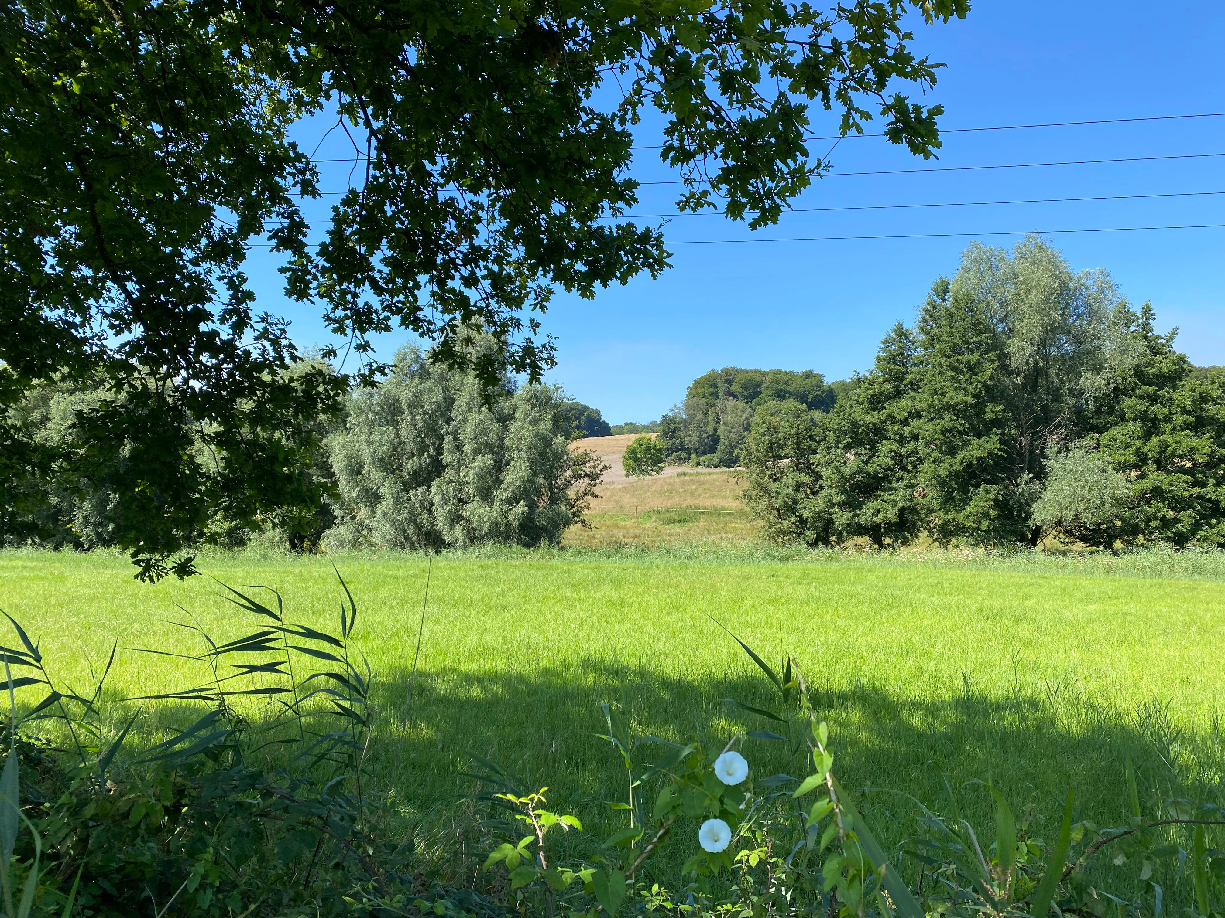
A sunny, green landscape of the Hubbelrather Bachtal nature reserve featuring a foreground of tall grass and trees, looking out over an open meadow toward a wooded hillside under a clear blue sky.
A scenic view of the Hubbelrather Bachtal nature reserve with open meadows, trees, and rolling terrain.

Hubbelrather Bachtal ecosystems, habitats, and plant life

Ecologically, Hubbelrather Bachtal is structured around the contrast between a permanently moist stream valley and drier, structurally varied slopes and ridges. The valley floor is dominated by wet habitats characteristic of small lowland brooks: reedbeds, sedge- and rush-dominated wet grassland, damp meadows in various stages of use and abandonment, and herbaceous floodplain communities along the banks of the Hubbelrather Bach.

On the Erkrath slopes, habitats shift toward mesophilic deciduous woodland. Birch and beech are the dominant tree species, forming stands that include both younger growth and older trees. These woodlands sit alongside grassland and fallow areas, creating edge habitats that are important for transitional species. In the western part of the reserve, a near-natural forest covers a ridge with deep incisions, providing mature trees, deadwood, and cavities that are particularly significant for specialized fauna.

The former sand quarry within the reserve adds a rare ecological dimension for such a compact site. Open, sandy substrate, exposure to sun, and a warmer microclimate turn this area into a local heat island, supporting dry meadow and pioneer vegetation that differs fundamentally from the wet habitats elsewhere in the reserve. This juxtaposition of wet, cool valley and dry, warm hollow is one of the defining ecological features of Hubbelrather Bachtal and is the reason the area supports an unusually broad range of species for its size.
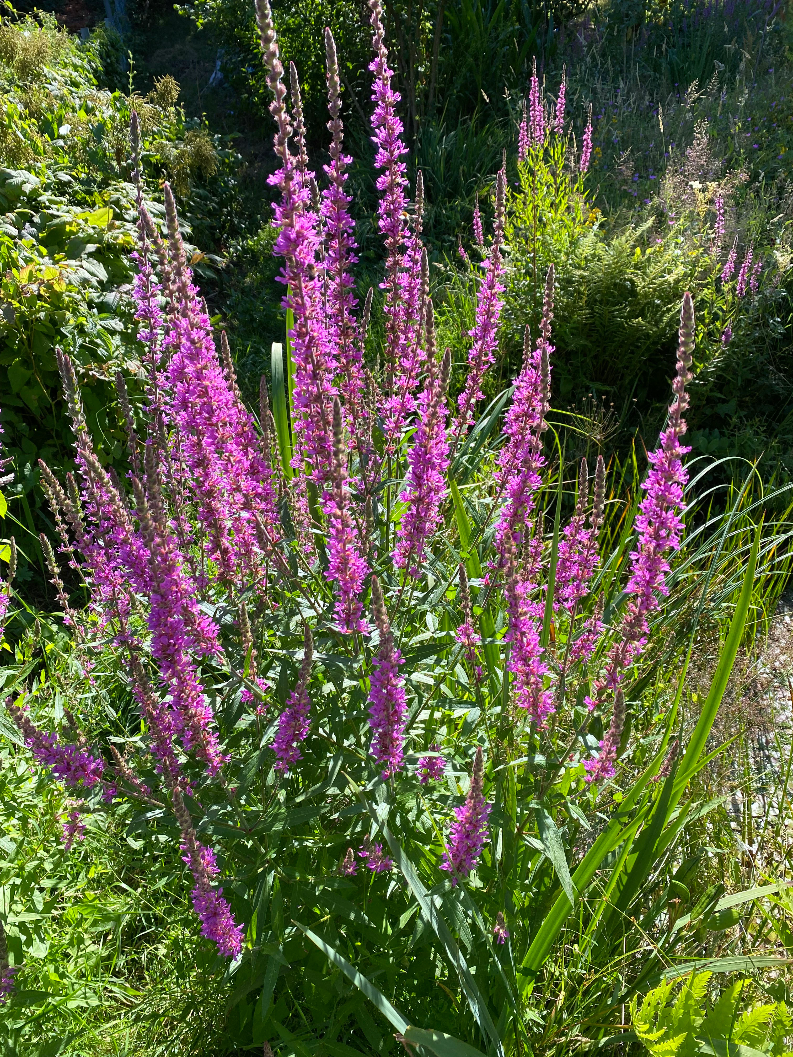
A cluster of purple loosestrife flowers with tall, vibrant pink-purple spikes growing in a lush, green natural meadow.
Purple loosestrife, Lythrum salicaria, blooming in the Hubbelrather Bachtal stream valley.

Hubbelrather Bachtal wildlife and species highlights

Wildlife in Hubbelrather Bachtal is shaped by the same wet-versus-dry contrast that defines the reserve's habitats. The permanently damp valley floor and its reedbeds are particularly important for breeding and feeding birds associated with wetlands and stream corridors. Red List species recorded in the reserve include the common kingfisher (Eisvogel), the common nightingale (Nachtigall), the Eurasian reed warbler (Teichrohrsänger), and the white-throated dipper (Wasseramsel), all of which rely on the structural diversity of reeds, wet grassland, and open water.

The mature and old-growth trees on the slopes and especially along the ridge forest provide nesting and roosting opportunities for cavity-breeding birds and bats. Among the bat species documented in the area are the common noctule (Abendsegler) and the Daubenton's bat (Wasserfledermaus), both of which use tree cavities and forage along the stream and over the wet meadows.

The dry, sun-exposed former sand quarry adds a different wildlife dimension. The warm, sandy conditions support butterflies, such as the map butterfly (Landkärtchen) recorded on snake knotweed, as well as heat-loving insects and pioneer plant communities. Wet meadows in the valley bottom also attract a rich insect fauna supported by characteristic wet-meadow plants such as purple loosestrife (Blutweiderich), yellow loosestrife (Gilbweiderich), and giant horsetail (Riesenschachtelhalm), the last of which is itself regarded as threatened in the North Rhine-Westphalia Red List.

Taken as a whole, the reserve supports a community of wetland, woodland, and dry-site species that would be difficult to maintain in any single habitat type alone, and that is the main reason for the site's conservation importance.
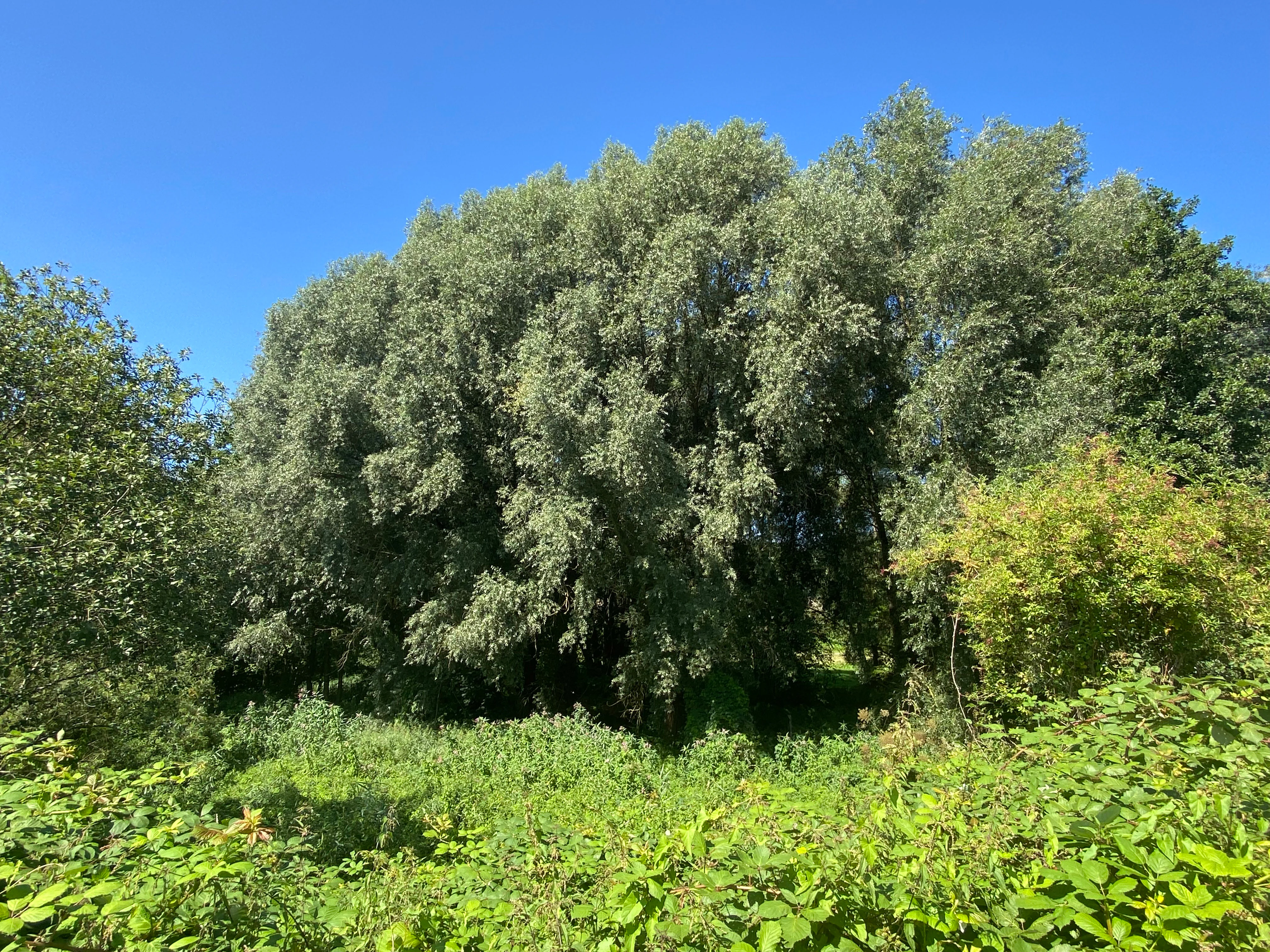
A dense stand of green trees under a clear blue sky, with lush bushes and undergrowth in the foreground.
Lush trees and foliage in the Hubbelrather Bachtal nature reserve.

Hubbelrather Bachtal conservation status and protection priorities

Hubbelrather Bachtal is recognized as a Naturschutzgebiet under German nature protection law and as an IUCN Category IV Habitat/Species Management Area in international classifications. Its designation under the Mettmann district landscape plan of 2012 formally anchors its protection within regional land-use planning, with the lower landscape authority of the Mettmann district responsible for its administration.

From a conservation perspective, the reserve matters for several reasons. It secures a representative stretch of the Hubbelrather Bach valley in a region facing intense pressure from motorway infrastructure, landfill operations, and continuing suburban growth between Düsseldorf and the Bergisches Land. Its permanently waterlogged valley floor, reedbeds, and wet meadows form a coherent, functioning stream-avenue habitat that supports multiple Red List species, while the adjoining woodland and former sand quarry preserve complementary dry, warm habitat elements.

The site also serves as the southern anchor of a larger cross-boundary habitat complex. Together with the separately protected Düsseldorfer section of the same valley, Hubbelrather Bachtal forms a continuous protected stream valley spanning two municipalities, which is important for species that move along the watercourse and the connected woodland. In the wider Mettmann district network of nature reserves, the area is a notable example of a small but ecologically rich valley habitat in an urban-adjacent setting.

Top sights and standout views in Hubbelrather Bachtal

A protected basin-shaped stream valley along the Hubbelrather Bach, with permanently waterlogged valley floor, reedbeds, and rush- and sedge-rich wet grassland. Birch and beech woodland on the Erkrath slopes, including a structurally rich near-natural forest on a ridge with deep incisions in the western part of the reserve. A former sand quarry that functions as a climate-favored warm island, providing a valuable dry habitat for heat-loving insects and plants in direct contrast to the surrounding wet valley. A documented refuge for red-listed bird species such as common kingfisher, common nightingale, reed warbler, and white-throated dipper, as well as for bat species including common noctule and Daubenton's bat, in a heavily urbanized landscape between Düsseldorf and the Bergisches Land.
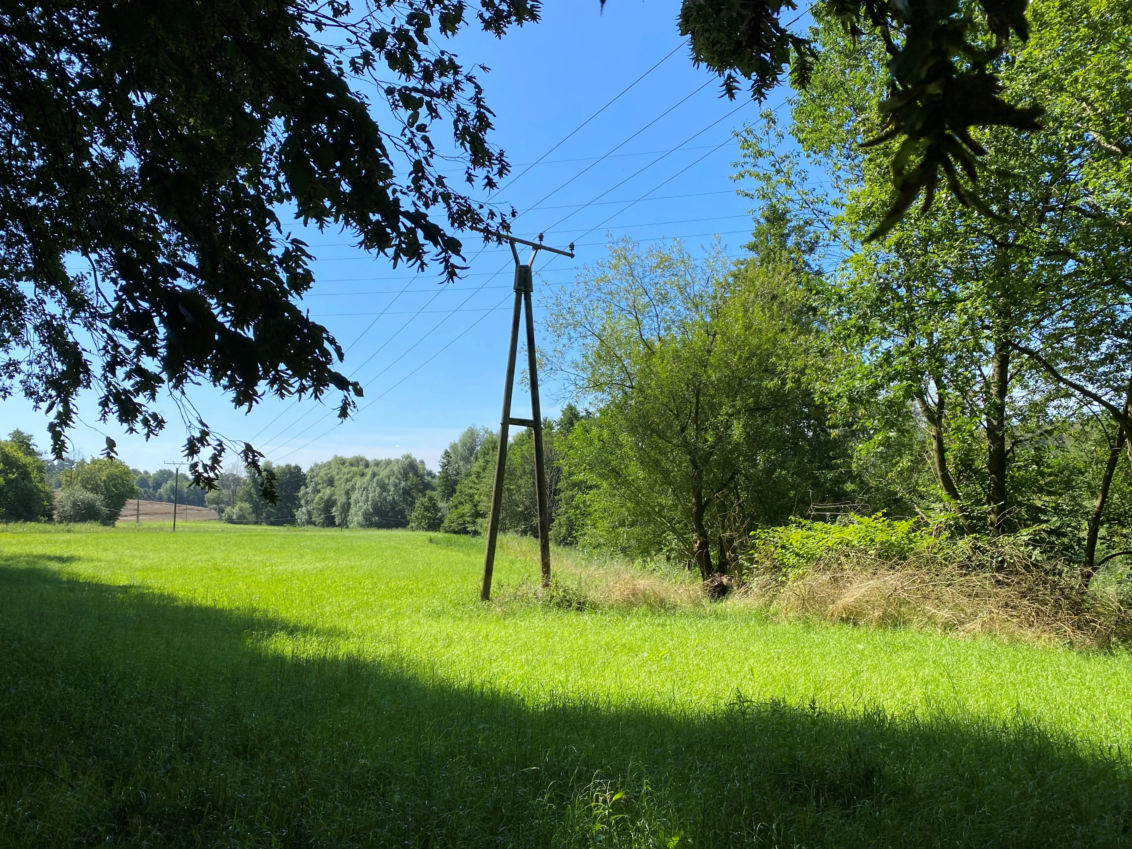

A view of a green meadow with a wooden power line pole in the center, flanked by trees and a bright blue sky.
A grassy meadow at the edge of the Hubbelrather Bachtal nature reserve in Germany.
Monthly climate preview

Long-term representative temperature and precipitation averages for Hubbelrather Bachtal

Hubbelrather Bachtal Climate Normals and Monthly Weather Patterns

Historical records from 1991 to 2000 outline the measured annual temperature and precipitation rhythm across Hubbelrather Bachtal at a representative coordinate. Reviewing the complete twelve-month profile provides deeper context for monthly climate variations and average temperature ranges.
Annual mean10 °C
1 °C19 °C
Jan
Feb
Mar
Apr
May13°
Jun17°
Jul19°
Aug19°
Sep15°
Oct10°
Nov
Dec
Warmest month
July

19.2 °C

Coolest month
January

1.3 °C

Wettest month
December

2.6 mm/day

Driest month
April

1.6 mm/day

Park location guide

Geography guide, regional context, and park location map for Hubbelrather Bachtal

Hubbelrather Bachtal park geography, regions, and map view in Germany

Understand where Hubbelrather Bachtal sits in Germany through a broader geographic reading of the surrounding landscape, nearby location context, and its mapped position within the national park landscape.

How Hubbelrather Bachtal fits into Germany

Germany is a federal republic in Western and Central Europe with a population of over 83 million across sixteen constituent states. It is Europe's largest economy by nominal GDP and a major global exporter and importer. The capital is Berlin, and the country borders Denmark, Poland, Czech Republic, Austria, Switzerland, France, Luxembourg, Belgium, and the Netherlands.

Wider geography shaping Hubbelrather Bachtal in Germany

Germany is located in Western and Central Europe, spanning 357,022 km². It borders Denmark to the north, Poland and the Czech Republic to the east, Austria and Switzerland to the south, and France, Luxembourg, Belgium, and the Netherlands to the west. The country has coastlines on the Baltic Sea and North Sea to the north, with the Alps located in the southern region.

Map view of Hubbelrather Bachtal

Use this park location map to pinpoint Hubbelrather Bachtal in Germany, understand its exact geographic position, and read its mapped placement within the surrounding landscape more clearly.

Pigeon | © OpenStreetMap contributors

Location context for Hubbelrather Bachtal

Nordrhein-Westfalen

Visual reference guide to wet valley habitats, stream terrain, and protected woodland environments

Hubbelrather Bachtal Photos and Landscape Scenery Explorer

Visual documentation captures the basin-shaped stream valley, waterlogged wetlands, and mixed beech woodland defining Hubbelrather Bachtal. Examining these detailed landscape views reveals the ecological contrasts between damp lowland meadows and sunlit sandy habitats across the protected reserve.

A Map butterfly, Araschnia levana, with orange and black patterned wings, rests on a cluster of small pink flowers.

A green, grassy meadow in the foreground with a large deciduous tree to the left and a line of trees in the background under a clear blue sky.

A sunny, green landscape of the Hubbelrather Bachtal nature reserve featuring a foreground of tall grass and trees, looking out over an open meadow toward a wooded hillside under a clear blue sky.

A cluster of purple loosestrife flowers with tall, vibrant pink-purple spikes growing in a lush, green natural meadow.

A dense stand of green trees under a clear blue sky, with lush bushes and undergrowth in the foreground.

A sunny day landscape view of a green meadow in the foreground leading into a tree lined valley with a blue sky overhead.

A view of a green meadow with a wooden power line pole in the center, flanked by trees and a bright blue sky.

A sunny day view of a grassy meadow bordered by trees and shrubs in a valley, with a clear blue sky above.

Park atlas

Compare adjacent stream valleys, lowland reserves, and protected habitats across the surrounding region

Parks Near Hubbelrather Bachtal and Protected Areas Across the Regional Landscape

Compare Hubbelrather Bachtal with other protected areas and nearby lowland stream valleys across the surrounding region. Broadening the geographic scope reveals how similar wetland habitats and woodland mosaics connect local conservation landscapes.
Watercolor painting of a green valley with a winding stream and gentle hills in the background.
Nature reserveNordrhein-Westfalen
About 0.9 km away#1 closest

Southwest

Morper Bachtal: Mapped Nature Reserve and Stream Valley Geography in Germany

Protected wetland landscapes and regional habitat connectivity.

Morper Bachtal represents a tightly layered protected area where open water, reedbeds, and beech forests converge along the Rotthäuser Bach. This detailed look at its landscape composition and position within the district of Mettmann reveals the significance of its compact, undulating terrain and corridor role in German regional geography.

Area
0.74 km²
Established
1984
IUCN
IV
Relief
Upland
Watercolor painting of a calm pond with cattails in the foreground and rolling hills in the background.
Nature reserveNorth Rhine-Westphalia
About 2.8 km away#2 closest

Northwest

Naturschutzgebiet Pillebachtal, Dernkamp und Gallberg: Protected Landscape and Geography

Nature reserve in North Rhine-Westphalia, Germany

An urban-adjacent nature reserve, this area provides a mapped look at the transition between mature beech forest stands and moist wetland corridors along the Pillebach stream. It serves as a study in ecological structure, featuring reed beds, meadow springs, and gallery woodlands that offer a protected refuge within the Rhine-Ruhr metropolitan region.

Area
0.745 km²
Established
1996
IUCN
IV
A watercolor painting showing a soft, peaceful landscape with light green rolling hills in the background, a flat plain in the middle ground, and grasses and wildflowers in the foreground under a pale, warm sky.
Nature reserveNordrhein-Westfalen
About 3.4 km away#3 closest

East

Laubacher Steinbruch Nature Reserve: Mapped Geographic Overview and Protected Landscape Analysis

Calcareous habitats in the Neandertal valley, Germany

Laubacher Steinbruch is a distinct nature reserve characterized by a mosaic of sycamore maple forest, steep limestone cliffs, and dry scree fields. Situated within the Neandertal Natura 2000 site, it acts as a critical refuge for specialized plant communities and reptiles, forming an integral part of the regional conservation network in Nordrhein-Westfalen.

Area
0.06 km²
Established
1997
IUCN
IV
A watercolor painting showing a winding stream flowing through a green valley with soft hills and trees in the background.
Nature reserveKreis Mettmann
About 4 km away#4 closest

East

Laubachtal Nature Reserve: Geographic Mapping of the Mettmann Wetland Corridor

A protected stream valley in Kreis Mettmann, Germany

Laubachtal functions as a critical 15 hectare nature reserve within the Mettmann district, preserving a mosaic of stream, pond, and wet meadow habitats. This protected area serves as an essential ecological corridor for amphibians and migratory birds, offering a focused look at small-scale conservation geography within the urban-edge environment of North Rhine-Westphalia.

Area
0.15 km²
Established
1997
IUCN
IV
Relief
Upland
A watercolor illustration of a gentle winding stream flowing through a lush green valley at dawn or dusk.
Nature reserveNordrhein-Westfalen
About 5.3 km away#5 closest

North

Schwarzbachtal bei Götzenberg: Nature Reserve and Protected Landscape in North Rhine-Westphalia

Mapped stream valley, floodplain, and forest geography

Schwarzbachtal bei Götzenberg is an ecologically rich nature reserve located near Ratingen in the Mettmann district. The protected area features a well-preserved stretch of the Schwarzbach stream, old-growth beech stands, and complex wetland mosaics including reedbeds and ponds, providing essential habitat within a suburban landscape.

Area
0.54 km²
Established
1984
IUCN
IV
Relief
Lowland
Watercolor painting of a meandering stream flowing through a green meadow, with trees in the background.
Nature reserveNordrhein-Westfalen
About 6.6 km away#6 closest

Southeast

Hildener Stadtwald, Bereich Sandbach-Krebsbach Protected Nature Reserve and Wetland Geography

A mapped overview of the Bergische Heideterrasse riparian corridor.

Hildener Stadtwald, Bereich Sandbach-Krebsbach stands as an important nature reserve within the urbanised landscape of North Rhine-Westphalia. The area is characterized by its hydrologically dynamic sandy brooks, old-growth alder stands, and distinct microhabitats ranging from wet heath to dry oak-birch forests. This protected entity offers a clear look at the structural complexity of lowland mire ecosystems within a broader regional forest context.

Area
0.27 km²
Established
1938
IUCN
IV
Relief
Lowland
A watercolor painting showing a soft landscape scene with a winding stream, low-lying vegetation, and distant hills in pale green and earth tones.
Nature reserveNorth Rhine-Westphalia
About 7 km away#7 closest

Southeast

Mahnerter Bachtal: Mapping the Protected Stream Valley Habitats of North Rhine-Westphalia

A vital riparian landscape and lowland nature reserve

Mahnerter Bachtal preserves a significant lowland stream valley in Erkrath, featuring alder swamps, wet meadows, and ancient oak forests. This 28-hectare nature reserve functions as a crucial east-west ecological corridor, offering a rare glimpse of undisturbed valley geography within the sprawling industrial landscape of the German Rhine-Ruhr metropolitan area.

Area
0.28 km²
Established
1997
IUCN
IV
A horizontal watercolor painting of a calm stream flowing through a grassy valley with distant hills and scattered trees under a soft, pink-tinted sky.
Nature reserveKreis Mettmann
About 7.3 km away#8 closest

Southeast

Hühnerbachtal Nature Reserve: Geography and Protected Landscape in Kreis Mettmann

Mapped stream valley ecosystems and local habitat connectivity.

Hühnerbachtal protects a unique valley mosaic in Germany, characterized by floodplain forests and steep wooded slopes. The reserve maintains a critical biotope network near Haan, offering a deep look into the regional geography and protected terrain of the Mettmann district.

Area
0.244 km²
Established
1997
IUCN
IV

Common questions about visiting, size, designation, and location context for Hubbelrather Bachtal

Hubbelrather Bachtal FAQs for park facts, access, geography, and protected area context

Find quick answers about Hubbelrather Bachtal, including protected-area facts, park geography, trail and visitor context, and how the park fits into its surrounding country and regional landscape.
MoriAtlas Explorer

Continue Your Protected Areas Search Across the Global Atlas

Deepen your exploration by continuing the structured search for national parks and protected areas worldwide. Utilize the comprehensive filtering capabilities to compare different conservation landscapes and refine your understanding of global park geography. Discover more about the distribution and characteristics of protected natural areas.

Global natural geography