
Why Hummelsbach Nature Reserve stands out
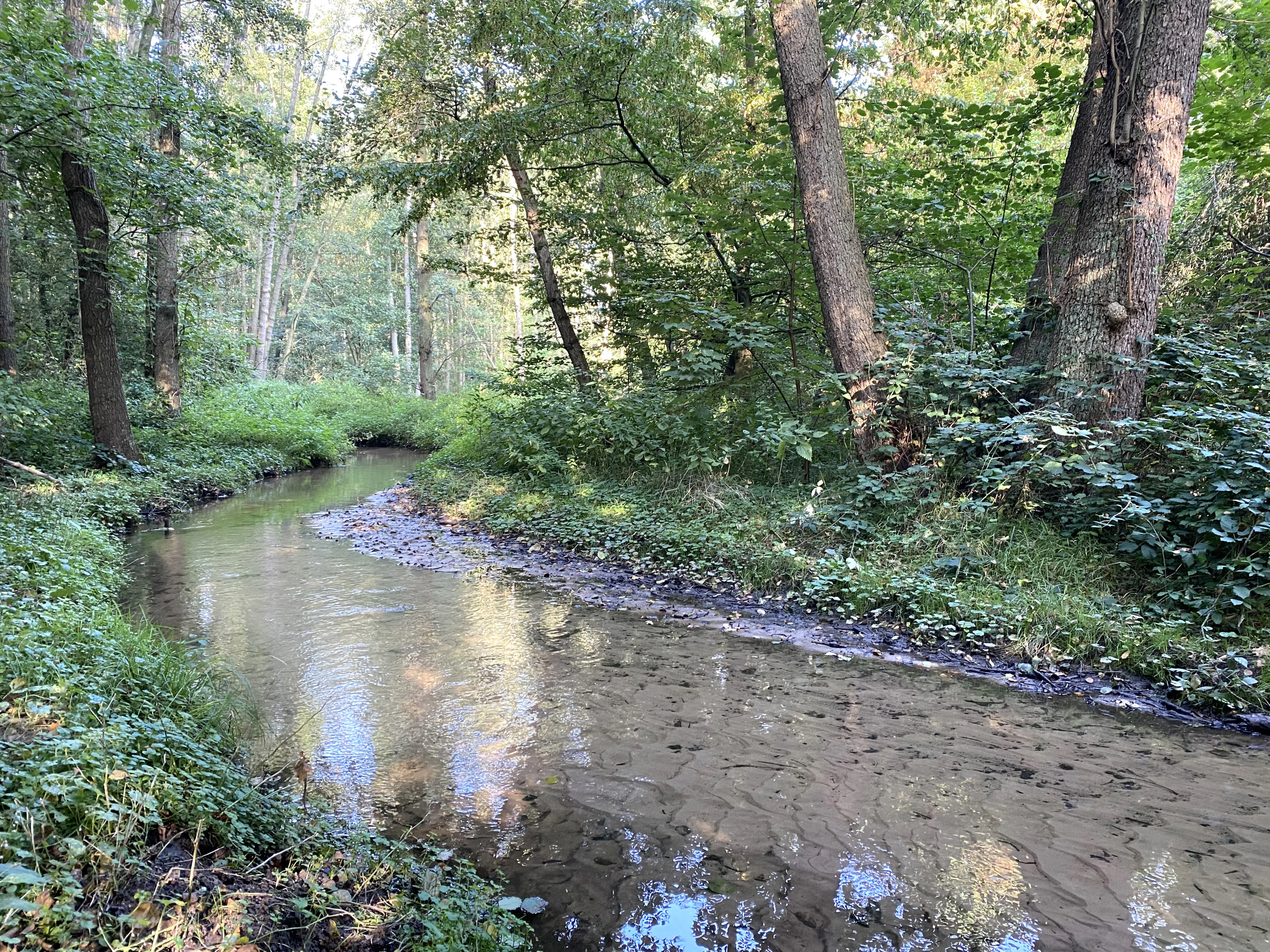
Hummelsbach is best known for its protected section of the Hummelsbach, a structurally rich, near-natural sandy brook with flat and steep banks and fallen deadwood. Although the first 300 meters west of the A3 autobahn suffer from deep erosion, much of the stream within the reserve retains valuable natural character. The reserve's most distinctive ecological feature is its alder floodplain forest, which in parts still shows good development. In the understory, blackberry often dominates, while the wet fallow areas harbor wood club-rush and reed sweet-grass. The site's value lies in its mosaic of wet woodland, wet fallow land, and species-rich dry grassland, functioning as a local biotope connection between the hill landscape of the Bergisches Land and the lowland Rhine floodplain.
Hummelsbach Nature Reserve history and protected-area timeline
Hummelsbach was first formally designated as a nature reserve in 1984, establishing legal protection for the brook and its surrounding floodplain habitat within the Mettmann district. The reserve's framework was revisited and updated in 2012 when it was incorporated into the Mettmann district landscape plan, reflecting evolving ecological priorities including erosion control along the sand-bottomed brook and ongoing management of the wet and dry grassland areas.
The reserve's management has long been guided by the Lower Landscape Authority (Untere Landschaftsbehörde) of the Kreis Mettmann, with input from the state-level Fachinformationssystem of North Rhine-Westphalia's Office for Nature, Environment and Consumer Protection. This official ecological assessment has consistently emphasized the site's value as a near-natural sandy brook with alder floodplain forest, and as a regionally important biotope link between the Bergisches Land and the Rhine floodplain.
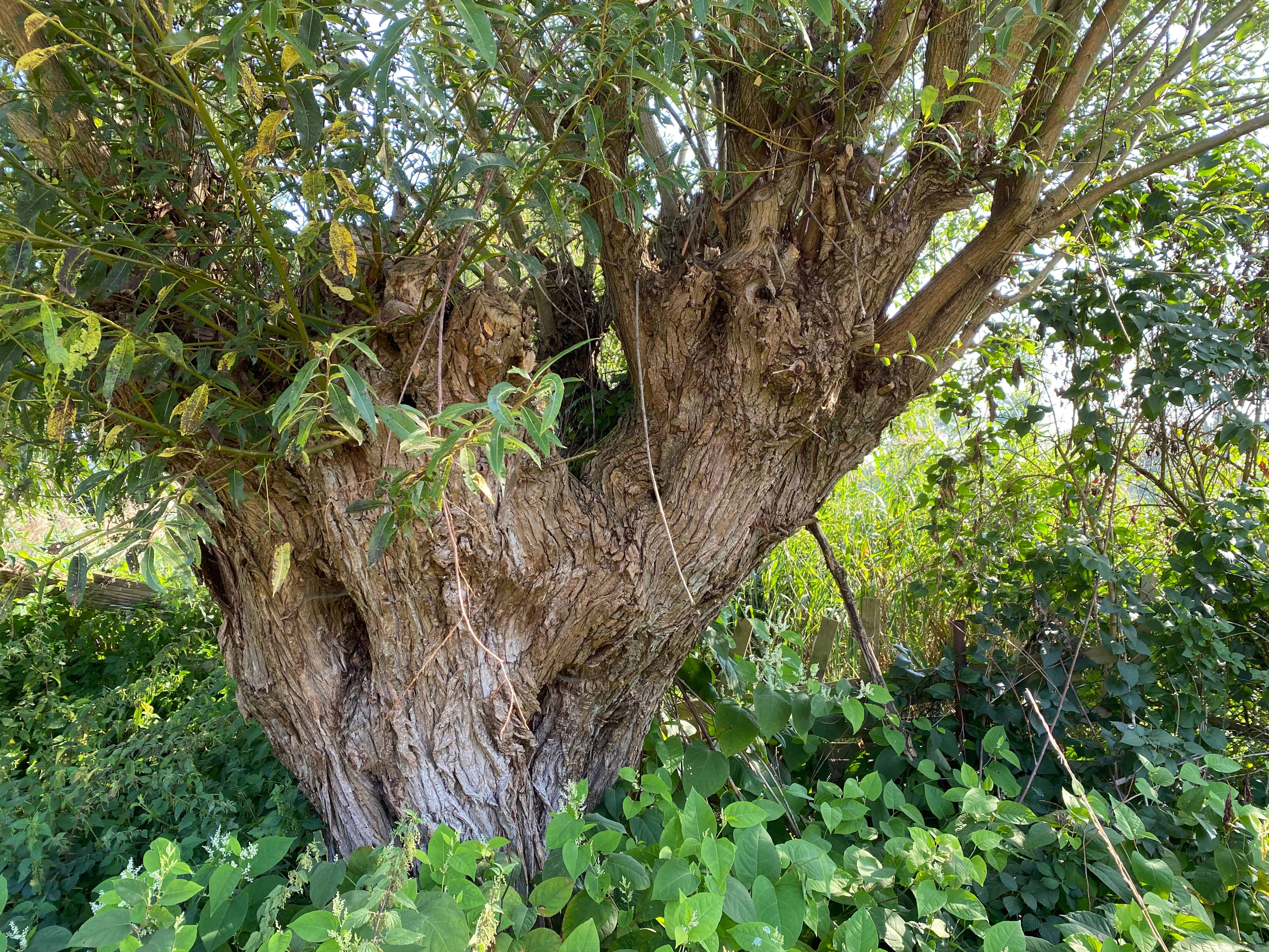
Beyond the formal designation date, the cultural landscape around the Hummelsbach reflects longer historical patterns of land use. The presence of old pollarded willows (Kopfweiden) along the brook suggests centuries of traditional riparian management, while the southern dry-grassland complex with horse grazing continues a pastoral tradition typical of the western Lower Rhine region.
Hummelsbach Nature Reserve landscape and geographic character
The Hummelsbach reserve sits at a modest elevation of around 55 to 65 meters above sea level, with an average near 60 meters, typical of the gently rolling terrain at the edge of the Bergisches Land where it meets the lower Rhine plain. Its topography is shaped less by dramatic relief than by the subtle valley of the Hummelsbach and the surrounding woodland mosaic.
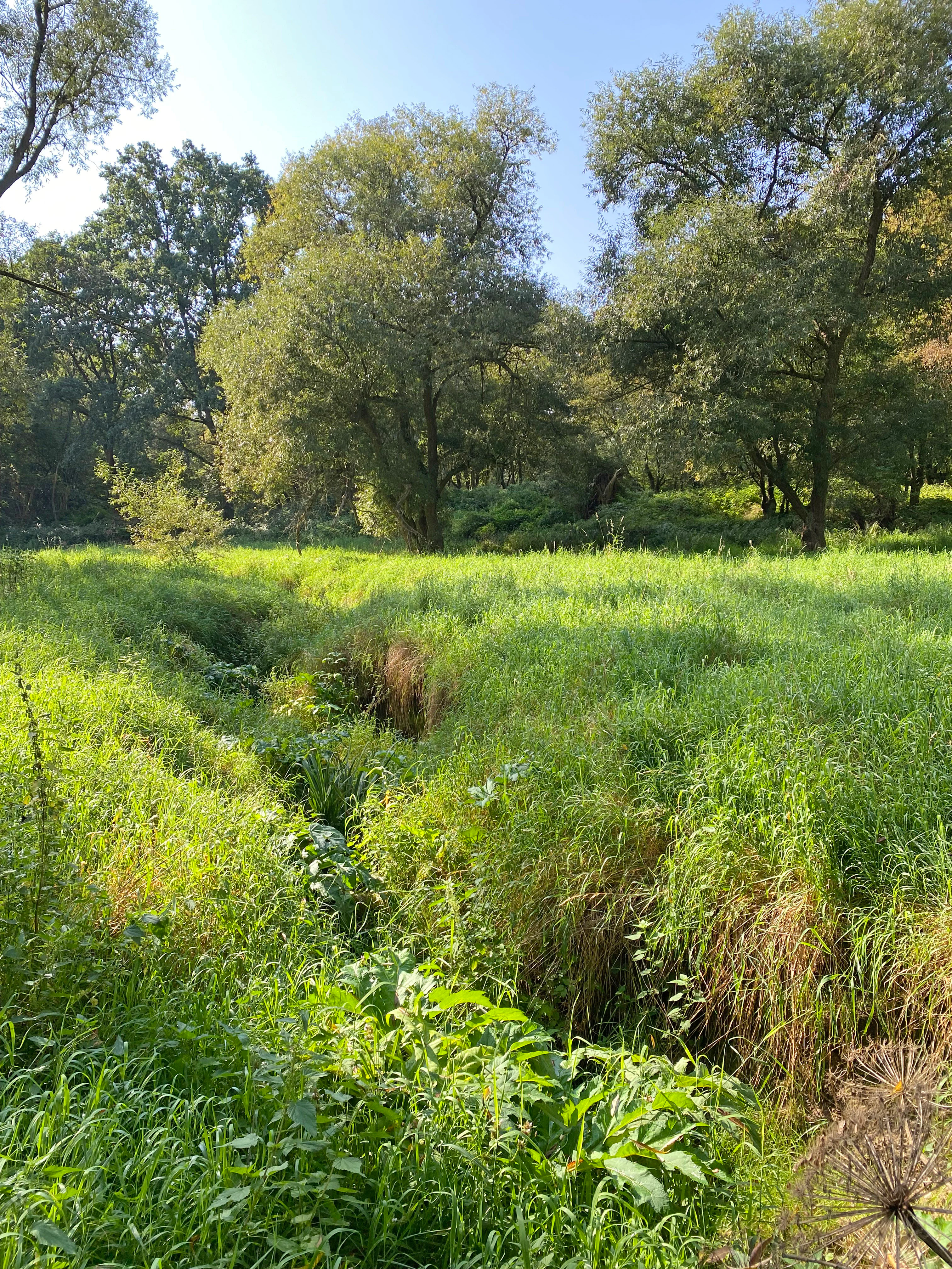
The central landform is the brook valley itself, which cuts through the reserve from northeast to southwest. Its sandy bed and uneven banks create a varied cross-section of flat banks, steep eroded banks, and accumulations of fallen trees, giving the watercourse a structurally rich, near-natural character despite the proximity of motorway infrastructure. The northeastern edge of the reserve is bordered by the A3 autobahn, whose surface drainage has historically influenced water flow into the brook.
Away from the immediate brook corridor, the landscape transitions into patches of wet woodland, damp fallow land, and a drier southern grassland zone. Old pollarded willows, muddy ditches, and small wet clearings break up the forested cover, while the southern dry grassland complex, grazed by horses, opens the canopy and adds visual and ecological variety. The result is a compact but layered landscape mosaic where water, woodland, meadow, and human-shaped elements all coexist within a few hectares.
Hummelsbach Nature Reserve ecosystems, habitats, and plant life
Ecologically, Hummelsbach belongs to the category of small lowland brook reserves typical of the western Lower Rhine transition zone. Its habitat structure is dominated by alder-dominated wet forests, ranging from true alder floodplain woodland (Erlenauenwald) along the main brook to alder swamp woodland (Erlenbruchwald) in the wettest depressions. These forests provide shade that moderates water temperatures and supplies leaf litter and woody debris that shape brook habitats.
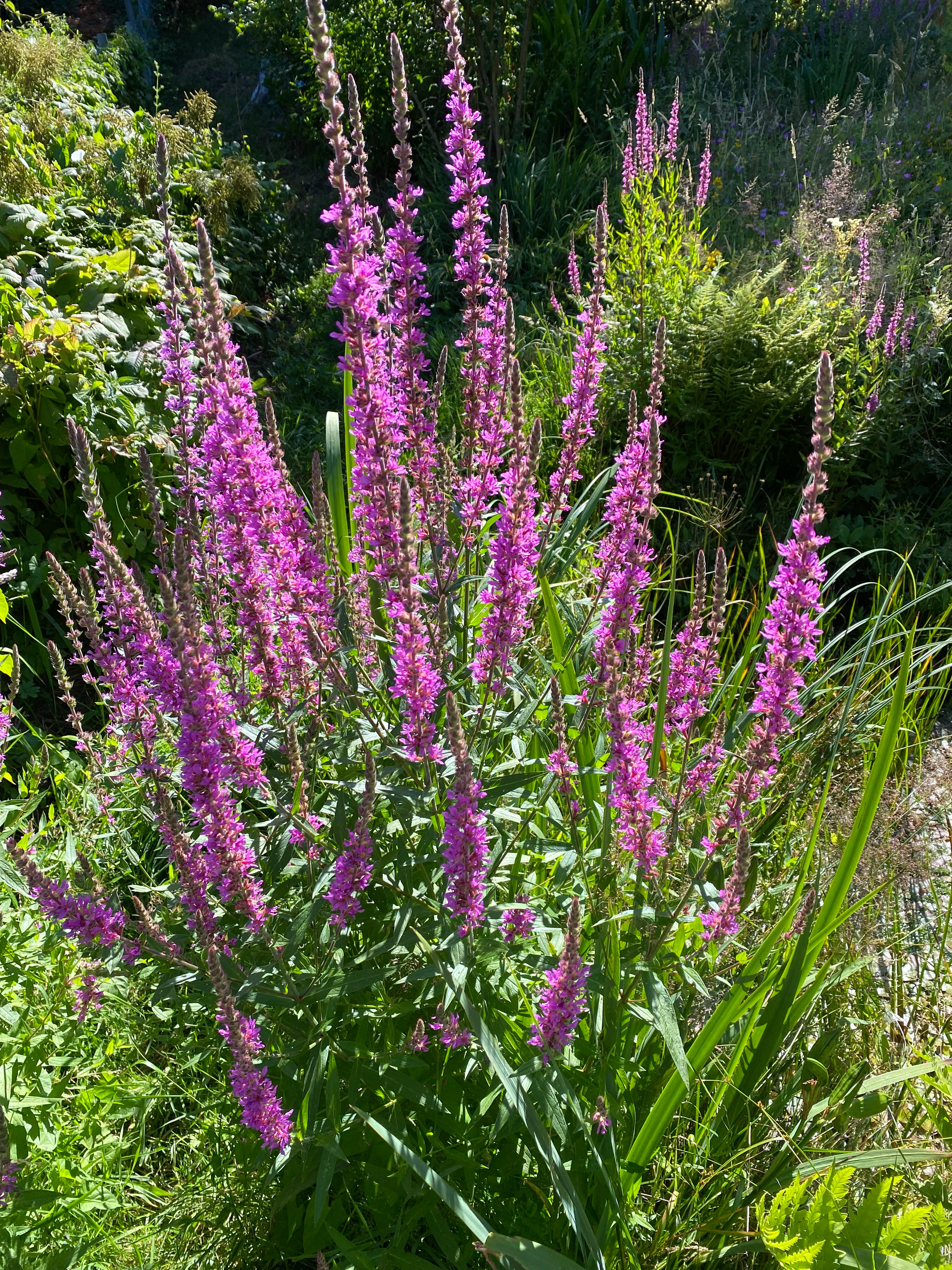
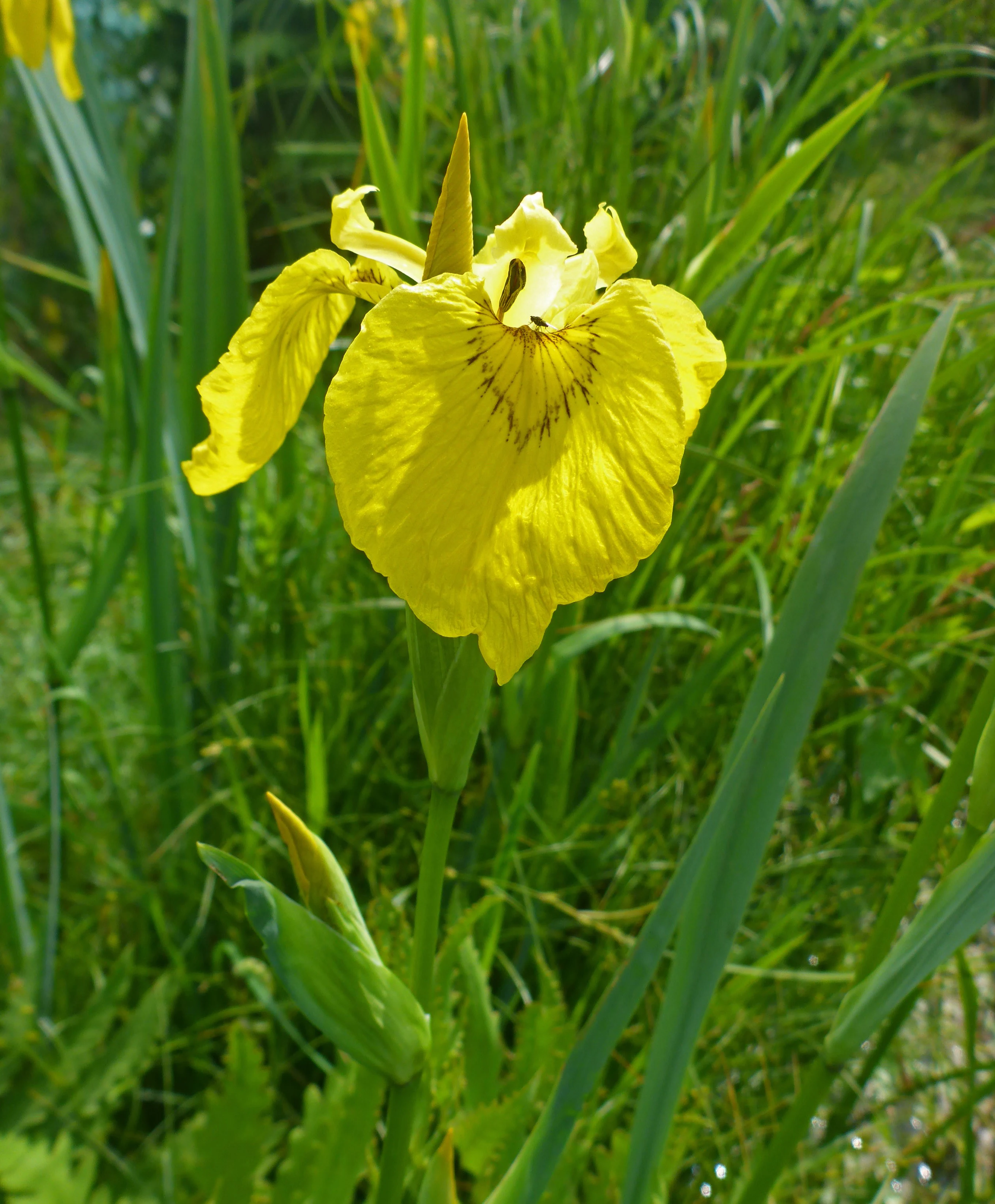
The understory and ground vegetation reflect the moisture gradient running through the site. Blackberry can dominate parts of the herb layer in the alder forests, while wet fallow areas in the northern part of the reserve support characteristic species such as wood club-rush (Waldsimse) and reed sweet-grass (Rohrglanzgras). Along the brook itself, wetland plants including purple loosestrife (Blutweiderich), meadowsweet (Mädesüß), and yellow flag iris (Sumpf-Schwertlilie) contribute to a diverse riparian flora, with meadowsweet in particular noted for attracting insects.
The southern part of the reserve introduces a contrasting dry grassland component, where lean soils support a species-richer meadow community maintained by horse grazing and rotational mowing. Old pollarded willows scattered through the reserve add another structural and ecological dimension, providing nesting sites, deadwood resources, and traditional cultural character. Together these habitats form a small but ecologically representative mosaic of wet and dry conditions within an otherwise heavily modified landscape.
Hummelsbach Nature Reserve wildlife and species highlights
Although the source material does not record detailed species inventories, the habitat structure of Hummelsbach supports a wide range of typical lowland brook and alder forest wildlife. The alder floodplain forest, with its abundance of deadwood, fallen trees, and old pollarded willows, provides breeding, shelter, and foraging habitat for numerous woodland birds, cavity-nesting species, and small mammals.
The wet fallow areas and brook margins create conditions for amphibians and aquatic invertebrates, especially where shallow, slow-moving water and leaf litter accumulate. The presence of meadowsweet along the brook is explicitly noted as attracting insects, suggesting that the reserve plays a meaningful role as a local insect habitat. The mix of wet woodland, damp ditches, and dry grassland also supports a variety of pollinators and other invertebrates across the moisture gradient.
Horse grazing on the southern grassland helps maintain open conditions that benefit butterflies, wild bees, and ground-nesting birds, while the surrounding woodland edges provide transitional habitat for larger mammals moving through the broader landscape between Ratingen and the Bergisches Land.
Hummelsbach Nature Reserve conservation status and protection priorities
Hummelsbach holds regional conservation significance as one of the few protected near-natural sections of a sandy lowland brook in an otherwise heavily urbanized and industrialized part of North Rhine-Westphalia. Its 13-hectare footprint may be small, but its ecological role in connecting the upland Bergisches Land with the Rhine floodplain through functioning alder floodplain forest gives it disproportionate value.
The reserve has been formally protected since 1984 and was re-anchored in the Mettmann district landscape plan in 2012, ensuring continued management oversight by the Lower Landscape Authority. Its IUCN Category IV designation reflects its role as a Habitat/Species Management Area, focused on maintaining and developing specific habitat features rather than allowing complete ecological non-intervention. Official state-level assessments highlight the brook, its alder floodplain forest, and the wet fallow and dry grassland areas as the core value-defining features.
Active conservation measures include retention and restoration of the natural brook course, mitigation of deep erosion in the stretch near the A3, control of the water balance around alder stands, near-natural forest management, and rotational mowing of fallow grasslands on a roughly three-year cycle. Together, these measures aim to keep Hummelsbach functioning as a stable, ecologically representative element of the local biotope network.
Hummelsbach Nature Reserve cultural meaning and human context
The Hummelsbach reserve reflects centuries of human interaction with lowland brook landscapes in western Germany. The presence of old pollarded willows along the brook is a direct echo of traditional riparian management, in which willows were regularly cut for basket-making, fodder, or fuel, shaping both the landscape and its associated wildlife communities.
The southern part of the reserve continues a more recent but still traditional land use pattern, with dry grassland maintained through horse grazing and periodic mowing. This combination of woodland, brook, pasture, and old cultivated trees connects the modern nature reserve to a longer history of mixed use in the Bergisches Land and Lower Rhine border region.
Being situated just north of Ratingen's town center and close to major roads and the Breitscheid motorway interchange, Hummelsbach also illustrates the cultural shift toward preserving small but ecologically rich natural areas within densely populated industrial regions of Germany.
Top sights and standout views in Hummelsbach Nature Reserve
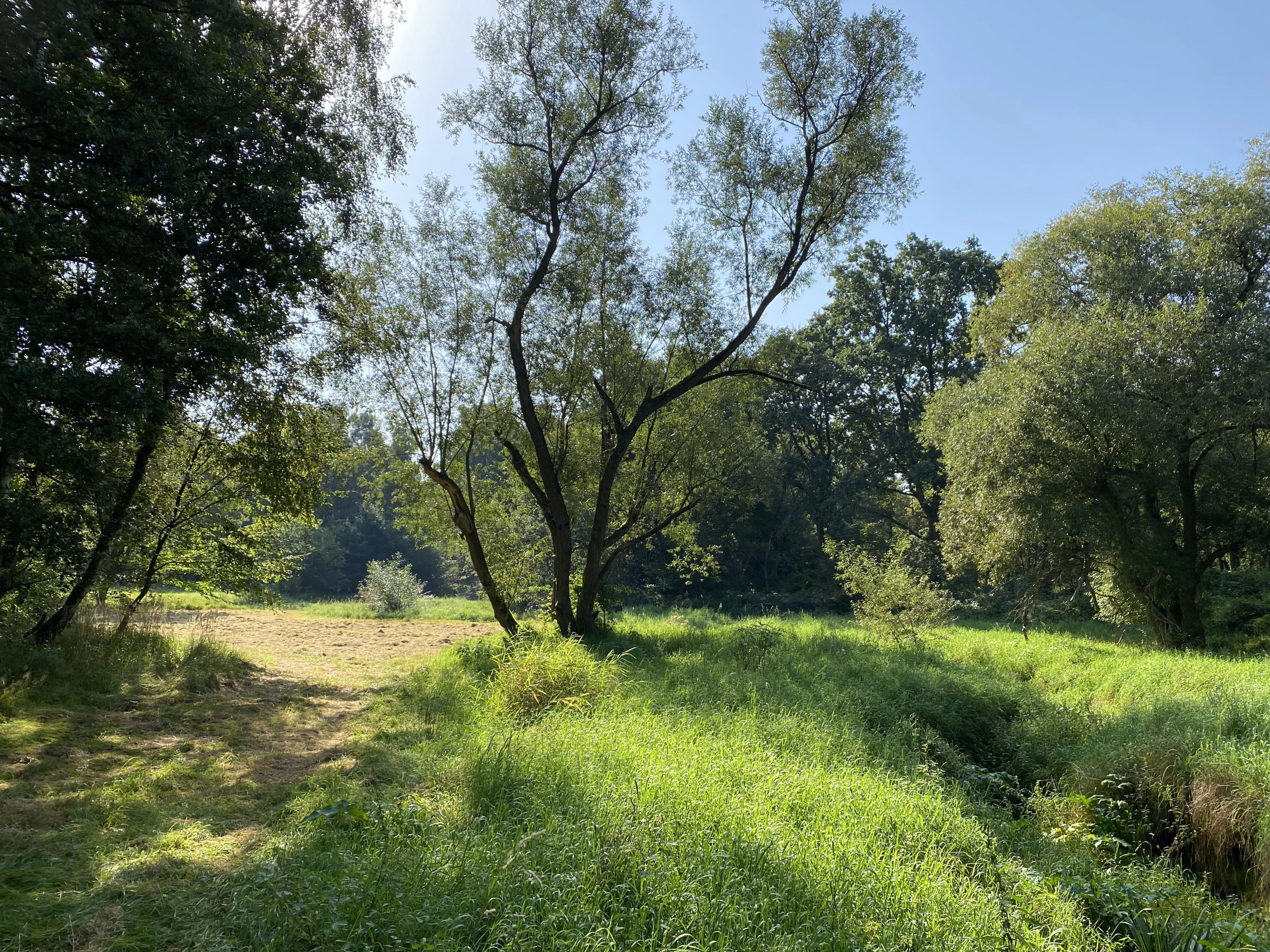
Hummelsbach's highlights include its structurally rich sandy brook with steep banks, fallen trees, and patches of near-natural alder floodplain forest, all within a compact 13-hectare footprint. The reserve's mosaic of alder woodland, wet fallow land with wood club-rush and reed sweet-grass, and dry grassland grazed by horses gives it exceptional habitat diversity for its size.
Its value is amplified by its role as a biotope link between the hill forests of the Bergisches Land and the open Rhine floodplain, and by its direct adjacency to the Ratinger Waldsee reserve to the southwest. Together, these features make Hummelsbach a small but significant stronghold for sandy brook and alder floodplain habitats in one of Germany's most densely populated regions.
Best time to visit Hummelsbach Nature Reserve
Because Hummelsbach is a compact lowland nature reserve at around 60 meters elevation, its seasonal character shifts primarily through vegetation and water conditions rather than dramatic weather changes. Spring and early summer typically bring the richest display of brook-side flora, with meadowsweet in bloom and active insect life along the water's edge, while the wet fallow areas show their strongest green growth.
Late spring through summer is generally the most rewarding period for observing the full habitat mosaic, when the contrast between the dark alder forest, lush wet areas, and the open southern dry grassland is most pronounced. Autumn highlights the alder-dominated canopy and the brook corridor, and is often the best time to appreciate fallen leaves and woody debris along the banks. Winters tend to be mild and quiet, with the wet forest and brook retaining much of their structural character year-round.