
Mori Atlas logo
Nature reserveIbenkuppe

Geographic analysis of the Muschelkalk plateau, the historic Abrißwand landslide scar, and the Rosoppe valley.

Ibenkuppe Nature Reserve: Mapping the Limestone Escarpments and Forested Slopes of Thuringia

(Naturschutzgebiet Ibenkuppe)

Ibenkuppe is a compact protected natural area in the Eichsfeld district of Thuringia, showcasing a distinct Muschelkalk cuesta landscape. This reserve covers 29 hectares of steep, fully forested slopes and valley pasture fragments defined by the erosive action of the Rosoppe stream. The site serves as a vital geological example of limestone cliff habitats and mass-movement landforms within the broader central German geography.

limestone escarpmentmuschelkalkforested slopesvalley landscapenature reserveeichsfeld
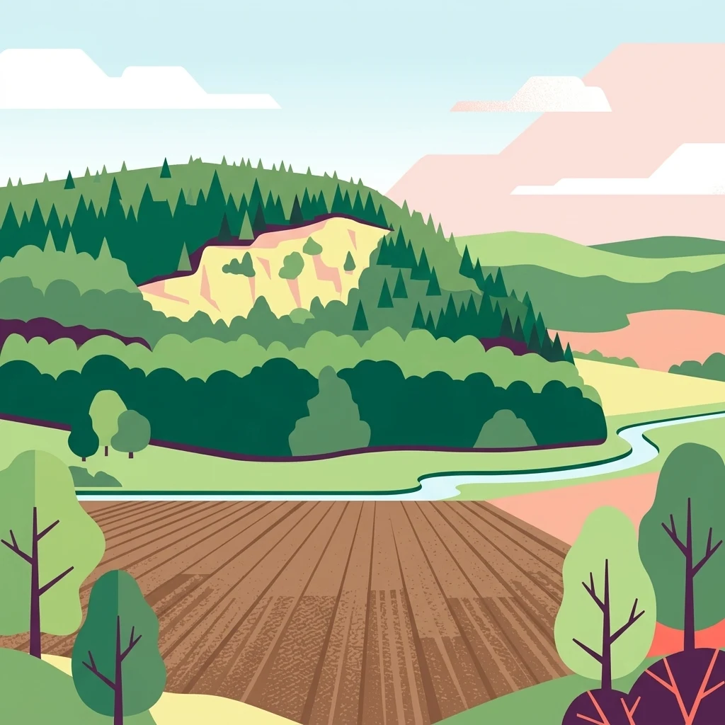
Digital illustration of a hilly landscape with a forested ridge, a visible rock face, a winding stream, and an agricultural field in the foreground.

Ibenkuppe

Nature reserve

Park overview

Structured park overview, official facts, and landscape profile for Ibenkuppe Nature Reserve

Ibenkuppe Nature Reserve park facts, protected area profile, and essential visitor context

Review the core facts for Ibenkuppe Nature Reserve, including designation, size, terrain, visitor scale, habitats, and operating context in one park-focused overview.

About Ibenkuppe Nature Reserve

Ibenkuppe is a small but geologically expressive nature reserve located in the Eichsfeld region of northwestern Thuringia. The protected area lies along the western escarpment of the Obereichsfelder Muschelkalkhöhe, a stepped limestone plateau that rises to roughly 500 meters in the surrounding area. The Ibenkuppe itself is a south-pointing spur approximately 450 meters in elevation, surrounded by the eroded tributary valleys of the Rosoppe river and its small inflows to the north and south.

What makes the reserve distinctive is the combination of geological exposure and ecological continuity. The slopes are composed of Wellenkalk, capped locally by Middle Muschelkalk, and display classic cuesta morphology, with the forested scarp sloping sharply westward, southward, and southeastward toward the valley floor. A large relict landslide scar on the western flank reveals the area's geomorphic history, while perennial forest cover stabilizes the steep terrain. By contrast, the upper plateau opens into farmland, marking a sharp transition from contiguous woodland to the open Eichsfeld heights.

Although modest in size, the reserve provides a representative cross-section of the stepped limestone landscape that borders the Thuringian Basin. It is framed by a network of regional roads, including the L 1007 along its western edge, the L 1006 to the north, the K 230 a short distance to the south, and the L 2022 to the southwest, placing it within reach of nearby villages such as Flinsberg, Martinfeld, and the historic settlement remains of Ascherode.

Quick facts and research context for Ibenkuppe Nature Reserve

Ibenkuppe is a designated nature reserve (Naturschutzgebiet) in the Eichsfeld district of Thuringia, assigned the official identifier 66. It has been protected under German nature conservation law since 1997 and spans roughly 29 hectares.

The site's defining landscape features are the steep slopes of the Ibenkuppe spur and the deeply incised Rosoppe valley, with exposures of Lower and Middle Muschelkalk limestone. Its name traces to the yew tree (Eibe), historically common in the area. The reserve also forms part of a broader landscape mosaic that includes old orchards and meadow fragments in the lower valley.

Protection and recognition

Review verified terrestrial protection measures and international recognition records for Ibenkuppe.

Ibenkuppe Protection Status and Documented Conservation Scope

Comprehensive protected area records outline the documented terrestrial conservation status and administrative designation history of Ibenkuppe. Official recognition details and management scope provide clear context for ongoing preservation efforts across the natural landscape.

Protection details

Protection scope
Terrestrial
Park context

Deeper park guide and search-rich context for Ibenkuppe Nature Reserve

Ibenkuppe Nature Reserve history, landscape, wildlife, and travel context

Explore Ibenkuppe Nature Reserve through its history, landscape character, ecosystems, wildlife, conservation priorities, cultural context, and seasonal travel timing in a structured park guide built for atlas discovery and search intent.

Why Ibenkuppe Nature Reserve stands out

The reserve is best known for its strikingly steep, fully wooded limestone slopes, the deeply cut Rosoppe valley, and a prominent mass-movement scar (Abrißwand) on the western flank of the spur. It is also notable as a compact example of a Thuringian Muschelkalk cuesta landscape, where forested plateau edges meet traditionally used valley pastures.
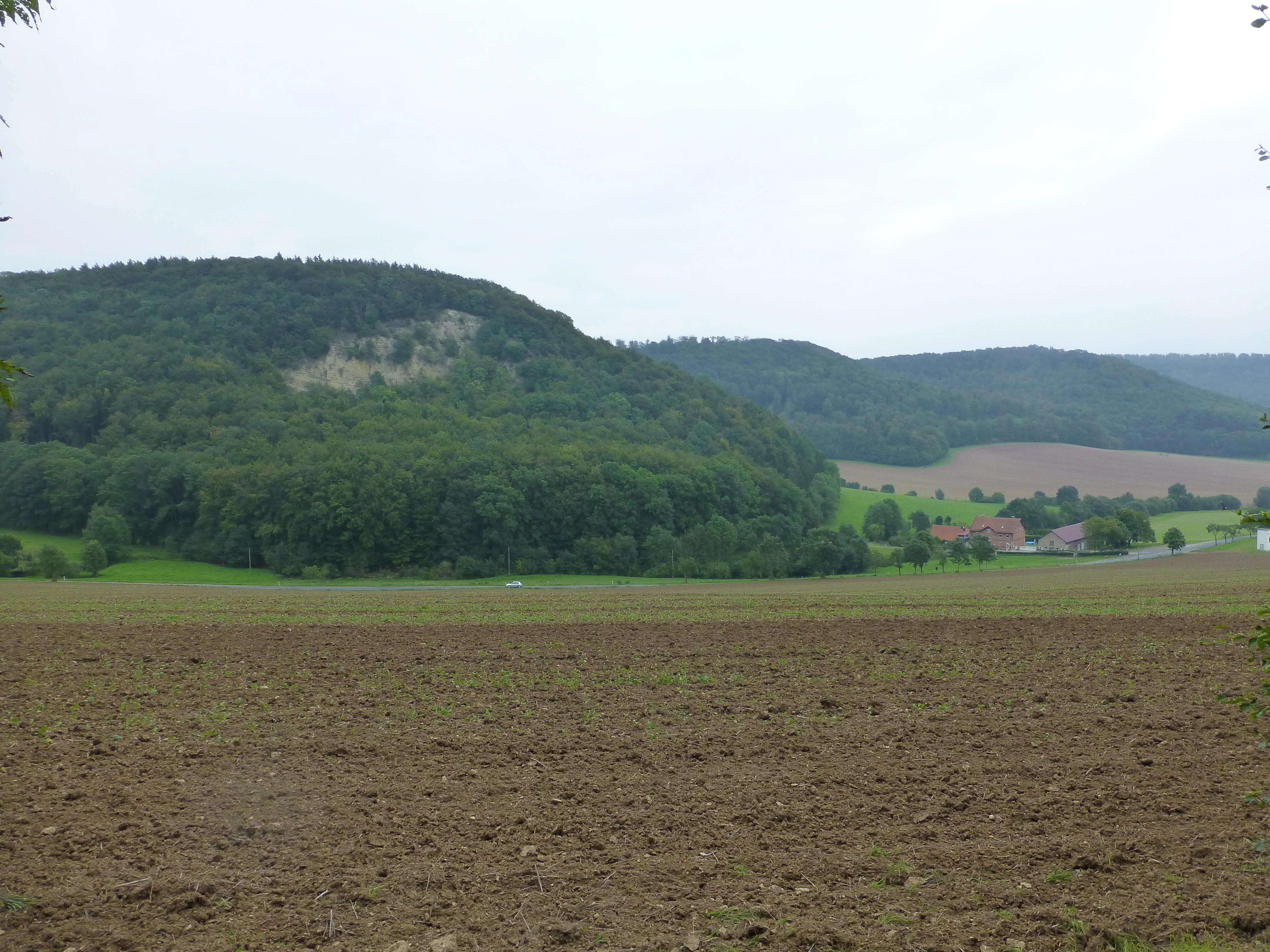
A wide view of a rural landscape with a large plowed field in the foreground, a forested hill with a visible rocky outcrop on the left, and a small farmstead tucked at the base of the hills.
The Ascherode farmstead nestled beneath the forested slopes of the Ibenkuppe.

Ibenkuppe Nature Reserve history and protected-area timeline

German nature conservation law has recognized the area formally since 1997, when the roughly 29-hectare zone was designated as a nature reserve (Naturschutzgebiet) under the identifier 66. The designation built on earlier scientific work carried out in the early 1990s, including a 1993 study commissioned by a local authority that evaluated the site's flora, vegetation, grasshoppers, birds, amphibians, and reptiles.

Beneath the modern conservation history lies an older human footprint. Below the Ibenkuppe lay the small settlement of Ascherode, today reduced to a single farmstead, with its associated mill demolished in 1975. This reflects a long pattern of settlement contraction in marginal valley landscapes, where the steep wooded slopes have often preserved a more continuous natural cover than the plateau top.

Ibenkuppe Nature Reserve landscape and geographic character

The landscape of the Ibenkuppe reserve is shaped by the contrast between plateau and valley. The spur itself rises to about 450 meters and forms part of the western rim of the Obereichsfeld Muschelkalk plateau, which climbs to roughly 500 meters elsewhere in the area. Erosion by the Rosoppe and its small tributaries has cut the slopes into three steep flanks, dropping westward, southward, and southeastward into the valley system below.

Geologically, the spur is built of well-bedded Lower Muschelkalk (Wellenkalk), with harder Middle Muschelkalk forming the upper cap. This combination produces the characteristic stepped escarpment profile typical of the Thuringian cuesta landscapes. The western face carries the reserve's most dramatic landform: the Abrißwand, a detachment scar whose top sits several meters below the surrounding ridge line, with large debris cones massed at its foot.

Vegetation follows the topography tightly. The steep slopes remain fully forested, while the plateau transitions into farmland. In the valley bottom, near the Rosoppe stream, smaller fragments of traditional meadow and pastureland survive along the edges of the reserve, creating a fine-grained mosaic between woodland, cliff, and open ground that defines the area's scenery.

Ibenkuppe Nature Reserve ecosystems, habitats, and plant life

Ecologically, the reserve sits at the lowland margin of the Thuringian Basin, where forested limestone escarpments meet valley floor habitats. Its roughly 29 hectares preserve an unusually complete sequence of these slope and valley environments, including closed-canopy forest on the steep slopes, cliff and scree microhabitats along the Abrißwand, and small relict patches of orchard meadow and pastureland in the lower valley.

The plateau-edge forest is the reserve's ecological backbone, maintaining vertical structure and habitat continuity across an otherwise intensively farmed upland. In the valley, the remaining orchard meadows and pastures reflect the long-running interface between woodland, agriculture, and valley settlements. The combination of exposed rock, debris slopes, mature forest, and semi-open valley land gives the small area a disproportionately rich structural diversity.

The site's moss flora has been studied in detail, with documented inventories highlighting the importance of the cool, shaded limestone habitats for bryophyte communities. While the reserve's overall area is modest, its variety of moisture regimes, exposures, and substrates supports distinctive plant communities on both the cliff faces and the valley floor.

Ibenkuppe Nature Reserve wildlife and species highlights

Expert studies of the Ibenkuppe, including a 1993 baseline inventory prepared for the reserve's designation, surveyed the area's grasshoppers, birds, amphibians, and reptiles alongside its flora and vegetation. These studies established the site as a meaningful local refuge for typical species of Thuringian limestone escarpment habitats.

Forest birds associated with mature deciduous woodland on steep slopes, reptile and amphibian species using the rocky debris areas and seeping valley margins, and grasshopper communities of semi-open valley meadows all form part of the area's known fauna. Although detailed population figures are not broadly reported, the reserve's mosaic of forest, cliff, and meadow fragments provides a continuous set of habitats that supports this typical, regionally characteristic species assemblage.

Ibenkuppe Nature Reserve conservation status and protection priorities

The Ibenkuppe has been formally protected as a nature reserve (Naturschutzgebiet) since 1997, under the designation number 66 in the Eichsfeld district's inventory. Its conservation value lies in the preservation of a compact, structurally diverse section of the Obereichsfeld Muschelkalk escarpment, an otherwise fragmented and largely agricultural landscape.

By keeping the steep slopes continuously forested and retaining small remnants of valley pasture and orchard habitat, the reserve maintains ecological connectivity and protects the geomorphological features, including the Abrißwand, that would otherwise be vulnerable to erosion or land-use change. The site's bryological and faunal surveys underline its role as a reference area for understanding and conserving the species communities of the Thuringian limestone plateau margins.

Ibenkuppe Nature Reserve cultural meaning and human context

The reserve's name itself carries cultural memory. Ibenkuppe derives from the regional use of Eibe (yew), a tree that historically grew here and lent its name to the spur. Beneath the slopes also lies the remnant of Ascherode, once a small medieval settlement now reduced to a single farmstead; its mill was demolished in 1975, marking a quiet chapter of rural depopulation in the Eichsfeld valleys.

Today the area sits within a cultural landscape where forestry, small-scale farming, and historic road networks, including the L 1007, L 1006, K 230, and L 2022, frame the protected slopes. The reserve thus reads not only as a natural site but also as a small, layered cultural environment shaped by centuries of interaction between villagers and a demanding limestone terrain.

Top sights and standout views in Ibenkuppe Nature Reserve

The Ibenkuppe reserve concentrates several high-value features into a small footprint: steep, fully forested Muschelkalk slopes, the prominent Abrißwand landslide scar on its western flank, and the deeply incised Rosoppe valley with its surviving fragments of valley pasture. The combination of geological exposure, mature forest, and traditional land use makes it a representative microcosm of the Thuringian limestone landscape.

Best time to visit Ibenkuppe Nature Reserve

Spring and early summer tend to be the most rewarding periods for experiencing the Ibenkuppe area, when valley meadows and remnant orchard patches in the Rosoppe valley are fresh and birdlife along the forest edges is most active. Late summer and early autumn bring stable, clear weather that highlights the dramatic contrast between the wooded slopes and the open Eichsfeld plateau above. Winter visits can reveal the geological structure of the Abrißwand and the layered Muschelkalk most clearly, when foliage thins and bare rock is more visible.


Monthly climate preview

Trace monthly weather patterns and long-term temperature averages for Ibenkuppe

Ibenkuppe Climate Normals and Annual Temperature Rhythm

Representative coordinate measurements reveal the long-term annual temperature and precipitation rhythm across Ibenkuppe. Examining the complete monthly profile provides deeper context for the recorded climate normals at this protected location.
Annual mean8 °C
-1 °C18 °C
Jan-1°
Feb
Mar
Apr
May12°
Jun16°
Jul18°
Aug18°
Sep14°
Oct
Nov
Dec
Warmest month
July

18.2 °C

Coolest month
January

-0.9 °C

Wettest month
July

2.6 mm/day

Driest month
April

1.5 mm/day

Park location guide

Geography guide, regional context, and park location map for Ibenkuppe Nature Reserve

Ibenkuppe Nature Reserve park geography, regions, and map view in Germany

Understand where Ibenkuppe Nature Reserve sits in Germany through a broader geographic reading of the surrounding landscape, nearby location context, and its mapped position within the national park landscape.

How Ibenkuppe Nature Reserve fits into Germany

Germany is a federal republic in Western and Central Europe with a population of over 83 million across sixteen constituent states. It is Europe's largest economy by nominal GDP and a major global exporter and importer. The capital is Berlin, and the country borders Denmark, Poland, Czech Republic, Austria, Switzerland, France, Luxembourg, Belgium, and the Netherlands.

Wider geography shaping Ibenkuppe Nature Reserve in Germany

Germany is located in Western and Central Europe, spanning 357,022 km². It borders Denmark to the north, Poland and the Czech Republic to the east, Austria and Switzerland to the south, and France, Luxembourg, Belgium, and the Netherlands to the west. The country has coastlines on the Baltic Sea and North Sea to the north, with the Alps located in the southern region.

Map view of Ibenkuppe Nature Reserve

Use this park location map to pinpoint Ibenkuppe Nature Reserve in Germany, understand its exact geographic position, and read its mapped placement within the surrounding landscape more clearly.

Pigeon | © OpenStreetMap contributors

Location context for Ibenkuppe Nature Reserve

Thuringia

Examine the terrain, steep escarpments, and protected habitats defining Ibenkuppe

Ibenkuppe Photos and Visual Landscape Guide: Exploring Forested Limestone Scenery

Visual documentation captures the rugged limestone escarpments and densely wooded slopes of Ibenkuppe. Photographic records reveal the dramatic structure of the Rosoppe valley and surrounding protected terrain.

A wide view of a rural landscape with a large plowed field in the foreground, a forested hill with a visible rocky outcrop on the left, and a small farmstead tucked at the base of the hills.

A steep, light-colored limestone rock face embedded in a dense, green forest hillside.

Park atlas

Compare surrounding regional terrain and adjacent limestone conservation areas

Other Parks Near Ibenkuppe And Related Protected Landscapes To Explore Next

Browsing other parks near Ibenkuppe helps connect isolated limestone escarpment reserves with broader regional geography. Comparing adjacent protected landscapes provides a clearer picture of the wider terrain across the surrounding district.
Watercolor painting of a rolling forested ridge under a pale sky.
Nature reserveThuringia
About 7.7 km away#1 closest

Northwest

Lengenberg Nature Reserve: A Geographical Overview of the Eichsfeld Ridge

Protected beech and yew woodlands in Thuringia, Germany

The Lengenberg Nature Reserve forms a prominent, fully forested ridge within the Eichsfeld region of Thuringia. Renowned for hosting one of the most substantial yew populations in central Europe, the reserve showcases a geological transition between shell limestone and red sandstone. This mapping of the terrain provides insight into the ecological structure of the Eichsfeld-Hainich-Werratal area.

Area
0.26 km²
Established
1961
Relief
Mountain
Climate
Temperate
Wide watercolor illustration of green trees and hills with purple mountains in the background under a pale sky.
Nature reserveThuringia
About 8.9 km away#2 closest

Southwest

Stein, Rachelsberg, Gobert: A Protected Limestone Landscape in Western Thuringia

Mapping a historic nature reserve and beech forest complex

Stein, Rachelsberg, Gobert stands as a key protected area within Thuringia. This nature reserve offers deep insights into limestone ridge geography, historic border woodland continuity, and diverse habitats ranging from dry grasslands to tufa springs and orchid-rich beech forests.

Area
7.16 km²
Established
1999
IUCN
IV
Relief
Mountain
Nature reserveThuringia
About 10 km away#3 closest

West

Stein, Rachelsberg Nature Reserve: Mapped Muschelkalk Terrain in Thuringia

Protected low mountain hills and forested karst landscapes

The Stein, Rachelsberg nature reserve in Thuringia represents a protected mosaic of Muschelkalk ridges and Buntsandstein valleys. Its geography is defined by strongly broken relief, rocky outcrops, and a unique ring of forested summits including the Dieberg and Goburg, forming an essential link in regional conservation networks across the Thuringia and Hesse border.

Area
5.06 km²
Established
2023
Relief
Mountain
Climate
Temperate
Watercolor painting of a green landscape with rolling hills, a winding path or stream, and trees on both sides against a light background.
Nature reserveWerra-Meißner-Kreis
About 11 km away#4 closest

West

Kalkklippen südlich des Iberges Nature Reserve and Muschelkalk Landscape Atlas

Protected beech forests and active landslide topography

This nature reserve in Werra-Meißner-Kreis reveals an active Muschelkalk ridge characterized by steep limestone cliffs and boulder-strewn talus slopes. Study the site's unique ecological composition, featuring noble hardwood-rich beech forests and native European yew populations that highlight the region's complex natural history and geological significance.

Area
0.473 km²
Established
1995
IUCN
IV
A horizontal watercolor illustration depicting gentle rolling hills, grassy meadows, and distant mountain silhouettes in muted pastel tones.
Nature reserveThuringia
About 11 km away#5 closest

West

Röhrsberg - Hasenwinkel - Mühlberg: Mapping the Protected Landscapes of Thuringia

Geological ridge systems and native forest habitat networks.

The Röhrsberg - Hasenwinkel - Mühlberg nature reserve represents a significant protected area in Thuringia, characterized by the juxtaposition of Muschelkalk limestone hills and Zechstein dolomite ridges. This site offers a concentrated view of regional terrain, shifting from closed beech forests to open juniper heaths. It serves as an essential geographic reference for understanding the ecological mosaic of the lower Werra hill country.

Area
4.51 km²
Established
1999
IUCN
IV
Relief
Upland
A wide watercolor painting showing a gentle river winding through green hills with pink flowering trees and pale blue mountains in the background.
Nature reserveUnstrut-Hainich-Kreis
About 12 km away#6 closest

South

Klosterschranne, Faulunger Stein Nature Reserve: Mapped Boundaries and Regional Geography

A protected Muschelkalk valley landscape in the Thuringia region

Klosterschranne, Faulunger Stein consists of a protected woodland and rock environment shaped by limestone erosion. The reserve features sharp valley spurs, calcareous springs, and cliffs that rise up to thirty meters, anchoring a larger network of habitats within the Upper Eichsfeld plateau. Users can examine the layered conservation status and distinct topographic features that define this ecologically significant German site.

Area
2.983 km²
Established
1996
IUCN
IV
Relief
Mountain
A horizontal watercolor painting showing a calm pond with distant hills, trees on the left, and reeds on the right under a soft, sunset-colored sky.
Nature reserveWerra-Meißner-Kreis
About 13 km away#7 closest

South

Kiesteich unter der Aue’schen Kugel: Protected Nature Reserve and Wetland Landscape

Regional geography and habitat mapping in Werra-Meißner-Kreis

Kiesteich unter der Aue’schen Kugel is a specialized nature reserve that safeguards essential wetland habitats within the Werra river corridor. This protected area features two former gravel lakes shielded by dense vegetation, serving as a critical refuge for water-dependent species. Its inclusion in the Auenverbund Werra landscape protection network underscores its role in regional ecological connectivity and river-basin conservation efforts.

Area
0.093 km²
Established
1984
IUCN
IV
Access
Highly restricted
A soft watercolor painting of a meadow landscape, featuring a dirt path winding through wildflowers toward green trees with rolling hills in the background.
Nature reserveThuringia
About 13 km away#8 closest

East

Kühmstedter Berg Nature Reserve: A Protected Landscape and Archaeological Site in Thuringia

Examining forest ecology and medieval earthworks on a central German ridge

Kühmstedter Berg stands as a protected nature reserve in Thuringia, characterized by its Muschelkalk geology and established beech-rich oak and hornbeam woodland. This site maps a critical intersection of natural forest habitat and historical land use, featuring visible remnants of a Bronze Age tumulus cemetery and the defensive lines of the medieval Mühlhäuser Landgraben.

Area
0.387 km²
Established
1961
Relief
Upland
Scope
Terrestrial

Common questions about visiting, size, designation, and location context for Ibenkuppe Nature Reserve

Ibenkuppe Nature Reserve FAQs for park facts, access, geography, and protected area context

Find quick answers about Ibenkuppe Nature Reserve, including protected-area facts, park geography, trail and visitor context, and how the park fits into its surrounding country and regional landscape.
MoriAtlas Explorer

Continue Your Protected Areas Search Across the Global Atlas

Deepen your exploration by continuing the structured search for national parks and protected areas worldwide. Utilize the comprehensive filtering capabilities to compare different conservation landscapes and refine your understanding of global park geography. Discover more about the distribution and characteristics of protected natural areas.

Global natural geography