
Mori Atlas logo
Nature reserveIm Dulbaum bei Alsbach

Examining the ecological geography and mapped boundaries of this unique Rhine Plain nature reserve

Im Dulbaum bei Alsbach Nature Reserve: A Protected Inland Sand Dune Landscape in Hesse, Germany

(Naturschutzgebiet „Im Dulbaum bei Alsbach“)

Im Dulbaum bei Alsbach is a protected nature reserve situated in the Hessian section of the Upper Rhine Plain. This area preserves a rare fragment of inland sand dune terrain, characterized by calcareous dry grasslands and specialized scrub habitats that have become increasingly uncommon in central Europe. The site functions as a vital ecological stepping stone, connecting fragmented sandy ecosystems across the Bergstraße region through its designated status as a Natura 2000 and FFH territory.

sand grasslandsinland dunesdry grasslandcalcareous sand habitatssteppe-like vegetationnature reserve
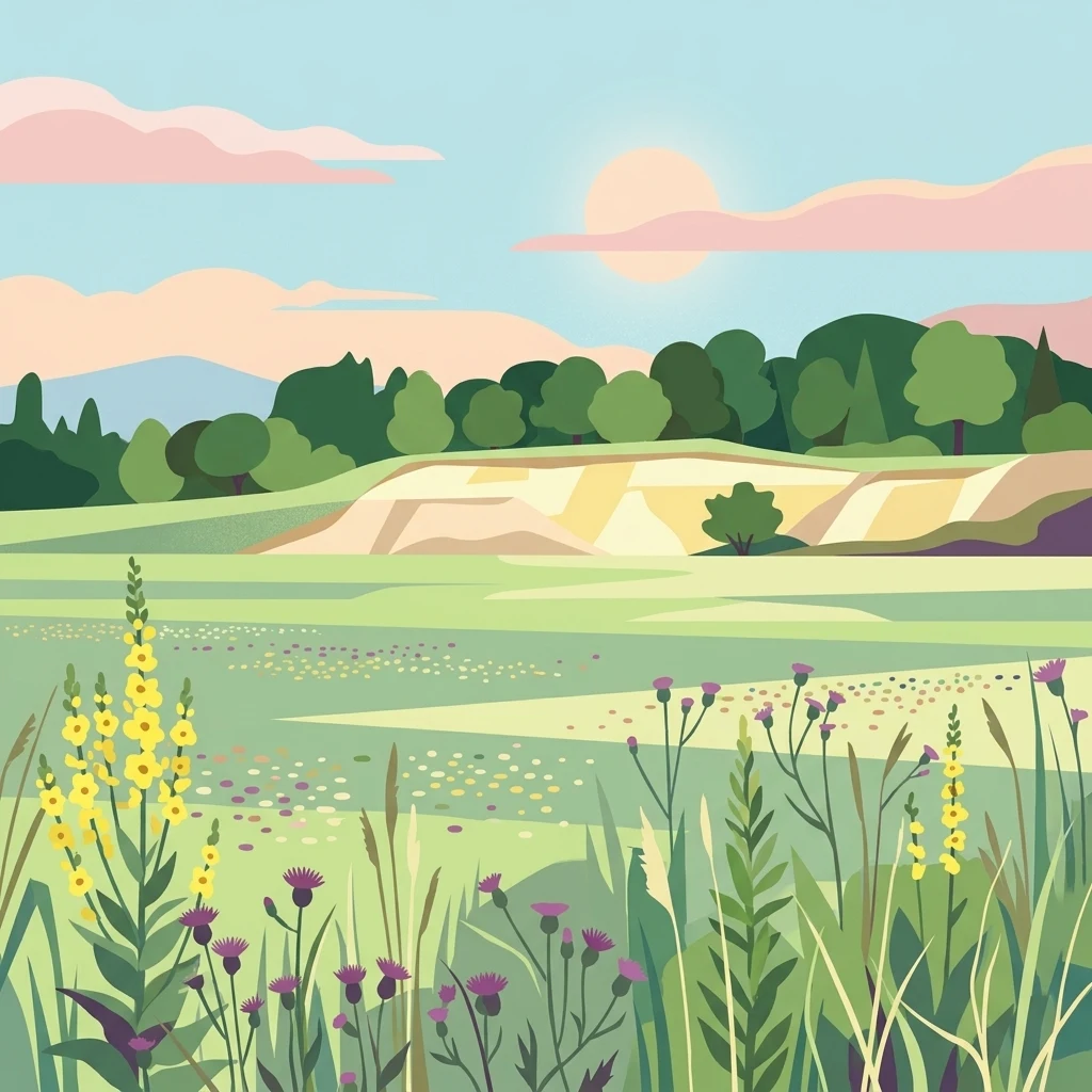
An illustration showing a semi-arid landscape with foreground wildflowers, a sandy dune, and a background of green trees under a soft sun.

Im Dulbaum bei Alsbach

Nature reserve

Park overview

Structured park overview, official facts, and landscape profile for Im Dulbaum bei Alsbach

Im Dulbaum bei Alsbach park facts, protected area profile, and essential visitor context

Review the core facts for Im Dulbaum bei Alsbach, including designation, size, terrain, visitor scale, habitats, and operating context in one park-focused overview.

About Im Dulbaum bei Alsbach

Im Dulbaum bei Alsbach is a compact nature reserve in southern Hesse, Germany, that protects what remains of a once extensive inland dune landscape in the Hessian Rhine Plain. The reserve sits northwest of the village of Alsbach, in the natural region known as the Seeheimer Rinne, just a short distance from where the flat Rhine Plain rises into the wooded slopes of the Bergstraße. Although it covers only about 9.2 hectares, the site has an unusually high ecological density because it preserves habitats that have disappeared across most of the surrounding agricultural lowland.

The defining feature of the reserve is its calcareous, wind-deposited sand substrate, which supports dry sand grasslands and smaller patches of so-called subpannonian steppe turf. These open, sunny habitats are maintained by sheep grazing, which prevents shrubs and trees from taking over and keeps the sandy ground exposed. This grazing regime, introduced around the year 2000, gradually replaced an earlier period when parts of the area had been cultivated as arable fields or mined for sand. The result is a young but increasingly coherent ecological recovery, in which characteristic sandgrass flora and associated insect and reptile communities are re-establishing themselves.

Ecologically, Im Dulbaum bei Alsbach belongs to a network of sandy grassland fragments along the Rhine that includes the Seeheimer Düne, the Pfungstädter Düne, and the Düne „Neben Schenkenäcker“ between Seeheim and Jugenheim. In regional conservation planning, the reserve is treated as a stepping stone, an isolated but ecologically functional island, that helps link these scattered dry habitats. Its dual designation as a Hessian Naturschutzgebiet and as an EU Natura 2000 FFH site underlines its importance for both national biodiversity policy and European habitat conservation.

Visitors approaching the reserve will notice that it is bordered by intensively farmed fields on most sides and by the A5 motorway rest area at Alsbach to the east. This surrounding land-use pressure is part of what makes the protection of Im Dulbaum so important: without active management, the open dune landscape would rapidly revert to scrub or be further disturbed by nutrient and pesticide inputs from neighboring farmland.

Quick facts and research context for Im Dulbaum bei Alsbach

Im Dulbaum bei Alsbach is a German nature reserve located in the Hesse district of Landkreis Darmstadt-Dieburg, within the community of Alsbach-Hähnlein. It lies in the Hessian Rhine Plain northwest of Alsbach, near the Bergstraße transition to the Odenwald. The reserve covers around 9.2 hectares of formerly quarried inland sand terrain. It was provisionally secured in 1992 and formally designated as a nature reserve on 25 November 1994; since 16 January 2008 it has also been an EU Natura 2000 site under the FFH code 6217-303. Administratively it is classified as IUCN Category IV, reflecting its focus on habitat and species management rather than wilderness protection.

Protection and recognition

Documented terrestrial protection history and official Natura 2000 records

Im Dulbaum bei Alsbach Protection Status and International Recognition Data

Im Dulbaum bei Alsbach holds established terrestrial protection status dating back to 1994 with verified Natura 2000 recognition records. Structured administrative entries assemble designation timelines and international recognition frameworks for conservation research.

International recognition

Protection details

Protection scope
Terrestrial
Designated year
1994
Transboundary protection
No
WDPA ID
163858
Park context

Deeper park guide and search-rich context for Im Dulbaum bei Alsbach

Im Dulbaum bei Alsbach history, landscape, wildlife, and travel context

Explore Im Dulbaum bei Alsbach through its history, landscape character, ecosystems, wildlife, conservation priorities, cultural context, and seasonal travel timing in a structured park guide built for atlas discovery and search intent.

Why Im Dulbaum bei Alsbach stands out

Im Dulbaum bei Alsbach is primarily known for its dry, calcareous sand grasslands and small patches of subpannonian steppe-like vegetation, which are among the most threatened habitat types in central Europe. The reserve preserves a remnant of the inland dune belt that runs through the Upper Rhine Plain and is one of the few surviving examples of this kind of landscape in southern Hesse. It is equally valued for the unusual concentration of heat-loving, sandy-ground specialist plants and insects that have persisted here despite the surrounding agricultural intensification, the bordering motorway rest area, and the site's earlier use as a sand quarry. In a broader ecological sense, Im Dulbaum bei Alsbach is also recognized as a stepping stone for habitat connectivity between the calcareous sand habitats of the Bergstraße and the northern Upper Rhine Plain. Its role in maintaining species migration, dispersal, and genetic exchange between isolated sandy grasslands gives it significance well beyond its modest size.
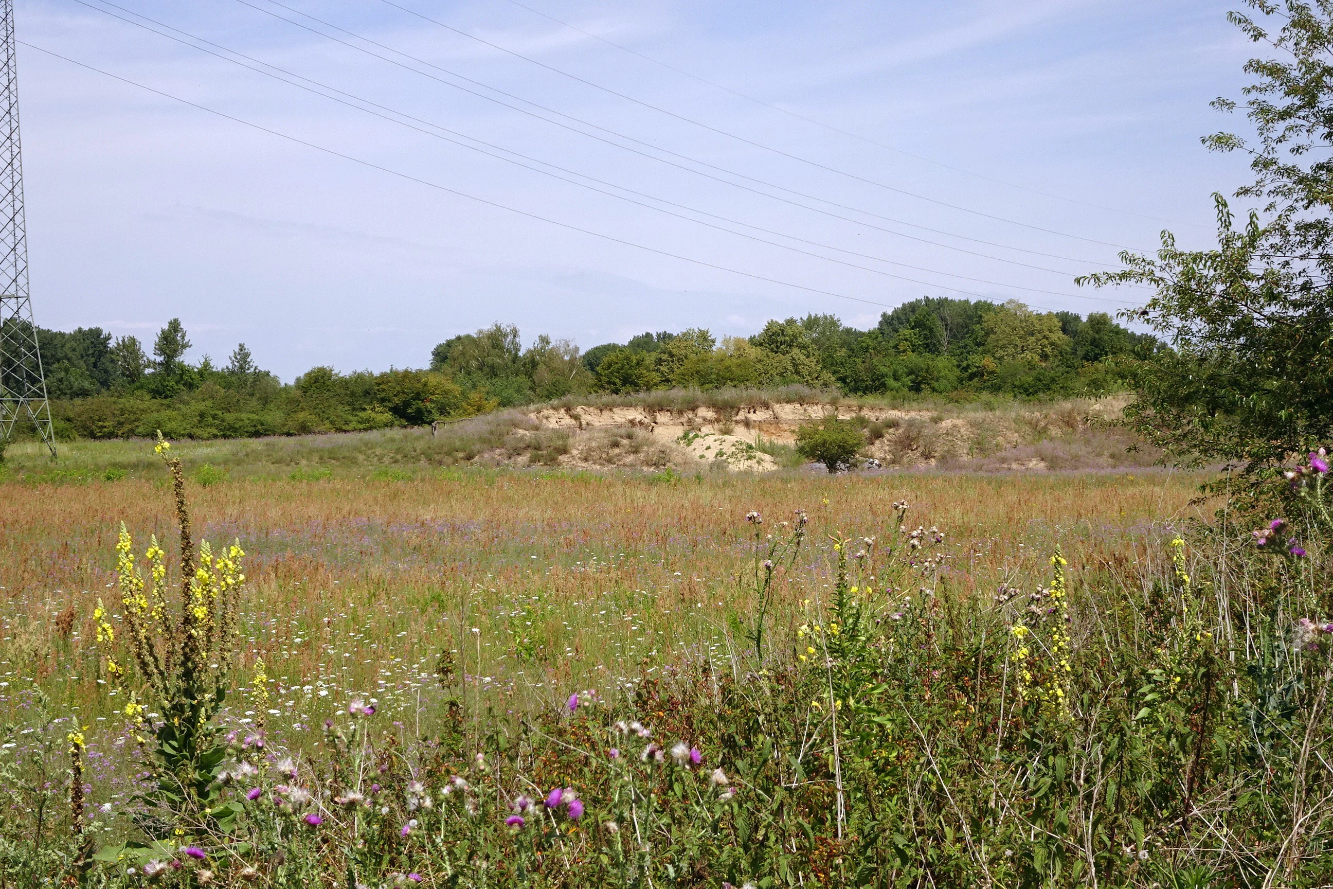
A landscape view of a nature reserve featuring a field of semi-arid grassland with yellow and purple wildflowers in the foreground and a sandy embankment topped with green trees in the background.
View across the open grassland toward the sandy embankment in Im Dulbaum bei Alsbach nature reserve.

Im Dulbaum bei Alsbach history and protected-area timeline

The landscape of Im Dulbaum bei Alsbach originated from wind-blown sands deposited during the late Pleistocene and early Holocene, forming part of the broad belt of inland dunes that crosses the Upper Rhine Plain between Darmstadt and Rastatt. For centuries, the area was shaped by human activity: sand was quarried in a former Sandgrube, and parts of the terrain were ploughed as fields, with agricultural use continuing locally until 1992.

The formal protection of Im Dulbaum began on 3 November 1992, when the Hessian authorities provisionally secured the site as a nature reserve. Two years later, on 25 November 1994, it was officially designated as a Naturschutzgebiet through a formal Schutzverordnung, giving it binding legal status under Hessian conservation law. Since the beginning of 2008, on 16 January of that year, the area has also been recognized as part of the European Natura 2000 network under the designation FFH-Gebiet 6217-303, extending its protection framework to the European Habitats Directive level.

In practical conservation terms, the early twenty-first century brought a shift in land management. Arable use ended in 1992, and around the year 2000 extensive sheep grazing was introduced to maintain the open sandy grassland character. More recent measures include the erection of a fence in the southern part of the reserve in 2014 to reduce pollution and nutrient inputs from the adjacent motorway rest area, reflecting ongoing efforts to defend the habitat against surrounding land-use pressures.

Im Dulbaum bei Alsbach landscape and geographic character

Im Dulbaum bei Alsbach is set in the flat Hessian Rhine Plain, in the natural region known as the Seeheimer Rinne. To the southwest, the Odenwald, and especially the prominent Melibokus, rise above the plain, providing a scenic backdrop to the otherwise low-lying reserve. The terrain itself is gently undulating rather than dramatic, shaped by soft, wind-deposited sand rather than bedrock relief.

The defining physical feature of the reserve is its inland sand dune geology. The substrate consists of calcareous, wind-blown sands that belong to the aeolian dune belt running along the Upper Rhine. This sandy base determines nearly every visible aspect of the landscape: the dryness of the soil, the pale color of the ground, the open and exposed character of the vegetation, and the way light reflects from the bare patches between grass tufts.

The site is also a place of contrast, with visible traces of its industrial past. It includes a former sand quarry, parts of which have been partially recolonized with woody vegetation in a process of recultivation, while other parts have been returned to open dune grassland. The presence of a high-voltage power line running through the central, more wooded section adds another distinctive infrastructure element to the otherwise quiet natural setting. At the edges, the reserve meets a landscape of intensively used farmland and, immediately to the east, the modern Alsbach rest stop along the Bundesautobahn 5.
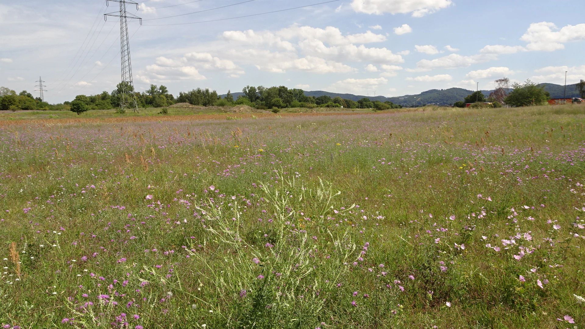
A wide view of a sandy grassland area in summer with wildflowers blooming; a high voltage power pylon stands on the left in the background.
Flowering sandy grasslands in the Im Dulbaum bei Alsbach nature reserve.

Im Dulbaum bei Alsbach ecosystems, habitats, and plant life

The ecological identity of Im Dulbaum bei Alsbach is built around dry, open sand habitats that have become exceptionally rare in the heavily farmed Rhine Plain. The most important habitat type is dry calcareous sand grassland, known in German as Trockene, kalkreiche Sandrasen, which forms the backbone of the protected area. Smaller, particularly species-rich patches belong to a habitat type classified as subpannonian steppe turf, a continental steppe-like grassland that is biogeographically remarkable this far west in central Europe.

These open habitats are framed by warm-loving hedge and scrub margins whose structure and plant composition reflect the calcareous, sandy substrate. Together, the grasslands and scrub edges create a fine-grained mosaic of microhabitats: bare sand patches, dense grass tussocks, low shrub layers, and warm sheltered edges. Each of these supports a slightly different community of plants and animals, and the small scale of the variation is part of what gives the reserve its high ecological density.

In ecological network terms, Im Dulbaum bei Alsbach plays the role of a stepping stone within a much larger regional biotope network connecting calcareous sand habitats along the Hessian Bergstraße with similar sites in the northern Upper Rhine Plain. Its small area is offset by its very specific habitat qualities: the combination of calcareous sand, dry microclimate, and active management through grazing creates conditions in which species that have largely vanished from the surrounding agricultural landscape can still find suitable habitat.
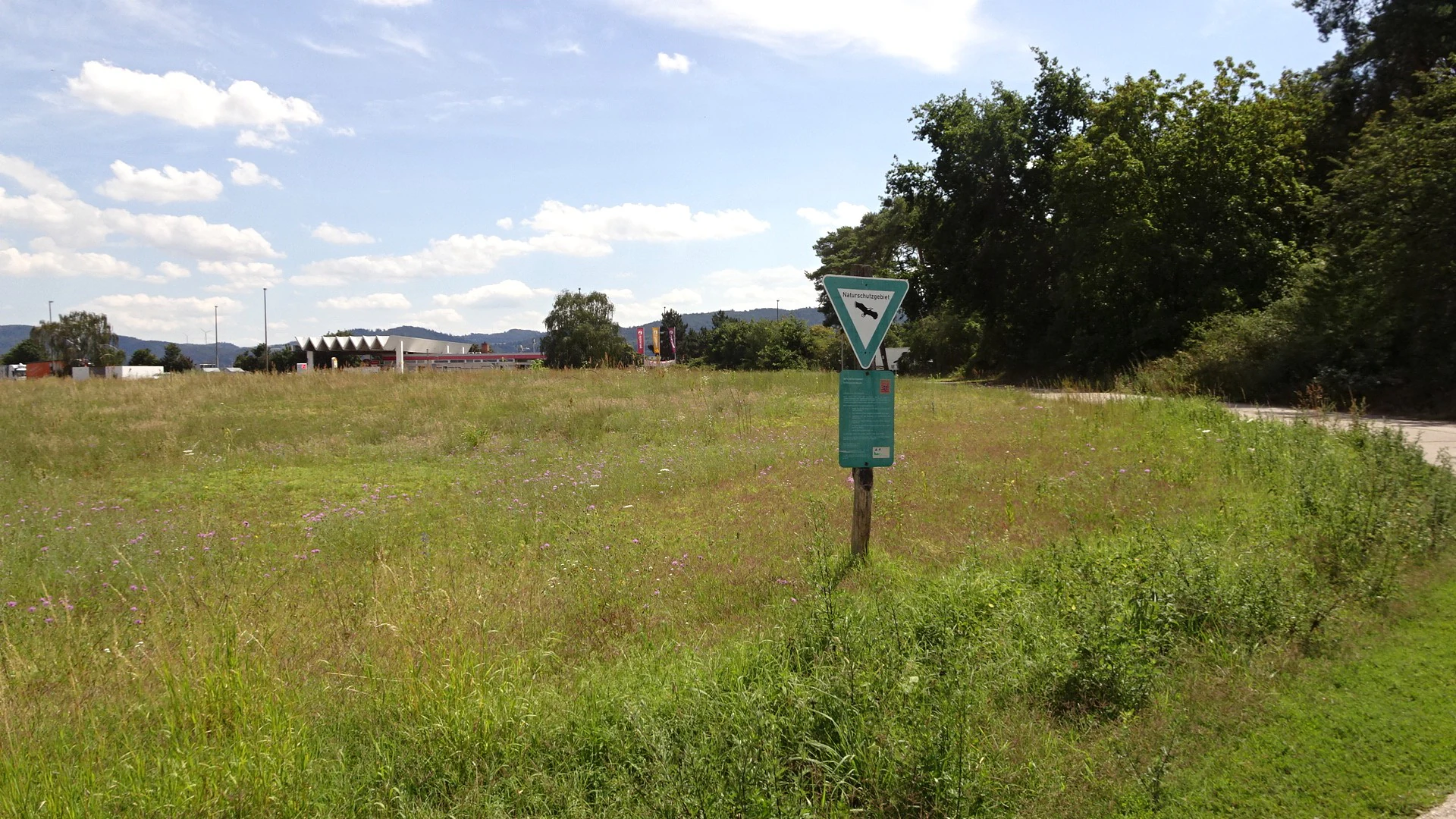
A nature reserve triangular warning sign on a wooden post in an open grassy field with trees and distant buildings in the background.
A nature reserve sign marks the boundary of the Im Dulbaum area, featuring typical sand grassland vegetation.

Im Dulbaum bei Alsbach wildlife and species highlights

The wildlife of Im Dulbaum bei Alsbach is shaped by warmth, openness, and sandy ground. Reptiles are among the most visible representatives of this heat-loving fauna, with the sand lizard (Zauneidechse) regularly recorded in the open dune sections where sunny bare patches provide basking habitat and loose sand for egg-laying.

The invertebrate fauna is particularly distinctive and reflects the continental steppe-like character of the grassland. Notable species include the blue-winged grasshopper (Blauflügelige Ödlandschrecke) and the western sickle-bearing bush cricket (Westliche Beißschrecke), both of which are associated with dry, warm, open sandy habitats and are increasingly rare in intensively used landscapes. The common heath snail (Gemeine Heideschnecke) is also recorded, a further indicator of the dry, calcareous conditions that define the reserve.

Because of the small size of the area, larger mammals are not a focus of the reserve, but the ecological significance of the site for invertebrates and reptiles is disproportionately high compared with its modest extent. The mosaic of bare sand, low turf, and scrub margins provides a wide range of niches for ground-dwelling insects, while the surrounding field margins and small woodlots offer additional hunting and dispersal habitat.

Im Dulbaum bei Alsbach conservation status and protection priorities

Im Dulbaum bei Alsbach has conservation significance well beyond its modest size. Designated first as a Hessian Naturschutzgebiet and later as an EU Natura 2000 site, it is protected under two overlapping frameworks that reflect both national biodiversity priorities and the European Habitats Directive. Its IUCN Category IV status indicates a focus on active habitat and species management rather than passive wilderness protection, an approach that fits the site's history of sand quarrying and past agricultural use.

The core conservation goal is the long-term preservation of dry calcareous sand grasslands and open dune habitats, which have been reduced to tiny fragments across the Rhine Plain by cultivation, afforestation, and development. The reserve is also managed to maintain and where possible expand small patches of subpannonian steppe habitat. As a stepping stone within the regional biotope network linking sand habitats along the Bergstraße with those of the northern Upper Rhine Plain, it plays an important role in maintaining connectivity for sandy-ground species that would otherwise be confined to increasingly isolated habitat islands.

Active management is central to the conservation strategy. Extensive sheep grazing, introduced around 2000, is used to keep the sandy surface open and to prevent woody encroachment. Recent measures, including the construction of a fence in the southern part of the reserve in 2014, aim to limit nutrient and pollutant inputs from neighboring farmland and the adjacent motorway rest area. Ongoing concerns include the spread of the non-native tree of heaven (Götterbaum) in the central wooded section, which is being monitored as part of wider neophyte management efforts.

Im Dulbaum bei Alsbach cultural meaning and human context

The cultural context of Im Dulbaum bei Alsbach is closely tied to the long history of human use of the Rhine Plain sands. The reserve lies in a landscape that has been worked by farmers and sand quarriers for generations, and its current character reflects a deliberate shift from extractive and agricultural use toward ecological restoration. Extensive grazing by sheep, an older regional tradition, now plays a central role in maintaining the open sand grassland, connecting the contemporary reserve to older pastoral land-use practices of the Bergstraße region.

The site also occupies a symbolic position within the broader cultural geography of the Hessian Bergstraße, the historic route along the western edge of the Odenwald. Nearby landmarks such as the Melibokus constitute recognizable features of the regional identity, with the dunes and the wooded hills together forming a characteristic Bergstraße landscape. While Im Dulbaum itself is a small, quiet reserve rather than a place of major cultural events, its existence reflects a growing regional awareness of the value of the smaller natural areas that punctuate this densely inhabited landscape.

Top sights and standout views in Im Dulbaum bei Alsbach

Im Dulbaum bei Alsbach stands out for its compact but ecologically intense preservation of dry calcareous sand grasslands, a habitat type that has been almost lost from the Rhine Plain. The reserve combines relict inland dune terrain, a former sand quarry in recovery, and actively grazed open sand grassland into a single, tightly defined area. Its dual status as a Hessian nature reserve and as an EU Natura 2000 FFH site highlights both its regional and its European-level conservation value, while its role as a stepping stone in the regional biotope network gives it an importance that extends well beyond its roughly nine-hectare footprint.

Best time to visit Im Dulbaum bei Alsbach

Im Dulbaum is at its most atmospheric in late spring and early summer, when the sand grasslands come into bloom and the characteristic sandy-ground flora, including sand thyme and sand broomrape, is most visible. Warm, sunny days also bring out the reptile and insect life that depends on the open sandy ground, with sightings of sand lizards and specialist grasshoppers most likely during extended periods of fine weather. Because the reserve is small and surrounded by farmland and infrastructure, visits are best approached as short quiet walks within a broader exploration of the Hessian Bergstraße rather than as full-day outings, and calm weather will make the dune landscape and its backdrop against the Odenwald hills particularly rewarding.

Monthly climate preview

Long-term temperature and precipitation records measured at representative park coordinates

Im Dulbaum bei Alsbach Climate Normals and Annual Weather Patterns

Historical climate data for Im Dulbaum bei Alsbach records mean monthly temperatures ranging from near freezing to warm summer highs alongside steady precipitation throughout the year. Reviewing these measured long-term averages provides essential context for understanding the environmental baseline of the protected area.
Annual mean10 °C
0 °C20 °C
Jan
Feb
Mar
Apr
May14°
Jun18°
Jul20°
Aug20°
Sep15°
Oct10°
Nov
Dec
Warmest month
July

20.3 °C

Coolest month
January

0.1 °C

Wettest month
July

2.4 mm/day

Driest month
April

1.5 mm/day

Park location guide

Geography guide, regional context, and park location map for Im Dulbaum bei Alsbach

Im Dulbaum bei Alsbach park geography, regions, and map view in Germany

Understand where Im Dulbaum bei Alsbach sits in Germany through a broader geographic reading of the surrounding landscape, nearby location context, and its mapped position within the national park landscape.

How Im Dulbaum bei Alsbach fits into Germany

Germany is a federal republic in Western and Central Europe with a population of over 83 million across sixteen constituent states. It is Europe's largest economy by nominal GDP and a major global exporter and importer. The capital is Berlin, and the country borders Denmark, Poland, Czech Republic, Austria, Switzerland, France, Luxembourg, Belgium, and the Netherlands.

Wider geography shaping Im Dulbaum bei Alsbach in Germany

Germany is located in Western and Central Europe, spanning 357,022 km². It borders Denmark to the north, Poland and the Czech Republic to the east, Austria and Switzerland to the south, and France, Luxembourg, Belgium, and the Netherlands to the west. The country has coastlines on the Baltic Sea and North Sea to the north, with the Alps located in the southern region.

Map view of Im Dulbaum bei Alsbach

Use this park location map to pinpoint Im Dulbaum bei Alsbach in Germany, understand its exact geographic position, and read its mapped placement within the surrounding landscape more clearly.

Pigeon | © OpenStreetMap contributors

Location context for Im Dulbaum bei Alsbach

Hesse
Recorded earthquake history

Examine the Historical Seismic Records for Im Dulbaum bei Alsbach

Consult the historical catalogue of recorded earthquakes associated with the geography of Im Dulbaum bei Alsbach. MoriAtlas provides this data as a transparent reference for regional seismic events, including event magnitude, depth, and distance, to support a deeper understanding of the area beyond its protected sand dune landscapes.

Im Dulbaum bei Alsbach Earthquake History

Catalogued events

23 events

Strongest magnitude

Magnitude 3.8

Most recent event

May 17, 2014

This history includes earthquakes recorded inside the park or within 50 km of its borders

Visual reference for inland sand dunes and dry grassland habitats

Im Dulbaum bei Alsbach Photos and Landscape Scenery

Photographic records reveal the distinct sandy terrain, calcareous grasslands, and open dune formations that define the reserve. Visual documentation provides clear insight into the protected landscape and rare habitat characteristics of the Upper Rhine Plain.

A landscape view of a nature reserve featuring a field of semi-arid grassland with yellow and purple wildflowers in the foreground and a sandy embankment topped with green trees in the background.

A wide view of a sunny, semi-arid grassland landscape featuring sparse shrubs and wildflowers, with a large electricity pylon and the Melibokus mountain in the distance.

A wide view of a sandy grassland area in summer with wildflowers blooming; a high voltage power pylon stands on the left in the background.

A nature reserve triangular warning sign on a wooden post in an open grassy field with trees and distant buildings in the background.

Park atlas

Compare nearby sandy terrain, inland dune reserves, and related habitats across southern Hesse.

Explore Other Parks Near Im Dulbaum bei Alsbach and Connected Regional Protected Areas

Continue browsing parks near Im Dulbaum bei Alsbach to discover comparable dry grassland reserves and protected landscapes across the Upper Rhine Plain. Comparing adjacent protected areas reveals broader ecological connections and regional terrain patterns within the surrounding Hessian environment.
A soft, delicate watercolor painting depicting a meandering river flowing through a lush, grassy wetland landscape with rolling hills in the background.
Nature reserveHessen
About 0.8 km away#1 closest

Northwest

Altneckarlachen von Alsbach, Hähnlein und Bickenbach: Protected Wetland and River Geography

A rare mosaic of prehistoric river loops in the Hessian Rhine plain

Altneckarlachen von Alsbach, Hähnlein und Bickenbach protects a unique sequence of prehistoric Neckar meanders featuring shallow water zones, reed belts, and black-alder swamp forest. This nature reserve in the Darmstadt-Dieburg district remains a critical wetland sanctuary, preserving a vital ecological cross-section of the ancient Rhine-Neckar landscape and its associated peatland soils.

Area
0.892 km²
Established
1990
IUCN
IV
Relief
Lowland
A watercolor landscape illustration showing a winding stream, marsh grasses, and trees with soft rolling hills in the background, set against a pale background.
Nature reserveHessen
About 2.5 km away#2 closest

North

Pfungstädter Moor Nature Reserve: Hessian Wetland and Ancient River Landscape

Protected wetland area in the Hessian Rhine plain

This nature reserve encompasses a rare silted-up segment of the ancient Neckar river, forming a complex of reed beds, alder carr, and peat bog habitats. Managed through creative restoration techniques that lift Rhine water into the moor, the landscape remains a vital ecological sanctuary in the heart of Hesse, standing in sharp contrast to the surrounding agricultural terrain.

Area
0.97 km²
Established
1955
IUCN
IV
Relief
Lowland
A soft watercolor painting of a rolling green hillside with trees, set against a pale, light-colored background.
Nature reserveHessen
About 3.1 km away#3 closest

Southeast

Orbishöhe von Auerbach und Zwingenberg: Geography, Landscape, and Protected Area Mapping

An examination of Hessian quarry-based ecological conservation sites.

The Orbishöhe von Auerbach und Zwingenberg nature reserve serves as a prime example of localized conservation within the Odenwald hills. Its landscape is defined by former quarry faces and open slope terraces, which provide a critical habitat for rare and threatened plant species. This resource offers a clear look at the reserve's topography, physical boundaries, and its broader role within the Natura 2000 network of protected German lands.

Area
0.064 km²
Established
1988
A horizontal watercolor painting showing a soft, impressionistic landscape with rolling hills, sparse trees, and pale green and pink tones on a white background.
Nature reserveHesse
About 4.8 km away#4 closest

Northeast

Kalksandkiefernwald bei Bickenbach, Pfungstadt und Seeheim-Jugenheim Protected Area Atlas

A rare calcareous sand pine forest in the Hessian Rhine plain

Located in the Darmstadt-Dieburg district, this reserve protects an airy, light-filled woodland on calcareous sandy ground. The terrain is defined by its gentle undulations and historical woodland grazing traces, offering a unique look at forest management in the Rhine plain. Explore the distribution of its two distinct sections, including the specialized sand grass vegetation found along its managed utility corridors.

Area
0.874 km²
Established
1996
IUCN
IV
Relief
Lowland
A horizontal watercolor illustration of a soft, hazy landscape featuring light pink blooming trees in a green field, with rolling, misty purple and brown hills in the background.
Nature reserveHesse
About 5.7 km away#5 closest

East

Fuchswiese bei Stettbach: Mapped Nature Reserve and Protected Meadow Landscape in Hesse

Exploring the ecological boundaries of a specialized wet meadow reserve in southern Hesse

Fuchswiese bei Stettbach is a dedicated nature reserve serving as a critical habitat for threatened meadow butterfly species. Located in the Darmstadt-Dieburg district of Hesse, this protected area preserves wet meadow vegetation amidst the northern Odenwald fringe. The site offers a focused view into how small, carefully managed landscapes contribute to the broader ecological health and regional geography of central Germany.

Area
0.03 km²
Established
2010
Watercolor painting showing a stylized, panoramic landscape of rolling hills and forest, depicted in soft green and earth tones against a white background.
Nature reserveHessen
6.4 km away#6 closest

East

Felsberg bei Reichenbach Nature Reserve: Geography and Granite Boulder Field Analysis

Protected forest and geological monument in the Odenwald range

Felsberg bei Reichenbach protects 168 hectares of Odenwald mountain slope in Southern Hessen. The site is centered on the Felsenmeer, a dramatic sea of granite boulders created by frost weathering, framed by mixed deciduous woodland. This area functions as an important Natura 2000 habitat, preserving both specialized rock ecosystems and montane forest, providing a clear geographic link between the Lautertal valley and the high slopes of the Felsberg summit.

Area
1.677 km²
Established
1972
IUCN
IV
Relief
Mountain
A watercolor painting of a pastoral landscape with soft green meadows, scattered trees, and distant purplish hills under a white sky.
Nature reserveHessen
6.4 km away#7 closest

Southeast

Magerrasen von Gronau mit angrenzenden Flächen Protected Landscape and Regional Geography

A network of calcareous meadows in the Odenwald foothills

Located in the Bergstraße district of Hessen, this protected area spans three distinct sub-areas characterized by nutrient-poor calcareous soils. These warm, sun-exposed meadows serve as an essential refugium for orchid diversity and specialized butterfly populations, standing as a representative example of successfully managed dry grassland ecosystems within the broader Geo-Naturpark Bergstraße-Odenwald.

Area
1.6 km²
Established
2004
A pale, soft-toned watercolor painting showing rolling green and golden dunes under a light, hazy sky.
Nature reserveHessen
7.4 km away#8 closest

Northeast

Düne am Ulvenberg von Darmstadt-Eberstadt: Inland Sand Dune Protected Area Geography

A rare Pleistocene dune ecosystem in the Hessen region.

Düne am Ulvenberg von Darmstadt-Eberstadt represents a critical inland dune fragment within the Upper Rhine Graben. This nature reserve provides essential habitat for sand-dwelling flora in a setting defined by its open, dry sandy flats, pine woodland, and specialized steppe-like turf that persists as a unique geological legacy.

Area
0.089 km²
Established
1991
IUCN
IV

Common questions about visiting, size, designation, and location context for Im Dulbaum bei Alsbach

Im Dulbaum bei Alsbach FAQs for park facts, access, geography, and protected area context

Find quick answers about Im Dulbaum bei Alsbach, including protected-area facts, park geography, trail and visitor context, and how the park fits into its surrounding country and regional landscape.
MoriAtlas Explorer

Continue Your Protected Areas Search Across the Global Atlas

Deepen your exploration by continuing the structured search for national parks and protected areas worldwide. Utilize the comprehensive filtering capabilities to compare different conservation landscapes and refine your understanding of global park geography. Discover more about the distribution and characteristics of protected natural areas.

Global natural geography