
Mori Atlas logo
Protected areaIsle of Lewis

Examining the ancient gneiss geology, expansive peatlands, and diverse Atlantic coastal terrain

Isle of Lewis Protected Area: Comprehensive Geography and Landscape Mapping in Na h-Eileanan Siar

The Isle of Lewis functions as a vast protected landscape within the Outer Hebrides of Scotland. This geographic profile traces the dramatic contrasts between the western machair grasslands, the rugged eastern sea lochs, and the expansive peat-covered interior plateau. By mapping these physical characteristics, visitors gain insight into the ancient Lewisian gneiss formations and the layered history of this unique island environment.

Outer HebridesAtlantic coastmachairpeatlandsblanket bogsea lochs
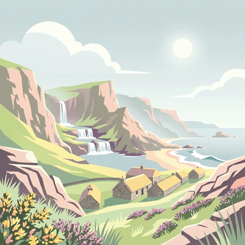
An illustration showing a small group of stone cottages with thatched roofs at the base of grassy, rocky cliffs; a tiered waterfall flows down the cliffside toward a sandy beach and the sea under a clear sky.

Isle of Lewis

Protected area

Park overview

Structured park overview, official facts, and landscape profile for Isle of Lewis

Isle of Lewis park facts, protected area profile, and essential visitor context

Review the core facts for Isle of Lewis, including designation, size, terrain, visitor scale, habitats, and operating context in one park-focused overview.

About Isle of Lewis

The Isle of Lewis is the northern and larger part of the island usually called Lewis and Harris, which is itself the biggest island in the Outer Hebrides archipelago off Scotland's north-west coast. While the two halves share a continuous landmass, they are distinct in character. Lewis is generally flatter and more fertile, while Harris to the south rises into sharper mountain terrain. Because Lewis has the greater area of usable ground and the only major town, it contains the majority of the population of the Western Isles and serves as the demographic and administrative heart of the archipelago.

The island's geography divides neatly into two contrasting coastlines and an extensive interior. The Atlantic west coast, exposed to prevailing south-westerly winds, is lined with long sandy beaches backed by dunes and the fertile grass-and-wildflower plains known locally as machair. This side feels open, light, and exposed. By contrast, the eastern coastline, sheltered by the bulk of the island, is composed of rocky cliffs, small coves, sea lochs, and the more sheltered anchorages where most of the population lives and where Stornoway, the only town and burgh in the Outer Hebrides, developed. Between these two coasts lies an interior dominated by peat-covered moorland, freshwater lochs, and rocky knolls, with the highest ground rising in the south-west near Mealaisbhal.

Beyond its physical character, Lewis is deeply shaped by the layering of history and culture on the landscape. The Callanish standing stones, set in a complex of stone circles and avenues built more than 4,500 years ago, are among the most important prehistoric ceremonial landscapes in Europe. Iron Age brochs such as Dùn Chàrlabhaigh, Norse-influenced place names, medieval clan histories, crofting townships, and the traditional blackhouse villages of Garenin and Arnol all testify to successive waves of settlement and land use. The Lewis chessmen, found buried in a sand dune on the island in 1831, are a vivid reminder of the Viking-era connections that once tied the Hebrides to Norway and the wider North Atlantic world.

Lewis today retains a cultural intensity that feels different from much of mainland Scotland. The Scottish Gaelic language remains a daily vernacular for a large share of the population, Sabbath observance is still pronounced, peat is still cut and burned, and a strong Presbyterian tradition shapes community life alongside crofting, fishing, Harris Tweed weaving, and a growing tourism economy centred on Stornoway as the gateway.

Quick facts and research context for Isle of Lewis

Lewis occupies roughly 1,770 square kilometres of the larger Lewis and Harris island and is the more populous, flatter, and more fertile northern half.

Its principal settlement, Stornoway, is the only town and burgh in the Outer Hebrides, and is the administrative centre of Comhairle nan Eilean Siar, the local authority covering the whole island chain.

The underlying geology is dominated by some of the oldest rocks in Europe, the Archaean gneisses of the Lewisian complex, while the surface landscape is shaped by extensive peat bogs, machair plains, dunes, freshwater lochs, and heavily indented sea lochs.

Along with parts of Harris and North Uist, southern Lewis falls within a National Scenic Area, while the Lewis Peatlands are recognised internationally as a Ramsar wetland site and as a Special Protection Area and Special Area of Conservation.

Protection and recognition

Documented protection history and management scope for Isle of Lewis

Isle of Lewis Protection Status and Designated Area Recognition

Established with a mixed protection scope in the year 2000, Isle of Lewis maintains a documented conservation record within the regional protected area framework. Review the official designation history and international recognition sources associated with this protected landscape.

Protection details

Protection scope
Mixed
Designated year
2000
Transboundary protection
No
Park context

Deeper park guide and search-rich context for Isle of Lewis

Isle of Lewis history, landscape, wildlife, and travel context

Explore Isle of Lewis through its history, landscape character, ecosystems, wildlife, conservation priorities, cultural context, and seasonal travel timing in a structured park guide built for atlas discovery and search intent.

Why Isle of Lewis stands out

Lewis is best known for the Callanish standing stones, a remarkable Neolithic ceremonial complex that forms one of the most important prehistoric sites in Britain. It is equally recognised for its sweeping Atlantic machair and dune systems on the west coast, for the vast blanket bog and peatland interior, and for the strong presence of Scottish Gaelic language and culture that remains more visible here than in almost any other part of Scotland. Wildlife is another defining feature: the island combines great seabird and eagle country with populations of red deer, otters, and grey seals along a heavily indented and varied coastline.
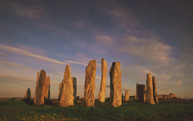
A group of tall, weathered standing stones arranged in a circle on a grassy hillside, illuminated by the warm light of a late sunset.
The prehistoric Callanish Stones on the Isle of Lewis silhouetted against a golden sunset sky.

Isle of Lewis history and protected-area timeline

Human presence on Lewis stretches back thousands of years. Pollen evidence preserved in the island's peat shows that around 8,000 years ago much of the original woodland was burned to encourage grazing for deer, beginning a long transformation of the natural landscape. By roughly 5,000 years ago, the earliest settled farming communities had appeared, leaving behind small houses and larger ritual monuments including the great stone circle complex at Callanish.

From about 500 BC, Lewis entered the Iron Age, with larger and more imposing structures culminating in the brochs, the drystone tower-fortresses of local chieftains. The best surviving example on the island, Dun Carloway, still dominates its landscape. Scots-speaking Gaelic peoples arrived over the following centuries, and from the 6th century onward Christian missionaries associated with Saint Columba spread Christianity through the islands. Norse raids and settlement followed from the 9th century, and by the later medieval period Lewis formed part of the Norse-Gaelic world, including the Kingdom of Mann and the Isles. Norse influence survives in many place names and in artefacts like the Lewis chessmen.

In 1266 the Treaty of Perth transferred the Western Isles from Norway to Scotland. Power in the region passed through the Lordship of the Isles, the MacLeod clan's control of Lewis, and then, after prolonged feuding and forfeiture, to the Fife adventurers and ultimately in 1609 to the Mackenzies of Kintail. The 18th and 19th centuries brought Highland clearances, the collapse of crofting under pressure from sheep, deer, and sporting estates, large-scale emigration, and another wave of upheaval in 1918 when Lord Leverhulme bought the island and attempted rapid industrialisation before withdrawing after resistance from crofters.

Isle of Lewis landscape and geographic character

Lewis presents a clear and dramatic contrast between its western and eastern coasts. The Atlantic west side is shaped by long stretches of pale sand, backed by dune systems and the flat, lime-rich grasslands of the machair, which run inland from beaches such as those at Mangersta and Uig. The eastern coast is far more rugged, with cliffs, headlands, and deeply indented sea lochs including Loch Roag, Loch Seaforth, and Loch Erisort, with the Butt of Lewis in the far north crowned by its lighthouse on cliffs of about 40 metres.

Pushing inland from either coast, the landscape rises gently into a broad peat-covered plateau dotted with freshwater lochs, exposed gneiss outcrops, and, in the south-west, the highest ground of the island. Mealaisbhal, the highest point, reaches 574 metres, and the surrounding southern uplands contain the majority of the island's freshwater lochs. The interior is sparsely settled; apart from the central village of Achmore, almost all communities cling to the coastline.

Geologically, Lewis is famous for ancient rocks. The Lewisian gneiss complex, of Archaean age, is among the oldest rock formations in Europe and gives the interior its weathered, low-relief character. Small patches of granite, basalt, and sandstone intrude into this ancient basement, including distinctive outcrops near Carloway and along the Eye Peninsula. Together with the blanket bog, machair, dunes, and indented sea lochs, this gives Lewis a strongly layered physical identity.
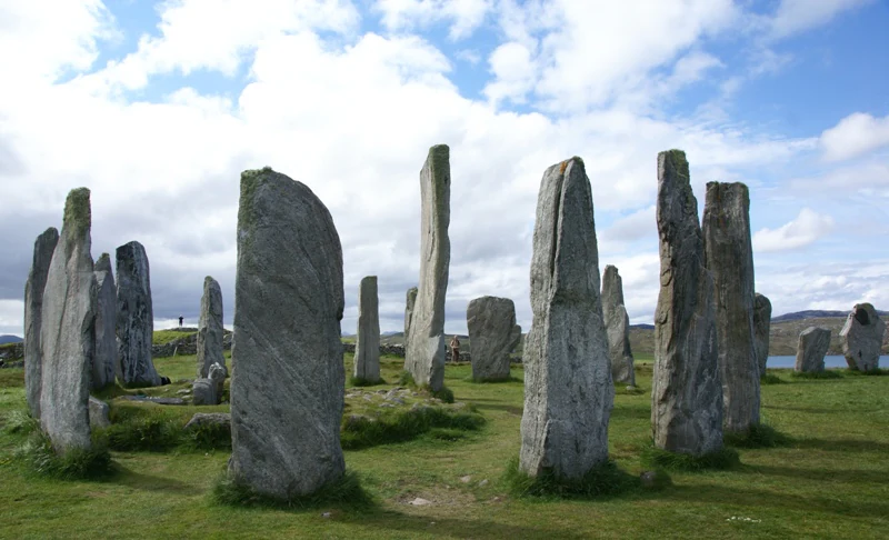
A group of tall, weathered standing stones arranged in a circular formation on a grassy field under a partly cloudy sky.
The Calanais Standing Stones, an ancient Neolithic site on the Isle of Lewis.

Isle of Lewis ecosystems, habitats, and plant life

Lewis encompasses a remarkable diversity of island habitats within a relatively compact area. The western machair is one of the richest low-intensity agricultural grasslands in Europe, supporting wildflowers, orchids, and the insect life that depends on them. Above and inland, the wide moorlands of ling, bell heather, and cross-leaved heath cover much of the island, with abundant insectivorous plants such as sundews thriving in the damp conditions.

The Lewis Peatlands form one of the largest contiguous blanket bog systems in Europe and are recognised as a Special Protection Area, Special Area of Conservation, and Ramsar site for their importance to migratory and resident birds. Around the coast, machair, dunes, sea cliffs, sea lochs, and offshore waters provide further habitat gradients. Sites of Special Scientific Interest cover much of the island, and the southern parts of Lewis fall within a National Scenic Area shared with Harris and North Uist.

Unlike many parts of Scotland, Lewis lost almost all of its native woodland centuries ago. Only small, isolated pockets survive on inland cliffs and on islands within lochs, sheltered from fire and grazing. Later 19th-century plantings around Lews Castle in Stornoway and 20th-century Forestry Commission plantations of spruce and pine, the latter badly affected by moth outbreaks, now provide the main tree cover. The machair, moorland, peatlands, freshwater lochs, and marine environment together give Lewis a distinctive ecological character within the UK.
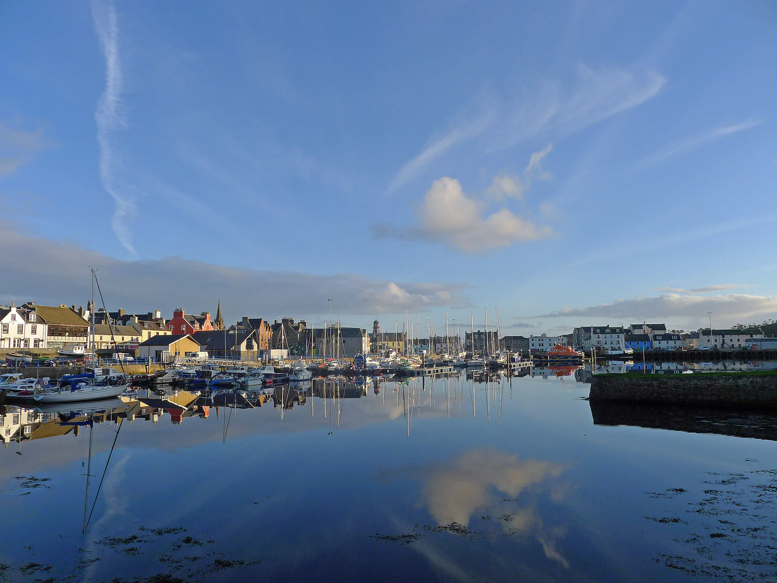
A calm harbour scene in Stornoway with several small boats moored, reflecting the blue sky and clouds on the still water surface, with buildings lining the shore in the background.
A view of the inner harbour in Stornoway on the Isle of Lewis.

Isle of Lewis wildlife and species highlights

Lewis supports a rich and varied fauna shaped by its position on the Atlantic edge of Europe. The cliffs and sea lochs of the coast host large seabird colonies, including shag, gannet, fulmar, kittiwake, guillemot, and several gull species, while the inland moors and machair hold red grouse, woodcock, curlews, and oystercatchers. The Uig hills in the west are a notable area for both golden eagles and white-tailed eagles, with peregrine falcons using the coastal cliffs and merlin and buzzard common across hill and moor land.

Only two native land mammals are recognised in the Western Isles: the red deer and the Eurasian otter. Rabbits, mountain hares, hedgehogs, feral cats, polecats, and both brown and black rats were all introduced, as were American mink from fur farms, which threaten ground-nesting birds and are the target of an ongoing eradication effort. Lewis's freshwater lochs and rivers support trout, Arctic char, Atlantic salmon, eel, sticklebacks, mullet, and flounder, while the surrounding seas are home to grey seals, dolphins, and harbour porpoises, with occasional whale and shark sightings. There are no snakes; the slowworm, a legless lizard, is the only reptile, and the common frog occurs in small numbers as an introduced species.
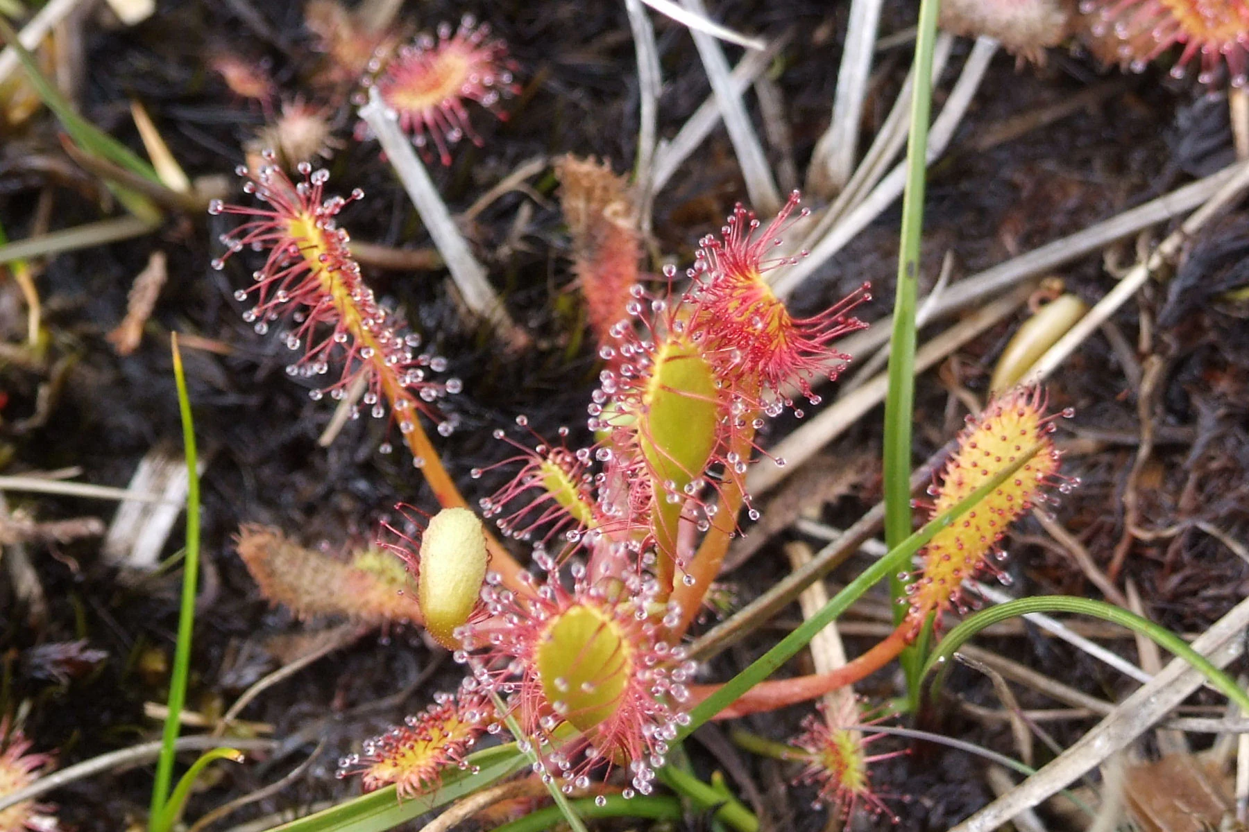
A close up view of several Drosera anglica plants, showing their reddish, glandular leaves covered in glistening sticky droplets, growing among moss and dead grass.
The carnivorous Drosera anglica, commonly known as the Great Sundew, growing in the peatland environment of the Isle of Lewis.

Isle of Lewis conservation status and protection priorities

The conservation importance of Lewis is recognised at multiple levels. The Lewis Peatlands Ramsar site, Special Protection Area, and Special Area of Conservation cover a vast area of blanket bog of major international value for birds and wetland habitat. Several individual Sites of Special Scientific Interest protect specific features including Glen Valtos, Cnoc a' Chapuill, Port of Ness, and Tolsta Head, while fifteen further SSSIs focus on biological interests across the island. Southern Lewis forms part of a designated National Scenic Area shared with Harris and North Uist.

Conservation management deals with both protection and active intervention. The Hebridean Mink Project has already removed American mink from the Uists and Barra and is working to do the same on Lewis and Harris, where escaped mink threaten ground-nesting birds and the local fishing industry. Habitat restoration efforts address the long history of woodland loss, the fragile balance of the machair under changing agricultural patterns, and the international significance of the peatlands as carbon stores and biodiversity hotspots. The combination of statutory designations and active species management reflects the island's position as one of the more ecologically distinctive parts of Scotland.

Isle of Lewis cultural meaning and human context

Lewis carries a cultural identity that sets it apart from much of mainland Scotland. Scottish Gaelic is widely spoken as a daily language, hybrid Gaelic-English discourse is common, and a strong Gaelic-medium school system, the Gaelic cultural centre An Taigh Cèilidh in Stornoway, and the Royal National Mòd all sustain the language. Presbyterian tradition remains deeply influential, with broad observance of the Sabbath and a strong continuing presence of the Free Church and Church of Scotland alongside other small denominations.

Traditional crofting life is visible across the island, from the restored blackhouse villages at Garenin and Arnol to the small coastal townships where peat is still cut using traditional tools and stacked by hand. Saga-era memory is layered into the landscape too: Norse-Gaelic place names, the Viking legacy embodied by the Lewis chessmen, the lingering traces of the Lords of the Isles and the clan MacLeod, the clearances, and the 1918 land raids against Lord Leverhulme's attempts at industrialisation. Cultural events such as the Hebridean Celtic Festival reinforce Lewis's distinctive position within Scottish and Gaelic culture.
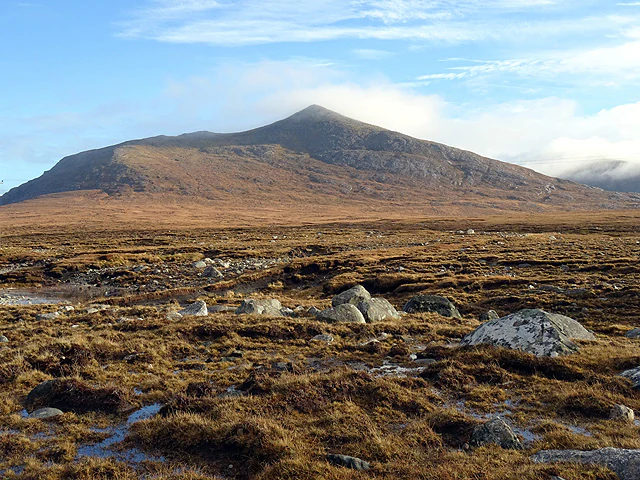
A wide shot of a vast, brown, boggy landscape covered in moss and scattered stones, leading to a prominent, smooth-sloped mountain under a clear blue sky.
Boggy peatland terrain near Islibhig with the peak of Mealaisbhal in the distance.

Top sights and standout views in Isle of Lewis

Among Lewis's most distinctive features are the Callanish standing stones, a 4,500-year-old ceremonial complex of stone circles and avenues of major archaeological importance.

The west coast machair and dune systems, the great sweep of the Atlantic beaches at Mangersta and Uig, and the wide expanse of the Lewis Peatlands together define much of the island's landscape character, while the Butt of Lewis cliffs and lighthouse mark a stark northern extremity.

The cultural depth of the island, from the restored blackhouse villages of Garenin and Arnol to the deep-rooted presence of Scottish Gaelic, crofting, peat cutting, and Presbyterian Sabbath observance, gives Lewis a strong and unusually preserved cultural identity.
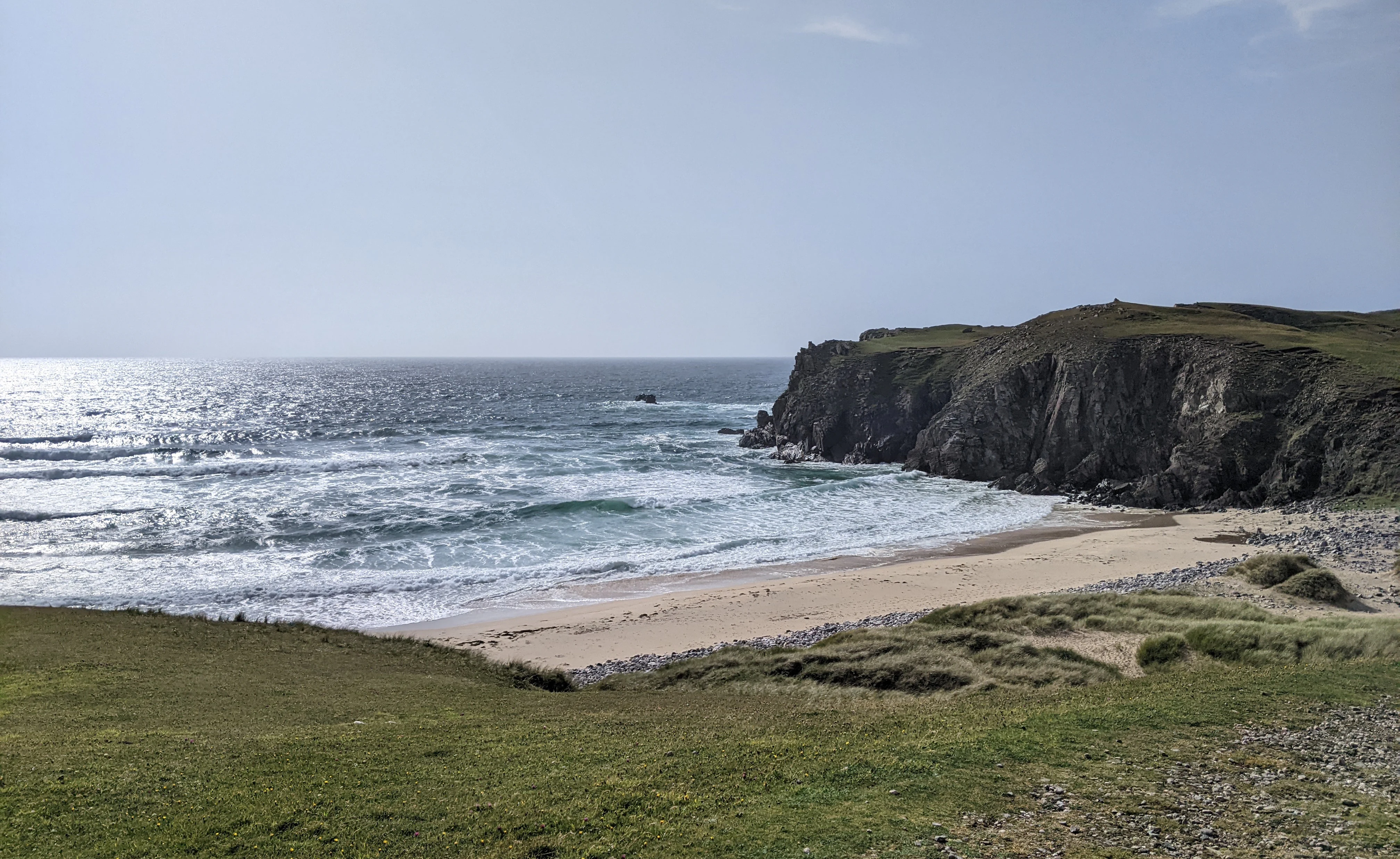
A wide angle view of a sandy beach bordered by steep dark cliffs and grassy dunes on a bright day.
A view over the sandy coastline and rugged cliffs of Mangersta Beach on the Isle of Lewis.

Best time to visit Isle of Lewis

Lewis has a cool, moist Atlantic climate shaped by the Gulf Stream, with relatively mild summers and winters but frequent wind and rain at any time of year. Spring and early summer are often the most rewarding for wildlife and landscape colour, when machair wildflowers are at their peak and migrant bird activity is high.

Summer, though cloudier than visitors sometimes expect, brings longer daylight hours, the Hebridean Celtic Festival in Stornoway in July, and the warmest conditions for walking, beach exploration, and boat trips. Autumn can be very windy and stormy, while winter is quieter, atmospheric, and marked by peat fires and strong sense of community life, though short days and frequent rain will limit outdoor activity.
Monthly climate preview

Long-term representative averages for monthly temperature and precipitation rhythms

Isle of Lewis Climate Normals and Annual Temperature Patterns

Representative coordinates record measured multi-year temperature variations and daily precipitation rates across twelve distinct months for the Isle of Lewis. Examining the complete monthly climate normals reveals detailed long-term averages for annual temperature swings and precipitation totals.
Annual mean9 °C
6 °C14 °C
Jan
Feb
Mar
Apr
May
Jun12°
Jul13°
Aug14°
Sep12°
Oct10°
Nov
Dec
Warmest month
August

13.6 °C

Coolest month
February

5.6 °C

Wettest month
January

5 mm/day

Driest month
May

2.8 mm/day

Park location guide

Geography guide, regional context, and park location map for Isle of Lewis

Isle of Lewis park geography, regions, and map view in United Kingdom

Understand where Isle of Lewis sits in United Kingdom through a broader geographic reading of the surrounding landscape, nearby location context, and its mapped position within the national park landscape.

How Isle of Lewis fits into United Kingdom

The United Kingdom is a parliamentary constitutional monarchy located in northwestern Europe, consisting of four constituent countries: England, Scotland, Wales, and Northern Ireland. As a major global power with over 69 million residents, it maintains significant international influence in politics, economics, and culture.

Wider geography shaping Isle of Lewis in United Kingdom

The United Kingdom is an island nation located in northwestern Europe, surrounded by the Atlantic Ocean, North Sea, English Channel, Celtic Sea, and Irish Sea. It shares a land border with the Republic of Ireland to the west. The territory includes the island of Great Britain, the northeastern portion of Ireland, and most of the smaller British Isles islands.

Map view of Isle of Lewis

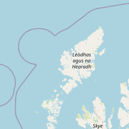
Use this park location map to pinpoint Isle of Lewis in United Kingdom, understand its exact geographic position, and read its mapped placement within the surrounding landscape more clearly.

Pigeon | © OpenStreetMap contributors

Location context for Isle of Lewis

Na h-Eileanan SiarScotland

Explore photographic records of Atlantic beaches, machair grasslands, and ancient peatlands.

Isle of Lewis Photos and Landscapes: Visualizing the Outer Hebrides Terrain

Visual documentation captures the striking contrast between rugged eastern sea cliffs and sweeping western dune systems across the Isle of Lewis. Examining these protected habitats provides deeper insight into the ancient geological formations and remote coastal environments shaping the region.

A group of tall, weathered standing stones arranged in a circle on a grassy hillside, illuminated by the warm light of a late sunset.

A high-angle view of traditional stone cottages with thatched roofs nestled in a green valley near a rocky coastline, with the ocean in the background under a partly cloudy sky.

A group of tall, weathered standing stones arranged in a circular formation on a grassy field under a partly cloudy sky.

A calm harbour scene in Stornoway with several small boats moored, reflecting the blue sky and clouds on the still water surface, with buildings lining the shore in the background.

A close up view of several Drosera anglica plants, showing their reddish, glandular leaves covered in glistening sticky droplets, growing among moss and dead grass.

A landscape view of a loch in the foreground with grassy, rocky terrain and rolling mountains in the distance under a partly cloudy sky.

A wide shot of a vast, brown, boggy landscape covered in moss and scattered stones, leading to a prominent, smooth-sloped mountain under a clear blue sky.

A wide angle view of a sandy beach bordered by steep dark cliffs and grassy dunes on a bright day.

A gravel path leads through a row of traditional stone cottages with thatched roofs at the Garenin Blackhouse Village.

The stone ruins of an ancient church with two gabled wall segments remaining, set within a grass-covered cemetery on the Isle of Lewis.

A red-bodied damselfly perched on a gray, lichen-spotted rock surrounded by low-growing heather.

A large, rounded, neatly organized stack of cut, dark brown peat blocks resting on a green grassy field, with a glimpse of a white building structure to the left.

Park atlas

Compare adjacent coastal landscapes, peatlands, and island reserves across the region

Explore Other Parks Near the Isle of Lewis and Surrounding Regional Protected Areas

Continue geographic discovery by comparing the Isle of Lewis with surrounding coastal reserves and interior peatland habitats. Reviewing nearby protected areas provides broader regional context for Hebridean terrain, wildlife corridors, and island ecosystems.
A soft watercolor illustration depicting a landscape of rolling green hills, a calm body of water, and sparse grassy vegetation.
Protected landscapeWestern Isles
About 65 km away#1 closest

Southwest

South Lewis, Harris and North Uist National Scenic Area Geography and Protected Lands

A diverse Scottish landscape of mountains and Atlantic coastline

Spanning from south-west Lewis through Harris to North Uist, this protected area features a striking blend of mountain glens, white sand machair beaches, and expansive peatlands. It serves as a flagship landscape for the Western Isles, characterized by its indented fjardic shorelines and remote maritime character that defines the northern Hebridean environment.

Area
2,024 km²
Established
1981
Relief
Mountain
Climate
Temperate
Protected landscapeHighland
About 65 km away#2 closest

South

Trotternish National Scenic Area: A Geographic Atlas of the Isle of Skye Protected Landscape

Basalt escarpments and geologic landmarks in the Scottish Highlands

Trotternish National Scenic Area features a long, continuous basalt escarpment that defines the spine of northern Skye. This protected landscape contains complex ridge formations, dramatic coastal cliffs, and a rich record of Jurassic geology. Learn about the physical geography, mapped extent, and natural terrain that make this region a key protected area within the Highland geography of Scotland.

Established
1981
Relief
Upland
Climate
Temperate
Access
Moderate access
A watercolor painting showing a soft landscape featuring purple mountains in the background, a line of green evergreen trees, and a river winding through a grassy plain under a light sky.
Nature reserveOuter Hebrides
About 93 km away#3 closest

Southwest

Monach Islands Nature Reserve: Atlas Overview of Outer Hebrides Coastal Landscapes

Mapped protected areas and machair grassland geography

The Monach Islands consist of three main islands linked by tidal flats, creating a dynamic environment shaped by coastal erosion and maritime forces. As a protected nature reserve, the islands are vital for understanding rare machair habitats and the marine geomorphology of the Outer Hebrides, serving as a critical refuge for seabirds and thousands of breeding grey seals.

Area
5.981 km²
IUCN
IV
Relief
Lowland
Climate
Temperate
Protected landscapeHighland
About 101 km away#4 closest

Southeast

Wester Ross National Scenic Area: Protected Highland Mountain and Coastal Landscape Atlas

Geographic mapping of the Northwest Highlands terrain

Wester Ross National Scenic Area spans vast stretches of the Northwest Highlands, characterized by towering Torridonian sandstone peaks and deeply carved sea lochs. This protected region integrates ancient Scots pine forests, glacial-carved glens, and complex coastal environments into one of the most recognizable geographic features of Scotland. The landscape serves as a vital record of geological heritage and high-latitude biodiversity within the Highland administrative region.

Area
1,634.58 km²
Established
1981
Visitors
70K annual
Relief
Mountain
A wide watercolor illustration showing a mountain range in the distance, a valley, and green forests on either side, with soft pastel colors.
Protected landscapeHighland
About 101 km away#5 closest

East

North West Sutherland National Scenic Area: Mapping the Peaks and Coasts of Highland Scotland

Protected quartzite mountain landscapes and Atlantic coastal geography

This detailed overview of the North West Sutherland National Scenic Area maps the dramatic interplay between the white quartzite mountains of Foinaven and Arkle and the darker Lewisian gneiss that forms the underlying Highland landscape. The analysis provides deep insights into the region's knock and lochan topography, sea lochs, and the protected coastal habitats of Handa Island, anchoring the area within its broader Scottish geological context.

Area
266 km²
Established
1981
Relief
Mountain
Climate
Temperate
Marine protected areaScotland
About 101 km away#6 closest

West

West of Scotland Marine Protected Area: Geographic Atlas and Seafloor Mapping

Extensive North Atlantic deep sea protected zone in Scotland

Spanning a immense area west of the Outer Hebrides, the West of Scotland Marine Protected Area is a critical offshore conservation zone defined by its varied benthic topography. From the steep continental slope to the sediment plains of the Rockall Trough, the area houses complex deep sea fish populations, cold water coral reefs, and sponge aggregations on isolated seamounts.

Area
107,773 km²
Established
2020
Scope
Marine
Water
Water-dominated
A soft, impressionistic watercolor painting of a Scottish loch surrounded by rolling green hills and distant mountain silhouettes.
Marine protected areaRoss and Cromarty
About 113 km away#7 closest

Southeast

Loch Carron Marine Protected Area: Coastal Geography and Protected Seabed Landscape Atlas

Exploring the tidal basins and underwater terrain of Ross and Cromarty.

Loch Carron stands as a landmark marine protected area defined by its dramatic underwater depth changes and robust tidal currents. This protected sea loch features the world's largest flame shell colony nestled beneath the cliffs at Strome Castle. The surrounding Highland geography of Ross and Cromarty creates a compressed, mountain-framed landscape that influences the rich ecological character of this essential coastal habitat.

Area
23 km²
Established
2019
Relief
Lowland
Climate
Temperate
Marine protected areaHighland
About 118 km away#8 closest

Southeast

Loch Alsh Nature Conservation Marine Protected Area: Geography and Protected Boundaries

A vital Highland marine landscape featuring rare underwater flame shell colonies.

Loch Alsh sits as a distinct marine boundary in the Northwest Highlands of Scotland. This protected area safeguards a vast seafloor ecosystem, most notably a massive flame shell colony that has transformed local understanding of marine biodiversity in the region. The loch landscape blends ancient metamorphic geology with the fjord-like waters separating Skye from the mainland, offering a unique perspective on protected coastal terrains.

Area
0.75 km²
Established
2014
Relief
Mountain
Climate
Temperate

Common questions about visiting, size, designation, and location context for Isle of Lewis

Isle of Lewis FAQs for park facts, access, geography, and protected area context

Find quick answers about Isle of Lewis, including protected-area facts, park geography, trail and visitor context, and how the park fits into its surrounding country and regional landscape.
MoriAtlas Explorer

Continue Your Protected Areas Search Across the Global Atlas

Deepen your exploration by continuing the structured search for national parks and protected areas worldwide. Utilize the comprehensive filtering capabilities to compare different conservation landscapes and refine your understanding of global park geography. Discover more about the distribution and characteristics of protected natural areas.

Global natural geography