
Mori Atlas logo
State or regional parkJuniper Beach Provincial Park

A distinct protected area featuring arid sagebrush steppe and Thompson River riverfront terrain

Juniper Beach Provincial Park: Mapping Desert Ecology and River Landscapes in British Columbia

Juniper Beach Provincial Park offers a rare glimpse into the dry interior plateau of south central British Columbia. Spanning 260 hectares along the Thompson River, the park protects a vital corridor where sandy beaches meet sun-baked sagebrush slopes. This mapped landscape provides an essential contrast to the surrounding forested terrain, serving as an important habitat for diverse wildlife and showcasing the unique desert ecology of the Thompson Country region.

provincial parkdesert ecologysagebrush stepperiver corridorThompson RiverBritish Columbia interior
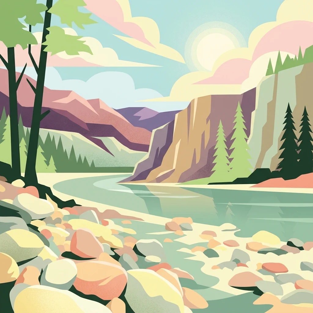
A stylized vector-style illustration of a river flowing through a canyon with rocky riverbanks, evergreen trees, and soft-colored clouds in the sky.

Juniper Beach Provincial Park

State or regional park

Park overview

Structured park overview, official facts, and landscape profile for Juniper Beach Provincial Park

Juniper Beach Provincial Park park facts, protected area profile, and essential visitor context

Review the core facts for Juniper Beach Provincial Park, including designation, size, terrain, visitor scale, habitats, and operating context in one park-focused overview.

About Juniper Beach Provincial Park

Juniper Beach Provincial Park occupies a narrow but ecologically meaningful stretch of the Thompson River corridor in south central British Columbia. The park lies west of the small community of Savona and just below the outflow of Kamloops Lake, where the Thompson River begins its descent toward the Fraser system. Positioned along BC Highway 1, the park is roughly 20 kilometers east of Cache Creek and about 65 kilometers west of Kamloops, placing it firmly within the dry heart of the province's interior plateau.

The defining character of Juniper Beach lies in the meeting of two very different environments. A riverside beach of gravel and sand runs along the Thompson, while the bluff and benchland above rises into classic British Columbia desert scenery. Sagebrush and other drought-adapted plants cover much of the upland, giving the park a look and feel more reminiscent of the American Southwest than the conifer-rich landscapes that most visitors associate with the province. This unusual ecological profile is the reason the area was placed under formal protection.

Established in 1989, the park was created specifically to safeguard this desert habitat from pressures along the busy Highway 1 corridor. It is now administered by BC Parks as an IUCN Category II reserve, the same international designation used for national parks worldwide, and it functions as both a conservation site and a recreational gateway. Visitors come for the riverside atmosphere, the fishing in the Thompson, and the chance to experience a slice of arid interior ecology that is difficult to find elsewhere in coastal-temperate British Columbia.

Although the park is compact at roughly 260 hectares, its combination of river, canyon-edge benches, and dry shrubland creates a landscape that feels more open than its size suggests. Seasonal wildflowers, reptile activity on warm slopes, and the annual rhythm of salmon and steelhead runs in the Thompson add layers of interest for hikers, anglers, and naturalists who take time to explore beyond the campground.

Quick facts and research context for Juniper Beach Provincial Park

Juniper Beach Provincial Park covers roughly 260 hectares on the north side of the Thompson River in the Thompson Country region of British Columbia. It was established in 1989 and is operated by BC Parks under an IUCN Category II designation. The park protects arid sagebrush desert ecology along the river corridor, and its vehicle-accessible campground traditionally opens seasonally between late April and mid October.

Protection and recognition

Review documented terrestrial protection scope and international recognition facts

Juniper Beach Provincial Park Protection Status and Conservation Records

Juniper Beach Provincial Park holds a documented terrestrial protection scope within the broader protected area network. Evaluating official designation records clarifies the baseline management framework and administrative status for this natural landscape.

Protection details

Protection scope
Terrestrial
Transboundary protection
No
Park context

Deeper park guide and search-rich context for Juniper Beach Provincial Park

Juniper Beach Provincial Park history, landscape, wildlife, and travel context

Explore Juniper Beach Provincial Park through its history, landscape character, ecosystems, wildlife, conservation priorities, cultural context, and seasonal travel timing in a structured park guide built for atlas discovery and search intent.

Why Juniper Beach Provincial Park stands out

Juniper Beach is best known for its unusual combination of a sandy Thompson River beach with true desert-ecosystem vegetation. Within a province dominated by temperate rainforest and mountain landscapes, the park preserves a pocket of sagebrush steppe, making it a rare example of British Columbia's dry interior ecology. The park is also notable for the wildlife that this dry habitat supports, including Western Rattlesnakes and mule deer on land, and trout, steelhead, and salmon in the adjacent Thompson River. Birdlife such as the Western Tanager, Mountain Bluebird, and Northern Oriole adds seasonal color to the riverbank setting.
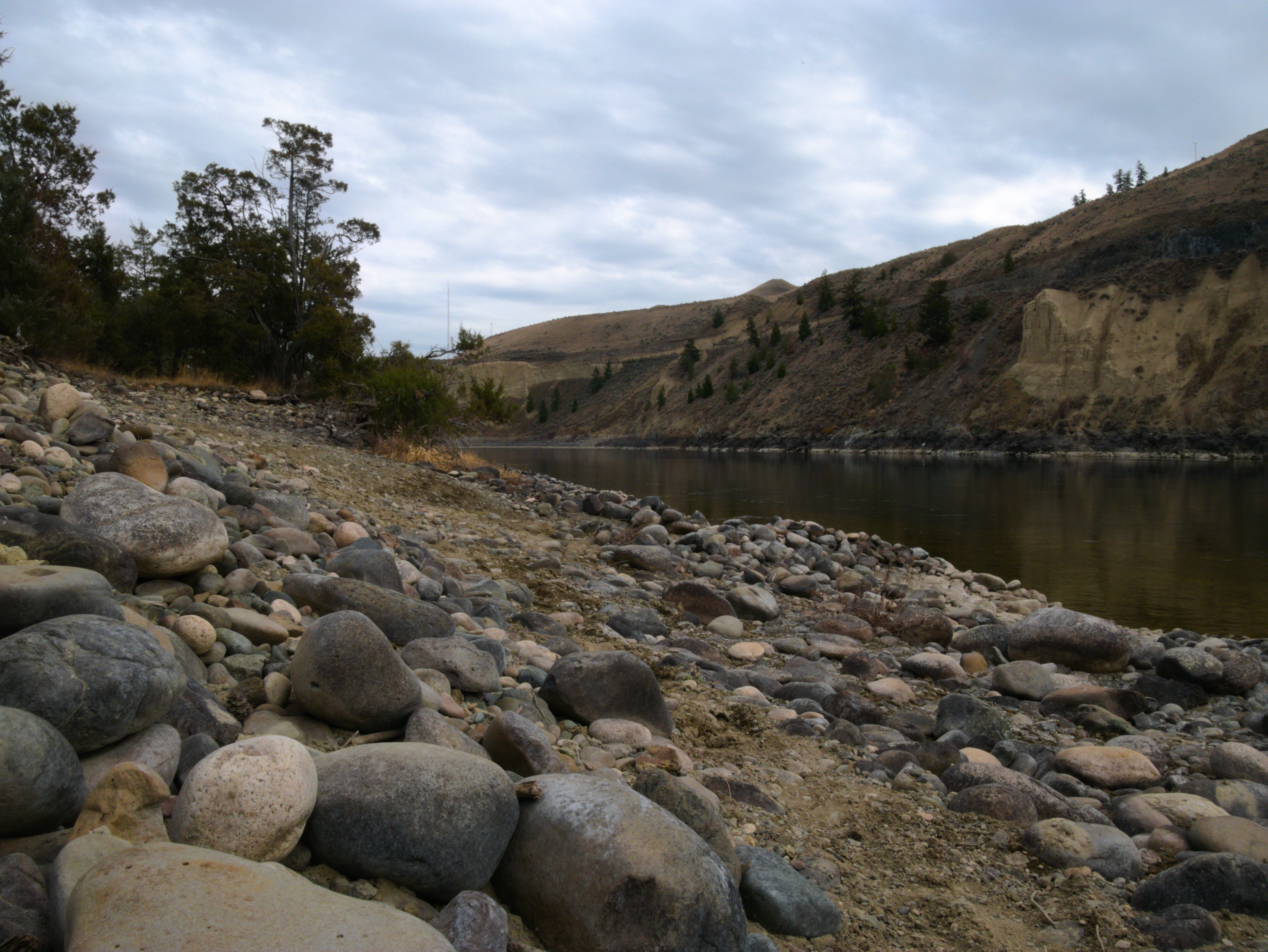
A rocky, dry riverbank with smooth stones in the foreground; the Thompson River flows calmly in the midground, flanked by rolling, arid hills under a cloudy sky.
A rocky riverbank along the Thompson River in Juniper Beach Provincial Park.

Juniper Beach Provincial Park history and protected-area timeline

Juniper Beach Provincial Park was formally established in 1989, when the British Columbia government designated the area as a protected provincial park. The creation of the park reflected growing recognition of the distinct desert ecology found along the Thompson River corridor, an environment that stood out sharply from the forested landscapes that dominate most of the province. Since its establishment, the park has been operated by BC Parks and classified internationally under the IUCN's Category II system, the same level of protection applied to national parks in many countries.

Over time, the park's role as a desert refuge and a Highway 1 traveler stop has reinforced its identity as a small but unusually focused conservation site in British Columbia's dry interior.

Juniper Beach Provincial Park landscape and geographic character

The landscape of Juniper Beach Provincial Park is shaped first by the Thompson River, which curves along the park's southern edge in a broad, gravel-rich channel. A flat riverside beach gives way to a series of benches and bluffs climbing toward the interior plateau, and these benches form the stage for the park's characteristic vegetation.

Above the beach, the terrain is dry, exposed, and sun-baked. Sagebrush-covered slopes, loose gravel, and patchy bunchgrass create a sweeping open-country feel. To the north and east, the land rises toward the broader savanna-like terrain of the Thompson Country, while downstream the river continues toward its meeting with the Fraser system far to the west. The overall impression is of a small desert pocket pinched between river and plateau, a striking contrast to the lakes, forests, and ranching landscapes that surround Kamloops Lake upstream.

Juniper Beach Provincial Park ecosystems, habitats, and plant life

Ecologically, Juniper Beach is unusual because it preserves a fragment of British Columbia's interior desert within a province better known for wet coastal forests. The dominant habitat is sagebrush steppe, shaped by low rainfall, hot summers, and cold winters, with vegetation adapted to sandy or rocky soils that do not retain moisture. Drought-resistant shrubs, hardy bunchgrasses, and seasonal wildflowers fill the open benches above the river.

Where the slope meets the river, the habitat transitions sharply into a riparian band of willows and other moisture-loving plants, and the river itself introduces a cooler, more productive environment. The result is a compressed ecological gradient, with desert on the uplands and a narrow green ribbon of river-edge life along the beach, giving the park an unusually high habitat contrast for its size.

Juniper Beach Provincial Park wildlife and species highlights

The wildlife of Juniper Beach reflects the meeting of desert and river. In the dry sagebrush areas above the beach, the park supports Western Rattlesnakes, which use the warm rocky slopes, as well as mule deer that move through the open shrubland. The relative openness of the terrain makes wildlife comparatively easy to observe compared with thicker forested settings.

The Thompson River itself adds an entirely different set of species. Trout, steelhead, and salmon inhabit the cool water, drawing anglers from across the region. Birdlife is notably diverse for a small park, with species such as the Western Tanager, Mountain Bluebird, and Northern Oriole recorded in the area, taking advantage of both the river-edge habitat and the insect-rich sagebrush slopes. Together, these species create a wildlife profile that combines arid-country specialists with classic British Columbia salmonid river fauna in an unusually compact landscape.

Juniper Beach Provincial Park conservation status and protection priorities

The conservation value of Juniper Beach Provincial Park lies primarily in what it preserves rather than its size. At roughly 260 hectares, the park is modest in area, but the habitat it protects is exceptionally rare within British Columbia. The sagebrush desert ecosystem along the Thompson River is a small and vulnerable fragment of a much larger historical dry zone, and protecting a representative piece of it inside a formal park helps maintain ecological continuity along the river corridor.

The park's IUCN Category II designation places it in the same international protection tier as national parks, recognizing both its ecological importance and its role in preserving natural processes. By shielding this desert habitat from the development pressures that follow BC Highway 1, Juniper Beach contributes to the broader network of arid-zone refuges that sustains interior species, from rattlesnakes and desert-adapted birds to the salmon and steelhead that depend on the river below.

Top sights and standout views in Juniper Beach Provincial Park

The standout quality of Juniper Beach Provincial Park is the unusual pairing of a peaceful Thompson River beach with classic British Columbia desert scenery, a combination that is hard to match anywhere else in the province. Within a compact footprint, the park delivers sagebrush slopes, river-edge habitat, productive salmonid waters, and an accessible location along Highway 1.

Its greatest strengths are ecological: the chance to see Western Rattlesnakes, mule deer, and dry-country birds in their natural habitat, and the opportunity to fish in a river known for trout, steelhead, and salmon. For travelers, the park also offers a memorable sense of place, an interior British Columbia where river, canyon, and desert converge in a single, easily explored landscape.

Best time to visit Juniper Beach Provincial Park

The park's traditional camping season runs from late April through mid October, which coincides with the months when the desert ecology is most active and accessible. Late spring brings wildflower color to the sagebrush benches and warming temperatures that draw reptiles to the open slopes, while summer offers the warmest conditions for river swimming, fishing, and observing dry-country wildlife.

Early autumn can also be rewarding, with cooler air, active bird migration along the river corridor, and the beginning of salmon runs in the Thompson. In contrast, winter conditions along this stretch of interior British Columbia can be cold and icy, and the campground is typically closed, leaving the park quieter and less suited to typical visitor use.
Monthly climate preview

Long-term monthly temperature and precipitation rhythm at a representative elevation

Juniper Beach Provincial Park Climate Normals and Annual Temperature Patterns

Representative coordinate records show measured monthly temperature and precipitation normals spanning sub-zero winter minimums and warm summer peaks. Examining the complete twelve-month sequence reveals detailed fluctuations in long-term averages across the protected area.
Annual mean3 °C
-9 °C16 °C
Jan-9°
Feb-7°
Mar-2°
Apr
May
Jun12°
Jul16°
Aug15°
Sep10°
Oct
Nov-3°
Dec-8°
Warmest month
July

15.7 °C

Coolest month
January

-8.7 °C

Wettest month
June

2 mm/day

Driest month
February

1 mm/day

Park location guide

Geography guide, regional context, and park location map for Juniper Beach Provincial Park

Juniper Beach Provincial Park park geography, regions, and map view in Canada

Understand where Juniper Beach Provincial Park sits in Canada through a broader geographic reading of the surrounding landscape, nearby location context, and its mapped position within the national park landscape.

How Juniper Beach Provincial Park fits into Canada

Canada is a federal parliamentary constitutional monarchy spanning North America from the Atlantic to the Pacific and Arctic Oceans. With a population of over 41 million, it is officially bilingual in English and French at the federal level. The country gained independence from the United Kingdom through a gradual process culminating in 1982.

Wider geography shaping Juniper Beach Provincial Park in Canada

Canada occupies the northern portion of North America, sharing its longest international border with the United States. The country extends from the Atlantic Ocean to the Pacific Ocean and northward into the Arctic Ocean, giving it the longest coastline of any nation.

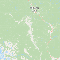
Map view of Juniper Beach Provincial Park

Use this park location map to pinpoint Juniper Beach Provincial Park in Canada, understand its exact geographic position, and read its mapped placement within the surrounding landscape more clearly.

Pigeon | © OpenStreetMap contributors

Location context for Juniper Beach Provincial Park

British Columbia
Recorded earthquake history

View Recorded Earthquake History Near Juniper Beach Provincial Park

Examine the historical catalogue of seismic events and epicentre data associated with the geography of Juniper Beach Provincial Park. MoriAtlas provides a clear view of recorded magnitudes and regional activity for those studying the seismic history of this Thompson Country landscape.

Juniper Beach Provincial Park Earthquake History

Catalogued events

1 event

Strongest magnitude

Magnitude 3.4

Most recent event

Dec 16, 2015

This history includes earthquakes recorded inside the park or within 50 km of its borders

Visual exploration of dry interior plateau terrain, sagebrush steppe, and Thompson River corridors.

Juniper Beach Provincial Park Photos, Scenery, and Protected Landscape Views

Visual documentation captures the arid interior plateau habitats, sagebrush slopes, and riverbank topography defining Juniper Beach Provincial Park. Photographic field records help observers examine regional desert ecology and protected terrain characteristics in granular detail.

A rocky, dry riverbank with smooth stones in the foreground; the Thompson River flows calmly in the midground, flanked by rolling, arid hills under a cloudy sky.

Park atlas

Compare adjacent arid terrain and regional river ecosystems across the interior plateau.

Explore Protected Areas and Parks Near Juniper Beach Provincial Park

Browse nearby protected landscapes that share the dry climate and river corridors surrounding Juniper Beach Provincial Park. Comparing these neighboring habitats reveals the wider ecological patterns of the interior plateau.
State or regional parkBritish Columbia
40 km away#1 closest

West

Marble Canyon Provincial Park: A Geological Exploration of British Columbia's Limestone Terrain

Mapping the canyons, mountain lakes, and microbialite ecosystems of the Marble Range.

Marble Canyon Provincial Park provides a dense concentration of natural features in British Columbia. The area protects a deep, river-carved limestone gorge, surrounding mountain slopes, and the distinct carbonate structures of Pavilion Lake. This site serves as a vital natural laboratory for geological and scientific research while offering an accessible landscape of cliffs and clear interior waters.

Area
25.44 km²
Established
1956
IUCN
II
Relief
Mountain
A horizontal watercolor illustration depicting gentle green hills, a small grove of trees, and a pale ground plane against a white background.
Protected areaBritish Columbia
About 42 km away#2 closest

East

Lac du Bois Grasslands Protected Area: Mapped Geography and Interior Plateau Landscapes

Exploring dryland ecosystems and native prairies in British Columbia.

Located in the Thompson-Nicola Regional District, this protected area spans over fifteen thousand hectares of rolling hills and elevated rocky benches. It remains a flagship example of interior plateau conservation, preserving a unique ecological gradient that stretches from arid sagebrush-covered terrain up into denser montane coniferous forest communities.

Area
157.12 km²
Established
1996
IUCN
II
Relief
Upland
State or regional parkBritish Columbia
About 43 km away#3 closest

Northeast

Porcupine Meadows Provincial Park: Protected Interior Landscapes and Plateau Geography

High-elevation sub-alpine meadows on the Bonaparte Plateau

Porcupine Meadows Provincial Park serves as a critical protected area within the interior of British Columbia. The terrain is characterized by expansive sub-alpine meadows, boggy wetland complexes, and mature old growth forest stands. This remote high-elevation environment offers a unique look at the plateau geography situated west of the North Thompson River, highlighting the transition between alpine habitats and forest interior.

Area
27.04 km²
Established
1996
IUCN
II
Relief
Upland
State or regional parkBritish Columbia
53 km away#4 closest

Northwest

Edge Hills Provincial Park: Mapping the Fraser Canyon and Interior British Columbia Geography

A remote protected fore-range between canyon and mountain

Edge Hills Provincial Park offers a study in interior British Columbia topography, where dramatic vertical relief from the Fraser River canyon meets high-elevation rolling hills. This undeveloped preserve highlights the transition between coniferous forests and dry grasslands, providing a distinct geographic perspective for those interested in Canadian protected landscapes and rugged mountain terrain.

Area
118.82 km²
Established
1995
IUCN
II
Relief
Mountain
A watercolor painting showing a soft landscape with rolling hills, a winding stream or lake, and grassy vegetation.
State or regional parkBritish Columbia
About 102 km away#5 closest

South

Kentucky Alleyne Provincial Park: Glacial Landscapes and Interior Protected Areas

Mapping kettle lake geography in the British Columbia interior

Kentucky Alleyne Provincial Park preserves a compact, richly varied landscape of kettle lakes, eskers, and dry interior forest. Located in the Nicola region of British Columbia, this protected area offers a clear look at glacial landforms and sun-warmed Ponderosa pine woodlands, standing as a distinct geographic landmark within the Canadian interior range country.

Area
1.9 km²
Established
1981
IUCN
II
Relief
Upland
A watercolor illustration of a mountain range behind a calm lake with evergreen trees and grassy banks.
State or regional parkBritish Columbia
About 109 km away#6 closest

Southwest

Joffre Lakes Provincial Park: Geographic Atlas of Southwestern British Columbia Mountains

Glacial valleys and alpine wilderness protected areas

Joffre Lakes Provincial Park serves as a benchmark for alpine geography in British Columbia, showcasing a compact amphitheater of polished bedrock, moraines, and intense turquoise lakes. This protected area offers a focused look at the intersection of glacial hydrography and high-mountain terrain within the Coast Mountains, illustrating how meltwater and high-altitude peaks define this regional ecosystem.

Area
14.87 km²
Established
1996
Relief
Mountain
Climate
Alpine
A horizontal watercolor painting depicting a light, airy landscape with distant snow-capped mountains, rolling green hills, and coniferous forest edges.
State or regional parkBritish Columbia
121 km away#7 closest

Southwest

Garibaldi Provincial Park: An Atlas of Volcanic and Glacial Terrain in British Columbia

Protected wilderness in the Garibaldi Volcanic Belt

Garibaldi Provincial Park preserves a massive expanse of mountainous wilderness, defined by iconic landmarks such as The Black Tusk and Garibaldi Lake. The park represents a crucial study in vertical zonation, transitioning from temperate coastal forests to vast alpine meadows, glaciers, and jagged volcanic summits. Analyze the geological history and mapped protected boundaries that shape this significant British Columbia conservation area.

Area
1,950 km²
Established
1920
IUCN
II
Visitors
136K annual
A panoramic watercolor illustration depicting rolling green and lavender hills with dark green conifer tree silhouettes in the foreground under a pale pink sky
Protected landscapeBritish Columbia
About 125 km away#8 closest

Northwest

Churn Creek Protected Area: Geography and Mapped Landscapes of the Chilcotin Plateau

Dryland canyon systems and open grassland ecosystems in British Columbia

Spanning over 36,000 hectares, Churn Creek Protected Area preserves an unusual interior dryland environment defined by bluebunch wheatgrass steppe and sagebrush communities. The area sits where the Chilcotin Plateau meets the Fraser River, creating a mosaic of benches, hoodoos, and deep drainages that transition into the Camelsfoot Range.

Area
367.47 km²
Established
1995
IUCN
VI
Relief
Mixed relief

Common questions about visiting, size, designation, and location context for Juniper Beach Provincial Park

Juniper Beach Provincial Park FAQs for park facts, access, geography, and protected area context

Find quick answers about Juniper Beach Provincial Park, including protected-area facts, park geography, trail and visitor context, and how the park fits into its surrounding country and regional landscape.
MoriAtlas Explorer

Continue Your Protected Areas Search Across the Global Atlas

Deepen your exploration by continuing the structured search for national parks and protected areas worldwide. Utilize the comprehensive filtering capabilities to compare different conservation landscapes and refine your understanding of global park geography. Discover more about the distribution and characteristics of protected natural areas.

Global natural geography