

Why Kaiserstuhl Conservation Park stands out
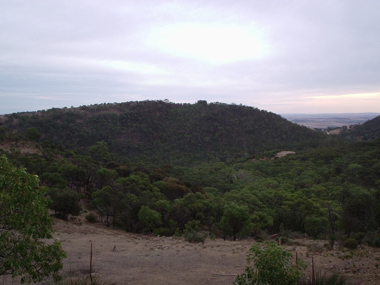
The conservation park is best known for protecting the forested slopes and ridges around Kaiserstuhl hill, a roughly 600-metre high elevation in the northern Mount Crawford Forest that carries the dual Aboriginal name Patpoori. Its identity is closely tied to this single prominent natural feature, whose German name reflects the strong cultural connections between 19th-century South Australian settlers and their European origins.
Kaiserstuhl Conservation Park history and protected-area timeline
The conservation park was originally proclaimed on 3 May 1979 under the National Parks and Wildlife Act 1972, covering a selection of land parcels in the cadastral unit of the Hundred of Moorooroo. These initial sections formed the core of what would become the present-day park.
In 1987, the reserve was expanded through a further proclamation on 3 December, adding sections 859, 860, 861, and 862 to the existing protected area. By 2016, the combined landholdings of the park totalled approximately 4.35 square kilometres. The park was also recognised on the now-defunct Register of the National Estate in 1980, reflecting its early acknowledgement as a place of natural heritage value within South Australia.
The hill after which the park is named carries its own layered history. It was originally named Kaiserstuhl by the geologist Joseph Menge, after a celebrated wine-growing mountain range near Freiburg in southwestern Germany. During the period of anti-German sentiment associated with the First World War, the name was changed to Mount Kitchener in 1918, before later being restored to its original form. Today the hill is dual-named with the Aboriginal name Patpoori, recognising the longer Indigenous history of the landscape.
Kaiserstuhl Conservation Park landscape and geographic character
The landscape of Kaiserstuhl Conservation Park is shaped by the hill after which it is named, a forested elevation of roughly 600 metres that rises from the surrounding country of the eastern Barossa Ranges. Although the park itself is compact, it sits within a wider setting of gentle ridges, valleys, and mixed land use typical of the Mount Crawford Forest area.
The terrain is characterised by the contrast between wooded high ground and the lower, more open country of the Barossa Valley to the west. Native forest vegetation covers the slopes associated with Kaiserstuhl hill, while the park's boundaries follow a mix of section lines, roads, and rural land edges, with Tanunda Creek Road forming a clear eastern boundary.
The experience of the landscape is closely tied to walking. The Heysen Trail, a long-distance route traversing South Australia, traces the western side of the conservation park, giving visitors a way to engage with the forested terrain and the broader ridgelines of the region. The protected area functions less as a dramatic scenic landmark than as a preserved piece of the original wooded country that once extended more widely across the hills around the Barossa.
Kaiserstuhl Conservation Park ecosystems, habitats, and plant life
Kaiserstuhl Conservation Park forms part of the northern Mount Crawford Forest, a substantial native forest reserve that retains woodland and forest habitat on the higher country east of the Barossa Valley. The park contributes a small but locally significant block of this habitat network, supporting the continuity of native vegetation cover in an area otherwise shaped by agriculture and viticulture.
Because the park is designated as an IUCN Category III protected area focused on a natural feature rather than a large ecosystem, its conservation role centres on safeguarding the immediate landscape around Kaiserstuhl hill. The native forest reserve setting suggests eucalypt woodland and related South Australian hill country vegetation typical of the eastern Barossa Ranges.
Ecologically, the park's value lies in its contribution to habitat connectivity within a broader forest landscape. Even at a relatively modest size, its protected status helps maintain forest cover that would otherwise be vulnerable to gradual conversion or fragmentation through adjacent land uses.
Kaiserstuhl Conservation Park wildlife and species highlights
The conservation park's wildlife profile is shaped by its location within a larger native forest landscape rather than by a particularly rich or unique species assemblage of its own. The wooded slopes and connected habitat of the northern Mount Crawford Forest support typical South Australian hill country fauna, with the park acting as a protected refuge within a wider working rural environment.
Specific species records are not emphasised in available sources, and the park is better understood as part of a regional forest ecosystem than as a stand-alone wildlife destination. Its ecological role is primarily one of maintaining native habitat rather than hosting a distinctive fauna profile of its own.
Kaiserstuhl Conservation Park conservation status and protection priorities
Kaiserstuhl Conservation Park holds a clear conservation purpose through its status as an IUCN Category III protected area, a designation reserved for natural monuments or features of recognised value. Its protection is centred on the integrity of the landscape associated with Kaiserstuhl hill and its surrounding forested terrain.
Recognition on the former Register of the National Estate in 1980 reflects an early acknowledgement of the park's natural heritage significance within South Australia. Governance is provided by the Department for Environment and Water, the state body responsible for managing South Australia's network of parks and conservation reserves.
In regional terms, the park's conservation value lies in its contribution to the persistence of native forest in an area otherwise dominated by viticulture, grazing, and settlement. Its position within the Mount Crawford Forest system gives it a role in maintaining habitat continuity, even though its size is modest compared with major wilderness reserves further afield in the state.
Kaiserstuhl Conservation Park cultural meaning and human context
The cultural landscape around Kaiserstuhl Conservation Park reflects two intersecting strands of South Australian history. The hill's German name, given by the geologist Joseph Menge and echoing the famous Kaiserstuhl wine-growing range near Freiburg in southwestern Germany, points to the strong 19th-century German settler character of the Barossa region. This shared naming has long linked the local landscape with European viticultural heritage.
World War I disrupted this connection briefly: the German name was officially changed to Mount Kitchener in 1918, before later being restored. The hill's dual Aboriginal name, Patpoori, runs alongside this European story and acknowledges the longer Indigenous history of the country, in which native forest and ranges held their own meanings long before European settlement.
The park therefore sits within a landscape layered with multiple cultural associations, from Aboriginal place-naming and the persistence of German-Australian heritage to the modern wine identity of the Barossa.
Top sights and standout views in Kaiserstuhl Conservation Park
The park's standout feature is the forested country surrounding Kaiserstuhl (Patpoori) hill, a 600-metre elevation at the heart of the conservation area. Combined with the park's situation within the larger Mount Crawford Forest and its position along the Heysen Trail, this single landscape focus gives the reserve a clear identity as a protected natural feature in the eastern Barossa Ranges.
Best time to visit Kaiserstuhl Conservation Park
The Barossa Ranges experience mild South Australian seasonal variation, with warm to hot summers and cooler, wetter winters. Spring and autumn typically offer pleasant walking conditions on the Heysen Trail and the surrounding forest tracks, while winter brings cooler temperatures and greener vegetation across the hills. Summer visits are possible, but the heat and drier conditions shape how comfortably the open forest environment can be explored.
