
Mori Atlas logo
Protected areaKalkmagerrasen bei Roßbach

A historic mosaic of juniper scrub, rare orchid habitats, and limestone hills in the Werra Meißner Kreis region

Kalkmagerrasen bei Roßbach: Mapping the Protected Calcareous Grassland Landscapes of Germany

(Naturschutzgebiet Kalkmagerrasen bei Roßbach)

Kalkmagerrasen bei Roßbach preserves a striking mosaic of submediterranean semi-dry grassland across Zechstein limestone hillslopes in northern Hesse. This protected area guards one of Germany's most significant populations of the rare Orchis tridentata orchid within a landscape shaped by traditional low-intensity grazing. The surrounding terrain of the Kleinalmeröder Hügelland creates a distinctively open, sun-warmed environment that contrasts sharply with the forested ridges of the nearby Kaufunger Wald.

calcareous grasslandorchid habitatjuniper scrubcultural landscapesheep pasture relicNatura 2000
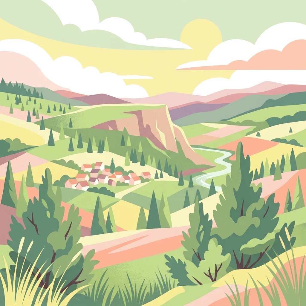
A digital illustration of a green hilly landscape featuring a small cluster of houses in a valley, a winding stream, scattered coniferous trees, and soft hills in the background under a pale sun.

Kalkmagerrasen bei Roßbach

Protected area

Park overview

Structured park overview, official facts, and landscape profile for Kalkmagerrasen bei Roßbach

Kalkmagerrasen bei Roßbach park facts, protected area profile, and essential visitor context

Review the core facts for Kalkmagerrasen bei Roßbach, including designation, size, terrain, visitor scale, habitats, and operating context in one park-focused overview.

About Kalkmagerrasen bei Roßbach

Kalkmagerrasen bei Roßbach is a compact, ecologically dense protected landscape in northern Hesse. It consists of five separate units, locally known as 'Großer Hesselberg', 'Auf dem Keßstieg', 'Der Ameisenkopf', 'Der Kalkrain' and 'Auf der Warte', distributed across the municipal territories of Dohrenbach, Ellingerode, Roßbach and Witzenhausen. Together they form one of the most important surviving examples of submediterranean semi-dry limestone grassland in central Germany, anchored in the rolling terrain of the Kleinalmeröder Hügelland.

The defining physical setting is provided by Zechstein sediments. Their weathering produced shallow, humus-poor, base-rich soils that were never well suited to arable farming. Instead, these slopes were historically used for extensive grazing by sheep and goats, and this chronic, low-intensity disturbance, combined with the absence of fertilizer, allowed a specific habitat type to develop: sparse, flower-rich vegetation broadly classified as Submediterranean Halbtrockenrasen. Today, this habitat is exceedingly rare in the region, having been pushed to the margins by agricultural intensification and land abandonment.

The reserve's vegetation profile is unusually rich. The plant community is dominated by grasses and flowering herbs typical of the Gentiano-Koelerietum association, and the landscape is interspersed with juniper bushes that, together with the grassland flora, evoke a near-Mediterranean feel. Beyond its ecological character, the area is part of the famous Witzenhausen cherry-growing region, where sweet cherry orchards lend additional seasonal beauty in spring bloom and autumn colour. The reserve is also embedded in the Geo-Naturpark Frau-Holle-Land and lies at the cusp of the Osthessisches Bergland and Fulda-Werra-Bergland natural regions, where the Kleinalmeröder Hügelland meets the higher ridges of the Kaufunger Wald to the north, west and south.

Although the protected footprint is modest in size, its biological concentration is exceptional. It not only safeguards rare plant communities but also supports an unusually complete fauna of insects, reptiles, amphibians and breeding birds associated with traditional, open, flower-rich cultural landscapes in Germany.

Quick facts and research context for Kalkmagerrasen bei Roßbach

Kalkmagerrasen bei Roßbach is a nature reserve and Natura 2000 Fauna-Flora-Habitat site in the Werra-Meißner-Kreis of northern Hesse, covering five parcels between the villages of Roßbach and Ellingerode near Witzenhausen. The site lies within the Geo-Naturpark Frau-Holle-Land and within the natural region of the Lower Werra Hills. It sits on Zechstein limestone soils of the Kleinalmeröder Hügelland at elevations roughly between 236 m and 327 m above sea level.

The reserve was legally protected in 1996 and integrated into the European Natura 2000 network in 1999, with formal Hessian confirmation in 2008. Its primary purpose is to conserve a rare, historically grazed calcareous grassland type with juniper scrub and species-rich flowering meadows, together with a high number of endangered plants and animals.

Protection and recognition

Documented terrestrial protection scope, designation history, and international recognition data

Kalkmagerrasen bei Roßbach Protection Status and Natura 2000 Recognition

Kalkmagerrasen bei Roßbach maintains a documented terrestrial protection status established in 1999 alongside official Natura 2000 recognition records. Structured database entries compile verified designation history and management scope for geographic analysis.

International recognition

Protection details

Protection scope
Terrestrial
Designated year
1999
Transboundary protection
No
WDPA ID
163987
Park context

Deeper park guide and search-rich context for Kalkmagerrasen bei Roßbach

Kalkmagerrasen bei Roßbach history, landscape, wildlife, and travel context

Explore Kalkmagerrasen bei Roßbach through its history, landscape character, ecosystems, wildlife, conservation priorities, cultural context, and seasonal travel timing in a structured park guide built for atlas discovery and search intent.

Why Kalkmagerrasen bei Roßbach stands out

The reserve is especially known for its species-rich calcareous semi-dry grassland, often referred to as Enzian-Schillergras-Rasen, which carries one of the largest German populations of the threatened orchid Orchis tridentata (Dreizähniges Knabenkraut). Tens of thousands of these orchids bloom across the protected slopes in late spring, making the site a nationally significant stronghold for the species. The grasslands also host a remarkable range of other orchids, juniper bushes and butterflies rare in Hesse. The reserve is likewise valued as a cultural landscape relic. Its surviving fragments of juniper-dotted grazing land, together with neighbouring sweet cherry orchards of the Witzenhausen cherry-growing region, form a distinctive mosaic that retains the character of a historic Hutelandschaft shaped by generations of shepherding.
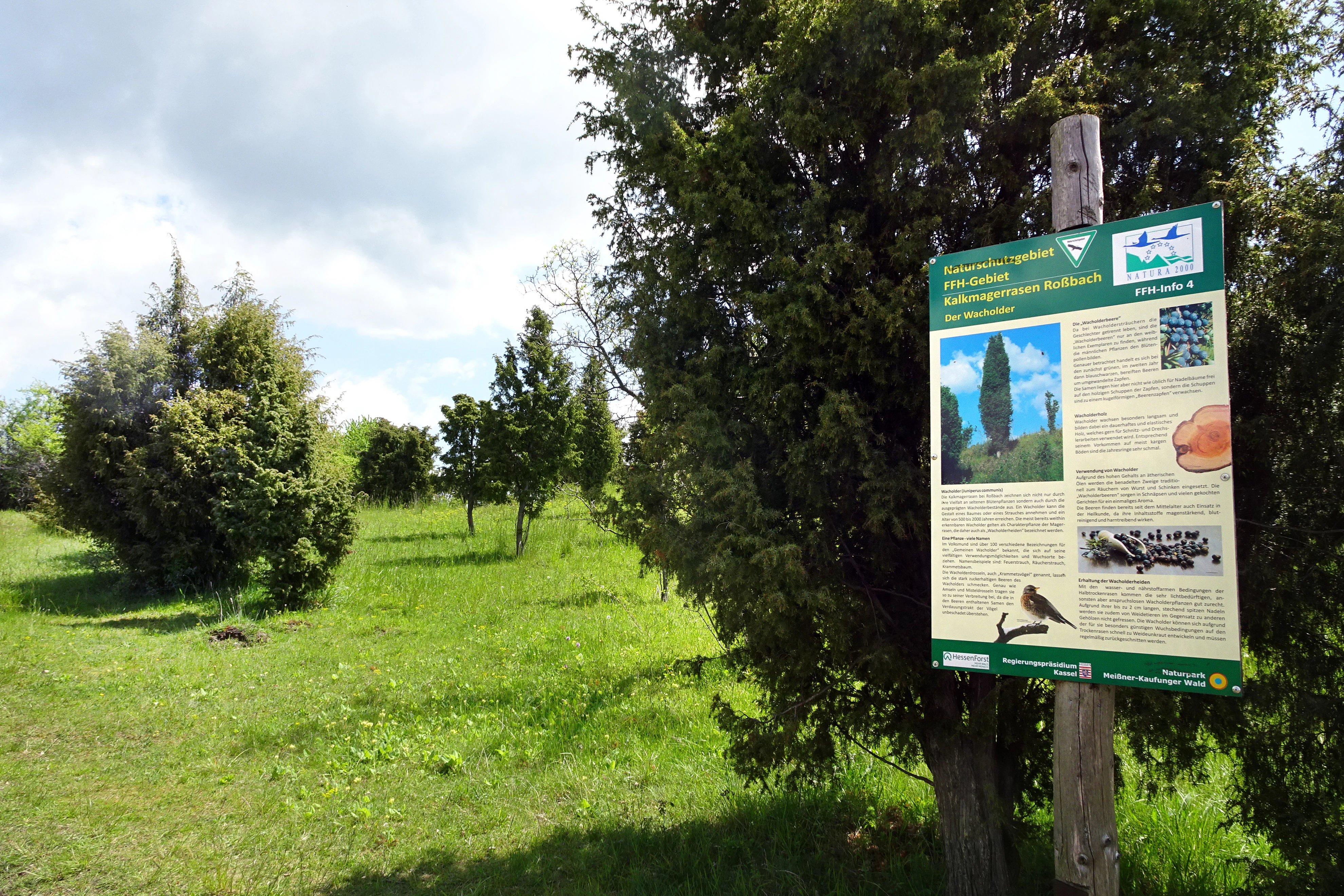
An informational park sign mounted on a wooden post stands in a grassy area with scattered juniper bushes.
An informational sign explaining the Kalkmagerrasen bei Roßbach nature reserve.

Kalkmagerrasen bei Roßbach history and protected-area timeline

The area's ecological history is inseparable from centuries of traditional land use. The shallow, lime-rich soils on the hilltops and slopes of the Kleinalmeröder Hügelland were long unsuitable for ploughing but well suited to extensive grazing by sheep and goats. This persistent pastoral use, without fertilization or reseeding, allowed the open, species-rich calcareous grassland of the Submediterranean Halbtrockenrasen type to develop. Over time, the cultural landscape also integrated hedges, orchards and field margins, and the juniper bushes that dot the slopes became emblematic features of this shepherding heritage.

Through the twentieth century, the decline of traditional grazing and the intensification or abandonment of land use gradually reduced such grasslands across Hesse, leaving only isolated remnants. Five of these fragments around Roßbach and Ellingerode survived in a sufficiently intact state to merit formal recognition. On 26 December 1995, the Regierungspräsidium in Kassel issued a regulation declaring the area a Naturschutzgebiet with the national identifier 1636030, ensuring protection of the open calcareous grasslands, adjoining meadows, fields and woodlands as part of a historically evolved cultural landscape.

In 1999, the same five plots, with identical boundaries and conservation objectives, were reported to the European Commission as part of the implementation of the EU Habitats Directive. They became a candidate Fauna-Flora-Habitat site within the transboundary Natura 2000 network, motivated by the area's significant calcareous grasslands in various successional stages and its rich flora and fauna in former sheep-walk relics of the central uplands. Following this, the EU required a formal statutory protection, which came in January 2008 when the Hessian 'Verordnung über Natura 2000-Gebiete in Hessen' [Hessian regulation on Natura 2000 sites] was enacted, formally securing the site's FFH status under site number 4624-302.

Kalkmagerrasen bei Roßbach landscape and geographic character

Physically, the reserve sits within the Kleinalmeröder Hügelland, a gently rolling hill country that forms part of the natural region of the Lower Werra Hills in the broader Osthessisches Bergland. Elevations within the protected area vary from roughly 236 m to 327 m above sea level, and the protected plots occupy hilltops and their slopes rather than valley bottoms. The underlying substrate is Zechstein limestone, whose weathering has produced shallow, humus-poor, mineral-rich soils that are unusually dry and warm relative to the surroundings.

To the north, west and south, the reserve is framed by the higher and more forested Hinterer Kaufunger Wald, part of the Fulda-Werra-Bergland, creating a clear contrast between the open, sunny hills and the dark wooded ridges beyond. Within and around the protected plots, the visible landscape is a mosaic of open calcareous grassland, juniper scrub, hedges, orchards, meadows and small fields. From viewpoints such as the 'Auf der Warte' parcel, the eye opens out over the Gelstertal and across to Roßbach and the wooded high ground of the Kaufunger Wald, giving the area a striking sense of openness despite its small total extent.

Particularly characteristic is the visual rhythm of juniper bushes punctuating the flowering herb layer; depending on whether they take tree-like or shrub-like form, they lend the slopes an almost semi-arid or Mediterranean feel, an impression amplified by the exposed limestone slopes, dry grassland flora and bright flowering pulses in late spring.
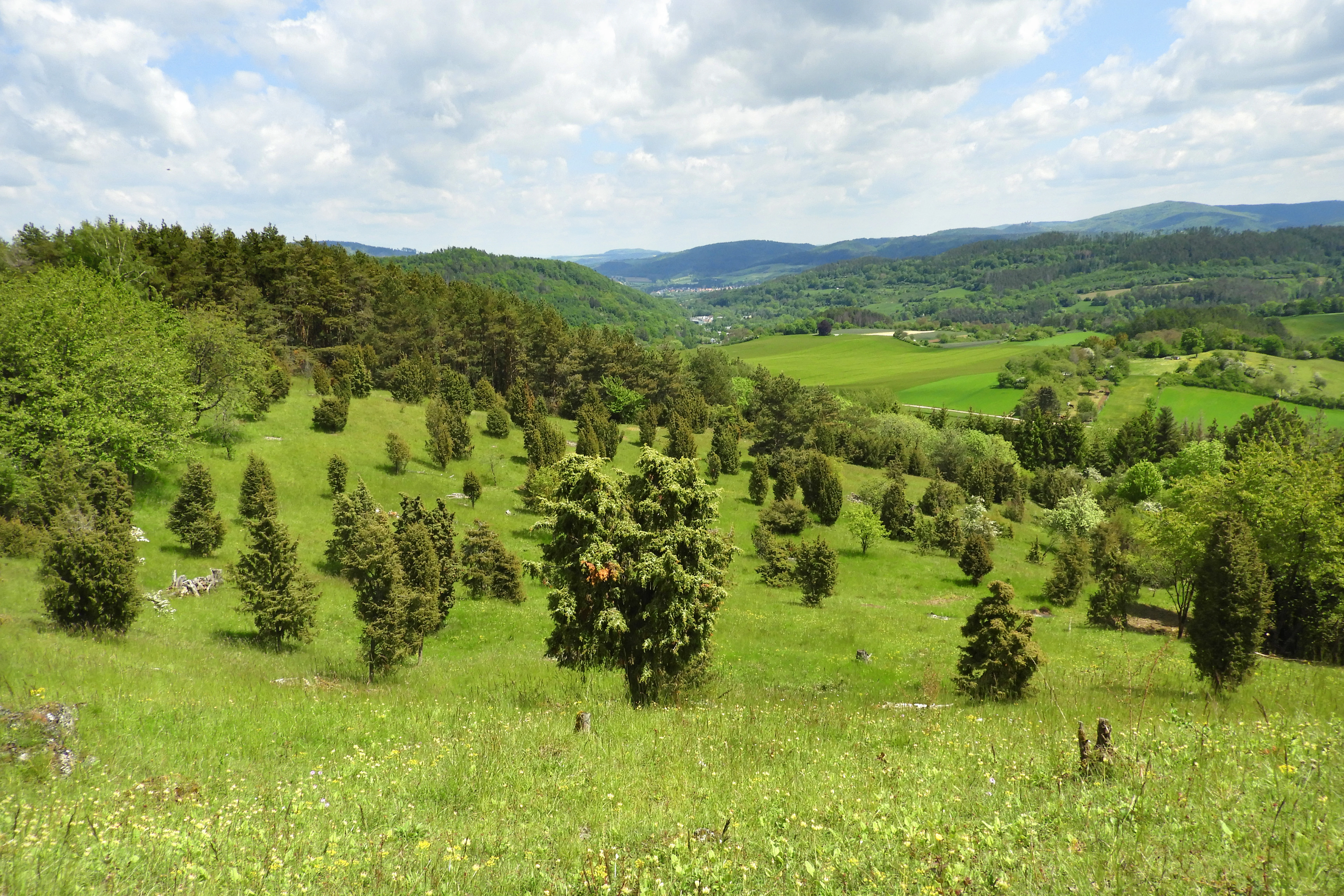
A green, sloped meadow dotted with numerous juniper bushes, with a forested hillside in the background under a cloudy blue sky.
A scenic view of the calcareous grassland nature reserve at Kalkmagerrasen bei Roßbach, featuring characteristic juniper bushes.

Kalkmagerrasen bei Roßbach ecosystems, habitats, and plant life

Ecologically, the reserve is dominated by the habitat type 'Submediterrane Halbtrockenrasen' [submediterranean semi-dry grassland], a category now exceptionally rare in northern Hesse. The dominant plant community corresponds to the Enzian-Schillergras-Rasen, an association rich in characteristic species including stemless thistle, fringed gentians, quaking grass, oat grass, restharrow, golden thistle, bulbous buttercup and bird's-foot trefoil. Typical grasses of the assemblage include Fieder-Zwenke, sheep's fescue, Koeleria, quaking grass, tall oat grass and several sedges, while characteristic herbaceous species include kidney vetch, cypress spurge, hawkweed, purging flax, small burnet, spring potentilla, small burnet saxifrage, small scabious, broad-leaved thyme and the rough violet.

The guard species of greatest conservation interest are the orchids. Among those documented in the area are Ohnhorn, Großes Zweiblatt, Mücken-Händelwurz, fly orchid, military orchid, Orchis tridentata, Orchis mascula, green-flowered ladies' tresses, autumn lady's tresses, white helleborine, broad-leaved and dark-red helleborines. Several are on Hesse's red lists, and the autumn lady's tresses is considered critically endangered. Late in May and early June, the slopes fill with tens of thousands of Orchis tridentata plants, making this reserve one of the most significant German strongholds of the species. Hesse has recognized a particular national responsibility for both Orchis tridentata and the fly orchid under its biodiversity strategy. Most native orchids enjoy special protection under German federal nature conservation law and EU species protection regulations.

Juniper plays a decisive structural role. Its spiny needles make it unpalatable to grazing animals, so it survives where sheep and goats have shaped the land, becoming a visual signature of the historic pasture landscape. Without continued grazing and periodic removal of woody regrowth, the open character deteriorates rapidly through Verbuschung [woody encroachment].

Kalkmagerrasen bei Roßbach wildlife and species highlights

The reserve's botanical richness directly supports a striking insect fauna, particularly among butterflies and day-flying moths. Documented species include the gray-brown skipper, red and small chequered skippers, the swallowtail, the brimstone-like Hufeisenklee-Gelbling, the silver-washed fritillary, the meadow brown, the comma, the green hairstreak, the clouded yellow and several blues including the small and silvery blues. Several are listed in various threat categories in Hesse.

Of particular conservation significance is the Skabiosen-Scheckenfalter (Euphydryas aurinia), whose presence here represents one of only two known populations in Hesse. Although not classified as critically endangered, it is listed in Annex II of the EU Habitats Directive as a species of community interest, requiring the designation of special areas for its protection.

Reptiles and amphibians add another layer. The reserve hosts three Annex IV species protected under both the EU Habitats Directive and German federal law: the natterjack toad (Kreuzkröte), the smooth snake (Schlingnatter) and the sand lizard (Zauneidechse). All three are considered threatened across Europe and are strictly protected.

Birds also benefit from the habitat mosaic. Bush-nesting species with notable occurrences include the red-backed shrike, the wryneck, the lesser whitethroat and blackcap, the European turtle dove and the common nightingale, completing a community typical of well-structured, flower-rich pastoral landscapes in central Europe.

Kalkmagerrasen bei Roßbach conservation status and protection priorities

Conservation recognition for Kalkmagerrasen bei Roßbach operates on two complementary legal levels. Since the end of 1995, it has been protected as a Hessian Naturschutzgebiet, and since 1999 it has formed part of the European Natura 2000 network as a Fauna-Flora-Habitat site, with statutory confirmation in 2008 under Hessian law. This dual status reflects the site's outstanding importance for both regional biodiversity and the European-level conservation of grassland, juniper and species habitats.

The conservation rationale highlights three principles. First, the area preserves an exceptionally complete example of the submediterranean semi-dry calcareous grassland habitat, including its varied successional stages, in a region where the habitat has otherwise been almost lost. Second, the landscape around the protected plots remains a coherent, historic mosaic of meadows, fields, orchards and hedges, providing the necessary context for many species that depend on the wider cultural landscape. Third, the site hosts a notable share of rare and threatened species of plants, butterflies, amphibians, reptiles and breeding birds, including several taxa for which the EU Habitats Directive requires the designation of Special Areas of Conservation.

To prevent further loss, the management regime continues to rely on extensive grazing and selective removal of encroaching shrubs to maintain the open grassland character. The Welsh botanical value, the EU-listed insect populations and the Annex IV herpetofauna together give the reserve a formal conservation weight that exceeds what its modest surface area might suggest.

Kalkmagerrasen bei Roßbach cultural meaning and human context

Kalkmagerrasen bei Roßbach is fundamentally a product of long-term human land use. The grassland, juniper stands and orchard mosaics all trace back to centuries of extensive sheep and goat grazing, which shaped soils too thin for arable farming into one of Hesse's most ecologically distinctive open landscapes. The reserve therefore preserves a living memory of a regionally characteristic pastoral economy that has largely vanished from the Werra-Meißner-Kreis.

The surrounding area reinforces this cultural dimension. The reserve lies within the historical cherry-growing landscape of Witzenhausen, one of the largest and oldest sweet cherry regions in the area, where orchards still define the rural scenery in spring bloom and autumn colour. Many of the protected grasslands sit alongside cultivated fields and traditional Streuobstwiesen (orchard meadows), integrating the conservation area into a broader working agricultural mosaic rather than isolating it as a separate green enclave. The reserve and its setting remain shaped by these intertwined biological and cultural threads.

Top sights and standout views in Kalkmagerrasen bei Roßbach

Five-part reserve guarding rare submediterranean limestone grassland on Zechstein soils; one of Germany's largest populations of the nationally important orchid Orchis tridentata; classic Enzian-Schillergras-Rasen community rich in gentians, orchids and juniper; breeding and feeding habitat for EU-protected species including the Annex II butterfly Euphydryas aurinia and Annex IV herpetofauna; landscape integration with the historic cherry-growing region of Witzenhausen; access via the certified Wacholderpfad Roßbach premium hiking trail within the Geo-Naturpark Frau-Holle-Land.

Best time to visit Kalkmagerrasen bei Roßbach

Late May and June are the most rewarding period of the year to visit Kalkmagerrasen bei Roßbach. At this time tens of thousands of Orchis tridentata plants bloom across the slopes, joined by many other orchids and a peak display of spring and early summer herbs in the calcareous grassland. The reserve also intersects with the wider Witzenhausen cherry-growing region, so spring visits can pair the calcareous grasslands with the surrounding blossom of sweet cherry orchards, while early autumn brings distinctive leaf colour across these same cultural landscapes.

Outside this peak season the reserve remains accessible year-round, with the juniper-studded slopes and sweeping views over the Gelstertal and Kaufunger Wald offering quieter but still attractive walking conditions. Visitors should note that the local Wacholderpfad Roßbach premium trail is rated moderately demanding because of its repeated climbs and descents; comfortable walking shoes are advisable, especially in the wetter months.

Monthly climate preview

Long-term representative point measurements for monthly temperature and precipitation rhythms

Kalkmagerrasen bei Roßbach Climate Normals and Annual Temperature Patterns

Kalkmagerrasen bei Roßbach records measured monthly temperatures ranging from sub-zero winter minimums to warm summer maximums alongside steady precipitation rates. Reviewing the complete twelve-month climatology dataset reveals deeper variations in historical averages across the protected area.
Annual mean8 °C
-1 °C18 °C
Jan-1°
Feb
Mar
Apr
May12°
Jun16°
Jul18°
Aug18°
Sep14°
Oct
Nov
Dec
Warmest month
July

18.2 °C

Coolest month
January

-0.9 °C

Wettest month
July

2.6 mm/day

Driest month
April

1.5 mm/day

Park location guide

Geography guide, regional context, and park location map for Kalkmagerrasen bei Roßbach

Kalkmagerrasen bei Roßbach park geography, regions, and map view in Germany

Understand where Kalkmagerrasen bei Roßbach sits in Germany through a broader geographic reading of the surrounding landscape, nearby location context, and its mapped position within the national park landscape.

How Kalkmagerrasen bei Roßbach fits into Germany

Germany is a federal republic in Western and Central Europe with a population of over 83 million across sixteen constituent states. It is Europe's largest economy by nominal GDP and a major global exporter and importer. The capital is Berlin, and the country borders Denmark, Poland, Czech Republic, Austria, Switzerland, France, Luxembourg, Belgium, and the Netherlands.

Wider geography shaping Kalkmagerrasen bei Roßbach in Germany

Germany is located in Western and Central Europe, spanning 357,022 km². It borders Denmark to the north, Poland and the Czech Republic to the east, Austria and Switzerland to the south, and France, Luxembourg, Belgium, and the Netherlands to the west. The country has coastlines on the Baltic Sea and North Sea to the north, with the Alps located in the southern region.

Map view of Kalkmagerrasen bei Roßbach

Use this park location map to pinpoint Kalkmagerrasen bei Roßbach in Germany, understand its exact geographic position, and read its mapped placement within the surrounding landscape more clearly.

Pigeon | © OpenStreetMap contributors
Recorded earthquake history

Browse the Historical Earthquake Catalogue for Kalkmagerrasen bei Roßbach

Access a detailed archive of recorded seismic events associated with the geography of Kalkmagerrasen bei Roßbach. This catalogue provides a transparent view of historical tremors near the reserve, allowing for geographic analysis of regional activity without implying future hazards or current site conditions.

Kalkmagerrasen bei Roßbach Earthquake History

Catalogued events

1 event

Strongest magnitude

Magnitude 3.1

Most recent event

Oct 13, 1980

This history includes earthquakes recorded inside the park or within 50 km of its borders

Visual reference guide to limestone grassland terrain, juniper stands, and rare flora

Kalkmagerrasen bei Roßbach Photos: Landscape, Scenery, and Protected Habitats

Visual documentation captures the exposed limestone slopes, scattered juniper stands, and specialized orchid habitats that define the protected nature reserve. Exploring these detailed photographs reveals the distinctive semi-arid character and cultural landscape remnants preserved across the hilly terrain.

An informational park sign mounted on a wooden post stands in a grassy area with scattered juniper bushes.

A landscape view of a green grassy hillside in the foreground with scattered juniper shrubs, looking out toward a small town nestled in a valley and forested hills with wind turbines on the horizon under a cloudy sky.

A green, sloped meadow dotted with numerous juniper bushes, with a forested hillside in the background under a cloudy blue sky.

Park atlas

Compare regional hill country terrain and connected calcareous grassland reserves in Hesse

Exploring Parks Near Kalkmagerrasen bei Roßbach and Surrounding Protected Landscapes

Browsing other parks near Kalkmagerrasen bei Roßbach reveals a diverse network of protected natural areas and unique regional habitats. Comparing surrounding terrain provides valuable geographic context for understanding the broader conservation landscape of central Germany.
A horizontal watercolor painting showing a winding river flowing through a lush valley with forested hills in the background.
Protected areaHesse
2.9 km away#1 closest

North

Freudenthal bei Witzenhausen Protected Landscape and Wetland Geography in Hesse

A restored gravel pit wetland system in the northern Hesse Werra valley.

Freudenthal bei Witzenhausen represents a high-value conservation landscape within Hesse, serving as a primary site for breeding and migratory waterbirds. The reserve comprises three interconnected quarry lakes surrounded by alluvial woodland, ruderal vegetation, and meadows. This habitat mosaic is part of the Natura 2000 network, providing essential ecological connectivity within the riverine corridor of the lower Werra valley.

Area
0.76 km²
Established
1980
Relief
Lowland
Climate
Temperate
A minimalist watercolor painting featuring soft green trees and rolling hills in the background against a light, airy white backdrop.
Nature reserveWerra-Meißner-Kreis
3 km away#2 closest

North

Ermschwerder Heegen Nature Reserve: Muschelkalk Ridge and Floodplain Geography

Protected mosaic of forests, marshes, and meadows in northern Hesse

Ermschwerder Heegen preserves a compact but ecologically significant landscape in the Werra-Meißner-Kreis. Its unique topography features a limestone ridge dropping into the Werra valley, supporting a rich mixture of forest, orchard, and wetland habitats that rank among the most important in the region for biodiversity.

Area
0.37 km²
Established
1985
IUCN
IV
Watercolor painting of a pastoral landscape with light green hills in the distance, a field with flowering pink trees, and a pale green meadow in the foreground.
Nature reserveWerra-Meißner-Kreis
4.2 km away#3 closest

East

Ebenhöhe-Liebenberg Nature Reserve: Geography and Protected Habitat Mapping

Protected calcareous forests and dry grassland mosaic

Explore the mapped boundaries and natural terrain of the Ebenhöhe-Liebenberg nature reserve. This site provides a critical habitat mosaic including orchid-rich beech woodlands, nutrient-poor grasslands, and sandstone outcrops that form a significant conservation area within the Hessian highlands.

Area
142.48 km²
Established
1995
IUCN
IV
Relief
Upland
Watercolor painting of a mountain landscape with green slopes, coniferous forests, and rocky outcroppings under a soft, light-filled sky.
Nature reserveHesse
4.8 km away#4 closest

South

Meißner Nature Reserve in Northern Hesse: Mapping the Hoher Meißner Basaltic Massif

A comprehensive look at forest wilderness, bogs, and volcanic geology

Covering roughly 930 hectares, the Meißner nature reserve in northern Hesse protects an ecologically distinct upland landscape. The area features a significant basalt plateau, ancient scree slopes, mountain meadows, and hanging spring bogs, offering a prime example of protected central German topography and forest wilderness.

Area
9.322 km²
Established
1989
IUCN
IV
Relief
Mountain
A soft, light-colored watercolor painting of a rolling hilly landscape with sparse trees and open grassy meadows.
Nature reserveWerra-Meißner-Kreis
About 7.3 km away#5 closest

South

Bühlchen bei Weißenbach Nature Reserve: Protected Limestone Grasslands in Werra-Meißner-Kreis

Geographic atlas of a historic juniper heath and limestone hilltop.

Bühlchen bei Weißenbach represents a rare, semi-open cultural landscape shaped by centuries of sheep grazing on shell limestone summits. This nature reserve, integrated into the Natura 2000 network, offers a dense concentration of rare orchids and gentians across its rocky, nutrient-poor slopes, serving as a critical site for regional ecological study and landscape preservation.

Area
0.08 km²
Established
1985
IUCN
IV
Relief
Mountain
Protected areaEllerode
7.8 km away#6 closest

North

Kreideberg bei Ellerode Protected Area: Geography, Boundaries, and Landscape Map

A diverse calcareous forest habitat in northern Hesse

The Kreideberg bei Ellerode reserve showcases a unique geological character with its chalk-influenced substrate and rich botanical communities. This protected landscape encompasses old-growth beech stands, semi-dry grasslands, and rare calcareous spring features. The site represents an essential, compact habitat corridor within the broader Werra-Meißner-Kreis regional geography.

Area
0.571 km²
Established
1995
Relief
Upland
Climate
Temperate
A soft watercolor illustration depicting a winding river landscape with lush trees and rolling hills in the background.
Nature reserveLandkreis Eichsfeld
About 8.7 km away#7 closest

East

Kelle, Teufelskanzel Nature Reserve: Geographic Overview and Protected Area Atlas

Steep slopes and sandstone ridges in Landkreis Eichsfeld

Situated along the Höheberg ridge in Thuringia, Kelle, Teufelskanzel represents a vital 200 hectare nature reserve. Its geography is defined by deep V-shaped valleys, dramatic rock outcrops like the Teufelskanzel, and a dense mix of deciduous forests that form part of the historic Inner German Border conservation zone.

Area
2.002 km²
Established
1996
IUCN
IV
Relief
Mountain
A horizontal watercolor painting showing a soft, muted landscape with rolling hills, a central open area, and clusters of green trees under a pale sky.
Nature reserveWerra-Meißner-Kreis
About 9.7 km away#8 closest

Southeast

Kripp- und Hielöcher Nature Reserve: Karst Geography and Protected Land in Werra-Meißner-Kreis

Geology-focused nature reserve featuring gypsum sinkholes and dry grasslands.

Kripp- und Hielöcher provides a rare look at Zechstein gypsum karst in Hesse. The reserve is split into two distinct areas, the Kripplöcher and Hielöcher, showcasing natural rock monuments, active karst springs, and a historical cultural landscape maintained through centuries of traditional land use.

Area
0.17 km²
Relief
Upland
Climate
Temperate
Access
Moderate access

Common questions about visiting, size, designation, and location context for Kalkmagerrasen bei Roßbach

Kalkmagerrasen bei Roßbach FAQs for park facts, access, geography, and protected area context

Find quick answers about Kalkmagerrasen bei Roßbach, including protected-area facts, park geography, trail and visitor context, and how the park fits into its surrounding country and regional landscape.
MoriAtlas Explorer

Continue Your Protected Areas Search Across the Global Atlas

Deepen your exploration by continuing the structured search for national parks and protected areas worldwide. Utilize the comprehensive filtering capabilities to compare different conservation landscapes and refine your understanding of global park geography. Discover more about the distribution and characteristics of protected natural areas.

Global natural geography