
Mori Atlas logo
Nature reserveKelle – Teufelskanzel

Tracing the sandstone cliffs and deciduous forest mosaics above the Werra river valley

Kelle – Teufelskanzel: A Detailed Atlas of Nature Reserve Geography and Mapped Boundaries

(Naturschutzgebiet Kelle – Teufelskanzel)

Discover the rugged landscape of Kelle – Teufelskanzel, a protected nature reserve in Thuringia that features dramatic Middle Bunter sandstone cliffs and steep slopes plunging toward the Werra. This area provides a window into centuries of coppice forest management, with a complex mosaic of oak, beech, and lime woodlands across its 200 hectares. Understanding the topography of the Kelletal valley and the high-elevation Teufelskanzel viewpoint offers critical context for the conservation importance of this core site within the transboundary Grünes Band.

German nature reserveNaturschutzgebietBunter sandstonesandstone cliffsdeciduous forestcoppice woodland
A flat-style digital illustration of a scenic valley in spring with blooming fruit trees, red wildflowers, pine trees, and rolling mountains in the distance.

Kelle – Teufelskanzel

Nature reserve

Park overview

Structured park overview, official facts, and landscape profile for Kelle, Teufelskanzel

Kelle, Teufelskanzel park facts, protected area profile, and essential visitor context

Review the core facts for Kelle, Teufelskanzel, including designation, size, terrain, visitor scale, habitats, and operating context in one park-focused overview.

About Kelle, Teufelskanzel

Kelle – Teufelskanzel is a nature reserve in the western Eichsfeld region of Thuringia, situated on the steep western face of the Höheberg, a ridge belonging to the Lower Werra Uplands at the border with Hesse. The reserve lies just east of the Werra river, between the villages of Lindewerra and Bornhagen, and falls administratively within the Verwaltungsgemeinschaft Hanstein-Rusteberg in the Landkreis Eichsfeld. It is part of the larger Naturpark Eichsfeld-Hainich-Werratal, which links protected areas across northern Thuringia.

Geologically, the area sits within the Bunter sandstone block of the Höheberg, a slab that was uplifted at the transition from the Eichenberg-Saalfeld fault zone into the Leine graben. This geological background gives the reserve its most striking physical character: an almost vertical sandstone cliff face, deeply incised valleys, exposed rock slabs, and scree slopes. The relief is extreme in the small space of the reserve: from around 505 meters at the Junkerkuppe down to about 140 meters along the Werra loop near Lindewerra, with much of the fall concentrated on a horizontal distance of roughly 1.4 kilometers.

Ecologically, the reserve is defined not by wilderness but by cultural legacy. Its forests grew out of centuries of coppice management, in which oaks were periodically cut and debarked for use as tanning material and for walking sticks. Lindewerra, known as the 'Stockmacherdorf Deutschlands', developed a thriving stick-making trade that depended directly on these woods. After the collapse of traditional management and the end of intensive forestry, the former coppice stands evolved into richly structured near-natural deciduous forests.

Today, the reserve is a tightly layered mosaic of oak-hornbeam woodlands derived from coppice, beech-dominated stands on less disturbed slopes, maple-linden scree forests on steep rocky faces, alder brook woodland along the small Kelle stream, dry heaths on exposed sandstone, and traditional orchards along the western edge. This combination of habitat diversity, structural richness, and old trees with abundant deadwood is what underpins its high value for forest wildlife.

Quick facts and research context for Kelle, Teufelskanzel

Kelle – Teufelskanzel is a German nature reserve (Naturschutzgebiet, IUCN Category IV) of roughly 200 hectares in the Landkreis Eichsfeld in Thuringia, on the western face of the Höheberg above the Werra river near Lindewerra and Bornhagen. It lies within the Naturpark Eichsfeld-Hainich-Werratal, in the geological setting of the Lower Werra Uplands, and is simultaneously a Natura 2000 Flora-Fauna-Habitat site and covered by the European Birds Directive SPA 'Werrabergland südwestlich Uder'. Its identity combines steep Middle Bunter sandstone cliffs, the iconic Teufelskanzel viewpoint, and ecologically rich deciduous woodlands that grew out of historic coppice use.

Protection and recognition

Examine the terrestrial protection records, designation timeline, and official registry data for Kelle – Teufelskanzel.

Kelle – Teufelskanzel Protection Status and Designation History

Kelle – Teufelskanzel maintains a documented terrestrial protection status established in 1996 within the global database registry. Review the official designation history, management scope, and verified administrative records associated with this protected area.

Protection details

Protection scope
Terrestrial
Designated year
1996
Transboundary protection
No
WDPA ID
164048
Park context

Deeper park guide and search-rich context for Kelle, Teufelskanzel

Kelle, Teufelskanzel history, landscape, wildlife, and travel context

Explore Kelle, Teufelskanzel through its history, landscape character, ecosystems, wildlife, conservation priorities, cultural context, and seasonal travel timing in a structured park guide built for atlas discovery and search intent.

Why Kelle, Teufelskanzel stands out

The reserve is best known for its steep Middle Bunter sandstone cliffs crowned by the Teufelskanzel viewpoint, which looks out over a dramatic horseshoe bend of the Werra, and for its richly structured deciduous woodlands shaped by centuries of coppice (Niederwald) management. Together with the neighboring Hessian Harthberg reserve, it forms a core section of the Grünes Band along the former Inner German Border.
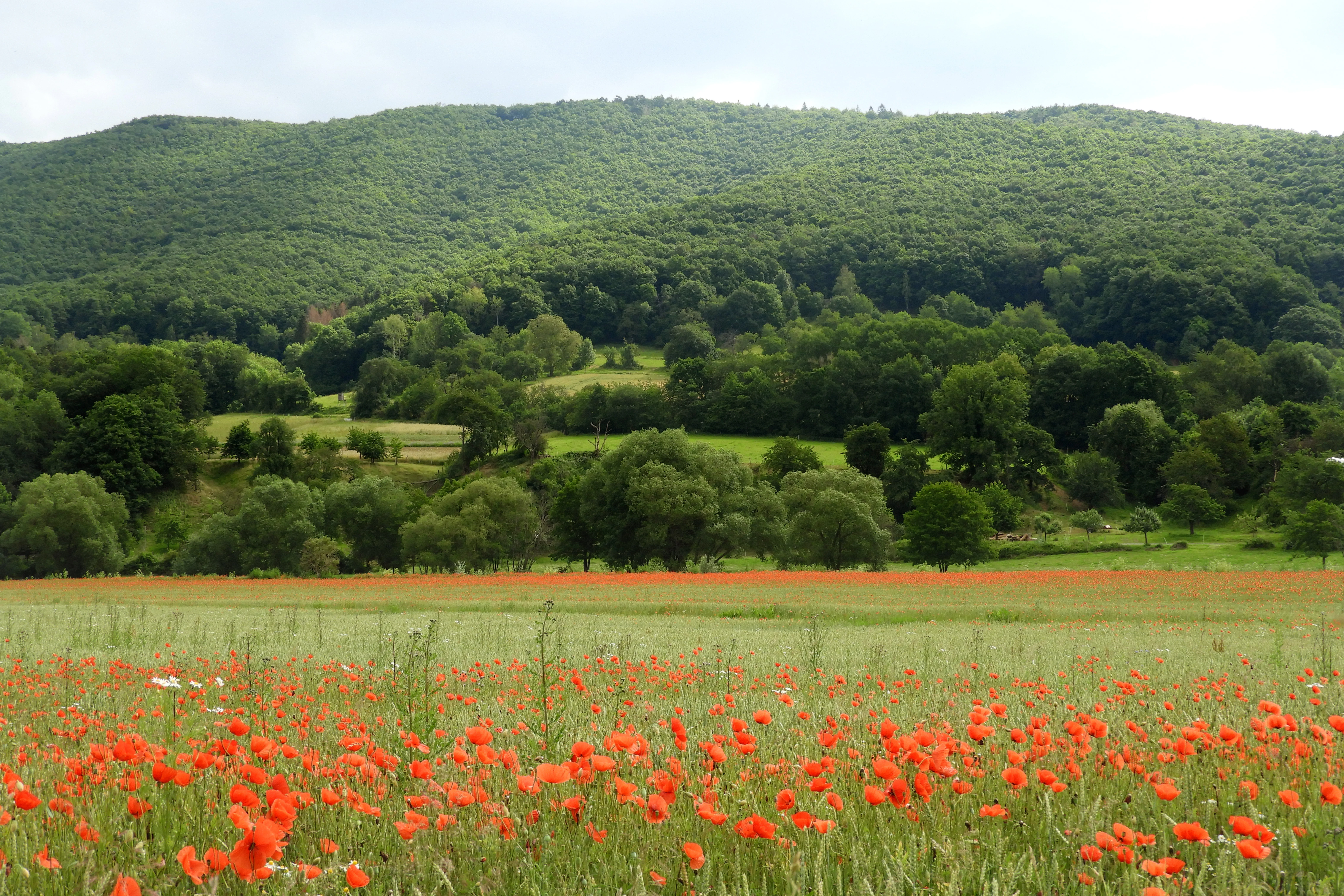
A wide view of a field filled with red poppy flowers in the foreground, leading to green meadows, trees, and a forested mountain slope in the distance.
A field of blooming poppies with the forested hills of the Kelle, Teufelskanzel nature reserve in the background.

Kelle, Teufelskanzel history and protected-area timeline

The forests of the Höheberg have a long history shaped by human use. From the early nineteenth century and especially from the 1830s onwards, the woodlands around Lindewerra were managed as coppice. Shoots of oak were cut roughly every ten to twenty years, stripped of their bark for tanning leather in nearby Eschwege in Hesse, and the resulting stems were further processed into walking sticks. Lindewerra became nationally known as the 'Stick-Maker Village of Germany', where almost every family was at least partly involved in the trade.

Because of this long history as coppice, the vegetation developed in a particular direction. When traditional use faded in the twentieth century, the coppice stands were left to develop, and they have matured into the present-day mix of oak-hornbeam forests, beech woodlands, and rock scree forests that give the reserve much of its character.

A second historical layer was added by the political geography of the twentieth century. Following the Wanfried Agreement in 1945, the state border between the Soviet and American occupation zones ran directly along the steep western face of the Höheberg. This border later became the Inner German Border. From the 1960s onwards, the border was progressively fortified, producing a 100 to 200 meter wide cleared strip with fence, patrol road, and observation towers. After reunification, the installations were removed and nature reclaimed the slope. The former border strip is still visible today in the differing vegetation patterns, and only viewpoints such as the Lindewerrablick have been deliberately kept open.

The reserve itself was first secured on an interim basis from 1990 to 1995, and on 12 April 1996 the Thüringer Landesverwaltungsamt formally declared the Kelle – Teufelskanzel area a Naturschutzgebiet. In 2008 it became a Flora-Fauna-Habitat site within the Natura 2000 network under the EU Habitats Directive, and it is also wholly covered by the EU Birds Directive SPA 'Werrabergland südwestlich Uder'. The surrounding landscape protection area 'Obereichsfeld', formed in 2009, adds a wider landscape-scale framework, and in 2018 the Thuringian parliament declared the larger Grünes Band project in the Eichsfeld-Werratal area a Nationales Naturmonument, in which Kelle – Teufelskanzel serves as a core area.

Kelle, Teufelskanzel landscape and geographic character

The reserve is shaped by very strong relief compressed into a small area. The Höheberg ridge rises to roughly 505 meters at the Junkerkuppe and falls in less than two kilometers to about 140 meters along the Werra loop, producing slope angles between roughly 18° and 36° on the western face. Two small valleys cut deeply into this slope: the Kelletal and the adjacent, smaller Lindewerratal. The Kelletal begins as a narrow V-shaped valley and turns into a Kerbsohlental with seasonal flow, before its main stream deepens into a gorge up to about eight meters deep in the lower section. The upper part of the Kelle is notable for springs that emerge from the platy sandstones and cascade down the steep slope in successive steps.

The western edge of the Höheberg is dominated by Middle Bunter sandstone cliffs, of which the Teufelskanzel and surrounding rocks form the most prominent group. The Teufelskanzel stands at roughly 452 meters in elevation, comprising freestanding erosional remnants, or 'Härtlinge', that rise about 25 meters above the slope. The cliffs drop almost vertically into the Werra valley, and from their top one looks directly into the horseshoe-shaped Werra loop with the villages of Lindewerra and Oberrieden and the hilly Hessian landscape beyond. Felsklippen (rock outcrops) and erosion ridges line the upper edges of the slope, while fragmented dells and gullies structure the steep flanks.

Hydrologically, the reserve belongs to the Werra catchment. Temporary streams flow down the Kelletal and the Lindewerratal toward the Werra; the Werratal cycle path and the Werra-Burgen-Steig long-distance trail both run along or above this valley floor and frame the western boundary of the reserve.
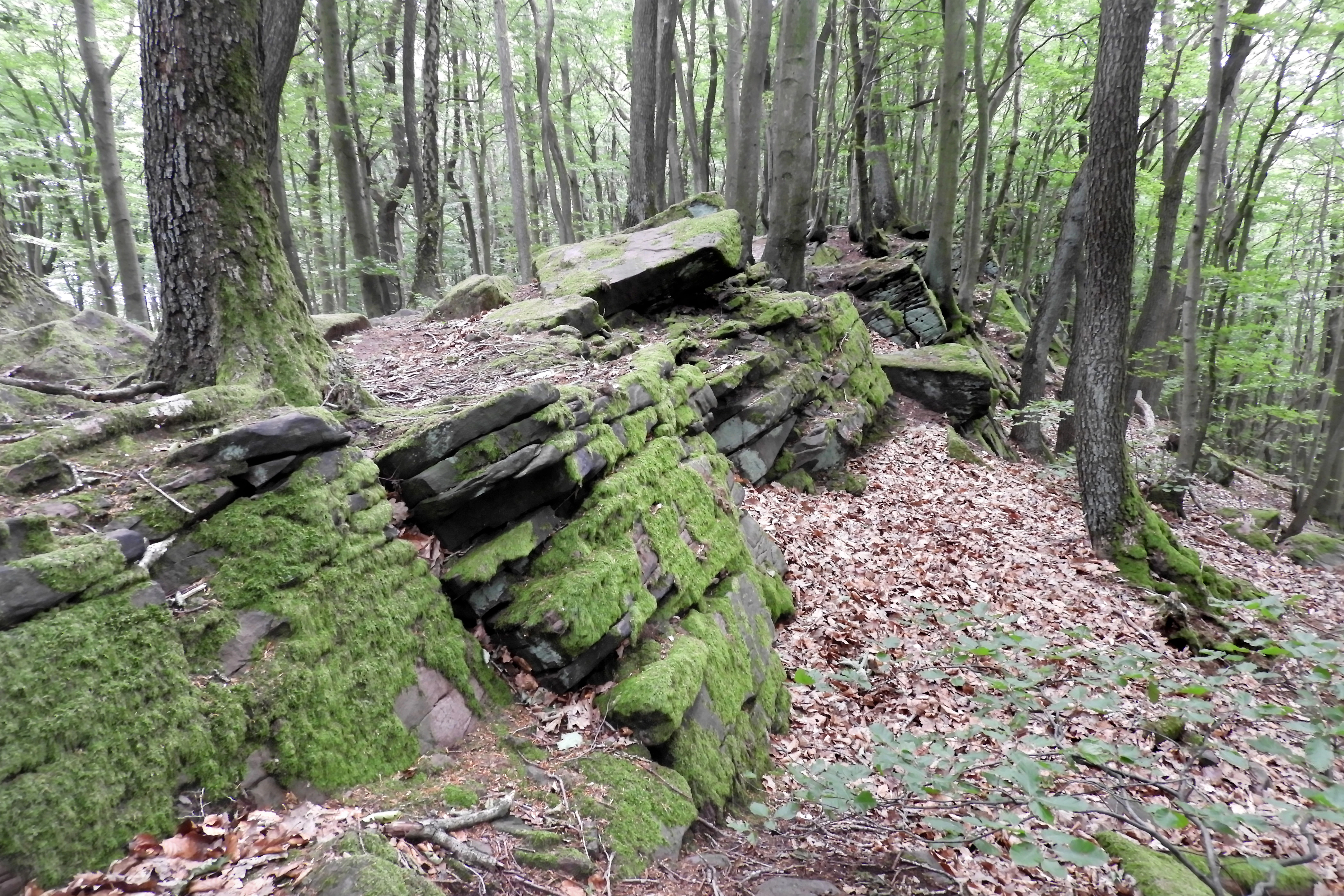
A section of mossy, layered sandstone rock formations set within a dense deciduous forest with leaf litter on the ground.
Mossy sandstone rock formations within the forested landscape of Kelle, Teufelskanzel Nature Reserve.

Kelle, Teufelskanzel ecosystems, habitats, and plant life

The vegetation mosaic of Kelle – Teufelskanzel reflects the interplay of steep topography, sandstone geology, long-standing coppice use, and the open conditions that followed the collapse of the Inner German Border. Four main forest types dominate the area.

On those parts most strongly shaped by former coppice management, the woodlands have developed into Labkraut oak-hornbeam forests (Galio-Carpinetum), characterized by sessile oak, pedunculate oak, and hornbeam, with woodruff-type herbs in the ground layer. On less historically disturbed sites, the canopy shifts to beech-dominated Hainsimsen-Buchenwald with European beech, which today holds the largest area in the reserve. On steep rocky slopes with coarse talus, Norway maple and small-leaved lime form a scree-slope forest adapted to unstable substrate, while along the Kelle and other small streams, alder brook woodland with Stellaria-like ground flora occupies the moist valley floors.

Beyond the closed woodland, the reserve contains open sandstone rocks and associated Silikat-Schutthalden (silicate scree slopes), dry heath patches, and traditional orchards along the western edge. Botanical surveys from the early 1990s recorded more than 200 plant species, including the stately orchid, poisonous lettuce, and spear-leaved waterwort. Of particular conservation interest is the Prächtiger Dünnfarn, a delicate filmy fern once thought extinct in Germany that survives here as gametophyte colonies forming green, cotton-like mats in narrow crevices of sandstone rock.
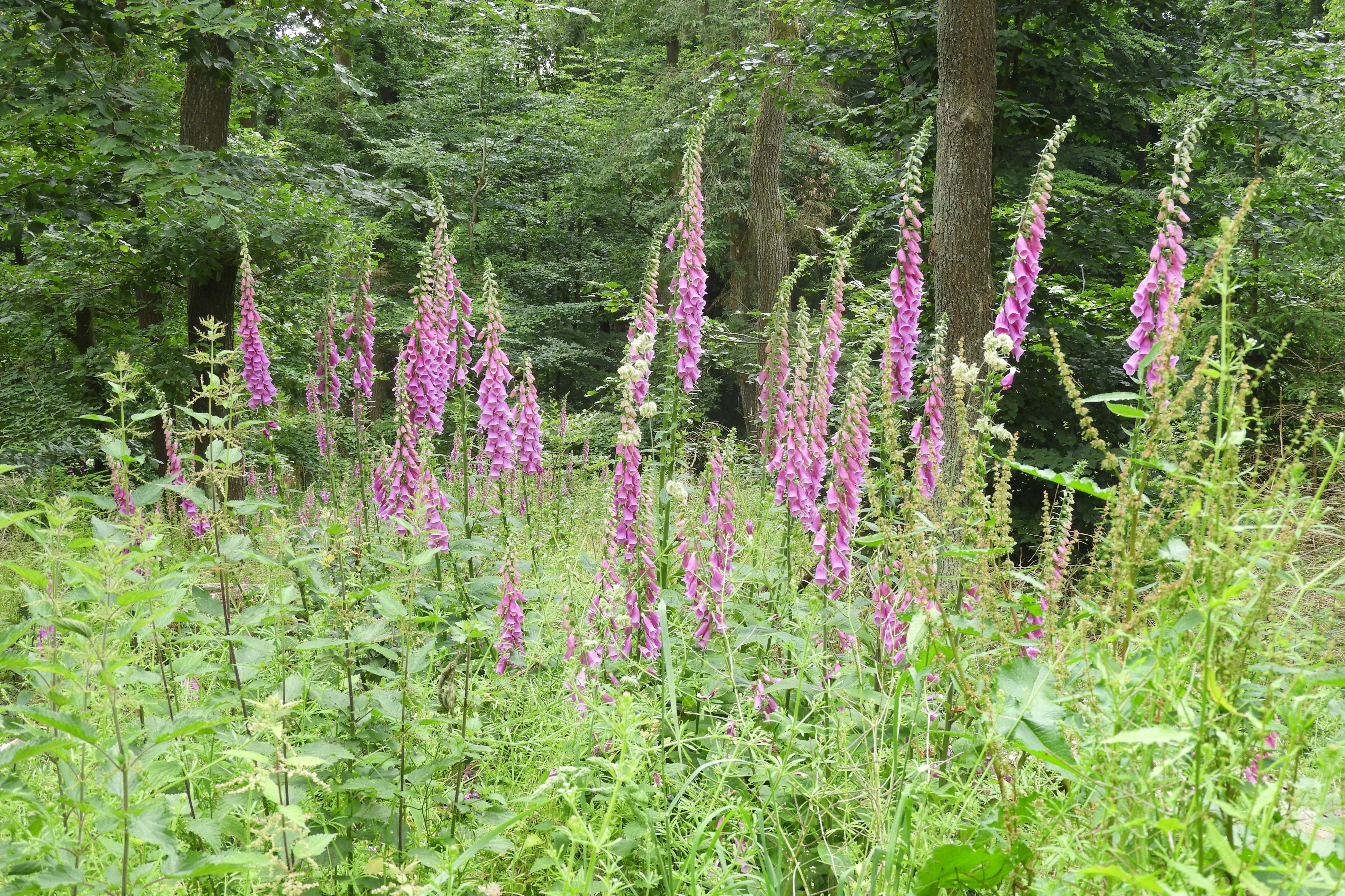
A cluster of tall, purple foxglove flowers blooming in a lush green forest clearing.
Foxgloves blooming in a forest clearing within the Kelle, Teufelskanzel nature reserve.

Kelle, Teufelskanzel wildlife and species highlights

The reserve's richness of old trees, deadwood, and structurally varied forest creates habitat for a wide range of demanding forest-dwelling animals. The European wildcat is described as a resident species here, and the area is also visited by a suite of rare birds associated with mature broadleaf and mixed forests.

Birds listed under Annex I of the EU Birds Directive as particularly worthy of protection, and recorded in or relevant to the reserve, include black woodpecker, middle spotted woodpecker, grey-headed woodpecker, red-breasted flycatcher, Tengmalm's owl, kingfisher, eagle owl, black stork, peregrine falcon, red-backed shrike, red kite, and honey buzzard. The reserve also hosts hobbies, Eurasian woodcock, and wryneck as migratory species protected under the directive's Article 4(2).

Within the broader EU SPA 'Werrabergland südwestlich Uder', the woodland mosaics and adjoining farmland are also important for black kite, European turtle dove, great grey shrike, quail, and the kingfisher and eagle owl, whose nesting riverside habitat is maintained through low-intensity landscape management.
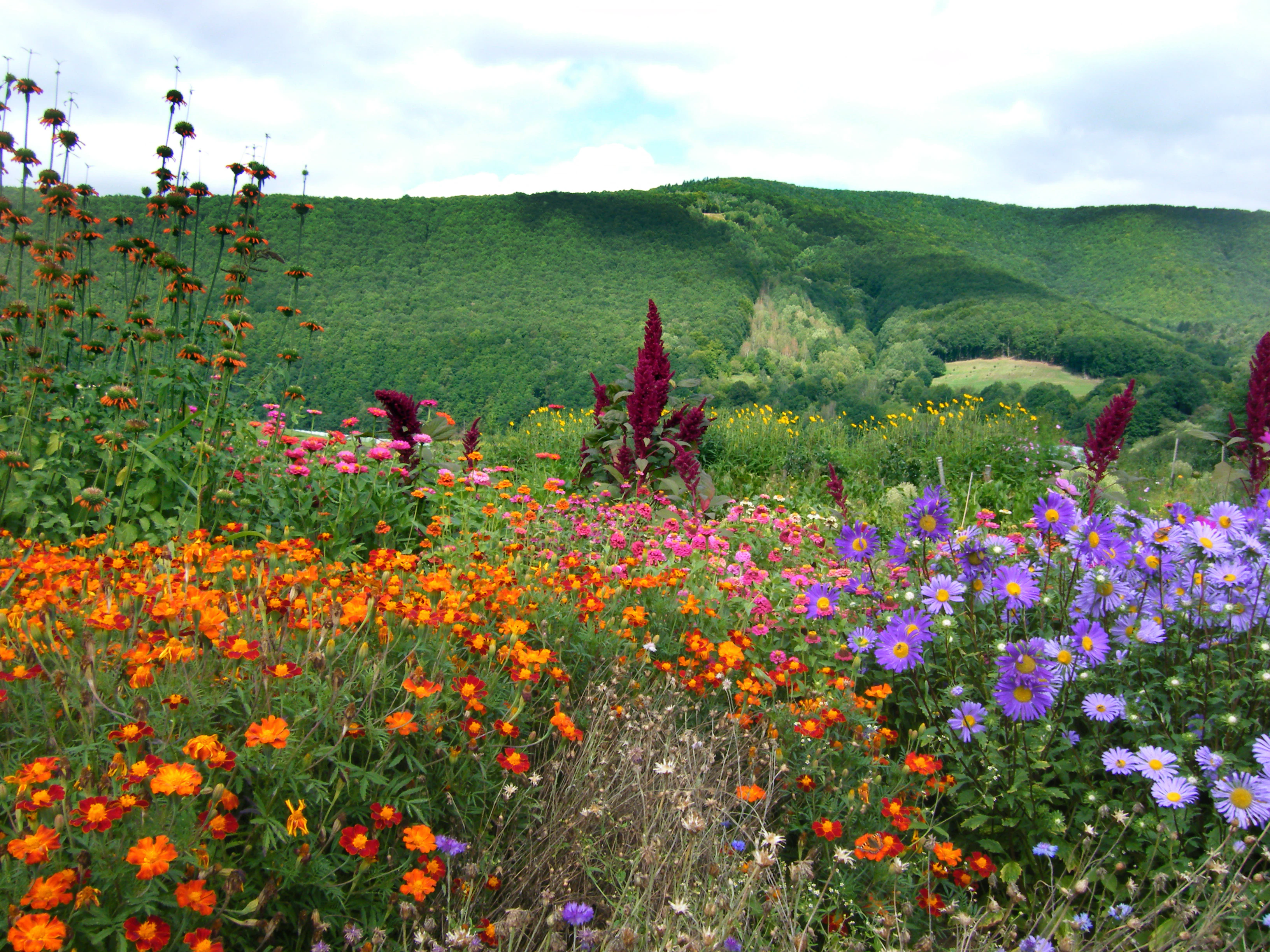
A vibrant garden of orange, pink, and purple flowers in the foreground with a dense green forest-covered hill in the background under a cloudy sky.
A colorful flower bed in the foreground with the forested slopes of Kelle-Teufelskanzel in the background.

Kelle, Teufelskanzel conservation status and protection priorities

Kelle – Teufelskanzel is protected at multiple overlapping levels, which together reflect the high ecological value of its relatively small area. It is a nationally designated Naturschutzgebiet (IUCN Category IV: Habitat/Species Management Area), an EU Flora-Fauna-Habitat site under the Habitats Directive with the same boundaries, and lies entirely within the EU Birds Directive site 'Werrabergland südwestlich Uder'. It is also part of the larger Landscape Protection Area 'Obereichsfeld', giving additional landscape-scale protection.

The conservation aims focus on preserving or restoring closed deciduous forest cover, particularly Hainsimsen-Buchenwald beech forests, silicate scree slopes, dry heaths, and the Middle Bunter sandstone cliffs with their colonies of Prächtiger Dünnfarn. The FFH legal framework was set by the Thüringer Natura 2000-Erhaltungsziele-Verordnung of 29 May 2008. The reserve is also a core element of the Biotopverbund Eichsfeld-Werratal along the Grünes Band, and in 2018 the Thüringer Landtag declared this larger project a Nationales Naturmonument, an overarching framework that connects Kelle – Teufelskanzel with the Hessian Harthberg reserve and additional Thuringian FFH areas into one of Germany's most important continuity corridors for biodiversity.

Kelle, Teufelskanzel cultural meaning and human context

The reserve sits in a region of northern Thuringia and southern Lower Saxony long associated with folk tales and legends. In pre-Christian tradition, the sandstone cliffs were linked to Odin and his valkyries; later Christian-era folklore identified the rock with the Devil, who according to one tale set out to carry the entire boulder to the Meißner mountain in Hesse but abandoned it near Burg Hanstein after being caught resting by a witch returning from the Blocksberg. Ludwig Bechstein retold this legend in his Deutsches Sagenbuch of 1853. The writer Theodor Storm, who served as a judge in Heiligenstadt from 1856 to 1864, is said to have visited the Teufelskanzel and described the cliff and view in his 1867 novella 'Eine Malerarbeit'.

The reserve's landscape is also a product of cultural land use. The traditional coppice forests of the Höheberg supplied raw materials for tanning in Eschwege and for the walking-stick industry of Lindewerra, and the orchards along the lower edge of the slope carry on a centuries-old fruit-growing tradition. As a border landscape between 1945 and 1990, the hillside also bears the marks of the Inner German Border, whose cleared strip remains visible in the differing vegetation even several decades after reunification.

Top sights and standout views in Kelle, Teufelskanzel

The Teufelskanzel viewpoint, perched on a 25 meter high Middle Bunter sandstone cliff edge above a dramatic horseshoe bend of the Werra, is the single most iconic feature of the reserve and offers panoramic views across Lindewerra, Oberrieden, and the Hessian uplands. Equally important, though less visible, is the reserve's mosaic of forest types shaped by centuries of coppice use: oak-hornbeam forests derived from former Niederwald, large areas of beech forest on less disturbed slopes, maple-lime scree forests on the steepest rock faces, and alder brook woodland along the Kelle stream. The presence of the Prächtiger Dünnfarn fern, once thought extinct in Germany, and a rich deadwood-dependent fauna including wildcat, black stork, eagle owl, and multiple rare woodpeckers, together with the reserve's role as a core area in the Grünes Band along the former Inner German Border, give the site a conservation weight well beyond its modest 200 hectare footprint.

Best time to visit Kelle, Teufelskanzel

Spring and early summer are particularly rewarding for visiting the reserve, when the deciduous forests of the Höheberg are in fresh leaf, woodland birds such as woodpeckers, red kite, and honey buzzard are most active, and orchard meadows along the lower slopes come into blossom. Late spring and early summer also favor viewing flowering plants along forest edges and light gaps.

In summer, the deep Kelletal valley and the damp alder brook woodland along the Kelle stream remain noticeably cooler and greener than the exposed sandstone cliffs and dry heaths, which reach their warmest and driest character in mid-summer.

Autumn brings strong color contrast across the reserve, from the rust and gold of the beech and oak forests to the red of the orchard meadows, and is a good period for observing fungi and late-season forest wildlife. The Teufelskanzel viewpoint itself is accessible year-round via marked trails; in winter, after frost or light snow, the bare deciduous canopy opens wide views from the cliff edge across the Werra valley, although visitors should expect short, steep, slippery sections on the lower paths after freezing nights.

Monthly climate preview

Long-term representative monthly temperature and precipitation data rhythms for Kelle – Teufelskanzel

Kelle – Teufelskanzel Climate Normals and Annual Temperature Patterns

The recorded monthly climate normals for Kelle – Teufelskanzel track steady shifts in average temperature and precipitation across a standardized multi-year baseline. Reviewing the complete twelve-month profile provides deeper analytical context for long-term regional environmental research.
Annual mean8 °C
-1 °C18 °C
Jan-1°
Feb
Mar
Apr
May12°
Jun16°
Jul18°
Aug18°
Sep14°
Oct
Nov
Dec
Warmest month
July

18.2 °C

Coolest month
January

-0.9 °C

Wettest month
July

2.6 mm/day

Driest month
April

1.5 mm/day

Park location guide

Geography guide, regional context, and park location map for Kelle, Teufelskanzel

Kelle, Teufelskanzel park geography, regions, and map view in Germany

Understand where Kelle, Teufelskanzel sits in Germany through a broader geographic reading of the surrounding landscape, nearby location context, and its mapped position within the national park landscape.

How Kelle, Teufelskanzel fits into Germany

Germany is a federal republic in Western and Central Europe with a population of over 83 million across sixteen constituent states. It is Europe's largest economy by nominal GDP and a major global exporter and importer. The capital is Berlin, and the country borders Denmark, Poland, Czech Republic, Austria, Switzerland, France, Luxembourg, Belgium, and the Netherlands.

Wider geography shaping Kelle, Teufelskanzel in Germany

Germany is located in Western and Central Europe, spanning 357,022 km². It borders Denmark to the north, Poland and the Czech Republic to the east, Austria and Switzerland to the south, and France, Luxembourg, Belgium, and the Netherlands to the west. The country has coastlines on the Baltic Sea and North Sea to the north, with the Alps located in the southern region.

Map view of Kelle, Teufelskanzel

Use this park location map to pinpoint Kelle, Teufelskanzel in Germany, understand its exact geographic position, and read its mapped placement within the surrounding landscape more clearly.

Pigeon | © OpenStreetMap contributors

Location context for Kelle, Teufelskanzel

Landkreis Eichsfeld

Examine the rugged terrain, dramatic viewpoints, and protected habitats of the Höheberg ridge.

Kelle – Teufelskanzel Photos and Landscapes: Visual Explorer of Sandstone Cliffs and Deciduous Forests

Visual documentation of Kelle – Teufelskanzel reveals the steep sandstone relief, rocky outcrops, and structured deciduous woodlands rising above the Werra river. Detailed imagery provides an authentic perspective on the protected nature reserve, highlighting the distinctive landscape character of Thuringia.

A wide view of a field filled with red poppy flowers in the foreground, leading to green meadows, trees, and a forested mountain slope in the distance.

A meadow landscape with several blooming white-flowered fruit trees in the foreground, with rolling green hills and forested mountains in the distance under a partly cloudy sky.

A section of mossy, layered sandstone rock formations set within a dense deciduous forest with leaf litter on the ground.

A cluster of tall, purple foxglove flowers blooming in a lush green forest clearing.

A vibrant garden of orange, pink, and purple flowers in the foreground with a dense green forest-covered hill in the background under a cloudy sky.

Park atlas

Compare adjacent nature reserves and regional conservation areas across the Werra valley.

Explore Parks Near Kelle – Teufelskanzel and Surrounding Protected Landscapes

Continue browsing protected areas near Kelle – Teufelskanzel to examine similar sandstone relief and deciduous forest ecosystems. Comparing adjacent regional reserves provides a broader perspective on the protected landscapes framing the Werra river basin.
A horizontal watercolor illustration depicting gentle rolling hills, grassy meadows, and distant mountain silhouettes in muted pastel tones.
Nature reserveThuringia
About 2 km away#1 closest

East

Röhrsberg - Hasenwinkel - Mühlberg: Mapping the Protected Landscapes of Thuringia

Geological ridge systems and native forest habitat networks.

The Röhrsberg - Hasenwinkel - Mühlberg nature reserve represents a significant protected area in Thuringia, characterized by the juxtaposition of Muschelkalk limestone hills and Zechstein dolomite ridges. This site offers a concentrated view of regional terrain, shifting from closed beech forests to open juniper heaths. It serves as an essential geographic reference for understanding the ecological mosaic of the lower Werra hill country.

Area
4.51 km²
Established
1999
IUCN
IV
Relief
Upland
Watercolor painting of a pastoral landscape with light green hills in the distance, a field with flowering pink trees, and a pale green meadow in the foreground.
Nature reserveWerra-Meißner-Kreis
About 2.9 km away#2 closest

West

Ebenhöhe-Liebenberg Nature Reserve: Geography and Protected Habitat Mapping

Protected calcareous forests and dry grassland mosaic

Explore the mapped boundaries and natural terrain of the Ebenhöhe-Liebenberg nature reserve. This site provides a critical habitat mosaic including orchid-rich beech woodlands, nutrient-poor grasslands, and sandstone outcrops that form a significant conservation area within the Hessian highlands.

Area
142.48 km²
Established
1995
IUCN
IV
Relief
Upland
A horizontal watercolor illustration showing a soft, panoramic landscape with rolling green hills, small clumps of trees, and rocky formations on a white background.
Nature reserveLandkreis Eichsfeld
About 3.1 km away#3 closest

East

Hasenwinkel bei Fretterode: Protected Dolomite Ridge and Juniper Heath in Landkreis Eichsfeld

Nature reserve geography and landscape analysis

The Hasenwinkel bei Fretterode nature reserve is characterized by a prominent dolomite ridge rising above the agricultural lands of Landkreis Eichsfeld. This site offers an look at historically grazed calcareous grasslands and rocky outcrops. Our mapping covers its extent as a vital component of the regional protected-area network, showcasing its ecological importance and distinctive geology.

Area
0.062 km²
Established
1939
IUCN
IV
Relief
Upland
Wide watercolor illustration of green trees and hills with purple mountains in the background under a pale sky.
Nature reserveThuringia
About 5.6 km away#4 closest

Southeast

Stein, Rachelsberg, Gobert: A Protected Limestone Landscape in Western Thuringia

Mapping a historic nature reserve and beech forest complex

Stein, Rachelsberg, Gobert stands as a key protected area within Thuringia. This nature reserve offers deep insights into limestone ridge geography, historic border woodland continuity, and diverse habitats ranging from dry grasslands to tufa springs and orchid-rich beech forests.

Area
7.16 km²
Established
1999
IUCN
IV
Relief
Mountain
Nature reserveThuringia
About 7.5 km away#5 closest

Southeast

Stein, Rachelsberg Nature Reserve: Mapped Muschelkalk Terrain in Thuringia

Protected low mountain hills and forested karst landscapes

The Stein, Rachelsberg nature reserve in Thuringia represents a protected mosaic of Muschelkalk ridges and Buntsandstein valleys. Its geography is defined by strongly broken relief, rocky outcrops, and a unique ring of forested summits including the Dieberg and Goburg, forming an essential link in regional conservation networks across the Thuringia and Hesse border.

Area
5.06 km²
Established
2023
Relief
Mountain
Climate
Temperate
Watercolor painting of a mountain landscape with green slopes, coniferous forests, and rocky outcroppings under a soft, light-filled sky.
Nature reserveHesse
About 7.9 km away#6 closest

Southwest

Meißner Nature Reserve in Northern Hesse: Mapping the Hoher Meißner Basaltic Massif

A comprehensive look at forest wilderness, bogs, and volcanic geology

Covering roughly 930 hectares, the Meißner nature reserve in northern Hesse protects an ecologically distinct upland landscape. The area features a significant basalt plateau, ancient scree slopes, mountain meadows, and hanging spring bogs, offering a prime example of protected central German topography and forest wilderness.

Area
9.322 km²
Established
1989
IUCN
IV
Relief
Mountain
A horizontal watercolor illustration depicting rolling green hills, scattered trees, and soft mountain silhouettes against a pale sky.
Protected areaGermany
About 8.7 km away#7 closest

West

Kalkmagerrasen bei Roßbach: Protected Calcareous Grassland and Juniper Landscape in Germany

Geographic atlas and protected area overview in Hesse

Kalkmagerrasen bei Roßbach consists of five distinct plots that protect rare Enzian Schillergras Rasen communities on shallow Zechstein limestone soils. This site remains a critical stronghold for diverse orchid populations and protected butterfly species within the Werra Meißner region. The mosaic of juniper, flowering herbs, and historic cherry orchards creates a unique Mediterranean character rarely found in central German hill country.

Area
0.551 km²
Established
1996
Relief
Upland
Climate
Temperate
Watercolor painting of a green landscape with rolling hills, a winding path or stream, and trees on both sides against a light background.
Nature reserveWerra-Meißner-Kreis
About 8.9 km away#8 closest

Southeast

Kalkklippen südlich des Iberges Nature Reserve and Muschelkalk Landscape Atlas

Protected beech forests and active landslide topography

This nature reserve in Werra-Meißner-Kreis reveals an active Muschelkalk ridge characterized by steep limestone cliffs and boulder-strewn talus slopes. Study the site's unique ecological composition, featuring noble hardwood-rich beech forests and native European yew populations that highlight the region's complex natural history and geological significance.

Area
0.473 km²
Established
1995
IUCN
IV

Common questions about visiting, size, designation, and location context for Kelle, Teufelskanzel

Kelle, Teufelskanzel FAQs for park facts, access, geography, and protected area context

Find quick answers about Kelle, Teufelskanzel, including protected-area facts, park geography, trail and visitor context, and how the park fits into its surrounding country and regional landscape.
MoriAtlas Explorer

Continue Your Protected Areas Search Across the Global Atlas

Deepen your exploration by continuing the structured search for national parks and protected areas worldwide. Utilize the comprehensive filtering capabilities to compare different conservation landscapes and refine your understanding of global park geography. Discover more about the distribution and characteristics of protected natural areas.

Global natural geography