
Mori Atlas logo
Nature reserveKleine Lummersbach bei Cyriaxweimar

A dense ecological mosaic of broadleaf woodland, rare habitats, and managed water features

Kleine Lummersbach bei Cyriaxweimar Nature Reserve and Protected Landscape Atlas in Hessen Germany

(Naturschutzgebiet und FFH-Gebiet Kleine Lummersbach bei Cyriaxweimar)

Kleine Lummersbach bei Cyriaxweimar represents a significant protected area within the Lahn hills of Hessen. This nature reserve and FFH site showcases an intricate landscape shaped by historical military use, which created a distinctive pattern of sessile oak stands, beech forest, and nutrient-poor grassland. The reserve supports a high density of protected species, including various bat colonies and amphibians that thrive within its unique network of forest ponds and open clearings.

nature reserveFFH siteNatura 2000broadleaf forestsessile oak woodlandbeech forest
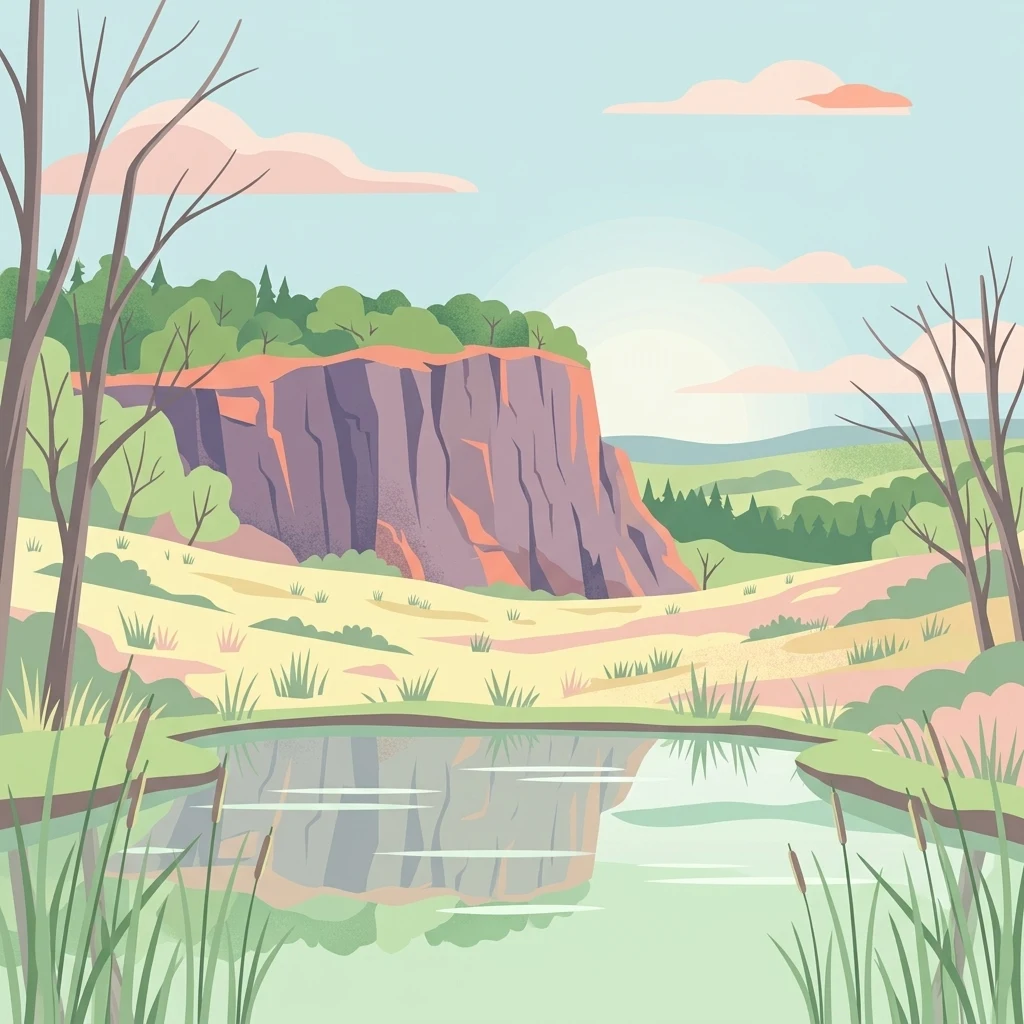
A flat-style digital illustration showing a calm pond in the foreground with tall reeds, a grassy meadow in the midground, and a large rocky cliff face backed by forest and a soft sky.

Kleine Lummersbach bei Cyriaxweimar

Nature reserve

Park overview

Structured park overview, official facts, and landscape profile for Kleine Lummersbach bei Cyriaxweimar

Kleine Lummersbach bei Cyriaxweimar park facts, protected area profile, and essential visitor context

Review the core facts for Kleine Lummersbach bei Cyriaxweimar, including designation, size, terrain, visitor scale, habitats, and operating context in one park-focused overview.

About Kleine Lummersbach bei Cyriaxweimar

Kleine Lummersbach bei Cyriaxweimar is a small but ecologically important protected area on the edge of Marburg in central Hesse. Its defining quality is diversity: the reserve brings together old broadleaf woodland, open nutrient-poor grasslands, scrub, wet hollows, small ponds, and a former quarry within a footprint of roughly 138 hectares. This richness is the direct legacy of a century of human use, first as farmland and rough grazing, then as a military training ground, and finally as a managed nature reserve.

The site lies southwest of Marburg's historic core, between the villages of Cyriaxweimar to the south and east, Haddamshausen to the north, and Hermershausen further west. Two district roads, the K 68 along the northern edge and the K 69 along the southeastern side, frame the reserve and make it readily accessible on foot. A network of paths crosses the area, allowing short walks through both the open clearings and the older woodland stands.

Ecologically, the reserve functions as a refuge within an otherwise heavily managed regional landscape. The combination of mature oak and beech woodland, open grassland areas kept open by renewed sheep grazing, and a constellation of small water bodies provides niches for bats, breeding amphibians, butterflies, and a wide range of woodland and meadow plant species. Since 1997 this combination of habitats has been formally protected as a Hessian nature reserve, and since 2008 it has been part of the European Natura 2000 network as a Fauna-Flora-Habitat site under the EU Habitats Directive, administered by the Regierungspräsidium Gießen.

Quick facts and research context for Kleine Lummersbach bei Cyriaxweimar

Kleine Lummersbach bei Cyriaxweimar is a combined nature reserve (Naturschutzgebiet) and European FFH site administered by the Regierungspräsidium Gießen in the state of Hesse, Germany. It lies within the municipal area of Marburg in the Marburg-Biedenkopf district, between the settlements of Cyriaxweimar, Haddamshausen, and Hermershausen, southwest of the town center.

The area was designated as a nature reserve in 1997 and added to the Natura 2000 network as an FFH site in 2008. It is classified as IUCN Category IV (Habitat/Species Management Area) and is recorded in the World Database on Protected Areas under WDPA ID 318662. Its landscape has been strongly influenced by former use as a German and French military training ground until the early 1990s.

Protection and recognition

Documented terrestrial protection history and Natura 2000 designation data

Kleine Lummersbach bei Cyriaxweimar Protection Status and Recognition

Kleine Lummersbach bei Cyriaxweimar maintains formal terrestrial protection records established in 2008 alongside associated Natura 2000 designations. Official recognition sources outline the foundational management scope and baseline conservation data for this protected area.

International recognition

Protection details

Protection scope
Terrestrial
Designated year
2008
Transboundary protection
No
WDPA ID
318662
Park context

Deeper park guide and search-rich context for Kleine Lummersbach bei Cyriaxweimar

Kleine Lummersbach bei Cyriaxweimar history, landscape, wildlife, and travel context

Explore Kleine Lummersbach bei Cyriaxweimar through its history, landscape character, ecosystems, wildlife, conservation priorities, cultural context, and seasonal travel timing in a structured park guide built for atlas discovery and search intent.

Why Kleine Lummersbach bei Cyriaxweimar stands out

Kleine Lummersbach bei Cyriaxweimar is best known for its unusual mix of habitats created by former military training, including rare old oak and beech woodland alongside open heath-like grassland and small ponds. It is particularly valued for protecting bat species such as the Bechstein's bat and the greater mouse-eared bat, both of which depend on the older tree stands and structurally varied forest floor. The reserve is also recognized for its populations of protected amphibians, including the strictly protected great crested newt, which use the network of small pools scattered across the former training area. The coexistence of mature broadleaf forest, nutrient-poor grassland restored by sheep grazing, and water-filled vehicle tracks gives the site a distinctive ecological profile rarely found in such a compact area in Hesse.
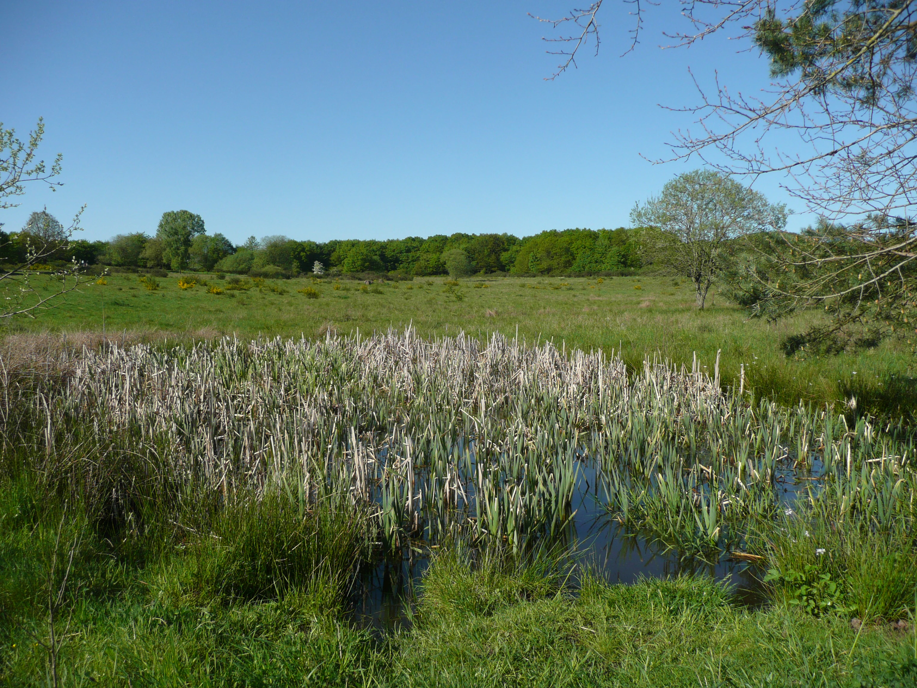
A small, grassy wetland pond filled with tall reeds, surrounded by a rolling green meadow and a forest line under a clear blue sky.
A view of the wetland area within the Kleine Lummersbach nature reserve during spring.

Kleine Lummersbach bei Cyriaxweimar history and protected-area timeline

Parts of the Lummersbach area were used as a military training ground by German and later French forces from the beginning of the twentieth century until the early 1990s. The constant movement of heavy tracked vehicles and wheeled transport across the terrain created deep ruts, which over decades filled with water and produced a network of small pools and wet hollows. Areas that were not regularly driven over were left alone, allowing broadleaf woodland to develop largely without commercial forestry intervention.

When military use ended in the early 1990s, the unusual combination of disturbed, open ground and undisturbed old forest that had emerged gave the area an unexpectedly high nature conservation value. In 1997 it was formally designated as a nature reserve (Naturschutzgebiet) under Hessian law to permanently protect these habitats and their associated species. The site was then included in the European Natura 2000 network as a Fauna-Flora-Habitat (FFH) area in 2008, recognizing its role in protecting habitats and species listed under the EU Habitats Directive.

In addition to its natural features, the southeastern edge of the reserve contains a late-medieval sandstone wayside cross from the fourteenth century, known locally as the 'Steinernes Kreuz', which gives its name to a nearby field. Originally standing freely in the landscape, it was broken in 1962 when a tank struck it and lost part of its horizontal arm. The cross was later re-erected at the roadside and is listed as a protected cultural monument.

Kleine Lummersbach bei Cyriaxweimar landscape and geographic character

The landscape of Kleine Lummersbach bei Cyriaxweimar is shaped by the gently rolling terrain of the Lahn hills southwest of Marburg, with elevations and contours that subtly channel water and shape vegetation. The reserve sits on a transitional slope between the Marburg valley and the surrounding uplands, creating natural pockets where moisture collects and where open ground and forest alternate over short distances.

The surface pattern of the reserve is unusually varied for its size. Roughly the largest share is covered by broadleaf and mixed woodland, with notable stands of sessile oak in the northwest that were originally planted in the mid-nineteenth century for timber for half-timbered houses, and a roughly hundred-year-old beech forest with a sparse ground layer in other parts of the site. These wooded blocks are interspersed with open meadows, nutrient-poor grassland, scrub, and wet depressions. Small ponds dot the landscape, many of them originating as water-filled tracks from military vehicles, and are now supplemented by additional pools deliberately created for conservation purposes. A disused small quarry near Haddamshausen adds further structural variety.

Two roads define the boundaries of the area: the K 68 along the northern edge and the K 69 along the southeastern edge. Between them, a network of paths runs through both the open clearings in the northeast and the denser woodland, offering changing views across grassy rides, water surfaces, and continuous forest cover.
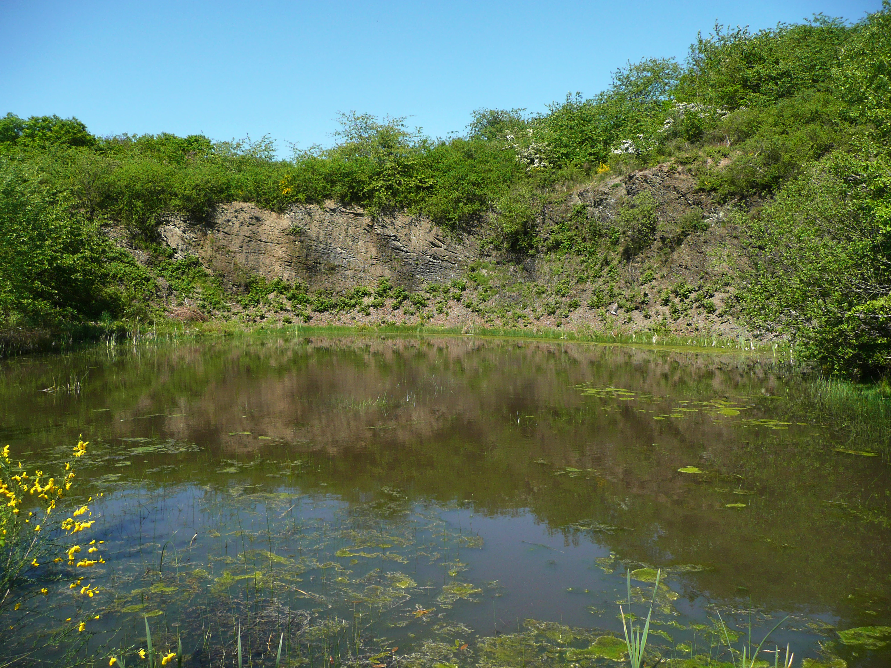
A small, still pond reflects the surrounding rock face and lush green vegetation in a former quarry at Kleine Lummersbach bei Cyriaxweimar.
A tranquil pond formed within a former quarry in the Kleine Lummersbach bei Cyriaxweimar nature reserve.

Kleine Lummersbach bei Cyriaxweimar ecosystems, habitats, and plant life

The habitat mosaic of Kleine Lummersbach bei Cyriaxweimar is the product of overlapping land uses over more than a century. Former arable fields and rough sheep pastures became open training ground for the military, and abandoned vehicle tracks filled with water to create small ponds. The combination of partially driven-over terrain and largely untouched sections produced an unusually rich mixture of broadleaf and mixed woodland, scrub, wet areas, meadows, nutrient-poor grassland, small water bodies, and a former quarry within a compact area.

In the wooded parts, the forest has had enough uninterrupted development to develop features associated with older stands. The northwest contains a notable share of sessile oaks that were originally planted around the middle of the nineteenth century, primarily for building timber for half-timbered houses in the region. Elsewhere, a roughly hundred-year-old beech forest with a relatively open ground layer forms a structurally different woodland habitat. These varied forest conditions support different ecological communities and provide important roosting and foraging conditions for several protected bat species.

The open areas in the northeast were formerly used as cropland or sheep pasture. After military use ended, sheep grazing was reintroduced specifically to keep these open habitats from being lost to shrub encroachment. This management has preserved a varied grassland structure, including nutrient-poor swards that support specialized insect communities, particularly butterflies. The scattered ponds, combined with these wet and dry open habitats, complete a small but coherent ecological network across the reserve.

Kleine Lummersbach bei Cyriaxweimar wildlife and species highlights

Because of its mosaic of old woodland, open grassland, scrub, and standing water, Kleine Lummersbach bei Cyriaxweimar supports a diverse but locally concentrated fauna. Bat conservation is one of the most distinctive aspects of the site: the older oak and beech stands provide roosting and foraging opportunities for several protected species, including the rare Bechstein's bat, which benefits from the mature broadleaf structure, and the greater mouse-eared bat, for which the more open beech forest with patchy ground vegetation serves as a particularly good hunting habitat.

The various small ponds and puddles scattered across the reserve are a key resource for amphibians. These water bodies, many of which originated in military vehicle tracks and have since been supplemented by deliberate conservation measures, support numerous amphibian species, including the strictly protected great crested newt. The combination of aquatic breeding habitats and surrounding terrestrial cover allows these populations to persist within the protected area.

The open, nutrient-poor grasslands maintained by renewed sheep grazing provide habitat for a wide range of insects, especially butterflies, which in turn support a broader food web in the reserve. The varied structure of meadows, scrub edges, and forest margins lets different insect and bird communities coexist across a small area, contributing to the local biodiversity value of the site.

Kleine Lummersbach bei Cyriaxweimar conservation status and protection priorities

Kleine Lummersbach bei Cyriaxweimar is protected both as a Hessian nature reserve under the German Naturschutzgebiet framework and as a European Fauna-Flora-Habitat (FFH) site within the Natura 2000 network. The dual designation reflects the area's importance at both regional and European scales and ties it to the conservation obligations of the EU Habitats Directive.

Its conservation value is tied closely to the unusual habitat mosaic created by its former use as a military training area. The combination of relatively undisturbed old broadleaf woodland and regularly disturbed open ground, both maintained since the end of military use in the early 1990s, supports protected species such as Bechstein's bat, the greater mouse-eared bat, the great crested newt, and a range of butterfly species associated with nutrient-poor grassland. Active management, including the reintroduction of sheep grazing on the former open areas, is used to prevent shrub encroachment and to maintain the grassland structures on which these species depend. The site is administered by the Regierungspräsidium Gießen and is recorded in the World Database on Protected Areas under WDPA ID 318662.

Kleine Lummersbach bei Cyriaxweimar cultural meaning and human context

The most visible cultural feature of the reserve is a late-medieval sandstone wayside cross from the fourteenth century that stands at the southeastern edge of the area along the K 69. Known locally as the 'Steinernes Kreuz', it gave its name to the historic field 'Der Steinerne Kreuz Acker' that surrounds it. The cross is a Sühnkreuz, a type of penitential or atonement cross common in parts of medieval Germany, and it bears a heavily weathered coat-of-arms with three heart-shaped leaves whose points meet in the center, reminiscent of the arms of the Dernbach noble family. It is today listed as a protected cultural monument.

The cross and the field name are reminders that the landscape, even before its military period, was shaped by long-term local use as farmland and rough pasture. Sheep grazing in particular has a continuous history here, from medieval communal use through the twentieth-century pastoral phase to the present-day conservation grazing that maintains the open grassland habitats of the reserve. The cycle of land use and abandonment that runs through the reserve's history is part of what gives the site its present cultural and ecological character.

Top sights and standout views in Kleine Lummersbach bei Cyriaxweimar

Kleine Lummersbach bei Cyriaxweimar stands out among Hessian nature reserves for the unusually direct connection between its military past and its present ecological value. The pools that originated as water-filled vehicle tracks and the mature oak and beech stands that avoided commercial forestry together create a habitat mosaic rarely seen in such a compact protected area.

Visitors and ecological interest alike benefit from the site's combination of protected mammals (notably bats and amphibians), insect-rich grassland, and mixed broadleaf forest within walking distance of Marburg, paired with formal protection at both Hessian and European levels through its status as a nature reserve and an FFH site.

Best time to visit Kleine Lummersbach bei Cyriaxweimar

The reserve can be visited year-round, but the experience of its open habitats changes noticeably with the seasons. Spring and early summer are the most rewarding period for the meadows and nutrient-poor grasslands in the northeast of the area, when revived sheep-grazed swards come into growth and butterflies and other insects become active around blooming flowers and along scrub margins. The many small ponds are also most visible and most alive with amphibian activity in spring.

Midsummer offers dense, green woodland undergrowth and full leaf cover in the broadleaf and mixed forest stands, while late summer and autumn highlight the structural difference between the oak-dominated northwest and the older beech forest elsewhere, as acorns and beech mast ripen. In winter, when the broadleaf trees have lost their leaves, the underlying structure of the different forest types, the open clearings, and water-filled ruts become easier to read against the landscape.

Monthly climate preview

Long term representative temperature averages and monthly precipitation patterns

Climate Normals and Annual Weather Rhythms for Kleine Lummersbach bei Cyriaxweimar

Kleine Lummersbach bei Cyriaxweimar exhibits measured monthly temperature variation alongside consistent precipitation values across the sampled coordinates. Reviewing the complete twelve month profile provides granular long term climate statistics and deeper seasonal context.
Annual mean8 °C
-1 °C18 °C
Jan-1°
Feb
Mar
Apr
May12°
Jun15°
Jul18°
Aug17°
Sep13°
Oct
Nov
Dec
Warmest month
July

17.6 °C

Coolest month
January

-1 °C

Wettest month
July

2.6 mm/day

Driest month
April

1.7 mm/day

Park location guide

Geography guide, regional context, and park location map for Kleine Lummersbach bei Cyriaxweimar

Kleine Lummersbach bei Cyriaxweimar park geography, regions, and map view in Germany

Understand where Kleine Lummersbach bei Cyriaxweimar sits in Germany through a broader geographic reading of the surrounding landscape, nearby location context, and its mapped position within the national park landscape.

How Kleine Lummersbach bei Cyriaxweimar fits into Germany

Germany is a federal republic in Western and Central Europe with a population of over 83 million across sixteen constituent states. It is Europe's largest economy by nominal GDP and a major global exporter and importer. The capital is Berlin, and the country borders Denmark, Poland, Czech Republic, Austria, Switzerland, France, Luxembourg, Belgium, and the Netherlands.

Wider geography shaping Kleine Lummersbach bei Cyriaxweimar in Germany

Germany is located in Western and Central Europe, spanning 357,022 km². It borders Denmark to the north, Poland and the Czech Republic to the east, Austria and Switzerland to the south, and France, Luxembourg, Belgium, and the Netherlands to the west. The country has coastlines on the Baltic Sea and North Sea to the north, with the Alps located in the southern region.

Map view of Kleine Lummersbach bei Cyriaxweimar

Use this park location map to pinpoint Kleine Lummersbach bei Cyriaxweimar in Germany, understand its exact geographic position, and read its mapped placement within the surrounding landscape more clearly.

Pigeon | © OpenStreetMap contributors

Location context for Kleine Lummersbach bei Cyriaxweimar

Hessen
Recorded earthquake history

Explore Historical Earthquake Records for Kleine Lummersbach bei Cyriaxweimar

Examine a catalogued history of documented seismic events located in the vicinity of Kleine Lummersbach bei Cyriaxweimar. This MoriAtlas resource provides structured access to historical earthquake data, allowing for deeper insight into the regional geological context of this protected site.

Kleine Lummersbach bei Cyriaxweimar Earthquake Records

Catalogued events

1 event

Strongest magnitude

Magnitude 3.4

Most recent event

Nov 4, 1975

This history includes earthquakes recorded inside the park or within 50 km of its borders

Explore photographic documentation of mature woodlands, open clearings, and rare terrain features.

Visualizing Kleine Lummersbach bei Cyriaxweimar: Landscapes, Scenery, and Protected Habitats

Visual records reveal the complex topography, old oak and beech stands, and open wetland pools that define Kleine Lummersbach bei Cyriaxweimar. Photographic documentation helps researchers and nature observers analyze the protected habitats and varied terrain structure of the reserve.

A small, grassy wetland pond filled with tall reeds, surrounded by a rolling green meadow and a forest line under a clear blue sky.

Panoramic landscape of an open, dry grassland area with scattered shrubs and bushes, framed by dense woodland and rolling hills in the background under a blue sky.

A small, still pond reflects the surrounding rock face and lush green vegetation in a former quarry at Kleine Lummersbach bei Cyriaxweimar.

Park atlas

Compare adjacent nature reserves and regional conservation zones across central Hesse

Parks Near Kleine Lummersbach bei Cyriaxweimar and Surrounding Protected Landscapes

Browse nearby national parks and protected areas sharing similar ecological traits with Kleine Lummersbach bei Cyriaxweimar. Compare regional park geography and adjacent woodland habitats to understand broader conservation networks.
A horizontal watercolor painting depicting a soft-focus landscape of low green hills, wooded areas, and open fields under a pale sky.
Protected landscapeHessen
About 14 km away#1 closest

West

Naturpark Lahn-Dill-Bergland: Protected Area Mapping and Geographic Landscape Overview

Regional Mittelgebirge terrain in the heart of Hessen

Naturpark Lahn-Dill-Bergland serves as a core protected landscape in western Hessen, spanning the districts of Marburg-Biedenkopf and Lahn-Dill-Kreis. This atlas entry details the park's topography, including the Bottenhorner Hochflächen and the expansive forest masses of the Schelder Wald, providing a clear geographic context for its layered ridges and scenic river valley systems.

Area
830.9 km²
Established
2007
Relief
Mountain
Climate
Temperate
A soft watercolor painting showing a panoramic view of a marshy valley with green coniferous forests in the midground and pale, soft-hued hills in the background.
Nature reserveHesse
16 km away#2 closest

North

Christenberger Talgrund: A Protected Nature Reserve in the Central Hessian Burgwald Landscape

Geography of a rare valley bog and stream corridor

Christenberger Talgrund is a protected nature reserve located at the edge of the Burgwald forest in Hesse. The site features a distinctive valley floor shaped by the Rodenbach, where historical peat accumulation has preserved transitional bog habitats, rare Sphagnum mosses, and specialized moisture-dependent invertebrate populations within a compact, forested setting.

Area
1.166 km²
Established
1987
IUCN
IV
A soft watercolor painting depicting a gentle landscape with rolling hills, meadows, and sparse vegetation, rendered in muted pastel tones.
Nature reserveHessen
About 16 km away#3 closest

Southwest

Brühl von Erda Nature Reserve: Geographic Overview and Mapped Protected Landscapes

A diverse habitat mosaic in the Hessen region

Located in central Hessen, the Brühl von Erda nature reserve comprises 33 hectares of complex terrain including spring hollows, wet meadows, and dry grassland swards. This protected area acts as a focal point for regional conservation, preserving a transition zone between waterlogged fens and drier, thin-soil slopes within the Lahn-Dill-Kreis district.

Area
0.337 km²
Established
1979
IUCN
IV
Relief
Lowland
Nature reserveHessen
About 17 km away#4 closest

East

Saurasen bei Schweinsberg Nature Reserve: Protected Geography and Floodplain Landscape

Ohm River basin protected area in central Hessen

Saurasen bei Schweinsberg is a compact, habitat-rich nature reserve located in the Ohm River lowland. The protected area features a unique hydrological mosaic of alder-ash woodland, sedge fens, and wet grasslands, serving as a sanctuary for diverse migratory birds and the threatened European tree frog. This site offers deep insights into the intersection of active river dynamics and traditional cultural landscapes in central Hessen.

Area
0.136 km²
Established
1985
Relief
Lowland
Climate
Temperate
Watercolor illustration depicting a serene wetland landscape with a small forest patch on the left, grassy marshland in the center, and a pink-toned shoreline on the right.
Nature reserveHessen
About 18 km away#5 closest

Northeast

Franzosenwiesen/Rotes Wasser: Protected Nature Reserve and Lowland Stream Geography

Hessen regional conservation and Burgwald foothills terrain

The Franzosenwiesen/Rotes Wasser reserve offers a window into the lowland stream geography of central Germany. This site preserves a vital corridor of wet meadows and riparian habitat along the Rotes Wasser brook, serving as a key example of the conservation landscapes found within the rolling foothills of the Burgwald region in Hessen.

Area
0.898 km²
Established
1987
Relief
Lowland
Climate
Temperate
A watercolor painting depicting a soft-focus landscape with rolling green hills in the distance, a grassy foreground, and a single bare-branched tree on the right side.
Nature reserveHessen
About 21 km away#6 closest

Northeast

Merzhäuser Teiche Nature Reserve: Geographic Atlas and Protected Landscape Overview

A dense wetland mosaic in the Burgwald region of Hessen.

Merzhäuser Teiche is a compact nature reserve situated on the edge of the Burgwald, Hesse's largest contiguous forest. Centered on three small ponds linked by the Kimmelbach, the area protects a transition zone of alder swamp, wet meadows, and nutrient-poor grassland. This site serves as a crucial habitat for waterbirds, amphibians, and rare butterflies within a characteristic central German landscape.

Area
0.201 km²
Established
1990
IUCN
IV
Relief
Lowland
A soft watercolor painting showing layered, gentle green hills and rolling terrain against a light, pale sky.
Nature reserveHessen
26 km away#7 closest

Northeast

Kalkkuppen bei Winterscheid: Protected Geological Landscapes in the Gilserberg Heights

A detailed atlas view of this Hessen nature reserve

This nature reserve in the Schwalm-Eder-Kreis district protects four distinctive limestone hills built from Lower Muschelkalk. These outcrops stand as a geological anomaly within a region otherwise dominated by sandstone. The site serves as a vital component of the European Habitats Directive, offering a rare opportunity to study calcareous vegetation patterns and structural geology within the rolling terrain of northern Hesse.

Area
0.429 km²
Established
1986
IUCN
IV
Watercolor painting of a rolling landscape with green hills, a small body of water, and clusters of trees under a soft, pale sky.
Nature reserveHessen
About 28 km away#8 closest

Southwest

Koppe Nature Reserve: Protected Basalt Hill and Geological Landmark in Central Hessen

A defined volcanic cone within the forested Hörre ridge range

Koppe stands as a prominent nature reserve in central Hessen, recognized for its unusual conical shape and exposed columnar basalt formations. This protected site integrates geological interest with varied woodland habitats, ranging from dense summit beech forests to open heath communities of pine and juniper. It remains a focal point for understanding the complex natural terrain and protected landscape transitions found throughout the wider Westerwald-Lahn-Taunus region.

Area
0.234 km²
Established
1931
Relief
Mountain
Climate
Temperate

Common questions about visiting, size, designation, and location context for Kleine Lummersbach bei Cyriaxweimar

Kleine Lummersbach bei Cyriaxweimar FAQs for park facts, access, geography, and protected area context

Find quick answers about Kleine Lummersbach bei Cyriaxweimar, including protected-area facts, park geography, trail and visitor context, and how the park fits into its surrounding country and regional landscape.
MoriAtlas Explorer

Continue Your Protected Areas Search Across the Global Atlas

Deepen your exploration by continuing the structured search for national parks and protected areas worldwide. Utilize the comprehensive filtering capabilities to compare different conservation landscapes and refine your understanding of global park geography. Discover more about the distribution and characteristics of protected natural areas.

Global natural geography