
Mori Atlas logo
Nature reserveKleines Laufenbachtal

A diverse protected mosaic of nutrient-poor grasslands, natural rock outcrops, and stream corridors in the Eifel region.

Kleines Laufenbachtal Nature Reserve: Mapping Protected Brook Habitats and Eifel Valley Landscapes

(Naturschutzgebiet Kleines Laufenbachtal)

Kleines Laufenbachtal is a protected nature reserve located in the Eifel region of North Rhine-Westphalia, Germany, spanning thirteen hectares of varied terrain. This valley serves as a critical biotope network, featuring a complex mixture of wet meadows, reed beds, and naturally occurring rock formations along the course of the Kleiner Laufenbach. Its unique geomorphological structure and stream-side ecosystems offer a significant example of concentrated biodiversity within the broader Monschau river system.

stream valleybrook habitatwet meadownutrient-poor grasslandreed bedsnatural rock formations
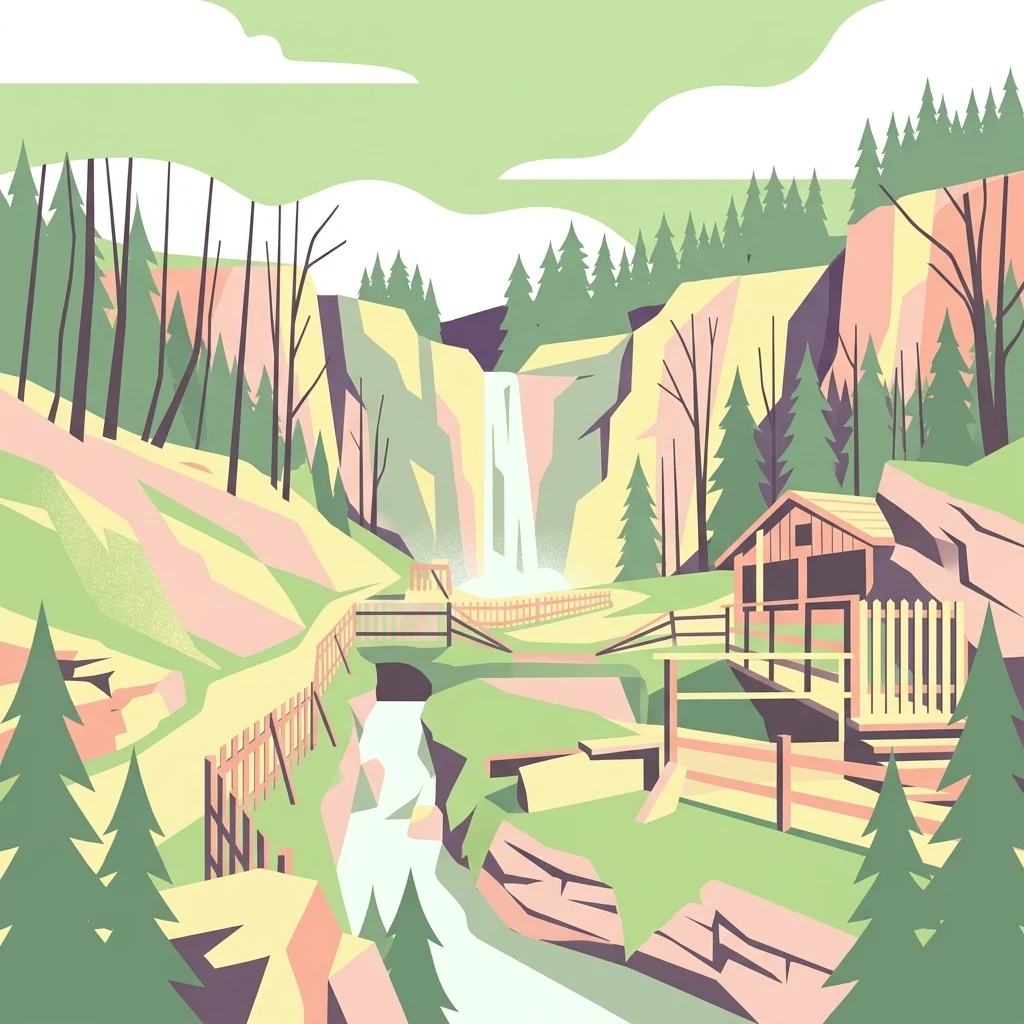
A flat-style digital illustration showing a rocky stream valley featuring a small waterfall, coniferous trees, and a rustic wooden structure with fencing in the foreground.

Kleines Laufenbachtal

Nature reserve

Park overview

Structured park overview, official facts, and landscape profile for Kleines Laufenbachtal

Kleines Laufenbachtal park facts, protected area profile, and essential visitor context

Review the core facts for Kleines Laufenbachtal, including designation, size, terrain, visitor scale, habitats, and operating context in one park-focused overview.

About Kleines Laufenbachtal

Kleines Laufenbachtal is a designated nature reserve in the northern Eifel, occupying a short but steeply defined valley carved by the Kleiner Laufenbach brook. Although the reserve is small, roughly 13 hectares, its concentrated variety of habitats has made it one of the locally important protected sites within the Städteregion Aachen in North Rhine-Westphalia. The valley connects the higher ground near Mützenich with the broader Rur valley around Monschau, creating a natural ecological bridge between the Eifel uplands and the historic town below.

The protected area was established in 1997 as part of the Monschau landscape plan and is administered by the lower landscape authority of the Städteregion Aachen. Within the German federal system it is registered as a formal Naturschutzgebiet (nature protection area) and is catalogued under the identifier ACK-048, with corresponding World Database on Protected Areas entry 318666. Its IUCN classification is Category IV, indicating a habitat and species management area where the priority is the maintenance of specific habitats rather than the preservation of large, unmanaged ecosystems.

The reserve's character is shaped by the fact that the entire valley was largely left in a near-natural state. The Kleiner Laufenbach flows through it in an unbuilt, uncanalised course, flanked by reed-dominated stretches (Röhricht), wet and moist meadows, and patches of nutrient-poor grassland. Small standing waters and naturally eroded rock formations along the slopes add micro-habitats that support a diverse range of species, some of which are listed as threatened in the regional Red Lists of North Rhine-Westphalia. The valley also plays a cooling and fresh-air role for Monschau, which sits at the lower end of the valley below the reserve.

Quick facts and research context for Kleines Laufenbachtal

Kleines Laufenbachtal is a 13-hectare nature reserve located in the city territory of Monschau in the Städteregion Aachen, North Rhine-Westphalia. It was designated in 1997 and carries the official NRW identifier ACK-048 (WDPA 318666). The reserve follows the upper section of the Kleiner Laufenbach brook between Mützenich and its confluence with the Rur near the Felsenkeller brewery museum. The site is managed by the Untere Landschaftsbehörde of the Städteregion Aachen and is classified as an IUCN Category IV Habitat/Species Management Area focused on the protection of threatened habitats rather than wilderness.

Protection and recognition

Documented conservation records and official protected area designations

Kleines Laufenbachtal Protection Status and International Recognition Data

Kleines Laufenbachtal maintains a recorded protection status and official database registration within international environmental inventories. Environmental researchers examine these structured records to evaluate management scope and verify documented geographic designations.

Protection details

WDPA ID
318666
Park context

Deeper park guide and search-rich context for Kleines Laufenbachtal

Kleines Laufenbachtal history, landscape, wildlife, and travel context

Explore Kleines Laufenbachtal through its history, landscape character, ecosystems, wildlife, conservation priorities, cultural context, and seasonal travel timing in a structured park guide built for atlas discovery and search intent.

Why Kleines Laufenbachtal stands out

Kleines Laufenbachtal is best known for its compact but ecologically rich combination of intact stream habitat, wet and dry grassland types, and distinctive natural rock formations within a single small valley. The reserve protects a near-natural mosaic of reed beds, unbuilt brook sections, small standing waters, nutrient-poor grassland, and naturally exposed rock outcrops that are both geomorphologically unusual and ecologically specialized habitats. It is also notable for forming part of a broader biotope network connecting the upper Rur valley, linking ecologically valuable sites in the northern Eifel near Monschau. Despite its modest size, the site demonstrates how a small valley landscape can concentrate many of the habitat types that the surrounding region otherwise struggles to maintain.
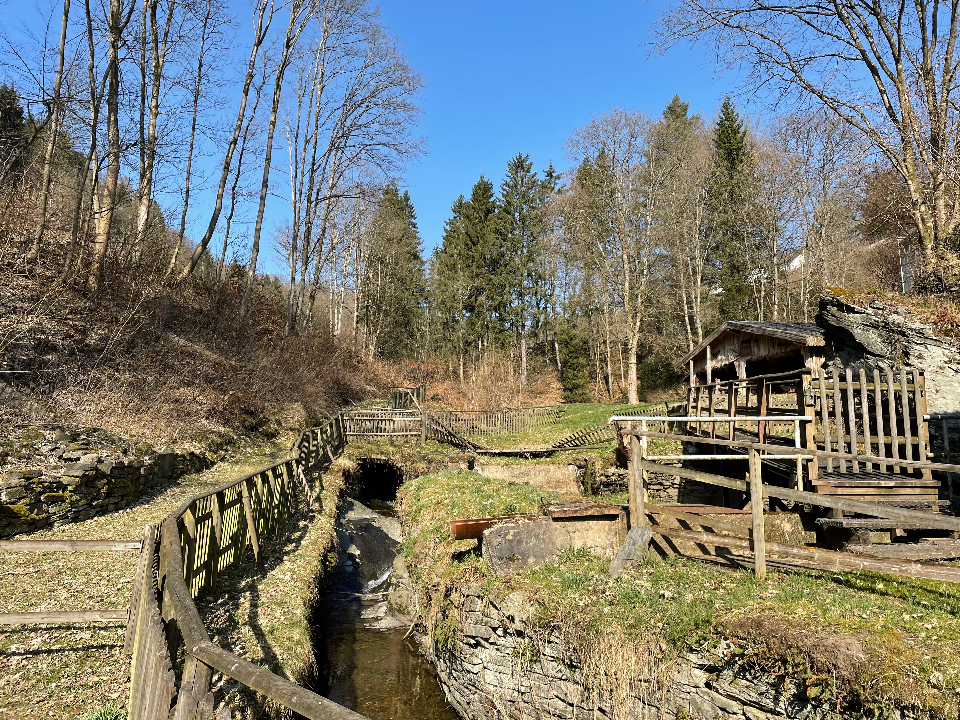
A clear, sunny day view of a small stream flowing through a valley, flanked by wooden fences and surrounded by bare deciduous trees and evergreen pines.
A view of the Kleiner Laufenbach valley, showcasing the stream environment and wooden infrastructure.

Kleines Laufenbachtal history and protected-area timeline

Kleines Laufenbachtal became formally protected as a Naturschutzgebiet in 1997, when it was incorporated into the regional landscape plan (Landschaftsplan) of Monschau. The designation followed a regional effort to consolidate protection around the remaining near-natural valleys of the northern Eifel and the headwaters feeding into the Rur.

The reserve was designed to preserve a pre-existing, largely intact valley landscape that had not been subject to intensive agricultural conversion or structural alteration. By bringing the area under formal protection, the regional authority sought to permanently secure the habitats and species present, while also maintaining the valley's function as a climatic buffer delivering cool, clean air to the town of Monschau in the Rur valley below.

The site has since been integrated into the broader biotope network of the upper Rur valley, linking it to neighbouring reserves such as the Feuerbach-Laufenbachtal, the Holderbachtal, and the Vennhochfläche near Mützenich, forming a connected system of protected valleys and upland surfaces in the Monschau area.

Kleines Laufenbachtal landscape and geographic character

The landscape of Kleines Laufenbachtal is defined by a steep, narrow stream valley typical of the northern Eifel. The valley walls rise quickly from the brook, and the terrain is shaped by erosion and natural rockfall rather than by human intervention. Along the slopes, naturally formed rock outcrops (Felsbildungen) are exposed, creating stony structures that double as geomorphological landmarks and ecologically distinct micro-habitats.

The valley floor is wet and soft in character. Reed-like vegetation lines sections of the brook, especially where the water slows, while wet meadows and moist grassland occupy flatter pockets. Elsewhere the slopes support drier, nutrient-poor grassland (Magergrünland), giving the reserve a strong environmental contrast over very short distances. Small standing waters, including natural pools, add further structural diversity.

The valley opens downward toward the Rur river, into which the Kleiner Laufenbach discharges near the historic Felsenkeller brewery museum, anchoring the reserve within the wider visual and ecological landscape of the Monschau valley system.

Kleines Laufenbachtal ecosystems, habitats, and plant life

Ecologically, Kleines Laufenbachtal is defined by the unusual concentration of habitat types within a very small area. The brook corridor provides near-natural stream habitat, while the surrounding reeds, wet meadows, and nutrient-poor grasslands contribute a layered mosaic of plant communities. This mosaic supports many species listed on the Red Lists of North Rhine-Westphalia for plants, fungi, and animals.

The standing waters within the reserve add aquatic and amphibian habitat, while the exposed rocks host specialised communities adapted to thin soils and fluctuating moisture. The combination of wet and dry biotopes within a single valley makes the site valuable for invertebrates, amphibians, and birdlife that depend on varied structural conditions.

The reserve is also explicitly designed to function as part of a biotope network linking the upper Rur valley with neighbouring protected valleys around Monschau. This connectivity allows species to move between otherwise isolated habitat patches and strengthens the ecological resilience of the regional landscape.

Kleines Laufenbachtal wildlife and species highlights

Kleines Laufenbachtal supports a diverse fauna typical of near-natural Eifel stream valleys, including amphibians associated with the small standing waters and species tied to wet and nutrient-poor grasslands. The reserve's purpose explicitly includes the protection of animals listed on the North Rhine-Westphalian Red Lists, suggesting that the valley holds regionally important occurrences of threatened fauna.

The reed beds and wet meadows offer habitat for invertebrates, including dragonflies and butterflies whose life cycles depend on these specific vegetation structures. The rocky outcrops along the slopes provide refuges for reptile and invertebrate species adapted to dry, sun-exposed stony environments, creating an unusual juxtaposition with the wet valley floor close by.

Birds associated with mixed open-valley habitats, meadows, and woodland edges are likely to use the reserve, and the protected status of the valley contributes to maintaining habitat conditions that sustain them within the larger landscapes around Monschau and the upper Rur valley.

Kleines Laufenbachtal conservation status and protection priorities

The conservation significance of Kleines Laufenbachtal lies in its function as a compact, formally protected refuge for habitat types that have become rare or threatened within North Rhine-Westphalia. By combining near-natural brook sections, reed stands, wet meadows, nutrient-poor grassland, small standing waters, and natural rock formations in one protected site, the reserve safeguards a representative cross-section of Eifel valley ecology.

The 1997 designation under the Monschau landscape plan formalised this protection and integrated the valley into the regional biotope network linking it with the upper Rur valley and adjacent protected areas such as the Feuerbach-Laufenbachtal and the Holderbachtal. Management is overseen by the Untere Landschaftsbehörde of the Städteregion Aachen, with the explicit aims of habitat optimisation, maintenance of the biotope complex, and protection of threatened species.

The reserve is also recognised for its climatic function, supplying cool, clean air to Monschau in the valley below. This combination of biodiversity protection, landscape conservation, and local climate regulation gives the small site a layered conservation profile that extends beyond pure species protection.

Kleines Laufenbachtal cultural meaning and human context

Kleines Laufenbachtal lies within the historic town territory of Monschau, a town long characterised by its half-timbered architecture, textile history, and position within the Eifel landscape. The valley connects the higher settlements around Mützenich with the Rur valley town below, and the brook that gives the reserve its name flows into the Rur adjacent to the Felsenkeller brewery museum, a well-known cultural landmark in Monschau.

Although the reserve itself is not a cultural site, its setting within a historically layered town landscape and its role as a fresh-air corridor for Monschau reflect how natural and cultural values are closely intertwined in this part of the Eifel.

Top sights and standout views in Kleines Laufenbachtal

Kleines Laufenbachtal stands out for fitting an unusually broad range of protected habitat types, including stream, reed, wet meadow, nutrient-poor grassland, and rock habitats, into a single small valley. The reserve's 1997 designation under the Monschau landscape plan gives it formal protection status and integrates it into a wider network of valley reserves around the upper Rur.

The natural rock formations along the slopes are a defining feature, valued both as geomorphological landmarks and as ecologically specialised habitats. Combined with the valley's role in supplying fresh air to Monschau below, these features make the reserve a small but ecologically and functionally significant site within the Städteregion Aachen.

Best time to visit Kleines Laufenbachtal

Kleines Laufenbachtal is best experienced in late spring and early summer, when the wet meadows and nutrient-poor grasslands are most florally diverse and when amphibians and invertebrates are most active around the standing waters and reeds. Autumn can also be rewarding for observing fungi and moisture-dependent plant communities in the valley.

The exposed rock formations can be appreciated throughout the year, though they are most accessible when vegetation is lower and the paths along the valley are drier. Visitors should be aware that the reserve is managed primarily for habitat protection, so low-impact visits that stay on existing paths and respect the protected vegetation and brook sections are appropriate in any season.

Monthly climate preview

Measured monthly temperature ranges and precipitation patterns across the representative park coordinate

Kleines Laufenbachtal Climate Normals and Long-Term Weather by Month

Representative coordinates record long-term monthly temperature variations spanning sub-zero winter lows to warm summer maximums alongside steady daily precipitation averages. Complete twelve-month records provide broader analytical context for examining long-term climatological trends across the protected area.
Annual mean8 °C
0 °C17 °C
Jan
Feb
Mar
Apr
May11°
Jun15°
Jul17°
Aug17°
Sep13°
Oct
Nov
Dec
Warmest month
July

17 °C

Coolest month
January

-0 °C

Wettest month
December

3.1 mm/day

Driest month
April

1.9 mm/day

Park location guide

Geography guide, regional context, and park location map for Kleines Laufenbachtal

Kleines Laufenbachtal park geography, regions, and map view in Germany

Understand where Kleines Laufenbachtal sits in Germany through a broader geographic reading of the surrounding landscape, nearby location context, and its mapped position within the national park landscape.

How Kleines Laufenbachtal fits into Germany

Germany is a federal republic in Western and Central Europe with a population of over 83 million across sixteen constituent states. It is Europe's largest economy by nominal GDP and a major global exporter and importer. The capital is Berlin, and the country borders Denmark, Poland, Czech Republic, Austria, Switzerland, France, Luxembourg, Belgium, and the Netherlands.

Wider geography shaping Kleines Laufenbachtal in Germany

Germany is located in Western and Central Europe, spanning 357,022 km². It borders Denmark to the north, Poland and the Czech Republic to the east, Austria and Switzerland to the south, and France, Luxembourg, Belgium, and the Netherlands to the west. The country has coastlines on the Baltic Sea and North Sea to the north, with the Alps located in the southern region.

Map view of Kleines Laufenbachtal

Use this park location map to pinpoint Kleines Laufenbachtal in Germany, understand its exact geographic position, and read its mapped placement within the surrounding landscape more clearly.

Pigeon | © OpenStreetMap contributors

Location context for Kleines Laufenbachtal

Nordrhein-Westfalen

Explore protected habitats, stream terrain, and natural rock formations through imagery

Kleines Laufenbachtal Photos and Scenery: Visualizing Eifel Valley Landscapes

Visual records capture the steep stream valley, native reed beds, and exposed rock formations that define Kleines Laufenbachtal. Photographic documentation reveals the compact ecological mosaic of wet meadows and nutrient-poor grasslands across the protected reserve.

A clear, sunny day view of a small stream flowing through a valley, flanked by wooden fences and surrounded by bare deciduous trees and evergreen pines.

Park atlas

Compare nearby stream valleys, protected landscapes, and connected natural reserves across the northern Eifel.

Explore Parks Near Kleines Laufenbachtal and Protected Areas in the Surrounding Eifel Region

Browse adjacent protected areas and natural reserves sharing similar stream valley characteristics with Kleines Laufenbachtal. Extending the geographic comparison reveals how regional biotope networks connect localized habitats throughout the surrounding terrain.
A soft watercolor illustration of a rolling green landscape with flowering trees and distant forested hills, isolated on a white background.
Nature reserveNordrhein-Westfalen
About 3.5 km away#1 closest

Southeast

Kluckbachtal Nature Reserve: Geographic Atlas and Protected Stream Valley Overview

Mapped riparian forest and orchard meadow habitats in Nordrhein-Westfalen

Kluckbachtal protects a distinctive valley segment between Rohren and Höfen, featuring a complex of stream beds, wet grasslands, and old oak and alder woodland. This nature reserve is recognized for its significant role in preserving Red List species and traditional cultural landscapes, offering a detailed look at the ecology of the northern Eifel region through its varied habitats.

Area
1.13 km²
Established
1997
IUCN
IV
Relief
Upland
A horizontal watercolor painting showing a soft, stylized landscape with rolling green hills, distant purplish ridges, and grassy foreground elements on a white background.
Nature reserveNordrhein-Westfalen
About 3.7 km away#2 closest

East

Mittleres Rurtal mit den Felsbildungen der Perdsley und Wiselsley Protected Nature Reserve Map

Exploring the Rur valley river dynamics and cliff geology

Investigate the topographical features of the Mittleres Rurtal mit den Felsbildungen der Perdsley und Wiselsley, a critical nature reserve characterized by free flowing river segments and steep ravine forests. This overview outlines the ecological distribution of rock formations and riparian habitats across the Monschau region landscape.

Area
1.33 km²
Established
2003
IUCN
IV
Watercolor illustration showing a soft-focus landscape with rolling green hills, a winding stream, and hints of red floral color against a light background.
Nature reserveNordrhein-Westfalen
About 4.1 km away#3 closest

South

Naturschutzgebiet Perlenbach-Fuhrtsbachtal: Geographic Atlas and Protected Area Context

Mapped brook valleys and rare Eifel wetland habitats

The Naturschutzgebiet Perlenbach-Fuhrtsbachtal protects a distinctive valley system near the Eifel plateau. This area is recognized for its cold, humid microclimate and diverse habitats, ranging from spring-fed fens to ancient meadow systems. Beyond its rare floral displays, the reserve serves as a critical refuge for freshwater pearl mussels and ice-age butterfly relict species, illustrating the intersection of regional geography and conservation.

Area
3.4 km²
Established
1976
IUCN
IV
Relief
Upland
Watercolor painting of a soft, hazy landscape featuring rolling hills and marshy wetlands in muted green and yellow tones.
Nature reserveNorth Rhine-Westphalia
About 4.8 km away#4 closest

Northeast

Kalltal Nature Reserve: Protected Stream Valley and Eifel Landscape in North Rhine-Westphalia

Ecological corridor with rare bog habitats and wet meadows.

Kalltal protects a stretch of the Kall stream, creating a haven for moisture-dependent plant species and wildlife within the Monschau municipality. Its terrain is defined by soft wet grasslands, peat-rich depressions, and small forest patches that form an intact ecological refuge within the broader German landscape.

Area
0.545 km²
Established
1998
IUCN
IV
A pale, minimalist watercolor painting showing a soft-focus landscape with green trees in the foreground, rolling hills in the background, and hints of pink in the foreground foliage.
Protected areaGermany
About 5.4 km away#5 closest

Southeast

Holderbachtal, Dürholderbachtal: Protected Area Geography and Landscape Mapping in Germany

Integrated stream valley and wetland habitat analysis

Holderbachtal, Dürholderbachtal covers 187 hectares of diverse terrain in Germany, blending alder swamp forests with species-rich grasslands. This protected area offers deep insight into the valley-bound ecology and hydrological characteristics that define the Eifel region. Explore the connection between the primary stream systems, spring mires, and the surrounding woodland mosaic in this structured geographic overview.

A soft watercolor illustration showing a hazy, green landscape with a winding stream, distant hills, and low-lying vegetation on a white background.
Nature reserveNordrhein-Westfalen
About 5.5 km away#6 closest

Northeast

Kranzbach und Kranzbruchvenn: Protected Nature Reserve and Bog Landscape in Nordrhein-Westfalen

Wetland stream valleys and historic military relic landscapes

Investigate the specialized wetland ecosystems of Kranzbach und Kranzbruchvenn, a nature reserve in Nordrhein-Westfalen known for its bog and fen habitats. The site offers a detailed case study of small-stream hydrology and the transformation of former Westwall dragon teeth structures into unique marsh environments.

Area
0.328 km²
Established
2002
IUCN
IV
Watercolor illustration of rolling green hills and meadows with patches of pink and yellow flowers
National parkNorth Rhine-Westphalia
About 6 km away#7 closest

East

Eifel National Park: North Rhine-Westphalia Protected Area Atlas

Explore mapped boundaries and regional geography.

Gain a structured understanding of Eifel National Park, a key protected area within Germany's North Rhine-Westphalia region. This page focuses on its geographic identity, detailing mapped boundaries and offering context within the state's broader natural landscapes. MoriAtlas enhances your exploration by presenting Eifel National Park as a distinct entity within a larger geographic framework, ideal for atlas-based research and understanding protected land distribution.

Area
107 km²
Established
2004
IUCN
II
Relief
Upland
A soft, horizontal watercolor painting of rolling green hills under a faint, warm-toned sky, with no sharp outlines.
Nature reserveNorth Rhine-Westphalia
About 6.9 km away#8 closest

Northeast

Lenzbach Nature Reserve: Protected Stream Valley and Habitat Connectivity in the Northern Eifel

Geographic atlas and ecological landscape context in North Rhine-Westphalia

Lenzbach Nature Reserve encompasses a near-natural headwater stream valley characterized by expansive wet grasslands and spring mires. As part of the Natura 2000 Kalltal und Nebentäler complex, the reserve serves as an essential ecological link within the cross-border landscape between Belgium and Germany, supporting diverse wetland flora and maintaining habitat connectivity for regional wildlife.

Area
0.11 km²
Established
1999
IUCN
IV

Common questions about visiting, size, designation, and location context for Kleines Laufenbachtal

Kleines Laufenbachtal FAQs for park facts, access, geography, and protected area context

Find quick answers about Kleines Laufenbachtal, including protected-area facts, park geography, trail and visitor context, and how the park fits into its surrounding country and regional landscape.
MoriAtlas Explorer

Continue Your Protected Areas Search Across the Global Atlas

Deepen your exploration by continuing the structured search for national parks and protected areas worldwide. Utilize the comprehensive filtering capabilities to compare different conservation landscapes and refine your understanding of global park geography. Discover more about the distribution and characteristics of protected natural areas.

Global natural geography