Why Kursi National Park stands out
Kursi is best known for its identification as the traditional site of the Miracle of the Swine described in the Synoptic Gospels, where Jesus healed a demon-possessed man by casting the demons into a herd of pigs. The park is also renowned for containing the largest Byzantine monastic complex ever excavated in Israel, with well-preserved remains including a basilica-style church, mosaic floors depicting local flora and fauna, a bathhouse, and pilgrims' facilities. The 2015 discovery of a marble slab with Aramaic inscription, indicating Jewish or Judeo-Christian presence at the site around 500 CE, has added significant archaeological importance to the location.
Kursi National Park history and protected-area timeline
The monastery at Kursi was established in the fifth century CE during the Byzantine period, when Christianity was the dominant religion of the Roman Empire and pilgrimage to holy sites was flourishing. The location's association with the Miracle of the Swine made it a destination for Christian pilgrims from across the Mediterranean world, prompting the construction of extensive facilities to accommodate visitors including a luxurious bathhouse, additional buildings for pilgrims and monks, and defensive walls. The complex remained active through the Byzantine era until 614 CE when Sassanian Persian armies invaded the region and destroyed most churches and monasteries in the area, including the one at Kursi. After destruction, the church was rebuilt and continued functioning under Muslim rule following the Islamic conquest of Palestine between 638 and 641 CE. The settlement's role as a Christian pilgrimage site ended with the devastating 749 earthquake that destroyed the church, after which Arab squatters used the ruins as dwellings in the ninth century. The site lay forgotten for many centuries until construction workers discovered Byzantine pottery in 1970, leading to major archaeological excavations from 1971 to 1974 that unearthed the largest Byzantine monastic complex found in Israel.
Kursi National Park landscape and geographic character
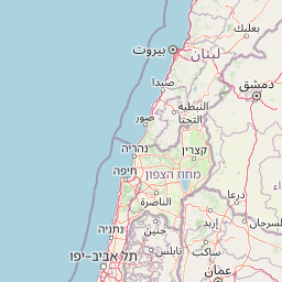
Kursi National Park occupies a scenic position on the eastern shore of the Sea of Galilee, where the Golan Heights descend toward the lake through the wadi of Nahal Samakh. The landscape around the site features the characteristic terrain of this region, with basalt stone formations and fertile ground that supported both agricultural activity and the substantial monastery complex. The park's setting offers panoramic views across the Sea of Galilee, a freshwater lake of approximately 164 square kilometers that holds significant religious, historical, and ecological importance in the region. The archaeological remains are set against this backdrop of rolling hills and volcanic terrain that characterizes the Golan Heights, an elevated plateau region that was formed by ancient volcanic activity and contains rich soils suitable for agriculture and grazing.
Kursi National Park ecosystems, habitats, and plant life
While Kursi is primarily an archaeological site rather than a nature reserve, the park and its surrounding region contain diverse Mediterranean ecosystems. The eastern shore of the Sea of Galilee supports wetland habitats and riparian zones along the wadis descending from the Golan Heights. The broader Golan Heights region features a mix of grasslands, scrubland, and forested areas, with vegetation patterns that vary with elevation and soil composition. The mosaic floors uncovered at the monastery depict local flora including citrons, date palms, pomegranates, and grapes, providing insight into the agricultural products that thrived in this region during the Byzantine period. The area around the Sea of Galilee serves as an important habitat for various bird species, with the lake and its surroundings supporting both resident and migratory bird populations.
Kursi National Park wildlife and species highlights
The wildlife in the Kursi area centers on the ecological systems of the Sea of Galilee and the Golan Heights. The lake and its shores provide habitat for fish species and waterfowl, with the mosaic floors of the Byzantine church depicting cormorants, doves, and geese among the local fauna. The Golan Heights supports populations of mammals including gazelles, foxes, and smaller species adapted to the Mediterranean scrubland and grassland environments. The region is also significant for bird migration, with various species using the lake and surrounding areas as rest stops along migratory routes between Europe and Africa.
Kursi National Park conservation status and protection priorities
Kursi National Park represents an important preservation effort for Byzantine archaeological heritage in Israel. The site has been protected as a national park and has undergone conservation work including the partial reconstruction of the church to help visitors understand its three-dimensional structure. The Israel Antiquities Authority has conducted ongoing excavations and conservation efforts, with significant discoveries such as the marble slab with Aramaic inscription from 2015 adding new dimensions to understanding the site's complex history. The preservation of the Kursi complex provides valuable information about Byzantine monastic architecture, pilgrimage practices, and the religious history of the Holy Land, making it significant both archaeologically and culturally.
Kursi National Park cultural meaning and human context
Kursi occupies a unique position at the intersection of multiple religious and cultural traditions. Its identification as the site of the Miracle of the Swine gives it profound Christian significance, while the 2015 discovery of the Aramaic inscription indicating Jewish or Judeo-Christian presence suggests a more complex religious landscape than previously understood. The site represents the Byzantine period when the Holy Land was a major destination for Christian pilgrims, and the scale of the monastery complex reflects the importance of pilgrimage in the religious economy of late antiquity. The site also reflects the region's layered history, having served Christian, Jewish, and other communities across different periods, with the archaeological evidence providing physical testimony to these overlapping histories.
Top sights and standout views in Kursi National Park
The standout features of Kursi National Park include the extensive ruins of the Byzantine monastery complex, one of the largest ever found in Israel, with its fortified walls, central church, and pilgrims' facilities. The partially reconstructed church allows visitors to appreciate the basilica's architecture and scale, while surviving mosaic fragments display geometric patterns and depictions of local plants and animals. The discovery in 2015 of a marble slab with an Aramaic inscription, the only such artifact found in an ancient synagogue in Israel or the Golan Heights, added remarkable archaeological significance. The site's dual identification as a Christian pilgrimage location and potentially a Jewish or Judeo-Christian settlement provides unique insight into the religious complexity of the Byzantine period in this region.
Best time to visit Kursi National Park
Kursi National Park can be visited throughout the year, though the climate of the Sea of Galilee region influences the visitor experience. The area experiences hot, dry summers and mild, relatively wet winters. Spring and autumn generally offer the most comfortable conditions for exploring the archaeological site, with moderate temperatures that allow for extended walks through the ruins. The summer months can bring high temperatures, particularly in July and August, making early morning or late afternoon visits more comfortable. Winter may bring rain and cooler conditions, though the park remains open and the off-season can offer a quieter experience for visitors interested in exploring the site without crowds. Visitors should check current opening hours and any access restrictions before planning their visit.