

Mori Atlas logo
National parkLa Malinche National Park

Discover the mapped boundaries and regional natural context of this national park.

La Malinche National Park: A Protected Landscape of Geographic Significance in Tlaxcala

(Parque Nacional La Malinche)

La Malinche National Park represents a significant protected natural area within Mexico's Tlaxcala region, offering a unique lens for geographic exploration and atlas-based discovery. This park serves as a key entity for understanding regional landscapes, mapped terrains, and the distribution of conservation lands. Engage with its specific geography and protected area identity to enrich your atlas-driven understanding of Mexico's natural heritage.

Volcanic MountainNational ParkConifer ForestTrans-Mexican Volcanic BeltHigh-Altitude EnvironmentPine-Oak Forest

La Malinche National Park

National park

Park overview

Structured park overview, official facts, and landscape profile for La Malinche National Park

La Malinche National Park park facts, protected area profile, and essential visitor context

Review the core facts for La Malinche National Park, including designation, size, terrain, visitor scale, habitats, and operating context in one park-focused overview.

About La Malinche National Park

La Malinche National Park occupies a prominent position in Central Mexico's geography, protecting the massive volcanic edifice of La Malinche-Matlalcueitl that rises as an isolated conical peak visible across the Mexican highlands. The park straddles the border between Tlaxcala and Puebla states, encompassing the entire火山 cone and its surrounding highland environment. The volcano's formation resulted from intense volcanic activity that created the Trans-Mexican Volcanic Belt, and the mountain's distinctive profile has made it a landmark for centuries. The protected area serves critical ecological functions, including watershed protection for the Atoyac-Zahuapan river basin that supplies water for agricultural use and human consumption in the surrounding region. Several permanent and seasonal streams originate on the volcano's slopes, feeding tributaries that ultimately reach the Rio Zahuapan and the Presa de Valsequillo reservoir. The park's establishment in 1938 reflected early Mexican conservation efforts to preserve significant natural landscapes, and it remains one of the country's oldest national parks.

Quick facts and research context for La Malinche National Park

La Malinche National Park protects a prominent stratovolcano in the Trans-Mexican Volcanic Belt, with its summit reaching 4,462 meters elevation. The park covers approximately 45,711 hectares across Tlaxcala and Puebla states at altitudes ranging from 2,400 to 4,461 meters. It was established as Mexico's 17th national park on October 6, 1938, making it one of the country's oldest protected areas. The volcano's gentle slopes and proximity to Mexico City make it a popular destination for altitude acclimatization and weekend hiking. The park contains the Centro Vacacional IMSS La Malintzi recreational facility with cabins and camping areas.

Protection and recognition

Verifying terrestrial protection scope and official environmental management bounds

La Malinche National Park Protection Status and Designation Framework

Serious researchers can trace the official terrestrial protection status and established conservation classification of La Malinche National Park. Verifying documented designation details helps clarify regional environmental administration boundaries and international conservation alignment within the global database.

Protection details

Protection scope
Terrestrial
Transboundary protection
No
Park context

Deeper park guide and search-rich context for La Malinche National Park

La Malinche National Park history, landscape, wildlife, and travel context

Explore La Malinche National Park through its history, landscape character, ecosystems, wildlife, conservation priorities, cultural context, and seasonal travel timing in a structured park guide built for atlas discovery and search intent.

Why La Malinche National Park stands out

La Malinche National Park is best known for its iconic volcanic peak that serves as both a mountaineering training ground and a visually striking landmark of Central Mexico's landscape. The park protects significant conifer forest ecosystems that blanket the volcano's middle elevations, including pine forests, oyamel fir groves, and mixed pine-oak woodland. Its elevation gradient from 2,400 to over 4,400 meters creates distinct ecological zones that support substantial biodiversity, with documented species including over 920 plants and animals, of which 40 are classified as at-risk under Mexican environmental regulations. The mountain holds cultural significance as Matlalcueitl in Nahuatl mythology, and its distinctive shape is said to resemble a woman in traditional lore.

La Malinche National Park history and protected-area timeline

La Malinche National Park was established on October 6, 1938, becoming one of Mexico's pioneering national parks and the 17th park to receive this designation in the country. The creation of the park reflected growing awareness in early 20th-century Mexico of the need to protect outstanding natural landscapes and watersheds. The park's selection was influenced by the mountain's prominent geographic position, its ecological significance as a forested watershed, and its cultural importance to the region. During the subsequent decades, the park received infrastructure improvements including the development of the Centro Vacacional IMSS La Malintzi facility, which provides visitor accommodations and recreational opportunities. The park has faced ongoing conservation challenges related to logging, agriculture, and recreational use, prompting continued management efforts to maintain forest health and biodiversity.

La Malinche National Park landscape and geographic character

The landscape of La Malinche National Park is dominated by the imposing volcanic cone of La Malinche-Matlalcueitl, a perfectly isolated stratovolcano that rises dramatically from the surrounding Mexican highlands. The mountain reaches 4,462 meters above sea level and features a gently sloping base that becomes steeper and more technical toward the rocky summit. The volcano's upper reaches form a jagged crest with several peaks, and during winter months the highest points become snow-covered. Deep barrancas, or ravines, radiate from the summit down the mountain's flanks, carving through the forested slopes. The volcano's shape is notable for resembling a bent woman when viewed from certain angles, with the distribution of pine forests at the lower elevations appearing like a skirt in traditional descriptions. Several secondary volcanic cones surround the main peak, including Monte Cuatlapanga, El Oclayo, Cerro Xaltonalli, El Filete, and Pico Tlachichihuatzi. The park's terrain ranges from the montane slopes at around 2,400 meters elevation up to the alpine zone near the summit.

La Malinche National Park ecosystems, habitats, and plant life

The ecological diversity of La Malinche National Park reflects its substantial elevation range and position within the Trans-Mexican Volcanic Belt. The park contains multiple distinct vegetation zones that change with altitude, including pine-oak forest at lower elevations, pure pine forest in the mid-montane zone, oyamel fir forest at higher elevations, and alpine grassland at the summit. The pine forests are particularly extensive, with Pinus hartwegii dominating the high-altitude zone between approximately 3,200 and 4,000 meters. The oyamel fir forest, characterized by Abies religiosa, occupies altitudes between 2,800 and 3,200 meters. Below these conifer zones, pine-oak forest contains species including Pinus leiophylla, P. montezumae, P. pseudostrobus, P. patula, and various oak species. The summit areas above 4,000 meters feature grassland vegetation dominated by Calamagrostis and Festuca species adapted to alpine conditions. Juniperus deppeana occupies areas in the middle and lower zones, and induced grasslands have developed in cleared areas.

La Malinche National Park wildlife and species highlights

La Malinche National Park supports a diverse animal community with more than 920 documented species of plants and animals. The mammalian fauna includes more than 27 species, with notable inhabitants including the bobcat or lynx, raccoon, opossum, armadillo, and various rodent species. The park protects important populations of the Mexican gray squirrel and the volcano mouse. Avian diversity is particularly rich, with 77 documented bird species including the rufous hummingbird, the Mexican sheartail, the red warbler, and the Mexican thrush. The park supports significant reptile and amphibian populations, with five amphibian species and eleven reptile species recorded. Among the reptiles are several lizard species and snakes including the three-striped rattlesnake. Many species are endemic to the Trans-Mexican Volcanic Belt, including fifteen species of particular conservation significance. The threatened Montezuma quail, coati, and bobcat are among the species requiring protection within the park.

La Malinche National Park conservation status and protection priorities

La Malinche National Park serves important conservation functions within Central Mexico's protected area network. The park protects critical watershed areas that feed the Atoyac-Zahuapan river system, contributing to water supply for agricultural and human use in the region. The protected area preserves significant examples of Mexican highland forest ecosystems, including old-growth conifer forests that have become increasingly rare in the region. The park's biodiversity is substantial, with over 920 documented species including 40 species that fall within risk categories under Mexico's NOM-059 environmental standard. Sixteen species are endemic to the Trans-Mexican Volcanic Belt, highlighting the park's significance for regional biodiversity conservation. Management challenges include balancing visitor access with resource protection, addressing forest management issues related to historical logging and agricultural expansion, and maintaining ecological connectivity in the highland environment.

La Malinche National Park cultural meaning and human context

La Malinche volcano holds significant cultural importance in Mexican tradition, particularly in Nahuatl-speaking communities of the region. The mountain is known as Matlalcueitl in the Nahuatl language, a name that appears in the park's formal title and connects the natural landscape to indigenous heritage. The mountain's name translates to something like "the one who wears the blue skirt," reflecting traditional interpretations of the mountain's profile and the appearance of its forested slopes. The volcano has historically served as an important landmark for navigation and orientation across the Central Mexican landscape. The park lies in a region with strong indigenous cultural heritage, and the mountain's prominence has made it a symbol of regional identity for communities in both Tlaxcala and Puebla states.

Top sights and standout views in La Malinche National Park

The primary highlight of La Malinche National Park is the opportunity to climb or hike a major volcanic peak in the Trans-Mexican Volcanic Belt, reaching elevations exceeding 4,400 meters within a relatively accessible distance of Mexico City. The park offers one of the most attainable high-altitude experiences in Central Mexico, with a paved road reaching near the summit and the Centro Vacacional providing visitor facilities including cabins and camping. The ecological diversity across the park's substantial elevation range creates varied landscapes from forested slopes to alpine meadows. The mountain's distinctive profile and cultural significance as Matlalcueitl add historical depth to the outdoor experience.

Best time to visit La Malinche National Park

The best time to visit La Malinche National Park depends on visitor priorities, with the dry winter months from November through April offering clearer skies and more stable weather conditions, though nights at higher elevations can be very cold. The summer rainy season from June to September brings warmer temperatures and more vibrant vegetation but also increased cloud cover and afternoon thunderstorms. For mountaineering and summit attempts, the period from November through March typically provides the most favorable conditions, though winter snow may add technical difficulty to the upper reaches. The park can be visited year-round, but weekend crowds are common given its popularity as a near-city destination from Mexico City.
Monthly climate preview

Long-term temperature ranges and monthly precipitation averages for Tlaxcala

La Malinche National Park Climate Normals and Annual Weather Patterns

La Malinche National Park exhibits measured annual temperature variations alongside distinct monthly precipitation rhythms recorded across representative station coordinates. Reviewing the complete twelve-month climatology profile reveals precise shifts in long-term averages for this protected terrain.
Annual mean16 °C
13 °C20 °C
Jan13°
Feb15°
Mar17°
Apr19°
May20°
Jun19°
Jul17°
Aug17°
Sep16°
Oct16°
Nov14°
Dec14°
Warmest month
May

20 °C

Coolest month
January

13.3 °C

Wettest month
September

5.9 mm/day

Driest month
December

0.3 mm/day

Park location guide

Geography guide, regional context, and park location map for La Malinche National Park

La Malinche National Park park geography, regions, and map view in Mexico

Understand where La Malinche National Park sits in Mexico through a broader geographic reading of the surrounding landscape, nearby location context, and its mapped position within the national park landscape.

How La Malinche National Park fits into Mexico

Mexico, officially the United Mexican States, is a country in North America spanning the Sierra Madre mountain ranges, coastal plains, and tropical regions. It borders the United States to the north, Guatemala and Belize to the southeast, and has coastlines along the Pacific Ocean, Gulf of Mexico, and Caribbean Sea. With a population exceeding 130 million, Mexico is home to one of the world's most significant concentrations of Indigenous languages alongside Spanish.

Wider geography shaping La Malinche National Park in Mexico

Mexico occupies a land area of 1,972,550 km2, making it the thirteenth-largest country in the world. The terrain is highly diverse, featuring the Sierra Madre Occidental and Sierra Madre Oriental mountain ranges, the Mexican Plateau, coastal lowlands along the Pacific and Gulf/Caribbean margins, and the Yucatan Peninsula. The country spans multiple climate zones from desert in the north to tropical rainforest in the south.

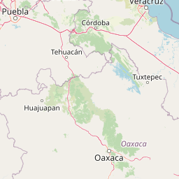
Map view of La Malinche National Park

Use this park location map to pinpoint La Malinche National Park in Mexico, understand its exact geographic position, and read its mapped placement within the surrounding landscape more clearly.

Pigeon | © OpenStreetMap contributors

Location context for La Malinche National Park

Tlaxcala
Park atlas

Compare related protected areas, trace the Trans-Mexican Volcanic Belt, and discover connected highland landscapes.

Explore Other National Parks Near La Malinche National Park and Central Mexico's Volcanic Belt

After exploring La Malinche National Park, continue your geographic discovery by browsing other national parks and protected areas across Central Mexico's Trans-Mexican Volcanic Belt. Compare their diverse ecological zones, volcanic terrain, and conservation landscapes, understanding their regional spread and unique features in Tlaxcala and Puebla.
National parkMexico
About 65 km away#1 closest

West

Iztaccíhuatl, Popocatépetl National Park: Mexico's National Park Protected Area

Mapped boundaries and regional geographic context.

Iztaccíhuatl, Popocatépetl National Park is a protected natural landscape offering insight into Mexico's geography. This atlas entry focuses on the park's defined boundaries and its role within the national protected areas framework. Explore the unique geographic character and mapped extent of this significant park, understanding its position within the country's natural landscape atlas.

Area
398.19 km²
Established
1935
IUCN
II
Relief
Mountain
National parkState of Mexico
About 77 km away#2 closest

West

Sacromonte National Park: National Park Atlas and Protected Landscape Exploration

Discover mapped boundaries and regional geographic context.

Investigate Sacromonte National Park as a key protected area within Mexico's State of Mexico. This detailed view provides insight into its designation as a national park, emphasizing its geographic setting and the characteristics of its protected landscape. Users interested in atlas-style discovery will find information that clarifies the park's physical presence and regional importance, facilitating a deeper understanding of its mapped terrain.

Area
0.44 km²
Established
1952
IUCN
II
Scope
Terrestrial
National parkMexico
About 84 km away#3 closest

East

Pico de Orizaba National Park: Mexico's Key National Park for Atlas Exploration

Discover mapped boundaries and regional geographic context.

Access detailed atlas information for Pico de Orizaba National Park, a protected natural area in Mexico. This entry focuses on its geographic scope, mapped landscape features, and its significance as a national park within the region. Explore the park's protected boundaries and understand its place in the broader geographical context of Mexico.

IUCN
II
National parkState of Mexico
About 90 km away#4 closest

West

Molino de Flores Nezahualcóyotl National Park: National Park Protected Landscape Exploration

Mapped geographic context within the State of Mexico.

Access structured details about Molino de Flores Nezahualcóyotl National Park, a significant protected area designated as a national park. This entry focuses on its role as a mapped landscape, providing essential geographic context for understanding its boundaries and natural terrain. Discover how this protected area contributes to the broader atlas of conservation lands in the region.

Area
0.49 km²
Established
1937
IUCN
II
Visitors
10K annual
National parkMexico
About 99 km away#5 closest

East

Cofre de Perote National Park: A National Park within Mexico's Geographic Atlas

Explore its protected landscape and regional map context.

Cofre de Perote National Park is a vital protected area within Mexico, offering a unique national park designation. This entry focuses on its geographic significance, mapping its boundaries and situating it within the country's broader protected lands. Users can explore the park's landscape identity and its atlas-relevant features, providing a factual basis for understanding its role in Mexico's natural heritage.

Established
1937
IUCN
II
Relief
Mountain
Climate
Alpine
National parkVeracruz
About 102 km away#6 closest

Southeast

Cañón del Río Blanco National Park: Explore Its Mapped Protected Area and Regional Geography

Discover the geographic context and protected landscape of this national park.

Cañón del Río Blanco National Park offers a distinct protected-area identity within the geography of Veracruz. This canonical page focuses on the park's mapped boundaries and its significance as a national park. Use this resource for structured exploration of its protected landscape and regional setting, enhancing your understanding of Mexican protected areas.

Area
488 km²
Established
1938
IUCN
II
Relief
Mountain
Protected areaPuebla
About 104 km away#7 closest

North

Zona Protectora Forestal Vedada Cuenca Hidrográfica del Río Necaxa: Mountain Watershed Atlas

Protected Sierra Madre Oriental mountain landscapes and reservoirs

This protected area safeguards the complex upper watershed of the Necaxa River, where dense cloud forests meet engineered reservoirs. Spanning the mountainous border region, the area serves as a key case study in forest conservation, river basin management, and wetland habitat protection within the broader geographic framework of the Sierra Madre Oriental.

Area
421.29 km²
Established
1938
IUCN
VI
Relief
Mountain
Protected areaMorelos
About 104 km away#8 closest

West

Corredor biológico Chichinautzin: Protected Area and Volcanic Highland Geography

Mapping the biological corridor between Morelos and the Mexican highlands

As a strategic biological corridor, Corredor biológico Chichinautzin preserves a rugged, volcanic landscape of pine forests and deep ravines. The protected area ensures essential connectivity between major national parks and provides a critical water source for the surrounding region, marking it as a centerpiece of ecological conservation in the central Mexican highlands.

Area
378.73 km²
Established
1988
Scope
Terrestrial
Water
Major water bodies

Common questions about visiting, size, designation, and location context for La Malinche National Park

La Malinche National Park FAQs for park facts, access, geography, and protected area context

Find quick answers about La Malinche National Park, including protected-area facts, park geography, trail and visitor context, and how the park fits into its surrounding country and regional landscape.
MoriAtlas Explorer

Continue Your Protected Areas Search Across the Global Atlas

Deepen your exploration by continuing the structured search for national parks and protected areas worldwide. Utilize the comprehensive filtering capabilities to compare different conservation landscapes and refine your understanding of global park geography. Discover more about the distribution and characteristics of protected natural areas.

Global natural geography