
Mori Atlas logo
Nature reserveLaubacher Steinbruch

Examining the ecological terrain, ravine forest boundaries, and calcareous rock mosaic within the Neandertal valley.

Laubacher Steinbruch Nature Reserve: A Detailed Geographic Atlas of Protected Limestone Landscapes

(Naturschutzgebiet Laubacher Steinbruch)

Laubacher Steinbruch represents a significant six-hectare nature reserve located on the edge of Mettmann in Nordrhein-Westfalen. This former limestone quarry now sustains a complex mosaic of damp ravine forests, dry rocky slopes, and lime-rich scree vegetation that serves as an essential stepping stone within the Neandertal conservation corridor. The mapped terrain showcases a unique intersection of vertical limestone cliffs, open grassland habitats for sand lizards, and humid forest zones sheltered within the Düssel valley.

limestone quarryravine forestcalcareous grasslandlimestone cliffsrocky habitatsNatura 2000
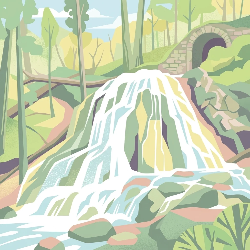
A stylized digital illustration of a cascading waterfall flowing over rocks, surrounded by a forest with a stone arch tunnel visible in the background.

Laubacher Steinbruch

Nature reserve

Park overview

Structured park overview, official facts, and landscape profile for Laubacher Steinbruch

Laubacher Steinbruch park facts, protected area profile, and essential visitor context

Review the core facts for Laubacher Steinbruch, including designation, size, terrain, visitor scale, habitats, and operating context in one park-focused overview.

About Laubacher Steinbruch

Laubacher Steinbruch is a compact but ecologically dense nature reserve in the lower Neandertal, southwest of the historic center of Mettmann in the district of Kreis Mettmann, North Rhine-Westphalia. With an area of about 6 hectares, it sits on the valley side of the Düssel river and immediately next to the Neanderthal Museum, making it one of the small protected sites whose scenery can be experienced alongside one of the most famous paleoanthropological sites in Europe.

The protected site was originally an old limestone quarry. When extraction stopped, the rock walls, scree slopes, and quarry floor were left to develop naturally, while later landscape-management measures deliberately re-exposed more rock faces. This is the origin of the unusual landscape mosaic: damp, sheltered quarry bottoms with humid conditions, vertical limestone walls in various stages of shadow and sun exposure, gravelly scree with characteristic lime-loving plants, and open dry grasslands at the edges of the reserve. A managment track running to the still-active quarry to the north divides the area in two.

Ecologically, the reserve is significant because it bundles several rare, EU-protected habitat types into a very small area. The western quarry floor has developed into a humid ravine forest dominated by sycamore maple (Ahorn) and ash (Esche), with a regionally notable stock of wych elm (Berg-Ulme) in the second tree layer. Above, the ravine forest transitions into dry tall-herb communities, low shrubs, and locally developed calcareous rock and scree vegetation featuring stonecrops (Mauerpfeffer), dry grassland (Trockenrasen), and slightly thermophilous thickets. Characteristic ferns such as the maidenhair spleenwort (Braunstieliger Streifenfarn) and the hart's tongue fern (Hirschzungenfarn) colonize the rock faces, while the bellflower Rapunzel-Glockenblume appears in the open vegetation.

Beyond its plant communities, the reserve is managed specifically for reptiles, especially the sand lizard (Zauneidechse). A former sports ground east of the access track has been converted into a small pond and surrounding dry grassland that provides egg-laying sites and shelters. All open areas are used by sand lizards, and ongoing measures aim to keep the rock faces and dry grasslands free of encroaching woodland. The piped-in Laubach stream itself is ecologically impaired, but a short gallery-like strip of alder floodplain forest still runs along its lower section before it enters the Düssel.

Administratively, the reserve was designated in 1997 and is governed under the Landschaftsplan (landscape plan) of Kreis Mettmann, last updated in 2012. Its official identifier ME-036 is registered in the World Database on Protected Areas under WDPA-ID 318714. As part of the larger Neandertal FFH area, the site also plays a role in maintaining west-east ecological connectivity through the broader Neandertal valley corridor, an internationally significant protected landscape for nature conservation in western Germany.

Quick facts and research context for Laubacher Steinbruch

Laubacher Steinbruch is a designated nature reserve (Naturschutzgebiet) under IUCN management category IV, meaning it is managed primarily for habitat and species conservation. It carries the official code ME-036 and is part of the Natura 2000 site DE-4707-302 "Neandertal", which covers roughly 269 hectares as an FFH (Fauna-Flora-Habitat) area.

With only around 6 hectares, it is one of the smaller protected sites in Kreis Mettmann, but it has a particularly concentrated mosaic of habitats, ranging from humid ravine forest to dry calcareous grassland and exposed limestone cliffs. The reserve lies immediately next to the Neanderthal Museum near Mettmann, in a valley corridor that connects the western and eastern parts of the Neandertal landscape.

Protection and recognition

Documented protection metrics and international recognition records

Laubacher Steinbruch Protection Status and Designated Area Records

Laubacher Steinbruch features structured protection status records and associated database entries for conservation analysis. Documented management scope and formal designation details provide clear reference points for this protected site.

Protection details

WDPA ID
318714
Park context

Deeper park guide and search-rich context for Laubacher Steinbruch

Laubacher Steinbruch history, landscape, wildlife, and travel context

Explore Laubacher Steinbruch through its history, landscape character, ecosystems, wildlife, conservation priorities, cultural context, and seasonal travel timing in a structured park guide built for atlas discovery and search intent.

Why Laubacher Steinbruch stands out

Laubacher Steinbruch is best known for its unusually well-preserved mosaic of calcareous habitats that developed on the walls and slopes of a former limestone quarry. In its small area it combines three rare habitat types that are nationally important under the EU Habitats Directive: a maple-ash ravine forest with regionally significant wych elm (Berg-Ulme) populations, thermophilous limestone rock communities with characteristic ferns and stonecrops, and dry calcareous grassland with rock outcrops. The reserve is also valued as habitat for the sand lizard (Zauneidechse), for which egg-laying sites and shelters have been actively created on the open terrain. Because it lies within the Neandertal Natura 2000 site and directly adjacent to the Neanderthal Museum, the area combines strong ecological value with a distinctive cultural and scientific setting.
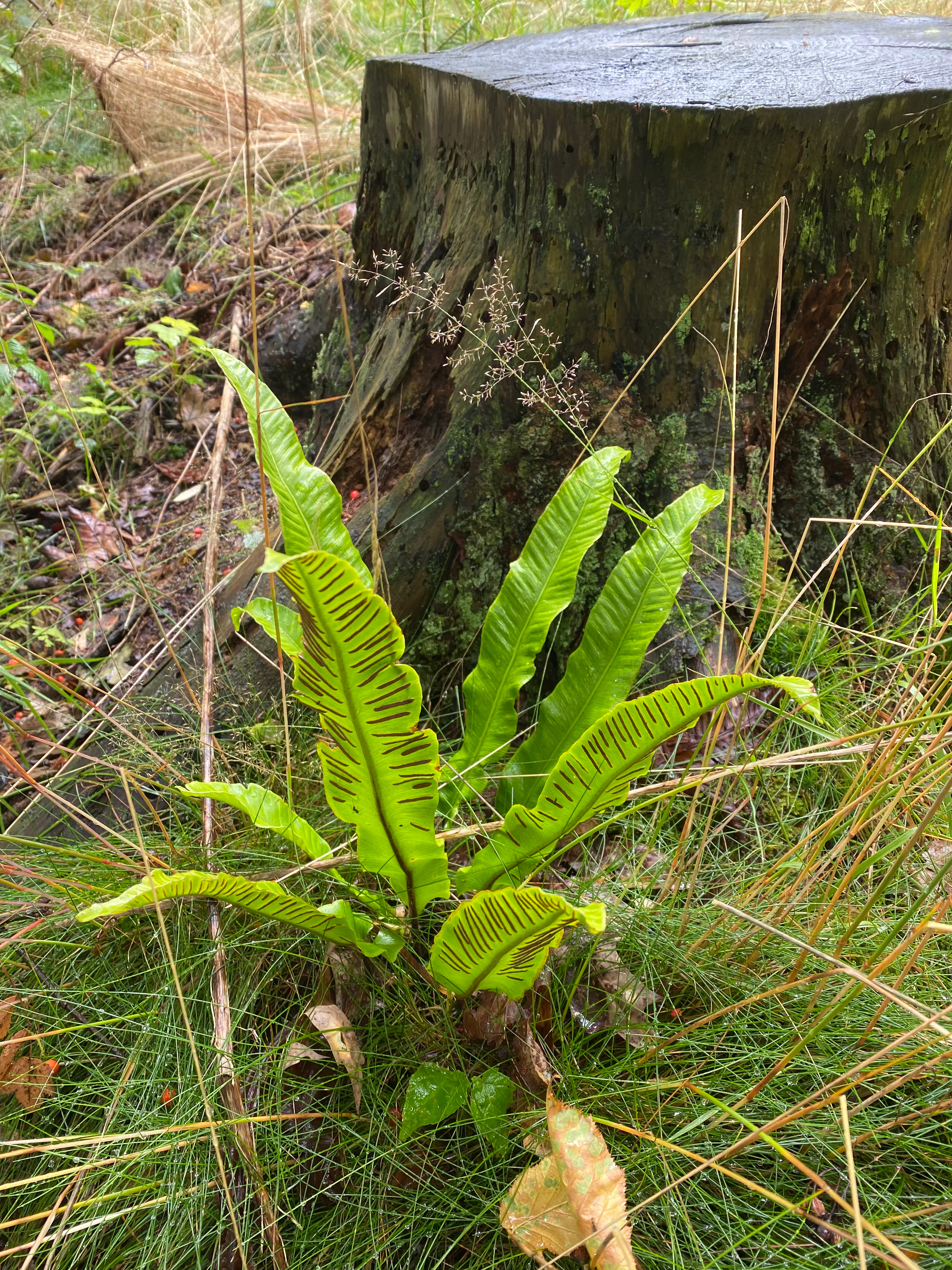
A bright green Hart's tongue fern with visible dark spore patterns on its fronds, situated at the base of a dark, weathered tree stump in a woodland area.
Hart's tongue fern growing beside an old tree stump in the forest.

Laubacher Steinbruch history and protected-area timeline

The Laubacher Steinbruch originated as a working limestone quarry. According to the official description of the nature conservation authorities, the quarry was opened at roughly the same time as the discovery of the Neanderthal remains, whose original find site lies just south of the present-day reserve area. Extraction at the site eventually ceased, and the property passed into nature conservation ownership through the broader protection history of the Neandertal.

The area was formally designated as a nature reserve (Naturschutzgebiet) in 1997 under the identifier ME-036 and is managed under the Landschaftsplan of Kreis Mettmann, which was most recently revised in 2012. Following its designation, the former quarry was deliberately allowed to revert to natural processes, and additional sections of rock were later re-exposed to expand the open rock and calcareous grassland habitats.

A significant adjacent context for the reserve's history is the development of the Neanderthal Museum, founded in 1996, and the surrounding network of protected sites in the Neandertal and Kreis Mettmann. The reserve is now embedded in the Natura 2000 site DE-4707-302 "Neandertal", an FFH area of about 269 hectares that ties together multiple nature reserves along the valley, including the nearby Westliches Neandertal and Fraunhofer Steinbruch reserves on the opposite bank of the Düssel.

Laubacher Steinbruch landscape and geographic character

Laubacher Steinbruch is characterized by the dramatic topography of a former limestone quarry set into the slope of the Düssel valley. The terrain descends from roughly 100 meters above sea level at the higher edges of the reserve down to about 80 meters along the river-side boundary, with an average elevation around 90 meters. The quarry walls, scree fields, and basin floor create a sequence of micro-landforms that catch sunlight and moisture very differently from one another.

The southern boundary of the protected area is formed by the Mettmanner Straße (L 357) and the Düssel river running beside it in the valley bottom. To the north, the reserve borders an active limestone quarry, from which an internal Werkstraße (quarry access track) cuts the protected area into two working zones. Eastward of this track lies the area around the small artificial pond on a former sports ground, while the larger western rock face and ravine forest occupy the western side.

Across the Düssel, on the opposite bank, the protected sites Westliches Neandertal (34 hectares, ME-045) and Fraunhofer Steinbruch (5 hectares, ME-030) adjoin the reserve, and the broader Neandertal valley forms a continuous natural corridor. Within Laubacher Steinbruch itself, the visual character is one of steep vertical limestone cliffs, loose limestone scree, patches of dry grassland, and a closed canopy of broadleaf ravine forest in the sheltered lower parts, with the small piped section of the Laubach stream lined by a narrow strip of alder floodplain forest where it approaches the Düssel.

A steep limestone rock face partially covered in green vegetation, set against a clear blue sky, with a road sign in the foreground.
A view of the limestone quarry face at Laubacher Steinbruch nature reserve.

Laubacher Steinbruch ecosystems, habitats, and plant life

The protected area is essentially a textbook example of how a small abandoned quarry, once left to natural processes, can develop into a high-value calcareous mosaic. The deepest parts of the western quarry form a basin-like depression where the bowl-shaped topography traps humidity, producing the persistent damp conditions that support a maple-ash ravine forest (Ahorn-Eschen-Schluchtwald). The forest consists predominantly of sycamore maple (Acer pseudoplatanus) and ash (Fraxinus excelsior), with a regionally distinctive occurrence of wych elm (Ulmus glabra) in the second tree layer that has been highlighted as a particular conservation focus of the site.

As elevation increases along the quarry walls, the moist forest transitions into drier habitats: tall-herb communities, lightly thermophilous thickets, small patches of calcareous scree vegetation with white stonecrop (Sedum album, Mauerpfeffer) and dry grassland (Trockenrasen), and locally outcropping limestone cliffs. Some rock faces are heavily shaded by encroaching trees, while others, including sections deliberately re-exposed along the western edge, are fully open to sunlight.

On the open rock faces, typical calcareous rock vegetation has established itself, dominated in many places by the maidenhair spleenwort (Asplenium trichomanes, Braunstieliger Streifenfarn) and, depending on the level of shading, by characteristic bryophyte communities. Where the light is stronger, large parts of the rock are by nature almost vegetation-free, accentuating the visual contrast between lush forest in the basin and stark white limestone walls above. On the eastern side of the access track, a former sports ground has been turned into a small pond dominated by stoneworts (Armleuchteralgen), surrounded by managed dry grassland designed to maintain open habitat structure.

Laubacher Steinbruch wildlife and species highlights

The most prominent animal focus of the reserve is the sand lizard (Lacerta agilis, Zauneidechse), a strictly protected species in Germany. All open areas of the reserve, including the dry rocky slopes, the dry grassland patches, the edges of the small pond, and the cleared sections near the active quarry, are used by the species. On the eastern side of the Werkstraße, dedicated egg-laying sites and shelter structures have been created for the lizards, and the northern rock face in that section is deliberately kept open for their benefit.

The mosaic of damp forest, open rock, scree, dry grassland, pond, and stream also creates habitat for a wide range of invertebrates typical of calcareous habitats, including the characteristic bryophyte, fern, and stonewort communities highlighted in the official site description. The alder-lined section of the Laubach stream and the pond with stonewort vegetation provide aquatic and semi-aquatic microhabitats alongside the dry cliff communities, allowing moisture-loving and drought-loving species to coexist within a very small area.

Laubacher Steinbruch conservation status and protection priorities

Laubacher Steinbruch is protected under German nature conservation law as a Naturschutzgebiet and classified as IUCN Category IV: Habitat/Species Management Area. Its overarching conservation aim is to preserve and develop the mosaic of ravine forest, exposed limestone rock communities, scree vegetation, and thermophilous dry grassland that has developed in the former quarry. These habitats are recognized under the EU Habitats Directive, and the ravine forest in particular qualifies as a "priority" habitat type for conservation.

Management actively works to maintain and expand open rock faces and dry calcareous grassland by regularly mowing the dry sites and by clearing encroaching trees, in order to counteract the natural succession towards closed forest that would otherwise shade out the rare cliff and grassland communities. Special measures also target the population of wych elm in the second tree layer, which is regionally important and vulnerable.

Beyond its own boundaries, Laubacher Steinbruch functions as a small but ecologically important component of a much larger protected system. As part of the FFH/Natura 2000 site "Neandertal" (DE-4707-302), it contributes to the connectivity of the Neandertal corridor, which is considered a regionally significant west-east connectivity corridor for nature conservation and an internationally important Natura 2000 area. Its proximity to the Neanderthal Museum also makes it a place where biodiversity conservation and the cultural heritage of the Neanderthal site are managed side by side.

Laubacher Steinbruch cultural meaning and human context

The most distinctive cultural dimension of Laubacher Steinbruch is its setting immediately adjacent to the Neanderthal Museum and the original find site of the Neanderthal-type fossils in the Neandertal. The official description of the reserve notes that the quarry was opened at roughly the same time as the discovery of the Neanderthal remains, linking the site's industrial history directly to one of the most significant moments in the history of human paleontology.

Today the reserve is part of a wider cultural landscape in which paleanthropology and natural heritage are tightly interwoven: visitors to the Neanderthal Museum walk into a valley where small protected sites such as Laubacher Steinbruch, Westliches Neandertal, and Fraunhofer Steinbruch maintain the natural character of the Neandertal. For local residents and visitors, the area provides an unusual combination of cultural-tourism attraction and accessible, well-documented natural habitats within the densely populated Bergisches Land region.

Top sights and standout views in Laubacher Steinbruch

Laubacher Steinbruch stands out for packing an unusually complete set of threatened calcareous habitats into a tiny area: humid maple-ash ravine forest with regionally rare wych elm, exposed limestone cliffs supporting maidenhair spleenwort and hart's tongue fern, lime-rich scree and dry grassland with white stonecrop, and open rocky terrain managed for sand lizards.

Its position directly beside the Neanderthal Museum and its role within the larger Neandertal Natura 2000 area give this small reserve an outsized significance, both as a stepping stone in the regional west-east conservation corridor and as a place where cultural heritage and rich biodiversity are experienced together.

Best time to visit Laubacher Steinbruch

The most rewarding periods to experience the character of Laubacher Steinbruch are late spring and summer, when the contrast between the moist, shaded ravine forest in the quarry basin and the sunlit, species-rich dry grasslands and rock faces is most vivid. Spring brings the most active period for woodland wildflowers and ferns on the rock walls, while early to mid-summer is when the dry grasslands are at their flowering peak and the sand lizards are most visible basking on the open rocks and along the dry-grassland edges.

For visitors particularly interested in botanical details, a calmer early-summer visit offers the best combination of mild weather for walking the valley and active lizard behavior on warm days. The surrounding area along the Düssel and around the Neanderthal Museum is accessible year-round, but the small reserve itself is best appreciated in the warmer months when sunlight reaches the rock faces and the ecological contrast between forest, cliff, and dry grassland is most dramatic.

Monthly climate preview

Long term temperature ranges and monthly precipitation averages for Laubacher Steinbruch

Laubacher Steinbruch Climate Normals and Annual Weather Patterns

Representative coordinates track measured monthly temperature swings and daily precipitation norms across the Laubacher Steinbruch protected area. Detailed twelve month climate statistics provide complete monthly weather records for thorough environmental analysis.
Annual mean10 °C
1 °C19 °C
Jan
Feb
Mar
Apr
May13°
Jun17°
Jul19°
Aug19°
Sep15°
Oct10°
Nov
Dec
Warmest month
July

19.2 °C

Coolest month
January

1.3 °C

Wettest month
December

2.6 mm/day

Driest month
April

1.6 mm/day

Park location guide

Geography guide, regional context, and park location map for Laubacher Steinbruch

Laubacher Steinbruch park geography, regions, and map view in Germany

Understand where Laubacher Steinbruch sits in Germany through a broader geographic reading of the surrounding landscape, nearby location context, and its mapped position within the national park landscape.

How Laubacher Steinbruch fits into Germany

Germany is a federal republic in Western and Central Europe with a population of over 83 million across sixteen constituent states. It is Europe's largest economy by nominal GDP and a major global exporter and importer. The capital is Berlin, and the country borders Denmark, Poland, Czech Republic, Austria, Switzerland, France, Luxembourg, Belgium, and the Netherlands.

Wider geography shaping Laubacher Steinbruch in Germany

Germany is located in Western and Central Europe, spanning 357,022 km². It borders Denmark to the north, Poland and the Czech Republic to the east, Austria and Switzerland to the south, and France, Luxembourg, Belgium, and the Netherlands to the west. The country has coastlines on the Baltic Sea and North Sea to the north, with the Alps located in the southern region.

Map view of Laubacher Steinbruch

Use this park location map to pinpoint Laubacher Steinbruch in Germany, understand its exact geographic position, and read its mapped placement within the surrounding landscape more clearly.

Pigeon | © OpenStreetMap contributors

Location context for Laubacher Steinbruch

Nordrhein-Westfalen

Explore the dramatic terrain, limestone cliffs, and specialized ravine forest ecosystems of the protected area.

Laubacher Steinbruch Photos and Landscape Scenery: Visualizing Quarry Habitats

Visual documentation reveals the rugged topography and distinct calcareous habitats preserved across the former quarry terrain. Examining these detailed photographic records helps observers understand the complex mosaic of rocky slopes and shaded woodlands that define the protected landscape.

A bright green Hart's tongue fern with visible dark spore patterns on its fronds, situated at the base of a dark, weathered tree stump in a woodland area.

A small waterfall flowing over rocky terrain surrounded by a wooded ravine.

A steep limestone rock face partially covered in green vegetation, set against a clear blue sky, with a road sign in the foreground.

Park atlas

Compare regional nature reserves and connected conservation corridors across the valley

Explore Parks Near Laubacher Steinbruch and Surrounding Protected Landscapes

Browsing other parks near Laubacher Steinbruch reveals a wider network of protected limestone formations, ravine forests, and river valleys. Comparing these adjacent reserves provides essential geographic context for understanding regional biodiversity patterns and conservation corridors.
A watercolor painting showing a winding stream flowing through a green valley with soft hills and trees in the background.
Nature reserveKreis Mettmann
About 2 km away#1 closest

North

Laubachtal Nature Reserve: Geographic Mapping of the Mettmann Wetland Corridor

A protected stream valley in Kreis Mettmann, Germany

Laubachtal functions as a critical 15 hectare nature reserve within the Mettmann district, preserving a mosaic of stream, pond, and wet meadow habitats. This protected area serves as an essential ecological corridor for amphibians and migratory birds, offering a focused look at small-scale conservation geography within the urban-edge environment of North Rhine-Westphalia.

Area
0.15 km²
Established
1997
IUCN
IV
Relief
Upland
A soft, light watercolor painting of a green, rolling valley with trees and gentle hills, rendered in a minimalist style on a white background.
Nature reserveNordrhein-Westfalen
About 3.4 km away#2 closest

West

Hubbelrather Bachtal: Nature Reserve and Protected Stream Valley in Nordrhein-Westfalen

A diverse habitat mosaic from lowland wetlands to dry sandy slopes

Hubbelrather Bachtal is a protected nature reserve in the Mettmann district, defined by a basin-shaped valley floor along the Hubbelrather Bach. The area features a complex mosaic of reedbeds, sedge-rich grasslands, and beech woodland slopes, providing essential refuge for endangered species in the urbanized corridor between Düsseldorf and the Bergisches Land.

Area
28.29 km²
Established
1997
IUCN
IV
A watercolor painting showing a soft landscape scene with a winding stream, low-lying vegetation, and distant hills in pale green and earth tones.
Nature reserveNorth Rhine-Westphalia
About 3.9 km away#3 closest

Southeast

Mahnerter Bachtal: Mapping the Protected Stream Valley Habitats of North Rhine-Westphalia

A vital riparian landscape and lowland nature reserve

Mahnerter Bachtal preserves a significant lowland stream valley in Erkrath, featuring alder swamps, wet meadows, and ancient oak forests. This 28-hectare nature reserve functions as a crucial east-west ecological corridor, offering a rare glimpse of undisturbed valley geography within the sprawling industrial landscape of the German Rhine-Ruhr metropolitan area.

Area
0.28 km²
Established
1997
IUCN
IV
Watercolor painting of a green valley with a winding stream and gentle hills in the background.
Nature reserveNordrhein-Westfalen
About 4.1 km away#4 closest

West

Morper Bachtal: Mapped Nature Reserve and Stream Valley Geography in Germany

Protected wetland landscapes and regional habitat connectivity.

Morper Bachtal represents a tightly layered protected area where open water, reedbeds, and beech forests converge along the Rotthäuser Bach. This detailed look at its landscape composition and position within the district of Mettmann reveals the significance of its compact, undulating terrain and corridor role in German regional geography.

Area
0.74 km²
Established
1984
IUCN
IV
Relief
Upland
A horizontal watercolor painting of a calm stream flowing through a grassy valley with distant hills and scattered trees under a soft, pink-tinted sky.
Nature reserveKreis Mettmann
About 4.3 km away#5 closest

Southeast

Hühnerbachtal Nature Reserve: Geography and Protected Landscape in Kreis Mettmann

Mapped stream valley ecosystems and local habitat connectivity.

Hühnerbachtal protects a unique valley mosaic in Germany, characterized by floodplain forests and steep wooded slopes. The reserve maintains a critical biotope network near Haan, offering a deep look into the regional geography and protected terrain of the Mettmann district.

Area
0.244 km²
Established
1997
IUCN
IV
Watercolor painting of a meandering stream flowing through a green meadow, with trees in the background.
Nature reserveNordrhein-Westfalen
About 4.5 km away#6 closest

South

Hildener Stadtwald, Bereich Sandbach-Krebsbach Protected Nature Reserve and Wetland Geography

A mapped overview of the Bergische Heideterrasse riparian corridor.

Hildener Stadtwald, Bereich Sandbach-Krebsbach stands as an important nature reserve within the urbanised landscape of North Rhine-Westphalia. The area is characterized by its hydrologically dynamic sandy brooks, old-growth alder stands, and distinct microhabitats ranging from wet heath to dry oak-birch forests. This protected entity offers a clear look at the structural complexity of lowland mire ecosystems within a broader regional forest context.

Area
0.27 km²
Established
1938
IUCN
IV
Relief
Lowland
A horizontal watercolor illustration showing a landscape with sparse trees, grasses, and soft pastel colors representing a heathland habitat.
Nature reserveNordrhein-Westfalen
About 5.3 km away#7 closest

South

Hildener Heide, östlich Taubenberg: Protected Nature Reserve and Heathland Atlas

Mapping the ecological landscape in Nordrhein-Westfalen

Hildener Heide, östlich Taubenberg is a distinct nature reserve in the Mettmann district, notable for its intact wet heath and bog asphodel populations. This protected area contributes to a wider forest and heath network across the Bergische Heideterrasse, showcasing how active conservation management shapes unique lowland terrain.

Area
2 km²
Established
1993
IUCN
IV
A soft watercolor illustration of a calm stream winding through a wetland or bog area, with gentle hills in the background and a split tree trunk in the foreground.
Nature reserveNordrhein-Westfalen
About 5.4 km away#8 closest

South

Hildener Stadtwald, Bereich Biesenbach: Protected Wetland and Heathland Geography

Nature reserve complex in the Mettmann district of Nordrhein-Westfalen

This compact nature reserve preserves a critical network of bog woodland and stream-fed alder swamp within the sand-dominated terrain of the Bergische Heideterrasse. The area demonstrates a clear transition between elevated dry forest margins and permanently wet peat moss communities, anchoring a wider regional system of protected heathland habitats.

Area
0.09 km²
Established
1938
IUCN
IV
Relief
Lowland

Common questions about visiting, size, designation, and location context for Laubacher Steinbruch

Laubacher Steinbruch FAQs for park facts, access, geography, and protected area context

Find quick answers about Laubacher Steinbruch, including protected-area facts, park geography, trail and visitor context, and how the park fits into its surrounding country and regional landscape.
MoriAtlas Explorer

Continue Your Protected Areas Search Across the Global Atlas

Deepen your exploration by continuing the structured search for national parks and protected areas worldwide. Utilize the comprehensive filtering capabilities to compare different conservation landscapes and refine your understanding of global park geography. Discover more about the distribution and characteristics of protected natural areas.

Global natural geography