
Mori Atlas logo
Nature reserveLaubachtal

Mapping the riparian landscape, stream corridor, and wetland refuge in Germany

Laubachtal Nature Reserve: A Detailed Geographic Atlas of the Mettmann Stream Valley Mosaic

(Naturschutzgebiet Laubachtal (ME-037))

Laubachtal serves as a vital 15 hectare nature reserve protecting the upper Laubach stream valley in the Mettmann district. This geographic overview highlights the reserve as a complex mosaic of reed beds, moist grasslands, and riparian woodlands that function as a critical habitat refuge. The area preserves an essential ecological corridor within the densely settled landscape of North Rhine-Westphalia, providing a structured look at the stream hydrology and natural boundaries of this protected site.

Nature ReserveWetlandsStream ValleyReed BedsWet GrasslandRiparian Woodland
A flat-design digital illustration depicting a waterfall cascading down a mountain into a river, surrounded by pine forests and grassy slopes.

Laubachtal

Nature reserve

Park overview

Structured park overview, official facts, and landscape profile for Laubachtal Nature Reserve

Laubachtal Nature Reserve park facts, protected area profile, and essential visitor context

Review the core facts for Laubachtal Nature Reserve, including designation, size, terrain, visitor scale, habitats, and operating context in one park-focused overview.

About Laubachtal Nature Reserve

Laubachtal is a small nature reserve on the western edge of the city of Mettmann in the German state of North Rhine-Westphalia. The reserve follows the upper course of the Laubach, a modest right-bank tributary of the Düssel, beginning near the Karpendelle district where the stream rises and ending where the watercourse disappears beneath the Südring, a stretch of the B 7 federal highway that forms Mettmann's southern bypass.

The landscape of the reserve is shaped by the shallow, slow-moving stream and its immediate surroundings. Over its roughly 1.2 kilometer length, the Laubach meanders through a sequence of habitats that together form a surprisingly diverse wetland mosaic for such a small area. Ponds and small waterbodies are scattered along the course, some of them clearly visible at sites such as the pond near Ellershof. Reed beds line sections of the stream, and patches of wet grassland, flood meadows, fallow margins, scrub, and small woodland areas create a transitional zone between aquatic and terrestrial habitats.

The surrounding land uses illustrate the reserve's value as a refuge. To the west, agricultural fields press up against the protected area, while suburban and transport infrastructure frame the eastern end near the Südring. Within this intensively used setting, the protected valley functions as a small corridor of relatively undisturbed habitat. It is particularly notable for amphibians, which use the ponds, ditches, and wet areas as breeding sites and year-round habitat, and for insects that benefit from the combination of water, reed, and flowering wet meadow vegetation.

Woodland is present only in small patches, but the riparian tree line along the Laubach is characteristic. Ash, black alder, and willow form an unlined, natural-looking gallery that follows the stream. The water quality of the Laubach is recorded as class 2 on the German scale, meaning moderately polluted, yet still sufficient to support the ecological communities that define the reserve. Traditional land uses such as orchards and extensive meadow management are also part of the cultural landscape near the protected corridor, and Highland cattle graze parts of the valley, contributing to the maintenance of open habitat.

Quick facts and research context for Laubachtal Nature Reserve

Laubachtal is a small protected nature reserve in Mettmann, North Rhine-Westphalia, designated under the German Naturschutzgebiet category and classified as IUCN Category IV, a Habitat/Species Management Area. It carries the official identifier ME-037 and the World Database on Protected Areas record 164384.

The reserve covers 15 hectares and spans the upper Laubach valley over a 1.2 km stretch. It lies at elevations between roughly 145 and 155 meters above sea level and is administered by the lower landscape authority (Untere Landschaftsbehörde) of the Mettmann district.

Protection and recognition

Examine the verified terrestrial conservation scope and official designation details for Laubachtal.

Laubachtal Protection Status and International Recognition Records

Terrestrial protection metrics for Laubachtal establish the documented conservation framework and designated boundaries. Official recognition data outlines international status and administrative records for this protected area.

Protection details

Protection scope
Terrestrial
Transboundary protection
No
WDPA ID
164384
Park context

Deeper park guide and search-rich context for Laubachtal Nature Reserve

Laubachtal Nature Reserve history, landscape, wildlife, and travel context

Explore Laubachtal Nature Reserve through its history, landscape character, ecosystems, wildlife, conservation priorities, cultural context, and seasonal travel timing in a structured park guide built for atlas discovery and search intent.

Why Laubachtal Nature Reserve stands out

Laubachtal is best known for its compact, ecologically rich mosaic of stream, pond, reed bed, wet grassland, and riparian woodland habitats set within an intensively used urban and agricultural landscape. It functions as a refuge for amphibians, rare insects, and breeding or migratory birds, and it preserves one of the small upper stream valleys of the Düssel river system in the Bergisches Land.
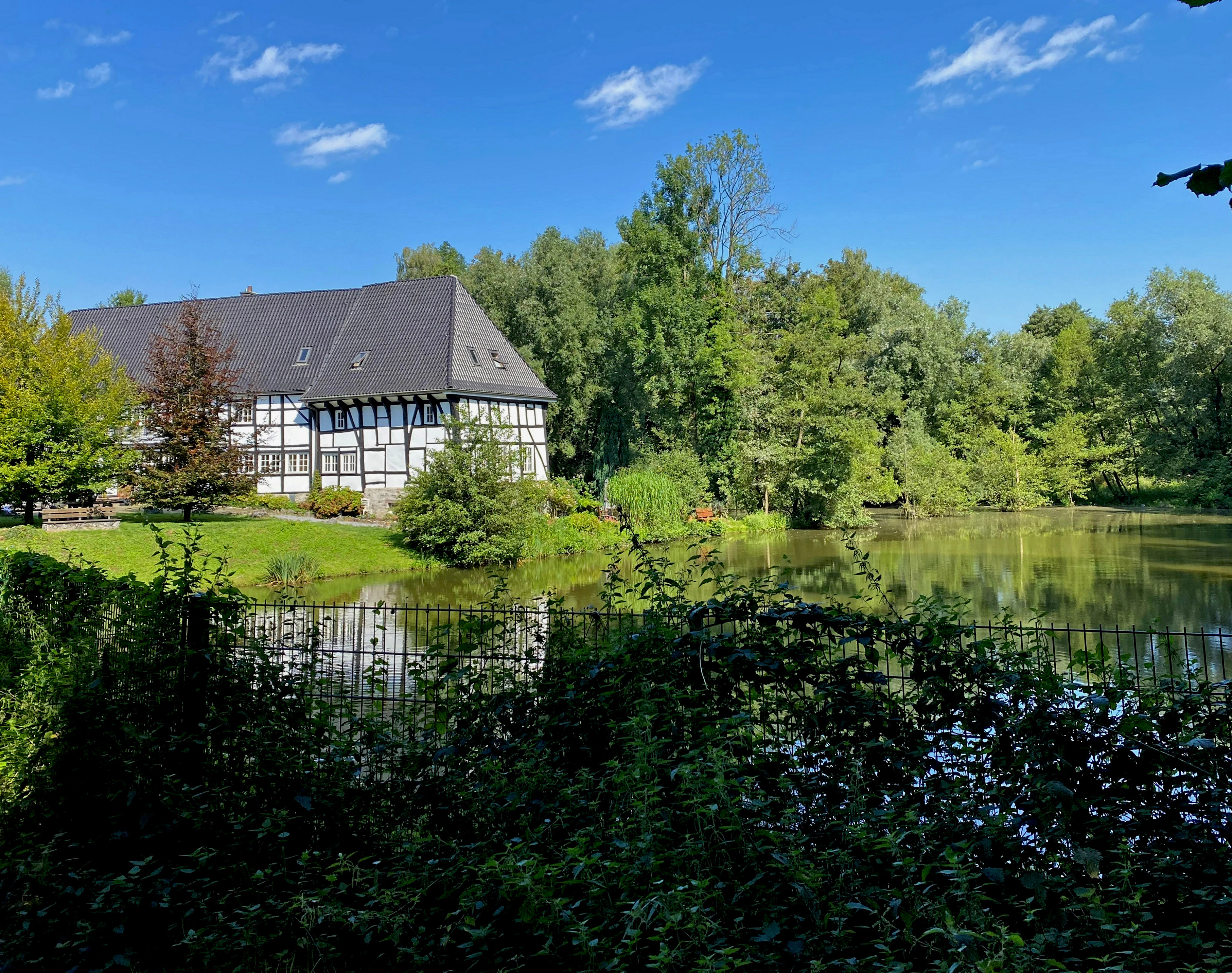
A traditional timber-framed building, known as Haus Laubach, sits on the grassy shore of a reflective pond, surrounded by lush green trees under a clear blue sky.
Haus Laubach situated by a tranquil pond within the Laubachtal Nature Reserve.

Laubachtal Nature Reserve history and protected-area timeline

Laubachtal was first designated as a nature reserve in 1997 and was subsequently incorporated into the Mettmann district landscape plan (Landschaftsplan) of 2012. The 2012 landscape plan provides the principal modern description of the site and its ecological value, including the detailed habitat, vegetation, and species accounts that frame current management.

Like many small German nature reserves, Laubachtal emerged from broader regional efforts to protect ecologically valuable stream valleys and wetland remnants in the densely settled area between the Ruhr and the lower Rhine, where agriculture, settlement, and infrastructure have reduced natural habitat to small, scattered fragments. The reserve's small size reflects this pressure: the protected area is essentially the remaining higher-quality stretch of an otherwise heavily impacted urban stream valley.

Laubachtal Nature Reserve landscape and geographic character

The landscape of Laubachtal is defined by a narrow, gently sloping stream valley typical of the Bergisches Land region north of Düsseldorf. Elevations within the reserve range only from about 145 to 155 meters above sea level, giving the valley a quiet, low-relief character rather than a dramatic river gorge.

The most prominent physical features are the Laubach stream itself, its shallow floodplain, and the small ponds and ditch-like waterbodies along its course. Reed beds and wet depressions interrupt the floodplain at intervals, while slightly higher ground carries meadows, scrub, and fragments of alluvial woodland. The valley sits at the western edge of Mettmann, framed by agricultural land on one side and by suburban settlement and the Südring road corridor on the other, which gives the reserve the feel of a hidden green ribbon running through a busy urban-rural interface.
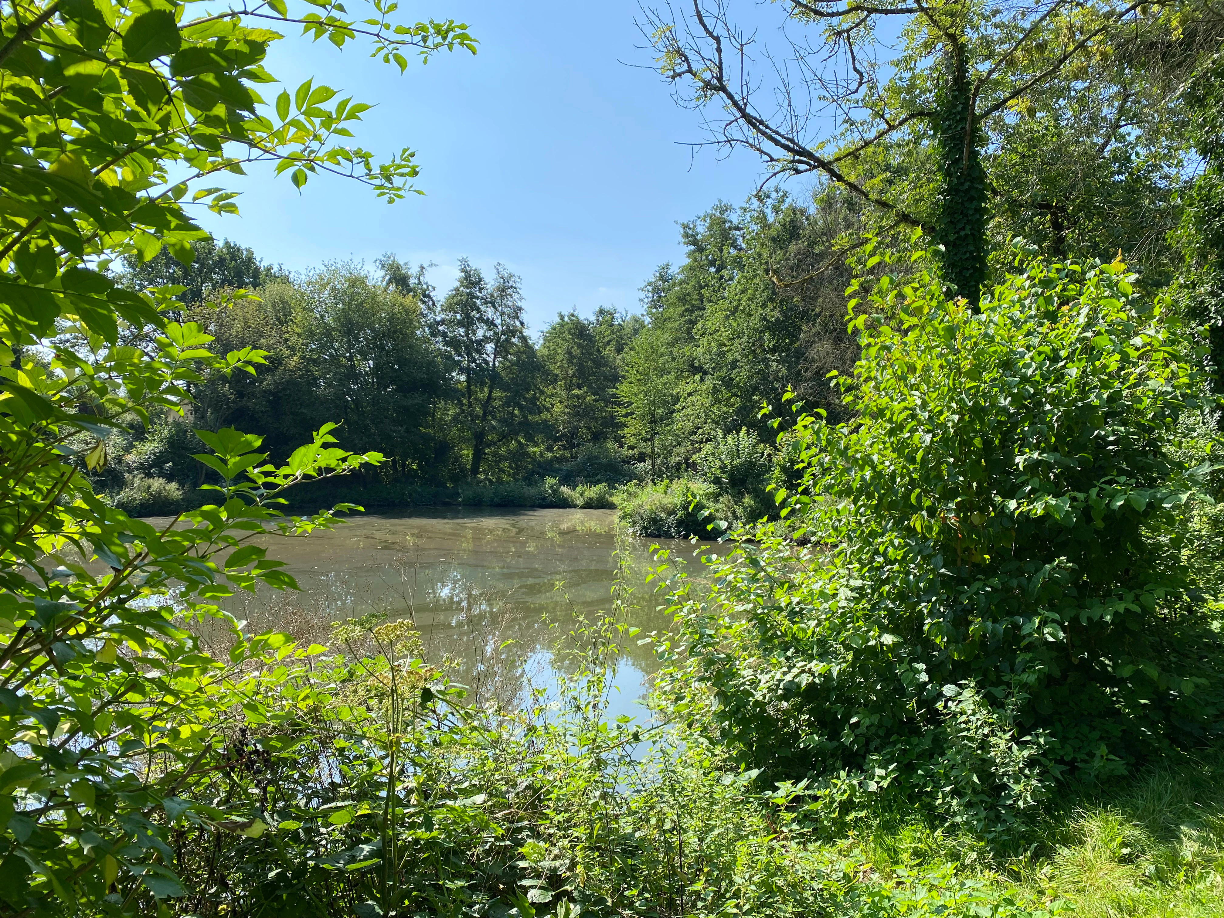
A small pond framed by green leafy trees and bushes on a sunny day in the Laubachtal valley.
A tranquil pond surrounded by lush riparian vegetation in the Laubachtal Nature Reserve.

Laubachtal Nature Reserve ecosystems, habitats, and plant life

Ecologically, Laubachtal is significant because it preserves, in compact form, several habitat types that have become rare in the intensively used surroundings of the Mettmann district. The reserve's vegetation mosaic combines reed beds, moist and wet grasslands, flood meadows, fallow margins, scrub, small ponds, and patches of alluvial woodland with a continuous riparian tree line of ash, black alder, and willow.

The reed communities include stands assignable to the floating sweet-grass reed and watercress reed associations, both indicators of fluctuating water levels and clean enough substrate to support characteristic wetland flora. The wet grasslands host a recognizable suite of damp-meadow species including marsh thistle, meadowsweet, marsh yarrow, several sedges, ragged robin, marsh iris, marsh marigold, watercress, reed canary grass, common reed, creeping valerian, and bittersweet nightshade. A small orchard area (Streuobstwiese) and a stand of alluvial forest (Auwald) are also part of the mosaic.

Together, these habitats create an unusually high habitat density for a 15 hectare site. They offer breeding, feeding, and shelter conditions for amphibians and insects, and they provide a continuous ecological link along the stream corridor through an otherwise heavily modified landscape.
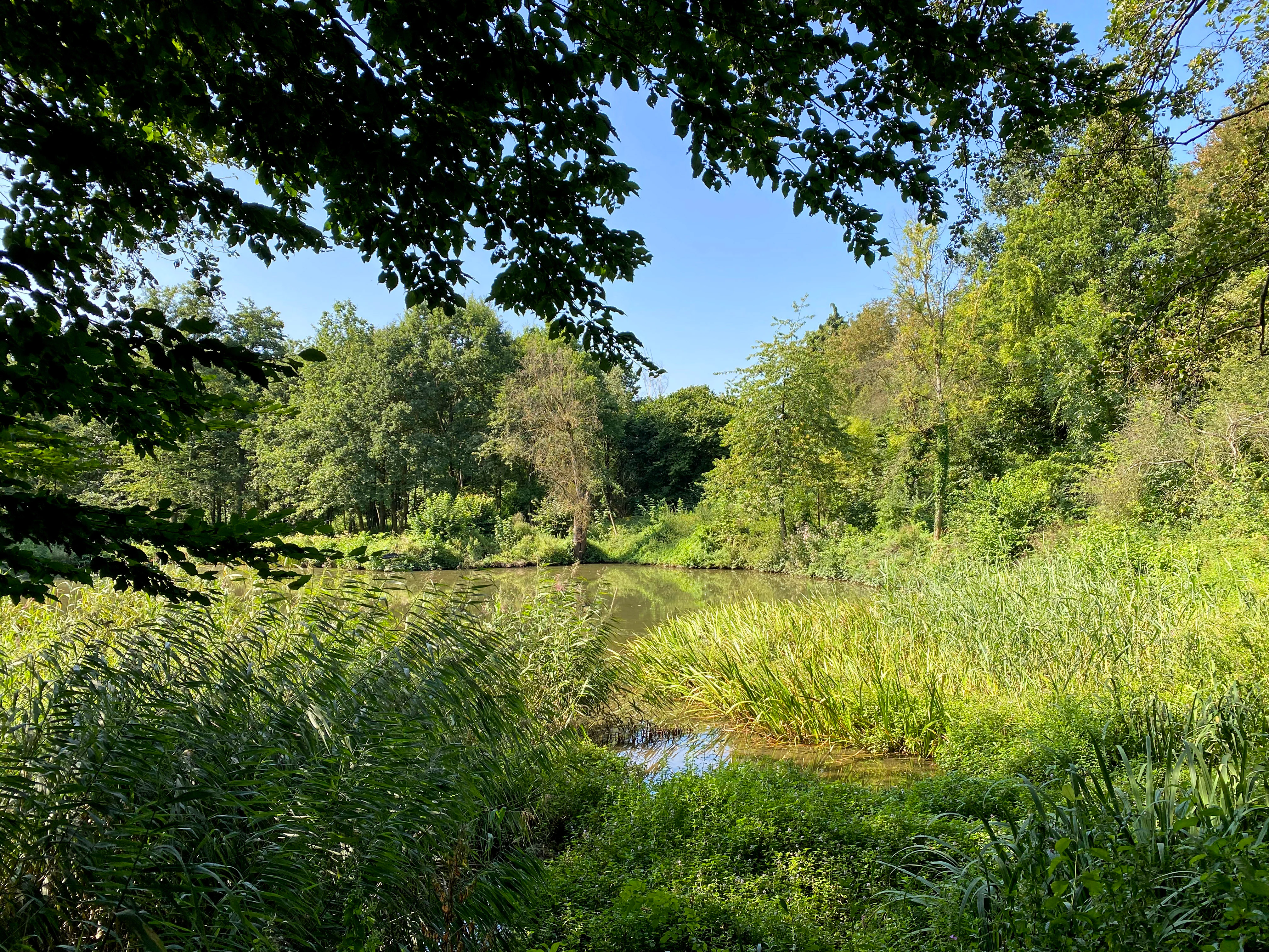
A small pond framed by tall reeds and lush green trees under a clear blue sky in a nature reserve.
A tranquil pond surrounded by lush riparian vegetation within the Laubachtal nature reserve.

Laubachtal Nature Reserve wildlife and species highlights

Wildlife is a central reason for the reserve's designation. The combination of still water, reed beds, wet meadows, and riparian woodland supports amphibians as a key group, with the ponds and wet areas serving both as spawning sites and as year-round habitat.

The reserve is also important for birds. Several Red List species have been documented, including the common kingfisher, the common nightingale, and the yellow wagtail, which use the area as breeding, passage, or feeding habitat. Two endangered bat species have been recorded, reflecting the value of the older trees, scrub, and structures along the valley for foraging and roosting.

Invertebrate interest is also notable. The strongly endangered long-winged bush-cricket has been recorded in the valley, and the wall brown butterfly, classified as endangered, is also present. These records underline how a small wetland mosaic in an urban-edge setting can support rare insect fauna alongside more conspicuous bird and mammal life.
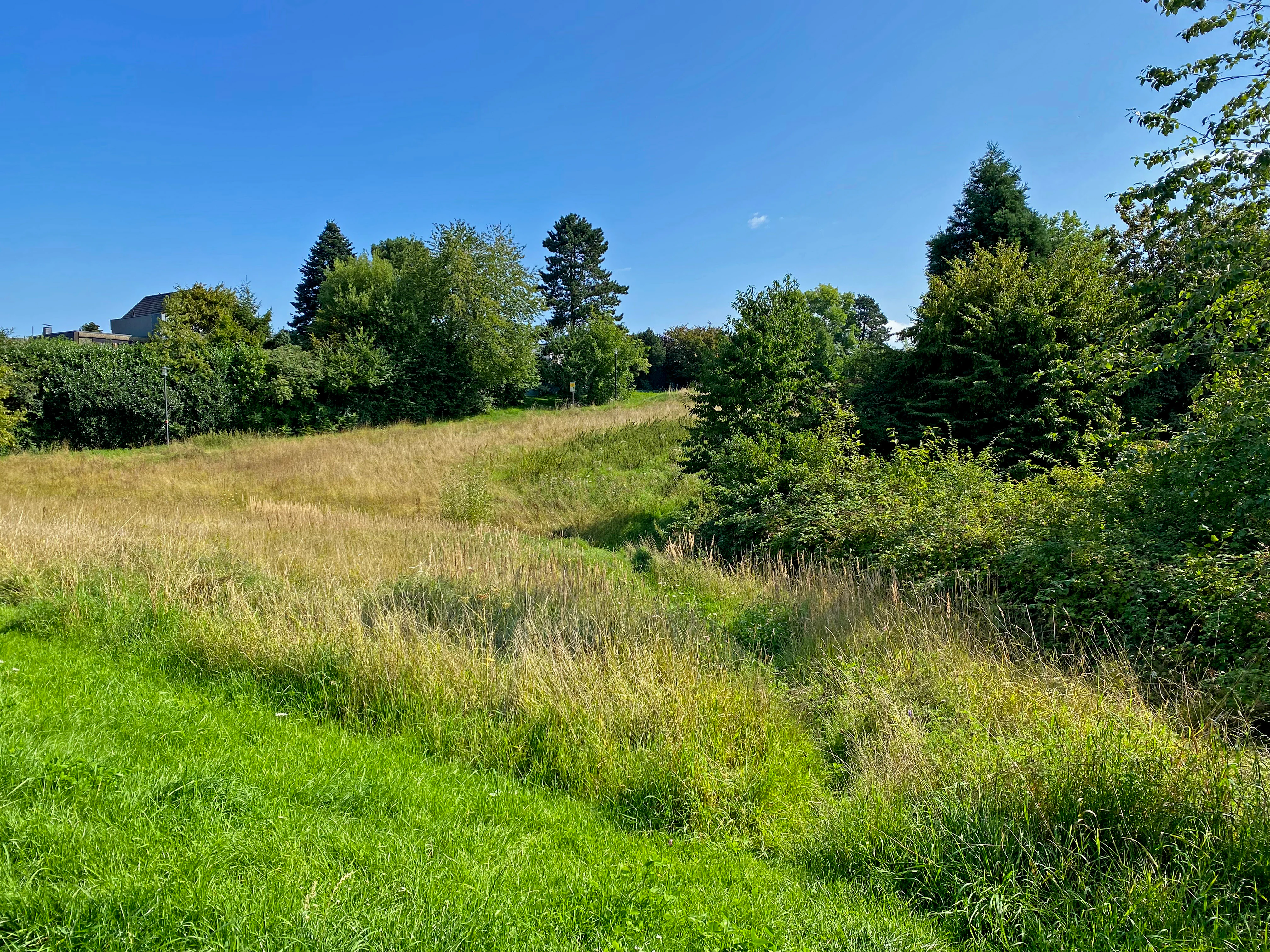
A green, grassy valley landscape with tall golden meadow grasses, surrounded by scattered deciduous and coniferous trees under a clear blue sky.
The Karpendelle, a source hollow within the Laubachtal nature reserve.

Laubachtal Nature Reserve conservation status and protection priorities

Laubachtal's conservation significance lies in its role as a refuge for wetland, riparian, and meadow habitats within a densely populated and heavily farmed district. The landscape plan for the Mettmann district explicitly describes the site as an ecologically valuable biotope complex in an intensively used environment, providing a retreat for flora and fauna that would otherwise be lost from the area.

The main conservation values include the protection of amphibian spawning habitat, the maintenance of a connected stream-side habitat corridor, the preservation of reed bed and wet meadow communities, and the safeguarding of feeding and resting sites for Red List bird, bat, and insect species. Protection status also helps maintain the traditional extensive uses, including orchard meadows and grazing with hardy cattle, that historically shaped the valley's open character and continue to support its botanical diversity.

Laubachtal Nature Reserve cultural meaning and human context

Although Laubachtal is primarily valued for its natural heritage, the landscape contains visible traces of traditional rural land use that shape its current character. Orchard meadows (Streuobstwiesen) along the valley preserve an older form of mixed fruit and grassland management, and Highland cattle graze parts of the area, helping to keep meadows open and structurally diverse.

The historic farmstead of Haus Laubach sits within or near the protected area, and the surrounding Karpendelle neighborhood and the Ellershof area reflect a long pattern of settlement along the stream corridor. These features link the reserve's ecological value to a working cultural landscape rather than to untouched wilderness.
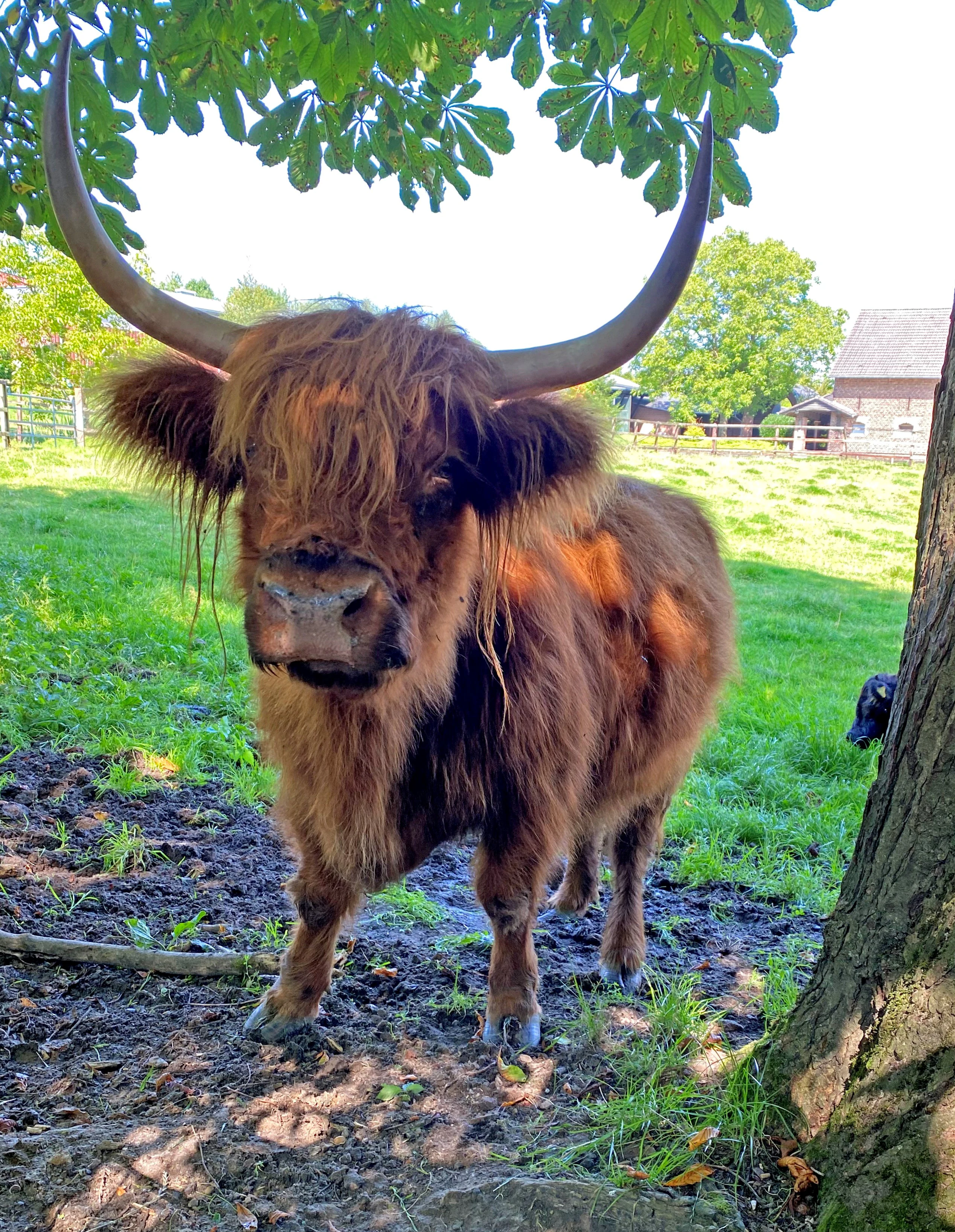
A close-up portrait of a shaggy Scottish Highland cow with long curved horns, standing on muddy ground beneath the canopy of a tree in a sunny pasture.
A Scottish Highland cow standing in a grassy pasture at the Laubachtal nature reserve.

Top sights and standout views in Laubachtal Nature Reserve

A compact 15 hectare wetland mosaic combining ponds, reed beds, wet meadows, and riparian woodland along the upper Laubach stream near Mettmann. The reserve supports Red List birds such as the kingfisher, nightingale, and yellow wagtail, along with endangered bats and rare insects, and it preserves a thin but ecologically rich corridor of natural habitat through one of the more densely settled parts of North Rhine-Westphalia.
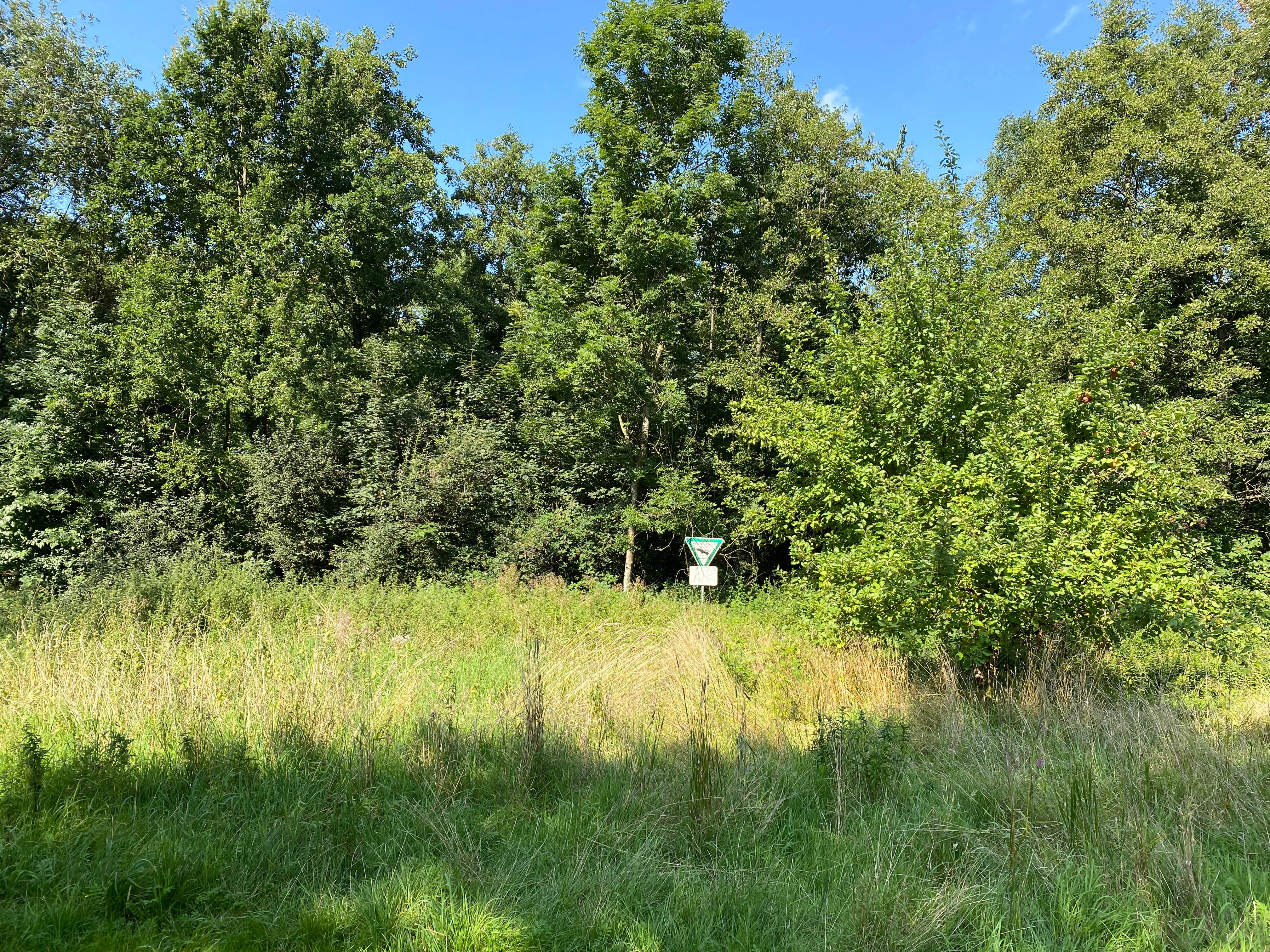

A green triangular nature reserve sign mounted on a post at the edge of a grassy meadow with dense forest in the background.
A nature reserve boundary sign located along the meadow edge in Laubachtal.
Monthly climate preview

Long-term representative averages for monthly temperature and precipitation patterns

Laubachtal Climate Normals and Annual Temperature Rhythm

Representative coordinate records show measured monthly temperature ranges alongside consistent precipitation levels across the Laubachtal reference period. Examining complete twelve-month climate normals reveals detailed shifts in average temperature and precipitation across the protected area.
Annual mean10 °C
1 °C19 °C
Jan
Feb
Mar
Apr
May13°
Jun17°
Jul19°
Aug19°
Sep15°
Oct10°
Nov
Dec
Warmest month
July

19.2 °C

Coolest month
January

1.3 °C

Wettest month
December

2.6 mm/day

Driest month
April

1.6 mm/day

Park location guide

Geography guide, regional context, and park location map for Laubachtal Nature Reserve

Laubachtal Nature Reserve park geography, regions, and map view in Germany

Understand where Laubachtal Nature Reserve sits in Germany through a broader geographic reading of the surrounding landscape, nearby location context, and its mapped position within the national park landscape.

How Laubachtal Nature Reserve fits into Germany

Germany is a federal republic in Western and Central Europe with a population of over 83 million across sixteen constituent states. It is Europe's largest economy by nominal GDP and a major global exporter and importer. The capital is Berlin, and the country borders Denmark, Poland, Czech Republic, Austria, Switzerland, France, Luxembourg, Belgium, and the Netherlands.

Wider geography shaping Laubachtal Nature Reserve in Germany

Germany is located in Western and Central Europe, spanning 357,022 km². It borders Denmark to the north, Poland and the Czech Republic to the east, Austria and Switzerland to the south, and France, Luxembourg, Belgium, and the Netherlands to the west. The country has coastlines on the Baltic Sea and North Sea to the north, with the Alps located in the southern region.

Map view of Laubachtal Nature Reserve

Use this park location map to pinpoint Laubachtal Nature Reserve in Germany, understand its exact geographic position, and read its mapped placement within the surrounding landscape more clearly.

Pigeon | © OpenStreetMap contributors

Location context for Laubachtal Nature Reserve

Kreis MettmannNordrhein-Westfalen

Explore protected area views, wetland habitats, and the quiet terrain of Laubachtal.

Laubachtal Photos and Landscape Scenery: Visualizing the Stream Valley

Visual documentation captures the complex wetland habitats, gentle stream valley terrain, and riparian vegetation defining Laubachtal. Examining protected area photography reveals the ecological character and distinct visual identity of this urban-edge conservation landscape.

A traditional timber-framed building, known as Haus Laubach, sits on the grassy shore of a reflective pond, surrounded by lush green trees under a clear blue sky.

A wooden footbridge with a green metal railing crosses a small stream in a shaded forest area, with a larger tree trunk standing prominently on the bank.

A small pond framed by green leafy trees and bushes on a sunny day in the Laubachtal valley.

A small pond framed by tall reeds and lush green trees under a clear blue sky in a nature reserve.

A green, grassy valley landscape with tall golden meadow grasses, surrounded by scattered deciduous and coniferous trees under a clear blue sky.

A narrow dirt trail leads into a wooded area bordering a grassy meadow in the Laubachtal nature reserve.

A close-up portrait of a shaggy Scottish Highland cow with long curved horns, standing on muddy ground beneath the canopy of a tree in a sunny pasture.

A green triangular nature reserve sign mounted on a post at the edge of a grassy meadow with dense forest in the background.

A sunny clearing surrounded by dense green deciduous trees and thick undergrowth in a wooded valley.

Park atlas

Compare adjacent wetland habitats and nearby stream valley reserves

Parks Near Laubachtal and Surrounding Regional Protected Areas

Continue exploring regional conservation areas by comparing other protected habitats located near Laubachtal. Reviewing adjacent stream valleys and wetland reserves helps reveal broader ecological patterns across the Bergisches Land landscape.
A watercolor painting showing a soft, peaceful landscape with light green rolling hills in the background, a flat plain in the middle ground, and grasses and wildflowers in the foreground under a pale, warm sky.
Nature reserveNordrhein-Westfalen
About 2 km away#1 closest

South

Laubacher Steinbruch Nature Reserve: Mapped Geographic Overview and Protected Landscape Analysis

Calcareous habitats in the Neandertal valley, Germany

Laubacher Steinbruch is a distinct nature reserve characterized by a mosaic of sycamore maple forest, steep limestone cliffs, and dry scree fields. Situated within the Neandertal Natura 2000 site, it acts as a critical refuge for specialized plant communities and reptiles, forming an integral part of the regional conservation network in Nordrhein-Westfalen.

Area
0.06 km²
Established
1997
IUCN
IV
A soft, light watercolor painting of a green, rolling valley with trees and gentle hills, rendered in a minimalist style on a white background.
Nature reserveNordrhein-Westfalen
About 4 km away#2 closest

West

Hubbelrather Bachtal: Nature Reserve and Protected Stream Valley in Nordrhein-Westfalen

A diverse habitat mosaic from lowland wetlands to dry sandy slopes

Hubbelrather Bachtal is a protected nature reserve in the Mettmann district, defined by a basin-shaped valley floor along the Hubbelrather Bach. The area features a complex mosaic of reedbeds, sedge-rich grasslands, and beech woodland slopes, providing essential refuge for endangered species in the urbanized corridor between Düsseldorf and the Bergisches Land.

Area
28.29 km²
Established
1997
IUCN
IV
Watercolor painting of a green valley with a winding stream and gentle hills in the background.
Nature reserveNordrhein-Westfalen
About 4.9 km away#3 closest

West

Morper Bachtal: Mapped Nature Reserve and Stream Valley Geography in Germany

Protected wetland landscapes and regional habitat connectivity.

Morper Bachtal represents a tightly layered protected area where open water, reedbeds, and beech forests converge along the Rotthäuser Bach. This detailed look at its landscape composition and position within the district of Mettmann reveals the significance of its compact, undulating terrain and corridor role in German regional geography.

Area
0.74 km²
Established
1984
IUCN
IV
Relief
Upland
A watercolor painting showing a soft landscape scene with a winding stream, low-lying vegetation, and distant hills in pale green and earth tones.
Nature reserveNorth Rhine-Westphalia
About 5.1 km away#4 closest

Southeast

Mahnerter Bachtal: Mapping the Protected Stream Valley Habitats of North Rhine-Westphalia

A vital riparian landscape and lowland nature reserve

Mahnerter Bachtal preserves a significant lowland stream valley in Erkrath, featuring alder swamps, wet meadows, and ancient oak forests. This 28-hectare nature reserve functions as a crucial east-west ecological corridor, offering a rare glimpse of undisturbed valley geography within the sprawling industrial landscape of the German Rhine-Ruhr metropolitan area.

Area
0.28 km²
Established
1997
IUCN
IV
A watercolor illustration of a gentle winding stream flowing through a lush green valley at dawn or dusk.
Nature reserveNordrhein-Westfalen
About 5.4 km away#5 closest

Northwest

Schwarzbachtal bei Götzenberg: Nature Reserve and Protected Landscape in North Rhine-Westphalia

Mapped stream valley, floodplain, and forest geography

Schwarzbachtal bei Götzenberg is an ecologically rich nature reserve located near Ratingen in the Mettmann district. The protected area features a well-preserved stretch of the Schwarzbach stream, old-growth beech stands, and complex wetland mosaics including reedbeds and ponds, providing essential habitat within a suburban landscape.

Area
0.54 km²
Established
1984
IUCN
IV
Relief
Lowland
A horizontal watercolor painting of a calm stream flowing through a grassy valley with distant hills and scattered trees under a soft, pink-tinted sky.
Nature reserveKreis Mettmann
About 5.8 km away#6 closest

South

Hühnerbachtal Nature Reserve: Geography and Protected Landscape in Kreis Mettmann

Mapped stream valley ecosystems and local habitat connectivity.

Hühnerbachtal protects a unique valley mosaic in Germany, characterized by floodplain forests and steep wooded slopes. The reserve maintains a critical biotope network near Haan, offering a deep look into the regional geography and protected terrain of the Mettmann district.

Area
0.244 km²
Established
1997
IUCN
IV
Watercolor painting of a calm pond with cattails in the foreground and rolling hills in the background.
Nature reserveNorth Rhine-Westphalia
About 6.2 km away#7 closest

West

Naturschutzgebiet Pillebachtal, Dernkamp und Gallberg: Protected Landscape and Geography

Nature reserve in North Rhine-Westphalia, Germany

An urban-adjacent nature reserve, this area provides a mapped look at the transition between mature beech forest stands and moist wetland corridors along the Pillebach stream. It serves as a study in ecological structure, featuring reed beds, meadow springs, and gallery woodlands that offer a protected refuge within the Rhine-Ruhr metropolitan region.

Area
0.745 km²
Established
1996
IUCN
IV
Watercolor painting of a meandering stream flowing through a green meadow, with trees in the background.
Nature reserveNordrhein-Westfalen
About 6.3 km away#8 closest

South

Hildener Stadtwald, Bereich Sandbach-Krebsbach Protected Nature Reserve and Wetland Geography

A mapped overview of the Bergische Heideterrasse riparian corridor.

Hildener Stadtwald, Bereich Sandbach-Krebsbach stands as an important nature reserve within the urbanised landscape of North Rhine-Westphalia. The area is characterized by its hydrologically dynamic sandy brooks, old-growth alder stands, and distinct microhabitats ranging from wet heath to dry oak-birch forests. This protected entity offers a clear look at the structural complexity of lowland mire ecosystems within a broader regional forest context.

Area
0.27 km²
Established
1938
IUCN
IV
Relief
Lowland

Common questions about visiting, size, designation, and location context for Laubachtal Nature Reserve

Laubachtal Nature Reserve FAQs for park facts, access, geography, and protected area context

Find quick answers about Laubachtal Nature Reserve, including protected-area facts, park geography, trail and visitor context, and how the park fits into its surrounding country and regional landscape.
MoriAtlas Explorer

Continue Your Protected Areas Search Across the Global Atlas

Deepen your exploration by continuing the structured search for national parks and protected areas worldwide. Utilize the comprehensive filtering capabilities to compare different conservation landscapes and refine your understanding of global park geography. Discover more about the distribution and characteristics of protected natural areas.

Global natural geography