
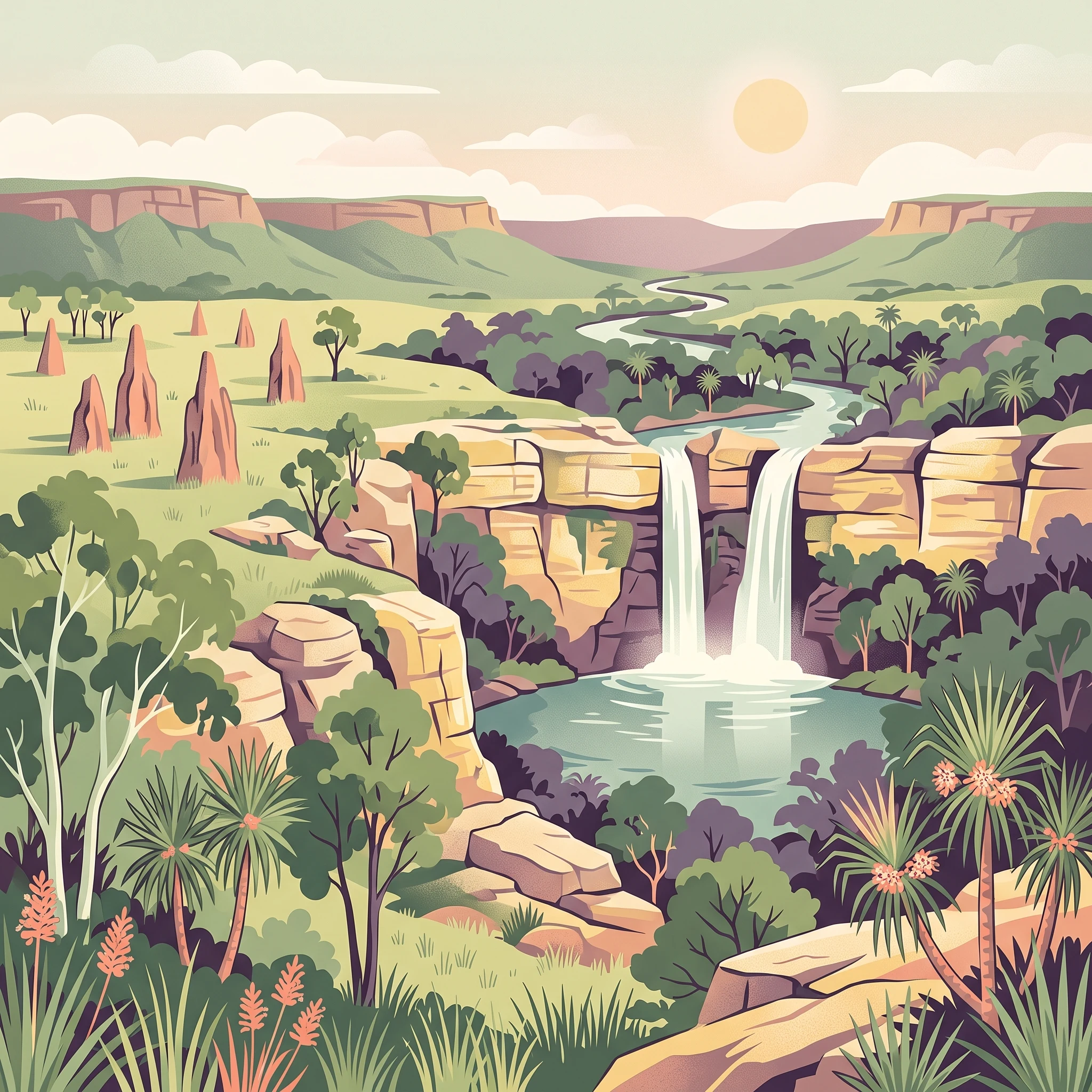
Trip Timing Overview
When to visit Litchfield National Park: the best months and planning trade-offs
Determining the best time to visit Litchfield National Park requires balancing the reliability of road access with the intensity of Northern Territory heat. The dry season, which spans from May through September, is widely regarded as the most practical window for visitors. During these months, the park experiences minimal rainfall, clear skies, and daytime temperatures that, while warm, are manageable compared to the extreme heat of the late dry season. This period ensures that major attractions such as the waterfalls at Florence and Wangi Falls remain accessible and the associated swimming holes are typically open for public use. Visitors arriving during these months can expect consistent conditions that facilitate navigation of the park’s walking tracks, including the multi-day Tabletop Track.
The Trade-offs of Seasonal Planning
Choosing when to visit involves a fundamental trade-off between accessibility and personal tolerance for heat and humidity. While the cooler, drier months offer stable conditions, they also coincide with the period when most visitors arrive at the park. Those prioritizing solitude may find the shoulder months more appealing, yet these transitions require careful planning. As the year moves into October and November, temperatures rise significantly, often pushing maximums above 40 degrees Celsius. This 'build-up' to the tropical wet season brings rising humidity and the first onset of significant rainfall. Consequently, the later months of the year require greater flexibility, as certain tracks or remote areas may face localized access restrictions or sudden weather changes.
Understanding Climatic Influences on Travel
The park’s climate is defined by two distinct phases rather than a traditional four-season model. The shift from the arid, breezy conditions of June and July to the oppressive heat of the late year is the primary factor shaping the visitor experience. Visitors should consider that while the lack of rain simplifies travel logistics in the mid-year, the physical environment of Litchfield,with its sandstone gorges and monsoon rainforests,responds dynamically to the arrival of the monsoon. The lush landscapes that draw many travellers are often a result of the preceding wet season, meaning that visiting earlier in the dry season often provides a chance to see waterfalls with higher flow rates before the natural drying process of the landscape accelerates under the heat of August and September. Travellers must approach these seasonal windows as general guides, understanding that daily conditions are subject to localized weather patterns and official park management decisions.
Seasonal Planning
Best months to visit Litchfield National Park for specific visitor needs
Balancing comfort and access during the dry season
For most visitors, the period between May and September represents the primary window for a reliable park experience. During these months, the daily maximum temperatures typically range from the mid-30s to high 30s in Celsius, yet the critical advantage is the low relative humidity, which drops significantly from over 60 percent in May to below 40 percent in July. This drop in moisture makes the intense daytime heat far more manageable for those planning to hike the Tabletop Track or explore the sandstone escarpments. Because precipitation is negligible during this window, walking paths remain clear, and the infrastructure supporting access to popular sites like Wangi Falls and Florence Falls is at its most stable. If your priority is active exploration, this five-month span offers the most consistent conditions for outdoor activity without the risk of seasonal storm disruptions.
Navigating the heat of the transition months
October and November serve as the build-up phase, marking a distinct shift that requires careful consideration. Temperatures during this time often reach their annual peaks, with average maximums exceeding 40 degrees Celsius in October. While the crowds of the peak dry season may dissipate, the trade-off is the rapidly increasing humidity and the return of sporadic, unpredictable rainfall. This period is best suited for travelers who are accustomed to tropical heat and prefer visiting when the park is less populated. However, those sensitive to extreme thermal conditions or high humidity levels may find these months uncomfortable. It is essential to treat this as a transitional period where the park environment changes rapidly from arid to humid, potentially affecting the ease of movement and increasing the demand on personal hydration and heat management strategies.
Experiencing the landscape during the tropical summer
From December through April, the park enters its tropical summer. While some travelers are drawn to the region for the dramatic storms and the lush, revitalized landscapes that emerge after the initial rains, this is also the season of highest precipitation. Humidity levels frequently climb above 80 percent, and the frequency of rainfall increases significantly, peaking in January and February. During this time, the primary visitor priority shifts from strenuous hiking to observing the landscape, as accessibility to specific sites can change rapidly due to water levels and management responses to wet weather. Visitors selecting these months should prioritize flexibility, as the primary compromise is the reduced reliability of movement across the park compared to the dry season. This period remains a niche choice for those who specifically wish to see the waterfalls at their most forceful and the monsoon forests in full growth, provided they are prepared for high heat, elevated humidity, and frequent rain.
Annual Climate Overview
Understanding Litchfield National Park weather and climate patterns by month
Interpreting the Annual Climate Cycle
Understanding the climate in Litchfield National Park requires looking beyond basic weather averages. The park experiences a distinct tropical rhythm where temperature, precipitation, and humidity move in predictable, yet intense, patterns. The climate data from the last three decades highlights that while the park remains consistently warm, the distinction between the dry and wet months hinges on the presence of moisture rather than large fluctuations in ambient air temperatures. It is important to note that the provided climate normals are statistical long-term averages for the specific sample location and elevation, which act as a baseline for understanding regional trends rather than serving as live weather forecasts or guarantees for every corner of the park.
The Relationship Between Heat and Humidity
Temperature patterns in the park show a high degree of consistency, with maximums frequently hovering between 33 and 35 degrees Celsius for most of the year. The most notable heat, however, occurs in the transition months of September and October. During these periods, average maximum temperatures climb to their yearly peaks, frequently exceeding 40 degrees Celsius. This is often the most physically taxing time to explore the park, as the combination of high heat and rising humidity can make strenuous activities feel significantly more exhausting. Unlike the cooler, drier months of June and July, where humidity levels drop comfortably below 50 percent, the latter part of the year sees a steady climb in moisture content, reaching levels that often exceed 80 percent by the heart of the wet season in January and February.
Patterns in Rainfall and Seasonal Moisture
Rainfall is the most significant variable that dictates the park's operational environment. From May through August, precipitation is minimal, creating a stable period where the ground is firm and access to trails and waterfall plunge pools is at its most reliable. The shift begins to manifest in November, as daily rainfall averages begin to climb from the near-zero values seen in the middle of the year to several millimeters per day. By January and February, the park experiences its peak rainfall, characterized by high daily averages and near-constant high humidity. These months do not just offer a different view of the landscape; they represent a fundamental change in the park's environmental state, where heavy rainfall can obscure access and alter the intensity of the waterfall systems.
Daylight and Wind Dynamics
Daylight hours remain relatively stable throughout the year, varying only by roughly 90 minutes between the shortest days in June and the longest days in December. While this narrow window means that hikers do not have to contend with extreme shifts in sunlight, it does mean that planning for temperature exposure remains relevant year-round. Wind speeds follow a clearer pattern, generally peaking during the middle of the year. In June and July, slightly higher wind speeds, often averaging around 4 meters per second, can provide a subtle cooling effect, particularly in exposed areas or along the sandstone escarpments. As the year progresses toward the high-humidity build-up, wind speeds tend to decrease, further contributing to the feeling of stagnant, heavy air that often precedes the onset of the northern monsoon rains.
Seasonal Environment
Understanding Wet and Dry Seasons in Litchfield National Park
Defining the Annual Weather Rhythm
Litchfield National Park does not follow a traditional four-season calendar. Instead, its rhythm is dictated by a stark dichotomy between the dry season and the monsoon-influenced wet season, separated by volatile transition phases. Understanding these periods is essential, as the park environment shifts from arid, accessible bushland to a saturated, high-energy tropical landscape that limits movement.
The Dry Season: Reliable Access and Cooling Cycles
Spanning from May through September, the dry season represents the most stable phase for navigation. During these months, precipitation is negligible, and humidity levels reach their lowest points, often dropping well below 50 percent during the peak of June and July. Visitors during this time experience clear, sunny days that facilitate easy access to the park's primary water features and hiking trails. The environmental shift here is subtle but significant: as the season progresses from May to August, the diurnal temperature range widens. Nights and early mornings become noticeably cooler, which is a welcome relief for those camping or planning sunrise hikes, while mid-day temperatures remain consistently warm.
The Build-Up: Heat and Rising Humidity
October and November form the critical transition period known locally as the build-up. This phase represents a distinct shift in environmental energy. While the dry season provides structural stability to the park's roads and paths, the build-up sees a rapid accumulation of atmospheric moisture. Humidity levels begin to climb from the mid-40 percent range observed in late dry season to well over 60 percent by November. During this time, visitors encounter some of the year's highest maximum temperatures, often exceeding 40 degrees Celsius. The landscape becomes parched and high-pressure conditions dominate, creating an intense, dry heat that precedes the onset of the monsoon. This period requires cautious planning, as the intensity of the sun and the lack of moisture in the air create demanding conditions for physical activity.
The Tropical Summer: Landscape Transformation
From December through April, the park enters the wet season. This phase is defined by high rainfall, with averages peaking in January and February. The character of the park changes entirely during this window; the monsoon rainforests flourish, and the waterfall systems become powerful, often reaching their maximum flow. However, this is also the most challenging period for standard access. High relative humidity consistently stays above 80 percent, and the frequent rainfall events can alter the state of park tracks and access roads. The transition into the early wet season in December maintains residual heat from the build-up, while the latter months from March into April serve as a secondary transition period as the monsoon rains begin to taper off, signalling the slow return to the drier, more predictable conditions of the coming May.
Seasonal Experiences
Seasonal landscape and visitor activity changes in Litchfield National Park
Swimming and water-based activity timing
The primary appeal of Litchfield National Park lies in its perennial, spring-fed swimming holes, yet the experience of these sites shifts considerably throughout the year based on precipitation and temperature. During the cooler months from May to August, the air temperature is ideal for bushwalking between plunge pools. While water temperatures remain refreshing year-round, the ambient heat of September and October often makes the water feel more inviting. Visitors should note that swimming access is entirely contingent upon management decisions, which are frequently influenced by seasonal rainfall patterns that may trigger safety closures to protect against rising water levels or other environmental hazards. These closures are not predictable based on historical averages alone, necessitating verification of current site status before planning a swim.
Walking and hiking across seasonal landscapes
The park offers a diverse range of walking experiences, from short, accessible strolls to the multi-day Tabletop Track. Because many trails traverse exposed sandstone escarpments or open woodlands, the thermal intensity of the mid-year and late-year months is a critical planning factor. Between May and August, daytime temperatures are generally lower, allowing for more comfortable completion of longer walks like the trail between Florence Falls and Wangi Falls. During these months, the drier air and moderate wind speeds assist in keeping trails accessible and manageable for those with a reasonable level of fitness.
As the season transitions into the build-up period of October and November, temperatures regularly exceed 40 degrees Celsius. Exploring the park's geological features, such as the Lost City, becomes significantly more taxing during this time due to the intense solar exposure and high humidity. Travelers aiming to experience the park's varied ecosystems, including pockets of monsoon rainforest and cycad-lined creeks, will find the dry season provides the most stable conditions for navigating terrain that ranges from rocky and broken ground to flat, shaded tracks. The late-year months, while offering a dramatic change in atmospheric conditions, require careful consideration of individual heat tolerance and physical limits.
Observing natural phenomena and unique terrain
The distinctive magnetic termite mounds serve as a year-round point of interest, but their function as natural temperature regulators becomes most apparent during the extreme heat of the transition periods. While these structures are static, the surrounding landscape undergoes significant visual shifts that influence the visitor experience. In the months leading into the wet season, the vegetation begins to respond to the atmospheric moisture, changing the appearance of the woodlands and creek lines. Conversely, the height of the dry season features a clearer, more open landscape that highlights the structural sandstone formations and the distinct, dramatic cliffs that characterize the escarpment country. Visitors focused on the geological history of the region should align their expectations with these broader environmental rhythms rather than assuming a uniform landscape throughout the year.
Travel Priorities
Selecting the Best Time to Visit Litchfield National Park by Interest
Balancing Walking Comfort with Temperature Limits
For those prioritising multi-day or strenuous hiking, such as traversing the Tabletop Track, the timing window is narrow. The most suitable period is early in the dry season, specifically May and June. During these months, average daily temperatures remain at the lower end of the annual range, with mean temperatures around 24 to 25 degrees Celsius and comfortable humidity levels. This creates a more manageable thermal environment for sustained physical activity across rocky and exposed terrain. By July and August, while conditions remain dry, maximum temperatures begin to climb significantly, often exceeding 35 degrees Celsius, which can turn long walks into high-exertion challenges regardless of the lack of rainfall.
Prioritising the Driest Landscape Conditions
Visitors whose primary goal is to experience the park with the most reliable access to 4WD tracks and remote locations, such as the Lost City, should aim for the height of the dry season in July and August. These months record the lowest precipitation levels, often reaching near-zero daily averages. The trade-off for this exceptionally dry and stable weather is the onset of higher afternoon temperatures. While the humidity is low, the solar exposure is intense. Travellers choosing this window should plan their most strenuous explorations for the cooler morning hours to mitigate the impact of the afternoon peak, which consistently climbs into the high 30s.
Seeking Milder Air and Longer Days
If your priority is to balance daytime warmth with the most tolerable overnight temperatures, May and early June offer the best experience. While October and November are technically the warmest months of the year, they are often too intense for comfortable outdoor exploration due to the combination of high heat and rising humidity that precedes the wet season. Conversely, May provides a respite after the heavy rains of the preceding months, with vegetation still lush but access to walking tracks and swimming holes largely restored. This period avoids the extreme heat of the build-up while providing daylight hours that remain sufficient for a full day of activity, typically around 11 to 12 hours.
Navigating the Trade-Offs of the Build-up
Many travellers are tempted by the months of October and November due to their lower visitor density. However, these months represent a significant departure from the steady climate of the dry season. The build-up is characterised by rapidly increasing humidity and soaring temperatures, where maximums frequently exceed 40 degrees Celsius. While access to swimming holes remains, the physical demand of navigating the park in such conditions is high. This period is best suited for those who are well-acclimated to tropical heat and are willing to prioritise early-morning activity schedules to avoid the midday peak. Choosing this window effectively requires a trade-off: you gain quieter trails at the cost of significantly higher environmental stress and lower overall comfort for any strenuous outdoor pursuit.
Access and Permits
Seasonal Road Access and Planning for Litchfield National Park
Accessing the park involves navigating a mix of paved and unpaved routes that change significantly based on the time of year. For most visitors, the primary entry point is the sealed road via the town of Batchelor, which connects directly to the Stuart Highway. This route provides the most consistent access to the northern attractions, including the major swimming spots, and is generally viable for standard two-wheel-drive vehicles throughout the dry season. However, travel plans must account for the fact that conditions on all access roads can shift rapidly due to maintenance, weather events, or local management decisions.
Navigating Seasonal Road Variations
While the northern end of the park features bitumen surfaces that cater to general tourism, the southern sections often require a high-clearance four-wheel-drive vehicle. These routes typically involve crossing creeks that are dry during the middle of the year but can become impassable during periods of heavy rainfall. Because the park landscape is subject to dynamic tropical weather, particularly as the wet season begins to build, travellers should never assume that a route reported as open one week will remain so for their entire trip. Always verify current road status through the official Northern Territory Parks and Wildlife website before departing, as park rangers manage closures to ensure public safety during or after high-water events.
Planning for Infrastructure and Site Access
Beyond the primary road networks, internal access to specific sites like walking tracks or isolated rock formations depends on both vehicle capability and current park management directives. Some areas may be restricted for ecological protection or due to damage, and these operational details are subject to change without advance notice. When planning your visit, do not rely on static maps or historical travel reports to determine if a specific track or facility is currently open. Check the park's official advisory pages for real-time alerts regarding site-specific access, temporary facility limitations, or scheduled maintenance that could impact your itinerary.
Transport and Entry Requirements
Visitors approaching the park should prepare for self-sufficient travel. There is no public transport infrastructure servicing the park interior, and most visitors rely on private vehicles or booked commercial tours from Darwin or Batchelor. If you are planning a visit that involves remote exploration or extended stays in designated camping zones, consult official sources for the latest information on permits or site-specific bookings, as these requirements can be updated to manage visitor density and protect sensitive habitats. Ensuring your transport and entry plans remain flexible allows you to adapt to the reality of Northern Territory environmental conditions, where local weather events often necessitate sudden changes to travel logistics.
Safety and Preparation
Seasonal Weather Hazards and Packing for Litchfield National Park
Navigating Tropical Heat and Humidity
Preparation for a visit to this region centers on managing the high temperatures and significant humidity fluctuations that define the tropical climate. Throughout the year, maximum temperatures consistently remain high, often exceeding 35 degrees Celsius, with the most intense heat occurring in the build-up months of September, October, and November. During these periods, maximum temperatures can rise significantly above the annual average. Visitors should prioritize light, breathable clothing and establish a consistent routine for monitoring heat conditions. Because comfort and exertion levels vary greatly between the cool, breezy mornings of the dry season and the stifling, humid conditions of the late-year transition, adjust your activity intensity to match the day-to-day reality rather than relying solely on monthly averages.
Seasonal Safety and Trail Awareness
Safety in the park is inherently linked to your choice of activity and the prevailing seasonal conditions. Walking tracks, including the extensive Tabletop Track, demand different levels of preparation depending on the time of year. In the dry season, trails are generally accessible and offer better visibility, but the combination of sun exposure and dry conditions requires careful management of physical exertion. Always consult official park alerts and trailhead information before starting any hike, as trail conditions can change due to local weather events or routine maintenance. Carrying a physical map of the area is essential for orientation, particularly on longer, less-trafficked routes where mobile reception may be inconsistent or entirely absent.
Environmental Hazards and Proactive Packing
Effective preparation involves recognizing the park as a natural environment with specific environmental considerations. Regardless of the month, the presence of long grass necessitates caution, as it can hide uneven terrain or local wildlife. When near water, always remain within designated safe zones. Because certain bodies of water are not declared safe for human interaction, prioritize adherence to official signage and site-specific warnings. If your plans include evening activities or overnight stays, bring effective, repellent gear to manage the presence of insects. Since environmental conditions, road accessibility, and site safety status are dynamic, always visit the official Northern Territory Parks website to confirm current alerts and safety directives before finalizing your travel plans or venturing into remote sections of the park. Treating every seasonal normal as a broad guide rather than a forecast ensures you remain adaptable to the specific conditions you encounter during your visit.
Finalizing your visit
How to choose the right time to visit Litchfield National Park
Choosing the right time for your trip requires balancing the reliability of the dry season against your personal tolerance for heat and crowd levels. The core decision hinges on whether you prioritize effortless access to the primary swimming holes or if you are willing to navigate more challenging weather in exchange for a quieter, more isolated experience. While the dry season months offer the most stable conditions, they also coincide with peak visitor numbers, particularly around the major waterfalls like Wangi and Florence.
Aligning seasonal access with your priorities
If your main objective is to explore the full extent of the park, including the 4WD-dependent areas and the longer Tabletop Track, the months from May to September remain the most predictable choice. During this window, you benefit from lower humidity and clear, sunny days that make physical exertion more manageable. The trade-off is a higher volume of fellow travellers, which can impact the sense of solitude at popular natural attractions. For those who find the dry season too busy, the shoulder months of the build-up offer a distinct alternative, provided you accept that thermal intensity will be higher and your travel dates must be flexible to accommodate potentially rapid changes in localized weather.
Evaluating the role of temperature and humidity
It is important to remember that comfort levels vary significantly as the year progresses. The rapid climb in temperatures throughout September and October transforms the experience from a mild outdoor adventure to a test of heat resilience. If you are sensitive to extreme heat, aim for the earlier months of the dry season, such as May or June, when the landscape remains lush from the recent rains but the humidity has dropped to levels that favor comfortable walking. Conversely, if you are drawn to the dramatic, storm-driven landscapes of the tropical wet, you must be prepared for restricted access and the necessity of constant monitoring of park alerts.
Final decision framework
To finalize your itinerary, reflect on your primary goals. If you require consistent, accessible infrastructure and standard service levels, focus your planning within the established dry season months. If your visit relies on specific experiences such as long-distance hiking, verify the current status of tracks and water levels with official park authorities before finalising your transport or accommodation. Regardless of your chosen dates, treat climate averages as a baseline rather than a promise. Always consult official park websites for real-time safety, access, and facility updates immediately before your departure to ensure your trip aligns with current environmental conditions.