
Mori Atlas logo
Nature reserveMagerrasen von Gronau mit angrenzenden Flächen

Mapping the calcareous dry grasslands and orchid habitats of the western Odenwald foothills

Magerrasen von Gronau mit angrenzenden Flächen Nature Reserve and Protected Landscape Atlas

(FFH-Gebiet Magerrasen von Gronau mit angrenzenden Flächen)

Magerrasen von Gronau mit angrenzenden Flächen comprises a series of protected dry and semi-dry meadow sub-areas nestled within the western foothills of the Odenwald in Hessen. This nature reserve plays a critical role in preserving nutrient-poor calcareous soils that sustain a high concentration of wild orchids, diverse butterfly species, and heat-adapted insect populations. Its fragmented terrain across three distinct zones reflects the traditional land-use patterns essential for maintaining open, species-rich habitats within the wider European Natura 2000 network.

dry grasslandcalcareous meadowsemi-dry grasslandFFH siteNatura 2000nature reserve
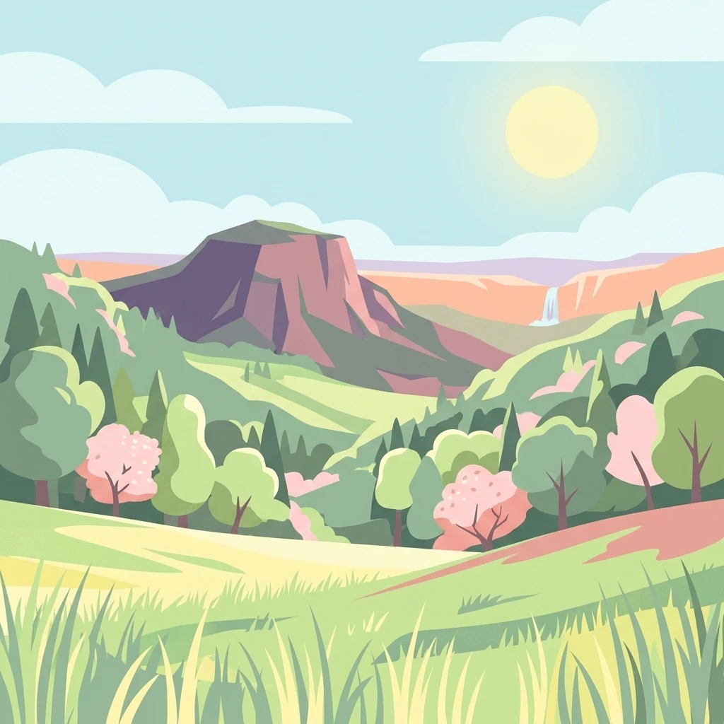
A digital illustration depicting a sunny landscape with grassy foreground, rolling green hills, a prominent rocky mountain peak in the distance, and a small waterfall flowing from a cliffside under a clear sky.

Magerrasen von Gronau mit angrenzenden Flächen

Nature reserve

Park overview

Structured park overview, official facts, and landscape profile for Magerrasen von Gronau mit angrenzenden Flächen

Magerrasen von Gronau mit angrenzenden Flächen park facts, protected area profile, and essential visitor context

Review the core facts for Magerrasen von Gronau mit angrenzenden Flächen, including designation, size, terrain, visitor scale, habitats, and operating context in one park-focused overview.

About Magerrasen von Gronau mit angrenzenden Flächen

Magerrasen von Gronau mit angrenzenden Flächen represents a compact yet characteristic example of the calcareous grassland landscapes found along the western edge of the Odenwald and the eastern foothills of the Upper Rhine Graben. Its three separate sub-areas, Bensendell/Rosengrund, Gronau, and Hemsberg, lie within the municipal territory of Bensheim and together form one of the more botanically valuable Natura 2000 sites in the Landkreis Bergstraße.

The dominant habitat character is shaped by traditional low-intensity meadow management. Centuries of grazing and hay cutting, never intensified by heavy fertilization, have produced the nutrient-poor Magerrasen that give the protected area both its name and much of its conservation significance. These open, sun-exposed grasslands support communities of aromatic herbs, wild orchids, and a wide spectrum of grassland insects, and they contrast strikingly with the surrounding, more wooded sections of the Geo-Naturpark Bergstraße-Odenwald.

As an FFH-Gebiet, the area is embedded in the European Natura 2000 network. It is administered by the Regierungspräsidium Darmstadt, and a Maßnahmenplan (management plan) was issued on 25 June 2007 to guide habitat conservation. The site illustrates how even small, fragmented grassland patches can carry substantial ecological weight when they preserve habitat types, such as Halbtrockenrasen and mageren Flachland-Mähwiesen, that have become rare across much of central Europe.

Quick facts and research context for Magerrasen von Gronau mit angrenzenden Flächen

Magerrasen von Gronau mit angrenzenden Flächen is a Natura 2000 Fauna-Flora-Habitat (FFH) site in the Landkreis Bergstraße of southern Hesse, within the Geo-Naturpark Bergstraße-Odenwald and the city of Bensheim. The site covers roughly 160 hectares across three non-contiguous sub-areas: Bensendell/Rosengrund, Gronau, and Hemsberg, the last of which largely coincides with the Naturschutzgebiet Hemsberg von Bensheim-Zell, designated in 1983.

The site was registered as an FFH area in 2004 and is administered by the Regierungspräsidium Darmstadt. It protects semi-dry grasslands, nutrient-poor hay meadows, and associated flora and fauna, including a notable concentration of orchid species and thermophilic butterflies. Its primary conservation objective is the long-term preservation and promotion of these species-rich, low-intensity meadow habitats.

Protection and recognition

Examine official protected area records, administrative designations, and conservation frameworks

Magerrasen von Gronau mit angrenzenden Flächen Protection Status and Natura 2000 Recognition

Magerrasen von Gronau mit angrenzenden Flächen holds documented recognition records including Natura 2000 site designations and verified WDPA database entries. Structured data profiles outline the formal conservation status and administrative framework associated with this protected landscape.
Park context

Deeper park guide and search-rich context for Magerrasen von Gronau mit angrenzenden Flächen

Magerrasen von Gronau mit angrenzenden Flächen history, landscape, wildlife, and travel context

Explore Magerrasen von Gronau mit angrenzenden Flächen through its history, landscape character, ecosystems, wildlife, conservation priorities, cultural context, and seasonal travel timing in a structured park guide built for atlas discovery and search intent.

Why Magerrasen von Gronau mit angrenzenden Flächen stands out

The site is best known for its species-rich calcareous and semi-dry grasslands (Magerrasen), which support one of the most diverse orchid floras of the Bergstraße district. Surveys by NABU Meerbachtal recorded seventeen orchid species in the Gronau and Zell cadastral areas, including Bocks-Riemenzunge, Bienen-Ragwurz, Pyramidenorchis, and Helm-Knabenkraut, alongside characteristic meadow plants such as meadow sage, thyme, and Berg-Aster. Equally distinctive is the rich butterfly fauna associated with these warm, flower-rich grasslands. Species such as the Thymian-Ameisenbläuling, Perlmuttfalter, and the striking Esparsetten-Widderchen depend on the diversity of nectar sources and host plants found here. The recent appearance of the praying mantis further underscores the site's role as a warm refugium for species expanding northward in response to climatic change.
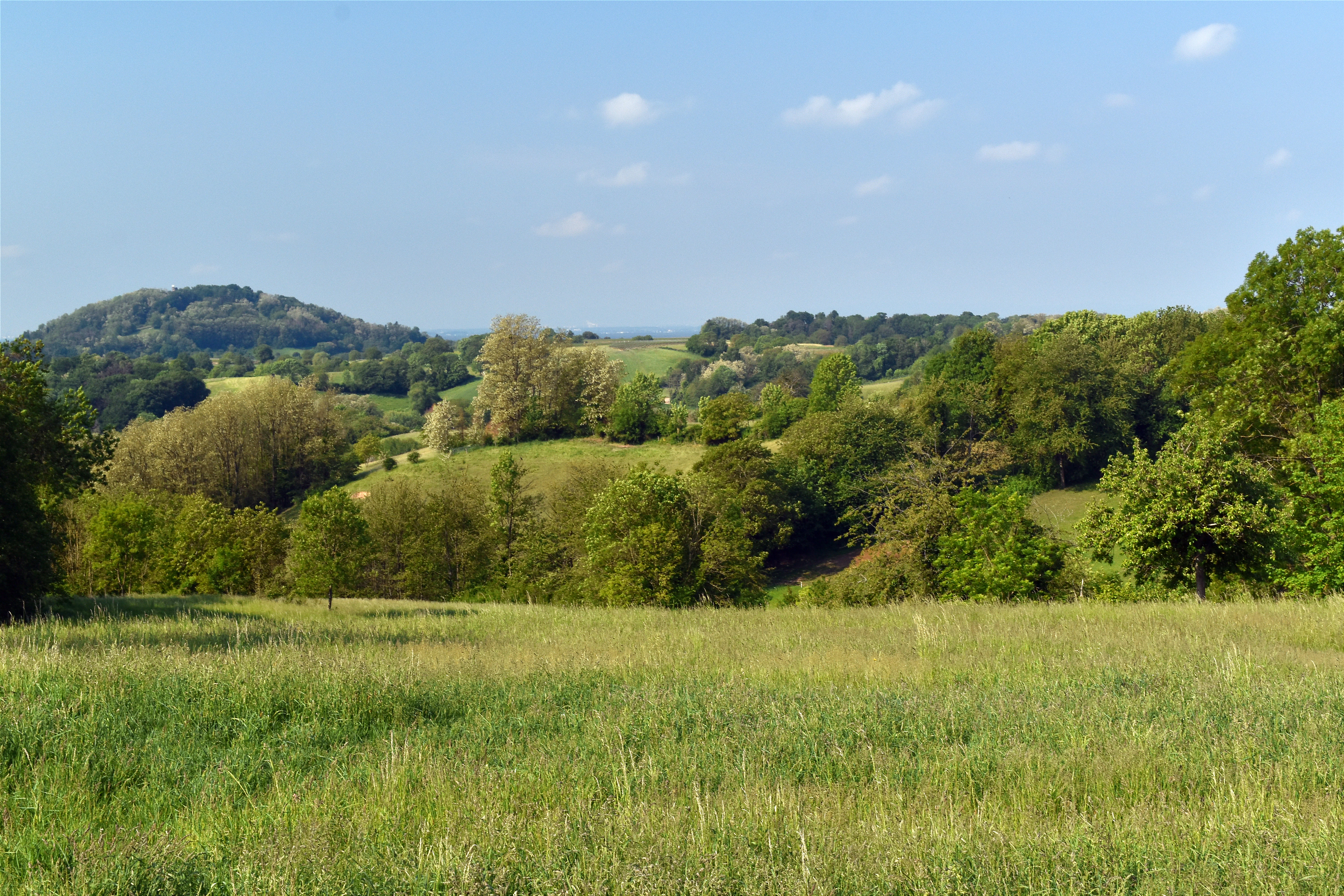
A wide landscape view of a green meadow in the foreground leading to rolling hills covered in forests and patches of grassland under a blue sky.
A view of the Magerrasen von Gronau conservation area with the Hemsberg in the distance.

Magerrasen von Gronau mit angrenzenden Flächen history and protected-area timeline

The area's formal protection history reflects two overlapping strands: the older national designation of the Hemsberg, and the more recent European-level recognition of the broader FFH-Gebiet. The Hemsberg sub-area, which today coincides almost entirely with the protected grasslands of Gronau, was designated as the Naturschutzgebiet Hemsberg von Bensheim-Zell in 1983, securing early legal protection for one of the most botanically valuable hills in the Bensheim area.

The wider protected landscape was integrated into the European Natura 2000 network in the early 2000s, with the FFH designation Magerrasen von Gronau mit angrenzenden Flächen officially recorded in 2004. The site carries the BfN identifier 6317-302 and the Natura 2000 site code DE6317302, linking it to the pan-European system for protecting threatened habitats and species.

A further milestone came on 25 June 2007, when the first management plan for the FFH area was published. This Maßnahmenplan defined the conservation objectives for the grasslands, focusing on the preservation and enhancement of Halbtrockenrasen and mageren Flachland-Mähwiesen as well as the protection of associated rare plant and animal species. Together, these steps transformed a historically appreciated botanical locality into a formally protected component of the European ecological network.

Magerrasen von Gronau mit angrenzenden Flächen landscape and geographic character

The protected area occupies a gentle, sun-warm transitional zone between the forested hills of the western Odenwald and the open agricultural lowlands of the Hessische Bergstraße. The three sub-areas, Bensendell/Rosengrund, Gronau, and Hemsberg, are not contiguous; they form a string of small, open meadow patches embedded between wooded slopes, orchards, and the broader mosaic of the Geo-Naturpark Bergstraße-Odenwald.

Topographically, the Hemsberg stands out, rising as a recognizable hill visible from the surrounding countryside and forming the dominant single landmark of the FFH-Gebiet. The associated Gronau and Bensendell/Rosengrund sub-areas extend along valleys and lower slopes that favour the development of dry, nutrient-poor soils. The result is a small-scale, undulating landscape of slopes, dry meadow terraces, and exposed hillside grasslands.

Calcareous subsoil, warm summer temperatures, and traditional land use combine to produce the open, herb-rich Magerrasen that define the visible character of the area. The landscape reads as a patchwork of low meadows, scattered shrubs, and forest margins, with the open sections offering wide views across the countryside toward the Rhine plain.

Magerrasen von Gronau mit angrenzenden Flächen ecosystems, habitats, and plant life

Ecologically, the site is a stronghold of calcareous and semi-dry grassland habitats that have become increasingly rare in western Europe. The two habitat types of overarching conservation importance are the Halbtrockenrasen, or semi-dry grasslands, and the mageren Flachland-Mähwiesen, nutrient-poor hay meadows of the lowlands. Both are listed under the EU Habitats Directive as priorities for conservation, and their presence is the principal reason for the area's inclusion in the Natura 2000 network.

The nutrient-poor soils impose a slow competitive regime that allows a high diversity of smaller, light-demanding plants to coexist. Aromatic herbs such as meadow sage and thyme form conspicuous elements of the flora, while the late-summer Berg-Aster adds a final wave of colour to the meadows. The grassland communities are intimately linked to traditional management: extensive grazing or late hay cutting keeps woody encroachment at bay and maintains the open habitat structure that the most specialized species depend on.

At the landscape scale, the dry meadows of Gronau are embedded in a network of small habitat islands set against the broader matrix of the Bergstraße-Odenwald Nature Park. This mosaic of dry meadows, forest patches, and valley habitats supports both the strictly meadow-bound species and more mobile groups that use different habitat types through the year.

Magerrasen von Gronau mit angrenzenden Flächen wildlife and species highlights

The wildlife value of the site is inseparably linked to its flora. The grasslands support a notably diverse butterfly fauna, with species such as the Thymian-Ameisenbläuling, members of the Perlmuttfalter group, and the striking day-flying Esparsetten-Widderchen recorded in the area. These insects depend directly on the diversity of nectar plants and specific host species found in the nutrient-poor meadows.

The orchid flora is a particular focus of local conservation work. Surveys by NABU Meerbachtal in the Gronau and Zell cadastral areas documented seventeen orchid species, making the area one of the orchid hotspots of the Landkreis Bergstraße. Notable species include the Bocks-Riemenzunge, Bienen-Ragwurz, Pyramidenorchis, and Helm-Knabenkraut, each of which depends on intact semi-open grassland and specific soil conditions.

In recent years, the area has also recorded the presence of the praying mantis (Mantis religiosa or a closely related European mantis), a warmth-loving insect that is expanding its range northward. Its appearance in the Gronau grasslands underscores the role of these dry, sunny habitats as potential refugia for thermophilic invertebrates as climate conditions shift.

Magerrasen von Gronau mit angrenzenden Flächen conservation status and protection priorities

Conservation significance at Magerrasen von Gronau mit angrenzenden Flächen is defined above all by the persistence of habitat types that have declined sharply across central Europe. The site's Halbtrockenrasen and mageren Flachland-Mähwiesen are both included in Annex I of the EU Habitats Directive, and their conservation status is one of the official reasons for the area's designation as an FFH-Gebiet within Natura 2000.

The Hemsberg sub-area holds an additional layer of protection. Already designated as a Naturschutzgebiet in 1983, it is recognized for its exceptional concentration of rare and threatened plant species. This dual status, both a national-level nature reserve and a component of a European FFH site, gives the Hemsberg a particularly strong legal and management framework.

Management is steered by the 2007 Maßnahmenplan, which focuses on the continued preservation and active promotion of the dry and semi-dry meadow communities. The overarching goal is to maintain the open, species-rich character of the grasslands in the face of pressures that have led to widespread loss of such habitats elsewhere, including agricultural intensification, abandonment leading to scrub encroachment, and the cumulative effects of atmospheric nitrogen deposition.

Magerrasen von Gronau mit angrenzenden Flächen cultural meaning and human context

The landscape protected at Gronau carries a strong imprint of long-standing small-scale land use. The dry meadows exist today because generations of farmers and herders in the Hessische Bergstraße maintained extensive grazing and hay-cutting regimes that, intentionally or not, preserved a habitat type of enormous botanical value. In that sense, the Magerrasen are as much a cultural artefact as a natural one.

Local voluntary engagement has played an important role in maintaining this heritage. NABU Meerbachtal, the regional chapter of Germany's largest nature conservation association, has been active in recording the orchid and butterfly fauna of the Gronau and Zell meadows, and many of the fine-scale biodiversity data for the site originate from voluntary surveys rather than formal monitoring programmes. The site thus also reflects the wider tradition of citizen-led botanical recording that has shaped awareness of the Hessische Bergstraße's natural heritage.

Top sights and standout views in Magerrasen von Gronau mit angrenzenden Flächen

Three separated sub-areas combining calcareous dry grasslands, semi-dry meadows, and forest margin habitats within one FFH-Gebiet.

A nationally protected nature reserve (Hemsberg von Bensheim-Zell, 1983) nested within the broader European Natura 2000 site.

Seventeen orchid species recorded by NABU Meerbachtal in the Gronau and Zell meadows, anchoring the site's reputation as a regional orchid hotspot.

Specialized butterfly fauna, including Thymian-Ameisenbläuling and Esparsetten-Widderchen, tightly linked to the diversity of nectar and host plants in the dry meadows.

A documented range expansion of the praying mantis into the area, illustrating the role of warm refugia in the Bergstraße landscape.

Best time to visit Magerrasen von Gronau mit angrenzenden Flächen

The dry and semi-dry meadows of Gronau change their character considerably across the year, and a visit timed to the flowering season offers the richest impression of the area's conservation value. In late spring and early summer, many of the characteristic orchids, including Pyramidenorchis and Bocks-Riemenzunge, come into flower, and the meadows take on the open, freshly cut appearance typical of traditionally managed hay meadows.

In high summer, the grasslands reach their full expression as Magerrasen, with aromatic herbs such as meadow sage and thyme blooming alongside later-flowering species like Berg-Aster. Butterfly activity is highest in this warmer period, and warm, sun-exposed slopes can reveal thermophilic invertebrates that are rare elsewhere in Hesse.

Because the area consists of several small, non-contiguous parcels, visits tend to be short and focused; choosing a clear, warm day in late spring or early summer best combines flowering display, insect activity, and the kind of broad views across the Bergstraße that help place the meadows in their wider landscape context.

Monthly climate preview

Long term monthly temperature and precipitation averages recorded at a representative coordinate

Magerrasen von Gronau mit angrenzenden Flächen Climate Normals and Temperature Rhythms

Representative coordinate sampling from 1991 to 2020 documents measured monthly temperature swings and precipitation rates across Magerrasen von Gronau mit angrenzenden Flächen. Reviewing the complete twelve month profile provides deeper insight into long term climate normals and seasonal weather patterns.
Annual mean10 °C
0 °C20 °C
Jan
Feb
Mar
Apr
May14°
Jun18°
Jul20°
Aug20°
Sep15°
Oct10°
Nov
Dec
Warmest month
July

20.3 °C

Coolest month
January

0.1 °C

Wettest month
July

2.4 mm/day

Driest month
April

1.5 mm/day

Park location guide

Geography guide, regional context, and park location map for Magerrasen von Gronau mit angrenzenden Flächen

Magerrasen von Gronau mit angrenzenden Flächen park geography, regions, and map view in Germany

Understand where Magerrasen von Gronau mit angrenzenden Flächen sits in Germany through a broader geographic reading of the surrounding landscape, nearby location context, and its mapped position within the national park landscape.

How Magerrasen von Gronau mit angrenzenden Flächen fits into Germany

Germany is a federal republic in Western and Central Europe with a population of over 83 million across sixteen constituent states. It is Europe's largest economy by nominal GDP and a major global exporter and importer. The capital is Berlin, and the country borders Denmark, Poland, Czech Republic, Austria, Switzerland, France, Luxembourg, Belgium, and the Netherlands.

Wider geography shaping Magerrasen von Gronau mit angrenzenden Flächen in Germany

Germany is located in Western and Central Europe, spanning 357,022 km². It borders Denmark to the north, Poland and the Czech Republic to the east, Austria and Switzerland to the south, and France, Luxembourg, Belgium, and the Netherlands to the west. The country has coastlines on the Baltic Sea and North Sea to the north, with the Alps located in the southern region.

Map view of Magerrasen von Gronau mit angrenzenden Flächen

Use this park location map to pinpoint Magerrasen von Gronau mit angrenzenden Flächen in Germany, understand its exact geographic position, and read its mapped placement within the surrounding landscape more clearly.

Pigeon | © OpenStreetMap contributors

Location context for Magerrasen von Gronau mit angrenzenden Flächen

Hessen
Recorded earthquake history

Review Recorded Earthquake History for Magerrasen von Gronau mit angrenzenden Flächen

Access the comprehensive collection of historical seismic events recorded in proximity to the Magerrasen von Gronau mit angrenzenden Flächen. MoriAtlas provides this transparent geographic dataset for researchers and those interested in the seismic history of the Hessian Bergstraße region.

Magerrasen von Gronau earthquake history

Catalogued events

21 events

Strongest magnitude

Magnitude 3.7

Most recent event

May 17, 2014

This history includes earthquakes recorded inside the park or within 50 km of its borders

Visual exploration of calcareous dry grasslands, meadow habitats, and Odenwald hill terrain

Magerrasen von Gronau mit angrenzenden Flächen Photos and Landscape Scenery

Photographic records reveal the distinct dry grassland patches, flowering meadows, and forest margin habitats that define Magerrasen von Gronau mit angrenzenden Flächen. Visualizing these protected limestone terraces and hillside slopes provides a clearer understanding of local conservation ecology across the Hessian Bergstraße region.

A wide landscape view of a green meadow in the foreground leading to rolling hills covered in forests and patches of grassland under a blue sky.

Park atlas

Compare adjacent protected landscapes and regional conservation areas

Exploring Other Parks Near Magerrasen von Gronau mit angrenzenden Flächen

Browsing nearby protected areas allows visitors to compare similar calcareous grassland habitats and regional park geography across the Odenwald foothills. Extending the geographic review provides a broader understanding of connected conservation networks and surrounding natural terrain.
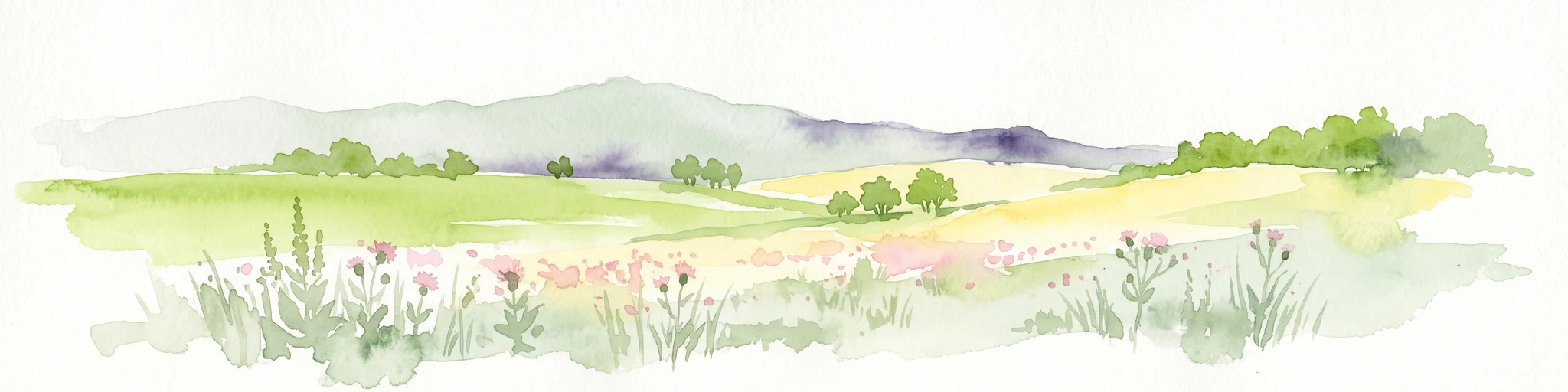
Watercolor painting showing a stylized, panoramic landscape of rolling hills and forest, depicted in soft green and earth tones against a white background.
Nature reserveHessen
2.7 km away#1 closest

Northeast

Felsberg bei Reichenbach Nature Reserve: Geography and Granite Boulder Field Analysis

Protected forest and geological monument in the Odenwald range

Felsberg bei Reichenbach protects 168 hectares of Odenwald mountain slope in Southern Hessen. The site is centered on the Felsenmeer, a dramatic sea of granite boulders created by frost weathering, framed by mixed deciduous woodland. This area functions as an important Natura 2000 habitat, preserving both specialized rock ecosystems and montane forest, providing a clear geographic link between the Lautertal valley and the high slopes of the Felsberg summit.

Area
1.677 km²
Established
1972
IUCN
IV
Relief
Mountain
A soft watercolor painting of a rolling green hillside with trees, set against a pale, light-colored background.
Nature reserveHessen
About 3.3 km away#2 closest

Northwest

Orbishöhe von Auerbach und Zwingenberg: Geography, Landscape, and Protected Area Mapping

An examination of Hessian quarry-based ecological conservation sites.

The Orbishöhe von Auerbach und Zwingenberg nature reserve serves as a prime example of localized conservation within the Odenwald hills. Its landscape is defined by former quarry faces and open slope terraces, which provide a critical habitat for rare and threatened plant species. This resource offers a clear look at the reserve's topography, physical boundaries, and its broader role within the Natura 2000 network of protected German lands.

Area
0.064 km²
Established
1988
A horizontal watercolor illustration of a soft green landscape with meadows, scattered trees, and distant rolling hills under a pale pink sky.
Nature reserveHessen
About 3.9 km away#3 closest

East

Schannenbacher Moor Nature Reserve: Geographic Overview and Protected Area Boundaries

Wetland and forest mosaic in the southern Hessian Odenwald

Schannenbacher Moor represents a significant protected area within Hessen, characterized by its combination of raised bog remnants, reedbeds, and near-natural floodplain woodlands. Framed by the Krehberg slopes and the Meerbach stream system, the reserve offers a rare example of low mountain bog ecology and biodiversity conservation. This mapped landscape provides essential data on the distribution of mire plant communities and bryophyte habitats in the region.

Area
0.162 km²
Established
1975
IUCN
IV
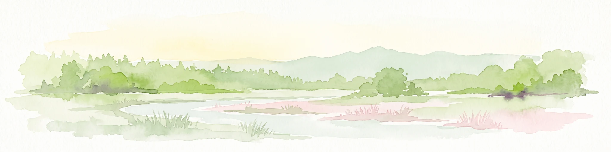
A soft-focus watercolor painting of a wetland scene showing a calm body of water with reeds in the foreground and a tree-lined horizon under a pastel sky.
Nature reserveHessen
About 4.2 km away#4 closest

Southwest

Erlache bei Bensheim: Exploring Protected Wetlands and Altneckar Landscapes in Hessen

A distinct nature reserve and bird sanctuary site

The Erlache bei Bensheim nature reserve serves as a critical wetland corridor in the Hessian Rhine plain. This area features a former loop of the River Neckar, now characterized by alder swamp forest, reedbeds, and open water, creating a highly specific ecological terrain surrounded by the regional infrastructure of the Bergstraße district.

Area
0.49 km²
Established
2000
IUCN
IV
Relief
Lowland
A horizontal watercolor illustration of a soft, hazy landscape featuring light pink blooming trees in a green field, with rolling, misty purple and brown hills in the background.
Nature reserveHesse
About 5.7 km away#5 closest

North

Fuchswiese bei Stettbach: Mapped Nature Reserve and Protected Meadow Landscape in Hesse

Exploring the ecological boundaries of a specialized wet meadow reserve in southern Hesse

Fuchswiese bei Stettbach is a dedicated nature reserve serving as a critical habitat for threatened meadow butterfly species. Located in the Darmstadt-Dieburg district of Hesse, this protected area preserves wet meadow vegetation amidst the northern Odenwald fringe. The site offers a focused view into how small, carefully managed landscapes contribute to the broader ecological health and regional geography of central Germany.

Area
0.03 km²
Established
2010
A watercolor painting showing a soft, stylized landscape of green meadows, sparse trees, and distant rolling hills against a white background.
Nature reserveHesse
6.4 km away#6 closest

Northwest

Im Dulbaum bei Alsbach Nature Reserve: Mapped Inland Dunes and Grassland Geography

A vital protected sandy terrain in the Hessian Rhine Plain

Im Dulbaum bei Alsbach protects a remnant of the historic Rhine graben sand dune belt in southern Hesse. This nature reserve provides essential habitat connectivity for heat-loving species through its distinct calcareous sand grasslands and former quarry terrain, offering a look into the region's complex ecological history.

Area
0.092 km²
Established
1994
IUCN
IV
Relief
Lowland
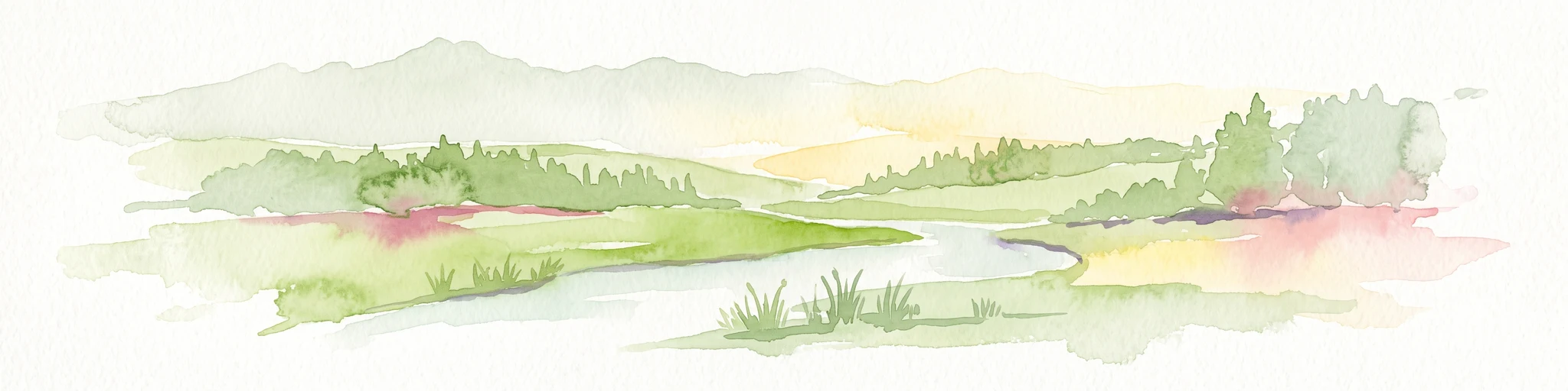
A soft, delicate watercolor painting depicting a meandering river flowing through a lush, grassy wetland landscape with rolling hills in the background.
Nature reserveHessen
About 7.6 km away#7 closest

Northwest

Altneckarlachen von Alsbach, Hähnlein und Bickenbach: Protected Wetland and River Geography

A rare mosaic of prehistoric river loops in the Hessian Rhine plain

Altneckarlachen von Alsbach, Hähnlein und Bickenbach protects a unique sequence of prehistoric Neckar meanders featuring shallow water zones, reed belts, and black-alder swamp forest. This nature reserve in the Darmstadt-Dieburg district remains a critical wetland sanctuary, preserving a vital ecological cross-section of the ancient Rhine-Neckar landscape and its associated peatland soils.

Area
0.892 km²
Established
1990
IUCN
IV
Relief
Lowland
Watercolor painting of a green wetland landscape with a winding stream and distant hills in soft pastel colors.
Nature reserveHesse
About 8.5 km away#8 closest

Southeast

Albersbacher Riedwiesen Nature Reserve: Mapped Geography and Protected Landscapes in Hesse

A detailed atlas view of the Albersbach stream valley conservation corridor.

Situated in the Weschnitz valley region of Hesse, the Albersbacher Riedwiesen nature reserve offers a concentrated look at traditional Odenwald landscapes. The area protects a unique combination of wet meadows, reedbeds, and dry grasslands that follow the natural meandering course of the Albersbach stream, providing a vital study in local geomorphology and conservation geography.

Area
0.124 km²
Established
1996

Common questions about visiting, size, designation, and location context for Magerrasen von Gronau mit angrenzenden Flächen

Magerrasen von Gronau mit angrenzenden Flächen FAQs for park facts, access, geography, and protected area context

Find quick answers about Magerrasen von Gronau mit angrenzenden Flächen, including protected-area facts, park geography, trail and visitor context, and how the park fits into its surrounding country and regional landscape.
MoriAtlas Explorer

Continue Your Protected Areas Search Across the Global Atlas

Deepen your exploration by continuing the structured search for national parks and protected areas worldwide. Utilize the comprehensive filtering capabilities to compare different conservation landscapes and refine your understanding of global park geography. Discover more about the distribution and characteristics of protected natural areas.

Global natural geography